Lighthouses of the United States: Northern California

The United States of America is a federal union of 50 states and a capital district. The west coast state of California is the most populous state in the nation with a population approaching 40 million. It is also the third largest state, with a coastline on the Pacific Ocean about 840 mi (1350 km) long.

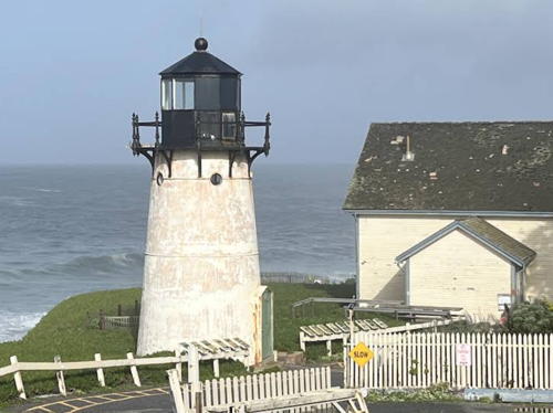
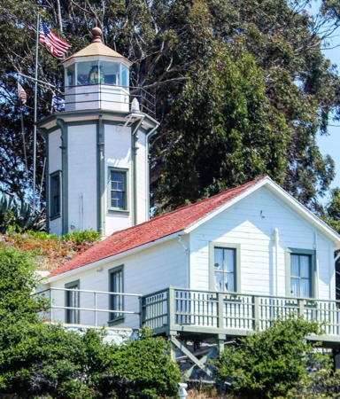
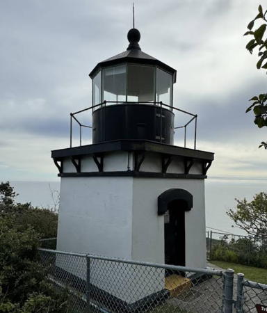
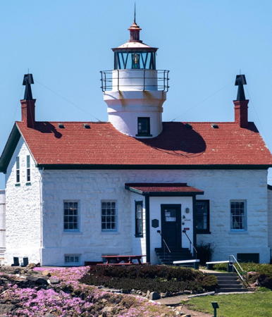
Formerly a Mexican territory, California became part of the U.S. after the Mexican War of 1848. The famous Gold Rush began in 1849 and the first lighthouses were built a few years later. These early lights, like the Point Pinos Light at right and the Battery Point Light shown near the bottom of the page, were built in a what was then a typical New England style. Ironically there are no examples of this style surviving in New England, so the only place to see these traditional New England lighthouses is in California.

This page includes the lighthouses of the northern California coasts from Monterey County north to the Oregon border. This area includes about two thirds of the state and includes the San Francisco Bay metropolitan area. Lighthouses of Southern California are on a separate page.

Navigational aids in the United States are operated by the U.S. Coast Guard but ownership (and sometimes operation) of historic lighthouses has been transferred to local authorities and preservation organizations in many cases. Aids to navigation in California are maintained by the Eleventh Coast Guard District with Aids to Navigation Teams at San Francisco and Humboldt Bay.

ARLHS numbers are from the ARLHS World List of Lights. Admiralty numbers are from volume G of the Admiralty List of Lights & Fog Signals. USCG numbers are from Vol. VI of the USCG Light List.

General Sources
California Lighthouses
An excellent site by Kraig Anderson, with information and photos on each of the light stations.
Lighthouses in California, United States
Aerial photos posted by Marinas.com.
Online List of Lights - California
Photos by various photographers posted by Alexander Trabas. Many of the photos for the San Francisco area are by Michael Boucher.
California Lighthouses
Fine photos of 33 sites by Robert English.
California Lighthouses
A site by Ed Litfin, with very fine photos, maps, and visitor information.
Lighthouses of California
A collection of photos by Bryan Penberthy and Michael Jackman.
California, United States Lighthouses
Aerial photos posted by Marinas.com.
Lighthouses in California
Photos by various photographers available from Wikimedia.
World of Lighthouses - California and Hawaii
Photos by various photographers available from Lightphotos.net.
Leuchttürme USA auf historischen Postkarten
Historic postcard images posted by Klaus Huelse.
U.S. Coast Guard Navigation Center: Light Lists
The USCG Light List can be downloaded in pdf format.
NOAA Nautical Chart Locator
Official nautical charts for the coast can be viewed online.
Navionics Charts
Navigation chart for California.


Point Pinos Light, Pacific Grove, April 2019
Instagram photo by Matthew Sweat
Point Montara Light
Point Montara Light, Montara, August 2008
Flickr Creative Commons photo by C.M. Hanchey

Monterey County Lighthouses
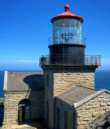
** Point Sur
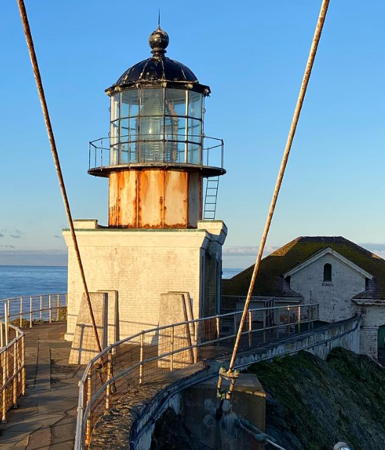
1889. Active; focal plane 273 ft (83 m); white flash every 15 s. 48 ft (15 m) square cylindrical sandstone tower attached to a 1-story sandstone fog signal building. Building is unpainted stone; lantern and gallery painted black, lantern roof red. The original Barbier and Fenestre 1st order Fresnel lens was on display for many years at the Monterey Maritime Museum; it was returned to the station in 2018 for display in the keeper's house museum. 2-1/2 story sandstone Romanesque keeper's house and many other light station buildings. Curtis Brown's photo is at right, Anderson has a fine page with good photos, a 2021 photo is available, Benjamin Allen has a 2023 photo, Marinas.com has aerial photos, Mike Leland has a street view, and Google has a satellite view. Central Coast Lighthouse Keepers manages restoration of the light station and provides guided tours of the site and buildings. International Chimney Corp. restored the lantern room during the winter of 2000-01; Lighthouse Digest has Jeremy D'Entremont's feature article on this project. The barn and workshop buildings have also been restored, and a replica of the 1907 wood water tower conceals a cellphone relay station. In April 2004 the lighthouse was transferred to California State Parks under the National Historic Lighthouse Preservation Act. Restoration of the head keeper's house began in 2009 and was completed in 2012. The 125th anniversary of the lighthouse was celebrated in August 2014. The Lightkeepers raised over $100,000 to return the Fresnel lens, and in November 2017 the Coast Guard approved the transfer. The lighthouse was closed in 2019 while a bridge on the access route was rebuilt. It reopened in 2020. In 2021 the state budgeted $4.5 million to replace two more bridges on the access road. This is one of the most spectacular lighthouse sites in the country, located high atop a giant volcanic rock off CA 1 about 4 miles (6 km) northwest of Big Sur. Accessible by a hike of 1/2 mile (800 m) and 360 vertical feet (110 m) of climbing (several long flights of stairs). Site, light station, and tower generally closed but open to three-hour guided tours on Wednesdays, Saturdays, and Sundays all year and on most dates during the summer; check the web site for the current schedule. Owner: California State Parks. Site manager: Point Sur State Historic Park . ARLHS USA-639; Admiralty G3988; USCG 6-0280.
**** Point Pinos
1855 (Francis Kelly and Francis Gibbons). Active; focal plane 89 ft (27 m); white light occulted every 4 s. 43 ft (13 m) round concrete tower rising from the roof of a 1-1/2 story stone Cape Cod keeper's house. Building painted white; lantern and gallery black; roof is red. The original 3rd order Henry-Lepaute Fresnel lens has been in continuous use since 1855; the original eclipser, a rotating opaque panel, is on display. Matthew Sweat's 2019 photo is at the top of this page, Anderson has an excellent page for the lighthouse, Wikipedia's article has a good photo by Hugh Mason, English has a good photo, Trabas has a photo, Marinas.com has aerial photos, Ryan Constantino has a street view, and Google has a satellite view. The original stone light tower was replaced with a concrete tower after being damaged by the San Francisco earthquake of 1906. This is the oldest active lighthouse on the U.S. Pacific coast, beautifully restored and maintained by the Pacific Grove Historical Society. The 150th anniversary of the station was celebrated in 2005. In August 2006 ownership of the lighthouse was transferred from the Coast Guard to the City of Pacific Grove. The city also has a page for the lighthouse. Starting in 2010 there has been a gradual restoration of the building, carried out with mostly volunteer labor and grants from various local sources. These efforts are continuing. In 2021 the lantern was being restored. Located on Asilomar Avanue in the Pacific Grove Municipal Golf Course, at the entrance to Monterey Bay. Site and tower open Friday through Monday in the winter and Thursday through Monday in season. Owner/site manager: City of Pacific Grove (Point Pinos Lighthouse ). ARLHS USA-634; Admiralty G3992; USCG 6-0290.
Point Sur Light
Point Sur Light, Big Sur, November 2007
ex-Flickr Creative Commons photo by Curtis Brown

Santa Cruz County Lighthouses
Santa Cruz is a city of about 65,000 residents located at the northern end of Monterey Bay, about 75 mi (120 km) south of San Francisco.

* Santa Cruz West Breakwater (Walton Lighthouse) (4)
2001 (station established 1964). Active; focal plane 36 ft (11 m); green light occulting every 4 s. 42 ft (13 m) round reinforced concrete tower with a copper-roofed lantern and a small gallery. Tower painted white with a green band. Fog horn (blast every 30 s). Trabas has Boucher's closeup photo, Anthony Solis has a photo with the Abbott lighthouse in the background, Marinas.com has aerial photos, Jeffery Heil has a 2023 photo, Jesse Dresbach has a street view, and Google has a satellite view. Built with private donations and Coast Guard approval, this lighthouse replaced a series of minor aids to navigation. Charles Walton, a local businessman, contributed a significant part of the cost in memory of his late brother Derek Walton, a merchant seaman. The lighthouse originally had a red band, but the daymark was changed in March 2003 after boaters protested that a green beacon should not have a red daymark. Located at the end of a jetty on the west side of the marina entrance. Accessible by walking the breakwater, or there's a good view from Twin Lakes State Beach, 5th Avenue at East Cliff Drive. Site open, tower closed. Site manager: U.S. Coast Guard. . ARLHS USA-1001; Admiralty G4002; USCG 6-0300.
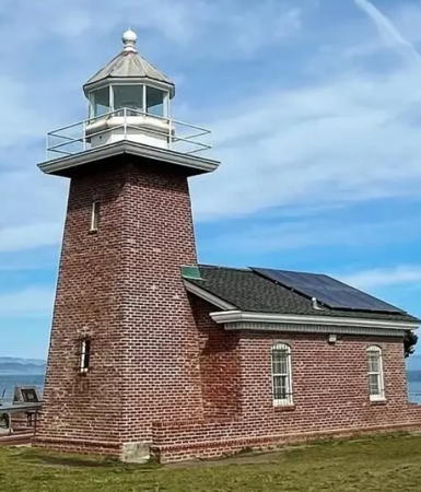
*** Santa Cruz (3) (Mark Abbott Memorial)
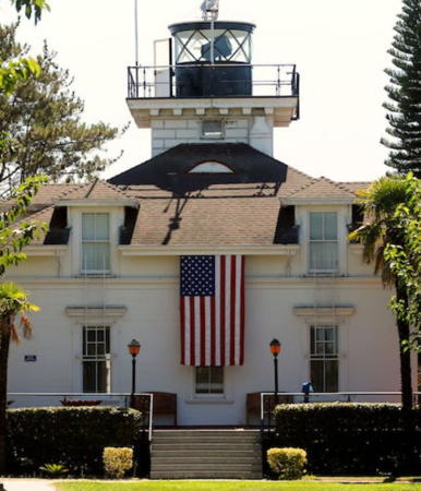
1967 (station established 1869). Active (privately maintained); focal plane 60 ft (18 m); white flash every 5 s. 39 ft (12 m) square brick tower attached to a 1-story brick museum. The building is unpainted red brick; lantern and gallery painted white. The lantern and 5th order Fresnel lens (1890) were transferred from the Oakland Harbor Light (see below), but the badly deteriorated lantern was replaced in 1996. C.M. Hanchey's photo is at right, Trabas has Boucher's closeup photo, a 2019 photo is available, Marinas.com has aerial photos, and Google has a photo, a street view and a satellite view. The lighthouse replaces an 1869 lighthouse that was sold and demolished in 1948 (foundation ruins of that building remain). The Coast Guard has a historic photo of the original lighthouse and Huelse has a postcard view. The present building is a surfing museum built as a memorial to Mark Abbott, a surfer who drowned nearby in 1965. In December 2008 the Santa Cruz City Council voted to close the museum as a cost-saving measure, but it was rescued by contributions from supporters. In 2011 the Coast Guard installed a flashing green light, which was much criticized by lighthouse supporters. In 2013 the city assumed control of the light and the 5th order Fresnel lens was installed, restoring the original rotating white light. The lighthouse may be endangered by erosion of the cliff on which it stands; El Niño waves were expanding a cave below the lighthouse in the spring of 2016. Located on West Cliff Drive in Santa Cruz, on Lighthouse Point overlooking Steamer Lane, a famous surfing site. Site open, museum open in the afternoons Thursday through Monday, also on Tuesdays between July 4 and Labor Day (early September). Owner/operator: City of Santa Cruz. Site manager: Santa Cruz Surfing Museum . ARLHS USA-1000; Admiralty G4001; USCG 6-0305.
Santa Cruz Light
Mark Abbott Memorial Light, Santa Cruz, August 2008
Flickr Creative Commons photo by C.M. Hanchey

San Mateo County Lighthouses
[Año Nuevo (3)]
1914 (station established 1872). Inactive since 1948. The light tower, a square skeletal structure with enclosed watch room, was overturned in 1976 and lies across the beach. The keeper's house and other light station buildings are incorporated in a scientific research facility operated by the Institute of Marine Sciences at the University of California at Santa Cruz. The Coast Guard has a historic photo of the light station, and Google has a satellite view. The lighthouse was replaced by a lighted whistle buoy (USCG 6-0315). The Spanish explorer Sebastián Vizcaíno discovered this cape on New Year's Day 1603 and named it Punta de Año Nuevo, New Year's Point. Año Nuevo is best known today for its large breeding population of elephant seals. Located on an rocky island just offshore about 8 miles (13 km) south of Pigeon Point on CA 1. The park's Marine Education Center on the mainland is open daily; during the winter breeding season there are guided tours of the island, for which reservations are required. Owner: California State Parks. Site manager: Año Nuevo State Park. ARLHS USA-017.
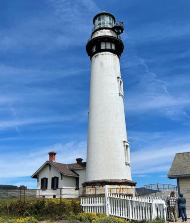
** Pigeon Point
1872. Active; focal plane 148 ft (45 m); white flash every 10 s. 115 ft (35 m) brick tower, painted white; lantern is black. The original 1st order Fresnel lens was removed from the tower in 2011 and is now displayed in the fog signal building; Michael Martin has a 2021 photo. The active light, a DCB-24 aerobeacon, is mounted on an extension of the gallery. A photo is at right, Anderson has a good page for the lighthouse, Trabas has Boucher's closeup photo, Tim Newsome has a 2021 photo, Lighthouse Digest has Gary Martin's January 2001 feature story, Marinas.com has aerial photos, Huelse has a historic postcard view, Joshua Kaufman-Horner has a street view, and Google has a satellite view. The lighthouse, a shorter sibling of Bodie Island Light, North Carolina, is one of the best known and most photographed California lighthouses, but recently it has been critically endangered and a member of the Lighthouse Digest Doomsday List. The historic light station is managed by California State Parks and the modern Coast Guard buildings are used as a youth hostel operated by Hostelling International - American Youth Hostels. The adjacent property was saved from development by the Peninsula Open Space Trust in 2000; the Trust later bought 3/4 mile (1.2 km) of beachfront to protect the light station. In December 2001 a section of the cornice fell and the light tower was closed to climbing. It has remained closed ever since. In October 2002 the station was listed for transfer under the National Historic Lighthouse Preservation Act; the trust and state parks developed a joint application for ownership. In March 2004 the National Park Service recommended approval of this application. Two nonprofit groups appealed the decision, but the light station was transferred to the state in May 2005. The California State Parks Foundation launched a campaign for $5 million to fund a restoration of the lighthouse. The aerobeacon failed in October 2008 and the backup light also failed in April 2009, but a new aerobeacon was installed later in 2009. In a $310,000 project in the fall of 2011 the Fresnel lens was removed and is now on display in the fog signal building. (For many years it was believed that this lens came from the Cape Hatteras Lighthouse in North Carolina, but Kevin Duffus has proved that this is not true; see his November 2002 article in Lighthouse Digest.) The project also stabilized the upper portion of the tower. In May 2012 the California Coastal Conservancy granted $200,000 to prepare architectural plans for a general restoration, then estimated to cost $7 million. In late 2016 the State Parks Foundation ended its fundraising with $3 million raised, but engineers now estimated the cost of restoration would be at least $11 million. The lighthouse was "in critical condition," according to a State Parks engineer. In 2019 the state parks agency requested $12.2 million to stabilize and reopen the lighthouse. The legislature appropriated $9.2 million but that money was redirected. Finally in 2021 the state budgeted $18.9 million for a complete restoration. In 2022 plans were being completed and in 2023 a $16 million contract was awarded to Sustainable Group, Inc., with ICC Commonwealth as a major subcontractor. Work will begin at the start of 2024 and will extend through 2025. Located on Pigeon Point Road just off CA 1 about 5 miles (8 km) south of Pescadero. Site open; fog signal building open Friday through Monday; tower closed. Owner: California State Parks. Site manager: Pigeon Point Light Station State Historic Park . ARLHS USA-599; Admiralty G4006; USCG 6-0320.

Pigeon Point Light, Pescadero, undated
Instagram photo by Santa Cruz Historic State Parks
Pillar Point Harbor
Date unknown. Active; focal plane 50 ft (15 m); white flash every 5 s. 45 ft (14 m) round cylindrical tower with an expanded upper portion. Fog horn (blast every 10 s). Trabas has Boucher's closeup photo, Chris Romero has a distant street view, and Google has a satellite view. Located at the end of the west breakwater of Pillar Point Harbor, on the north end of Half Moon Bay. Accessible only by boat. Site open, tower closed. Admiralty G4007; USCG 6-4145.
* Point Montara (3)
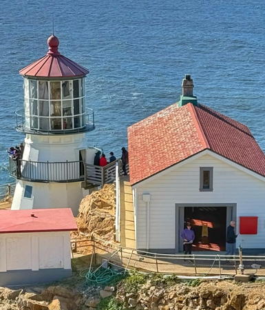
1881 (lighthouse relocated here in 1928; this station established in 1875). Active; focal plane 70 ft (21 m); white flash every 5 s. 30 ft (9 m) round steel tower with lantern and gallery; FA 251 lens (1970). Lighthouse painted white, lantern and gallery black. The original 4th order Fresnel lens (1912, transferred from earlier tower) is on display at the San Mateo County History Museum in Redwood City. 2-story wood duplex keeper's house (1875) and wood fog signal building (1902). C.M. Hanchey's photo is at the top of this page, English has a closeup, Trabas has Boucher's closeup photo, a 2022 photo is available, Marinas.com has aerial photos, the Coast Guard has a 1973 photo of the station, Chris Romero has a street view, and Google has a satellite view. Point Montara was established as a fog signal station in 1875; a post light was added in 1900 and replaced by a wooden skeletal tower in 1912. The present lighthouse was built in 1881 at Mayo's Beach on the bay side of Cape Cod, Massachusetts. Shipped to California as surplus after being deactivated in 1922, it was installed at Point Montara in 1928. This long-forgotten history was rediscovered by lighthouse researchers in 2007 and reported by Colleen MacNaney in the June 2008 issue of Lighthouse Digest. The light station has been restored by California State Parks and is used as a youth hostel operated by Hostelling International - American Youth Hostels. Hostel staff are housed in the historic keeper's house. Located at the end of 16th Street just off CA 1 at the southern edge of Montara. Site open, tower closed. Owner: U.S. Coast Guard (?). Site manager: California State Parks (Montara State Beach). . ARLHS USA-629; Admiralty G4010; USCG 6-0335.

San Francisco City and County Lighthouses
The city of San Francisco occupies a peninsula that encloses the west side of San Francisco Bay, a magnificent natural harbor. The bay is connected to the Pacific through a strait, the famous Golden Gate. The city proper has a population of about 800,000. The city itself is no longer a major port but San Francisco Bay is one of the largest ports in the country.

Farallon Island
1855. Active; focal plane 358 ft (109 m); white flash every 15 s. 41 ft (12.5 m) brick tower, lantern removed. Tower painted white. The original 1st order Fresnel lens is on display at the visitor center of the San Francisco Maritime National Historical Park on Fisherman's Wharf. The original keeper's house was demolished in 1969; two 1876 assistant keeper's houses survive. Sarah Murray has a 2011 photo, Lighthouse Digest has a photo, Wikipedia has an article with several photos, the New York Public Library has a historic photo showing the former lantern, and Google has a satellite view. The California Academy of Sciences maintains a webcam atop the tower. Endangered: the tower has deteriorated noticeably in recent years, so in 2012 it was added to the Lighthouse Digest Doomsday List. The Farallon Islands are a group of small islands and rocks 27 mi (43 km) west of the Golden Gate. Located on the highest point of Southeast Farallon Island. The island is closed to the public as a bird sanctuary, but the lighthouse can be seen from Oceanic Society half-day cruises to observe wildlife in the area. Site and tower closed. Owner: U.S. Coast Guard. Site manager: U.S. Fish and Wildlife Service (Farallon Islands National Wildlife Refuge). ARLHS USA-281; Admiralty G4014; USCG 6-0355.
Mile Rocks
1906 (James A. McMahon). Active; focal plane 49 ft (15 m); white flash every 5 s. Circular 1-story steel building mounted on a massive stone caisson, painted with red and white horizontal bands; rotating aerobeacon. The original 3rd order Fresnel lens was moved to the Old Point Loma Light in San Diego (see the Southern California page). Trabas has a photo by Michael Boucher, a 2020 photo is available, Christian Bojorque has a photo of a helicopter landing on the lighthouse, Marinas.com has aerial photos, and Bing has a satellite view. The original light tower had four stories crowned by a lantern; the Coast Guard has a historic photo, and Huelse has a postcard view. All of the tower except the first story was demolished in 1966, and a landing pad for helicopters was built on top of the surviving story. Located on a rock off Land's End at the south entrance to the Golden Gate, about 2 miles (3 km) southwest of the Golden Gate Bridge (US 101). There's a good view from the Land's End Trail in Lincoln Park, San Francisco. Site and tower closed. Owner/site manager: U.S. Coast Guard. . ARLHS USA-496; Admiralty G4054; USCG 6-0365.
* Fort Point (3)
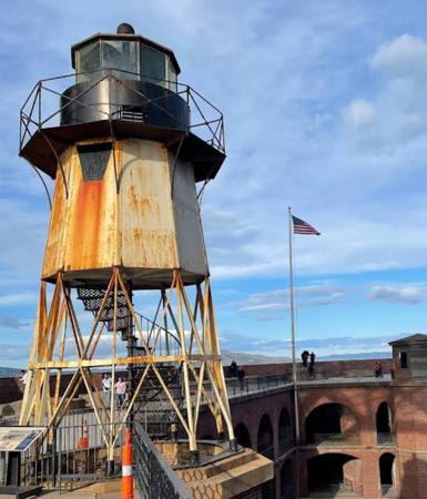
1864 (station established 1855). Inactive since 1934. 27 ft (8 m), 9-sided pyramidal cast iron skeletal tower, partially enclosed under the lantern, mounted on top of Fort Winfield Scott. Tower painted white, lantern black. Keeper's house demolished. SatnamSingh Sidhu's photo is at right, a 2022 closeup is available, Guillermo Labatte has a photo, and the Coast Guard has a 1918 historic photo. Located beside the south anchorage of the Golden Gate Bridge; Scott Fisher has a good photo of the lighthouse under the bridge, and Google has a satellite view. The bridge, built in 1933-37, made the light redundant. Site open (free) Friday through Sunday, lighthouse closed. Owner: U.S. National Park Service. Site manager: Fort Point National Historic Site. ARLHS USA-295.
Golden Gate Bridge South Pier
1937. Active (privately maintained); focal plane 50 ft (15 m); red flash every 15 s. Fog horn (blast every 20 s). Approx. 40 ft (12 m) square Art Deco concrete tower. Trabas has Boucher's closeup photo and Google has a sea view, but the bridge hides the tower in Google's satellite view. The lighthouse was built as part of the construction of the bridge betweeen 1933 and 1937. Hidden away under the bridge it is probably the least well known U.S. lighthouse. Located on the north side of the south pier of the bridge. Accessible only by boat. Site and tower closed. Owner/site manager: Golden Gate Bridge, Highway and Transportation District. Admiralty G4068; USCG 6-4260.

Fort Point Light, San Francisco, March 2022
Google Maps photo by SatnamSingh Sidhu
* Marina District
1931. Inactive for many years; charted as "stone lighthouse." Approx. 35 ft (11 m) octagonal unpainted stone tower with lantern. David Ohmer has a photo, Nick Zi Chen has a photo, Lighthouse Digest has a 2017 article on the lighthouse, and Google has a street view and a satellite view. This lighthouse was built to be a navigational aid guiding vessels into the yacht harbor. The stones are cobblestones salvaged from city streets. It was never an official light and it's not known how long it was active. Located on the breakwater of the yacht harbor off Marina Boulevard. Site open, tower closed. Owner/site manager: City of San Francisco.
* Alcatraz Island (2)
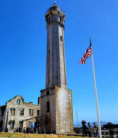
1909 (station established 1854). Active; focal plane 214 ft (65 m); white flash every 5 s. 84 ft (25.5 m) octagonal pyramidal unpainted reinforced concrete tower, lantern painted white; DCB-24 aerobeacon (1977). The original 4th order Fresnel lens (1902, transferred from the earlier lighthouse) is in storage for future display. Fog horn (blast every 30 s when needed) in a white square building 175 yards (160 m) southeast of the lighthouse. J A 2022 photo is at right, Trabas has Boucher's closeup photo, Brendan Kiely has a 2021 photo, Marinas.com has aerial photos, Huelse has a historic postcard view, and Google has a street view and a satellite view. This light station is the oldest on the U.S. West Coast; the National Archives has a historic photo of the original lighthouse. The island is famous as the former site of a high-security federal prison (1933-1963). The keeper's house, formerly attached to the tower, was destroyed by fire in June 1970 while Indian protesters occupied the island. In 2007 the Coast Guard was seeking to transfer this and four other area light stations to the National Park Service. Located on an island about 3 miles (5 km) east of the Golden Gate Bridge in San Francisco Bay. In 2015 the Lands End clothing company donated $25,000 for an engineering study of the lighthouse. Accessible by passenger ferry (toll) from Fisherman's Wharf in San Francisco. Site open, tower closed. Owner: U.S. Coast Guard. Site manager: U.S. National Park Service (Golden Gate National Recreation Area). . ARLHS USA-003; Admiralty G4082; USCG 6-4315.
[Alcatraz North Fog Signal]
1900. Active; two 2 s blasts every 30 s. 1-story building, painted white and floodlit at night. The modern fog signal stands in front of the building. Trabas has Boucher's closeup photo but the shadow of a larger building helps hide the horn in Google's satellite view. The building originally housed a fog bell. The bell was replaced by a siren in 1913 and later by a horn. Located on the northwestern tip of Alcatraz island. Site and building closed. Admiralty G4084; USCG 6-4325.

Alcatraz Light, San Francisco Bay, April 2022
Instagram photo by tatiana_rwc
Yerba Buena Island (Goat Island)
1875. Active; focal plane 95 ft (29 m); white light occulted every 4 s. 25 ft (7.5 m) octagonal cylindrical wood tower; 5the order Fresnel lens (1886). Fog horn (blast every 30 s). Tower painted white with black trim; lantern roof is red. The 2-story Victorian wood keeper's house is the residence of the Coast Guard district commandant. Original brick fog signal building and oil house. The lighthouse is adjacent to the San Francisco Coast Guard Station. English has a nice photo, Trabas has Boucher's view from the bay (also seen at right), the Coast Guard has a historic photo showing the entire light station, Marinas.com has aerial photos, Huelse has a historic postcard view, and Google has a satellite view. Yerba Buena mean "Good Herb" in Spanish. Located at the southern tip of Yerba Buena Island in the middle of San Francisco Bay. The island is crossed by the I-80 expressway between the two spans of the San Francisco-Oakland Bay Bridge, but access is restricted. There are good views from the ferries between Oakland and San Francisco. Site and tower closed. Owner/site manager: U.S Coast Guard. . ARLHS USA-908; Admiralty G4140; USCG 6-4595.

Alameda County (Oakland Area) Lighthouses
Oakland is a port city on the east side of San Francisco Bay; it is the largest of the many ports on the Bay. The city proper has a population of about 450,000.

*
Oakland Harbor (2) (relocated)
1903 (station established 1890). Inactive since 1966. Short square cylindrical wood tower on the roof of a 2-story wood keeper's house. The lantern was transferred in 1966 to the Santa Cruz Light (see above). Sverre Slotfeldt has a 2022 photo, a 2007 photo is available and Google has a street view and a satellite view. This lighthouse was originally located at the Oakland Harbor entrance; the Coast Guard has a historic photo of the lighthouse on station. In 1966 the lighthouse was sold for $1 and relocated six miles (10 km) south to 1951 Embarcadero Cove in Oakland, where it has served as Quinns Lighthouse Restaurant. It was thoroughly renovated in 1984. Quinns closed in January 2024, but the restaurant reopened as a Vietnamese restaurant in April. Owner/site manager: Quinns Lighthouse Restaurant & Pub . ARLHS USA-560.

Yerba Buena Light, San Francisco
photo copyright Michael Boucher; used by permission
* Lightship WLV-605 Relief
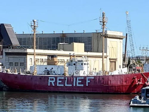
1951. Decommissioned 1975. 158 ft (48 m) 2-masted steel lightship. Hull painted red, superstructure white with gold trim, masts gold. C.W. Bash's photo is at right, Stevan Gaskill has a photo, John Kelly has a 2021 photo, a page with many photos is available, Raines Cohen has a street view, and Google has a satellite view. Built by Rice Brothers Shipyard in Boothbay, Maine, the ship served as the Overfalls off Cape Henlopen, Delaware, until 1960, then as Blunts off Cape Mendocino until 1969, when it became the relief lightship for the Pacific coast. After decommissioning the ship was donated to Olympia, Washington, but efforts to operate it as a museum there failed. The vessel was sold into private ownership in 1979. After sailing it to California and maintaining it for seven years, the owner, Alan Hosking, donated the ship to the U.S. Lighthouse Society in late 1986. Docked in Oakland, it was carefully restored by USLHS volunteers. In 2002 the ship sailed under its own power to a new berth at Jack London Square in Oakland. In 2008 the Society moved its headquarters to Washington state, and in 2012 it sold the Relief to The Anchor Program, which uses the vessel to train underprivileged youth and young adults in maritime trades. Site open, ship closed. Owner/site manager: The Anchor Program. . ARLHS USA-693.
Oakland Centerline Range Rear
Date unknown. Active; focal plane 44 ft (13.5 m); yellow light, 3 s on, 3 s off. 44 ft (13.5 m) tripod. Google has a sea view and a satellite view. The range guides ships to Oakland's huge container port. Located south of the east end of the San Francisco-Oakland Bay Bridge. Accessible only by boat. Site and tower closed. USCG 6-4618; Admiralty G4157.1.

Lightship Relief, Oakland Harbor, July 2007
Flickr Creative Commons photo by C.W. Bash

Contra Costa County (Richmond Area) Lighthouse
Richmond is a city north of Oakland, on the east side of the strait connecting San Francisco Bay to the circular basin of San Pablo Bay. The city has a population of about 110,000.
Southampton Shoal (2)
1960. Active; focal plane 32 ft (10 m); red light, 3 s on, 3 s off. 32 ft (10 m) post adjoining a square 1-story equipment building. Entire lighthouse is white. Fog bell (strike every 10 s). Jef Poskanzer has a closeup photo, another photo (bottom of the page) is available and Google has a satellite view. The original lighthouse has been relocated (see below). Located on the shoal about 1.8 mi (3 km) southwest of Point Richmond. Accessible only by boat. Site open, tower closed. Admiralty G4192; USCG 6-5480.
Point Potrero Range Rear
Date unknown. Active; focal plane 46 ft (14 m); red light, 3 s on, 3 s off. 46 ft (14 m) tripod. Trabas has Boucher's photo and Google has a distant sea view and a satellite view. The range guides ships in the dredged channel to the Port of Richmond. The front light is on a shorter ttower. Located off the east end of Brooks Island opposite Point Potrero. Accessible only by boat. Site and tower closed. USCG 6-5741; Admiralty G4206.21.
** East Brother Island
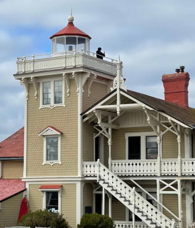
1873 (Paul J. Pelz). Active; focal plane 61 ft (18.5 m); white flash every 5 s. 48 ft (14.5 m) square pyramidal wood tower attached to a 2-story Victorian wood keeper's house; FA 251 lens. The house is buff-shingled with white trim; lantern and roofs are red. Fog signal (blast every 30 s) operates only October through March. Original wood fog signal building, assistant keeper's house, and other light station buildings. The light station was privately restored in 1979-80 and is now a bed and breakfast inn. Two innkeepers are hired for two-year contracts to manage the property. A 4th order Fresnel lens of unknown origin is displayed in the fog signal building. Frank Schulenburg's photo is at right, Anderson has photos and a good historical account, Trabas has Boucher's closeup photo, Larry Myhre has a 1999 photo, Todd Lappin has a good view of the light, the Coast Guard has a historic photo, Marinas.com has aerial photos, Michael Chrien has a 2015 street view, and Google has a satellite view. In the late 1960s the Coast Guard announced it would demolish the lighthouse and replace it with a skeletal tower, but it was persuaded to drop its plan by public pressure. In 1979 East Brother Light Station, Inc., a non-profit group, took over the station and began restoring it. The group operates the station under a license from the Coast Guard. However, in April 2021 the power cable to the island failed, throwing the future of the operation in doubt. Power was restored later in the year, although additional repairs to equipment at both ends was required. Located on a small island just off Point San Pablo in the San Pablo Strait connecting San Pablo Bay to San Francisco Bay. Accessible by a short boat ride from Point San Pablo Yacht Basin, at the end of Richmond Lane in Richmond. Site and tower open. Owner: U.S. Coast Guard. Site manager: East Brother Light Station . ARLHS USA-258; Admiralty G4215; USCG 6-5865.
 
East Brother Island Light
East Brother Island Light, Richmond, March 2013
Wikimedia Creative Commons photo by Frank Schulenburg

San Joaquin County (Stockton Area) Lighthouse
San Joaquin County occupies the delta of the San Joaquin River, one of the two rivers emptying into San Francisco Bay. Stockton, the county seat, is a city of about 325,000 residents.
* Discovery Bay
2013. Active (privately maintained and unofficial; charted as active by Navionics); focal plane 40 ft (12 m); continuous (?) white light. 36 ft (11 m) octagonal metal tower with lantern and gallery. Tower painted white, lantern and gallery black. Google has a satellite view and a street view from the water. Discovery Bay is a community of homes along a network of dredged waterways. The lighthouse was contributed to the community by longtime resident Ed Stewart. Located at the entrance to the community's waterways from Indian Slough. Site open, tower closed. Owner/site manager: Town of Discovery Bay.
Southampton Shoal (1)
1905. Inactive since 1960. Square wood tower with lantern on a 2-story Victorian keeper's house. The original 5th order Fresnel lens is on display at the Angel Island Interpretive Center. The lighthouse originally had 3 stories and was located on Southampton Shoals, northeast of Angel Island and southwest of Point Richmond in San Francisco Bay. In 1966 the upper two stories were relocated to Tinsley Island in the San Joaquin River delta about 15 miles (25 km) northwest of Stockton, where the building is used as a yacht club. Beth McIntyre's photo is at right, the Coast Guard has a 1953 historic photo of the light on station, Marinas.com has aerial photos of the present location and Google has a satellite view. Accessible only by boat, and permission to land should be obtained in advance. Site and tower open by appointment. Owner/site manager: St. Francis Yacht Club. ARLHS USA-777.
Stockton Channel Range J Rear
Date unknown. Active; focal plane 57 ft (17.5 m); white light, 3 s on, 3 s off. 54 ft (16.5 m) square skeletal tower carrying a rectangular daymark colored red with a white vertical stripe. Google has a street view and a satellite view. This is the tallest light of ten ranges guiding vessels in the Stockton Deep Water Channel. Completed in the 1930s, the channel is dredged through the San Joaquin Delta to a depth of 35 ft (10.7 m), providing access to Stockton for large vessels. Located on the north side of the channel about 8 km (5 mi) northwest of the city. Site and tower closed although the light can be seen from nearby. USCG 6-7125.

Solano County (Vallejo Area) Lighthouse
* [Carquinez Strait]
1910. Inactive since 1951. 2-1/2 story wood keeper's house; the light tower, formerly attached, has been removed. English has a good photo, Marinas.com has aerial photos, and Google has a street view and a satellite view. Originally located at the end of a pier in Carquinez Strait, which connects San Pablo Bay with Suisun Bay. The lighthouse has been restored and relocated about 1 mile (1.5 km) east to the Glen Cove Marina, off Glen Cove Parkway in Vallejo, a city of about 120,000 residents. Modern additions have greatly altered the appearance of the building; the Coast Guard has a 1910 historic photo showing its original appearance. In 2015 the building was opened for weddings, business meetings, and other events. Site open. Owner: Western Water Ways, Inc. Site manager: The Lighthouse at the Glen Cove Marina . ARLHS USA-142.

Southampton Shoal Light, Stockton, May 2015
Google Maps photo by Beth McIntyre

Marin County Lighthouses
Marin County occupies the peninsula on the north side of the Golden Gate. The county has a population of about 265,000.

*
Point Blunt (4?)
Date unknown (station established 1915). Active; focal plane 60 ft (18 m); green flash every 5 s. Light and fog signal on a 3.5 m (12 ft) post next to a 1-story former fog signal building. Fog horn (blast every 15 s when needed). Trabas has Boucher's closeup photo and Google has a satellite view. In 1961 a Coast Guard station with several keeper's houses was constucted and the light was placed atop the fog signal building. Several buildings survive from that station, which served only until the light was automated in 1971. The Coast Guard has a 1915 photo of an earlier light. Located on the southeastern point of Angel Island, off Tiburon in San Francisco Bay about 4 miles (6.5 km) northeast of the Golden Gate Bridge. Island accessible by ferries from Tiburon, San Francisco, Oakland, or Vallejo. Site open, tower closed. Owner: U.S. Coast Guard. Site manager: Angel Island State Park. ARLHS USA-617; Admiralty G4119; USCG 6-4335.
[Point Knox (Angel Island)]
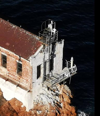
1900 (fog bell station established 1887). Inactive since the 1960s. A post light was added to the station in 1900. The keeper's house and other buildings were burned in 1963 after the station was moved to Point Blunt, but remarkably the original fog bell remains, mounted in a sawhorse-style wood frame in the center of the foundation pad of the keeper's house. Google has a satellite view. Located at the southwestern corner of Angel Island, below a sheer bluff. Accessible only by boat. Site and tower closed. Owner: California State Parks. Site manager: Angel Island State Park. ARLHS USA-1288.
Point Stuart
1915. Inactive. Light centered on the roof of a 1-story fog signal building. Anderson has a recent photo and Google has a sea view and a satellite view. This lightbeacon was maintained by keepers from Point Knox and later from Point Blunt. The light, which marked the entrance to Raccoon Strait between Angel Island and the mainland, has been replaced by an offshore lightbuoy (USCG 6-4350). Located on the west side of Angel Island about 1/2 mi (800 m) north of Point Knox. Practically inaccessible (the light is on a platform halfway up a steep bluff). Site and tower closed. Owner: California State Parks. Site manager: Angel Island State Park. ARLHS USA-1204.
* Lime Point (1)
1900 (fog signal station established 1883). Inactive. The 1-story brick fog signal building was converted to a lighthouse in 1900 by mounting a navigation beacon on the wall of the station. The keeper's house was demolished in the 1960s. Fog horn (2 blasts every 30 s) when needed. A photo is at right, Kari Messer has a 2023 photo, Google has a 2014 sea view, the Coast Guard has a historic photo, and Google has a satellite view. Currently the active light (focal plane 15 ft (4.5 m); white flash every 5 s) is mounted on a short post in front of the building; Trabas has Boucher's closeup photo. In 2007 the Coast Guard was seeking to transfer this and four other area light stations to the National Park Service. Located adjacent to the north anchorage of the Golden Gate Bridge. Accessible by a short hike from the Fort Baker parking lot of the Golden Gate National Recreation Area. Site and tower closed but the building can be viewed from nearby. Owner/site manager: U.S. Coast Guard. . ARLHS USA-434. Active light: Admiralty G4072; USCG 6-4270.
Point Diablo (2)
1923. Active; focal plane 85 ft (26 m); white light, 3 s on, 3 s off. Navigation light mounted on a post beside a square 1-story wood fog signal building. Building painted white. Continuously operating fog signal (blast every 15 s). Trabas has Boucher's closeup photo, Marinas.com has aerial photos, and Google has a satellite view. Keepers from Lime Point originally maintained this beacon. In 2007 the Coast Guard was seeking to transfer this and four other area light stations to the National Park Service. Located on a very steep headland halfway between Point Bonita and Lime Point, about 1.2 miles (2 km) west of the Golden Gate Bridge. Accessible only by boat. Site and tower closed. Owner: U.S. Coast Guard. Site manager: U.S. National Park Service (Golden Gate National Recreation Area). ARLHS USA-974; Admiralty G4064; USCG 6-4250.
Lime Point Light
Lime Point Light, Sausalito, December 2008
Flickr Creative Commons photo by mel1st
** Point Bonita (2)
1877 (station established 1855). Active; focal plane 140 ft (43 m); white light occulted every 4 s. 33 ft (10 m) lantern mounted atop a 1-story brick fog signal building. The original 2nd order Fresnel lens is still in use. Building painted white, lantern black. Fog horn sounds two blasts every 30 s when needed. The original keeper's house has been demolished, but the original oil house (1877) and a second brick fog signal building (1903) survive. Several nearby houses, built in the 1960s as Coast Guard housing, are now occupied by park service staff, and in 2015 one was renovated for possible rental to the general public. In 1856 this was the site of the first fog signal on the U.S. West Coast, a cannon. The lantern and watch room were relocated from the 1855 lighthouse, making them among the oldest on the Pacific coast. Don DeBold's photo is at right, Dana Smith has a closeup photo, Britten has some fine photos of this spectacular light station, the park service has a page for the lighthouse, Lighthouse Digest has Mary Hanley's article on its history, the Coast Guard has a 1955 historic photo, Marinas.com has aerial photos, Brett Allen has a street view, and Google has a satellite view. In 2007 the Coast Guard began the process of transfering ownership of this and four other area light stations to the National Park Service. In early 2011 the suspension bridge leading to the lighthouse was closed due to safety concerns. It was replaced in a $1 million project beginning in fall 2011 and access was restored in April 2012. In 2021 the lighthouse was closed "to allow for repairs and maintenance to the site." It reopened in 2022. Located on a spectacular rocky point at the north entrance to the Golden Gate, about 2 miles (3 km) west of the Golden Gate Bridge. Accessible by a hike of about 1 mile (1.5 km) from the parking area; the hike includes a tunnel as well as the suspension bridge. Site open in the afternoons only, daily in the summer and Friday through Monday in the winter (the tunnel is closed at other times), tower closed. The Golden Gate National Parks Conservancy provides tours to the lighthouse. Operator: U.S. Coast Guard. Owner/site manager: U.S. National Park Service (Golden Gate National Recreation Area). . ARLHS USA-618; Admiralty G4052; USCG 6-0370.
Point Bonita Light
Point Bonita Light, Golden Gate, May 2012
Flickr Creative Commons photo by Don DeBold
**** Point Reyes (1)
1870. Inactive since 1975 (the light is lit briefly twice a month). 35 ft (10.5 m) 16-sided pyramidal cast iron tower (sibling of Cape Mendocino Light). Buildings painted white; roofs including the lantern roof are red. The original 1st order Fresnel lens is still mounted in the tower. The original keeper's house was demolished and replaced by modern dwellings in 1960. Wood fog signal building (1928). The active light ( is mounted on the roof of the fog signal building below the lighthouse. Frank Schulenburg's photo is at right, Vicki and Chuck Rogers have a good photo, a 2022 photo is available, the park service has a web site on the light station's history, Marinas.com has aerial photos, the Coast Guard has a 1970 historic photo, and Google has a street view and a satellite view. In 2003 the park service completed a major restoration including replacement of the walkway and stairs. In December 2004 the lens received much-needed repairs and planning began for a more complete restoration. In 2018-19 the Park Service carried out a $5 million project that including restoration of the lighthouse and the lens, upgrades to the Visitor Center, and improvements to the grounds and walkway. The Lighthouse Visitor Center offers exhibits and tours. Located on the westernmost point of the Point Reyes peninsula high above the Pacific (the original focal plane was 294 ft (90 m)). Accessible by a short but strenuous walk (with 308 stone stairs) from the parking area. However, the walkway is closed in high winds, which occur frequently. The visitor center is open daily Friday through Monday year round, weather permitting. Owner: U.S. Coast Guard. Site manager: U.S. National Park Service (Point Reyes National Seashore). . ARLHS USA-636.
* Point Reyes (2)
1975. Active; focal plane 265 ft (81 m); white flash every 5 s. The light is on a sqaure platform atop the A-frame roof of the 1-story fog signal building. Trabas has Boucher's closeup photo of the active light and Google has a satellite view. Located in front of and below the lighthouse. Owner: U.S. Coast Guard. Site manager: U.S. National Park Service (Point Reyes National Seashore). Admiralty G4356; USCG 6-0385.

Sonoma County Lightbeacon
* [Bodega Head]
Date unknown. Active; focal plane 110 ft (33.5 m); white flash every 6 s. Approx. 5 m (16 ft) post. No photo available but Google has a street view and a satellite view. Bodega Head is a prominent cape sheltering Bodega Bay about 20 mi (30 km) north of Point Reyes. The area is popular for its wide view of the Pacific. Located near the point of the cape. Site open, tower closed. Site manager: Sonoma Coast State Park. Admiralty G4356.8; USCG 6-7770.
Point Reyes Light
Point Reyes Light, Point Reyes, April 2012
Wikimedia Creative Commons photo by Frank Schulenburg

Mendocino County Lighthouses
**** Point Arena (2)
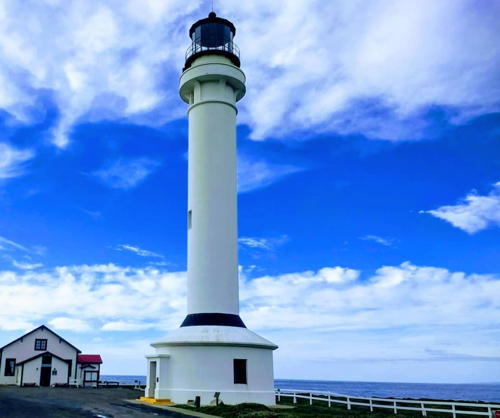
1908 (station established 1870). Active; focal plane 155 ft (47 m); white flash every 15 s. 115 ft (35 m) cylindrical reinforced white concrete tower rising from a 1-story round workroom. Lantern painted black. The original 1st order Fresnel lens (transferred from the 1870 tower) is on display in the wood fog signal building (1896), which houses a museum. The active light is mounted on the gallery outside the lantern. Four modern keeper's dwellings (1960) are available as vacation lodging. A photo is at right, David Dasinger has a good photo, Anderson has great photos and the history of the station, Trabas has Boucher's photo, Marinas.com has aerial photos, and Google has a street view and a good satellite view. This lighthouse was the first reinforced concrete lighthouse built in the U.S. The Coast Guard has a historic photo of the original lighthouse, a copy of the Pigeon Point Light (see above). It was demolished after being heavily damaged by the San Francisco earthquake of 1906. In September 2004 mercury was removed from the lantern room, clearing the way for restoration of the lens and tower. The California Cultural and Historical Endowment granted $1.2 million to restore the station and the preservation group raised another $300,000. In 2008-10 these funds supported a complete restoration of all the buildings, including disassembly, restoration, and display of the Fresnel lens. Located on a sharp, spectacular promontory at the end of Lighthouse Road, off CA 1 about 2 miles (3 km) north of the town of Point Arena. Site open, museum open daily except Thanksgiving Day and Christmas Day, tower open to guided tours. Owner/site manager: Point Arena Lighthouse Keepers, Inc. . ARLHS USA-611; Admiralty G4358; USCG 6-0420.
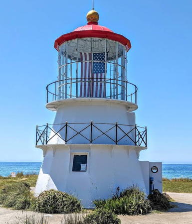
**** Point Cabrillo
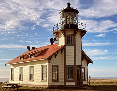
1909. Active; focal plane 84 ft (25.5 m); white flash every 10 s. 47 ft (14.5 m) octagonal cylindrical wood tower on a 1-story wood fog signal building. The original 3rd order Fresnel lens was restored to use in 1999. Original 1-1/2 story wood keeper's house. This is a complete light station, including two assistant keeper's houses (1908), oil house (1912), and other buildings. A 2023 photo is at right, Anderson has an excellent page for the lighthouse, Trabas has Boucher's closeup photo, Dave Dunne has another fine photo, the Coast Guard has a 1955 historic photo, Marinas.com has aerial photos, Huelse has a historic postcard view, Jonathan Fleming has a street view, and Google has a satellite view. The North Coast Interpretive Association began an extensive restoration of the light station in 1996. Restoration, completed by the end of 2001, included the lighthouse, oil house, and the blacksmith and carpentry shop, which currently houses a marine science exhibit. In May 2001 the California Coastal Conservancy sold the lighthouse and 300 surrounding acres to California State Parks for $4 million. These funds were transferred to the Point Cabrillo Lightkeepers Association (PCLK) to support continued restoration and operation of the light station. In 2004-05 an assistant keeper's house was restored and became a museum. The principal keeper's house was opened for overnight stays in 2006. A second assistant keeper's house was restored in 2009. There was great alarm in May 2011 when California State Parks announced that the light station would be closed in 2012 as a cost-cutting measure. PCLK negotiated an agreement with the state that keeps the station open under the association's management. In 2014 the Coast Guard proposed to deactivate the light and remove the lens but after discussions it dropped these plans. Located on a spectacular headland nearly surrounded by the ocean, at the end of Lighthouse Road, off CA 1 about 1 mile (1.6 km) south of Caspar and 4 mi (6.5 km) north of Mendocino. For most visitors there is a 1/2 mile (800 m) walk from the parking area, but handicapped visitors can drive to the lighthouse. Site open sunrise to sunset; lighthouse, keepers home and marine science exhibit open daily from 11am to 4pm. Owner: California State Parks (Point Cabrillo Light Station State Historic Park). Site manager: Point Cabrillo Lightkeepers Association . ARLHS USA-619; Admiralty G4362; USCG 6-0450.
* [Noyo River]
Date unknown. Active; focal plane 8.5 m (28 ft); green light occulting onve every 4 s. Fog Horn (blast every 30 s). 5 m (16 ft) post. Trabas has Boucher's photo, Anthony Wells has a street view and Google has a satellite view. Located on a short breakwater on the north side of the entrance to the Noyo River on the south side of Fort Bragg. Site open, tower closed. Admiralty G4364; USCG 6-8100 (light) and 8101 (fog signal).


Point Arena Light, Point Arena, March 2019
Instagram photo by Point Arena Lighthouse

Point Cabrillo Light, Mendocino, November 2023
Instagram photo by Point Cabrillo Lighthouse


Humboldt County Lighthouses
* Cape Mendocino (1) (relocated to Shelter Cove)
1868. Inactive since 1951 but charted as a landmark. 43 ft (13 m) 16-sided pyramidal cast iron tower. A photo is at right, Robert English has a good photo, Ed Lee has a 2023 photo, another closeup photo is available, Marinas.com has aerial photos, and Google has a street view and a satellite view. This lighthouse is very similar to the better-known Point Reyes Light (see above). The Coast Guard has a 1930 historic photo of the lighthouse on station at Cape Mendocino, where it stood in deteriorating condition for almost half a century after being deactivated. In 1998 a helicopter lifted the tower and carried it about 35 mi (55 km) south to Shelter Cove, where the lighthouse was restored and rebuilt during 1999-2000. The original 1st order Fresnel lens was mounted for many years in a replica of the lighthouse at the Humboldt County Fairgrounds in Ferndale. In 2008 the Coast Guard, noting that the lens was not properly protected, announced it was considering whether to require a more secure display or a transfer of the lens to another location. Negotations continued for several years, as the city worked on a plan to display it at the Ferndale Museum. In December 2011, however, the Coast Guard terminated the lease agreement and announced that it would soon remove the lens. After further negotiations an agreement was reached in September 2012. The lens was removed and stored pending restoration for display at the museum. The lighthouse is located at Mel Coombs Park in Shelter Cove, near Point Delgado on the coast about 20 miles (32 km) southwest of Redway. Site open, tower closed. Owner/site manager: Cape Mendocino Lighthouse Preservation Society . ARLHS USA-129.
Punta Gorda
1912. Inactive since 1951 but charted as a landmark. 27 ft (8 m) square cylindrical concrete tower on the roof of a rectangular concrete oil house. Building painted white, lantern black. The keeper's house and all other station buildings except the lighthouse and oil house were burned to the ground in 1970. Michael Garcia has a 2021 closeup photo, William Peters has a 2009 closeup photo, Chris LaLonde has a 2017 photo, the Coast Guard has a historic photo, Marinas.com has aerial photos, Brandon Aalberts has a street view from the lantern room, and Google has a satellite view. Members of a local volunteer fire department have helped maintain the lighthouse, and the state provided some assistance for restoration in 1989, but the lighthouse was recently in very poor condition. Finally in 2022-23 the Bureau of Land Management carried out a thorough restoration, replacing the stairway and fixing cracks in the walls. An August 2023 photo shows the results. Located in a wild area on Punta Gorda, about 12 miles (19 km) south of Cape Mendocino and 8 miles (13 km) southwest of Petrolia. Accessible by a 5.5-mile (9 km) hike or a guided mule ride along the coast from the end of Lighthouse Road (check carefully for tidal conditions). Site and tower open (the doors and windows of the building have been removed), but the tower is deteriorated and unsafe. Owner: U.S. Bureau of Land Management (King Range National Conservation Area). . ARLHS USA-679.

Cape Mendocino Light, Shelter Cove, April 2009
Flickr Creative Commons photo by Dave R.
#[Cape Mendocino (3) (original site)]
1951 (station established 1868). Deactivated and removed in 2013. This was a light mounted on a steel pole. Anderson has a 2005 photo and Google has a satellite view of the location. The historic 1868 lighthouse was relocated in 1998 to Shelter Cove (see above). The keeper's house has been demolished but the oil house remains at the original site. The modern light was on a level site about 350 yards (300 m) northwest and 93 ft (28 m) higher than the original location on a ledge of the cliff face; it was removed after being deactivated in May 2013. Located on a towering cliff at the cape. Mattole Road (quite rugged and difficult) leads to the cape from Ferndale; 4-wheel drive is required. The site is signed as closed but it is not fenced. Owner/site manager: U.S. Coast Guard. ARLHS USA-129H; ex-Admiralty G4374; ex-USCG 6-0480.
[Table Bluff (original site)]
1892. Inactive since 1961. The lighthouse has been relocated (next entry) but its foundation remains on the original site and Google has a satellite view. A 1-story wood fog signal and radio building survived for many years. The Wildlife Conservation Board and Coastal Conservancy purchased the land from private owners and conveyed it to the Bureau of Land Management. In 2012 the Bureau demolished the fog signal building and all the remaining structures of the station. Located at the end of Table Bluff Road, five miles west of US 101 north of Loleta. Site open but reported overgrown with vegetation. Owner: U.S. Bureau of Land Management. Site manager: Humboldt County (Table Bluff County Park).
* Table Bluff (relocated to Woodley Island)
1892. Inactive since 1961 (a decorative white light is displayed). 35 ft (10.5 m) square cylindrical wood tower, painted white with black trim; lantern and gallery painted black. The original 4th order Fresnel lens (1856; transferred from Humboldt Harbor Light) was sent to the Old Point Loma Light in San Diego in 1953, but it has been retrieved for display at the Humboldt Bay Maritime Museum. Frank Schulenburg.'s photo is at right, Becky Elliott has a 2022 photo, Berenice Calderón-García has a 2018 photo, Keith Whitfield has a 2008 photo, English also has a photo, Marinas.com has aerial photos, and Google has a street view and a satellite view. The keeper's house, formerly attached, was demolished in 1953. The original lighthouse was a sibling of the Ballast Point Light in San Diego, which is also demolished. Originally located on the South Spit near the entrance to Humboldt Bay, the tower was relocated in 1987 to the end of Startare Drive on Woodley Island in Arcata Bay, just off the Samoa Bridge on CA 255 in Eureka. Site open, tower closed. Owner: Humboldt Bay Harbor, Recreation and Conservation District. Site manager: Woodley Island Marina. . ARLHS USA-832.
[Humboldt Harbor]
1856. Inactive since 1892. The lighthouse collapsed in 1933 but foundation ruins remain. The cupola from the top of the lantern was discovered on the beach in 1987 and is on display at the Humboldt Bay Maritime Museum along with the original 4th order Fresnel lens. Formerly located on the North Spit of Humboldt Bay behind the Humboldt Bay Coast Guard Station. Google has a satellite view of the location. Site closed (fenced). ARLHS USA-1108.

Table Bluff Light, Woodley Island, January 2018
Wikimedia Creative Commons photo by Frank Schulenburg.
* Trinidad Memorial (replica; relocated)
1949 replica of the 1871 Trinidad Head Light (next entry). Inactive but charted as a landmark. 20 ft (6 m) square masonry tower with lantern, painted white; lantern roof is red. The fog bell from the original lighthouse is hung beside the tower and rung daily at noon. This lighthouse was built atop a steep bluff overlooking the Pacific. Teri Vogel has a photo of the light at its original location, another excellent photo is available, Marinas.com has aerial photos, and Google has a 2011 street view and a satellite view of the original location. The lighthouse was built as a memorial to sailors lost at sea. It was refurbished in 1998 with a new dome and new lantern windows. In 2003 members of the Yurok Indian nation sued the city for removal or relocation of the lighthouse on the grounds that the tribe owns the land on which it stood. In late 2017 engineers warned that there was danger of a landslide threatening the lighthouse. This led to a dispute between the tribes and the local Civic Club over where the lighthouse should be moved to avoid this threat. An agreement was reached in January 2018 and the lighthouse was moved to Indian-owned land near the harbor. In March a permanent site was selected: on the ocean side of the road leading away from the harbor area. The Coastal Commission approved plans for this location in February 2023 and the lighthouse was installed on a concrete foundation in December 2023. Ta Niusha has a September 2019 photo of the relocated lighthouse, Gil Jun has a 2021 photo, Anderson has a photo also showing the fog bell, and Google has a satellite view. The temporary location is at the foot of the hill at the entrance to the parking lot near the Seascape Restaurant. Site open; tower closed. Owner/site manager: City of Trinidad. .
** Trinidad Head
1871. Active; focal plane 196 ft (60 m); white light occulted every 4 s. 25 ft (7.5 m) square brick tower with lantern and gallery; 375 mm lens (1947). Fog horn (blast every 30 s). Lighthouse painted white; lantern and gallery painted black. Keeper's house replaced by modern Coast Guard housing in 1969. Original 4th order Fresnel lens transferred to Trinidad Memorial Light. Wood fog signal building (1900); the active fog horn is mounted on a post outside of the building. Jim Popenoe's street view is at right, the Bureau of Land Management has a photo, the Coast Guard has a 1955 historic photo of the station, Huelse has a postcard view, Marinas.com has aerial photos, and Google has a satellite view. A giant wave, one of the highest ever recorded, struck the tower on New Year's Eve 1914. Ownership of the lighthouse was transferred to the Bureau of Land Management in May 2014. In April 2015 BLM asked for suggestions on how to offer public access on a regular basis. The 150th anniversary of the lighthouse was celebrated in December 2021. Located high on a majestic bluff over the Pacific, beyond the end of Lighthouse Road on the southwest side of Trinidad. A short but challenging hiking trail leads to the top of the headland, from which the lighthouse can be seen. Site open on the first Saturday of each month and during the Trinidad Fish Festival in mid-June; tower open in the morning on days when the site is open. Owner/site manager: U.S. Bureau of Land Management. ARLHS USA-855; Admiralty G4408; USCG 6-0525.

Trinidad Head Light, Trinidad, August 2016
Google Maps street view by Jim Popenoe
Reading (Redding) Rock
Date unknown. Active; focal plane 98 ft (30 m); white flash every 4 s. Approx. 17 ft (5 m) post mounted on a square equipment shelter. A view from the sea (halfway down the page) is available, Steve and Kay Van Slyke have a distant view and Google has an indistinct satellite view. Located atop Reading (pronounced "Redding") Rock, an isolated pillar about 9 mi (15 km) northwest of Orick. Accessible only by boat. Site and tower closed. Owner: U.S. Coast Guard. Site manager: U.S. Bureau of Land Management (California Coastal National Monument). Admiralty G4410; USCG 6-0540.

Del Norte County Lighthouses
[Crescent City Entrance]
Date unknown. Active; focal plane 55 ft (17 m); white flash every 5 s. 55 ft (17 m) steel mast mounted on a concrete base. Fog horn (blast every 10 s). Trabas has Boucher's photo and Google has a satellite view. Located at the end of the west (main) breakwater of Crescent City. Site open, tower closed. Admiralty G4415; USCG 6-0550.
**** Battery Point (Crescent City)
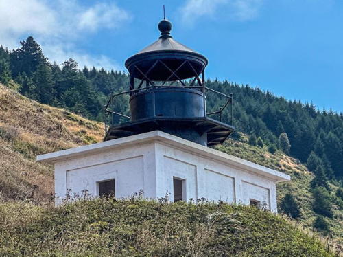
1856. Reactivated (inactive 1965-1982, now privately maintained); focal plane 77 ft (23.5 m); white flash every 30 s. 45 ft (14 m) cylindrical brick tower on the roof of a 1-1/2 story granite keeper's house; 5th order Fresnel lens (installed 1953). The original 4th order Fresnel lens is on display at the lighthouse. Lighthouse painted white; roof and lantern are red. The oil house (1880) is also preserved. Marcel Marchon's photo appears at right, the Del Norte County Historical Society has a page for the lighthouse, Justin Bise has a 2021 photo, Trabas has a photo by Klaus Potschien, Marinas.com has aerial photos, and Google has a satellite view and a foggy street view. The Coast Guard has a 1944 aerial photo of the station. One of only three surviving from the original series of California lighthouses, this lighthouse houses a small museum and quarters for volunteer caretakers, who occupy the building for one-month assignments. In February 2010 county officials learned that $180,000 was needed to correct leaks in the light tower. Located on a small island just off the foot of A Street in downtown Crescent City. Accessible from shore on foot at low tide. Site open, museum and tower open on days when the schedule of tides permits access, daily May through September and weekends October through March; check the light's Facebook page for current information. Owner: Del Norte County. Operator/site manager: Del Norte County Historical Society (Battery Point Lighthouse ). ARLHS USA-043; Admiralty G4417.5; USCG 6-0555.
St. George Reef
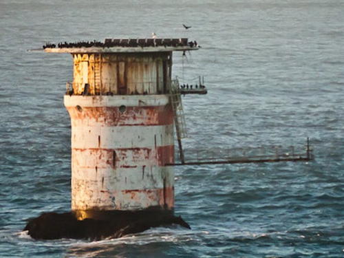
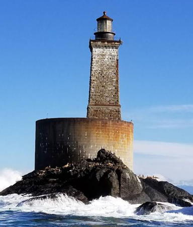
1892 (George Ballantyne). Reactivated (inactive 1975-2012, now privately maintained); focal plane 146 ft (44.5 m); white flash every 12 s. 90 ft (27.5 m) square granite tower, incorporating keeper's house, mounted on a massive concrete and granite base; the total height is about 140 ft (43 m). Solar-powered lens; the original 1st order Fresnel lens is on display at the Del Norte County Museum. Erica Meyer's 2017 photo is at the bottom of this page, Anderson has a fine page for the lighthouse, Anita Ritenour has a 2012 photo, and Marinas.com has aerial photos, but the lighthouse is only a fuzzy spot in Bing's satellite view. The Coast Guard has a 1955 photo. The tower took 10 years to build and is considered the nation's most expensive lighthouse. Preservation efforts have been underway for more than a decade. In spring 2000 the lantern room was accidently destroyed when a helicopter carrying it ashore for restoration came in too low. A replica lantern built by Fashion Blacksmith of Crescent City was installed in April 2002. Lighthouse Digest has a February 2006 feature on the ongoing restoration. Interior restoration is largely complete, with functioning electric power and utilities. The lighthouse was reactivated in March 2012. Located on Northwest Seal Rock, 3 miles (5 km) off Point St. George northwest of Crescent City. Accessible only by helicopter or by boat through very dangerous seas. Helicopter tours to the lighthouse were suspended in 2012 due to objections from state aviation safety officials. Following various modifications to improve safety, tours resumed in 2017. In 2021 the preservation society signed a 25-year lease of the lighthouse. Site and tower open only to helicopter tours ($300 per person) offered as weather permits November through April. Owner: Del Norte County. Operator/site manager: St. George Reef Lighthouse Preservation Society. ARLHS USA-793; Admiralty G4418; USCG 6-0561.
Battery Point Light
Battery Point Light, Crescent City, June 2005
Flickr Creative Commons photo
by Marcel Marchon

Lake Tahoe Lightbeacons (see also Nevada)
Lake Tahoe is a large and very scenic lake located in the Sierra Nevada range on the border of California and Nevada. The lake is about 22 mi (35 km) long and 12 mi (19 km) wide and has a surface elevation of 6225 ft (1897 m). Surprisingly, several navigational aids on the lake are maintained by the U.S. Coast Guard; after lobbying by wealthy landowners Congress passed an act in 1916 requiring the Lighthouse Bureau to install lights on the lake. It is doubtful whether any of these aids can be called lighthouses, but the following two sites are of some interest to lighthouse enthusiasts.

[Rubicon Point]
1916. Inactive since 1921. 12 ft (3.5 m) square wood tower; no lantern. Looks like an outhouse. Greg Thornhill has a 2019 photo, Jitendra Agrawal has a closeup photo, and Google has an indistinct satellite view of the point. Located on the southwest shore of the lake at an elevation of about 6300 ft (1920 m). Believe it or not, this structure was built by the Coast Guard. The Tahoe Heritage Foundation is interested in restoring the structure. Site and tower open. Owner: California State Parks. Site manager: D.L. Bliss State Park. ARLHS USA-917.
* [Sugar Pine Point (2)]
Date uncertain (station established 1921). Active; focal plane 4.5 m (15 ft); white flash every 4 s. 4 m (13 ft) post with red and white diamond-shaped daybeacon. Jeremy Gillespie has a street view from the beach and Bing has a satellite view. The original lighthouse, a wood pyramidal tower, replaced the Rubicon Point Light in 1921 and was reportedly removed in 1985. This has been claimed as "the world's highest working lighthouse," but there are much higher lights on Lake Titicaca in Peru and Bolivia. Located on a point on the west side of the lake, north of Rubicon Point. Owner: uncertain. Site manager: Ed Z'berg Sugar Pine Point State Park. ARLHS USA-916; USCG 6-8405.

Information available on lost lighthouses:

  • Mare Island, (1873-1930s), Carquinez Strait, Vallejo. Anderson also discusses this lighthouse on his Carquinez Strait page. This was another Paul J. Pelz design, similar to the East Brother Island lighthouse (see above). Located at the Mare Island Naval Shipyard, the light was of limited use after the establishment of the Carquinez Strait lighthouse in 1910. It was abandoned and demolished sometime in the 1930s. ARLHS USA-475.
  • Roe Island (1891-1944), Suisun Bay opposite the Port Chicago Naval Weapons Station. Anderson also has a page for the lighthouse. This lighthouse was abandoned after it was heavily damaged by a disastrous explosion of ammunition at the Port Chicago munitions terminal on 17 July 1944. It was sold and used as a summer cottage for a number of years, but eventually it was destroyed by fire. Google has a satellite view of pilings that survive from the light station. ARLHS USA-700.

Notable faux lighthouses:

  • Cape Mendocino (1) (replica) (1950), at the Humboldt County Fairgrounds in Ferndale. The original 1st order Fresnel lens of the Cape Mendocino lighthouse was mounted in the lantern of this tower for many years. The lens was removed in the fall of 2012 for restoration; it is currently in Coast Guard storage but may be displayed eventually at the Ferndale Museum. Anderson has a photo showing the lens in this tower, and Google has a street view and a satellite view.
  • Forbes Island (1992), formerly part of a restaurant afloat in San Francisco Bay at Pier 41, was never an aid to navigation. Google has a 2014 bay view of the lighthouse in San Francisco. The restaurant closed in April 2017 and was placed on sale. In November it was towed to the Holland Riverside Marina in Brentwood, where it remained on sale. Jessica Christie has a 2018 photo and Google has a March 2019 street view and a satellite view. By then the floating island had been sold; recently it was moved to the Willow Grove Ranch on Bradford Island near Oakley. Heidi Petty has a 2022 photo but the relocated island is not seen yet in Google's satellite view.
  • Suisun City (2007), a 52 ft (16 m) tower with lantern and gallery, is active, but it is purely decorative with no navigational function. M.J. DeCaires has a 2018 photo and Google has a street view and a satellite view.

St. George Reef Light, March 2012
Flickr Creative Commons photo by Anita Ritenour.

Adjoining pages: North: Oregon | East: Nevada | South: Southern California

Return to the Lighthouse Directory index | Ratings key

Checked and revised January 2, 2024. Lighthouses: 39. Lightships: 1. Site copyright 2024 Russ Rowlett and the University of North Carolina at Chapel Hill.