Lighthouses of China: Tiānjīn Area, Héběi

The People's Republic of China (中华, Zhōnghuá in Chinese) has a lengthy coastline, many large harbors, and a large number of lighthouses. During the colonial period of the late 19th and early 20th centuries Western powers occupied a number of locations in China and built lighthouses, many of which survive. In more recent years the People's Republic has developed modern ports throughout the country and built many lighthouses to serve them.

The People's Republic is divided into 23 provinces and 11 other province-level regions of various special types. Héběi (formerly spelled Hopei or Hopeh) is the province of northern China surrounding the provincial-level metropolitan districts of Běijīng and Tiānjīn. Its coast faces eastward on the Bohai Sea, a northwestward extension of the Yellow Sea lying west of the Liaodong and Shandong peninsulas. Bohai Bay is a western extension of the Bohai Sea. This page includes lighthouses of Tángshān, a prefectural-level city within Héběi Province at the northern entrance to Bohai Bay, the provincial-level city of Tiānjīn at the western end of the bay, and Cāngzhōu, a prefectural-level city within Héběi Province on the southern side of Bohai Bay.

There are many languages and dialects spoken in China, but Standard Chinese, often called Mandarin, is official. The pīnyīn system for transliterating Chinese into Latin characters is now the international standard but some locations continue to be known also under the spellings of older transliteration systems. The Chinese word for a lighthouse is dēngtǎ (灯塔). In Standard Chinese jiāo (formerly chiao) is a reef or rock, jiǎo is a cape or headland, dǎo (tao) is an island; (tsu) or tuózi ("lump") is a small island, hǎi is a sea, wān is a bay, hǎixiá is a strait, or jiāng is a river, hékǒu ("river mouth") is an estuary, and gǎng (kang) is a harbor.

Lighthouses in China are maintained by the PRC Maritime Safety Administration. The administration is organized in several regional administrations; Héběi and Tiānjīn lighthouses fall under the Tiānjīn MSA.

ARLHS numbers are from the ARLHS World List of Lights. CN numbers are Chinese light list numbers. Admiralty numbers are from volume P of the Admiralty List of Lights & Fog Signals. U.S. NGA List numbers are from Publication 112.

General Sources
Online List of Lights - China
Photos by various photographers posted by Alexander Trabas.
World of Lighthouses - China
Photos by various photographers available from Lightphotos.net.
Chinese English Pinyin Dictionary
A useful tool for juggling the representations of Chinese names.
Leuchttürme Chinas auf historischen Postkarten
Historic postcard views posted by Klaus Huelse.
Navionics Charts
Navigation chart for Héběi and Tiānjīn.
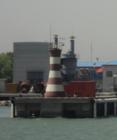

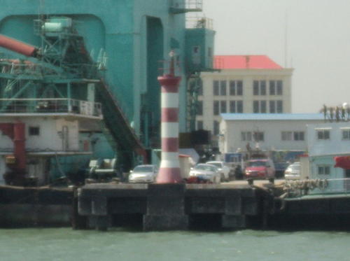
MSA Pier Light, Tiānjīn, May 2011
Wikimedia Creative Commons photo by Arrorro
Héběi Province: Tángshān City Lighthouses

Tángshān is a highly industrialized prefectural-level city at the northern entrance to Bohai Bay, described as a hub of steel, energy, chemical, and ceramics production. Most of the city had to be rebuilt after a disastrous earthquake in 1976 that killed several hundred thousand people. There are two major ports: the older Jīngtáng Gǎng facing the Bohai Sea and the newer Cáofēidiàn Gǎng facing Bohai Bay.

Làotíng County: Jīngtáng Harbor Lighthouses
Shǒugǎng Pier East
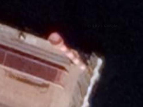
Date unknown. Active; focal plane 10 m (33 ft); white flash every 3 s. 7 m (23 ft) barbell-shaped tower colored with black and white horizontal bands. No photo available but Google has an indistinct satellite view. Located on a wharf in an eastern harbor basin of Jīngtáng. Site status unknown. CN-1310.622; Admiralty P3933.37.
Shǒugǎng Pier West
Date unknown. Active; focal plane 10 m (33 ft); red flash every 3 s. 7 m (23 ft) barbell-shaped tower colored with red and white horizontal bands. No photo available but Google has a satellite view. Located on a wharf in an eastern harbor basin of Jīngtáng. Site status unknown. CN-1310.621; Admiralty P3933.36.
Jīngtáng Gǎng (Tángshān Gǎng)
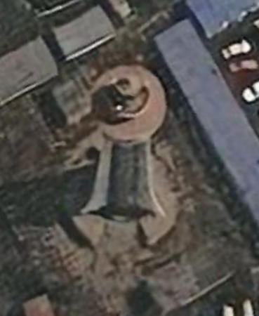
Date unknown (probably recent). Active; focal plane 40 m (131 ft); two white flashes every 10 s. 35 m (115 ft) round tower with three buttresses, painted with red and white horizontal bands. No photo available but Bing has the satellite view seen at right. Located on the east side of Jīngtáng harbor, the harbor of the city of Tángshān, at the northern entrance to Bohai Wan. Site status unknown. ARLHS PRC-034; CN-1310.1; Admiralty P3934; NGA 18494.
Jīngtáng East Breakwater No. 1 Head
Date unknown. Active; focal plane 12.5 m (41 ft); yellow flash every 4 s. 9 m (30 ft) round fiberglass tower colored with green and white horizontal bands. A photo is available and Google has a satellite view. Located at the end of the east outer breakwater at the entrance to Jīngtáng harbor. Site status unknown. CN-1310.65; Admiralty P3933.22.
Sigang Chi
Date unknown. Active; focal plane 12 m (39 ft); red flash every 2 s . 9 m (30 ft) barbell-shaped tower colored with red and white horizontal bands. No photo available but Google has a satellite view. This light may also serve as a leading light for vessels entering the harbor. Located at the corner of a wharf in the center of the harbor. Site status unknown. CN-1310.85; Admiralty P3933.5.
Jīngtáng Gǎng Entrance Range Front (5 towers)
Date unknown (2009?). Active; focal plane 39 m (128 ft); continuous white light. 36 m (118 ft) square pyramidal skeletal tower, painted with horizontal red and white bands and carrying a diamond shaped daymark. No photo available but Bing has a satellite view. In addition to the centerline range towers there are secondary towers marking the port and starboard sides of the channel. Located in a coal storage yard on the Tángshān waterfront. Site status unknown. CN-1314, Admiralty P3934.6 (centerline); CN-1314.2, P3934.62 (east limit); CN-1313.26, P3934.635 (east inner limit); CN-1313.28, P3934.636 (west inner limit); and CN-1314.4, P3934.64 (west limit).

Jīngtáng Gǎng Light, Tángshān
Bing Maps satellite view
Jīngtáng Gǎng Entrance Range Rear (5 towers)
2009-11. Active; focal plane 64 m (210 ft); continuous white light. 59 m (194 ft) square pyramidal skeletal tower, painted with horizontal red and white bands and carrying a diamond shaped daymark. No photo available. Bing has a satellite view of the centerline and east limit (on the right) lights; there are also satellite views of the west limit light and the east (left) and west inner lights. The centerline and east limit lights were relocated farther from the front light in 2011. Located 1.74 km (1.08 mi) northwest of the front light. Site status unknown. CN-1314.1, Admiralty P3934.61 (centerline); CN-1314.3, P3934.63 (east limit); CN-1313.27, P3934.6351 (east inner limit); CN-1313.29, P3934.6361 (west inner limit); and CN-1314.5, P3934.65 (west limit).
Jīngtáng West Breakwater South
Date unknown. Active; focal plane 10.5 m (34 ft); two red flashes every 6 s. 7 m (23 ft) tower colored with red and white horizontal bands. No photo available but Google has a satellite view. The original breakwater has been extended as part of a project to enclose and fill new land for industrial development. Site status unknown. CN-1310.685; Admiralty P3933.01.
Jīngtáng West Breakwater No. 1 Head
Date unknown. Active; focal plane 12.5 m (41 ft); yellow flash every 4 s. 9 m (30 ft) round fiberglass tower colored with red and white horizontal bands. No photo available but Google has a satellite view. Located at the end of the east outer breakwater at the entrance to Jīngtáng harbor. Site status unknown. CN-1310.653; Admiralty P3933.02.

Cáofēidiàn District: Cáofēidiàn Harbor Lighthouses
Cáofēidiàn was originally a long sandy island about 16 km (10 mi) offshore and 55 km (35 mi) east of Tánggū. Since 2006 the shallow area northwest of the island has been filled for development as an industrial area.

* Cáofēidiàn (Shaleif'ien Tao) (6?)
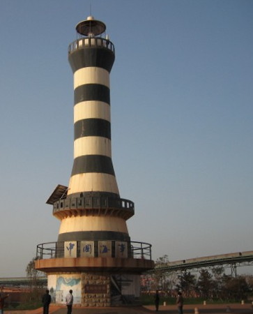
1998 (station established 1886). Active; focal plane 24 m (79 ft); three white flashes every 12 s. 21.5 m (71 ft) round hourglass-shaped fiberglass tower with lantern and gallery, mounted on a round concrete base. Lighthouse painted with black and white horizontal bands. A photo is at right, China Daily has a good photo (about 1/3 the way down the page), and Bing has a satellite view. According to MSA this is the 4th lighthouse built on the island, but a page formerly posted by the Cáofēidiàn Industrial Zone Management Committee said it is the 6th, and a blogger says it is the 10th. The original lighthouse here, a 13.5 m (45 ft) octagonal masonry tower, collapsed sometime after 1925 due to erosion. The second light, a 13.5 m (45 ft) skeletal tower, was destroyed in 1944 and replaced in 1950 by another skeletal tower; a larger tower was built in 1962 and a still larger one, the 23 m (75 ft) skeletal tower still listed by NGA, was built in 1965. Located at the southern end of the island. Accessible only by boat. Site open, tower closed. CN-1323; Admiralty P3932; NGA 18496
Cáofēidiàn East Breakwater
Date unknown. Active; focal plane 15 m (49 ft); green light, 2 s on, 2 s off. 12 m (39 ft) green fiberglass tower. No photo available but Google has a satellite view. Located on the east breakwater of the commercial harbor at Cáofēidiàn. Site status unknown. CN-1323.002; Admiralty P3931.2.
Cáofēidiàn Inner Breakwater
Date unknown. Active; focal plane 12.5 m (41 ft); green light, 2 s on, 2 s off. 10 m (33 ft) fiberglass tower colored with green and white horizontal bands. No photo available but Google has a satellite view. Located on the inner breakwater of the commercial harbor at Cáofēidiàn. Site status unknown. CN-1322.8; Admiralty P3931.26.
Cáofēidiàn Service Pier
Date unknown. Active; focal plane 10.5 m (34 ft); red light, 2 s on, 4 s off. 8 m (26 ft) white fiberglass tower. No photo available but Google has a satellite view. Located on the pier opposite the inner breakwater light. Site status unknown. CN-1322.79; Admiralty P3931.3.
Cáofēidiàn West Breakwater
Date unknown. Active; focal plane 15 m (49 ft); red light, 2 s on, 2 s off. 12 m (39 ft) red fiberglass tower. No photo available but Google has a satellite view. Located on the west breakwater of the commercial harbor at Cáofēidiàn. Site status unknown. CN-1323.004; Admiralty P3931.1.
Ergangchi Lianxiang Matou
Date unknown. Active; focal plane about 16 m (52 ft); light characteristic unknown. Approx. 14 m (46 ft) barbell-shaped tower. No photo available but Google has a satellite view. Located on a wharf on the west side of the Ergangchi basin at Cáofēidiàn. Site status unknown. Admiralty P3931.0728.
Caofeidian Light
Cáofēidiàn Light, Tángshān, 2009
Cáofēidiàn Tourist Bureau photo (no longer online)
 

Tiānjīn City (Tiānjīn Shì): Bīnhǎi District Lighthouses

Tiānjīn (formerly spelled Tientsin) is large metropolis at the western end of the Bohai Sea; it has a population of about 15.5 million and is China's fourth largest city. It is a national level city, meaning that it has the same status as a province. Bīnhǎi ("Seaside"), a sub-provincial level district, includes all of the coast of Tiānjīn. It has always been a major port; in recent times the port has been greatly expanded.

Dàgū Lighthouse
Dàgū (Taku)
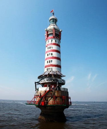
1978 (lightship station established 1878). Active; focal plane 36 m (118 ft); white flash every 10 s. 38 m (125 ft) round cylindrical concrete tower with lantern, mounted on a round concrete pier. Lighthouse painted white with narrow red horizontal bands; lantern painted white. A photo appears at right but the lighthouse is not shown in Google's satellite view. This is the landfall light for Bīnhǎi/Tánggū, located about 16 km (10 mi) east of the harbor entrance. Construction began in 1971 and lasted seven years. Riprap was installed around the base in 1998. The station is staffed by rotating crews of two keepers. In 2011 the 100-year old lightship Dàgū, which had been replaced by the lighthouse in 1978, was refurbished and placed on display at Qīngdǎo in Shāndōng. Located about 15 km (9 mi) east of the harbor. Accessible only by boat. Site status unknown. ARLHS PRC-019; CN-1327; Admiralty P3908; NGA 18500.

Xīngǎng ("New Harbor") Lighthouses
Xīngǎng North Breakwater
Date unknown. Active; focal plane 21 m (69 ft); green light, 2 s on, 2 s off. 16 m (52 ft) round barbell-shaped concrete tower painted with green and white horizontal bands. No photo available but Google has a satellite view. Located on a square concrete pier at the end of the north breakwater of the harbor. Accessible only by boat. Site and tower closed. CN-1327.02; Admiralty P3909.1; NGA 18500.6.
Xīngǎng International Cruise Terminal
Date unknown. Active; focal plane 14 m (46 ft); green light, 2 s on, 2 s off. 12 m (39 ft) round cylindrical fiberglass tower colored with black and white horizontal bands. Lightphotos.net has a distant view, Fang Wang has a 2022 view, and Google has a satellite view. Cruise ships dock here while passengers tour to Běijīng by bus. Located at the southeast corner of the pier in a basin north of the main harbor. Site status unknown. CN-1358.015; Admiralty P3911.3; NGA 18527.17.
Xīngǎng Vessel Pier South
Date unknown. Active; focal plane 12 m (39 ft); white light, 2 s on, 2 s off. 10 m (33 ft) round cylindrical fiberglass tower colored with black and white horizontal bands. Lightphotos.net has a photo and Google has a satellite view. Located at the south end of a pier in the center of the north side of Xīngǎng harbor. Site status unknown. CN-1361.214; Admiralty P3911.6; NGA 18527.
Xīngǎng Vessel Pier North
Date unknown. Active; focal plane 12 m (39 ft); red light, 2 s on, 2 s off. 10 m (33 ft) round cylindrical fiberglass tower colored with red and white horizontal bands. Lightphotos.net has a photo and Google has a satellite view. Located at the north end of a pier in the center of the north side of the Xīngǎng harbor. Site status unknown. CN-1361.216; Admiralty P3911.62; NGA 18527.1.
Dagu Light
Dàgū Light, Tiānjīn, August 2012
PRC Xinhua News Service photo
Hǎihé Lock Range Front
Date unknown. Active; focal plane 30 m (98 ft); white light, 1 s on, 1 s off. 27 m (89 ft) skeletal tower painted with red and white horizontal bands. No photo available but Google has a satellite view. The lock allows vessels to enter the Hǎihé River from the Xīngǎng harbor. Located about 1 km (0.6 mi) west of the front light. Site status unknown. CN-1365; Admiralty P3912.
Hǎihé Lock Range Rear
Date unknown. Active; focal plane 39.5 m (130 ft); white light, 2 s on, 2 s off. 36.5 m (120 ft) skeletal tower painted with red and white horizontal bands. No photo available but Google has a satellite view. The lock allows vessels to enter the Hǎihé River from the Xīngǎng harbor. Located about 300 m (0.2 mi) west of the lock. Site status unknown. CN-1366; Admiralty P3912.1.
Xīngǎng South Breakwater
Date unknown. Active; focal plane 21 m (69 ft); red light, 2 s on, 2 s off. 16 m (52 ft) round barbell-shaped concrete tower painted with red and white horizontal bands. No photo available but Google has a satellite view. Located on a square concrete pier off the end of the south breakwater of the harbor. Accessible only by boat. Site and tower closed. CN-1327.03; Admiralty P3909.2; NGA 18500.7.
Xīngǎng Cicum Pier
Date unknown. Active; focal plane 14 m (46 ft); red light, 2 s on, 2 s off. 12 m (39 ft) round cylindrical fiberglass tower, colored with red and white horizontal bands. No photo available but Google has a satellite view. Located on a short breakwater at the roll on/roll off terminal for trucks and autos on the northern branch of the Xīngǎng (Tánggū) harbor. Site status unknown. CN-1355; Admiralty P3911.8; NGA 18506.
Xīngǎng Oil Pier East
Date unknown. Active; focal plane 17 m (56 ft) red flash every 3 s. 15 m (49 ft) round barbell-shaped fiberglass tower, colored with red and white horizontal bands. No photo available but Google has a satellite view. Located at the oil terminal on the south side of the entrance to Tiānjīn's Xīngǎng harbor. Site and tower closed. CN-1327.04; Admiralty P3909.5; NGA 18501.
Xīngǎng Oil Pier West
Date unknown. Active; focal plane 17 m (56 ft) green flash every 3 s. 15 m (49 ft) round barbell-shaped fiberglass tower, colored with green and white horizontal bands. No photo available but Google has a satellite view. Located at the oil terminal on the south side of the entrance to Tiānjīn's Xīngǎng harbor. Site and tower closed. CN-1327.05; Admiralty P3909.6; NGA 18502.
Xīngǎng Range Front (7 towers)
Date unknown. Active; focal plane 28 m (92 ft); white light occulting once every 5 s. 28 m (92 ft) square skeletal tower. The tower carries three black diamond-shaped daymarks. No photo available but Google has a satellite view. The lighthouse is flanked on either side by skeletal towers carrying additional lights that indicate the sides of the dredged channel. This is the entrance range for the harbor of Tánggū (Xīngǎng is the name of the harbor subdistrict). Located on the south side of the harbor, just west of a slight bend in the waterway. Site status unknown. CN-1332, Admiralty P3910 (centerline); CN-1338, P3910.4 (northernmost); CN-1328, P3909.82 (north limit); CN-1330, P3909.83 (north middle); CN-1334, P3910.2 (south middle); CN-1336, P3910.3 (south limit); and CN-1340, P3910.42 (southernmost); NGA 18504.
* Xīngǎng Range Rear (7 towers)
Date unknown. Active; focal plane 52 m (171 ft); white light, 2 s on, 2 s off. 52 m (171 ft) square skeletal tower. The tower carries three black diamond-shaped daymarks. The lighthouse is flanked on either side by skeletal towers carrying additional lights that indicate the sides of the dredged channel. The photo at right shows all seven rear towers and Google has a satellite view. The Admiralty lists five of the seven towers; the northernmost and southernmost are omitted. Located in the downtown area 1.7 km (1.1 mi) west of the front light. Site status unknown, but the light should be visible from a nearby major street. CN-1333, Admiralty P3910.1 (centerline); CN-1339, P3910.41 (northernmost); CN-1329, P3909.821 (north limit); CN-1331, P3909.831 (north middle); CN-1335, P3910.21 (south middle); CN-1337, P3910.301 (south limit); and CN-1341, P3910.421 (southernmost); NGA 18508.

The seven Xīngǎng Range Rear Lights (south is on the left), Tiānjīn, May 2011
Wikimedia Creative Commons photo by Arrorro
Xīngǎng Hangzheng Service Pier
Date unknown. Active; focal plane 11 m (36 ft); red light, 2 s on, 2 s off. 8 m (26 ft) round tapered fiberglass tower colored with red and white horizontal bands. A photo is at right and Google has a satellite view. Located on a pier on the south side of Xīngǎng harbor. Site status unknown. CN-1337.1; Admiralty P3909.815; NGA 18524.5.
Xīngǎng HSA (MSA) Pier
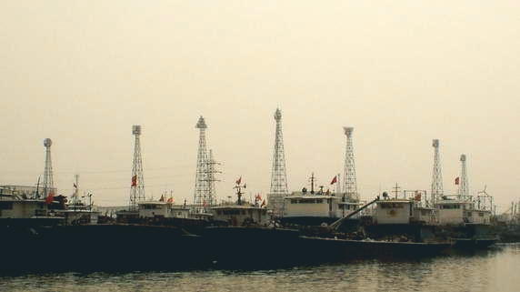
Date unknown. Active; focal plane 11 m (36 ft); red flash every 3 s. 8.5 m (28 ft) round tapered fiberglass tower colored with red and white horizontal bands. A photo is at the top of this page and Google has a satellite view. Located on a pier on the south side of Xīngǎng harbor. Site status unknown. CN-1327.1; Admiralty P3909.81; NGA 18526.
Bomaike Wharf
Date unknown. Active; focal plane 14 m (46 ft); green light, 2 s on, 2 s off. 12 m (39 ft) round cylindrical fiberglass tower colored with green and white horizontal bands. Thumelen Chandrasegaran has a very distant street view and Google has an indistinct satellite view. Located on a wharf in the south basin of Xīngǎng harbor. Site and tower closed. CN-1375.67; Admiralty P3911.5; NGA 18527.2.

Língǎng Harbor Lighthouses
The Língǎng ("Arrival Harbor") basin is south of and parallel to the main Xīngǎng basin.

Língǎng Zhonghangyou Pier East
Date unknown. Active; focal plane about 15 m (49 ft); green light, 2 s on, 8 s off. 12 m (39 ft) round cylindrical fiberglass tower colored with yellow and white horizontal bands. No photo available but Google has a satellite view. Located on a pier on the north side of the Língǎng basin. Site and tower closed. CN-1375.543; Admiralty P3911.568.

Hangzhen Service Pier Light, Tiānjīn, May 2011
Wikimedia Creative Commons photo by Arrorro
Língǎng Sino Chemical Pier East
Date unknown. Active; focal plane 14 m (46 ft); red light occulting once every 5 s. 12 m (39 ft) round cylindrical fiberglass tower colored with red and white horizontal bands. No photo available but Google has a satellite view. Located at the east end of a pier on the north side of the Língǎng basin. Site and tower closed. CN-1375.566; Admiralty P3911.57.
Língǎng Sino Chemical Pier West
Date unknown. Active; focal plane 14 m (46 ft); green light occulting once every 5 s. 12 m (39 ft) round cylindrical fiberglass tower colored with green and white horizontal bands. No photo available but Google has a satellite view. Located at the west end of a pier on the north side of the Língǎng basin. Site and tower closed. CN-1375.565; Admiralty P3911.59.
Língǎng Grain and Oil Pier East
Date unknown. Active; focal plane 18 m (59 ft); red light, 2 s on, 2 s off. 15 m (49 ft) round cylindrical fiberglass tower colored with red and white horizontal bands. No photo available but Google has a satellite view. Located on a pier on the south side of the Língǎng basin. Site and tower closed. CN-1375.515; Admiralty P3911.4; NGA 18527.46.
Língǎng Grain and Oil Pier West
Date unknown. Active; focal plane 18 m (59 ft); green light, 2 s on, 2 s off. 15 m (49 ft) round cylindrical fiberglass tower colored with green and white horizontal bands. No photo available but Google has an indistinct satellite view. Located on a pier on the south side of the Língǎng basin. Site and tower closed. CN-1375.516; Admiralty P3911.45.
Língǎng Berth 14
Date unknown. Active; focal plane 18 m (59 ft); red light, 2 s on, 2 s off. 15 m (49 ft) round cylindrical fiberglass tower colored with red and green horizontal bands. No photo available but Google has a satellite view (a portion is seen at right). NGA calls this Berth 11. Located on a pier on the south side of the Língǎng basin. Site and tower closed. CN serial 2511100.14; Admiralty P3911.52; NGA 18527.45.
Língǎng Industrial Zone General Pier
Date unknown. Active; focal plane 15 m (49 ft); green light, 2 s on, 2 s off. 12 m (39 ft) round cylindrical fiberglass tower colored with green and white horizontal bands. No photo available but Google has a satellite view. Located on a pier near the upper end of the south side of the Língǎng basin. Site and tower closed. CN-1357.639; Admiralty P3911.56; NGA 18527.3.

Língǎng Berth 14 Light, Tiānjīn
Google Maps satellite view

Dàgǎng Harbor Lighthouses
Dàgǎng ("Big Harbor") is a relatively new harbor south of the traditional harbors; it is the site of a large LNG terminal.

Dàgǎng North Breakwater
Date unknown. Active; focal plane 31 m (102 ft); green light, 2 s on, 2 s off. 25 m (82 ft) tower colored with green and white horizontal bands. No photo available and the light is not shown in Google's satellite view. Located at the end of the long north breakwater. Site status unknown. CN serial 2511268; Admiralty P3907.38.
Dàgǎng Operating Vessel Pier
Date unknown. Active; focal plane 14 m (46 ft); white light, 2 s on, 2 s off. 12 m (39 ft) round cylindrical fiberglass tower colored with red and white horizontal bands. No photo available but Google has a satellite view. Located on a pier in the inner Dàgǎng harbor. Site status unknown. CN-1377.35; Admiralty P3907.42.
Dàgǎng General Berth West
Date unknown. Active; focal plane 14 m (46 ft); white light, 1 s on, 1 s off. 12 m (39 ft) round cylindrical fiberglass tower colored with black and white horizontal bands. No photo available but Google has a satellite view. Located on a pier in the inner Dàgǎng harbor east of the Operating Vessel Pier. Site status unknown. CN-1377.32; Admiralty P3907.41.
Dàgǎng Building Materials Pier East
Date unknown. Active; focal plane 14 m (46 ft); red light, 2 s on, 2 s off. 12 m (39 ft) round cylindrical fiberglass tower colored with red and white horizontal bands. No photo available but Google has a satellite view. Located on the easternmost pier in the inner Dàgǎng harbor. Site status unknown. CN-1377.31; Admiralty P3907.4.
Dàgǎng South Breakwater
Date unknown. Active; focal plane 31 m (102 ft); red light, 2 s on, 2 s off. 25 m (82 ft) tower colored with red and white horizontal bands. No photo available and the light is not shown in Google's satellite view. Located at the end of the long south breakwater. Site status unknown. CN serial 2511269; Admiralty P3907.381.

Héběi Province: Cāngzhōu City: Huánghuá Lighthouses

Cāngzhōu is a prefectural-level city in Héběi Province, bounded on the north by Tiānjīn and on the south by Shāndōng Province. The county-level city of Huánghuá includes all of the coast of Cāngzhōu. The population of Cāngzhōu is more than 7 million, of which about 670,000 live in Huánghuá.

Huánghuá Harbor Lighthouses
To create a modern harbor for Huánghuá a large quay was extended into Bohai Bay. There are separate dredged channels leading to the north and south sides of the quay.

Huánghuá North Channel Range Front (3 towers)
Date unknown. Active; focal plane 46 m (150 ft); continuous white light. 45 m (148 ft) triangular skeletal tower. Google has a satellite view and a distant street view. 28 m (92 ft) skeletal towers to each side of the main light define the edges of the channel, showing a continuous green light on the north side and continuous red light on the south side. Located on a large filled area on the waterfront of Huánghuá. Site status unknown. CN-1380.8, Admiralty P3906.97 (centerline); CN-1380.81, Admiralty P3906.972 (south limit), and CN-1380.82, Admiralty P3906.973 (north limit).
Huánghuá North Channel Range Rear (3 towers)
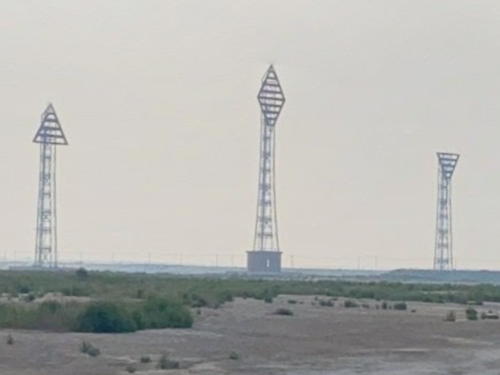
Date unknown. Active; focal plane 67 m (220 ft); continuous white light. Approx. 61 m (200 ft) triangular skeletal tower. Google has the street view seen at right and a satellite view. Approx. 45 m (148 ft) skeletal towers to each side of the main light define the edges of the channel, showing a continuous green light on the north side and continuous red light on the south side. Located about 2 km (1.25 mi) southwest of the front light. Site status unknown. CN-1380.83, Admiralty P3906.971 (centerline); CN-1380.84, Admiralty P3906.9721 (south limit); and CN-1380.85, Admiralty P3906.9731 (north limit).
Huánghuá Outer South Channel Range Front (5 towers)
Date unknown. Active; focal plane 58.5 m (192 ft); white flash every 6 s. 58 m (190 ft) round concrete tower. No photo available but Google has a satellite view. Additional skeletal towers to each side of the main light define the edges of the channel, showing continuous green lights on the north side and continuous red lights on the south side except the south middle light shows a white flash every 5 s. Located on the waterfront of Huánghuá. Site status unknown. CN-1378, Admiralty P3906.77 (centerline); CN-1378.02, Admiralty P3906.773 (north limit); CN-1378.04,Admiralty P3906.772 (north middle); CN-1378.06, Admiralty P3906.774 (south middle); and CN-1378.08, Admiralty P3906.775 (south limit).

North Channel Range Rear Lights, Huánghuá, August 2021
Google Maps street view
Huánghuá Outer South Channel Range Rear (5 towers)
Date unknown. Active; focal plane 81.5 m (267 ft); white flash every 6 s. 81 m (266 ft) round concrete tower. No photo available but Google has a satellite view. Two additional skeletal towers on each side of the main light define the edges of the channel, showing continuous green lights on the north side and continuous red lights on the south side except the south middle light shows a white flash every 5 s. Located about 2 km (1.25 mi) southwest of the front light. Site status unknown. CN-1378.01, Admiralty P3906.771 (centerline);CN-1378.03, Admiralty P3906.7731 (north limit); CN-1378.05, Admiralty P3906.7721 (north middle); CN-1378.07, Admiralty P3906.7741 (south middle); and CN-1378.09, Admiralty P3906.7751 (south limit).
Huánghuá Inner South Channel Range Front (5 towers)
Date unknown. Active; focal plane 33.5 m (110 ft); white flash every 4 s. 33 m (108 ft) round concrete tower. No photo available but Google has an indistinct satellite view. Additional skeletal towers to each side of the main light define the edges of the channel, showing a continuous green light on the north limit a continuous red light on the south limit, and white flashes every 3 s on the north and south middle. Located on the waterfront of Huánghuá, in a coal terminal south of the Outer Channel Front lights. Site status unknown. CN-1381, Admiralty P3906.78 (centerline); CN-1381.01, Admiralty P3906.783 (north limit); CN-1381.03, Admiralty P3906.782 (north middle); CN-1381.05, Admiralty P3906.784 (south middle); and CN-1381.07, Admiralty P3906.785 (south limit).
Huánghuá Inner South Channel Range Rear (5 towers)
Date unknown. Active; focal plane 53.5 m (176 ft); white flash every 4 s. 53 m (174 ft) triangular skeletal tower. No photo available but Google has a satellite view. Two additional skeletal towers on each side of the main light define the edges of the channel, showing a continuous green light on the north limit a continuous red light on the south limit, and white flashes every 3 s on the north and south middle. Located about 2 km (1.25 mi) southwest of the front light. Site status unknown. CN-1381.001, Admiralty P3906.781 (centerline); CN-1381.02, Admiralty P3906.7831 (north limit); CN-1381.04, Admiralty P3906.7821 (north middle); CN-1381.06, Admiralty P3906.7841 (south middle); and CN-1381.08, Admiralty P3906.7851 (south limit).
Dàkǒuhé Kǒu
Date unknown. Active; focal plane 20 m (66 ft); white flash every 4 s. 19 m (62 ft) tapered square skeletal tower. No photo available but Google has a satellite view (a portion is seen at right). The name of the lighthouse means "Big Mouth River Mouth." Located on the south side of the mouth of the Dàkǒuhé River on the south side of the Huánghuá harbor. Site may be open, tower closed. CN-1386; Admiralty P3906.75.

North Channel Range Rear Lights, Huánghuá, August 2021
Google Maps satellite view

Information available on lost lighthouses:

Notable faux lighthouses:

Adjoining pages: North: Qinshandao | South: Northwestern Shāndōng

Return to the Lighthouse Directory index | Ratings key

Posted March 5, 2008. Checked and revised August 2, 2023. Lighthouses: 49. Site copyright 2023 Russ Rowlett and the University of North Carolina at Chapel Hill.