Lighthouses of France: Corse (Corsica)

France (officially the French Republic, République française) has coasts facing south on the Mediterranean Sea, west on the open Atlantic Ocean, and north on the English Channel (La Manche in French). Long a leader in lighthouse design, France has scores of famous and historic lighthouses. And it was a French engineer and physicist, Augustin-Jean Fresnel (1788-1837), who invented the powerful and beautiful lenses used in lighthouses around the world.

The fourth largest island of the Mediterranean, Corsica (officially the Collectivité de Corse) is located southwest of mainland France, north of Sardinia, and due south of Genoa, Italy. After centuries of Genoese control the island was conquered by France in 1768-69 and has remained French territory since. Since 1982 the island has been governed as one of the 18 regions (régions) of the French Republic. Being classified also as a territorial collectivity (collectivité territoriale) gives it a degree of autonomy. Since 1975 it has been subdivided into two départements, Haute-Corse (Upper Corsica) and Corse-du-Sud (Southern Corsica).

French is the official and dominant language although some residents can also speak the indigenous Corsican language, closely related to Italian. The French word for a lighthouse, phare, is often reserved for the larger coastal lighthouses; a smaller light or harbor light is called a feu (literally "fire," but here meaning "light") or a balise (beacon). The front light of a range (alignement) is the feu antérieur and the rear light is the feu postérieur. In French île is an island, cap is a cape, pointe is a promontory or point of land, roche is a rock, récife is a reef, baie is a bay, estuaire is an estuary or inlet, détroit is a strait, rivière is a river, and havre is a harbor. In Corsican the word for a lighthouse is faru; isula is an island, puntu is a promontory or point of land, scogliu is a rock, and portu is a harbor.

Aids to navigation in France are maintained by the Bureau des Phares et Balises, an agency of the Direction des Affaires Maritimes (Directorate of Maritime Affairs). The Directorate has four regional offices (called Directions Interrégionale de la Mer, or DIRM) at Le Havre, Nantes, Bordeaux, and Marseille. Mediterranean lighthouses fall under DIRM Méditerranée, based in Marseille. However, many of the lights are actually operated by the transport ministries or port authorities of the departmental governments.

ARLHS numbers are from the ARLHS World List of Lights. Admiralty numbers are from volume E of the Admiralty List of Lights & Fog Signals. U.S. NGA List numbers are from Publication 113.

General Sources
Les Sentinelles des Mers - Méditerranée
Photos and information posted by Guy Detienne.
DIRM Méditerranée - Phares de Corse
An interactive map leads to information and photos for the major lighthouses.
Le Phare à travers le Monde - France - Méditerranée
A site maintained by Alain Guyomard and Robert Carceller.
Phareland, le Site des Phares de France
This site has photos and information about the major lighthouses.
Online List of Lights - Mediterranean France
Photos by various photographers posted by Alexander Trabas. Many of the photos for Corsica are by Eckhard Meyer, Arno Siering or Rainer Arndt.
France Lighthouses
Aerial photos posted by Marinas.com.
Lighthouses in Corsica
Photos by various photographers available from Wikimedia.
World of Lighthouses - South Coast of France
Photos by various photographers available from Lightphotos.net.
Société Nationale pour le Patrimoine des Phares et Balises (S.N.P.B.)
The French national lighthouse preservation organization.
Französische Leuchttürme und Baken auf historischen Postkarten
Historic photos and postcard images posted by Klaus Huelse.
GPSNauticalCharts
Navigational chart information for Corsica.
Navionics Charts
Navigational chart for Corsica.


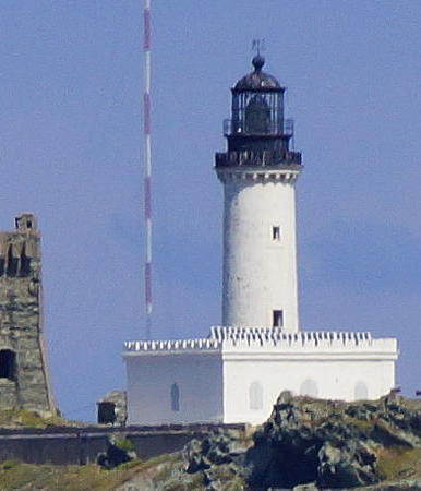
La Giraglia Light, Cap Corse, 2019
Wikimedia Creative Commons photo by Wolfgang Pehlemann
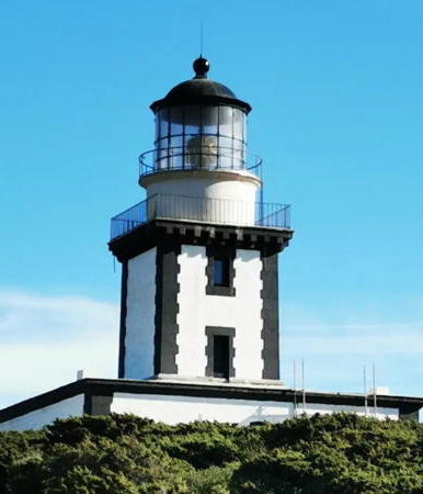

Pertusato Light, Strait of Bonifacio, April 2024
Instagram photo by Catherine Lamarche
Haute-Corse (Northern Corsica) Lighthouses

Calvi Lighthouses
* La Revellata
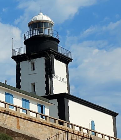
1844. Active; focal plane 97 m (318 ft); two white flashes every 10 s. 19 m (62 ft) square cylindrical masonry tower with lantern and gallery, rising from the center of a square 1-story masonry keeper's house. Lighthouse painted white with black trim outlining the corners of the tower and building; lantern painted white. Laura Borselli's 2022 photo is at right, Detienne has a page for the lighthouse, Pascal Poggi has a good 2012 photo, Alain Bachellier has a closeup photo, Trabas has Günther Hess's photo, Wikimedia has several photos, Huelse has a historic postcard view, Marinas.com has aerial photos, and Google has a street view and a satellite view. This is the landfall light for Calvi, a port on Corsica's northwest coast. Located on a knife-edge ridge at the tip of the Pointe de la Revellata, about 8 km (5 mi) northwest of Calvi via twisting mountain roads. Site open, tower closed. . ARLHS COR-004; Admiralty E0918; NGA 8044.
* Calvi Citadelle (Entrance)
Date unknown. Actove; focal plane 30 m (98 ft); green light occulting twice every 6 s. 6 m (20 ft) hexagonal tower on a square concrete base. Tower painted white; the small lantern is green. Trabas has Siering's photo, Hadrien Kermarrec has a 2023 photo, Gerd Besch has a closeup street view, and Google has a satellite view. Located below the historic citadel at the entrance to Calvi harbor. Site open, tower closed. ARLHS COR-039; Admiralty E0920; NGA 8052.
* Calvi Jetée (2)
1938 (station established 1899). Active; focal plane 10 m (33 ft); quick-flashing green light. 10 m (33 ft) square cylindrical stone tower. Tower unpainted, except that a narrow green band is painted around the top of the tower. Roberto Ferrari has a good photo, Trabas has a photo, Luca Palli has a street view, and Google has a satellite view. Located at the end of a sturdy groin extending into the sea at the foot of the citadel. Accessible by walking the mole. Site open, tower closed. ARLHS COR-040; Admiralty E0922; NGA 8056.

Île-Rousse (Isula Rossa) Lighthouses
* La Pietra (Île-Rousse)
1857. Active; focal plane 64 m (210 ft); three flashes every 12 s, white or green depending on direction. 13 m (43 ft) square cylindrical masonry tower with lantern and gallery, rising from the center of a square 1-story masonry keeper's house. Lighthouse painted white, lantern green. DIRM has a page for the lighthouse, Phareland.com has numerous photos of this station, Trabas has a great photo by Siering, Mauro Silva has a 2021 photo, Mauro Prelli has a sea view, and Google has a street view and a satellite view. This lighthouse is built on an island connected to the mainland by a causeway. The light is the landfall light for Île-Rousse, a terminal for ferries from Marseille. Located at the end of the D81A highway about 1 km (0.6 mi) north of Île-Rousse. Accessible by walking the access road (about 30 minutes); parking is available at the foot of the hill. Site open, tower closed. . ARLHS COR-015; Admiralty E0926; NGA 8068.

La Revellata Light, Calvi, August 2022
Google Maps photo by Laura Borselli
Île-Rousse Jetée (2)
1934 (station established 1858). Active; focal plane 12 m (39 ft); green light, 2 s on, 2 s off. 6 m (20 ft) round cylindrical tower with lantern and gallery, mounted on a circular stone base at the end of the pier. Tower painted white, lantern and gallery green. Trabas has Siering's closeup photo, Huelse has an interesting postcard view, and Google has a satellite view and a distant street view. Located at the end of the mole sheltering the ferry terminal of Île-Rousse. Site and tower closed; the lighthouse is easy to see at a distance. ARLHS COR-022; Admiralty E0928; NGA 8072.

Saint-Florent Lighthouses
Mortella
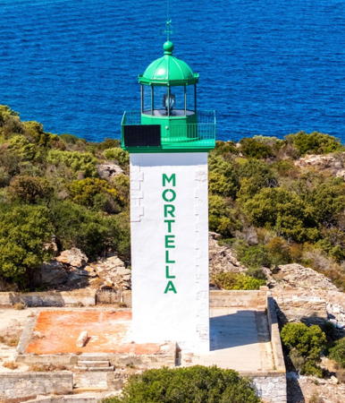
1877. Active; focal plane 43 m (141 ft); green light, 3 s on, 1 s off. 14 m (46 ft) square cylindrical masonry tower with lantern and gallery. The keeper's house, formerly attached, has been demolished. Lighthouse painted white, lantern and gallery green. A 2022 photo is at right, a 2005 photo is available, Pascal Lungo has a 2019 photo, a 2022 photo is available, Trabas has Meyer's distant view, and Google has a satellite view. This lighthouse marks the west side of the entrance to the Golfe de Saint-Florent on the north coast of Corsica. High above the lighthouse is a historic signal station (sémaphore). Located on Punta Mortella, about 6 km (4 mi) by sea northwest of Saint-Florent. Land access to this location appears to be through private property. Site and tower closed. . ARLHS COR-019; Admiralty E0930; NGA 8076.
Fornali
1876. Active; focal plane 14 m (46 ft); green flash every 4 s. 11 m (36 ft) square cylindrical masonry tower with lantern and gallery. The keeper's house, formerly attached, has been demolished. Lighthouse painted white with green trim on the corners of the tower, lantern and gallery green. Trabas has Meyer's photo and Google has a satellite view. This lighthouse is on the west side of the Golfe de Saint-Florent opposite the town of Saint-Florent. Located about 2.5 km (1.5 mi) west of Saint-Florent. Site open but not easy to reach; it may be possible to hike to the lighthouse from a campground on the outskirts of Saint-Florent although the trail passes through private property. Site and tower closed. . ARLHS COR-030; Admiralty E0932; NGA 8084.
Tignoso (Tignasu)
Date unknown. Active; focal plane 6 m (20 ft) (?); red flash every 4 s. 9 m (30 ft) round tower, painted red. Trabas has Meyer's photo and Google has a satellite view. The light is on top of the tower, so it seems the focal plane height should also be 9 m. Located on a rock in the Golfe de Saint-Florent, about 600 m (3/8 mi) northwest of the harbor of Saint-Florent. Accessible only by boat. Site open, tower closed. Admiralty E0934; NGA 8088.

La Giraglia Light, Cap Corse, July 2022
Google Maps photo by MR DL

Rogliano (Cap Corse Area) Lighthouses

Cap Corse (Île de la Giraglia)
1848 (Léonce Reynaud). Active; focal plane 85 m (279 ft); white flash every 5 s. 26 m (85 ft) round cylindrical stone tower with lantern and gallery, centered on a square 1-story masonry keeper's house. Lighthouse painted white, lantern and gallery black. A square stone watch tower built by Genoa in 1573 stands next to the lighthouse. Wolfgang Pehlemann's 2019 photo is at the top of this page, Guyomard and Carceller have a page for the lighthouse, a distant view and a view from the sea are available, Trabas has Siering's view, Huelse has a historic postcard view, Marinas.com has aerial photos, and Google has a satellite view. This important light station marks the extreme northern tip of Corsica, Cap Corse. The lighthouse was under construction for ten years before it was finally finished in 1848. Located at the northern tip of the Île de la Giraglia, a small island about 2 km (1.25 mi) off the point of Cap Corse. Accessible only by boat; there is a very distant view from the vicinity of Barcaggio. Site and tower closed (the island is closed to the public). . ARLHS COR-016; Admiralty E0852; NGA 8100.
* Macinaggio (2)
1939 (station established 1880). Active; focal plane 8 m (26 ft); white or red light depending on direction, occulting twice every 6 s. 8 m (26 ft) round unpainted stone tower; no lantern. Trabas has Siering's photo, Emanuele Benozzi has a photo, and Google has a closeup street view and a satellite view. This modest light replaced a cast iron tourelle. Located at the end of the breakwater at Macinaggio, the northernmost port of Corsica's east coast. Accessible by walking the pier. Site open, tower closed. ARLHS COR-012; Admiralty E0854; NGA 8104.

Bastia Lighthouses
Bastia is the capital of Haute-Corse, the principal port of the island and the destination for ferries arriving from Marseille, Toulon, Nice, Genoa, Savona, and Livorno.

Bastia Jetée de Saint-Nicolas (2)
1930s? (station established 1875). Active; focal plane 9 m (30 ft); green flash every 4 s. 5 m (16 ft) round cylindrical masonry tower with gallery. Tower unpainted except for a green band around the top of the tower. Max Musterhaus has a photo, Trabas has a photo, and Google has a satellite view and a distant street view. Located at the end of the breakwater protecting the newer harbor of Bastia. Site status unknown. ARLHS COR-026; Admiralty E0860; NGA 8124.
* Bastia Môle Génois (2)
1904 (station established 1863). Active; focal plane 13 m (43 ft); green light, occulting twice every 6 s. 9 m (30 ft) round cylindrical stone tower with lantern and gallery. Tower unpainted; lantern and gallery painted green. Trabas has Arndt's closeup, Guyomard and Carceller also have photos, Max Difermo has a photo of this light and the Jetée du Dragon light, Liveriu Marcelli has a 2022 drone view, Jean-Michel Gueugnot has a street view, and Google has a satellite view. Located at the end of the north mole enclosing the old harbor of Bastia. Accessible by walking the pier. Site open, tower closed. ARLHS COR-029; Admiralty E0858; NGA 8120.
* Bastia Jetée du Dragon (2)
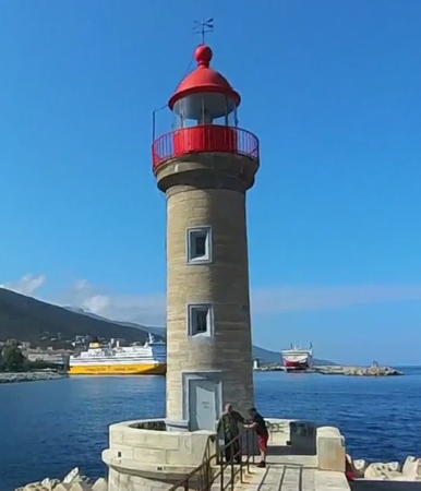
1904 (station established 1861). Active; focal plane 16 m (52 ft); four flashes, white or red depending on direction, every 12 s. 13 m (43 ft) round cylindrical stone tower with lantern and gallery. Tower unpainted; lantern and gallery painted red. A 2023 street view by Johan Hendriks is at right, Trabas has Arndt's photo, Wikimedia has a good 2011 photo, Guyomard and Carceller also have photos, Liveriu Marcelli has a 2022 drone view, Huelse has a historic postcard view, and Google has a satellite view. Located at the end of the south mole enclosing the old harbor of Bastia. Accessible by walking the pier. Site open, tower closed. ARLHS COR-031; Admiralty E0856; NGA 8112.

Jetée du Dragon Light, Bastia, June 2023
Google Maps street view by Johan Hendriks
Bastia Feu du Dragon
1864. Inactive since 1904. Approx. 10 m (33 ft) round masonry tower with gallery, unpainted, rising from the roof of a 1-story building within the Bastion du Dragon, now the site of a merchant marine academy. One must look carefully for this old lighthouse. The light is centered in a street view from the Jetée du Dragon and the lighthouse is also centered in a Google street view and satellite view. The old tower is now in the courtyard of a maritime professions school. Located above the base of the Jetée du Dragon. Site status unknown. Site manager: Lycée Maritime et Aquacole de Bastia. ARLHS COR-047.

Valle-di-Campoloro and San Giuliano Lighthouses
Campoloro Jetée Est
Date unknown. Active; focal plane 7 m (23 ft); red flash every 4 s. 5 m (16 ft) round unpainted stone tower with a red top. Trabas has Meyer's closeup photo, a view from the sea is available, and Google has a satellite view. Located on the east (really south) breakwater at Valle-di-Campoloro, a small craft port 10 km (6 mi) north of San Giulano. Site open, tower closed. Admiralty E0863; NGA 8132.
Alistro
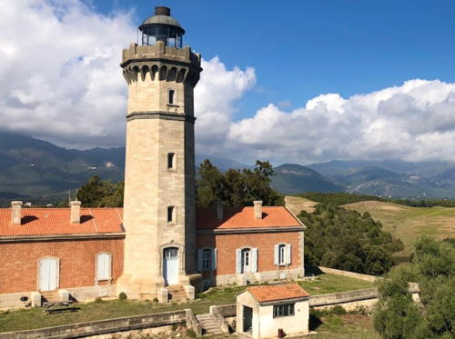
1864. Active; focal plane 93 m (305 ft); two white flashes every 10 s. 27 m (89 ft) octagonal masonry tower with lantern and gallery, attached to the front of a 1-story masonry keeper's house. The tower is unpainted light gray stone; lantern painted black. Two additional keeper's houses and other light station buildings. An important signal station stands near the lighthouse. Didier Masson's photo is at right, Detienne has a page for the lighthouse, Wikimedia has Pierre Bona's panoramic view, Trabas has a closeup photo, Huelse has a historic postcard view, and Google has a street view and a satellite view. This lighthouse is near the easternmost point of the island, but it does not mark any particular cape or hazard; its purpose is to fill in an otherwise dark section of the coastline. Located on the heights about 2 km (1.25 mi) from the coast near Alistro and 5 km (3 mi) north of Bravonne. Site and tower closed (restricted naval station) although the lighthouse can be seen from nearby. ARLHS COR-008; Admiralty E0864; NGA 8136.

Alistro Light, San Giuliano, October 2019
Google Maps photo by Didier Masson

Corse-du-Sud (Southern Corsica) Lighthouses

Porto-Vecchio Lighthouses
Punta San Ciprianu (Giovan Lungo, Cala Rossa, Pointe Saint-Cyprien)
1880. Active; focal plane 26 m (85 ft); flash every 4 s, white or green depending on direction. 13 m (43 ft) square cylindrical masonry tower with lantern and gallery, rising from the front of a 1-1/2 story masonry keeper's house. Lighthouse painted white, lantern dark green. Trabas has a closeup photo, Franz Christ has a 2017 photo, there is a view from the sea, and Google has a satellite view. This lighthouse marks the north side of the entrance to the Golfe de Porto-Vecchio, the largest and best harbor on the east coast of Corsica. Located on the Punta San Ciprianu in Cala Rossa. Site and tower closed (access is through private property); there's a distant view from Punta Chiappa on the other side of the gulf. ARLHS COR-037; Admiralty E0867; NGA 8156.
Pecorella
1973 (light added to existing daybeacon). Active; focal plane 12 m (39 ft); three green flashes every 12 s. 14 m (46 ft) round solid stone daybeacon to which a light has been added. Tower painted white with a green band at the top. It is not known when the daybeacon was built. Trabas has Meyer's photo, a distant view is available, and Bing has a satellite view. Located on a rock (Rocher Pecorella) in the center of the entrance to the Golfe de Porto-Vecchio, warning ships to pass to the south; the rock is about 1.5 km (1 mi) east of Punta San Ciprianu and the same distance north of Punta Chiappa. Accessible only by boat. Site and tower closed. ARLHS COR-038; Admiralty E0866.4; NGA 8152.
* Ponta di Pozzoli (Leading)
Date unknown. Active; focal plane 10 m (33 ft); white, red or green light depending on direction, 2 s on, 2 s off. 5 m (16 ft) round stone tower. Tower painted white; the top of the tower is painted red in Meyer's photo posted by Trabas but black in a 2019 Google street view and a 2020 photo by Jean-François Bonachera. Google also has a satellite view. This light leads ships in the entrance channel of the Golfe de Porto-Vecchio. Located at the foot of the Rue Pierre Puccinelli at the west end of the harbor. Site open, tower closed. ARLHS COR-036; Admiralty E0869; NGA 8160.
* Porto-Vecchio South Jetty
Date unknown. Active; focal plane 5 m (17 ft); two red flashes every 6 s. 4 m (13 ft) round stone tower rising from an equipment shelter. Trabas has Meyer's closeup photo and Google has a satellite view. Located on the south breakwater (the Admiralty calls it the east breakwater) of the marina at Porto-Vecchio. Accessible by walking the pier. Site open, tower closed. Admiralty E0870.6; NGA 8172.
* [Porto-Vecchio (Leading)]
Date unknown. Active; focal plane 9 m (29 ft); white, red or green light depending on direction, 2 s on, 2 s off. 7 m (23 ft) square gray stone column. Trabas has Siering's closeup photo and Google has a closeup street view and a satellite view. This light leads ships in the final approach channel for Porto-Vecchio. Located just west of the ferry quay at Porto Vecchio. Site open, tower closed. Admiralty E0870; NGA 8168.
* La Chiappa (Porto-Vecchio)
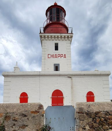
1845. Active; focal plane 65 m (213 ft); four white flashes, in a 3+1 pattern, every 15 s. 21 m (69 ft) square cylindrical masonry tower with lantern and gallery, rising from the center of a square 1-story masonry keeper's house. Formerly unpainted light gray stone, the lighthouse has recently been painted white; lantern and gallery painted red. Davide Cavadini Pilot's 2023 photo is at right, Olivier Bonnenfant has a photo, Trabas has Siering's closeup photo, Phareland.com has numerous photos, Wikimedia has a closeup, Marinas.com has aerial photos, and Google has a street view and a satellite view. This is the landfall light for Porto-Vecchio. Located on Punta Chiappa, the south side of the entrance to the Golfe de Porto-Vecchio, at the end of Route du Phare about 5 km (3 mi) northeast of Piccuvaghjia. Accessible by road; limited parking. Site open, tower closed. . ARLHS COR-007; Admiralty E0866; NGA 8148.

Chiappa Light, Porto-Vecchio, November 2023
Google Maps photo by Davide Cavadini Pilot

Strait of Bonifacio Lighthouses (see also Northern Sardinia)
The Strait of Bonifacio, only 11 km (7 mi) wide, separates Corsica from Sardinia. Strewn with rocks and shoals, it is one of the most dangerous passages in the western Mediterranean.
Écueil de Perduto (Perduto Rock)
1980. Active; focal plane 16 m (52 ft); three quick white flashes every 10 s. 28 m (92 ft) steel post with gallery and a small equipment shelter on the gallery; the column is supported by tripod bracing at the base. Tower painted black with one yellow horizontal band. Trabas has Darlene Chisholm's closeup photo and Bing has an indistinct satellite view. This light was installed as part of France's responsibility under an agreement with Italy to improve the safety of navigation in the Strait of Bonifacio. The listed focal plane conflicts with the listed tower height; presumably the 28 m figure for the latter is the total height of the structure including the underwater tripod. Located on a rock southeast of the Île Perduto in the approach to the Strait from the northeast, about 7 km (4.5 mi) east of the southern tip of Corsica. Accessible only by boat. Site open, tower closed. ARLHS COR-044; Admiralty E0875; NGA 7960.
Les Lavezzi (Îles Lavessi)
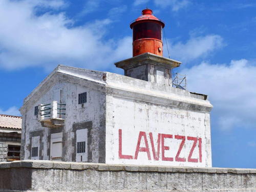
1874. Active; focal plane 27 m (89 ft); white or red light, depending on direction, occulting twice every 6 s. 12 m (39 ft) square cylindrical masonry tower with lantern and gallery, rising from the front of a 1-1/2 story masonry keeper's house. The tower and the front of the house are painted with red and white horizontal bands; the rest of the house is painted white. Louise Béguinot's photo is at right, Detienne has a page for the lighthouse, Trabas has Darlene Chisholm's closeup photo, Daniel Witting has a photo, Marco Palumbo has a closeup, Claude Garnier also has a closeup, and Google has a satellite view. The Îles Lavezzi, located in the middle of the eastern entrance to the Strait of Bonifacio, have been the scene of countless shipwrecks, including the loss of the French frigate Sémillante and all 750 men aboard in February 1855. The islands are now a protected nature reserve; ecotours are available from Bonifacio. Located on the southern point of the largest island of the group. Accessible only by boat. Site open, tower closed. . ARLHS COR-049; Admiralty E0872; NGA 7948.

Îles Lavezzi Light, Strait of Bonifacio, June 2021
Instagram photo by Louise Béguinot
Écueil Lavezzi (Tourelle des Lavezzi)
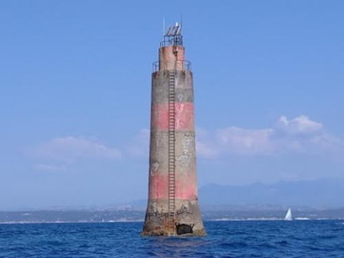
1904. Active; focal plane 18 m (59 ft); two white flashes every 6 s. 22 m (72 ft) round solid stone beacon with watch room and gallery, painted with red and black horizontal bands. Nicola Morandi's photo is at right, Trabas has Capt. Peter Mosselberger's photo, and Nicola Morandi has a closeup, but the light is not visible in Google's satellite view. Lighthouse painted with red and black horizontal bands. This is France's southernmost lighthouse. The word écueil means a reef, and this one is particularly hazardous. Located on an isolated rock in the very center of the Strait of Bonifacio about 1.5 km (1 mi) south of the Phare des Lavezzi. Accessible only by boat. Site and tower closed. ARLHS COR-033; Admiralty E0874; NGA 7952.

Bonifacio Lighthouses
* Pertusato
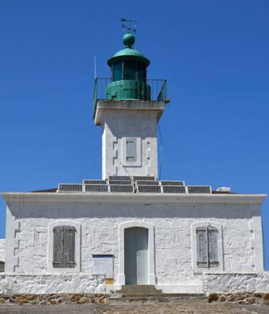
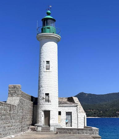
1844. Active; focal plane 100 m (328 ft); two white flashes every 10 s. 17 m (56 ft) square cylindrical masonry tower with lantern and gallery, rising from the center of a square 1-story masonry keeper's house. The lighthouse is painted white with black trim outlining the corners of the tower and building; lantern and gallery painted black. Catherine Lamarche's 2024 photo is at the top of this page, Detienne has a page for the lighthouse. another good photo is available, Trabas has Siering's photo, Vojtech Dvorak has a photo, Laurent Guibé has a 2019 photo, Guyomard and Carceller have a page for the lighthouse, Marinas.com has aerial photos, and Google has a satellite view. One of the great lighthouses of the Mediterranean, this historic light marks the southernmost tip of Corsica. For ships eastbound through the Strait of Bonifacio, it is the rear light of a range, Cap Feno being the front light. Located on Mont Pertusato at the point of the cape, about 5 km (3 mi) southeast of Bonifacio. Site open, tower closed. . ARLHS COR-006; Admiralty E0876; NGA 7944.

Écueil Lavezzi Light, Strait of Bonifacio, August 2020
Google Maps photo by Nicola Morandi
Pointe de l'Arinella (Arenella)
Date unknown. Active; focal plane 9 m (30 ft); red light occulting twice every 6 s. 9 m (30 ft) round concrete tower mounted on a round stone base. Lighthouse painted red. Trabas has Meyer's photo and Google has a satellite view. The harbor of Bonifacio is a narrow, fjord-like inlet. Located at the tip of a rocky point on the north side of the harbor. Accessible only by boat. Site open, tower closed. ARLHS COR-045; Admiralty E0886; NGA 7968.
La Madonetta
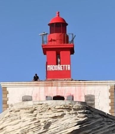
1854. Active; focal plane 28 m (92 ft); red light, 2 s on, 2 s off. 12 m (39 ft) square cylindrical masonry tower with lantern and gallery, rising from the center of a 1-story masonry keeper's house. Tower and lantern painted red; keeper's house painted white. Laëtitia Désiré's October 2022 photo is at right, Matthieu Faure has a closeup photo, Guyomard and Carceller have photos, Trabas has a fine photo by Meyer, Marinas.com has aerial photos, Huelse has a "pittoresque" postcard view, and Google has a satellite view. This lighthouse has a remarkable site atop a triangular block of sandstone attached to the mainland by a narrow peninsula. Located on the west side of the narrow entrance to the harbor of Bonifacio. There is no road access to this area, but there is a view of the lighthouse from a hiking trail along the coast. There is also a view from the west end of Bonifacio, where roadside parking is available. The lighthouse was restored in 2022; Teddy Lochard's July 2022 photo shows this work in progress, with the lantern temporarily removed. Work must have been nearly complete when the October photo at right was taken. Site and tower closed. . ARLHS COR-009; Admiralty E0878; NGA 7964.
Cap Feno
1874. Active; focal plane 23 m (75 ft) and 21 m (69 ft); two synchronized lights, each displaying a flash every 15 s; the upper light white or red depending on direction, the lower light always white but intensified along the line joining this light to the Phare de Pertusato. 12 m (39 ft) 3-story square masonry tower with a flat roof, painted white with a black band around the top. Lantern removed. Wikimedia has a closeup photo, Rachid Adda-Brahïm has a 2021 closeup, Guyomard and Carceller also have a closeup, Trabas has Darlene Chisholm's photo, Camille Ponche has a 2021 photo, and Google has a satellite view. Located on the point of the cape, about 6 km (4 mi) west of Bonifacio, marking the north side of the western entrance to the Strait of Bonifacio. There does not appear to be road access to this location. Site open, tower closed. ARLHS COR-013; Admiralty E0888; NGA 7980.

Southwest Coast Lighthouses
* Caldarello
Date unknown. Active; focal plana about 12 m (39 ft); quick flash every 1.2 s, white, red or green depending on direction. Approx. 7 m (23 ft) round white concrete tower. Trabas has Meyer's photo, Richard André has a closeup street view, and Google has a satellite view. Despite its location this is not a typical pierhead light: it is a leading light for vessels in the finger-like, 4 km (2.5 mi) long Baie de Figari. Located on the main pier of Pianottoli-Caldarello. Accessible by walking the pier. Site open, tower closed. Admiralty E0889; NGA 7986.

La Madonetta Light, Bonifacio, October 2022
Google Maps photo by Laëtitia Désiré
Les Moines
1911. Active; focal plane 27 m (89 ft); six quick white flashes followed by one long flash, every 15 s. 34 m (112 ft) round solid stone tower supporting a watch room and lantern; three galleries. Upper portion of the tower painted yellow, lower portion black. Trabas has a closeup photo and Google has a satellite view. This light was built when it became clear that the Phare de Sénétosa did not provide enough protection for ships off the southwest coast of Corsica. Located on the rocky reef called the Éceuil des Moines (Monks' Reef), about 6 km (4 mi) off the rugged coastline. Accessible only by boat. Site and tower closed. ARLHS COR-027; Admiralty E0890; NGA 7984.
Sénétosa
1892. Active; focal plane 54 m (177 ft); flash every 5 s, white or red depending on direction. Twin 15 m (49 ft) round masonry towers attached at opposite ends of a 2-story masonry keeper's house; the north tower has a 3rd order Fresnel lens, lantern and gallery, the south has a gallery and a red screen on a tripod. Building painted white; lantern, galleries and daymarker are black. Detienne has a page for the lighthouse, Stéphane Mousset has a closeup photo, Pierrette Ucciani has a closeup, Johanne Riollet has a 2021 photo, Marinas.com has aerial photos, Huelse has a historic postcard view, and Google has a satellite view. Only a few twin lighthouses were built in France and it is not clear whether the second tower here was ever lit. Located in a rugged coastal area roughly 15 km (10 mi) southwest of Grossa. There are trails to the lighthouse, but it's not clear how best to reach the site. Site open if you can get there, tower closed. . ARLHS COR-005; Admiralty E0894; NGA 7988.
* Propriano (Jetée du Scoglio-Longo) (2)
Date unknown (station established 1879). Active; focal plane 16 m (53 ft); white or green light, depending on direction, occulting three times every 12 s. 17 m (56 ft) round stone tower with lantern and gallery. Tower painted white, lantern and gallery dark green. Andre Darnaud's 2021 photo is at right, Neil Terence has a 2018 photo, Guyomard and Carceller have two photos by Catherine Boyer, Trabas has a photo, Huelse has a historic postcard view, a street view is available, and Google has a satellite view. The lighthouse was repainted in 2020-21. Propriano is a small port on the Golfe de Valinco in southwestern Corsica. The original light was on an 8.6 m (28 ft) masonry tower. Located at the end of the Jetée du Scoglio-Longo, which also serves as a breakwater mole for Propriano. Accessible by walking the jetty. Site open, tower closed. . ARLHS COR-035; Admiralty E0896; NGA 7992.

Propriano Light, Propriano, June 2021
Google Maps photo by Andre Darnaud

Ajaccio Area Lighthouses
Ajaccio (Ah-jat-sho), the birthplace of Napolean, is the capital of Corse-du-Sud, the principal port of the island's west coast and the largest city on the island; it has a population of about 72,000.
Cap Muro
1927. Active; focal plane 57 m (187 ft), white light, 3 s on, 1 s off. 11 m (36 ft) square cylindrical masonry tower; lantern removed. Tower painted white. Raphael Megard has a good drone view, a 2021 photo is available, Trabas has Meyer's distant view, Olivier Hochstaetter has a distant street view from the rocky coast, and Google has a satellite view. Located on the point of the cape, marking the southern entrance to the Golfe d'Ajaccio and the northern entrance to the Golfe de Valinco, about 7 km (4.5 mi) west of Acqua d'Oria. Reaching this remote location would require a lengthy hike over difficult terrain. Site and tower closed. ARLHS COR-014; Admiralty E0900; NGA 8004.
Ajaccio Citadelle
1851. Active; focal plane 19 m (62 ft); two flashes every 10 s, white or red depending on direction. 13 m (43 ft) round cylindrical masonry tower with lantern and gallery. Tower painted white, lantern and gallery red. Trabas has a good photo by Siering (also seen at right), a 2010 closeup is available, Huelse has a historic postcard view, Ralf Wegener has a street view, and Google has a satellite view. The lighthouse was built on the 16th century Citadelle d'Ajaccio, which stands on a peninsula projecting into the Golfe d'Ajaccio. The citadel is now a French military school and is closed to the public, although the lighthjouse can be seen from nearby. The city's traditional harbor is sheltered behind the peninsula and the citadel. Site and tower closed. ARLHS COR-025; Admiralty E0908; NGA 8008.
Écueil de la Citadelle
Date unknown. Active; focal plane 10 m (33 ft); four red flashes every 15 s. 13 m (43 ft) round concrete tower, painted red. A photo is available, Trabas has Hartmut Knape's photo, and Google has a satellite view and a distant street view. Located on a submerged reef about 400 m (1/4 mi) southeast of the Citadelle lighthouse. Accessible only by boat, but easily seen from shore. Admiralty E0906; NGA 8032.
Écueil de la Guardiola
Date unknown. Active; focal plane 6 m (20 ft); red flash every 2.5 s. 10 m (43 ft) round concrete tower, painted red. Trabas has a photo and Google has a satellite view. Located on a submerged reef about 4 km (2.5 mi) west of the Citadelle lighthouse. Accessible only by boat, but easily seen from shore. Admiralty E0905; NGA 8034.
Îles Sanguinaires
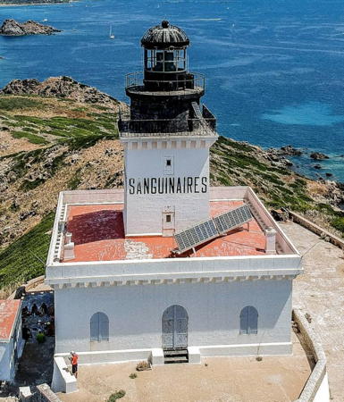
1844. Active; focal plane 98 m (322 ft); three white flashes every 15 s. 18 m (59 ft) square cylindrical masonry tower with lantern and gallery, rising from the center of a square 1-story masonry keeper's house. Lighthouse painted white, lantern and gallery red. Detienne has a page for the lighthouse, Trabas has a photo, a nice drone view is available, Stéphane Mousset has a 2021 closeup, Marco Luperto has a photo taken from a nearby watchtower, Romain Grellier has a closeup street view, Paul Carmen has a view from the sea, Marinas.com has aerial photos, Huelse has a historic postcard view, and Google has a satellite view. This is the landfall light for Ajaccio; it is built atop a steeply conical island in the northern entrance to the Golfe d'Ajaccio about 16 km (10 mi) west of the city. Ships arriving from France often pass through a narrow channel between the island and the mainland. Accessible only by boat. Site open, tower closed. ARLHS COR-003; Admiralty E0902; NGA 8036.
Phare d"Ajaccio
Citadelle Light, Ajaccio
photo copyright Arno Siering; used by permission

Cape Girolata Area Lighthouse
Île de Gargalu
Date unknown. Active; focal plane 37 m (121 ft); flash every 4 s, white or red depending on direction. 7 m (23 ft) post, white with a black top, rising from a square 1-story white equipment shelter. Elisabeth Fennec has a view from the sea and Google has a satellite view. Although modest in size this is an important light marking the northwestern "shoulder" of Corsica. Located on the Île de Gargalu, a small island just off Cape Girolata. Accessible only by boat. Site status unknown. Site manager: Reserve Naturelle de Scandola. ARLHS COR-011; Admiralty E0916; NGA 8040.

Information available on lost lighthouses:

  • Bastia Quai (?-?). No information on this light is available.

Notable faux lighthouses:

Adjoining pages: North: Liguria (Italian Riviera) | South: Northern Sardinia | West: Alpes-Maritimes (French Riviera)

Return to the Lighthouse Directory index | Ratings key

Posted April 17, 2006. Checked and revised April 6, 2024. Lighthouses: 38. Site copyright 2024 Russ Rowlett and the University of North Carolina at Chapel Hill.