Lighthouses of Germany: Hamburg Area

The Federal Republic of Germany (Bundesrepublik Deutschland in German) occupies a central location in northern Europe with two coastlines, one facing northwest on the North Sea and the other facing northeast on the Baltic Sea. The country's history is long and complex. The large number of historically independent German regions came together in 1871 to form the German Empire. The Empire became a republic after World War I (1914-18). After World War II (1939-45) Germany was divided into two countries, the German Federal Republic in the west, usually called West Germany, and the Communist-led German Democratic Republic in the east, usually called East Germany. After the Communist government collapsed the Federal Republic reunified the nation in October 1990.

On the North Sea coast of Germany the Elbe estuary leads from the sea to the port of Hamburg. The estuary has been improved for the navigation of large vessels and it's marked by more than 70 lighthouses in all: the largest number of lighthouses on any inland waterway in the world. This page lists those lighthouses in the city of Hamburg and on the north side of the Elbe above Brunsbüttel, where the waterway narrows from the broader waters of the Elbemündung (mouth of the Elbe). For lights on the south side of the estuary see the Cuxhaven and Stade page.

The Federal Republic is a federation of sixteen states (Länder) and the states are divided into districts (Kreise). The Free and Hanseatic City of Hamburg (Freie und Hansestadt Hamburg) is one of the 16 states. Downstream lighthouses on the north bank of the Elbe are in the Pinneberg and Steinburg Districts of the state of Schleswig-Holstein.

In German a lighthouse is a Leuchtturm ("light tower"), plural Leuchttürme. The front light of a range is the Unterfeuer and the rear light is the Oberfeuer. There are many modern range lighthouses and most of these towers are crowned by a topmark: a large, distinctive structure that serves to mark the range clearly in the daytime. Some topmarks are conical, others are funnel-shaped, and some consist of one or more gallery-like rings around the tower.

In German Insel is an island, Riff is a reef, Kap is a cape, Bucht is a bay, Fluss is a river, Mündung is a river mouth or estuary, and Hafen is a harbor. The word Straße ("street") is also used for a waterway or strait.

Lighthouses in Germany are operated by the regional harbor authority, called the WSA (Wasserstraßen- und Schiffahrtsamt). All the lights on this page are in the jurisdiction of WSA Elbe-Nordsee. The WSA's are linked to and regulated by a federal agency, the Wasserstraßen- und Schifffahrtsverwaltung des Bundes (WSV).

ARLHS numbers are from the ARLHS World List of Lights. DE numbers are the German light list (Leuchtfeuerverzeichnis) numbers as noted on Erich Hartmann's website. Admiralty numbers are from volume B of the Admiralty List of Lights & Fog Signals. These lights are not included on the U.S. NGA List.

General Sources
Leuchttürme und Leuchtfeuer an der Nordsee
Photos and information posted by Erich Hartmann, a contributor to the Online List of Lights.
Online List of Lights - Germany North Sea
Photos by various photographers posted by Alexander Trabas. Some of the Elbe photos are by Hartmann, Rainer Arndt, or Capt. Peter Mosselberger ("Capt. Peter").
Leuchtturm-Atlas
A large site with excellent photos and information on nearly all German lighthouses, maintained by Frank and Birgit Toussaint.
Leuchttürme.net - Deutschland
Outstanding photos by Malte Werning.
Lighthouses in Germany
Photos by various photographers available from Wikimedia.
World of Lighthouses - Germany
Photos by various photographers available from Lightphotos.net.
Leuchtturmseiten von Anke und Jens - Germany - River Elbe
This site has photos and information on many of the lights.
Deutsche Leuchttürme/Feuerschiffe
Photos posted by Klause Huelse. Huelse also has a large collection of historic postcard views.
Schifffahrtszeichen
Lighthouse information from WSA Elbe-Nordsee.
Interessengemeinschaft Seezeichen e.V.
Germany's national lighthouse preservation organization.
GPSNavigationCharts
Navigation chart information for the Elbe.
Navionics Charts
Navigation chart for the Elbe.


Bunthäuser Spitze Light, Hamburg, August 2012
Wikimedia Creative Commons photo by NordNordWest
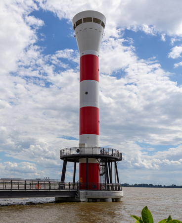
Blankenese Unterfeuer, Hamburg, July 2021
photo copyright Manfred Schmidt; used by permission

Hamburg City Lighthouses

In Hamburg the Elbe River divides into two streams, the Norderelbe (North Elbe) and Süderelbe (South Elbe). The city's downtown area is along the north side of the Norderelbe; the commercial harbors are along the south side of the Norderelbe and along the lower Süderelbe.

Southern Hamburg Lighthouses
* Estemündung (Este, Cranz) (1)
1967. Inactive since 1995. 6 m (20 ft) round white concrete tower with semicircular lantern and gallery, mounted on a concrete pier. Werning has a page for the lighthouse, Uwe Haße has a photo, and Google has a street view and a satellite view. The lighthouse was replaced with a modern post light, but that light has also been deactivated. The lighthouse replaced the 1882 Cranz lighthouse. It was repaired after a major fire on 24 May 1995 but the light was moved to a post offshore (unlisted red light). The Este is a creek that enters the south side of the Elbe at Cranz, just below Hamburg. Located on the pier at the east side of the entrance to the Este. Site open, tower closed. Owner/site manager: WSA Elbe-Nordsee. ARLHS FED-349; ex-Admiralty B1569.
* Bubendey-Ufer Oberfeuer (Waltershof)
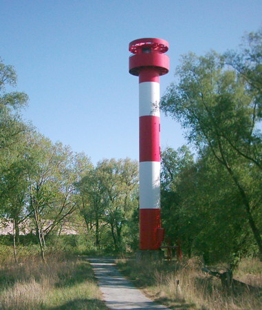
Date unknown. Active; focal plane 38 m (125 ft); white light 4 s on, 4 s off, synchronized with the front light. Approx. 35 m (115 ft) round cylindrical tower with lantern and gallery, painted with red and white horizontal bands. Trabas has Capt. Peter's closeup, Wikimedia has several photos, Gernot Baur has a 2017 photo, Ralf Kronemeyer has a river view from a passing harbor cruise ship, Sönke Knöfel has a closeup street view, and Google has a satellite view. Ufer is the German word for a riverbank. This is the rear light of an upstream (eastbound) range guiding ships into Hamburg harbor. The front light is on a 20 m (66 ft) post about 1 km west northwest. Located on the south bank of the Norderelbe on the west side of the entrance to the Parkhafen, near a petroleum tank complex. Site open, tower closed. Operator: WSA Elbe-Nordsee. ARLHS FED-287; DE 311661; Admiralty B1581.71.
Ellerholzhafen (Kaiser-Wilhelm-Hafen)
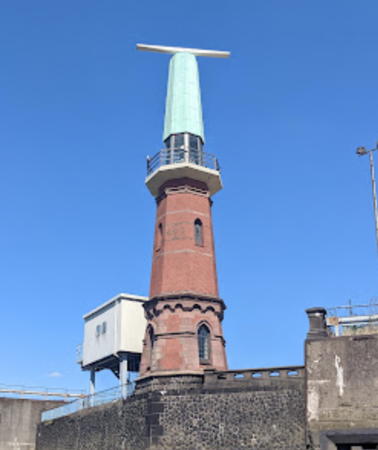
1902. Active; focal plane 19 m (62 ft); continuous red light. Approx. 22 m (72 ft) octagonal brick tower with lantern and gallery, extended by a octagonal "dunce cap" topped by a rotating radar antenna. A 2022 photo is at right, Trabas has a photo by Wolfgang Warncke, Andreas Köhler has a 2021 photo, Wikimedia has a 2013 photo, Huelse has a historic postcard view of the lighthouse with its original lantern, Richard Hovorka has a distant river view, and Google has a satellite view. This is the next to last light discussed on Hartmann's Hamburg Vorhafen page. The radar antenna was added in 1969 and the lighthouse may have been inactive for some period after that. In September 2009 the city of Hamburg listed the lighthouse as a historic site. Located near the Hamburg cruise ship terminal, at the end of the broad quay separating the Kaiser-Wilhelm-Hafen to the north from the Ellerholzhafen to the south, in the middle of Hamburg harbor. Site and tower closed. Operator: WSA Elbe-Nordsee. ARLHS FED-295; DE 313760; Admiralty B1593.96.

Ellerholzhafen Light, Hamburg, June 2022
Google Maps photo by *C. **
Altenwerder Unterfeuer
1999. Active; focal plane 25 m (82 ft); red light 2 s on, 2 s off, synchronized with the rear light. Approx. 22 m (72 ft) round cylindrical tower with lantern and gallery. Lighthouse painted with red and white horizontal bands. Trabas has a closeup by Wolfgang Warncke, Werning has a photo, Wikimedia has a photo, Olli Klein has a photo, Jan Gerrits has a street view, and Google has a satellite view. The range guides vessels southward past the commerical docks of the Süderelbe. Located south of the Altenwerder Container Terminal, on the south side of the Süderelbe about 300 m (1000 ft) west of the Ellerholz range lights. Site status unknown. Operator: WSA Elbe-Nordsee. ARLHS FED-278; DE 312700; Admiralty B1594.65.
Altenwerder Oberfeuer
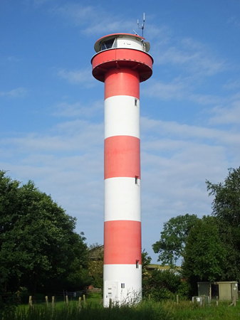
1999. Active; focal plane 31 m (102 ft); red light 2 s on, 2 s off, synchronized with the front light. Approx. 27 m (89 ft) round cylindrical tower with lantern and gallery. Lighthouse painted with red and white horizontal bands. A photo is at right, Trabas has a closeup by Wolfgang Warncke, Werning has a photo, Alexander Kurtz has a 2022 closeup, and Google has a satellite view. Located south of the Altenwerder Container Terminal, 165 m (540 ft) south of the front light. Site status unknown. Operator: WSA Elbe-Nordsee. ARLHS FED-279; DE 312701; Admiralty B1594.651.
Ellerholz Unterfeuer
2001. Active; focal plane 25 m (82 ft); red light 2 s on, 2 s off, synchronized with the rear light. Approx. 22 m (72 ft) round cylindrical tower with lantern and gallery. Lighthouse painted with red and white horizontal bands. Trabas has a closeup, Werning has a good photo, Wikimedia has a photo, and Google has a satellite view of both Ellerholz lights. The range guides vessels bound upstream on the Süderelbe through Hamburg harbor. Located on the south side of the Süderelbe near the Kattdykdamm. Site status unknown. Operator:WSA Elbe-Nordsee. ARLHS FED-293; DE 312810; Admiralty B1594.7.
Ellerholz Oberfeuer
2001. Active; focal plane 30 m (98 ft); red light 2 s on, 2 s off, synchronized with the front light. Approx. 27 m (89 ft) round cylindrical tower with lantern and gallery. Lighthouse painted with red and white horizontal bands. Werning has a photo, Trabas has a closeup, and Google has a satellite view of both lights. Located on the south side of the Süderelbe near the Kattdykdamm, 110 m (360 ft) south of the front light. Site status unknown. Operator:WSA Elbe-Nordsee. ARLHS FED-294; DE 312811; Admiralty B1594.71.
Moorburger Weide
2016. Active; focal plane 35 m (115 ft); white, red or green light depending on direction, 3 s on, 3 s off. Approx. 30 m (98 ft) round cylindrical tower with gallery, painted with black and white horizontal bands. Trabas has Hartmann's photo and Google has a satellite view and a distant 2022 street view. The lighthouse replaced a pair of small range lights. Located at the entrance to the Hohe Schaar petroleum terminal on the north side of the Süderelbe. Site status unknown. Operator: WSA Elbe-Nordsee. DE 312870; Admiralty B1595.6; NGA 10579.1.

Altenwerder Oberfeuer, Hamburg, May 2007
Wikimedia public domain photo by GeorgHH
** Bunthäuser Spitze
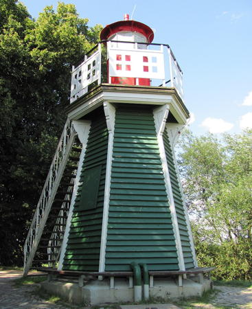
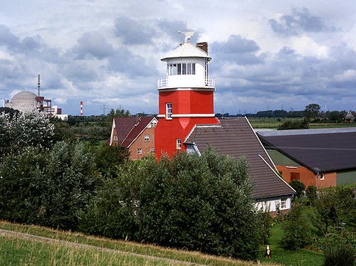
1914. Inactive since 1977. 7 m (23 ft) hexagonal pyramidal wood tower with lantern and gallery; an external stairway provides access to the gallery. Tower painted green, lantern red, gallery railing white. Mark Max Henckel's photo is at the top of this page, Werning has a good photo, Sylvia Haberstroh has a 2021 photo, Wikimedia has several photos, Bernhard Maas has a 2021 street view, and Google has a satellite view. The Bunthäuser Spitze is a narrow point of land dividing the Norderelbe and Süderelbe, the northern and southern branches of the Elbe, on the southeast side of Hamburg. The lighthouse marked this point for boats bound downstream. The tower now houses equipment used for monitoring the flow rate of the river. The building was restored in 1989 as part of the celebration of the 800th anniversary of Hamburg harbor, and it was repainted and repaired in 2007. Located in a city park near the point, beyond the end of the Moorwerder Hauptdeich; accessible by a short walk from the end of the road. Site open, and visitors can climb the external stairs to the gallery. Owner/site manager: WSA Elbe-Nordsee. . ARLHS FED-059.

Downtown Hamburg Lighthouse and Lightships
*** Trinity House Lightship 13 Das Feuerschiff
1952. Decommissioned 1989. 42 m (138 ft) 2-masted steel lightship, painted red; light tower with lantern mounted amidships. Hartmann has a page for the ship, a 2010 photo is available, Bernhard Maas has a 2021 street view, and Google has a satellite view and a closeup street view. Built by Philips & Sons, Dartmouth, England, the ship served many stations off the English coast. In 1991 the ship was sold to the German captain Wulf Hoffmann and sailed to Hamburg; since 1993 it has served as a floating restaurant, pub, and hotel in the city harbor in Hamburg. Located on the Vorsetzen, the waterfront in downtown Hamburg. Site open, ship open daily. Owner/site manager: Das Feuerschiff . ARLHS FED-144.
* Pagensand Süd (relocated)
1934. Inactive since 2015. 12 m (40 ft) round cylindrical steel(?) tower with lantern and gallery, mounted on a hexagonal stone base. Lighthouse painted red. This lighthouse marked the southern tip of the island of Pagensand (see below). In November 2015 it was relocated by barge and placed at the Museumshafen Oevelgönne on the north bank of the Elbe at Neumühlen. Hans Richter has a 2018 closeup photo, Markus Schaubmaier has a 2022 closeup, and Google has a street view and a satellite view. Wikipedia has Uwe Barghaan's 2007 view from the river of the lighthouse at its original location. Trabas has a photo of the small beacon that replaced it and Google has a satellite view. Site open, tower closed. Owner/site manager: Museumshafen Oevelgönne. ARLHS FED-186; ex-DE 310940; ex-Admiralty B1506.
* Feuerschiff (Lightship) Elbe 3
1888. Decommissioned 1977. 45.1 m (148 ft) lightship, originally 3-masted but now 2-masted. Hull painted red, superstructure white. The 2019 photo at right shows the ship under way in 2019, Jörg Schmalenberger has a 2019 photo, Christoph Bellin has a 2011 photo, Hartmann has a page for the ship, Wolfgang Woischnig has a 2022 photo, Marcel Müller has a street view, and Google has a satellite view. Built by Johann Lange in Vegesack and launched as the Weser, the ship served on that station until World War II. It was overhauled in 1936, and its current diesel engines were installed at that time. After World War II the ship served ten years as the Bremen, ten more as the Weser, and then, beginning in 1966, as the Elbe 3. Since 1979 the ship has been based in Hamburg as a museum and excursion ship. It is believed to be the world's oldest operational lightship. Berthed at the Museumshafen Oevelgönne on the north bank of the Elbe at Neumühlen, just west of the center of Hamburg. Site open; ship open for tours on Sunday afternoons except when it is on tour elsewhere; check locally for current information. Owner/site manager: Förderkreis Elbe3. . ARLHS FED-275.

Lightship Elbe 3 under way, Hamburg, May 2019
Instagram photo by hafen.strand.meer

Western Hamburg Lighthouses
* Holtenau Süd (lantern)
1895. Cast iron lantern and gallery from the Holtenau Süd lighthouse at the north entrance to the Nord-Ostsee Kanal in Holtenau, near Kiel (see the Flensburg to Lübeck page). Andreas Köhler has a photo, a 2021 closeup is available, and Google has a street view and a satellite view. The lantern was replaced in 1998 by a larger lantern capable of carrying a radar antenna. The original lantern is on display across a narrow canal from the International Maritime Museum west of downtown Hamburg. Site open, tower closed. Owner/site manager: Internationales Maritimes Museum Hamburg.
* Blankenese Oberfeuer (2)
2020. Active; focal plane 65 m (213 ft); white light 2 s on, 2 s off, synchronized with the front light. 62 m (203 ft) round cylindrical tower with an expanded top, painted with red and white horizontal bands. Niels Freckmann has the photo at right, Peter Bandsalatiere has a closeup 2021 photo, Trabas has a photo, several photos of the project are available, and Google has a satellite view. The Elbe is being dredged to accommodate larger ships, and this required a change in the alignment of the range. Located about 400 m (1/4 mi) east southeast of the previous light (next entry), adjacent to the Mühlenberger Segel-Club. Site and tower closed but the lighthouse is easy to see from nearby. Site open, tower closed. Operator: WSA Elbe-Nordsee. ARLHS FED-040; DE 311401; Admiralty B1568.71.
#Blankenese Oberfeuer (1)
1984. Removed in 2020. This was a 40 m (131 ft) round cylindrical tower with a funnel-shaped topmark, painted with red and white horizontal bands. Werning has a photo and Google has a street view at the base of the tower. Google also has a satellite view of the former location of the tower. Formerly located atop a hill in Baurs Park, on the north bank of the Elbe in the Blankenese neighborhood just west of Hamburg, 1350 m (4430 ft) east of the front light. Site open, tower closed.

2020 Blankenese Oberfeuer, Hamburg, October 2021
Google Maps photo by Niels Freckmann
* #Blankenese Unterfeuer (1)
1984. Replaced in 2020. This was a 42 m (138 ft) round cylindrical tower with a funnel-shaped topmark, painted with red and white horizontal bands. The tower's base was surrounded by two circular observation platforms. Werning has a photo, Wikimedia has photos, and Google has a 2008 street view of the tower and a satellite view of its former location. The Blankenese Range Lights were replaced in a project in 2019-20. Formerly located on a concrete pier just off the north bank of the Elbe in the Blankenese neighborhood just west of Hamburg; The pier is open to the public and a small beacon has been placed on it. Site open, tower closed.
* Blankenese Unterfeuer (2)
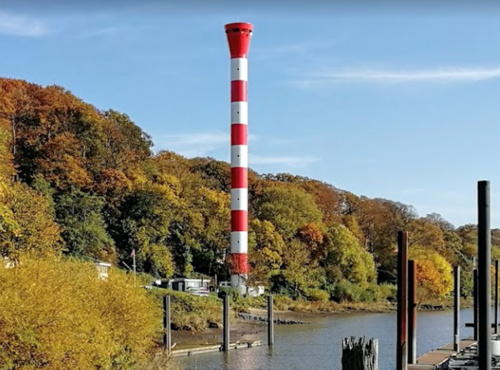
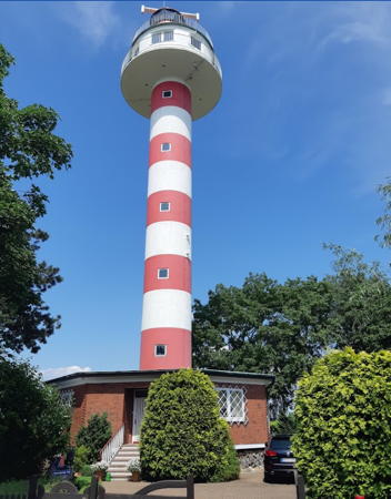
2020. Active; focal plane 33 m (108 ft); white light 2 s on, 2 s off, synchronized with the rear light. 33 m (108 ft) round cylindrical tower with an expanded top, painted with red and white horizontal bands. The tower's base is surrounded by two circular observation platforms. Manfred Schmidt's photo is at the top of this page, Trabas has a closeup photo, Bernd Wegmann has a 2021 photo, Marion Müller-Klausch has a July 2020 photo, and Google has a street view and a satellite view. Located on a concrete pier just off the north bank of the Elbe in the Blankenese neighborhood about 1 km (0.6 mi) west of the earlier light. Site open, tower closed. Operator: WSA Elbe-Nordsee. . ARLHS FED-039; DE 311400; Admiralty B1568.7.
* Wittenbergen Unterfeuer
1900. Active; focal plane 30 m (98 ft); white light 4 s on, 4 s off, synchronized with the rear light. 30 m (98 ft) hexagonal skeletal tower with a large circular lantern and gallery, enclosed 2-story watch room, and central cylinder. Lighthouse painted with red and white horizontal bands, lantern white with a black roof, gallery railing black. Werning has a good photo, Trabas has a closeup photo, Michael Knaust has a 2020 photo, a 2009 photo is available, Wikimedia has photos, Huelse has a historic postcard view, Ingo Maack has a closeup street view, and Google has a satellite view. This is the front light of a downstream (westbound) range marking the channel for ships leaving Hamburg. The initial placement of the tower was incorrect, so it was moved 8 m (26 ft) south in 1905. The lighthouse was restored and modernized in 1979. Located on the north bank of the Elbe at Wittenbergen; Site open, tower closed. Operator: WSA Elbe-Nordsee. . ARLHS FED-038; DE 311440; Admiralty B1568.
* Tinsdal (Wittenbergen) Oberfeuer
1900. Active; focal plane 56 m (183 ft); white light 4 s on, 4 s off, synchronized with the front light. 42 m (137 ft) hexagonal skeletal tower with a large circular lantern and gallery, enclosed 2-story watch room, and central cylinder. Lighthouse painted with red and white horizontal bands, lantern white with a black roof, gallery railing black. Manfred Schmidt's photo is at right, Trabas has a closeup photo by Wolfgang Warncke, Tanja Bulschack has a winter 2021 photo, Werning has a more distant view, Monika Wessel has a street view, and Google has a satellite view and a more distant street view. Sibling of the Grünendeich Oberfeuer (see the Cuxhanven and Stade page). The light was named for the nearby Tinsdal gunpowder factory. Located off the Tinsdalerweg near Wittenbergen, west of Hamburg, 800 m (1/2 mi) west of the front light. Site open, tower closed. Operator: WSA Elbe-Nordsee. . ARLHS FED-237; DE 311441; Admiralty B1568.1.

Tinsdal (Wittenbergen) Oberfeuer, Wittenbergen, July 2018
photo copyright Manfred Schmidt; used by permission
Schleswig-Holstein: Pinneberg District Lighthouses

Historically the north bank of the Elbe below Hamburg was part of the Duchy of Holstein. From 1815 to 1864 the duchy was a member of the German Confederation, but it was ruled by the King of Denmark, who also held the title Duke of Holstein. Prussia conquered and annexed Holstein in the Second Schleswig War in 1864.

Wedel Area Lighthouses
* Pagensand Nord (1) (relocated)
1933. Inactive since 1993. 12 m (40 ft) round cylindrical tower with lantern and gallery, painted red. Leuchtturm-Atlas has a page for the lighthouse, Hartmann also has a page, a closeup photo is available, and Google has a street view and a satellite view. This is one of three identical towers built at Pagensand during 1932-34. The deactivated lighthouse was relocated to the WSA Hamburg buoy depot in Wedel, a town on the north side of the Elbe about 16 km (10 mi) west of downtown Hamburg. Located on Deichstraße on the Wedel waterfront. Site open, tower closed. ex-DE 310820; ex-Admiralty B1500.
Juelssand (2)
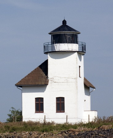
1896 (station established 1873). Inactive since 2010. 16 m (52 ft) square cylindrical brick tower with lantern and gallery rising at one corner of a 1-story brick keeper's house. Building painted white; lantern roof is black. A photo by Gunnar Ries is at right, Elke und Helmut Fleer have a photo, G. Baetje has a 2021 photo, and Google has a satellite view. This light guided downstream (westbound) traffic. The lighthouse is sealed and abandoned. Juelssand is a marshy island off the north bank of the Elbe. Located on the north side of the Elbe at a bend in the river, about 7 km (4 mi) west northwest of Wedel. There does not appear to be any land access to this location. Site open, tower closed. Owner/site manager: private. ARLHS FED-120; ex-Admiralty B1528.

Pagensand Lighthouses
Pagensand is a 6 km (4 mi) long island in the Elbe south of Kollmar. Most of the island is artificial, built with dredge spoil from the river in the early 20th century. Today much of the island is set aside as an ecological reserve. The main channel of the river is west of the island.

Pagensand Mitte Oberfeuer (2)
1992 (station established 1893). Active; focal plane 32 m (105 ft); white light 2 s on, 2 s off, synchronized with the front light. Approx. 30 m (98 ft) round cylindrical tower with lantern and gallery, painted with red and white horizontal bands. Trabas has Hartmann's view from the river, Juliane Herrmann has a photo, and Google has a satellite view. This range guides upstream (eastbound) traffic as it approaches the island. Located in the middle of Pagensand. Accessible only by boat. Site open, tower closed. Operator: WSA Elbe-Nordsee. ARLHS FED-183; DE 310801; Admiralty B1498.1.
Juelssand Light
Juelssand Light, Wedel, September 2009
Flickr Creative Commons photo by Gunnar Ries
Pagensand Mitte Unterfeuer (2)
1992 (station established 1893). Active; focal plane 20 m (66 ft); white light 2 s on, 2 s off, synchronized with the rear light. 20.5 m (67 ft) round cylindrical tower with lantern and two galleries, painted with red and white horizontal bands. Trabas has Hartmann's view from the river, Juliane Herrmann has a photo, and Google has a satellite view. Located on the west bank of Pagensand. Accessible only by boat. Site open, tower closed. Operator: WSA Elbe-Nordsee. ARLHS FED-181; DE 310800; Admiralty B1498.
#Pagensand Mitte
1933. Inactive since 1992 and demolished in 2010. 12 m (40 ft) round cylindrical tower, formerly with lantern and gallery, mounted on a hexagonal stone base. Lighthouse painted red with one white horizontal band. The light was deactivated in 1992 but the tower continued to function as a daybeacon and was floodlit at night. Google has a satellite view of the surviving base of the lighthouse. In September 2010 the lighthouse was removed and scrapped. This is one of three identical towers built at Pagensand during 1932-34. The Pagensand Nord tower is preserved at Wedel and the Pagensand Süd tower was relocated to Hamburg in 2015 (see above). Located on a shoal northwest of its replacement, the Pagensand Mitte Unterfeuer (previous entry). Accessible only by boat. Site open. ARLHS FED-185.
Pagensand Nord Unterfeuer
1986. Active; focal plane 20 m (66 ft); white light 4 s on, 4 s off, synchronized with the rear light. 20 m (66 ft) round cylindrical tower with lantern and two galleries, painted red with a white horizontal band. Trabas has Capt. Peter Mosselberger's closeup photo and Google has a satellite view. This light and the Kollmar Oberfeuer form a downstream (westbound) range guiding ships around the west side of the island. Located on an artificial islet in the river off the northern end of the island. Accessible only by boat. Site open, tower closed. Operator: WSA Elbe-Nordsee. ARLHS FED-182; DE 310960; Admiralty B1501.
Pagensand Nord (Leitfeuer) (2)
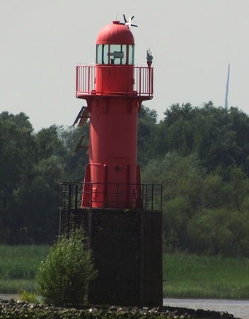
1993 (station established 1932). Active; focal plane 11 m (36 ft); white flash every 6 s; also a directional light, white, red, or green, occulting once every 6 s. 12 m (40 ft) round cylindrical tower with lantern and gallery mounted on a hexagonal stone base. Lighthouse painted red. Trabas has the photo by Capt. Peter Mosselberger seen at right and Google has a satellite view. This light is a near-copy of the original lighthouse, which was relocated to the WSA Hamburg buoy depot in Wedel (see above). Located on a stony artificial islet in the river northwest of the northern tip of the island. Accessible only by boat. Site open, tower closed. Operator: WSA Elbe-Nordsee. ARLHS FED-180; DE 310820; Admiralty B1500.

Pagensand Nord Light, Pagensand
photo copyright Capt. Peter Mosselberger; used by permission

Schleswig-Holstein: Steinburg District Lighthouses

Kollmar Area Lighthouses
* Kollmar (Pagensand Nord) Oberfeuer
1986. Active; focal plane 40 m (131 ft); white light 4 s on, 4 s off, synchronized with the front light. 40 m (131 ft) round cylindrical tower with lantern and gallery, painted red with a white horizontal band. Werning has a good photo, Trabas has Capt. Peter Mosselberger's closeup, Gunnar Liedtke has a 2023 photo, a view from the river is available, Mirko Jeckstadt has a closeup, and Google has a satellite view. Located beside the riverside highway on the north bank of the Elbe at Kollmar, 1330 m (0.8 mi) north of the front light. Site open, tower closed. Operator: WSA Elbe-Nordsee. . ARLHS FED-184; DE 310961; Admiralty B1501.1.
* Steindeich (Leuchtturm Elbe)
1968. Inactive since 1995. 33 m (108 ft) round cylindrical tower with lantern, equipment room, and double gallery, rising from the center of an octagonal 1-story brick control building. Tower painted with narrow red and white horizontal bands. Detlef Rettig's 2020 closeup photo is at right, Werning has a photo, Walter Steenblock has a photo, and Google has a satellite view. This tower carries a radar antenna that formerly played a key role in monitoring ship traffic on the Elbe. It was deactivated when the advent of satellite navigation made it unnecessary. The lighthouse was sold into private hands. Located behind the dike on the northwest bank of the Elbe at Steindeich, about 2.5 km (1.5 mi) west of Kollmar. Owner/site manager: Leuchtturm Elbe. ARLHS FED-229; ex-Admiralty B1490.

Glückstadt Area Lighthouses
Bielenberg
1907. Inactive since 1969. Approx. 8 m (26 ft) square tower embedded in one corner of 1-story keeper's house. Lantern removed. Building painted white with gray trim. Werning has a good photo and Google has a satellite view. The lighthouse has been refurbished as a private residence. The light was moved to a fiberglass tower, which remained in service until the new Kollmar lighthouse was commissioned in 1986. Located on the northeast bank of the Elbe at Bielenberg, roughly opposite the Ruthensand lighthouses. Site status unknown. Owner/site manager: private. ARLHS FED-283.
Rhinplate Süd
1991. Active; focal plane 15 m (49 ft); flash every 6 s, white or red depending on direction. Approx. 42 m (140 ft) round cylindrical tower topped by communications equipment; a wide gallery at the 15 m (50 ft) level carries a radar antenna and the navigation light. Tower painted white. Trabas has a photo showing only a lower section of the tower, Juliane Herrmann has a closeup of the observation level, Tobias Kappeler has a distant drone view, and Google has a good satellite view. Rhinplatte is a long, narrow island on the northeastern side of the Elbe just off Glückstadt. Located in the river just off the southern tip of the island. Accessible only by boat, but the lighthouse can be viewed from Bielenberg or from the other side of the river at Krautsand. Site and tower closed. Operator: WSA Elbe-Nordsee. DE 310720; Admiralty B1489.

Steindeich Light (Leuchturm Elbe), Steindeich, June 2020
Google Maps photo by Detlef Rettig
* Glückstadt Hafen (Nordmole) (3)
1995 (station established 1846). Active; focal plane 9 m (30 ft); white, red, or green light, depending on direction, occulting once every 6 s. 9 m (30 ft) round cylindrical tower with round lantern and gallery, mounted on a square stone and concrete base. Entire lighthouse painted white. Werning has a photo, Trabas has Capt. Peter Mosselberger's closeup photo, Bo Hansen has a street view, and Google has a satellite view. The original lighthouse, built by Denmark and seen in Huelse's postcard view, was replaced in 1914 with a square skeletal tower seen in a second postcard view. The modern light stands on the stone base of the 1914 light and its lantern was designed as a replica of the 1914 lantern. Glückstadt is the terminal for ferries crossing the Elbe to Wischhafen. Located at the northern entrance to Glückstadt harbor, on the northeast side of the Elbe. Site open, tower closed. Operator: WSA Elbe-Nordsee. ARLHS FED-090; DE 310600; Admiralty B1476.
* Glückstadt Oberfeuer (2)
2018 (station established 1937). Active; focal plane 40 m (131 ft); white light 4 s on, 4 s off, synchronized with the front light. 33 m (108 ft) tapered round concrete tower with triangular lantern and gallery. Lighthouse painted with red and white horizontal bands, lantern painted white with a black roof. Trabas has a great photo by Hartmann, a 2021 photo is available, and Google has a satellite view. This lighthouse replaced a shorter tower that had a focal plane of 30 m (98 ft). A photo of the older tower by Charles Hutchins is at right and Werning also has a photo. This is the rear light of an upstream (eastbound) range leading the ferries to Glückstadt. The lighthouse was refurbished and modernized in 1995. Located on the Neuendeich road at Jahnstraße in Glückstadt. Site open, tower closed. Operator:WSA Elbe-Nordsee. ARLHS FED-091; DE 310501; Admiralty B1456.1.
* Glückstadt Unterfeuer (2)
2018 (station established 1937). Active; focal plane 21 m (69 ft); white light 4 s on, 4 s off, synchronized with the rear light. 21 m (69 ft) round cylindrical concrete tower with triangular lantern and gallery. Lighthouse painted with red and white horizontal bands, lantern painted white with a black roof. Trabas has a photo by Hartmann and Google has a satellite view. This lighthouse replaced a shorter tower that had a focal plane of 15 m (49 ft). Thomas Schmikat has a July 2018 photo showing both the old and new towers. Werning has a good photo and Google has a good photo. Located on the northeast bank of the Elbe 1250 m (0.78 mi) northwest of the rear light. Site open, tower closed. Operator:WSA Elbe-Nordsee. ARLHS FED-089; DE 310500; Admiralty B1456.
* Stör Unterfeuer
Date unknown. Active; focal plane 7 m (23 ft); white flash every 3 s, synchronized with the rear light. 7 m (23 ft) round brick tower. The lantern has been removed and the light is now shone through a small opening in the middle of a triangular daymarker. Trabas has a closeup, Andreas Köhler has a 2021 photo, Thomas Schmikat has a sunset photo, and Google has a satellite view. The rear light is mounted on a bar supported by two poles; it can be moved laterally to adjust for minor changes in the channel alignment. Located at the mouth of the Stör River about 4 km (2.5 mi) north of Glückstadt. Site open, tower closed. Operator: WSA Elbe-Nordsee. ARLHS FED-348; DE 310560; Admiralty B1464.
Glückstadt Oberfeuer
1937 Glückstadt Oberfeuer, Glückstadt, August 2007
Flickr Creative Commons photo by Charles Hutchins

Wewelsfleth Area Lighthouses
* Hollerwettern Unterfeuer (2)
1982 (station established 1911). Active; focal plane 21 m (69 ft); white light 2 s on, 2 s off, synchronized with the rear light. 22 m (72 ft) round cylindrical concrete tower with lantern, a lower gallery, and two upper galleries forming a drum-shaped topmark. Lighthouse painted red with one white horizontal band. Werning has a good photo, Trabas has a closeup photo, another photo is available, and Google has a satellite view. Located on the northeast bank of the Elbe near Hollerwettern, about 5 km (3 mi) southeast of Wewelsfleth. Site open, tower closed. Operator: WSA Elbe-Nordsee. . ARLHS FED-350; DE 310520; Admiralty B1458.
* Hollerwettern Unterfeuer (1)
1911. Inactive since 1982. 18 m (60 ft) square tower with large lantern and gallery rising from a front corner of a 2-story keeper's house. Tower painted red, lantern white; keeper's house painted gray. This light was the front light of a downstream (westbound) range; the rear light was the original Brokdorf Oberfeuer, now demolished. Changes in the river channel made the old range obsolete. Werning's photo is at right, Ulf Scheeler has a good photo, Oliver Geilhardt has a 2020 photo, Huelse has a historic postcard view, and Google has a satellite view. The lighthouse is in use as a private residence. Located in the village of Hollerwettern on the northeast side of the Elbe, about 4 km (2.5 mi) southeast of Wewelsfleth. Site open, tower closed. Owner/site manager: private. . ARLHS FED-109.
Osterende Oberfeuer
1984. Active; focal plane 36 m (118 ft); white light 2 s on, 2 s off, synchronized with the front light. 38 m (125 ft) round cylindrical concrete tower with lantern and gallery forming a funnel-shaped topmark. Lighthouse painted with black and white horizontal bands, instead of the usual red and white, to distinguish it from the nearby Brokdorf Oberfeuer. Werning has a photo, Trabas has a closeup, and Google has a satellite view. The Osterende range is an upsteam (eastbound) range and helps guide ships approaching a major bend in the river. Located in a field east of the Brokdorf nuclear power plant. Site status unknown. Operator: WSA Elbe-Nordsee. ARLHS FED-345; DE 310351; Admiralty B1457.51.
Brokdorf (3) (Hollerwettern Oberfeuer)
1982 (station established 1889). Active; focal plane 44 m (144 ft); white light 2 s on, 2 s off, synchronized with the front light. 22 m (72 ft) round cylindrical concrete tower with lantern and two upper galleries forming a drum-shaped topmark. Lighthouse painted with red and white horizontal bands. Werning has a fine photo, Trabas has Capt. Peter Mosselberger's photo, and Google has a satellite view. Huelse also has a postcard view of the 1911 lighthouse, which was demolished in 1982. Located in the midst of the former Brokdorf nuclear power plant (decommissioned 31 December 2021). 1560 m (1 mi) north of the front light. Site and tower closed. Operator: WSA Elbe-Nordsee. DE 310521; Admiralty B1460.
Leuchtturm Hollerwettern
1911 Hollerwettern Light (also Brokdorf Oberfeuer in left distance), Hollerwettern
photo copyright Malte Werning; used by permission
* Osterende Unterfeuer
1984. Active; focal plane 20 m (66 ft); white light 2 s on, 2 s off, synchronized with the rear light. 21 m (69 ft) round cylindrical concrete tower with lantern and gallery forming a funnel-shaped topmark. Lighthouse painted with black and white horizontal bands to match the markings of the Oberfeuer. Werning has a good closeup, Trabas has a good photo, another photo is available, and Google has a photo and a satellite view. Located on the northeast bank of the Elbe in front of the Brokdorf nuclear power plant, 1025 m (0.6 mi) south of the rear light. Site open, tower closed. Operator: WSA Elbe-Nordsee. ARLHS FED-346; DE 310350; Admiralty B1457.5.

St. Margarethen Area Lighthouses
* Scheelenkuhlen Oberfeuer (3)
1976 (station established 1880). Active; focal plane 44 m (144 ft); white light 4 s on, 4 s off, synchronized with the front light. 47 m (154 ft) round cylindrical concrete tower with lantern and gallery, painted with red and white horizontal bands. Werning has a good photo, Trabas has a photo by Capt. Peter Mosselberger, a 2021 distant view is available, and Google has a satellite view and a distant street view. This is the rear light of an upstream (eastbound) range. The wooden tower built here in 1880 was replaced with a 10 m (33 ft) brick tower in 1887; unfortunately, that tower was demolished in 1976 when its directional light was replaced with the present range lights. Located north of the B431 highway about 2.5 km (1.5 mi) southeast of St. Margarethen. Site open, tower closed. Operator: WSA Elbe-Nordsee. ARLHS FED-321; DE 310301; Admiralty B1454.1; NGA 10574.2.
* Scheelenkuhlen Unterfeuer (2)
1976 (station established 1897). Active; focal plane 20 m (66 ft); white light 4 s on, 4 s off, synchronized with the rear lights. 23 m (75 ft) round cylindrical fiberglass tower with lantern and gallery, painted with red and white horizontal bands. This tower carries the front range lights for both the upstream Scheelenkuhlen and downstream St. Margarthen ranges. Trabas has a closeup by Capt. Peter Mosselberger (also seen at right), Werning has a good photo, Joerg Sundermann has a 2018 photo, and Google has a street view and a satellite view. Huelse has a historic postcard view of the 1897 lighthouse. Located beside the B431 riverside highway on the north bank of the Elbe 1810 m (1.1 mi) west of the rear light and about 1.5 km (1 mi) south of St. Margarethen. Site open, tower closed. Operator: WSA Elbe-Nordsee. ARLHS FED-230; DE 310300; Admiralty B1454; NGA 10574.
* St. Margarethen Oberfeuer
1983. Active; focal plane 36 m (118 ft); white light 4 s on, 4 s off, synchronized with the front light. 37 m (121 ft) round cylindrical concrete tower with lantern and gallery, painted with red and white horizontal bands. Werning has a good photo, Trabas has a closeup photo, Simon Köritz has a 2018 photo, and Google has a photo and a satellite view. This is the rear light of a downstream (westbound) range; the front light is carried on the Scheelenkuhlen Unterfeuer. Located 1075 m (0.6 mi) northwest of the front light and about 1 km (0.6 mi) west of St. Margarethen. Site open, tower closed. Operator: WSA Elbe-Nordsee. ARLHS FED-347; DE 310299; Admiralty B1453.9; NGA 10574.1.

Scheelenkuhlen Unterfeuer, St. Margarethen
photo copyright Capt. Peter Mosselberger; used by permission

Information available on lost lighthouses:

Notable faux lighthouses:

Adjoining pages: Northwest: North Frisia | West: Cuxhaven and Stade

Return to the Lighthouse Directory index | Ratings key

Posted March 30, 2005. Checked and revised January 22, 2024. Lighthouses: 40; lightships: 2. Site copyright 2024 Russ Rowlett and the University of North Carolina at Chapel Hill.