Lighthouses of Denmark: Fyn and Langeland

The Kingdom of Denmark (Danmark in Danish), located at the mouth of the Baltic Sea, includes the north-pointing peninsula of Jylland (Jutland) in the west and a large number of islands to the east. The capital, Copenhagen, is on the island of Sjælland. Other major Danish islands include Fyn (between Sjælland and Jylland), Lolland and Falster (south of Sjælland) and Bornholm (farther east in the Baltic). The Skaggerak is a sound separating Jylland from Norway to the northwest, while the Kattegat separates Jylland from Sweden to the northeast.

This page covers the lighthouses of Fyn and neighboring islands, including Ærø and Langeland. Fyn (called Funen in English and German) is roughly elliptical in shape, measuring about 100 km (60 mi) northwest to southeast and 80 km (50 mi) southwest to northeast. It is separated from Jylland on the west by the narrow strait of the Lille Bælt (Little Belt) and from Sjælland (Zealand) on the east by the wider strait of the Store Bælt (Great Belt). The E-20 expressway crosses the island from west to east, crossing the Lille Bælt by the New Little Belt Bridge and the Store Bælt by the Great Belt Fixed Link, completed in 1998. The island has a population of about 450,000.

Denmark is divided into five regions (regioner); Fyn and Langeland are governed along with southern Jylland in the South Denmark (Syddanmark) region. The regions are subdivided into municipalities (kommuner). Additional lighthouses of the South Denmark region are described on the West Coast and Southeast Jylland pages.

The Danish word for a lighthouse is fyr. The front light of a range is the forfyr and the rear light is the bagfyr. Næs is a cape, odde a narrow promontory or isthmus, ø is an island, bælt ("belt") is a strait, and havn is a harbor.

Danish aids to navigation are maintained by the Danish Maritime Authority (Søfartsstyrelsen).

ARLHS numbers are from the ARLHS World List of Lights. DFL numbers are from the Dansk Fyrliste. Admiralty numbers are from volume C of the Admiralty List of Lights & Fog Signals. U.S. NGA List numbers are from Publication 116.

General Sources
Danske Fyrtårne
A comprehensive site on Danish lighthouses by Ole Henrik Lemvigh, with many photos; the text is entirely in Danish.
Online List of Lights - Denmark Baltic Sea
Photos by various photographers posted by Alexander Trabas.
Leuchttürme.net - Dänemark
A fine web site by Malte Werning, with excellent photos.
Leuchtturmseiten von Anke und Jens - Denmark
Photos of more than 100 Danish lighthouses, with notes in English.
Dänische Leuchttürme
Photos of more than 175 Danish lighthouses posted by Klaus Huelse.
Denmark Lighthouses
Photos by Larry Myhre.
Lighthouses in Denmark
Photos by various photographers available from Wikimedia.
World of Lighthouses - Denmark
Photos by various photographers available from Lightphotos.net.
Lighthouses in Denmark
Aerial photos posted by Marinas.com.
Dänische Leuchttürme auf historischen Postkarten
Historic postcard views posted by Klaus Huelse.
Dansk Fyrliste 2022
Official Danish light list (in .pdf format); the list also includes lights of Greenland and Faroes.
OpenSeaMap
Navigational chart information for Denmark.
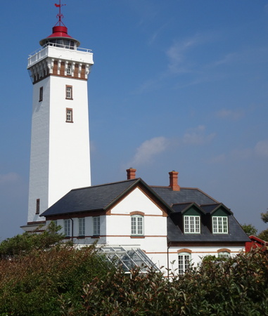
Helnæs Light, Lindehoved, August 2018
photo copyright Heather Craven; used by permission
Assens (West Fyn) Lighthouses
* Helnæs (Lindehoved)
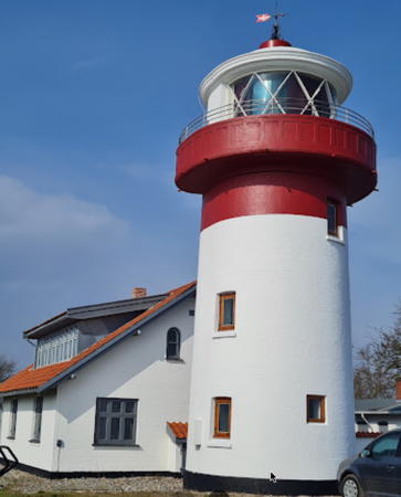
1901. Active; focal plane 30 m (98 ft); flash every 5 s, white, red, or green depending on direction. 28 m (98 ft) square masonry tower with lantern and gallery. Lighthouse painted white with red trim, lantern white with a red roof. 2-story masonry keeper's house and other light station buildings. Heather Craven's photo is above, Mogens Frederiksen has a 2022 photo, Johan Wieland has a good 2009 photo, the Lemvigh site has a page with several photos, Trabas has a photo, Huelse has a fine photo and a historic postcard view, Marinas.com has aerial photos, and Google has a street view and a satellite view. This is a well-known and frequently-visited lighthouse. Helnæs is an island off the southwestern corner of Fyn, joined to the mainland by a causeway and bridge. Located on the southwestern point of Helnæs, at the end of the Lindehovedvej. Site and tower closed, but the lighthouse is easy to see from the street or from the beach. . ARLHS DEN-015; DFL-4370; Admiralty C0988; NGA 2636.
* Assens (4?)
1976 (station established 1777). Active; focal plane 5 m (16 ft); white, red, or green light, depending on direction, occulting once every 10 s. 4 m (13 ft) round fiberglass (?) lantern, painted white with one narrow red horizontal band. Trabas has a good closeup, Lemvigh has a page with photos, Henrik Roholdt Petersen has a 2021 closeup, Jens Peter Hansen has a 2022 street view, and Google has a satellite view and a distant street view. This modern directional light replaced the former Assens range lights. Located at the end of the breakwater mole protecting the harbor of Assens. Accessible by walking the mole. Site open, tower closed. ARLHS DEN-051; DFL-4224; Admiralty C0977; NGA 2616.
* Assens Bagfyr
1900. Inactive since 1976. 8 m (26 ft) square tapered wood tower, painted a dark brown to eliminate its use as a navigational mark. The light was shown through a large window at the top of the tower. Lemvigh has a page with photos, Huelse also has a good photo, and Google has a street view and a satellite view. New range lights have been installed, and Trabas has a photo of the current rear light. Located on the Næsvej in Assens, about 150 m (500 ft) southwest of the waterfront. Site open, tower closed. Site manager: private. ARLHS DEN-052; ex-Admiralty C0978.1.
* [Assens Havn (4)]
1901 (station established 1777). Inactive since 1976(?). 7 m (23 ft) round cast iron (?) tower with lantern. Lighthouse painted white with a narrow red band under the lantern; lantern painted black. Wikimedia has a 2017 closeup photo, another photo is available, Lemvigh has a photo, Huelse has a historic postcard view, and Google has a street view and a satellite view. The original light was replaced in 1853 and again in 1895. Located at the end of a mole in Assens harbor; accessible by walking the mole. Site open, tower closed. . ARLHS DEN-050; ex-Admiralty C0984.
* Bågø (2)
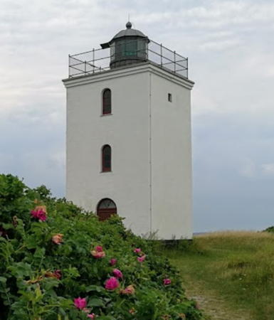
1816 (station established 1705) (Poul de Løwenørn). Inactive since 2014. 8 m (26 ft) old-style square cylindrical stone tower with lantern and gallery. Lighthouse painted white; lantern is greenish metallic. A photo is at right, Wikimedia has Ove Jensen's photo, Trabas has an excellent photo, Pete Shacky also has a photo, Philip Vesterdal has a 2022 street view, and Google has a satellite view. Bågø is an island about 1.5 km (1 mi) in diameter located about 5 km (3 mi) northwest of Assens on Fyn and the same distance northeast of Årøsund on the mainland. The Royal Danish Mail established the first light on the island to help guide mail boats crossing the Lille Bælt. The present lighthouse is one of Denmark's oldest surviving lights. Its lantern was transferred from the Kronborg Castle lighthouse in Copenhagen in 1878. In 2001 a local support group, Bågø Fyrs Venner, was granted the right to manage the building as a historic monument and conduct tours for the public. Unfortunately these tours have been suspended in recent years and the group's web site has disappeared. Annette Kallweit has an August 2013 photo showing the lighthouse being repainted. The island is accessible by ferry from Assens, and the lighthouse is only a short hike from the ferry terminal. Located at the southwestern point of Bågø. Site and tower closed. Site manager: Bågø Fyrs Venner (?). . ARLHS DEN-154; ex-DFL-4200; ex-Admiralty C0972; ex-NGA 2600.

Bågø Light, Bågø, June 2020
Google Maps photo by Andree Stephan
* Tvingsberg (ex-Forfyr)
1900. Active; focal plane 12 m (39 ft); two directional lights, white, red or green depending on direction. A light guiding northbound vessels is shown through a dormer window on one side of an 8 m (26 ft) 1-1/2 story keeper's house, and the directional light guiding southbound vessels (occulting once every 5 s) is shown through a 2nd floor window in a gable at one end of the same house. House painted white; dormer painted gray to match the gray shingled roof. Lemvigh has photos, Trabas has Eckhard Meyer's photo, and Google has a street view and a satellite view. In 2016 the directional light guiding northbound vessels replaced a front range light; see the next entry for the former rear light. Located on the coast at Tvingsberg, east of Bågø and about 3 km (2 mi) north of Assens. Site open, tower closed. ARLHS DEN-048; directional lights: southbound DFL-4214, northbound DFL-4218; Admiralty C0968, NGA 2608.
* Tvingsberg Bagfyr
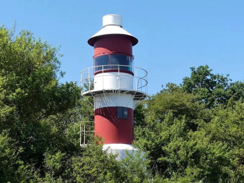
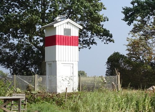
1900. Inactive since 2016. 10 m (33 ft) square tapered wood tower. The front of the tower is painted with red and white horizontal bands; the other sides are painted a dark brown or black. The light was shown through a large window at the top of the tower. The range guided northbound vessels. Trabas has a closeup photo, Lemvigh has photos, and Google has a street view and a satellite view. Although it is abandoned this lighthouse appears repainted and in good condition in a 2020 photo by Andreas Köhler. Located in a forest just off the Baunevej at Sandager, 2.2 km (1.4 mi) northeast of the front light. Site open, tower closed. ARLHS DEN-049; ex-DFL-4218a; ex-Admiralty C0968.1; ex-NGA 2612.

Middelfart (Northwest Fyn) Lighthouses
Fænø
1900. Active; focal plane 11 m (36 ft); flash every 5 s, white, red or green depending on direction. 8 m (26 ft) 1-1/2 story keeper's house; the lights are shown through a 2nd floor window. Lighthouse painted white. Huelse has a photo, Trabas has a photo, and Google has a satellite view. This leading light guides vessels northbound in the Lille Bælt. Fænø is an island in the Lille Bælt south of Middelfart. The island is accessible by ferry from Middelfart but the lighthouse is now a private residence. Located on the south coast of the island. Site and tower closed. Site manager: private. ARLHS DEN-153; DFL-4176; Admiralty C0962; NGA 2596.
* Stavrby Skov (Stavrby Forest)
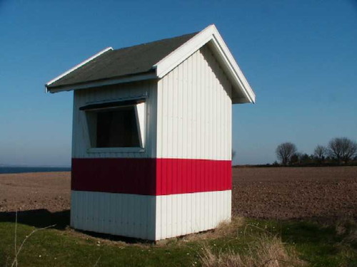
1965. Active; focal plane 9.5 m (31 ft); white, red, or green light, depending on direction, occulting once every 5 s. 4 m (13 ft) square wood building; the light is shown through a large rectangular window. Lighthouse painted white with one red horizontal band. Trabas has a photo and Google has a street view and a satellite view. The light guides vessels northbound approaching the E20 Lille Bælt Bridge. Stavrby Skov is a large forest park on the other side of the E20 motorway from the lighthouse. Located on the south side of the bridge abutment in Middelfart. Site open, tower closed. ARLHS DEN-227; DFL-4032; Admiralty C0924; NGA 2508.
* Strib (Strib Odde) (2)
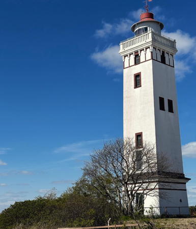
1900 (station established 1883). Active; focal plane 21 m (69 ft); white, red, or green light, depending on direction, occulting once every 5 s. 21 m (69 ft) square stone tower with lantern and gallery. Lighthouse painted white with red trim; lantern painted white with a red roof. Modern 2-story keeper's house. Torben Kessler's 2023 photo is at right, Wikimedia has a good 2008 photo, Lemvigh has a page with photos, Helle Mathorne has a 2021 photo, a good October 2005 photo is available, Werning has a good photo, Trabas has a closeup by Klaus Kern, Marinas.com has aerial photos, Huelse has a historic postcard view, and Google has a street view and a satellite view. The original light here was a 6 m (20 ft) cast iron tower that quickly proved to be too short. The lighthouse was restored to its original appearance in 2005. Located on a sharp point of land in Strib, marking the entrance to the Lille Bælt from the Kattegat. The street leading to the lighthouse is open, but parking appears to be limited. Site open, tower closed. . ARLHS DEN-047; DFL-4000; Admiralty C0922; NGA 2472.

Strib Light, Strib, May 2023
Instagram photo by Torben Kessler

Nordfyn (North Fyn) Lighthouses
Æbelø
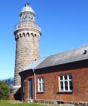
1883. Active; focal plane 20 m (66 ft); white flash every 15 s. 18 m (59 ft) round granite tower with lantern and gallery, attached to a 1-story brick keeper's house. The lighthouse is unpainted gray stone; lantern dome is gray metallic. This lighthouse is a sibling of the Skjoldnæs lighthouse on Ærø (see below). Klaus Huelse has a photo by Thorstein Bierstadt, Mikkel Kirketerp has a 2016 photo, Niels Mikkel Schultz-Johansen has a 2019 photo, Trabas has Jim Smith's view from the sea, Wikimedia has a distant view from the water, and Google has a satellite view. Æbelø is an island in the Kattegat about 7 km (4.5 mi) northeast of Bogense, connected to the mainland of Fyn by a long sandbar. The island is in a large area of shoals, making this a very dangerous area for navigation. Since 1995 the island has been owned by a foundation and is managed as a natural area. The island appears to be accessible (at least at low tide) by 4WD over the sandy isthmus; a hiking trail reaches the lighthouse. Located at the northwestern tip of the island. Site open, tower closed. Site manager: Aage V. Jensen Naturfonde. ARLHS DEN-001; DFL-2320; Admiralty C0893.5; NGA 2432.
Enebærodde (3)
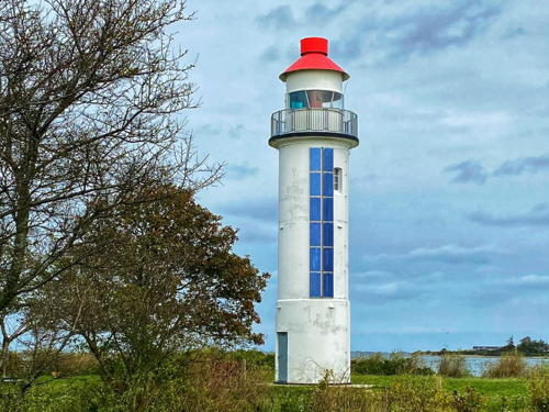
1926 (station established 1869). Active; focal plane 13 m (43 ft); white, red, or green light, depending on direction, 2 s on, 3 s off. 14 m (46 ft) round cylindrical (concrete?) tower with lantern and gallery. Lighthouse painted white; lantern dome is red. Two 1-1/2 story keeper's houses, also painted white with red roofs. Mette Poulsen's 2023 photo is at right, Nordfyns Kommune has a photo, Jan Jensen has a nice 2019 photo, Jytte Jensen has a good 2007 closeup, Trabas has Ina Rendtel's closeup photo, Wikimedia has photos, Marinas.com has aerial photos, and Google has a satellite view and a street view from across the fjord. This light marks the west side of the entrance to the Odense Fjord from the Kattegat. Located at the end of a long peninsula about 8 km (5 mi) southeast of Hasmark Strand. The road to the lighthouse is not open to the public, but it's possible to reach the lighthouse by hiking. There's a good view from the opposite side of the fjord. Site open, tower closed. . ARLHS DEN-061; DFL-2340; Admiralty C0890; NGA 2440.

Enebærodde Light, Nordfyn, October 2023
Instagram photo by Mette Poulsen

Kerteminde (Northeast Fyn)
Lighthouses
Romsø Tue
1973(?). Active; focal plane 10 m (33 ft); flash every 3 s, white, red or green depending on direction. 12 m (39 ft) post supporting a lantern and gallery. Entire lighthouse is green. Trabas has a photo by Capt. Theo Hinrichs but the light is not shown in Google's satellite view. Located about 5.5 km (3.5 mi) north northeast of Romsø. Accessible only by boat. Site open, tower closed. DFL-3500; Admiralty C1526; NGA 3648.
Romsø
1869. Inactive since 1973. 8 m (26 ft) octagonal cylindrical brick tower with lantern and gallery, centered on an octagonal 1-story brick base. The lighthouse is unpainted. Originally the tower was attached to a 1-1/2 story brick keeper's house. A newer 1-1/2 story house stands nearby, and a small fog signal building with diaphone horn also survives. Wolfgang Markl has a closeup photo, Huelse has a photo by Ole Lemvigh as well as a historic postcard view, Jeppe Ernst has a street view, and Google has a satellite view. Romsø is a low island in the Store Bælt about 4 km (2.5 mi) off the northeastern corner of Fyn. The entire island is privately owned, although some visitation is allowed. The lighthouse, which helped mark the entrance to the Store Bælt from the Kattegat, was replaced by a more useful light (next entry) that stands well out into the sound. The lighthouse is used now as an observation point, with cameras recording ship traffic through the Store Bælt. Located on the eastern tip of Romsø. Accessible only by boat. Site and tower closed (private property). ARLHS DEN-033.

Nyborg (East Fyn) Lighthouses
Sprogø (2)
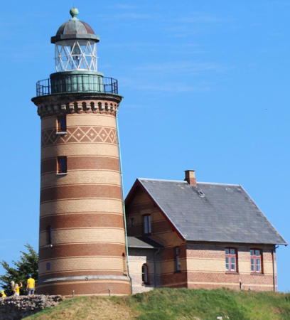
1868 (station established 1809). Reactivated (inactive 1980-1997); focal plane 44 m (144 ft); white flash every 5 s. 19 m (62 ft) round brick tower with lantern and gallery. The lighthouse is built of lighter and darker bricks arranged so that the tower has dark brown and light brown horizontal bands; the lantern is gray metallic. Pedro da Silva's 2022 photo is at right, Trabas has Klaus Kern's photo, Jan Slot-Carlsen has a closeup 2014 photo, Olli Wilkman has a photo, the Anke/Jens site also has a photo, Marinas.com has aerial photos, and Google has a street view and a satellite view. Sprogø is an island in the middle of the Storebælt between Nyborg and Korsør. The Great Belt Fixed Link (Storebæltsforbindelse) now carries the E20 motorway across the island, so thousands of vehicles roar past the lighthouse every day. The light was reactivated in connection with the completion of the Fixed Link project. Located on the highest point of the island, on the south side of the E-20. Site and tower closed. . ARLHS DEN-062; DFL-3405; Admiralty C1532.2; NGA 3688.

Sprogø Light, Sprogø, July 2022
Instagram photo by Pedro da Silva
* Knudshoved (4)
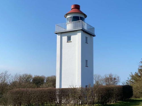
1948 (station established 1750). Active; focal plane 16 m (52 ft); white, red, or green light, depending on direction, 6 s on, 4 s off. 12.5 m (41 ft) square cylindrical concrete tower with lantern and gallery. Lighthouse painted white, lantern dome red. Ekaterina Akimova's photo is at right, Trabas has Eckhard Meyer's photo, Peter Michel has a good 2017 photo, Huelse also has a closeup photo, a 2022 photo is available, Marinas.com has aerial photos, and Google has a satellite view. The station has a complex history. There is a replica of the original "swingarm" light near the lighthouse; this is seen in the Anke/Jens photo. A short masonry tower was built in 1809. Klaus Huelse has a postcard view of the cast iron lighthouse installed in 1894. Knudshoved is a low spit sheltering the harbor of Nyborg. Located at the end of the spit, about 600 m (0.4 mi) south of the western end of the Great Belt Fixed Link. The surrounding area is a public park. Site open, tower closed. . ARLHS DEN-020; DFL-3545; Admiralty C1556; NGA 3752.
* Nyborg Fjord (Lindholm Havn) Bagfyr
Date unknown. Active; focal plane 13 m (43 ft); white light, 1 s on, 1 s off. 5 m (16 ft) square wood tower, painted white; the light is shown through a small square window. Trabas has a photo, Jan Jensen has a 2020 photo, and Huelse has a 2008 photo, but trees hide the rear light in Google's satellite view. The front light is in a similar but smaller wood cabinet 55 m (180 ft) to the east. Nyborg is the former terminal for ferries crossing the Store Bælt from Fyn to Sjaelland, but the bridges of the Great Belt Fixed Link (Storebæltsforbindelse) put the ferries out of business. Located off the Dyrehavevej at Lindholm Havn, on the south side of Nyborg. Site open, tower closed. DFL-3556a; Admiralty C1564.1; NGA 3780.

Knudshoved Light, Nyborg, April 2021
Instagram photo by Ekaterina Akimova

Langeland Lighthouses
Langeland, as its name suggests, is a long and narrow island: about 40 km (25 mi) in length from north to south. It has a population of about 15,000 and is a popular vacation destination for Danes and Germans. The island is connected to Fyn by bridges on highway 9 from Svendborg via Tåsinge, and a ferry crosses the Store Bælt from Langeland to Nakskov on the island of Falster.
* Lohals (3)
1933 (station established 1880). Active; focal plane 8 m (26 ft); white, red, or green light, depending on direction, 1 s on, 1 s off. 9 m (30 ft) square cylindrical masonry tower with lantern and gallery. Lighthouse painted white with gray trim; lantern dome painted red. The lighthouse adjoins several waterfront buildings. Trabas has a good closeup photo, Lemvigh has a page with photos, Erik Christensen has a 2010 closeup, and Google has a street view and a satellite view. Klaus Huelse has a postcard view of the cast iron tower installed in 1893; the lantern from that lighthouse was placed on the new and taller tower in 1933. Located at the foot of the south mole at Lohals, on the northwestern coast of Langeland. Site open, tower closed. ARLHS DEN-023; DFL-3648; Admiralty C1658; NGA 3972.
Frankeklint
1894. Active; focal plane 16 m (52 ft); red, or green light depending on direction, occulting once every 5 s. 1-story brick keeper's cottage with a semicircular lantern room at the seaward end. Lighthouse painted white; the house has a gray shingled roof. Lemvigh has a page with a closeup photo, Andreas Köhler has a 2020 photo, Trabas has an closeup by Eckhard Meyer, Jens Peter Hansen has a 2022 street view, and Google has a satellite view and a distant street view. Located atop a dune at the northwestern tip of Langeland. Site open, tower closed. ARLHS DEN-165; DFL-3668; Admiralty C1656; NGA 3968.
* Hov
1893. Active; focal plane 12 m (39 ft); white, red, or green light, depending on direction, 2 s on, 2 s off. 12 m (39 ft) round brick tower with lantern and gallery, attached to a 1-1/2 story brick keeper's house. Lighthouse painted white with one red horizontal band. Klaus van der Pütten's 2023 photo is at right, Wikimedia has Erik Christensen's 2009 photo, Trabas has Eckhard Meyer's photo, Lemvigh's page has good photos, Georg Onkel has a 2021 photo, Marinas.com has aerial photos, Huelse has a historic postcard view, Jens Peter Hansen has a 2022 street view, and Google has a satellite view. Located at the end of the Hov Fyrvej near the northeastern tip of Langeland. Site and tower closed but the lighthouse can be seen from nearby. . ARLHS DEN-035; DFL-3710; Admiralty C1668; NGA 3964.
Tranekær
1858. Inactive since 1977. 13 m (43 ft) square masonry tower with lantern and gallery, attached to a 2-1/2 story masonry keeper's house. Lighthouse painted white with dark gray trim, lantern dome red. Lemvigh's page has photos, H. Nielsen has a 2023 photo, Heidi Madsen has a 2022 photo, Marinas.com has aerial photos, Huelse has an interesting postcard view showing very different surroundings, and Google has a satellite view. After deactivation the station was sold as a private residence. Located on the east coast of Langeland, at the end of the Bukkeskovvej, about 4 km (2.5 mi) east of Tranekær village. Site and tower closed, although the lighthouse can be seen from the end of the road. Site manager: private. . ARLHS DEN-164.

Hov Light, Langeland, March 2023
Google Maps photo by Klaus van der Pütten
* Keldsnor (Kjelds Nor) (2)
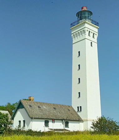
1905 (station established 1885). Active; focal plane 39 m (128 ft); two white flashes every 15 s; also a directional light (white, red or green depending on direction, occulting once every 5 s) is shown at a focal plane of 22 m (72 ft). 34 m (112 ft) square masonry tower with lantern and gallery. Lighthouse painted white with buff trim; lantern painted red. 1st order Fresnel lens in use. A 2023 photo by Chrysostomos Galathris is at right, Johan Wieland has a 2010 photo, Trabas has an excellent photo, Reinhard Justus has a 2021 photo, Werning has a photo, Lemvigh's page has photos, Marinas.com has aerial photos, Huelse has a historic postcard view, and Google has a satellite view. This lighthouse stands near the southern tip of Langeland and marks the west side of the southern entrance to the Store Bælt. It replaced the 1806 Fakkebjerg Fyr, a much smaller lighthouse located several miles to the west. Located at the end of the Rathvej about 4 km (2.5 mi) southeast of Søndenbro. Site and tower reported closed but the lighthouse can be seen from nearby. . ARLHS DEN-163; DFL-3775 (white light) and 3776 (directional light); Admiralty C1706; NGA 4192.

Langelandsbælt Offshore Lighthouses
These lights were built to guide ships sailing a newly-dredged deep-water channel east of Langeland.

Langelandsbælt Nord
1970s. Active; focal plane 10 m (33 ft); flash every 3 s, red or green depending on direction. 10 m (33 ft) round lantern and gallery mounted on a tall mast. Entire lighthouse painted red. Trabas has Capt. Peter Mosselberger's photo and Bing has a satellite view. Located on the east side of the channel at its northern end about 3 km (2 mi) east of the east coast of Langeland near the northern end of the island. Accessible only by boat. Site open, tower closed. DFL-3715; Admiralty C1672; NGA 3960.
Bøstrup Ost
1970s. Active; focal plane 10 m (33 ft); flash every 5 s, red or green depending on direction. 10 m (33 ft) round lantern and gallery mounted on a tall mast. Entire lighthouse painted green. Trabas has Capt. Peter Mosselberger's photo and Bing has a satellite view. Located on the west side of the channel about 5 km (3 mi) off the east coast of Langeland near Bøstrup. Accessible only by boat. Site open, tower closed. DFL-3720; Admiralty C1672.5; NGA 3956.
Spodsbjerg Sydost
1970s. Active; focal plane 10 m (33 ft); flash every 3 s, white, red or green depending on direction. 10 m (33 ft) round lantern and gallery mounted on a tall mast. Entire lighthouse painted yellow. Trabas Capt. Peter Mosselberger's photo and Google has a satellite view. Located about 2 km (1.25 mi) southeast of Spodsbjerg. Accessible only by boat; there should be good view of this light from the ferries between Spodsbjerg and the island of Falster. Site open, tower closed. DFL-3725; Admiralty C1673; NGA 3952.

Keldsnor Light, Østerskov, June 2023
Instagram photo by Chrysostomos Galathris
Højbjerg Ost
1970s. Active; focal plane 10 m (33 ft); flash every 5 s, red or green depending on direction. 10 m (33 ft) round lantern and gallery mounted on a tall mast. Entire lighthouse painted green. Trabas has Capt. Peter Mosselberger's photo and Google has a satellite view. Located on the west side of the channel about 1.5 km (1 mi) off the east coast of Langeland and 4 km (2.5 mi) south of Spodsbjerg. Accessible only by boat. Site open, tower closed. DFL-3754; Admiralty C1673.3; NGA 3932.
Langelandsbælt Syd (?)
1970s. Inactive since 2012. 10 m (33 ft) round lantern and gallery mounted on a tall mast. Entire lighthouse painted red. The light is not shown in Google's satellite view but may appear as a tiny spot in Bing's satellite view. NGA continues to list the light as a racon (interactive radar) station. Located on the east side of the channel at its southern end about 8 km (5 mi) east of Bukkemose on the southeast coast of Langeland. Accessible only by boat. Site open, tower closed. ex-DFL-3762; ex-Admiralty C1673.6; NGA 3928.

Svendborg (South Fyn) Lighthouses
Svendborg is a town at the south end of Fyn, separated from the island of Tåsinge by a narrow strait, part of the Svendborg Sund. Tåsinge is about 8 km (5 mi) in diameter and has about 6000 inhabitants. Highway 9 crosses the Svendborg Sund to Tåsinge and continues over two more bridges to Langeland.
* Elsehoved
1894. Active; focal plane 10 m (33 ft); white, red, or green light, depending on direction, 3 s on, 2 s off. 8 m (26 ft) round cylindrical cast iron tower with lantern and gallery, painted with red and white horizontal bands. Anne Skipper's 2023 photo is at right, Huelse has a good photo, Andreas Köhler has a 2020 photo, Trabas has a good photo, Wikimedia has a photo, Lemvigh has photos, and Google has a satellite view. This light marks a prominent point projecting into the west side of the Svendborg Sund opposite Lohals, Langeland. Located off the Elsehovedvej about 3 km (2 mi) south of Lundeborg. Site open, tower closed. . ARLHS DEN-006; DFL-3632; Admiralty C1590; NGA 3836.
Bækkehave
1925. Active; focal plane 6 m (20 ft); white, red, or green light, depending on direction, 3 s on, 2 s off. 6 m (20 ft) 2-story square tower, upper story wood and lower story concrete or masonry; the light is displayed through a square window. Lighthouse painted white with one red horizontal band. Trabas has a closeup photo, Lemvigh has a photo, and Google has a satellite view. Located on a promontory on the northwest side of Tåsinge and the south shore of the Svendborg Sund, about 2.5 km (1.5 mi) northwest of Strammelse. The lighthouse is on farm property, it is possible to reach it by walking along the shore. There are also good views from the ferry between Svendborg and Ærø. Site open, tower closed. ARLHS DEN-160; DFL-4800; Admiralty C1022; NGA 3924.
* Svendborg Havn Gasværk
Date unknown. Active; focal plane 8 m (26 ft); white, red, or green light, depending on direction, occulting once every 5 s. 6 m (20 ft) square wood hut mounted on a square metal skeletal tower; the light is displayed through a slit-like rectangular window. Hut painted white. Trabas has a photo and Google has a street view and a satellite view. Located near the end of the Tuxensvej on the east side of the Svendborg waterfront. Site open, tower closed. DFL-4856; Admiralty C1596.

Elsehoved Light, Lundeborg, July 2023
Instagram photo by Anne Skipper
* St.-Jørgens
1949. Active; focal plane 8 m (26 ft); white, red, or green light, depending on direction, occulting twice every 6 s. 8 m (26 ft) square wood hut mounted on a square wood skeletal tower; the light is displayed through a square window. Hut painted white with one red horizontal band; skeletal structure stained dark brown. Trabas has a closeup photo, Huelse also has a good closeup photo, Lemvigh has a page with photos, and Google has a street view, but a tree hides the light in Google's satellite view. Located on the Øreodden on the Svendborg waterfront, near St.-Jørgens church and about 250 m (800 ft) west of the highway 9 bridge across the sound. Site open, tower closed. DFL-4806; Admiralty C1591; NGA 3888.
Fyrskib 21 Skagens Rev
1911 (Rasmus Møllers Værft, Fåborg). Decommissioned 1988. 33.6 m (110 ft) wood lightship; the light was displayed from a lantern atop the mainmast. Hull painted a deep red with a white horizontal band; deckhouse and mast painted white, lantern deep red. Myhre has a 2007 photo and Google has a 2009 street view. Before World War II the ship served mostly on the Horns Rev station off Esbjerg in the North Sea. From 1945 to 1969 it was stationed off Læso, and its last station was at Skagens Rev off the end of the Skagen spit. It was the last Danish lightship withdrawn from its station, on 12 December 1988. In 2006 the ship was moored at Ebeltoft and placed in service as a café. More recently the café has closed and ship was moved across the harbor basin. Andreas Köhler has a 2015 closeup photo, Sebastian Gerber has a 2015 street view, and Google has a satellite view. Endangered: when Heather Craven and Ian Yarde visited in August 2018 the ship appeared to be in poor condition. In 2020 the foundation managing the frigate Jylland placed the lightship on sale, saying that they did not have funds to maintain it properly. In 2022 a fishing captain, Henning Kjeldsen, bought the ship for a nominal 1 krone. He is now renovating the ship in Svendborg and hopes eventually to return it to Skagen. We don't know the exact location of the ship in Svendborg harbor. Site status unknown. Owner/site manager: private. ARLHS DEN-009.

Ærø Lighthouses
Ærø is a long and slender island in Kiel Bay off the southern coast of Fyn. The island is about 30 km (19 mi) long and up to 8 km (5 mi) wide; the population is about 7000. Ærø is readily accessible by ferry from Fåborg or Svendborg on Fyn, from Mommark on Als, or from Rudkøbing on Langeland.

*
Skjoldnæs ("Shield Point")
1881. Active; focal plane 32 m (105 ft); one very long (4 s) white flash every 30 s. 22 m (72 ft) round granite tower with lantern and gallery, attached to a 2-story red brick keeper's house with granite trim. 1st order Fresnel lens in use. The lighthouse is unpainted dark gray stone; lantern dome is greenish metallic. Wolfgang Pehlemann's 2020 photo is at right, Trabas has a photo by Ina Rendtel, Lemvigh's page has photos, Malte Petersen has a 2022 photo, Marinas.com has aerial photos, Huelse has a historic postcard view, and Google has a street view and a good satellite view. This handsome lighthouse was built of granite shipped from Bornholm. The original rotating mechanism is still in place, although it is no longer used. In 2006 a golf course was built on the light station and surrounding property, and the keeper's house became the club house for the course. Located at the northwestern tip of Ærø, about 3 km (2 mi) northwest of Søby Havn. Site open, tower closed. Site manager: Ærø Golf Klub. . ARLHS DEN-158; DFL-4400; Admiralty C1070; NGA 2792.
* Søby Havn West Mole
2007. Active; focal plane 6 m (20 ft); continuous green light. 6 m (20 ft) octagonal wood tower with lantern. Tower painted white with a narrow green horizontal band; lantern dome is greenish metallic. Lemvigh has a photo, Andreas Köhler has a 2022 closeup, and Google has a satellite view and a distant street view. This light was built to match the historic lighthouse on the east mole (next entry). Søby Havn is the terminal for ferries from Fåborg and Mommark. Located at the end of the west mole at Søby Havn. Accessible by walking the pier. Site open, tower closed. DFL-5066; Admiralty C1074.5.
* Søby Havn East Mole
1875. Active; focal plane 6 m (20 ft); white or red light, depending on direction, 1 s on, 1 s off. 6 m (20 ft) octagonal wood tower with lantern. Tower painted white with a narrow red horizontal band; lantern dome is greenish metallic. Huelse has a good closeup photo, Trabas has a photo, Lemvigh's page has photos, Andreas Köhler has a 2022 closeup, and Google has a street view and a satellite view. The red band was added in 2007. Søby Havn is the terminal for ferries from Fåborg and Mommark. Located at the end of the east mole at Søby Havn. Accessible by walking the pier. Site open, tower closed. DFL-5064; Admiralty C1074; NGA 2804.

Skjoldnæs Light, Aerø, 2020
Wikimedia Creative Commons photo by Wolfgang Pehlemann
 

Fåborg-Midtfyn (Southwest Fyn) Lighthouses
* Østerhede Forfyr (1)
Date unknown. Inactive. 5 m (16 ft) square wooden tower; the light was shown through a small square window, which appears to be boarded up. Behind the building, the light was moved to an 11 m (36 ft) post carrying a triangular red daymark; it has also been deactivated. Huelse has a photo and the tiny light is centered in Google's satellite view. The Admiralty has dropped its listings for this range. Located off the Svendborgvej at the eastern entrance to Fåborg harbor. Site open, tower closed. ARLHS DEN-054; ex-DFL-4724b; ex-Admiralty C0998; NGA 2764.
Østerhede Bagfyr (1)
Date unknown. Inactive. 5 m (16 ft) square wooden tower; the light was shown through a small square window, which appears to be boarded up. Behind the building, the light was moved to a 13 m (43 ft) post carrying a triangular red daymark. That light has also been deactivated. Huelse has a photo of the original light but the small light is not distinguishable in Google's satellite view. Located off the Svendborgvej at the eastern entrance to Fåborg harbor, 212 m (700 ft) northeast of the front light. Site and tower closed (private property) but the light can be seen from outside the fence. ARLHS DEN-055; ex- DFL-4724a; ex-Admiralty C0998.1; NGA 2768.
* Nakkeodde
1916. Active; focal plane 9 m (30 ft); white, red, or green light, depending on direction, occulting once every 5 s. 4 m (13 ft) square wood building; the light is shown through a large rectangular window. Lighthouse painted white with one red horizontal band. Huelse's photo is at right, Trabas has a view from the sea, and Google has a satellite view. Located on the northeastern tip of the island of Avernakø about 800 m (1/2 mi) east of Munke; the island is accessible by ferry from Fåborg. Site open, tower closed. ARLHS DEN-157; DFL-4750; Admiralty C1020; NGA 2784.
* Munke
1925. Active; focal plane 10 m (33 ft); white, red, or green light, depending on direction, 2 s on, 2 s off. 4 m (13 ft) square wood building; the light is shown through a large square window. Lighthouse painted white with one red horizontal band. Huelse has a photo but trees hide the light in Google's satellite view. The light guides vessels into the harbor of Munke, on the northeast side of the island of Avernakø about 6 km (3.5 mi) south of Fåborg; the island is accessible by ferry from Fåborg. Located at the ferry terminal. Site open, tower closed. ARLHS DEN-156; DFL-4756; Admiralty C1016; NGA 2788.
Nakkeodde Light
Nakkeodde Light, Avernakø
photo copyright Klaus Huelse; used by permission
* Bjørnø
Date unknown. Active; focal plane 6 m (20 ft); white, red, or green light, depending on direction, 2 s on, 2 s off. 4 m (13 ft) square wood tower; the light is shown through a rectangular window. Lighthouse painted white with one red horizontal band. Huelse has a photo, Martin Impgaard has a street view, and Google has a satellite view. The light guides vessels approaching Bjørnø and Fåborg from the southeast. Bjørnø is an island about 2 km (1.2 mi) south of Fåborg; the island is accessible by ferry from Fåborg. Located near the southeastern tip of the island. Site open, tower closed. ARLHS DEN-155; DFL-4712; Admiralty C0991; NGA 2748.
* Sisserodde (Forfyr)
1921. Active; focal plane 8 m (26 ft); white, red, or green light, depending on direction, 1 s on, 1 s off. 5 m (16 ft) square wood tower on a concrete base. The front range light was formerly shown through a square window, but the modern directional light is mounted on the roof of the building. Lighthouse painted white with one red horizontal band. Ian Yarde's photo is at right, Trabas has Andreas Köhler's photo, Sten-Erik Brand has a 2022 photo, and Google has a street view and a satellite view. This light guides ships into the harbor of Fåborg through a narrow passage between the mainland of Fyn and the island of Bjornø. It was converted to a directional (sector) light in 1996. Located on the Bjerne Langgyde about 3 km (2 mi) southeast of Bjerne. Site open, tower closed. ARLHS DEN-053; DFL-4719; Admiralty C0992; NGA 2752.
Sisserodde Bagfyr
Date unknown. Inactive since 1996. 5 m (16 ft) square wood tower on a concrete base; the light was shown through a square window. Lighthouse painted white with one red horizontal band. Huelse has a photo, Google has a distant street view, and the small light is centered in Google's satellite view. The light was deactivated when the front light (previous entry) was converted to a directional light. It appears that the property owner is maintaining the lighthouse. Located on a farm on the Bjerne Langgyde about 3 km (2 mi) southeast of Bjerne. Site and tower closed (private property). ex-Admiralty C0992.1; ex-NGA 2756.

Sisserodde Forfyr, Bjerne, August 2018
photo copyright Ian Yarde; used by permission

Information available on lost lighthouses:

Notable faux lighthouses:

Adjoining pages: East: Sjælland | West: Southeast Jylland

Return to the Lighthouse Directory index | Ratings key

Posted February 1, 2007. Checked and revised April 11, 2024. Lighthouses: 43, lightships: 1. Site copyright 2024 Russ Rowlett and the University of North Carolina at Chapel Hill.