The Arab Republic of Egypt (Miṣr in Arabic) links northeastern Africa and southwestern Asia with the land bridge of Sinai connecting the two continents. This position has made it an important crossroads of the world for the many millennia of its history. In modern times it became a particularly crucial crossroads in 1869 with the completion of the Suez Canal by a French company, linking Egypt's Mediterranean and Red Sea coasts. At that time Egypt was nominally a province of the Ottoman (Turkish) Empire but in fact it was ruled as a monarchy. British troops invaded and occupied the country in 1882, declaring its independence from the Ottoman Empire and establishing a de facto British protectorate. Egyot was declared an independent kingdom in 1922 but British troops remained until the republic was established in 1953.
Egypt is famous as the home of the prototype of all lighthouses, the Pharos of Alexandria, built in the early third century BC. At nearly 120 m (390 ft), it was as tall as a modern skyscraper and much taller than any modern lighthouse. It remained in operation until after the Arab conquest of Egypt in 642 CE and stood for centuries more, finally collapsing after several earthquakes.
Egypt is divided into 27 governorates and the governorates are subdivided into regions. This page includes lighthouses of the Red Sea Governorate, which includes the entire Red Sea coast south of the immediate Suez area; there are separate pages for the Mediterranean Sea coast and for South Sinai and Suez.
Aids to navigation in Egypt are operated by the Egyptian Authority for Maritime Safely (EAMS). A private company, the Beacon Company of Egypt, maintains many of the lights under contract. Harbor lights at Hurghada and Safaga are maintained by the General Authority for Red Sea Ports.
The Arabic word for a lighthouse is mnarh or manara (منارة). Ra's is a cape, jaza'ir or jazirat is an island, mina' is a harbor, and shi'b is a reef. Transliteration of Arabic to Latin characters can be done in many ways, so alternate spellings are common.
ARLHS numbers are from the ARLHS World List of Lights. Lights on this page were formerly included in volume E of the Admiralty List of Lights & Fog Signals, but in 2013 they were moved to volume D with new numbers. U.S. NGA List numbers are from Publication 112.
- General Sources
- Beacon Company of Egypt - List of Lights
- This light list provides data on each light, but no photos. Gulf of Suez lights are included, but not Red Sea lights.
- EAMS - Projects
- For lighthouse photos click to "Navigational Aids" and then on "ATON are divided as per their location."
- Online List of Lights - Egypt - Gulf of Suez and Red Sea
- Photos by various photographers posted by Alexander Trabas.
- Lighthouses in Egypt
- Photos by various photographers available from Wikimedia.
- World of Lighthouses - Egypt
- Photos by various photographers available from Lightphotos.net.
- Afrikanische Leuchttürme auf historischen Postkarten
- Historic postcard images posted by Klaus Huelse.

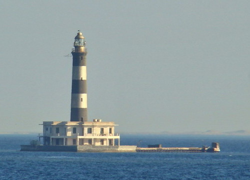
Akhaween (The Brothers) Light, Red Sea, November 2017
Google Maps photo by Maciej Sikora


