Lighthouses of Egypt: South Sinai and Suez

The Arab Republic of Egypt (Miṣr in Arabic) links northeastern Africa and southwestern Asia with the land bridge of Sinai connecting the two continents. This position has made it an important crossroads of the world for the many millennia of its history. In modern times it became a particularly crucial crossroads in 1869 with the completion of the Suez Canal by a French company, linking Egypt's Mediterranean and Red Sea coasts. At that time Egypt was nominally a province of the Ottoman (Turkish) Empire but in fact it was ruled as a monarchy. British troops invaded and occupied the country in 1882, declaring its independence from the Ottoman Empire and establishing a de facto British protectorate. Egyot was declared an independent kingdom in 1922 but British troops remained until the republic was established in 1953.

Egypt is famous as the home of the prototype of all lighthouses, the Pharos of Alexandria, built in the early third century BCE. At nearly 120 m (390 ft), it was as tall as a modern skyscraper and much taller than any modern lighthouse. It remained in operation until after the Arab conquest of Egypt in 642 CE and stood for centuries more, finally collapsing after several earthquakes.

Egypt is divided into 27 governorates. This page includes lighthouses of two governorates: South Sinai and Suez. There are separate pages for the Red Sea Governorate and for the Mediterranean Sea coast.

The Arabic word for a lighthouse is mnarh or manara (منارة). Ra's is a cape, jaza'ir or jazirat is an island, shi'b is a reef, khalīǧ is a bay or gulf, maḍīq is a strait, and mina' is a port or harbor. Transliteration of Arabic to Latin characters can be done in many ways, so alternate spellings are common.

Aids to navigation in Egypt are operated by the Egyptian Authority for Maritime Safely (EAMS). A private company, the Beacon Company of Egypt, maintains many of the coastal lights under contract. Harbor lights at Suez and at Sharm-el-Sheikh are maintained by the General Authority for Red Sea Ports.

ARLHS numbers are from the ARLHS World List of Lights. Lights on this page were formerly included in volume E of the Admiralty List of Lights & Fog Signals, but in 2013 they were moved to volume D with new numbers. U.S. NGA List numbers are from Publication 112.

General Sources
Beacon Company of Egypt - List of Lights
This light list provides data on each light, but no photos. The Red Sea lights are not included.
EAMS - Projects
For lighthouse photos click to "Navigational Aids" and then on "ATON are divided as per their location."
Online List of Lights - Egypt Red Sea
Photos by various photographers posted by Alexander Trabas. Jim Smith, Rainer Arndt, and Werner Seiler contributed most of the photos for this area.
Lighthouses in Egypt
Photos by various photographers available from Wikimedia.
World of Lighthouses - Egypt
Photos by various photographers available from Lightphotos.net.
Afrikanische Leuchttürme auf historischen Postkarten
Historic postcard images posted by Klaus Huelse.
GPSNauticalCharts
Navigation chart information for this area.
Navionics Charts
Navigation chart for the Sinai area.


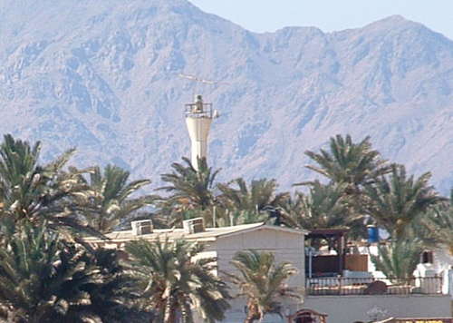
Abu el-Durg Light, Gulf of Suez, November 2022
Google Maps photo by ssk900
South Sinai Governorate Lighthouses

Southern Sinai is bordered by two deep but narrow extensions of the Red Sea: on the east the Gulf of Aqaba separates Sinai from Arabia and on the west the Gulf of Suez separates Sinai from the African mainland. Geographers consider Sinai to be part of Asia.

Gulf of Aqaba Lighthouses
* Nuwaybi (Nuweiba, Nuweibah)
Date unknown. Active; focal plane 46 m (151 ft); three white flashes, in a 2+1 pattern, every 10 s. 10 m (33 ft) round hourglass-shaped fiberglass tower mounted on a square concrete base. Entire lighthouse is white. No photo available but Google has a satellite view. Nuweiba is a resort town on the Gulf of Aqaba about 70 km (45 mi) south of the Israeli border and 150 km (90 mi) north of Sharm el-Sheikh. Founded by Israel during its occupation of the Sinai (1967-82), it is now a terminal for Arab Bridge Maritime ferries crossing the Gulf of Aqaba to Aqaba, Jordan. Located beside the main highway in Nuweiba. Site open, tower closed. Admiralty D7297.79 (ex-E6041.4); NGA 30432.
* Dhahab (Dahab)
Date unknown. Active; focal plane 20 m (66 ft); two white flashes every 20 s. 10 m (33 ft) round hourglass-shaped fiberglass tower mounted on a square concrete base. Entire lighthouse is white. J. Ulmer's photo is at right, Trabas has Seiler's photo, and Google has a satellite view. Dahab is a former fishing village, now a popular resort and scuba diving center, 80 km (50 mi) northeast of Sharm el-Sheikh. Located in downtown Dahab. Site open, tower closed. Admiralty D7297.77 (ex-E6041); NGA 30428.
Wādī Kīd
Date unknown. Active; focal plane 11 m (36 ft); three quick white flashes every 10 s. 9 m (29 ft) tower, probably a round hourglass-shaped fiberglass tower. The lighthouse is black with a yellow horizontal band. No photo available but Google has a satellite view. For southbound vessels, this light marks the west side of the entrance to the Strait of Tīrān. Located on a promontory about 19 km (12 mi) north of the narrowest part of the strait. Site open, tower closed. Admiralty D7297.76 (ex-E6040.9); NGA 30426.

Dhahab Light, Dhahab, July 2005
ex-Panoramio photo copyright J. Ulmer; permission requested

Strait of Tīrān and Sharm el-Sheikh Area Lighthouses
Ra's Muhammed is the cape at the southern tip of the Sinai Peninsula, where the Red Sea divides into two branches, the Gulf of Aqaba to the east and the Gulf of Suez to the west. Sharm el-Sheikh is a resort city overlooking the Strait of Tīrān, the entrance to the Gulf of Aqaba. Note: Tīrān Island, a large island partly blocking the entrance, was administered by Egypt from 1906 but in 2016 Egypt agreed to transfer the island to Saudi Arabia. Although a judge ruled against the transfer, it was ratified by the Egyptian parliament in June 2017 and the transfer took place in July. Egypt and Saudi Arabia have also agreed to the construction of a causeway and bridge across the Strait.
Gordon Reef
Date unknown. Active; focal plane 12 m (39 ft); red light occulting once every 7 s. 10 m (33 ft) round hourglass-shaped fiberglass tower mounted on a square concrete base. Upper half of the lighthouse is red, lower half white. Andrey Parfenov has a photo, the light is on the right in Sameer Showaiter's 2018 photo, and Google has a satellite view. In Parfenov's photo and in Victoria Ivanova's photo the light appears near the wreck of the MV Loullia, a bulk carrier that wrecked on the Gordon Reef in September 1981.Southbound ships in the Strait of Tīrān use the Enterprise Passage, a narrow channel between the Sinai coast and this light, located on the southwestern end of the reef. Accessible only by boat. Site open, tower closed. Admiralty D7297.7 (ex-E6040.7); NGA 30424.
Ra's Ghamila (Enterprise Passage)
Date unknown. Active; focal plane 12 m (43 ft); white flash every 10 s; also a green sector light occulting once every 7 s. 10 m (33 ft) round hourglass-shaped fiberglass tower mounted on a square concrete base. Entire lighthouse is green. A photo is available and Google has a satellite view. Located on a reef off the mainland opposite the Gordon Reef Light marking the west side of the exit from the Enterprise Passage. Accessible only by boat. Site open, tower closed. Admiralty D7297.67 (ex-E6040.3); NGA 30420.
* Ra's Umm Sudd (Um el Sayed, Ras Umm Sidd)
1987. Active; focal plane 45 m (148 ft); three white flashes every 20 s. 17 m (56 ft) square skeletal tower with lantern and gallery, painted white. A large rectangular white daymark covers most of the front of the lighthouse. George Bale's photo is at right, Trabas has Seiler's closeup photo, Jason Enright also has a closeup, a 2021 photo is available, Wikimedia has a photo by Jerrye and Roy Klotz, EAMS has a photo, Rosa Kuzova has a distant view, Olivier Bulle has a street view, and Google has a satellite view. Ra's Umm Sudd is a headland at the northern end of the Red Sea, about 20 km (13 mi) northeast of Ra's Muhammad, the tip of the Sinai Peninsula. The light station guides ships leaving the Red Sea for the Gulf of Aqaba. The lighthouse is easily accessible by road from the resorts in the nearby Sharm el-Sheikh area. Site probably open, tower closed. ARLHS EGY-020; Admiralty D7297.62 (ex-E6040); NGA 30416.
* Sharm el-Sheikh Entrance East (2)
Date unknown. Active; focal plane about 20 m (66 ft); green light, 3 s on, 2 s off. Approx. 9 m (30 ft) round hourglass-shaped green fiberglass tower mounted on a square concrete base. Trabas has Rainer Arndt's photo, Wikimedia has a photo, another photo is available, Olivier Bulle has a distant sea view, and Google has a satellite view. Located on the east side of the cruise ship harbor of Sharm el-Sheikh. Site open, tower closed. Admiralty D7297.61 (ex-E6039.9); NGA 30415.5.
Um el-Sayed Light
Ra's Umm Sudd Light, Sharm el-Sheikh, March 2013
Flickr photo copyright George Bale; used by permission
Sharm el-Sheikh Entrance West (2)
Date unknown. Active; focal plane about 20 m (66 ft); red light, 3 s on, 2 s off. Approx. 9 m (30 ft) round hourglass-shaped red fiberglass tower mounted on a square concrete base. Trabas has Rainer Arndt's photo and Google has a satellite view. Located on the west side of the cruise ship harbor of Sharm el-Sheikh. Site open, tower closed. Admiralty D7297.6 (ex-E6039.91); NGA 30415.

Gulf of Suez Entrance Lighthouses
Ra's Muhammad
Date unknown. Active; focal plane 15 m (49 ft); four white flashes every 20 s. 10 m (33 ft) hourglass-shaped fiberglass tower. Upper half of tower painted black, lower half white. No lantern. Matt Kieffer's photo is at right, Trabas has Seiler's closeup photo, Holger Brennecke has a 2018 photo, EAMS has a photo, Daniele Messina has a 2014 view from the sea, and Google has a satellite view. Though modest in size this is an important lighthouse marking the extreme southern tip of the Sinai Peninsula. The area is incorporated in the Ra's Muhammed National Park. Located at the end of a barren, rocky peninsula. Accessible only by boat. Site open, tower closed. ARLHS EGY-028; Admiralty D7296.724 (ex-E6039.5); NGA 30414.
[Beacon Rock]
Date unknown. Active; focal plane 9 m (30 ft); six quick white flashes followed by one long white flash every 15 s. 9 m (30 ft) post, upper half yellow and lower half black, mounted on a square concrete base. Roberto Galan has a 2021 photo and Google has a satellite view. The Admiralty lists this light as Qad Ibn Haddān Southward; it marks the end of shoals on the east side of the Strait of Gubal, the entrance to the Gulf of Suez. Located about 15 km (9 mi) west of Ra's Muhammad. Accessible only by boat. Site open, tower closed. Admiralty D7296.723 (ex-E6039.3); NGA 30413.
Qad Ibn Haddān (Kad ben Haddan)
1987. Active; focal plane 47 m (154 ft); white flash every 10 s. 39 m (128 ft) square pyramidal skeletal tower with lantern, gallery, and a rectangular white daymark. EAMS has a photo, Trabas has Werner Seiler's distant view from the sea, and Google has a satellite view. A building surrounds the lighthouse. This powerful light (it has a range of 40 km (25 mi)) marks the northeast side of the entrance to the Gulf of Suez, about 25 km (15 mi) northwest of Ra's Muhammad. Site status unknown. ARLHS EGY-026; Admiralty D7296.725 (ex-E6039); NGA 30412.
[Sha'b Ali (Shag Rock)]
Date unknown. Active; focal plane 12 m (39 ft); nine quick white flashes every 15 s. 12 m (39 ft) post mounted on a concrete pier. A German-language Wikipedia article has a photo, EAMS has a closeup photo, and Google has a satellite view. The light marks a very dangerous reef on the east edge of the channel entering the Gulf of Suez. Located about 16 km (10 mi) west of Qad Ibn Haddān. Accessible only by boat. Admiralty D7296.73 (ex-E6034.5); NGA 30398.
Ra's Muhammad Light
Ra's Muhammad Light, Ra's Muhammad, December 2009
Flickr Creative Commons photo by Matt Kieffer

Upper Gulf of Suez Lighthouses
Lahāţa
Date unknown. Active; focal plane 47 m (154 ft); three white flashes every 15 s. 39 m (128 ft) square cylindrical skeletal tower with lantern, gallery, and a rectangular white daymark. EAMS has a photo and Google has a satellite view. The light marks a headland on the east side of the Gulf, directly opposite 'Ayn Sukhnah. Located about 35 km (22 mi) southeast of Suez city. Site status unknown. ARLHS EGY-040; Admiralty D7297.31 (ex-E6021.5); NGA 30252.
Qad al Tawīla
Date unknown. Active; focal plane 47 m (154 ft); white flash every 10 s. 39 m (128 ft) square skeletal tower with lantern, gallery, and a rectangular white daymark. EAMS has a photo, Mohmd Salah has a distant view and Google has a satellite view. Ships northbound toward the Canal steer toward this light after turning from the bearing marked by the Ain Sokhna lighthouse. Located on the east side of the Gulf about 25 km (15 mi) southeast of Suez city. Site status unknown. ARLHS EGY-041; Admiralty D7297.3 (ex-E6021.2); NGA 30248.

Suez Governorate Lighthouses

Suez Harbor Lighthouses
Birkat Misallāt
Date unknown. Active; focal plane 42 m (138 ft); three white flashes every 15 s. 39 m (128 ft) square cylindrical skeletal tower with lantern, gallery, and a rectangular white daymark. Trabas has Smith's photo, EAMS has a photo, and Google has a satellite view. Located on the east side of the Gulf at Port Taufiq, about 3 km (1.8 mi) southeast of the Canal entrance. Site status unknown. Admiralty D7297.28 (ex-E6017); NGA 30230.
Newport Rock (Zenobia Rock) (2)
Date unknown (1960s?) (station established 1897). Active; focal plane 17 m (56 ft); white flash every 5 s. 9 m (30 ft) tripod tower with gallery, mounted on three strait piles. Lighthouse painted with black and white horizontal bands. The EAMS photo is at right, Trabas has Arndt's photo, and Bing has an indistinct satellite view. This light is on the east side of the channel for ships approaching or leaving the Suez Canal. The original lighthouse was described as a "cylindrical tower on a dwelling on piles." Located on a shoal about 8 km (5 mi) south of the southern entrance to the Suez Canal. Accessible only by boat. Site open, tower closed. ARLHS EGY-015; Admiralty D7297.29 (ex-E6020); NGA 30236.
Jazīrat al Khadrā (Qal'a Kebira, Green Island)
Date unknown (station established 1903). Active; focal plane 23 m (75 ft); quick-flashing white light. 23 m (75 ft) skeletal tower, painted with black and white horizontal bands and mounted on a square concrete pier. Trabas has Arndt's photo, Essam Sayed has a photo, and Google has an indistinct satellite view. There's nothing green about the islet; it is a barren reef. Located about 200 m (220 yd) south of the island, about 8 km (5 mi) southwest of the Canal entrance and 4 km (2.5 mi) northwest of the Newport Rock Light (next entry). Accessible only by boat. Site open, tower closed. Admiralty D7297.17 (ex-E6016); NGA 30232.
Būr Ibrāhīm (Port Ibrahim) South Mole
Date unknown. Active; focal plane 8 m (26 ft); continuous green light. 7 m (23 ft) round hourglass-shaped fiberglass tower mounted on a square concrete base. Entire tower is green. Trabas has Smith's photo, the light is at the left of Mohamed El Dali's photo of the harbor and Bing has a satellite view. Būr Ibrāhīm is the traditional port on the west side of the southern entrance to the Suez Canal. Located on the south mole of the harbor. Site and tower closed. Admiralty D7297.25 (ex-E6000); NGA 30200.
Būr Ibrāhīm (Port Ibrahim) North Mole
Date unknown. Active; focal plane 8 m (26 ft); continuous red light. 7 m (23 ft) round hourglass-shaped fiberglass tower mounted on a square concrete base. Entire tower is red. Trabas has Smith's photo and Bing has a satellite view. Located on the north mole of the harbor. Site and tower closed. Admiralty D7297.24 (ex-E5998); NGA 30196.

Newport Rock Light, Suez Harbor
EAMS photo
Būr Ibrāhīm (Port Ibrahim) Range Rear
Date unknown. Active; focal plane 25 m (82 ft); continuous red and white lights. Approx. 22 m (72 ft) square pyramidal skeletal tower. No photo available but Google has a satellite view. The front light is on a much shorter skeletal tower. Located on the main pier at Suez. Site and tower closed. Admiralty D7297.27 (ex-E5996.1); NGA 30208.
Būr Ibrāhīm (Port Ibrahim) Detached Breakwater East End
Date unknown. Active; focal plane 8 m (26 ft); quick-flashing white light. 7 m (23 ft) round hourglass-shaped fiberglass tower mounted on a square concrete base. Entire tower is white. Trabas has Arndt's photo, Lightphotos.net has a photo, and Bing has a satellite view. Located on the east end of the breakwater, just southwest of the mole lights. Site and tower closed. Admiralty D7297.23 (ex-E5997.2); NGA 30212.
Būr Ibrāhīm (Port Ibrahim) Detached Breakwater West End
Date unknown. Active; focal plane 8 m (26 ft); green flash every 2 s. 7 m (23 ft) round hourglass-shaped fiberglass tower mounted on a square concrete base. Entire tower is green. Trabas has Smith's photo and Bing has a satellite view. Located on the west end of the breakwater. Site and tower closed. Admiralty D7297.22 (ex-E5997); NGA 30216.

Upper Gulf of Suez West Shore Lighthouses
Ra's Muhajjarah (Ra's Muhaggara)
Date unknown. Active; focal plane 43 m (141 ft); four white flashes every 15 s. 39 m (128 ft) square skeletal tower, with a white daymark. EAMS has a photo and Google has a satellite view. Located on the west side of the Gulf about 18 km (11 mi) southwest of Suez city. Site status unknown. ARLHS EGY-043; Admiralty D7297.09 (ex-E6021); NGA 30244.
'Ayn Sukhnah (Ain Sukhna) (2)
2008 (?) (station established 1987). Active; focal plane 44 m (144 ft); white flash every 5 s; there is also a white, red or green light, depending on direction, occulting, but the period is not given in the NGA List. 39 m (128 ft) skeletal tower. A building surrounds the tower. An EAMS photo is at right and Google has a satellite view. This lighthouse is similar to the Ra's Umm Sudd lighthouse at Sharm ash Shaykh (see above). The directional light guides ships northbound toward the Suez Canal. 'Ayn Sukhnah is a port on the west side of the Gulf about 35 km (22 mi) southwest of Suez city. Site status unknown. ARLHS EGY-038; Admiralty D7297.05 (ex-E6021.8); NGA 30254.
Ra's Abū Daraj (Abu-el-Durg, Ra's Abu Darag) (2?)
1926 (?). Active; focal plane 50 m (164 ft); two white flashes every 20 s. Approx. 30 m (98 ft) round concrete tower with lantern and gallery, attached to a large crew quarters building. Lighthouse painted white. A 2022 photo is at the top of this page and EAMS has a closeup photo of the light in action. According to NGA's sailing directions (Publication 172) the light is shown from "a white round concrete tower surrounded by white buildings standing close seaward of a ruined lighthouse." There's no sign of an earlier lighthouse in a Google satellite view but behind the lighthouse there is another compound with a very tall communications tower. This may be an Egyptian Navy installation. According to EAMS the lighthouse was "renewed" in 1987. Located on a headland about 40 km (25 mi) north of Zaafarana. Site status unknown (probably closed). ARLHS EGY-003; Admiralty D7297.01 (ex-E6022.5); NGA 30256.

Information available on lost lighthouses:

  • North Bitter Lakes (1869-?), Suez Canal. This lighthouse has been demolished. ARLHS EGY-048.
  • Port Taufiq (Tewfik) (1880s?-?), Suez Canal. This lighthouse no longer exists; it has been replaced by modern range lights. ARLHS EGY-049.
  • South Bitter Lakes (1869-?), Suez Canal. This lighthouse has been demolished.

Notable faux lighthouses:


Ayn Sukhnah Light, Suez
EAMS photo

Adjoining pages: North: Mediterranean Egypt | Northeast: Israel | East: Jordan | Southeast: Western Saudi Arabia | South: Egypt Red Sea

Return to the Lighthouse Directory index | Ratings key

Posted July 25, 2006. Checked and revised November 6, 2023. Lighthouses: 24. Site copyright 2023 Russ Rowlett and the University of North Carolina at Chapel Hill.