Lighthouses of the United Kingdom: Eastern England

The United Kingdom (officially the United Kingdom of Great Britain and Northern Ireland) includes England, Scotland, Wales, and Northern Ireland. England is the largest and most populous of the four, occupying more than 62% of the island of Great Britain and with a population of more than 56 million. Separated from the European mainland by the North Sea on the east and the English Channel on the south, it also has coasts facing the Celtic Sea on the southwest and the Irish Sea on the northwest.

Historically England was divided into 39 counties. The Directory pages are organized by the modern division of England into 48 "ceremonial" counties, also called lieutenancy areas because each one has a Lord Lieutenant representing the monarch in that area. For local government the ceremonial counties are subdivided in various ways into council areas.

This page covers lighthouses of the eastern coast of England from Flamborough Head to the Stour, including the counties of East Riding of Yorkshire, Lincolnshire, Norfolk, and Suffolk. Facing the North Sea, this coastline includes the the busy ports of the Humber estuary and the coast of East Anglia.

The British system of lighthouse administration is decentralized, with the major towers under the management of Trinity House (a corporation chartered by the Crown) and smaller towers generally under the control of local port authorities. This system has generally assisted lighthouse preservation, and so has the British custom of building very sturdy brick or stone lighthouses at most of the stations. Most of the onshore lighthouses are accessible to visitors and several of them are major tourist attractions.

ARLHS numbers are from the ARLHS World List of Lights. Admiralty numbers are from Volume A of the Admiralty List of Lights & Fog Signals. U.S. NGA numbers are from Publication 114.

General Sources
Trinity House
Chartered by Henry VIII in 1514, Trinity House has built and operated lighthouses in Britain for nearly 500 years. Seven of the lighthouses have Visitor Centres.
Online List of Lights - England
Photos by various photographers posted by Alexander Trabas.
Photographers Resource - Lighthouses
Photos and articles on lighthouses of the British Isles.
Lighthouses of Eastern England and North East England
Photos and information from the Lighthouse Accomodations website.
Lighthouses in England
Photos available from Wikimedia; many of these photos were first posted on Geograph.org.uk.
United Kingdom Lighthouses
Aerial photos posted by Marinas.com.
Association of Lighthouse Keepers
Founded by serving and retired keepers, this lighthouse association is open to everyone.
Britische Leuchttürme auf historischen Postkarten
Historic postcard images posted by Klaus Huelse.
GPSNauticalCharts
Navigational chart information for the North Sea.
Navionics Charts
Navigational chart for England.


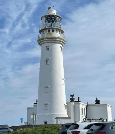
Flamborough Head Light, Flamborough, March 2024
Instagram photo by Lorraine Chadwick
East Riding of Yorkshire Lighthouses

The East Riding of Yorkshire, commonly called East Riding or East Yorkshire, includes a mostly rural area bordering the North Sea between Flamborough Head and the Humber estuary. The county's population is about 600,000. Most of the county is a unitary council area, but the City of Kingston upon Hull is an independent unitary district on the north side of the Humber.

Flamborough Head Area Lighthouses
* Flamborough Head (1) (Chalk Tower)
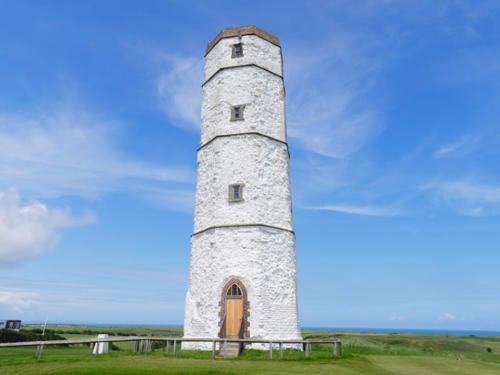
1673 (Sir John Clayton). Never activated as a lighthouse. 24 m (79 ft) octagonal cylindrical white chalk tower. A 2021 photo by Lee Collings is at right, Nicholas Mutton has a good 2010 photo, Alan Flynn has a closeup, Wikimedia has several photos, and Google has a street view and a satellite view. This remarkably well preserved seventeenth century tower is unique in England. It was designed as a lighthouse but there is no evidence it was ever lit; it served for more than a century as a daybeacon. The tower was restored in 1996. The Friends of the Chalk Tower , founded in 2012, are working to restore the interior and expand public openings. Located on Lighthouse Road at the fifth tee of the Flamborough Head Golf Club, about 800 m (1/2 mi) west of the 1806 lighthouse. Site open; the ground level of the tower is open on Sunday afternoons. Owner/site manager: East Riding of Yorkshire Council. . ARLHS ENG-274.
**** Flamborough Head (2)
1806 (Samuel Wyatt). Active; focal plane 65 m (213 ft); four white flashes every 15 s. 27 m (89 ft) round brick tower with lantern and double gallery, attached to a 2-story keeper's house. The original 1st order Fresnel lens is on display in the base of the tower. Entire lighthouse painted white. Lorraine Chadwick's photo is at the top of this page, Photographers Resource has a page for the lighthouse, Trabas has a photo, Wikimedia has many photos, Dave Sillence has a 2021 photo, Huelse has a historic postcard view, Marinas.com has aerial photos, and Google has a street view and a satellite view. This stately lighthouse, one of England's best known, is a very popular tourist attraction, and Trinity House has licensed the East Riding Council to open the lighthouse to the public. The 200th anniversary of the lighthouse was celebrated in November 2006. The lighthouse was repainted in 2010. A new LED optic in 2023 caused complaints that it does not rotate. Located on a rocky point jutting into the North Sea about 10 km (6 mi) northeast of Bridlington. Parking provided. Site open; tower open to guided tours on a variable schedule, generally on weekends May through September, Tuesday through Thursday in August and during certain holiday periods. Operator: Trinity House. Site manager: East Riding of Yorkshire Council. . ARLHS ENG-042; Admiralty A2582; NGA 1964.

Chalk Tower, Flamborough, June 2021
Google Maps photo by Lee Collings
* [Bridlington (3)]
1990s (station established 1852). Active; focal plane 12 m (39 ft); white flash every 2 s. 9 m (30 ft) fluted column with a lamppost-style lantern, mounted on a square stone pedestal. Column painted white, lantern black. Red and green harbor control lights and a yellow fog signal (blast every 60 s) are mounted on the side of the column. Trabas has a closeup photo, Martin Pearman has a closeup street view, and Google has a satellite view. This elegant post light is a replica of an 1886 original. Located at the end of the North Pier at Bridlington, a resort town of about 35,000 residents. Accessible by walking the pier. Site open, tower closed. Admiralty A2580; NGA 1960.

Withernsea Lighthouse
**** Withernsea
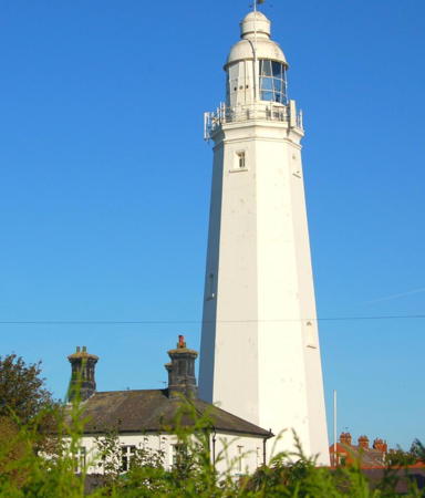
1894. Inactive since 1976. 39 m (127 ft) octagonal brick tower with lantern and gallery, painted white. A 2021 photo is at right, John Biggs has a 2022 photo, Paul Harrop has a 2010 photo, Wikimedia has several photos, Huelse has a historic postcard view, and Google has a street view and a satellite view. The Fresnel lens from this light was transferred to the St. Mary's Light in North Tyneside (see Northeastern England). One of the best known tourist attractions of the Hull area, this restored light station houses a café and a museum of local and maritime history. The museum was started in 1989 by the Campbell family to house momentos of Kay Kendall, a family member who was a popular film star of the 1950s. The light was lit in April 2020 to raise spirits during the Covid lockdown. In 2021 the lighthouse was repainted. Located on Hull Road at Arthur Street in downtown Withernsea, a town of about 6500 residents. Site open, museum and tower open on weekends and bank holidays mid May through October, daily from mid June through mid September and during Easter and Half Term holiday weeks. Owner: private. Site manager: Withernsea Lighthouse Museum . ARLHS ENG-169.

Spurn Lighthouses
Spurn is a sand spit (becoming an island at most high tides) curving out into the northern side of the entrance to the Humber estuary. Long the site of military fortifications, it was transferred to a wildlife trust in 1950 and is now a popular and important nature reserve.

*
[Spurn Point High (1)]
1773 (John Smeaton). Inactive since 1895. Foundations remain of this 34 m (112 ft) tower; it was replaced because a light was needed closer to the end of the spit. Site open. Owner: Yorkshire Wildlife Trust. Site manager: Spurn National Nature Reserve. ARLHS ENG-137.

Withernsea Light, Withernsea, August 2021
Instagram photo by Lighthouse Accommodation
* Spurn Point Low (2)
1852 (station established 1773). Inactive since 1895. 27 m (90 ft) round brick tower; the lantern has been replaced by a water tank. The tower was originally painted white, but only traces of the paint remain. The water tank is black. Peri Stracchino has a closeup, Wikimedia has Paul Glazzard's photo of both Spurn lighthouses, a 2021 closeup is available, Marinas.com has aerial photos, and Google has a satellite view. This light was the front light of a downbound (eastbound) range. Both of the 1773 Spurn Point lighthouses were built by John Smeaton. Located just offshore on the estuary side of the Spurn Point spit. Site open, tower closed. Owner: Yorkshire Wildlife Trust. Site manager: Spurn Point National Nature Reserve. ARLHS ENG-139.
** Spurn (Spurn Point High) (2)
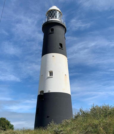
1895 (Sir Thomas Matthews) (station established 1773). Inactive since 1985. 39 m (128 ft) round brick tower with lantern and gallery, painted with black and white horizontal bands. A 2021 photo is at right, Neil Theasby has a good 2016 photo, Photographers Resource has a page with good photos, a 2008 photo is available, Blue Wilson has a 2022 photo, Wikimedia has numerous photos (mostly from Geograph.com), Huelse has a historic postcard view, Marinas.com has aerial photos, and Google has a satellite view and a street view from the lantern room. This abandoned lighthouse was endangered by lack of maintenance; Chris Cook's 2007 photo shows a deteriorating lighthouse. In March 2012 the Heritage Lottery Fund granted £68,600 to support preparation of a larger proposal for restoration of the lighthouse and development of a visitor center. In 2013 the trust sought another £650,000 for the restoration, and in September it was awarded £470,500. The restored lighthouse opened in 2016. Located near the end of the spit; accessible by bicycle or hiking several miles, but beware: since 2013 high tides wash over the route. Check tide tables before visiting the lighthouse. "Spurn Safari" guided tours are also available. Site open, tower open (tides and weather permitting) daily afternoons May through September and Friday through Sunday afternoons at other seasons. Check at the Spurn Discovery Centre for current opening times and tide conditions. Owner: Yorkshire Wildlife Trust. Site manager: Spurn Point National Nature Reserve. . ARLHS ENG-138; ex-Admiralty A2424.
* [Spurn Point Beacon]
Date unknown. Active, focal plane 11 m (36 ft); green flash every 3 s. 7 m (23 ft) quadrupod tower with a small open lantern; the lantern has a green conical roof. Trabas has a photo and Google has a street view and a distant satellite view. Located near the observation platform at the tip of Spurn Point. Site open, tower closed. Admiralty A2426; NGA 1780.

Spurn Point High Light, Easington, August 2021
Instagram photo by missmadrigal

Paull Lighthouses
Paull is a village of about 700 residents on the north bank of the Humber about 10 km (6 mi) downstream from Kingston Upun Hull.
* Thorngumbald Clough Low (Range Front)
1870. Active; focal plane 8 m (26 ft); white light, occulting every 2 s. 9 m (30 ft) round cast iron tower with lantern and gallery, painted white. Keeper's house recently demolished. Steve Roe has a good closeup and a photo showing both lights, Tom Crookes has a 2021 photo, Trabas has a photo, a history of the station is available, there is also a historic photo showing the keeper's house, and Google has a satellite view. The range guides eastbound vessels past Paull. John Mobbs and John Best visited these lighthouses in April 2013 and found them to be in very poor condition, succumbing to rust. A 2023 photo confirms these fears. These lights replaced the Paull Light after a shift in the river channel. In the east of England the word clough refers to a channel draining a wetland. Located on the north bank of the Humber about 1 km (0.6 mi) below Paull. Site open, tower closed. Operator: Port of Hull. ARLHS ENG-177; Admiralty A2506; NGA 1928.
* Thorngumbald Clough High (Range Rear)
1870. Active; focal plane 13 m (43 ft); white light, occulting every 2 s. 15 m (50 ft) round cast iron tower skeletal tower with lantern and enclosed watch room, painted red; lantern dome is white. Keeper's house recently demolished. Steve Roe has a good photo and a photo showing both lights, Trabas has a photo, a history of the station is available, there is also a historic photo showing the keeper's house, and Google has a satellite view. Located on the north bank of the Humber 113 m (125 yd) downstream from the front light and about 1.1 km (0.7 mi) below Paull. Site open, tower closed. Operator:Port of Hull. . ARLHS ENG-155; Admiralty A2508; NGA 1932.
* Paull
1836. Inactive since 1870. Approx. 14 m (46 ft) round stucco-covered brick tower with lantern and gallery, attached to a 2-story dwelling. Tower and dwelling painted white. A 2023 photo is at right, Paul Glazzard has a photo , Mick Evans has a good photo, Graham Sivills has a nice closeup, David Wigley has a 2023 photo, and Google has a street view and a satellite view. Sibling of the Killingholme South Low Light on the other side of the river. The lighthouse was built by Trinity House as a free-standing tower; the house was added sometime after deactivation. The building was transferred to the Humber Conservancy in 1908 but was auctioned into private hands in 1947. The lighthouse was restored by its owner, graphic designer James Deighton, in the late 1980s. Deighton extended the building, adding a cottage that was available as a bed and breakfast. In February 2010 the property was for sale for £189,950, and there is a report that it sold in 2011 for £145,000. Located on the north bank of the Humber at Paull, about 8 km (5 mi) below Hull. Site open, tower closed. Owner/site manager: private. . ARLHS ENG-099.

Paull Light, Paull, February 2023
Instqgram photo by cynical_yorkshire_man

Kingston upon Hull City Lightship
Kingston upon Hull, usually called simply Hull, is a city on the north bank of the Humber (and both sides of the much smaller River Hull) about 40 km (25 mi) from the sea. The city has a population of about 260,000.

** Humber Conservancy Board Lightship 12 Spurn
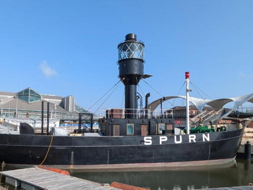
1927. Decommissioned 1975. Steel lightship, 30.5 m (100 ft) long, painted black. Steve Cameron's photo is at right and Howard Pulling has a good 2008 photo. Built at Goole on the Ouse, the ship served until 1959 at the Spurn station, 7.5 km (4.5 mi) east of Spurn Point. It was then moved to the Bull Shallows station just off Spurn Point. Acquired by the Hull City Council in 1983, the ship was restored and placed on public display in 1987. In 2011 it was closed for repair and refurbishment. The ship also closed in 2018 due to construction onshore; it reopened in 2019. In September 2021 City Council awarded a contract to restore and relocate the ship for improved visitor access and in October it was towed upriver to a drydock for the restoration. It returned to Hull in March 2023. In February 2024 it was berthed at its new dock, allowing it to reopen to visitors in spring 2024. To be located at the Hull Marina on Castle Street in downtown Hull.; Google has a satellite view of the location. Site and vessel currently closed. Owner: Hull City Council. Site manager: Hull Museums (Spurn Lightship ). ARLHS ENG-136.

Lightship Spurn, Hull, February 2024
BNN Peoples Network news photo

Goole Area Lighthouses
Goole is a town of about 20,000 residents on the south bank of the River Ouse. Located about 80 km (50 mi) from the sea it is England's furtherest inland port.

*
Apex (Trent Falls) (relocated to Goole)
1933. Inactive. 6 m (20 ft) square skeletal tower with lantern, gallery, and an enclosed equipment room in the base. Lighthouse painted red. Jeremy D'Entremont has a 2017 closeup photo, Karl Agre also has a photo, and Google has a 2021 street view and a satellite view. Dr. Neil Clifton has a 1974 photo of the lighthouse at its original location. This lighthouse formerly stood near Faxfleet in the confluence of the Rivers Ouse and Trent, which combine to form the Humber estuary. It was replaced by a post light on the original wood platform. Trabas has a photo of the current Apex light (Admiralty A2570.9); it is a directional light (three flashes every 5 s, red, green or white). The lighthouse has been relocated to the Goole Docks, a short distance west of Bridge Street. It was owned by the Yorkshire Waterways Museum, but the museum closed due to financial difficulties in 2019. Owner/site manager: unknown. Site open, tower closed. ARLHS ENG-297.
Whitgift
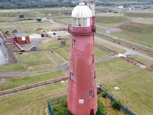
Date unknown (late 1800s). Active; focal plane 12 m (39 ft); continuous red light. 14 m (46 ft) round brick tower with lantern and gallery, mounted on an octagonal brick base. The active light appears to be on the gallery railing. Base unpainted; tower painted white. A photo is at right, Cath Simpkins has a closeup 2021 photo, Patrick Hoste has a 2023 closeup, Steve Fareham has a nice 2007 photo, Trabas has a photo, Wikimedia has several photos, and Google has a street view and a satellite view. Located in a pasture on the south bank of the Ouse between Whitgift and Ousefleet and about 10 km (6 mi) below Goole. Site tower closed (private property) although the lighthouse can be seen from a distance. Owner/operator: Port of Goole. . ARLHS ENG-185; Admiralty A2571.9.

Whitgift Light, Google, October 2021
Instagram photo by Kiran G

Lincolnshire Lighthouses

Lincolnshire is the second largest ceremonial county in England, with a population of about 1.1 million. It has a long coast on the North Sea from the Humber estuary south to the bay known as The Wash, but south of the Humber it has no major ports. The two Humberside districts, North Lincolnshire and North East Lincolnshire, are unitary (independent) districts. The rest of the county is governed by a county council sharing authority with seven borough councils.

North Lincolnshire (South Humberside) Lighthouses
* Killingholme North Low
1852. Inactive since 1920. 14 m (46 ft) round stucco-covered brick tower with lantern and gallery, attached to a 1-story keeper's house. Tower painted white, lantern dome black. Photographers Resource has a page, another photo is available, with photos and Google has a satellite view. Endangered. Formerly in poor condition this lighthouse was restored in 2003 as a private residence. However, David Wright's 2006 photo showed it to be in a continuing need of repainting and Jay Hilling's 2024 photo shows it once again in very poor condition. Located at the end of Station Road on the south bank of the Humber at Killingholme. Site and tower closed, but the lighthouse can be seen from the road. Owner/site manager: private. ARLHS ENG-061.
* Killingholme High (Range Rear) (2?)
1876 (station established 1836). Inactive since 2017. 24 m (79 ft) round brick tower with lantern and gallery, painted red; lantern dome is white. Former stucco covering of the tower has nearly all peeled off. Steve Haith's photo of this light and the South Low Light is at right, David Wright has a 2208 photo also showing this light and the South Low Light, Photographers Resource has a page with photos, Trabas has a good photo, Wikimedia has a photo, Marinas.com has aerial photos, and Google has a satellite view and a very distant street view. Located about 190 m (210 yd) west of the front light on the south bank of the Humber at Killingholme. Site open, tower closed. Owner: Port of Immingham. ARLHS ENG-175; ex-Admiralty A2440.1; ex-NGA 1916.
* Killingholme South Low (Range Front)
1836. Inactive since 2017. 14 m (46 ft) round stucco-covered brick tower with lantern and gallery, painted white. Steve Haith has the photo at right, David Wright has a closeup, Photographers Resource has a page with photos, Trabas has a photo, Marinas.com has aerial photos, and Google has a satellite view. Located about 400 m (1/4 mi) southeast of Station Road on the south bank of the Humber at Killingholme. Site open, tower closed. Owner: Port of Immingham. ARLHS ENG-176; ex-Admiralty A2440; ex-NGA 1912.

Killingholme South Low (front) and High Lights, June 2017
Google Maps photo by Steve Haith

North East Lincolnshire (Humber Entrance) Lighthouses
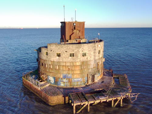
Bull Sand Fort
1919 (lightship station established 1832). Inactive. The light was mounted on a square tower atop the fort. The U.K. National Education Network has an aerial photo, a 2022 drone view is available, Wikipedia has a distant view, and the fort is a ghostly presence in Bing's satellite view. This is one of two Humber Forts built during World War I to protect the entrance to the Humber. In 1997 the fort was sold to the Streetwise Charitable Trust, which has since ceased operations; its current status is unknown. Located in the center of the entrance to the Humber, about 2.5 km (1.5 mi) southwest of Spurn Point. Accessible only by boat. Site open, tower closed.
Haile Sand Fort
Date unknown (station established 1919?). Active; focal plane 21 m (69 ft); red flash every 5 s. Mast mounted atop the fort. Mike Bradley has a 2023 photo, Wikipedia has a closeup, Trabas has a photo, and Google has a good satellite view. This is one of two Humber Forts built during World War I to protect the entrance to the Humber. In October 2018 the fort was placed on sale at auction; it sold for £117,000 to an unknown buyer. Located on the south side of the estuary about 1.5 km (1 mi) east of Humberston. Accessible only by boat. Site open, tower closed. Admiralty A2431; ex-NGA 1808.

South Holland District (The Wash) Lighthouse
The Wash is a shallow rectangular bay, about 25 km (15 mi) wide, separating Lincolnshire from Norfolk. The bay is only navigable by small craft.
* Holbeach Range Southeast End
Date unknown. Active; focal plane about 6 m (20 ft); red flash every 5 s. NGA lists a flagstaff, and Trabas's photo shows the flagstaff, but the light is mounted on a 2-story pump station building. Google has a satellite view and a distant street view. Located on the south coast of the The Wash near Gedney Drove End, about 4 km (2.5 mi) northwest of the River Nene mouth. Site open, tower closed. Admiralty A2390; NGA 1728.
* West Nene (West Sutton)
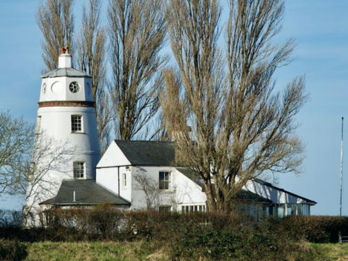
1830s. Active (unofficial); focal plane about 21 m (69 ft); two green flashes every 5 s. 19 m (60 ft) round tower attached to a 2-story building. A photo is at right and Google has a street view and a satellite view. This tower and a similar tower across the river were built when a new cut was dredged as the mouth of the River Nene. The building was originally a customs station but it has since been modified as a private residence. It was never lit as an official lighthouse, but it is now charted as an unofficial light. Located on the west bank of the Nene just off West Bank Road. Site and tower closed but the lighthouse can be viewed from the road. Owner/operator: private. Charted by Navionics and I-boating but not listed by the Admiralty.
* East Nene (East Sutton)
1830s. Active (unofficial); focal plane about 21 m (69 ft); continuous white light. 19 m (60 ft) round tower. Ian Ingall has a 2023 photo, Claire Murphey has a view across the waterway, and Google has a street view and a satellite view. The tower is attached to a 1-story dwelling, which is not the original house; it was added early in the 20th century. From 1933 to 1939 the house was occupied by Sir Peter Scott (son of the Antarctic explorer Capt. Robert F. Scott), a famous naturalist and conservationist. As a result the lighthouse is often called "Sir Peter Scott's Lighthouse." The building was bought by Doug and Sue Hilton in 2010 and in 2023 they made it available for vacation rental through Sykes Holiday Cottages. Located opposite the West Nene lighthouse. Site and tower closed but the lighthouse can be viewed from the road. Owner/operator: private. Not charted by Navionics and not listed by the Admiralty.

West Nene Light, Sutton Bridge, January 2022
Google Maps photo by dkd clayton

Norfolk Lighthouses

Norfolk occupies the northern half of East Anglia, a semicircular peninsula bulging into the North Sea. The county has a population of about 900,000. It has a 2-tier government with a county council and seven district councils.

King's Lynn and West Norfolk District Lighthouses
* Hunstanton (3)
1840 (station established 1665). Inactive since 1921. 19 m (61 ft) round cylindrical brick tower attached to a 2-story brick keeper's house. Entire building painted white. A 2023 photo is at right, Sally Abbott has a 2021 photo, Wikimedia has a photo, and Google has a 2009 street view and a satellite view. For many years lights were shown from St. Edmund's Chapel, built in 1272; the photo at right and another photo show the chapel ruins close to the lighthouse. The original wood lighthouse burned in 1777 and was replaced the next year by a second wood lighthouse. The second light was one of the first lighthouses to burn oil. Trinity House acquired the light station in 1837 and completed the present building in 1840. After deactivation the station was sold as a private residence and the owners built an additional circular story to replace the original lantern. In 2007 the owner, 60's rock star Bip Weatherall, placed the lighthouse on sale, and in late 2008 he lowered the price tag to £499,000. In 2016 the property was purchased by L&J Leisure and refurbished for weekly rental. A lightning strike in July 2018 damaged brickwork at the top of the tower. The lighthouse was repainted in the fall of 2022. The light stands at the eastern entrance to The Wash, the U-shaped bay between Norfolk and Lincolnshire. Located on Lighthouse Lane on the north side of Hunstanton, a town about 30 km (19 mi) north of King's Lynn. Site open; tower open only to guests. Owner: L&J Leisure (The Old Lighthouse ). ARLHS ENG-056.
Brancaster Harbour
Date unknown. Active; focal plane 8 m (26 ft); white flash every 5 s. Light mounted atop a 2-story clubhouse. Trabas has a photo, Mark Batten has a 2018 photo, and Google has a satellite view. Located at Brancaster Beach adjacent to the Royal West Norfolk Golf Club. Site open. Owner/site manager: National Trust (Brancaster Beach). Admiralty A2348.

Hunstanton Light, Norfolk, ctober 2023
Instagram photo by Uk_wild_walker

North Norfolk District Lighthouses
* Cromer Lifeboat Station
1999 (station established 1923). Active; focal plane 8 m (26 ft); two continuous red lights mounted vertically. Lights mounted on a lifeboat building. Wikipedia's drone view is by John Fielding, the Eastern Daily Press has an article with photos, Trabas has a photo, Matthew Bridges has a street view from the beach, and Google has a satellite view. There has been a lifesaving station at Cromer since 1804, and the present lifeboat station is one of the best known in England. Located at the end of the Cromer Pier, built in 1902. Accessible by walking the pier. Site open. Admiralty A2344; NGA 1680.
* Cromer (3)
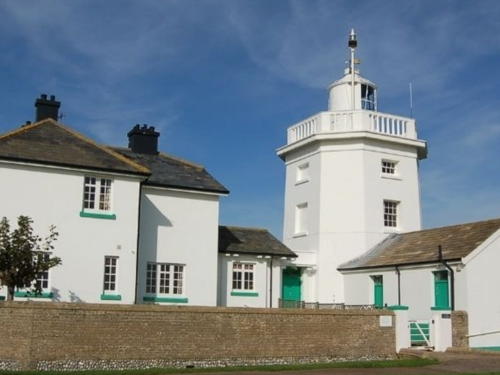
1833 (station established around 1719). Active; focal plane 84 m (276 ft); white flash every 5 s. 18 m (59 ft) octagonal cylindrical brick tower with lantern and gallery, painted white, attached to two 2-story keeper's houses. The houses are available for overnight accommodations. A photo by Robert William Evans is at right, Norman Walsh has a 2009 photo, Photographers Resource has a page with photos, Trabas has a fine closeup photo, a 2007 photo is available, Wikimedia has a good photo, Pat Niyomsilp has a street view, and Google has a satellite view. The light station is about 400 m (1/4 mi) from the cliffs overlooking the North Sea. These cliffs are subject to rapid beach erosion. The first lighthouse was built privately in 1676 and never lit due to opposition from Trinity House; it collapsed over the cliff in 1700. Trinity House built a brick lighthouse in 1719. In 1792 a rotating apparatus was installed making this only the second British lighthouse to display a flashing light. The present lighthouse was built in 1833 when it appeared that the 1719 tower would soon collapse over the cliff; it finally did so in 1866. Located on a high point above the cliffs east of Cromer, a town about 30 km (19 mi) north of Norwich. Site open, tower closed. Operator: Trinity House. . ARLHS ENG-028; Admiralty A2342; NGA 1676.

Cromer Light, Norfolk, November 2021
Instagram photo by Robert William Evans
** Happisburgh (Hasborough) (High)
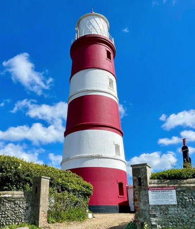
1791. Active (privately maintained); focal plane 41 m (135 ft); three white flashes every 30 s. 26 m (85 ft) round brick tower with lantern and gallery, painted with red and white horizontal bands. 1st order Fresnel lens (1868) in use. The two 2-story brick keeper's houses have been private residences since the light was automated in 1929. The name of this lighthouse is pronounced "Haisbro." A 2024 photo is at right, Angela and Chris Pye have a good photo, Trabas has an excellent photo, Photographers Resource has a page with photos, Wikimedia has several photos, and Google has a street view and an excellent satellite view. This historic light was declared redundant by Trinity House in 1988, but a local trust was organized to continue its operation. In 1990 a special act of Parliament chartered the Happisburgh Lighthouse Trust as Britain's first (and, so far, only) private lighthouse authority, allowing Trinity House to transfer ownership and operation to the trust. The lighthouse was originally accompanied by a low light, which was deactivated in 1883. In 2008 ruins of the low light were visible on the beach. The lighthouse was repainted and repaired in 2009 at a cost of £35,000. In 2016 one of the keeper's houses was for sale for £345,000. There was another repainting in 2018. Located in Happisburgh, a seaside village on the "shoulder" of Norfolk, about 25 km (15 mi) northeast of Norwich. Site open; tower open to guided tours on selected open days in the spring and summer, or by prior arrangement. Owner: Happisburgh Lighthouse Trust. Site manager: Friends of Happisburgh Lighthouse . ARLHS ENG-050; Admiralty A2336; NGA 1668.

Great Yarmouth District Lighthouses
Winterton (3)
1840 (station established 1616). Inactive since 1921. 19 m (62 ft) round brick tower with lantern and gallery. Tower painted white, lantern black. Ian Wright has a 2013 view, a 2019 photo is available, and Google has a satellite view. The original lantern was replaced many years ago by a circular observation room, as seen in Paul Smith's 2009 photo, Wikimedia's 2010 photo, and Google's distant street view taken in April 2011. The lighthouse was restored and repainted in 2011-12, and the present lantern was added at that time. The original lighthouse was replaced in 1687. The light was the rear light of a range from 1677 to 1791, when the Happisburgh lighthouse was built. In late 2016 the lighthouse became available for vacation rental. Located off the Holway on the south side of Winterton-on-Sea, a seaside resort village about 10 km (6 mi) north of Great Yarmouth. Site and tower closed except to paying guests. Owner/site manager: Winterton Lighthouse . ARLHS ENG-310.

Happisburgh Light, Norfolk, April 2024
Instagram photo by Freddie and Flo
Great Yarmouth Outer Harbour Entrance North
Date unknown. Active; focal plane 17 m (56 ft); quick-flashing green light. Approx. 14 m (46 ft) round barbell-shaped tower colored with green and white horizontal bands. Trabas has a photo and Google has a satellite view. The Outer Harbour is an artificially created basin just north of the mouth of the River Yare. Located on the north breakwater of the harbor. Site and tower closed. Owner: Great Yarmouth Port Authority. Admiralty A2317.2.
Great Yarmouth Outer Harbour Entrance South
Date unknown. Active; focal plane 17 m (56 ft); quick-flashing red light. Approx. 14 m (46 ft) round barbell-shaped tower colored with red and white horizontal bands. Trabas has a photo and Google has a satellite view. Located on the south breakwater of the harbor. Site and tower closed. Owner: Great Yarmouth Port Authority. Admiralty A2317.
* Gorleston (Range Rear)
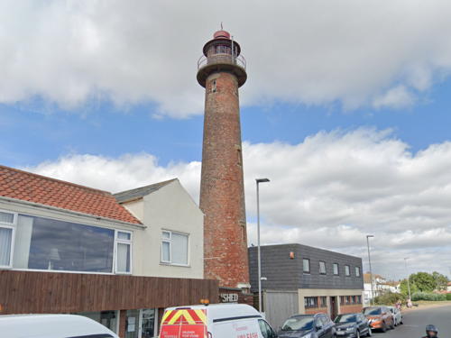
1887. Inactive since 2007. 21 m (69 ft) round brick tower, unpainted, with lantern and gallery. Keith Evans's photo is at right, Photographers Resource has a page for the lighthouse, Gary Skipper has a good 2007 photo, Karl Keeley has a 2018 photo, Wikimedia has photos, Trabas has a photo, and Google has a street view and a satellite view. The River Yare makes a right-angle bend to the east just before reaching the sea, and this lighthouse stands by the bend displaying its light through the river mouth. Originally it displayed a continuous red light; later it became also the rear light of a range. Google also has a street view of the former front light, mounted on a post. Possibly endangered: listed as a historic building by Englich Heritage, but no preservation plan is in evidence. Located at the end of Pier Road in Gorleston. Site open, tower closed. Owner: Great Yarmouth Port Authority. . ARLHS ENG-303; ex-Admiralty A2306.1; ex-NGA 1636.
* Gorleston South Pier (2)
1955 (station established 1852). Active; focal plane 11 m (36 ft); red flash every 3 s. 8 m (26 ft) square 2-story brick and concrete building with two galleries; the light is mounted on the roof along with communications equipment, harbor control lights, and the fog horn (three blasts every 60 s). Lower story is white, upper story unpainted red brick. Trabas has a photo, Richard Barnes has a photo, another photo is available, and Google has a satellite view and a street view across the river entrance. The original lighthouse was an octagonal brick tower of similar height; Photographers Resource has postcard views of that tower. The present lighthouse was presumably built as a harbormaster's office, but it is now a Coastwatch Station. Located at the end of the south pier in Gorleston, the seaport on the south side of Great Yarmouth. Site open, tower closed. Operator: Great Yarmouth Port Authority. Site manager: National Coastwatch Institution. . ARLHS ENG-221; Admiralty A2304; NGA 1624.

Gorleston Light, Norfolk, August 2022
Google Maps street view\

Suffolk Lighthouses

Occupying the south portion of East Anglia, Suffolk is a largely rural county with a population of about 760,000. Suffolk has a 2-tier government with a county council and six district councils, but the East Suffolk District includes all of the North Sea coastline.

Lowestoft Lighthouses
** Lowestoft (High) (5)
1874 (station established 1609). Active; focal plane 37 m (121 ft); white flash every 15 s. 16 m (52 ft) round brick tower with lantern and gallery, painted white, attached to 2-story keeper's house. A 2021 photo by Andrew Chilvers is at right, Andrew Chilvers has a similar 2021 photo, Photographers Resource has a page with photos, Stephen Craven has a photo, Trabas has a photo, Marinas.com has aerial photos, and Google has a street view and a satellite view. England's oldest official light station celebrated its 400th anniversary in 2009. No one is sure when the first light was shown but Trinity House took over its administration and built a new light in 1609. It was replaced in 1628 and again in 1676. A series of low lights, many of them temporary, were used in conjunction with the high lighthouse. Mike Lewis has posted a historic photo of the 1866 low lighthouse, which was discontinued and demolished in 1923. The lighthouse marks Lowestoft Ness, the easternmost point of the British Isles. It overlooks Sparrow's Nest Park and the Lowestoft Maritime Museum. Tours of the lighthouse are offered from 12 noon to 3:30 pm on the first Saturday afternoon of each month, April through August. Located on Yarmouth Road (A12), on a bluff about 1.5 km (1 mi) north of the Lowestoft harbor entrance. On-street parking available. Site open, tower closed except during tours. Operator: Trinity House. . ARLHS ENG-072; Admiralty A2280; NGA 1620.
* Lowestoft North Pier
1847. Active; focal plane 12 m (39 ft); green light, 4 s on, 1 s off. 9 m (30 ft) hexagonal cylindrical brick tower with lantern and gallery, rising from the center of a 1-story pavilion. Lighthouse painted white. Trabas has a photo, this is the light on the left in a 2022 photo by Andrew Chilvers, and Google has a satellite view and a distant street view of both pier lighthouses. Located on the end of the stone pier marking the narrow entrance to the harbor of Lowestoft. Accessible by walking the pier. Operator: Port of Lowestoft. ARLHS ENG-263; Admiralty A2286; NGA 1600.

Lowestoft Light, Suffolk, April 2021
Google Maps photo by Andrew Chilvers
* Lowestoft South Pier
1847. Active; focal plane 12 m (39 ft); red light, 4 s on, 1 s off. 9 m (30 ft) hexagonal cylindrical brick tower with lantern and gallery, rising from the center of a 1-story pavilion (used as a pilot station). Lighthouse painted white. Fog horn (4 blasts every 60 s). Trabas has a photo, Amelia Heath has a 2015 photo, this is the light on the right in a 2022 photo by Andrew Chilvers, and Google has a satellite view and a distant street view of both pier lighthouses. Located on the end of the stone pier marking the narrow entrance to the harbor of Lowestoft. Accessible by walking the pier. Operator: Port of Lowestoft. ARLHS ENG-264; Admiralty A2284; NGA 1604.
* Pakefield
1832 (Richard Suter). Inactive since 1864. 9 m (30 ft) round brick tower, painted white. Adrian Pye has a 2010 photo, Rene Schoeters has a 2017 photo, a 2019 photo is available, and Google has a satellite view. The usefulness of the lighthouse was short-lived, as the coastal channel shifted away from its location. In 1929 it was sold to the owners of the neighboring Pakefield Hall, which later became Pontin's Pakefield Holiday Park. The lighthouse was slightly damaged by machine gun fire during a German air raid on May 12, 1943. In 2000 local volunteers renovated the lighthouse as a coastwatch station. Located off London Road (A12) about 3 km (2 mi) south of Pakefield, a town just south of Lowestoft. Site open, tower closed. Owner: private. Site manager: Pakefield Coastwatch. . ARLHS ENG-098.

Southwold Lighthouse
** Southwold
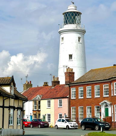
1890 (James Douglass). Active; focal plane 37 m (122 ft); four flashes every 20 s, white or red depending on direction. 31 m (102 ft) round brick tower with lantern and gallery, painted white, attached to a 2-story keeper's house. Nicholas Weber's 2023 photo is at right, Ella Mullins has a good 2009 photo, the Southwold Museum has a page on the lighthouse, Anthony Sutton has a 2023 closeup, Photographers Resource has a page with photos, Trabas has a photo, Steve Fareham has a good photo, Marinas.com has aerial photos, and Google has a street view and a satellite view. Thanks to its urban location the lighthouse was automated quite early, in 1938. The light was upgraded and extended in range in 2012-13 in order to take over the duties of the discontinued Orfordness Light (next entry). Located in the center of the seaside resort town of Southwold, about 15 km (9 mi) south of Lowestoft. Site open, tower open to guided tours on selected dates during the warmer months; reservations required well in advance. Operator: Trinity House. Site manager: Southwold Millennium Foundation . ARLHS ENG-135; Admiralty A2272; NGA 1588.

Southwold Light, Suffolk, April 2023
Instagram photo by Nicholas Weber

Ipswich Area Lighthouses
#Orfordness (Orford Ness) (High) (3)
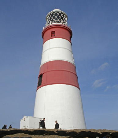
1793 (station established 1637). Inactive since 2013 and demolished in 2020. 30 m (98 ft) round old-style brick tower with lantern and gallery, painted white with two horizontal red bands. The rotating 1st order Chance Brothers Fresnel lens, installed in 1914, is now on display at the headquarters of the International Maritime Organization in London. J. Graham's closeup photo is at right, Alison Rawson has a fine 2008 closeup, Trabas has a photo, Wikimedia has many photos, and Google has a satellite view of the former location. The tower was formerly attached to two keeper's houses, which were demolished in 1959. This famous lighthouse had been gravely endangered for years. Orford Ness is a 20 km (13 mi) long barrier spit off southeastern Suffolk. There have been as many as eight low lighthouses and three high lighthouses here. The 1792 low lighthouse was lost to beach erosion in 1887 and by 2004 there was concern about rapid beach erosion near the surviving lighthouse. In March 2009 Trinity House announced that the lighthouse could fall in as little as five years, and a decision to move or demolish it was needed within two years. In January 2010 the buildings were sold for £2000 to Nicholas Gold, who established the Orfordness Lighthouse Trust. Gold claims the National Trust, stewarts of the Orford Ness National Nature Reserve, obstructed his efforts to save the lighthouse, although the National Trust denies this. The shoreline was bolstered with bags filled with gravel and shingles and Gold's organization removed artifacts from the lighthouse. In April 2014 the lighthouse trust began offering public tours of the lighthouse. In January 2016 winter storms threatened to undermine the lighthouse; an emergency appeal raised £10,000, enough to place sandbags around the base of the lighthouse. The sea continued its advance and in July 2019 the Trust announced it would end its efforts to save the lighthouse and concentrate on removing whatever artifacts could be saved. A bungalow (seen at right in the photo) collapsed in October 2019. In January 2020 the Trust announced it would demolish the nearby coast guard building and in late February a decision was made that the lighthouse must also be demolished. During the demolition the lantern was saved for future display on the mainland. The Ness was a restricted military area for many years; it was opened to the public by the National Trust in 1995 as a nature reserve and historic site. Located about 5 km (3 mi) southeast of Orford; accessible by passenger ferry and hiking trail (40 minutes each way). Site open, tower closed. Owner/site manger: Orfordness Lighthouse Trust . ARLHS ENG-096; ex-Admiralty A2258; ex-NGA 1564.
* Trinity House Lightship 87 Haven Ports
1932. Decommissioned 1973. Steel lightship, length 30 m (99 ft), painted red; the light was shown from a skeletal tower with lantern and gallery amidships. A closeup 2019 photo is available, Shane Mash has a closeup street view, and Google has a satellite view. The ship served on the East Goodwin, Mid-Barrow, and Cromer stations. It was sold to the Haven Ports Yacht Club in Ipswich, which has used the vessel as its club ship ever since. Before the sale, the light tower was removed and transferred to the Inner Dowsing light platform. The club was able to acquire the light tower of Lightship 88 as a substitute, although the two towers are not identical. Moored at the Suffolk Yacht Harbor near Ipswich. Site open, vessel closed. Owner/site manager: Haven Ports Yacht Club. ARLHS ENG-326.
Orford Ness Light
Orfordness Light (now lost), Suffolk, July 2006
Flickr Creative Commons photo by J. Graham

Information available on lost lighthouses:

Notable faux lighthouses:

Adjoining pages: North: Northeastern England | South: Southeastern England

Return to the Lighthouse Directory index | Ratings key

Posted August 27, 2004; checked and revised May 2, 2024. Lighthouses: 35, lightships: 2. Site copyright 2024 Russ Rowlett and the University of North Carolina at Chapel Hill.