Lighthouses of the United Kingdom: Southeastern England

The United Kingdom (officially the United Kingdom of Great Britain and Northern Ireland) includes England, Scotland, Wales, and Northern Ireland. England is the largest and most populous of the four, occupying more than 62% of the island of Great Britain and with a population of more than 56 million. Separated from the European mainland by the North Sea on the east and the English Channel on the south, it also has coasts facing the Celtic Sea on the southwest and the Irish Sea on the northwest.

Historically England was divided into 39 counties. The Directory pages are organized by the modern division of England into 48 "ceremonial" counties, also called lieutenancy areas because each one has a Lord Lieutenant representing the monarch in that area. For local government the ceremonial counties are subdivided in various ways into council areas.

This page covers lighthouses of southeastern England including Greater London and the neighboring counties of Essex and Kent. The south coast of Kent faces the Strait of Dover; the rest of this region faces eastward on the North Sea. London is by far the largest port, but there are many smaller ports.

The British system of lighthouse administration is decentralized, with the major towers under the management of Trinity House (a corporation chartered by the Crown) and smaller towers generally under the control of local port authorities. This system has generally assisted lighthouse preservation, and so has the British custom of building very sturdy brick or stone lighthouses at most of the stations. Most of the onshore lighthouses are accessible to visitors, and several of them are major tourist attractions.

ARLHS numbers are from the ARLHS World List of Lights. Admiralty numbers are from Volume A of the Admiralty List of Lights & Fog Signals. U.S. NGA numbers are from Publication 114.

General Sources
Trinity House
Chartered by Henry VIII in 1514, Trinity House has built and operated lighthouses in Britain for nearly 500 years. About a dozen of the lighthouses have Visitor Centres.
Online List of Lights - England
Photos by various photographers posted by Alexander Trabas.
Photographers Resource - Lighthouses
Photos and articles on lighthouses of the British Isles.
Lighthouses of Eastern England and South East England
Photos and information from the Lighthouse Accomodations website.
Lighthouses in England
Photos available from Wikimedia; many of these photos were first posted on Geograph.org.uk.
United Kingdom Lighthouses
Aerial photos posted by Marinas.com.
Leuchttürme.net - Kent, Sussex Counties
Photos posted by Malte Werning.
Britische Leuchttürme auf historischen Postkarten
Historic postcard images posted by Klaus Huelse.
Association of Lighthouse Keepers
Founded by serving and retired keepers, this lighthouse association is open to everyone.
GPSNauticalCharts
Navigational chart information for England.
Navionics Charts
Navigation chart for England.


North Foreland Light, Broadstairs and St. Peter's, Kent, February 2024
Instagram photo
by James Hollands
Essex Lighthouses

Essex is the county immediately to the northeast of London; its east coast faces the North Sea and its south coast faces the Thames Estuary. The population of the county is more than 1.8 million. Essex is divided into fourteen local council areas, including the independent (unitary) areas of Southend-on-Sea City and Thurrock Borough. The rest of the county has a 2-tier government with a county council and local district or borough councils.

North Sea Lightship
Trinity House Lightship Sunk Inner
Date unknown (lightship station established 2007). Active; focal plane 12 m (39 ft); five white flashes every 15 s. Steel lightship; the light is displayed from a light tower with lantern amidships. Entire vessel painted red. Fog horn (one blast every 30 s). MarineTraffic.com has a photo by Rene van Quekelberghe. This lightship is part of the traffic separation scheme for vessels approaching or leaving the Thames. Located in the North Sea about 18 km (11 mi) east of Harwich. Accessible only by boat. Site open, vessel closed. Admiralty A2172; NGA 1421.

Tendring District (Harwich Area) Lighthouses
The Tendring District occupies a peninsula in the east of Essex between the Rivers Stour to the north and Colne to the south. Harwich is the terminal for North Sea ferries to the Netherlands and Denmark, and it is also the support base for Trinity House lightship operations. Google has an October 2014 street view of the active Lightship 24 moored on the Harwich waterfront.
*** Trinity House Lightship LV-18
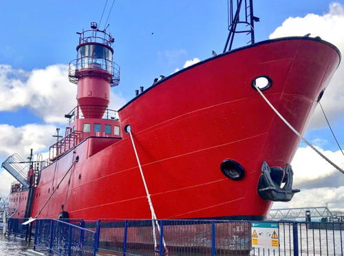
1958 (Philip & Son, Dartmouth). Decommissioned 1995. 40.5 m (133 ft) steel lightship; the light is displayed from a large lantern on a cylindrical mast amidships. Hull painted red, superstructure white. Keith Parrott has a 2017 photo, a 2022 closeup is available, and Google has a street view and a satellite view. After being withdrawn from service the ship was first sold to a company planning a marina development in Harwich. After this development failed to materialize it was sold again and served from 1999 to 2007 as a floating radio station off Harwich. In the spring of 2008 it was towed to Portland for the filming of the movie The Boat That Rocked. The ship returned to Harwich and on Easter weekend 2009 BBC Essex broadcast from the vessel. The ship then underwent a two-year restoration while the Tendring District and Essex County Councils secured a £220,000 grant from the Haven Gateway Partnership to create a mooring for the vessel as a tourist attraction. In May 2011 the restored ship was brought to its new berth; a photo is available. In February 2024 the ship was damaged by a fire in the engine room; an arsonist has admitted setting the fire. Restoration is underway and funds are being sought. Moored at the Ha'Penny Pier in Harwich. Site open, vessel closed during repair of fire damage, normally open daily March through October. Owner: Pharos Trust .
** Harwich High (Range Rear) (2)
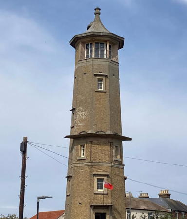
1818 (John Rennie Sr.) (station established 1665). Inactive since 1863. 21 m (70 ft) nine-sided brick tower; the light was shown through a window of the top story. Paul Devenish's 2021 photo is at right, Kit Reynolds has a photo, David Hawkins has a 2021 photo, and Google has a street view and a satellite view. The light was originally shown from a lantern atop the town gate. The present lighthouse was transferred to the Harwich Borough Council in 1909. Partially restored by the town in 1974, the tower stood empty until it was leased as a wireless museum in 1991. The museum closed sometime around 2010. In 2014 the lighthouse was leased to the Harwich Society, which reopened the museum to the public in 2015. The 200th anniversary of the two Harwich lighthouses was celebrated in September 2018. Located at the south end of West Street in downtown Harwich. Site open, museum and tower open on weekend afternoons from Easter through Whitsunday (Pentecost) and every afternoon from Whitsunday through the end of September. Owner: Tendring District Council. Site manager: The Harwich Society (The High Lighthouse ). ARLHS ENG-093.
** Harwich Low (Range Front) (3)
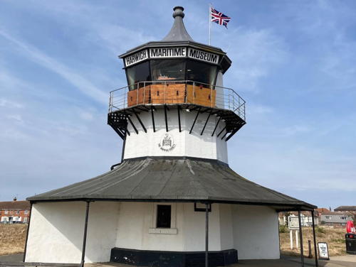
1818 (John Rennie Sr.) (station established 1665). Inactive since 1863. 9 m (30 ft) nine-sided, 3-story round cylindrical tower with gallery; the light was shown through a window of the top story. Tower painted white with a gray roof. A 2007 closeup is available, Stephen Keen has a closeup photo, Huelse has a historic postcard view, and Google has a street view and a satellite view. The original lighthouse was replaced in 1727 by a wood tower shown in a well known painting by John Constable. The present lighthouse was transferred to the Harwich Borough Council in 1909 but Trinity House reclaimed it briefly (1970-74) as a pilot station. Since 1980 it has housed a small maritime museum. Volunteers repainted the lighthouse in March 2009 and were stunned when vandals covered it with graffiti within hours. Located on the North Sea promenade off the Harbour Crescent in Harwich. Site open, museum open Friday through Sunday May 1 through August 31. Owner: Tendring District Council. Site manager: The Harwich Society (The Low Lighthouse) ). ARLHS ENG-092.

Harwich High Light, Harwich, April 2021
Instagram photo
by Paul Devenish
 
* Dovercourt Low (Range Front)
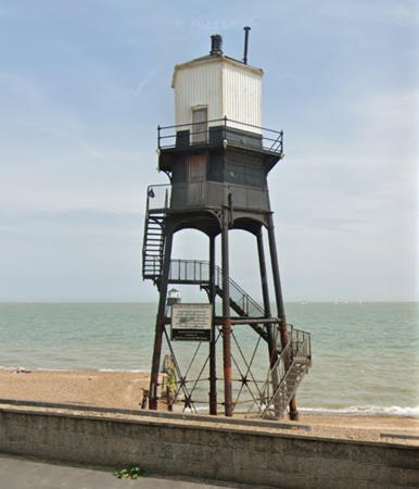
1863. Inactive since 1917. 8 m (27 ft) hexagonal lantern, watch room, and gallery on four cast iron screwpile legs. Tower painted black, lantern white with a black roof. Rennie Chivers has a good 2007 photo, Finlay Woodland has a 2022 photo, and Google has a street view and a satellite view. The Dovercourt Range Lights replaced the Harwich Range Lights in 1863. The lighthouses were restored in the 1980s. In 2005 both Dovercourt lights were leased to Tony O'Neil, custodian of the Harwich High Lighthouse, but this lease has since lapsed. The lighthouses have deteriorated from lack of maintenance, and in late 2017 town councillors launched a survey to determine the condition of the lights and what restoration measures would be needed. These efforts were suspended by the pandemic of 2020 but in June 2023 engineers were at work studying the lighthouses to develop a plan for restoring them. Due to deterioration of the iron it could cost several million pounds to restore the two lighthouses. Located just offshore at Dovercourt, a town on the south side of Harwich; easily visible from the promenade. Site open, tower closed--but nothing prevents visitors from climbing the external ladders to the gallery. Owner/site manager: Harwich Town Council. . ARLHS ENG-037.
* Dovercourt High (Range Rear)
1863. Inactive since 1917. 14 m (45 ft) hexagonal lantern, watch room, and gallery on six cast iron legs. Tower painted black, lantern white with a black roof. A 2024 photo is at right, Arthur Pijpers has a good photo, a 2021 photo is available, and Google has a street view and a satellite view. The Dovercourt Range Lights replaced the Harwich Range Lights in 1863. The lighthouses were restored in the 1980s. In 2005 both Dovercourt lights were leased to Tony O'Neil, custodian of the Harwich High Lighthouse, but this lease has since lapsed. In 2018 engineers declared the lighthouse to be basically sound but in need of some restoration. Located on the beach, near the seaside promenade at Dovercourt, on the south side of Harwich. Site open, tower closed. Owner/site manager: Harwich Town Council . ARLHS ENG-215.
*** Naze Tower (2)
1721. Inactive. 26 m (86 ft) 8-story octagonal stone tower. Wikimedia has a 2008 photo by Bob Jones and many additional photos, Lyle Tanner has a street view, and Google has a satellite view. This historic tower was built by Trinity House and functioned primarily as a daybeacon, although it is believed that lights were also shown from the top of the tower for various periods in the 1700s. The tower replaced an older tower said to date from the late 1500s. It served as the front beacon for a range guiding mariners through the Goldmer Gap, a passage through shoals offshore; the rear beacon was the Walton Hall Tower about 300 m (0.2 mi) northwest. Privately owned for many years, the Naze Tower was opened in 2004 as a tourist attraction featuring an art gallery, museum, and tea room as well as the observation level at the top. The tower commands a wide view of The Naze, a steep headland south of Harwich. Beach erosion in the area is severe, however, and the tower is now only 50 m (160 ft) from the edge of the cliff; it must be considered endangered. Located off Old Hall Lane at the north end of Walton-on-the-Naze. Site open, tower open daily April through October. Owner/site manager: Naze Tower .

Dovercourt High Light, Harwich, February 2024
Google Maps photo by JPJPhoto
** Bateman's Tower
Date unknown (tower built 1883). Active (privately maintained); focal plane 12 m (39 ft); continuous yellow light. 10 m (33 ft) octagonal cylindrical masonry tower with observation room and a conical roof. The tower is unpainted. Trabas has a closeup photo, Andrew Cartwright has a 2020 photo, Martin Hopkins has a 2020 street view, and Google has a street view and a satellite view. The triangular daymark on the tower is the rear beacon of a day range; the front beacon is a post at the water's edge. John Bateman built this tower for his daughter, who was suffering from tuberculosis. The roof was removed during World War II, when the tower was used for observation. In 2005 the tower was restored and a replica of the original roof was installed; this project was carried out by the Colne Yacht Club with funding from the Heritage Lottery. The building is now leased as a café serving sandwiches and desserts. Located on Westmarsh Point on the east side of the River Colne in Brightlingsea. Site open; café and tower open daily, weather permitting. Site manager: Bateman's Tower Café . Admiralty A2187; NGA 1440.
Gunfleet
1850. Inactive at least since 1951. Approx. 20 m (66 ft) octagonal screwpile tower, originally with a large lantern mounted on the roof of the hexagonal keeper's quarters; the tower now has a small lantern. A page for the lighthouse is available but the tower is not shown in Google's satellite view. Sources disagree on when the light was deactivated; several say Trinity House abandoned the lighthouse in 1921 but Wikipedia's article has sources showing it continued to be listed into the 1940s. It's possible the staffed light was replaced after 1921 by an obstruction warning light. In 1974 the lighthouse was briefly occupied by a "pirate" offshore radio station but the operators were evicted. Presently the tower carries meteorological instruments. Michel Forand has a historic photo (taken around 1910) showing the original appearance of the lighthouse. Located 10 km (6 mi) off Frinton-on-Sea at the northern entrance to the Thames embayment. Accessible only by boat. Site and tower closed. Owner/site manager: unknown. ARLHS ENG-049.

Colchester District (River Colne) Lightship
* Trinity House Lightship 16 Colne Light
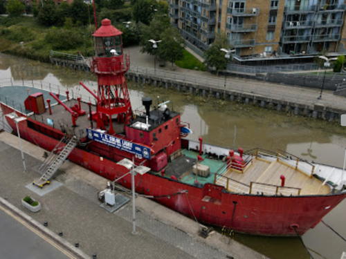
1954. Decommissioned 1988. 36.3 m (119 ft) two-masted steel lightship; light tower with lantern and gallery amidships. Vessel painted red. Dan Messenger's 2021 photo is at right, a 2007 photo is available, Dan Messenger has a 2021 drone view, and Google has a street view and a fine satellite view. We need more information on the history of this vessel; it is known to have been serving on the South Goodwin station when it was damaged in 1960. In 1988 the ship was sold as a training vessel for the Sea Cadets. In 2002 the ship was painted and refurbished so that it could also be used as a conference facility and party venue. Moored on the King Edward Quay at Hythe, a dockside area on the Colne estuary near Colchester. Site open, vessel closed to the public. Owner: Colchester Sea Cadets. ARLHS ENG-321.


Lightship 16 Colne Light, Colchester, October 2021
Google Maps photo by Dan Messenger


Maldon District (River Blackwater) Lighthouses
* Trinity House Lightship 15 Trinity
1955. Decommissioned 1988. 36.3 m (119 ft) two-masted steel lightship; light tower with lantern and gallery amidships. Vessel painted red. Built by Philip & Son, Ltd., of Dartmouth. A 2021 photo is at right, Andrew Dunn has a nice view of the ship and also a closeup photo, Barry Slemmings has another closeup, and Google has a satellite view and a distant street view. The ship served 1960-69 as the Scarweather off the Tyne estuary in the North Sea, and then 1969-80 as the Swansea in the Bristol Channel. In 1988 it was sold to Fellowship Afloat, a Christian organization for adventure and exploring the environment. The ship provides accommodations for participants in Fellowship Afloat programs. In 2022 the ship was being renovated and upgraded. Beached on Woodrolfe Creek at Tollesbury, on the north side of the Blackwater estuary. Site open, vessel closed to the public. Owner/site manager: Fellowship Afloat Charitable Trust . ARLHS ENG-320.
* Heybridge
Date unknown. Active; focal plane 10 m (33 ft); green light, 2.5 s on, 2.5 s off. Light mounted atop a 2-story waterfront building, the clubhouse of the Blackwater Sailing Club. Trabas has a photo and Google has a satellite view. The club is located on the north bank of the Blackwater estuary at Heybridge, on the east side of Maldon. Site open. Owner/site manager: Blackwater Sailing Club. Admiralty A2180.
* Marconi Sailing Club
Date unknown. Active; focal plane 7 m (23 ft); continuous white light. Light mounted on a lamppost atop a 2-story brick waterfront building, the clubhouse of the Marconi Sailing Club. Trabas has a photo and Google has a satellite view. The club is located on the south bank of the Blackwater estuary at the end of Stansgate Road. Site open. Owner/site manager: Marconi Sailing Club. Admiralty A2179.6.


Lightship 15 Trinity, Tollesbury, June 2021
Instagram photo by Maldon Court Prep School


Basildon Borough Lightship
* Trinity House Lightship 44 Newarp
1869 (C. Hill & Sons, Bristol). Decommissioned 1945. 32 m (105 ft) wood lightship. The ship was stationed off Caernarvon Bay, Wales, and later for many years on the Newarp station. After being decommissioned, it was sold to the Erith Yacht Club and later the Pitsea Yacht Club. The abandoned ship is aground in a creek in the Wat Tyler Country Park on the south side of Pitsea. Bill Robinson has a photo and Google has a satellite view. Site open; keep off the ship. Owner: unknown.

Thurrock Borough (Thames Estuary North Side) Lighthouses
* [Thurrock Yacht Club]
2012. Active (privately maintained and unofficial); focal plane about 13 m (43 ft); continuous (?) white light. 21 m (70 ft) mast and lantern of the lightship Gull (next entry). Bill Robinson has a photo, Uy Hoang has a street view, and Google has a satellite view. The mast and lantern were salvaged and restored by Small & Co. of Lowestoft. A dedication ceremony was held in November 2012. The light is said to be approved by the Port of London. Located a yacht club dock on the north bank of the Thames near the intersection of Argent Street and Thames Road in Grays. Site open, tower closed. Owner/operator: Thurrock Yacht Club. Charted by Navionics only as a daybeacon and not listed by the Admiralty.
* Trinity House Lightship 38 Gull (Brake)
1860. Decommissioned 1946. 27.5 m (90 ft) wood lightship; the light was shown from a lantern on a mast amidships. After serving on the Nab and Would stations, the ship spent its later career mostly as the Brake. The ship sank in 1929 after a collision with the liner City of York. Raised and repaired, it continued on the Brake station until it suffered another collision in 1940. Its last service as the Gull was quite brief. In 1946 it was sold as the club ship of the Thurrock Yacht Club at Grays. After the clubhouse was moved onshore the ship did not find another use. Beached on the Thames next to the club, it has been vandalized repeatedly and is now in a state of collapse. Piotr Rybowski has a 2023 photo, a 2006 photo is available, Glyn Baker also has a 2006 photo, Uy Hoang has a 2017 street view, and Google has a satellite view. In 2012 the mast and lantern (previous entry) were salvaged and restored. Bill Robinson's 2013 photo shows the restored mast and the remains of the ship. Located on the north bank of the Thames near the intersection of Argent Street and Thames Road in Grays. Site open; keep off the ship. Owner: Thurrock Yacht Club. Charted by Navionics as a wreck.
#Stoneness (1)
1885. Replaced in 2021. Active; focal plane 11 m (36 ft); green flash every 2.5 s. 12 m (38 ft) hexagonal skeletal tower, upper part enclosed, with lantern and gallery. Lighthouse painted red with a white band below the lantern. A 2008 photo is at right, Frederick Roll has a 2011 closeup, Bill Robinson also has a closeup, Trabas has a good photo, Uy Hoang has a distant street view, and Google has a satellite view. Huelse has a postcard view of an earlier configuration of the lighthouse. Due to detrioration of the structure it was replaced in 2021 by a tall post light. The lantern and watch room were removed by a crane and survive in storage. Located at the tip of a sharp point projecting into the north side of the Thames about 1200 m (3/4 mi) southeast of the Dartford Bridge. Site status unknown, tower closed. Operator: Port of London Authority (originally Trinity House). ARLHS ENG-289. Active light: Admiralty A2126.
Stoneness Light
Stoneness Light (replaced in 2021), Thurrock, September 2008
Flickr Creative Commons photo by kenjonbro

Greater London Lighthouses

Certainly one of the world's great cities, Greater London has a population approaching 9 million. The city is at the head of the Thames Estuary about 100 km (60 mi) from the open North Sea. Operated by the Port of London Authority, Britain's largest port has facilities in Greater London and in the adjoining shores of the Thames in Essex and Kent.

Thames Northside Lighthouses
* Coldharbour Point
1885. Active; focal plane 11 m (36 ft); white flash every 2.5 s. 9 m (30 ft) square skeletal tower painted red; there is a small equipmant shelter in the base. Bill Robinson has a closeup photo, Trabas has a photo, and Google has a street view and a satellite view. The Thames River Path passes the lighthouse. Located in a sharp bend of the estuary on the south side of Rainham. Site open, tower closed. Admiralty A2132.
* Trinity House Lightship 93
1939 (Philip & Son, Dartmouth). Decommissioned 2002. 40.85 m (134 ft) steel lightship with square pyramidal light tower, lantern, and gallery. Entire ship painted red. Jeremy Nicholl has a photo, Tony Moore has a closeup photo, and Google has a street view and a satellite view. The ship served a large part of its career on the Galloper station off Harwich, but also had several other assignments. Sold at auction in September 2004, it was owned by photographer Michele Turriani and used as a studio. The ship was formerly moored at the Trinity Buoy Wharf in Blackwall, a few feet from the Blackwall lighthouse; in 2014 it was moved to the Royal Victoria Dock a short distance downstream. In September 2020 Turriani put the ship on sale for £700,000; in 2021 the asking price was reduced to £595,000. It appears that the ship was sold but the new owner is not known. In September 2024 Andreas Köhler observed the ship moored at the Royal Albert Dock opposite London City Airport. Site open, ship closed. Owner/site manager: private. . ARLHS ENG-188.
Trinity House Lightship 95 Inner Dowsing
1939. Decommissioned 2004. Steel lightship, length 40.85 m (134 ft), painted red. The light was shown from a large lantern atop a skeletal tower amidships. The ship served many stations, most recently serving as the Inner Dowsing off the entrance to the Humber. In December 2004 the lightship was moored at Rochester for sale for £110,000. In July 2007 Paul Gruet took a photo of the ship moored at Hoo. Finally sold in late 2008, the ship was moved to the Trinity Buoy Wharf, where it is used as a music recording studio. Tom Bastin has a photo, Peter Trimming has a September 2009 photo showing LV-95 behind LV-93, Daniel Pieternella has a closeup street view, and Google has a river view and a satellite view. Site open, vessel closed. Owner: private. Site manager: Lightship 95 . ARLHS ENG-272.
* Blackwall (Trinity House Wharf)
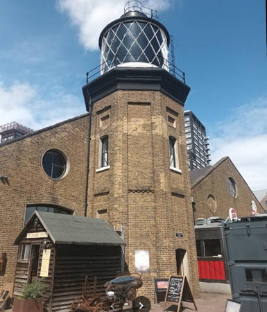
1863. Inactive since 1988. Hexagonal brick tower with lantern and gallery, attached to a 1-story brick depot buildings. Tower unpainted, lantern painted black. The lighthouse, part of the Trinity House lighthouse depot, was used for training purposes until Trinity House moved its operations to Harwich in 1988. A 2023 photo by Denis Matiz is at right, Andreas G. Pafitis has a street view, and Google has river view and a satellite view. Martin Stewart's October 2005 photo shows some restoration work in progress and by 2006 the building had reopened as venue and exhibition space. Located on the Trinity Buoy Wharf in Blackwall at the entrance to Bow Creek, opposite the London Millennium Dome. Site and building open, tower closed. Owner/site manager: Trinity Buoy Wharf . ARLHS ENG-275.

Blackwall Light, Greenwich, August 2023
Google Maps photo by Denis Matiz

Thames Southside Lighthouses
* Margaret Ness (Trip Cock Point)
1902. Active; focal plane 11 m (36 ft); two white flashes every 5 s. 9 m (30 ft) square skeletal tower painted red; there is a small equipmant shelter in the base. Paul Borger has a closeup photo, Trabas has a photo, Uy Hoang has a street view, and Google has a satellite view. A paved bicycle trail, part of the Thames Cycle Route, passes the lighthouse. Located in a bend of the estuary on the south bank in Woolwich. Site open, tower closed. Admiralty A2150.
* Crayford Ness (3)
1981 (station established 1895). Active; focal plane 19 m (62 ft); white flash every 5 s. 22.5 m (74 ft) square skeletal radar tower; the light is shown from a square metal enclosure midway on the tower. Trabas has a photo, Uy Hoang has a street view, and Google has a satellite view. A much taller communications tower stands next to the radar tower and is joined to it by an aerial walkway. The Thames bicycle path passes the lighthouse. Located on a promontory on the south bank of the Thames off Landau Way on the east side of Erith. Site probably open, tower closed. ARLHS ENG-027; Admiralty A2130.

Kent Lighthouses

Occupying the southeastern corner of England, Kent is the closest English land to the European mainland. Most of the county is a blunt peninsula projecting into the southwestern corner of the North Sea and bordering the Strait of Dover to the south. Kent is the most populous of the non-metropolitan counties with a population of about 1.85 million. Kent has a county council and twelve district council areas, but the Medway Council area has an independent (unitary) authority.

Dartford Borough Lighthouse
* [Broadness (2)]
1975 (station established 1885). Active; focal plane 12 m (39 ft); red light occulting once every 5 s. 10 m (33 ft) tripod painted red. René Steuns has a closeup 2022 photo, Trabas has a photo, and Google has a satellite view. This light replaced a hexagonal skeletal tower with lantern and gallery. Located just off a sharp point on the south side of the Thames above Gravesend; a footbridge connects to the light. Site and tower closed but the light is easily seen from shore. Operator: Port of London Authority. Admiralty A2124.

Gravesham Borough Lighthouses
* Northfleet Upper (2)
1972 (station established 1926). Active; focal plane 30 m (98 ft); white, red or green light depending on direction, 8 s on, 2 s off. Lantern mounted on the roof of an 8-story office building owned by Lafarge Cement UK, Ltd. Lantern painted red. Trabas has a closeup of the light and Google has a satellite view. This directional light guides vessels both upstream and downstream. The current light replaced a black iron skeletal tower at the end of a short jetty belonging to the Associated Portland Cement company, probably a predecessor of Lafarge Cement. Located on the waterfront just west of the lower light. Site open. Operator: Port of London Authority (originally Trinity House). Admiralty A2119.
* Northfleet Lower (2)
1883 (station established 1859). Inactive. 16 m (53 ft) four-legged circular wrought iron skeletal tower with lantern, gallery, and three landings. Entire lighthouse painted red. This is the oldest of the River Thames light stations. Phil Hamer's photo at right and Paddy Ballard's Lightphotos.net photo show that the lighthouse has been restored and repainted. Charlie McNeilly has a 2009 photo, Uy Hoang has a street view, and Google has a satellite view. Originally built on the India Arms Wharf, the lighthouse was relocated 282 m (925 ft) eastward in 1968 due to development of the waterfront. Located on the new India Arms Wharf in Northfleet, on the south side of the river. Apparently accessible by walking the wharf. Site open, tower closed. Operator: Port of London Authority (originally Trinity House). ARLHS ENG-089; ex-Admiralty A2118.

Northfleet Lower Light, Northfleet
Mapio.net photo by Phil R. Hamer
* Gravesend Town Pier
Date unknown (pier built in 1834). Active; focal plane about 14 m (46 ft); continuous red light. Approx. 7 m (23 ft) white post with lantern mounted on a square base. Trabas has a good photo, Stephen McKay has a 2012 photo, and Google has a street view and a satellite view. This pier is the terminal for a passenger ferry crossing the Thames to Tilbury. Located on the historic cast iron Gravesend Town Pier, at the end of High Street, about 400 m (1/4 mi) west of the Royal Terrace Pier. Site open, tower closed. Admiralty A2099.
** Trinity House Lightship 21 Seven Stones
1963 (Philip & Son, Dartmouth). Decommissioned 2008. 40.5 m (133 ft) steel lightship; the light was displayed from a large lantern on a cylindrical mast amidships. Vessel painted red. A 2018 photo is at right, Chris Whippet has a 2014 photo, Stefan Czapski has a 2012 photo, Brian Yau has a 2022 photo, and Google has a street view and a satellite view. This ship served much of its career on the East Goodwin station in the North Sea off the coast of Kent. It was transferred in 2003 to the Seven Stones Reef, northeast of the Isles of Scilly and northwest of Land's End. No longer crewed, the ship was operated automatically. It was retired from service in 2008, sold in 2009, and towed to the Gillingham Pier on the Medway. It was renovated as "a floating cultural facility designed to provide a range of services promoting and supporting the creative industries in the Medway area and beyond," according to its owners. The vessel can be hired for meetings and events. By April 2017 the ship was moored on the Thames waterfront just below the Gravesend Town Pier. Site open, vessel open only for scheduled events. Owner: Light Vessel 21 . ARLHS ENG-124.

LV21, Gravesend, January 2018
Instagram photo by lightvessel21
* Gravesend Royal Terrace Pier
Date unknown. Active; focal plane about 14 m (46 ft); continuous red light. Approx. 15 m (49 ft) light tower with an open cupola-style lantern rising from a 1-story pier building. Tower painted brown, lantern white. Trabas has a good photo, Phil Hamar has a photo, Arkady Beklemeshev has the view from the Thames, and Google has a satellite view and a distant street view. The pier, built in 1844, has an illustrious history. "Royal" was added to the name when Princess Alexandra of Denmark arrived there in 1863 to marry the Prince of Wales, later King Edward VII. (Alexandra is the great-grandmother of the late Queen Elizabeth II.) Located on Royal Pier Road in Gravesend, about 500 m (0.3 mi) east of the town pier. Site open, tower closed. Admiralty A2098.
* Shornemead (Shornmeade) (1)
1913. Inactive since 2004. Approx. 11 m (36 ft) hexagonal skeletal tower, upper part enclosed, with lantern and gallery, formerly mounted on timber pilings. A metal walkway connected the tower to the riverbank. Google has a satellite view of the former foundation of the light. Michael Millichamp visited the light in 2003 and found it was scheduled to be replaced by a modern aid, as happened later that year. He assumed it was going to be demolished but this didn't happen; when Anna Jenšíková visited in 2009 the lighthouse was still at the base of the Denton Pier. David Bullock has a 2008 photo and Google has a 2018 street view and a satellite view. In 2022 the port authority restored the lighthouse as seen in the photo at right and Google's 2022 street view. Located at the entrance to the port authority's Denton Pier, near the end of Mark Lane, Gravesend. Site open, tower closed. Owner/site manager: Port of London Authority. ARLHS ENG-281.
* Shornemead (Shornmeade) (2)
2004 (station established 1913). Active; focal plane 12 m (39 ft); two flashes every 10 s, white, red, or green depending on direction. Approx. 15 m (49 ft) round cylindrical tower with three galleries. Tower painted red with one white horizontal band. Trabas has a closeup photo and Google has a satellite view. The light stands in the water, no longer connected to shore, about 500 yd (460 m) west of the old location. Located on the south bank of the estuary near the Shornemead Fort, at the lower end of the Gravesend Reach. Site open, tower closed. Operator: Port of London Authority. Admiralty A2096.

Medway Council Area Lighthouses
* Cliffe
Date unknown. Active; focal plane 23 m (75 ft); white light, 2.5 s on, 2.5 s off. Approx. 20 m (66 ft) square skeletal tower. Trabas has a closeup photo and Google has a street view and a satellite view. This is a Port of London radar tower; it also carries a leading light guiding eastbound vessels. Cliffe stands on a low chalk escarpment rising above the level of the river. Located on Allens Hill at the end of West Street in Cliffe. Site open, tower closed. Operator: Port of London Authority. Admiralty A2085.5.

1913 Shornemead Light, Denton Pier, Gravesend, March 2022
Port of London Authority photo
 
[Yantlet Beacon]
Date unknown. Inactive daybeacon. Approx. 6 m (20 ft) square skeletal tower carrying a globe beacon, mounted on a platform supported by piles. John King has a good photo, Clem Andrews has a 2019 photo, and Google has a satellite view. Nearby is a pillar, the London Stone, that marks the outer limit of the authority of the Port of London. Located in the mouth of Yantlet Creek on the west side of the Isle of Grain. Accessible only by boat. Site open, tower closed.
Isle of Grain
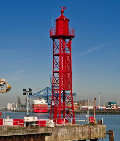
Date unknown. Active; focal plane 20 m (66 ft); quick-flashing light, white, red, or green depending on direction. 20 m (66 ft) triangular skeletal tower, mounted on a wood equipment room supported by piles. Tower painted red. The tower also carries a diamond-shaped daymark painted red and white; the daymark is edge-on on the right side of the tower in Trabas's photo. Uy Hoang has a street view and Google has a good satellite view. This is the leading light for vessels entering the Medway estuary. Located off Port Victoria Road at the eastern end of the Isle of Grain. Site status unknown. Admiralty A2009.7; NGA 1400.

Medway Council Area: River Medway Lightships
The quiet estuary of the River Medway is by far the largest sheltered harbor for smaller craft along the Thames. It has also become a haven for deactivated lightships.
* Trinity House Lightship 86 Nore
1931. Decommissioned 1974. Steel lightship, length 26.2 m (86 ft), painted red. The light was shown from a large lantern atop a mast amidships. This ship is on the left in the photo at right, Doug Marsh has a closeup of the owner in the lantern, Paul Borger has a 2013 photo, and Google has a satellite view. The ship served on the Edinburgh Channel station in the Thames estuary and at Cork Bank off Harwich. After decommissioning, it was sold to the Taylor Woodrow Maritime Heritage Site at St. Katherines Dock in London; John King has a 1984 photo of the ship at that location. Renamed Nore, it was used as office space. In 1996 it was sold to a private individual, who has moored it at the Port Werburgh Marina in Hoo, which caters especially to houseboats. When Iris Klempau visited Hoo in July 2008 she found the ship to be in poor condition, but the owner has continued his efforts at restoration. Site apparently open, vessel closed. Owner/site manager: private.
* Trinity House Lightship 80 Orwell
1914. Decommissioned 1977. Steel lightship, length 35.5 m (116 ft), painted red. The light was shown from a large lantern atop a mast amidships. This ship is on the right in the photo at right and Google has a satellite view. Ken Brown has a July 2008 photo of two lightships at Hoo, the Orwell (on the right) and the Nore. At the time of David Anstiss's photo at right, the two lightships were joined by Lightship 95. LV-80 served almost entirely on the Seven Stones station. After deactivation it was sold to become the headquarters for the Sea Cadets Corps in Ipswich, which renamed it T.S. Orwell. In October 2004 the Sea Cadets sold the ship for £5,000, its scrap value, but it shortly appeared for sale on Sotheby's list with a price tag of £85,000. After being sold at least once and perhaps twice more, it found a new owner who has refurbished it as a houseboat. As of July 2008 it appeared to be in very good condition. Site apparently open, vessel closed. Owner/site manager: private. ARLHS ENG-325.

Lightships 86 (left) and 80 at Hoo (now Port Werburgh), September 2012
Google Maps photo by Chris jW
Irish Lightship Albatross (?)
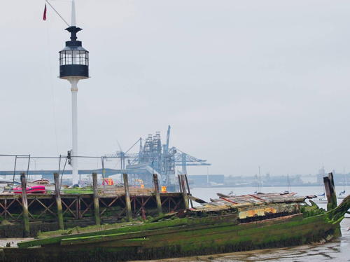
1925 (H. Robb Ltd, Leith). Decommissioned 1970. 31 m (102 ft) steel lightship; the light was shown from a round lantern on a slender mast amidships. Ship painted red, superstructure white. A historic photo shows the ship on its last assignment off Arklow, County Wicklow. In 1970 the ship was sold to the Scout Association of Ireland and moored in Dún Laoghaire Harbour as a sea cadet training ship. Several 1972 photos are available. High maintenance costs put an end to that career in the 1990s. In 1999 the ship was painted with luminous paint as part of an art installation. In 2000, according to the Commissioners of Irish Lights, it was sold to James Tyrrell and moved to Arklow. The light tower was removed and restored and is displayed on the Arklow waterfront. The rest of the ship was painted black and returned to Dublin, where it was a set for the 2002 movie Reign of Fire. In 2011 the ship was towed to Hoo on the Medway, where it was for sale for £75,000. Apparently it was sold for conversion to a bed and breakfast, but nothing came of this plan. In 2016 the ship was for sale again, for £70,000. Moored in 2016 at Hoo near the Nore and the Orwell; Google has a satellite view. We need information on the current condition of the ship. Site apparently open, vessel closed. Owner/site manager: private.
Trinity House Lightship 88 ex-Lord Nelson
1936. Decommissioned 1977. Steel lightship, length 30 m (99 ft), painted red. The ship served on the Cockle and Cork stations. It was sold to become the headquarter for the Sea Cadets Corps in Norwich, which renamed it T.S. Lord Nelson. The light tower, removed before the sale, was transferred to Lightship 87 at Ipswich (see Eastern England). The current status of this ship is unclear. In October 2004 Iris Klempau reported it was moored at Rochester and painted blue instead of red. Anna Jenšíková visited the ship in November 2009 and contributed the photo at right. More information is needed. Moored on the waterfront at Hoo. Owner: unknown. ARLHS ENG-327.
** Trinity House Lightship 16 (1) Inner Dowsing
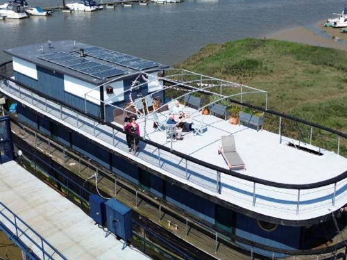
1840. Decommissioned 1945. 26.7 m (87 ft) wood lightship, now brought onshore and stripped of its masts. Ship painted dark red with white trim. Several photos are available and Google has a satellite view. This is the old LV16, not to be confused with the more modern Lightship 16 Colne Light now at Colchester (see above) or with Lightship 95, also called Inner Dowsing (see above). This ship served many stations, but it was on the Inner Dowsing station off the Humber when it was retired. The ship was first sold to the Benfleet Yacht Club but in 1983 it was brought to the Medway Bridge Marina in Rochester and opened as a private club. In 1989 it became a restaurant open to the public. The restaurant closed in 2008 but when Anna Jenšíková visited in November 2009 she found the ship being reconstructed; it reopened as Lightship 16 for overnight accommodations. In 2022 it went on the market and sold for £100,000 to a couple, Jeremy Lyons and Eunha Ru. After six months of renovation it is again available for overnight stays. Located at the marina, on the south side of the Medway, just downstream from the M2 expressway bridge in Rochester. Site open, ship open only to guests. Owner: Inner Dowsing Lightship. Site manager: Medway Bridge Marina.
Trinity House LV 88
Lightship 88 at Hoo, November 2009
photo copyright Anna Jenšíková; used by permission
Irish Lightship Cormorant (?)
1878. Decommissioned 1942. 28 m (91 ft) ironclad wood lightship. The ship served many stations off the Irish coast. After being decommissioned as a lightship it served during the 1950s as a pilot vessel under the name Lady Dixon. Later (and without its light mast) it was in private ownership as the Lady December. In 2013 the ship, by then moored at Hoo, was purchased by David Dudley. Dudley was gradually restoring the vessel, recounting his experiences and research in his blog. He has several historic photos of the ship. Sadly, Dudley was severely injured in a fall in May 2016. It is not clear if his son will be able to continue the project. We need information on the current location and condition of the ship. The UK Historic Ships website places the ship at Gillingham, across the Medway from Hoo, but there's no sign of it there in Google satellite views. Site open, vessel closed.

City of Canterbury Lighthouses
Herne Bay (1)
1899. Inactive. 15 m (49 ft) octagonal light tower mounted atop an octagonal wood building on a platform supported by concrete piles. The active light (focal plane 18 m (59 ft); quick-flashing white light) is on triangular skeletal mast. Trabas has a photo, Edward Evans has a 2017 street view, and Google has a satellite view. Gravely endangered. Phil Drew's 2020 drone view shows the structure nearing collapse. The Herne Bay Pier served passenger ships until 1963. Most of the pier was destroyed by winter storms in 1978 and 1979, and the rest, execpt for the landing stage at the end, was demolished in 1980. Located about 1 km (0.6 mi) offshore of Herne Bay, 8 km (5 mi) north of Canterbury. Site and tower closed, although there should be a good view from shore. Active light: Admiralty A1976; NGA 1376.
* [St. Mary's of Reculver]
12th century. Inactive daybeacons. Twin square stone church towers, the remains of an otherwise ruined church. Rob Farrow has a 2010 photo and Google has a street view and a satellite view. The site of an ancient monastery, Reculver is a historic place in English church history, site of a 7th century monastery and the 13th century St. Mary's Church. In 1810 Trinity House bought the ruins of the church to preserve the two towers as daybeacons, restored the towers, and added windvanes; Wikipedia has a photo taken between 1910 and 1916. The windvanes were removed about 1930 but the towers are still charted by Navionics as daybeacons. Located just off the beach at Reculver, about 2 km (1.25 mi) east of Herne Bay. Site open, towers closed.

Thanet District (Northeast Kent) Lighthouses
* Margate Pier (2)
1955 (station established 1828). Active; focal plane 18 m (59 ft); continuous red light. 20 m (66 ft) octagonal stone tower with lantern. Mike Smith's 2023 photo is at right, Zach Dills has a 2021 photo, Trabas has a fine closeup, Werning has a photo, and Google has a street view and a satellite view. Huelse has a historic postcard view of the original lighthouse, which was destroyed by the Great Storm of 1953. Located at the end of the breakwater pier in Margate. Site open, tower closed. Operator: unknown. . ARLHS ENG-079; Admiralty A1972; NGA 1372.

Margate Pier Light, Margate, March 2023
Google Maps photo
by Mike Smith
* North Foreland (2)
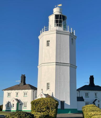
1691 (height increased in 1793). Station established 1636. Active; focal plane 57 m (187 ft); five white flashes every 20 s. 26 m (85 ft) octagonal cylindrical stone tower with lantern and gallery, painted white, attached to two 2-story keeper's houses. A 2024 photo by James Hollands is at the top of this page, another closeup photo is available, Trabas has a good photo, David Dean has a 2021 photo, Werning has a photo, Huelse has a historic postcard view, Marinas.com has aerial photos, and Google has a street view and a satellite view. This historic lighthouse marks the beginning of the approach to the Thames estuary and the port of London. The first tower was built by Sir John Meldrum in 1636; it was destroyed by fire in 1683. The second tower (the lower stage of the present lighthouse) was built 12 m (39 ft) tall. In 1719 it was acquired by the trustees of Greenwich Hospital. The tower was increased in height in 1793 by adding the upper octagonal section. In 1832 the lighthouse was purchased by Trinity House and the present lantern was installed in 1890. North Foreland was the last manned lighthouse in Britain, finally automated in November 1998. The two keeper's houses are available for vacation accommodations. Located at the northeastern corner of Kent, on North Foreland Road 2 km (1.2 mi) north of Broadstairs. Site open; tower closed. Operator: Trinity House. . ARLHS ENG-087; Admiralty A0966; NGA 1364.
* Ramsgate West Pier (Ramsgate Range Rear) (3)
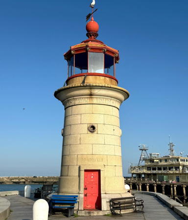
1842 (John Shaw). Station established 1783. Active; focal plane 12 m (39 ft); continuous red light. 11 m (36 ft) round granite tower with lantern and gallery. The tower is unpainted; lantern painted red. Hugh Llewelyn's photo is at right, Trabas has a photo, Werning also has a photo, a historic photo is available, Huelse has a historic postcard view, Marinas.com has aerial photos, Peter Ryder has a sea view, and Google has a satellite view. The front light of the range was a post light at the end of the east pier but the range has been discontinued. Located at the end of the pier in Ramsgate. Site open, tower closed. Operator: Port of Ramsgate. ARLHS ENG-241; Admiralty A0957.1; NGA 1348.

Dover Strait Eastern Entrance Lightships
Trinity House Lightship Foxtrot 3
Date unknown. Active; focal plane 12 m (39 ft); white flash every 10 s. Steel lightship; the light is displayed from a large lantern on a skeletal tower amidships. Vessel painted red. Fog horn (blast every 10 s). Trabas has a photo by Capt. Theo Hinrichs but the ship is not shown in Google's satellite view. The ship marks a location where the eastbound and westbound shipping lanes diverge; for westbound vessels this is the first light of the English Channel passage. Located in the center of the northern entrance to the channel, about 35 km (22 mi) east of the North Foreland and a similar distance northwest of Dunkerque. Accessible only by boat. Site open, vessel closed. Admiralty A0992; NGA 1336.

West Pier Light, Ramsgate, September 2020
Flickr Creative Commons photo
by Hugh Llewelyn
Trinity House Lightship East Goodwin
1964 (Charles Hill, Bristol, England). Active (?); focal plane 12 m (39 ft); white flash every 15 s. 40.5 m (133 ft) steel lightship, painted red. The light is shown from a large lantern on a skeletal tower amidships. Haven Boat Charters has contributed a 2008 photo, and Trabas has a distant view by Capt. Theo Hinrichs, but the ship is not shown in Google's satellite view. The ship is unstaffed and operates automatically. Located on the East Goodwin Sands, a shoal about 13 km (8 mi) east of Deal. Accessible only by boat. Site open, vessel closed. ARLHS ENG-189; Admiralty A0984; NGA 1324.
Trinity House Lightship Sandettié
Date unknown. Active; focal plane 12 m (39 ft); white flash every 5 s. Steel lightship; the light is displayed from a large lantern on a skeletal tower amidships. Vessel painted red. Fog horn (blast every 30 s). Trabas has a distant view but the ship is not shown in Google's satellite view. The ship is unstaffed and operates automatically. The Sandettié station was formerly the responsibility of France, but the last French lightship, BF-6 Sandettié, was withdrawn on 3 June 1989. (BF-6 is moored at Dunkerque as an exhibit of the maritime museum; see the France North Coast page.) The light marks the Sandettié Bank, which separates the eastbound and westbound shipping lanes at the eastern entrance to the Strait of Dover. Located in the North Sea at the eastern entrance to the Strait of Dover, about 13 km (8 mi) north of Calais and 25 km (15 mi) east of the South Foreland. Operator: Trinity House. Admiralty A0994; NGA 8932.
Trinity House Lightship Varne
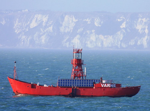
1958 (Philip & Son, Dartmouth) (station established 1890). Active; focal plane 12 m (39 ft); red flash every 20 s. 40.5 m (133 ft) steel lightship; the light is displayed from a large lantern on a cylindrical mast amidships. Vessel painted red. Trabas has an excellent photo by Capt. Theo Hinrichs (also seen at right), a closeup photo is available, and Haven Boat Charters has contributed a photo, but the ship is not shown in Google's satellite view. The ship is unstaffed and operates automatically marking a dangerous shoal in the westbound shipping lane. Located in the English Channel about 10 km (6 mi) southeast of Dover. Accessible only by boat. Site open, vessel closed. Operator: Trinity House. ARLHS ENG-270; Admiralty A0897.5 (formerly A0970); NGA 1224.
LV-19 Varne
Trinity House Lightship 19 Varne and White Cliffs of Dover
photo copyright Capt. Theo Hinrichs; used by permission

Dover District Lighthouses
Dover is the English town closest to the European continent; it is 33 km (21 mi) across the English Channel to Cap Gris Nez in France. As a result it is a very busy ferry port, with a high speed rail link to London and more than 40 ferry departures daily. The town has about 30,000 permanent residents.
* Deal Pier
2008? (station established 1865). Active; focal plane 7 m (23 ft); continuous red light. Post light mounted atop a pierhead restaurant. Trabas has a photo and Google has a satellite view. The present pier, the third at this location, was built in 1957 and extends 311 m (1020 ft) into the Channel. Trabas's photo and the satellite view are probably obsolete because a new restaurant was built on the pierhead in 2008. It's not clear how the light is mounted on the new building. Located at the end of the Deal Pier, about 13 km (8 mi) northeast of Dover and a similar distance south of Ramsgate. Site open (entry fee to the pier). Site manager: Deal Pier Kitchen . Admiralty A0950; NGA 1312.
South Foreland Low
1793. Inactive since 1904. 15 m (49 ft) octagonal cylindrical stone tower with lantern and gallery, painted white. Rene Schoeters has a 2017 closeup photo, Colin Smith has a 2011 photo, Werning has a photo, Huelse has a historic postcard view of the station, and Google has a satellite view. The keeper's cottages formerly attached to the tower have been demolished. In May 2020 the Cliff House estate that includes the lighthouse was for sale. Located near the shore, below the high light, on private property. Site and tower closed; the top of the tower can be seen from a distance. Owner/site manager: private. ARLHS ENG-130.
**** South Foreland (2) (High)
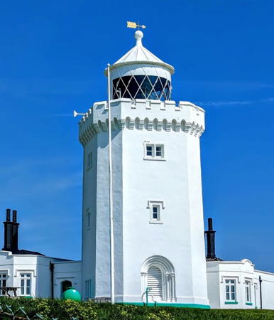
1843 (station established 1793). Inactive since 1988. 21 m (69 ft) octagonal cylindrical stone tower with lantern and gallery, painted white, attached to 1-story keeper's houses. Operational 1st order Fresnel lens mounted in the lantern. 2023 photo is at right, David Meggers has a good 2011 photo, Werning also has a good photo, Stefan Ruscanu has a 2021 closeup, Wikimedia has many photos, Huelse has a historic postcard view, and Google has a street view and a satellite view. The South Foreland is not a prominent cape but it is the southeasternmost corner of Britain and the eastern entrance to the Strait of Dover. The lighthouse was the scene of a famous experiment on Christmas Eve 1898, when Guglielmo Marconi succeeded in contacting the lightship Goodwin Sands using his newly-invented radio equipment. In 2004 the rotating mechanism of the lens was restored and returned to the tower. In 2014 there was a thorough restoration of the exterior of the lighthouse and in 2022 it was being repainted. Located atop the White Cliffs of Dover about 8 km (5 mi) east of the city near St. Margaret-at-Cliffe. No vehicle access. Accessible by biking or walking about 3 km (2 mi) from the National Trust's White Cliffs parking area in Dover or about 1.5 km (1 mi) from the public parking at the Coast Guard station in St. Margaret's-at-Cliffe. Site open; the tower is open to guided tours Friday through Monday and on school holidays, March through mid May and daily from mid-May through late October; tours available by appointment in the winter. Owner/site manager: National Trust (South Foreland Lighthouse ). ARLHS ENG-129.

South Foreland Light, St. Margaret-at-Cliffe, July 2011
Flickr Creative Commons photo by David Meggers
Dover Breakwater Knuckle
1909. Active; focal plane 15 m (49 ft); four flashes every 10 s, red or white depending on direction. 16 m (52 ft) round cast iron tower with lantern and gallery, painted white. Trabas has an excellent photo by Arno Siering, Werning has a photo, and Google has a satellite view. Located at the south end of the knuckle (bend) of the detached outer breakwater in Dover. Site and tower closed. Operator: Dover Harbour Board. ARLHS ENG-286; Admiralty A0926; NGA 1276.
Dover Breakwater West End
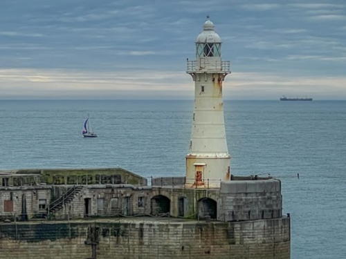
1909. Active; focal plane 21 m (69 ft); red light, one 3 s occultation every 30 s. 21 m (70 ft) round cast iron tower with lantern and gallery, painted white. This lighthouse and the Admiralty Pier Light bracket the western entrance to Dover Harbour. A 2023 photo is at right, Trabas has a good photo, Werning has a photo, Mirek Valasek has a photo, a good 2009 photo is available, Huelse has a historic postcard view showing the entire breakwater and both lighthouses, Marinas.com has aerial photos, and Google has a satellite view. Located at the west end of the detached outer breakwater. Site and tower closed. Operator: Dover Harbour Board. ARLHS ENG-294; Admiralty A0924; NGA 1272.
* Dover Prince of Wales Pier
1902. Active; focal plane 14 m (46 ft); very quick flashing green light. 14 m (46 ft) round stone tower with lantern and gallery, painted white. Located at the end of the pier, which separates the outer and inner harbors at Dover. Trabas has a fine photo, Werning has a photo, John Latter has a photo, and Google has a satellite view. Named for the then-prince, later King Edward VII, the Prince of Wales Pier is parallel to and sheltered by the Admiralty Pier. Accessible by walking the pier, which is very popular for walking and fishing. Site open, tower closed. Operator: Dover Harbour Board. ARLHS ENG-214; Admiralty A0902; NGA 1268.

Breakwater West End Light, Dover, July 2023
Google Maps photo by K. Stich
* Dover Admiralty Pier (3)
1908 (station established 1842). Active; focal plane 21 m (69 ft); white flash every 7.5 s. 22 m (72 ft) round cast iron tower with lantern and gallery, painted white. Fog horn (2 s blast every 10 s). Trabas has a good photo, Werning also has a photo, Sheila Bullock has a closeup, Marek Danilowicz has a street view, and Google has a satellite view. This lighthouse replaced a 9 m (30 ft) tower built in 1876. The pier includes Dover's Cruise Ship Terminal. In 2022 the pier was reopened for fishing. Located at the end of the pier, which extends 1220 m (4000 ft) west to east enclosing the western side of Dover Harbour. Accessible by walking the pier. Site open, tower closed. Operator: Dover Harbour Board. ARLHS ENG-036; Admiralty A0900; NGA 1236.
* Dubris Pharos
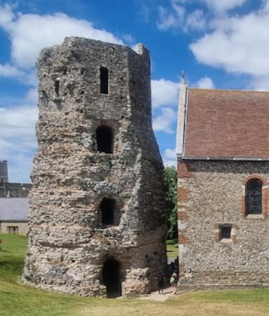
Around 130-150 AD. Ruined octagonal flint rubblestone stepped tower built by the Roman government of Britain. Francesco Marchini's 2022 photo is at right, another excellent photo and another 2022 photo are available, Wikimedia has a photo, Huelse has a colorized historic postcard view, and Google has a street view and a satellite view. This is the tallest Roman ruin in Britain and the only substantial Roman lighthouse ruin anywhere. The surviving portion of the tower is 19 m (62 ft) tall and has three stages (storys) and most of a fourth; the topmost 6 m (20 ft) are of medieval construction. Scholars believe the tower originally had eight stages and was about 24 m (80 ft) tall. An open fire was displayed from the top to guide ships into the harbor of Dubris, as Dover was called in Roman times. Since the twelfth century the tower has stood on the grounds of Dover Castle, adjacent to the Church of St. Mary sub Castro. The tower was used as the bell tower of the church in medieval times and in the 1580s it was renovated to serve also as a powder magazine. The Romans actually built two lighthouses, but a small lump of masonry called the Bredenstone is all that survives of the Western Pharos. Located on the heights above Dover Harbour. Site open, base of the tower open. Owner/site manager: English Heritage. . ARLHS ENG-034.

Folkestone and Hythe District Lighthouses
* Folkestone Pier
1860. Active; focal plane 14 m (46 ft); two white flashes every 10 s; in fog the characteristic changes to a white flash every 2 s. 13 m (43 ft) round stone tower with lantern and gallery. Tower unpainted; lantern painted white. Fog horn (four blasts every 60 s). Trabas has a photo, Marius Averitai has an excellent 2018 photo, Huelse has a historic postcard view, and Google has a street view and a satellite view. The historic pier (1809) has been redeveloped as a tourist destination with shops, restaurants, and entertainment venues. Located at the end of the Folkestone Harbour Arm in Folkestone. Site open daily, tower closed. Operator: Folkestone Harbour Company. . ARLHS ENG-216; Admiralty A0892; NGA 1228.

Dubris Pharos, Dover, July 2022
Google Maps photo by Richard White
* [Dungeness (3)]
1792 (Samuel Wyatt). Station established 1615. Inactive since 1904. The 35 m (115 ft) tower, similar in design to Smeaton's Tower at Eddystone, was demolished in 1904, but the keeper's houses survive. No photo available. Dungeness is the western entrance to the Strait of Dover; it is a broad wedge of land that is gradually extending itself into the Channel, making it necessary from time to time to build new lighthouses closer to the end of the point. Located about 600 m (1/3 mile) west of the point. Site open, buildings closed. Owner/site manager: unknown. ARLHS ENG-343.
**** Dungeness (4) (Dungeness Old)
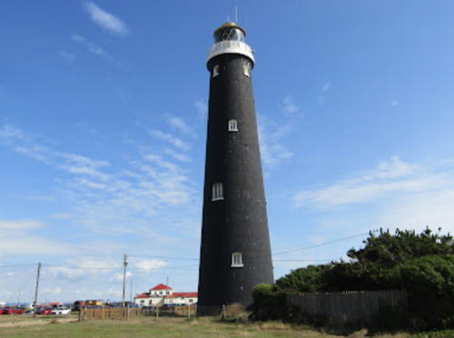
1904. Inactive since 1961. 43.5 m (143 ft) round brick tower with lantern and gallery. Tower painted black with white trim; lantern and gallery painted white. Original 1st order Fresnel lens. Circular 2-story Coast Guard quarters and detached 1-story keeper's house. Andrew Startup's 2022 photo is at right, Werning has a fine photo, Tony Ciantar has a good photo, and Google has a street view and a satellite view. The lighthouse was replaced due to the extension of the point and the fact that its light was partly obscured by a nearby nuclear power plant. Originally painted with a white horizontal band, as seen in Huelse's postcard view, the tower was repainted all black to prevent confusion with its replacement. Privately owned by the Stanners family, it became a very popular tourist attraction. In 2005 the family offered the lighthouse for sale; no price was specified. Probably it was sold, because it appears to be under new management. Located about 450 m (1/4 mi) west of the point. Accessible by road and by railroad from Romney; parking provided. Site open; tower open to guided tours on weekends and school holidays in April, May, September and October, daily except Mondays and Fridays in June, and every day in July and August. Site manager: The Old Lighthouse at Dungeness . ARLHS ENG-038.

Old Dungeness Light, Lydd, September 2022
Google Maps photo by Andrew Startup
* Dungeness (5)
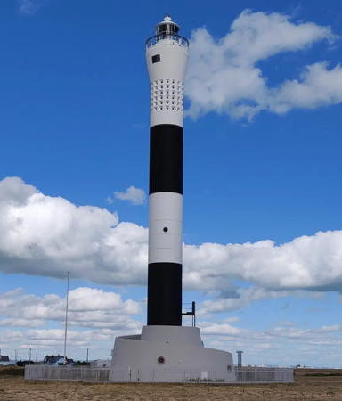
1961. Active; focal plane 40 m (131 ft); quick white flash every 10 s. 43 m (141 ft) round cylindrical concrete tower, flared at the top, with lantern and gallery. The tower has black and white horizontal bands, but these colors are in the concrete, not painted. Fog horn (3 blasts every 60 s). Lighthouse floodlit at night. John McGurrell's 2021 photo is at right, another 2021 photo is available, Werning has a photo, Trabas has a good photo, Marek Danilowicz has a street view, and Google has a good satellite view. The lighthouse is endangered by spreading cracks in the concrete caused by a lack of expansion joints; in March 2016 Trinity House announced a plan for emergency repairs. Located on the point. Site and tower closed, but the lighthouse can be viewed from nearby. Operator: Trinity House. . ARLHS ENG-085; Admiralty A0876; NGA 1220.

Information available on lost lighthouses:

  • Chapman (1851-1957), Thames estuary. The lighthouse was replaced by a bell buoy in 1957 and demolished shortly thereafter. ARLHS ENG-022.
  • Jenningtree Point (1901-1980s), south bank of the Thames. A photo is available (halfway down the page). It was replaced by a buoy and demolished.
  • Maplin (1838-1932), Thames estuary north of Shoeburyness, Essex. The lighthouse collapsed in 1932 after being undermined by the current. ARLHS ENG-078.
  • Mucking Flat (1851-1954), north side of the Thames estuary near Stanford-le-Hope. A small photo is available (halfway down the page). This lighthouse seems to have been rebuilt at some time; another photo shows it with four legs instead of seven. The lighthouse was removed after being damaged by storm floods in 1953 and by collision with a barge in 1954. It was replaced by a buoy. ARLHS ENG-306.
  • Purfleet (Beacon Hill) (1828-1920?), Thames estuary on the northeast side of London. This was an experimental lighthouse rather than a regular aid to navigation; it was abandoned about 1870 but survived until it was demolished around 1920. There is a photo taken shortly before the demolition. ARLHS ENG-307.
  • Tilburyness (1892-1931), north bank of the Thames. The lighthouse, an 11 m (35 ft) cast iron tower with lantern and gallery, was demolished in 1931.
  • Trinity House Lightship Station Sunk Centre. MarineTraffic.com has a photo by Rene van Quekelberghe. This lightship station was part of the traffic separation scheme for vessels approaching or leaving the Thames. It was replaced by a lightfloat in 2021. ex-Admiralty A2170; NGA 1420.
  • Whitstable (1830s-1960s), north Kent. The light was atop a chimney; it has been demolished. ARLHS ENG-309.

New Dungeness Light, Lydd, September 2021
Instagram photo by John McGurrell

Notable faux lighthouses:

Adjoining pages: North: Eastern England | South: France North Coast | West: Southern England

Return to the Lighthouse Directory index | Ratings key

Posted August 27, 2004; checked and revised May 9, 2024. Lighthouses: 36, lightships: 17. Site copyright 2024 Russ Rowlett and the University of North Carolina at Chapel Hill.