Lighthouses of the United Kingdom: Southwest England

The United Kingdom (officially the United Kingdom of Great Britain and Northern Ireland) includes England, Scotland, Wales, and Northern Ireland. England is the largest and most populous of the four, occupying more than 62% of the island of Great Britain and with a population of more than 56 million. Separated from the European mainland by the North Sea on the east and the English Channel on the south, it also has coasts facing the Celtic Sea on the southwest and the Irish Sea on the northwest.

Historically England was divided into 39 counties. The Directory pages are organized by the modern division of England into 48 "ceremonial" counties, also called lieutenancy areas because each one has a Lord Lieutenant representing the monarch in that area. For local government the ceremonial counties are subdivided in various ways into council areas.

This page lists lighthouses of the southwestern peninsula of England including the counties of Devon and Cornwall. The southern coast of the peninsula faces the English Channel and the north coast faces the Celtic Sea and Bristol Channel. This region includes many of the most famous English lighthouses.

The Cornish language, formerly extinct, has been revived in recent years. In Cornish the word for a lighthouse is golowji; enys is an island, krib is a reef, men is a rock at sea, penn tir is a headland, mor is the sea, and pleg mor is a bay.

The British system of lighthouse administration is decentralized, with the major towers under the management of Trinity House (a corporation chartered by the Crown) and smaller towers generally under the control of local port authorities. This system has generally assisted lighthouse preservation and so has the British custom of building very sturdy stone lighthouses at most of the stations. Most of the onshore lighthouses are accessible to visitors and several of them are major tourist attractions.

ARLHS numbers are from the ARLHS World List of Lights. Admiralty numbers are from Volume A of the Admiralty List of Lights & Fog Signals. U.S. NGA numbers are from Publication 114.


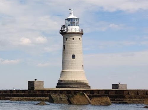
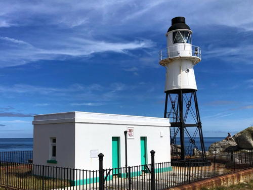
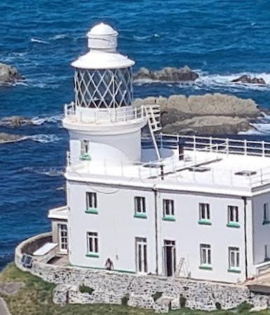
Longships Light, Land's End, March 2024
Google Maps photo by Joseph Jones
General Sources
Trinity House
Chartered by Henry VIII in 1514 as a charitable organization, Trinity House has built and operated lighthouses in Britain since 1609.
Photographers Resource - Lighthouses
A comprehensive guide to British lighthouses, with multiple photos and historical notes for many of the light stations.
Lighthouses of South West England
Photos and information from the Lighthouse Accomodations website.
Online List of Lights - England
Photos by various photographers posted by Alexander Trabas.
Lighthouses in England
Aerial photos posted by Marinas.com..
Lighthouses in England
Photos available from Wikimedia; many of these photos were first posted on Geograph.org.uk.
Lighthouses in Cornwall, England
Information on nine famous lighthouses posted by the tourist development board Cornwall Calling.
The History of Devon's Lighthouses
This BBC story by Jemima Laing links to a gallery of a dozen fine photos of Devon lighthouses.
United Kingdom Lighthouses
Aerial photos posted by Marinas.com.
Britische Leuchttürme auf historischen Postkarten
Historic postcard images posted by Klaus Huelse.
Association of Lighthouse Keepers
Founded by serving and retired keepers, this lighthouse association is open to everyone.
GPSNauticalCharts
Navigational chart for Devon and Cornwall.
Navionics Charts
Navigational chart for Devon and Cornwall.


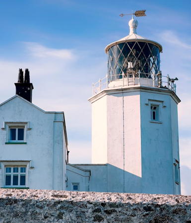
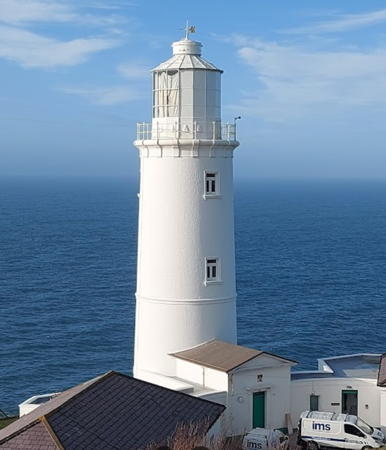
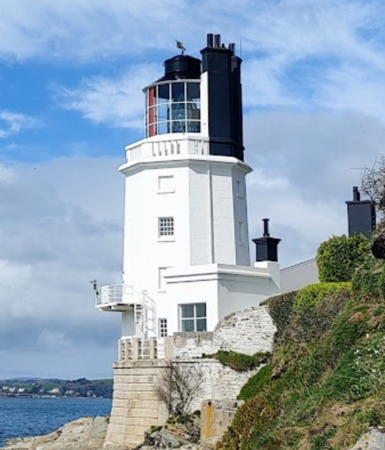
St. Anthony Head Light, Falmouth, Cornwall, March 2023
Google Maps photo by JessB ell

Devon South Coast Lighthouses

Devon spans the southwestern peninsula of England, facing the English Channel on the south and the Bristol Channel on the north. With a population of about 1.2 million, the county is divided into eight districts; Torbay and Plymouth have unitary (independent) governments and the rest of the county has 2-tier government with the Devon County Council and six district councils.

Teignbridge District Lighthouses
* Teignmouth (The Den)
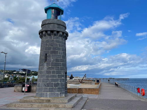
1845. Active; focal plane 10 m (33 ft); continuous red light. 6 m (20 ft) round limestone tower with lantern. The tower is unpainted; the lantern is blue plastic or fiberglass. A photo by Colin Edwards is at right, Trabas has Arno Siering's closeup, Leah Heath has a 2022 photo, Chris Allen has a 2011 photo, Brian Sexton has a good photo, Huelse has a historic postcard view, and Google has a street view and a satellite view. The lighthouse also functions as the front light of a range; the rear light is mounted on a tall black mast in front of the Lynton Hotel. This historic lighthouse was built by the Teignmouth Harbour Commission and has remained under their control ever since. Devon Heritage has a brief article describing its construction. Located on the beachfront at Den Point in Teignmouth. Site open, tower closed. Operator: Teignmouth Harbour Commission. . ARLHS ENG-153; Admiralty A0262; NGA 0392.
* [Phillip Lucette Beacon]
Date unknown. Active; focal plane 4 m (13 ft); red light, occulting once every 6 s. 4 m (13 ft) stone column, upper portion painted white. Trabas has Andreas Köhler's photo, Lighthouse Digest has Tony Denton's photo, Alan Hunt has a photo, and Google has a satellite view. Not a lighthouse but obviously a venerable beacon. Located on a submerged training wall (breakwater) on the south side of the entrance to the Teign, off Marine Parade in Shaldon. Site open, tower closed. Operator: Teignmouth Harbour Commission. Admiralty A0263; NGA 0400.

Teignmouth Light, Teignmouth, September 2023
Google Maps photo by Colin Edwards

Torbay Borough Lighthouses
Tor Bay (two words) is a semicircular bay 4.5 mi (7.2 km) wide facing east on the English Channel. The coastal area, including the towns of Torquay, Paignton, and Brixham, is called Torbay (one word). The borough has a population of about 130,000.

[Black Rock]
Date unknown. Active; focal plane 5 m (16 ft); three quick white flashes every 10 s. 5 m (16 ft) square skeletal tower painted black with one yellow horizontal band. Trabas has Eckhard Meyer's photo and Google has a fuzzy satellite view. Located on a reef just off Roundham Head at Paignton. Accessible only by boat. Site open, tower closed. Admiralty A0251.
* Brixham Breakwater (2)
1916 (station established 1878). Active; focal plane 9 m (30 ft); red light, occulting for 3 s every 15 s. Approx. 6 m (20 ft) round cylindrical cast iron tower with lantern and gallery, painted white. Trabas has Eckhard Meyer's closeup, Harry Wallis has a 2022 photo, Lewis Clarke has a 2010 closeup, Cyrill Kaderli has a street view, and Google has a satellite view. The present lighthouse was built as part of a project to extend the breakwater. In 1984 it was one of the last onshore English lighthouses to be electrified. Located at the end of the breakwater in Brixham; accessible by walking the breakwater. Operator: Tor Bay Harbour. Site open, tower closed. . ARLHS ENG-016; Admiralty A0246; NGA 0348.
* Berry Head
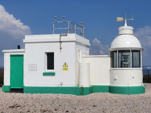
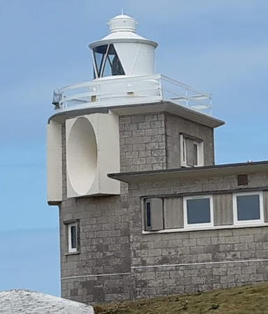
1906. Active; focal plane 58 m (191 ft); two white flashes, separated by 2.5 s, every 15 s. 4.5 m (15 ft) round cylindrical lantern attached to a 1-story square equipment building. Buildings painted white. Coast Guard and signal stations are nearby. Michael Cosgrove's 2021 photo is at right, Photographer's Resource has a fine page with many photos, Trabas has an excellent closeup by Eckhard Meyer, Gordon McKinlay also has a good closeup, Nathan Caselton has a street view, and Marinas.com has aerial photos. The light station actually faces northeast rather than south, as can be seen in a Google satellite view. In Huelse's historic postcard view, the light is flanked by acetylene tanks that formerly supplied fuel for the light. Celebrated as England's smallest lighthouse (it looks more like 3 m (10 ft) in photos), this is nonetheless considered a major light. Originally the rotating light was powered by weights that descended into an underground shaft 45 m (148 ft) long. Located at the end of Gillard Road in Brixham, marking the south entrance to Tor Bay. Site open, tower closed. Operator/site manager: Trinity House. . ARLHS ENG-007; Admiralty A0244; NGA 0344.

Berry Head Light, Brixham, April 2021
Google Maps photo by Michael Cosgrove

South Hams District (Dartmouth Area) Lighthouses
Dartmouth is a small port at the mouth of the River Dart; it has a population of about 5000.

*
[Kingswear Daymark]
1864. Inactive daybeacon. 25 m (82 ft) octagonal pyramidal hollow granite tower with a gracefully arched base, open underneath. Richard Gibson has a nice 2018 photo, Wesley Velroij has a good photo, and Google has a satellite view. This unusual tower is well maintained as a daybeacon and as a historical monument. Located at an elevation of about 145 m (475 ft) and about 700 m (0.44 mi) from the coast on the east side of the entrance to the Dart estuary. Accessible by road. Site open, and visitors can walk under the tower. Owner/site manager: Dart Harbour and Navigation Authority. .
* Kingswear (2)
1981 (station established 1864). Active; focal plane 9 m (30 ft); directional light, 1.5 s on, 1.5 s off; white light is shown southwestward over the clear channel, green to the right and red to the left. 4 m (13 ft) round cylindrical tower with a conical lantern mounted atop a large rock on the shore; the lights are shown through a rectangular window in the lantern. Trabas has a closeup by Stephan Hix and Google has a satellite view. This is the entrance leading light for Dartmouth. The original lighthouse, an 11 m (36 ft) hexagonal stone tower atop the cliff, was demolished in 1980 because it had become unsafe. A Google satellite view shows the foundation of the old lighthouse beside Beacon Road. Located on the north side of the entrance to the Dart estuary at Kingswear, southeast of Dartmouth. Site open, tower closed. Operator/site manager: Dart Harbour and Navigation Authority. ARLHS ENG-311; Admiralty A0236; NGA 0328.
* Dartmouth Castle
1856. Inactive since at least 1886 (since 1864, according to Michael Millichamp). Approx. 15 m (50 ft) square cylindrical stone tower, painted white, on the wall of the castle. The lighthouse tower is on the left in this photo and Google has a street view and a satellite view. The light was not very useful since the navigable channel is on the other side of the river entrance. Located on the west side of the entrance to the Dart estuary southeast of Dartmouth. Site open, tower closed. Owner: English Heritage. Site manager: Dartmouth Castle. ARLHS ENG-031.
**** Start Point
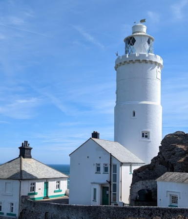
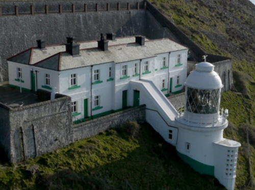
1836 (James Walker). Active; focal plane 62 m (203 ft); three white flashes every 10 s. In addition, a continuous red light is shown northeastward over the Skerries Bank from a window of the tower (focal plane 55 m (180 ft)). 28 m (92 ft) round cylindrical masonry tower attached to a keeper's house; buildings painted white. Fog horn (blast every 60 s). Three assistant keeper's cottages (1871). Chris Walsh has the 2022 photo seen at right, Photographer's Resource has a fine page with many photos, Trabas has a fine photo by Arno Siering, Wikimedia has additional photos, an Instagram drone view shows the spectacular site of the lighthouse, Huelse has a historic postcard view, and Google has a good satellite view. Two of the keeper's houses are available for overnight rental; another is occupied by a resident caretaker who conducts tours of the light station. A Trinity House Visitor Centre includes displays and a gift shop. The station is somewhat endangered by erosion of the cliff on which it stands; the 1860s fog signal building collapsed in 1989 after being undermined by erosion. Trinity House modernized the lighthouse in 2018-19 including installation of an LED optic. Note: there is another Start Point Light in the Orkney Islands, Scotland. Located at the end of a sharp promontory that juts eastward into the English Channel about 20 km (13 mi) south of Dartmouth; accessible by car from the A379 at Stokenham. Parking provided. Site open; tower open to tours daily during August and during Christmas holidays, and on a varying schedule otherwise from late May through October. Operator/site manager: Trinity House. . ARLHS ENG-148; Admiralty A0228; NGA 0324.


Start Point Light, Dartmouth, August 2022
Google Maps photo by NilfChris Walshanion


City of Plymouth and Eddystone Rocks Lighthouses
Plymouth is a historic seaport with a population of about 265,000. The city's harbor, at the confluence of the rivers Plym and Tamar, faces the protected bay of Plymouth Sound. Ships bound for Plymouth from the Atlantic must avoid the Eddystone Rocks, a notorious reef about 15 km (9 mi) southwest of the Sound. Four Eddystone Lighthouses have marked this dangerous location.

Plymouth Breakwater East Head
Date unknown. Active; focal plane 9 m (30 ft); red or white light, depending on direction, 3 s on, 7 s off. 7.5 m (25 ft) mast, carrying a ball topmark, atop a conical solid stone pyramid. Trabas has a photo by Stephen Hix and Google has a satellite view. Located at the east end of the breakwater. Accessible only by boat. Site open, tower closed. Admiralty A0114.5; NGA 0150.
* Staddon Point
Date unknown. Active; focal plane 15 m (49 ft); white, red or green light, depending on direction, occulting once every 10 s. 6 m (20 ft) round cylindrical concrete tower painted with red and white horizontal bands. Trabas has a photo by Eckhard Meyer and Google has a street view and a satellite view. This light guides vessels around the east end of the Plymouth Breakwater. Located on the point below Fort Bovisand. Site open, tower closed. Admiralty A0115.5; NGA 0153.
* Queen Anne's Battery Range Rear
Date unknown. Active; focal plane 14 m (46 ft); directional light, occulting once every 7.5 s, showing white southwestward over the channel, green to the right and red to the left. The light is shown from a small window in a square cylindrical clock tower mounted on the roof of a 2-story building. Trabas has a photo and Google has a street view and a satellite view. The front light of the range is on a red and white mast. Located at the end of Artillery Place off Teats Hill road in Cattedown, on the east side of Plymouth. Operator: Cattewater Harbour Commissioners. Site manager: unknown. Site open, tower closed. ARLHS ENG-312; Admiralty A0132; NGA 0184.
**** Eddystone (4) (Smeaton's Tower)
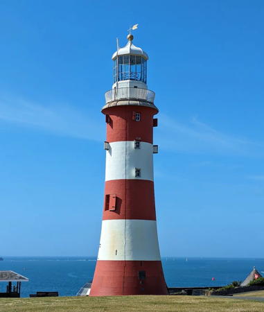
1759 (John Smeaton). Inactive since 1882. 22 m (72 ft) tapered granite tower with lantern and gallery, painted with red and white horizontal bands. The lantern, formerly red, is now painted white. Huelse's historic postcard view shows a different pattern. Hannah Slade's 2023 photo is at right, Ian Gedge has a fine 2007 photo, Wikimedia has many photos, Marinas.com has aerial photos, and Google has a street view and a good satellite view. Smeaton's Tower was the first successful stone waveswept tower and one of the great engineering marvels of the 18th century. When the current Eddystone lighthouse was built the upper 2/3 of the 1759 tower was saved for reassembly in Plymouth. It was carefully restored and renovated in 2000-02. The 250th anniversary of the lighthouse was celebrated on 17 October 2009. In 2015 a plan to floodlight the tower at night was being considered. The lighthouse was closed for repainting in the winter of 2019-20. Located on Plymouth Hoe, a grassy slope overlooking the town and harbor. Site open, tower open for guided tours (admission fee) Tuesday through Sunday and on bank holidays April through September, Saturdays only in December and January. Owner/site manager: Plymouth City Council (Smeaton's Tower ). ARLHS ENG-091.

1759 Eddystone Light (Smeaton's Tower), Plymouth, July 2023
Instagram photo by Hannah Slade
* Ocean Court (Hamoaze)
Date unknown. Active; focal plane 15 m (49 ft); quick-flashing light, white, red or green depending on direction. 3 m (10 ft) pyramidal wood tower mounted on a platform atop the corner of the multistory Ocean Court condominium building. Tower painted white with a triangular red daymark (point down). Trabas has a closeup photo and Google has a satellite view. The light overlooks the Mayflower Marina, guiding vessels approaching from the west (downstream). Located at the end of Richmond Walk in Plymouth. Operator: Cattewater Harbour Commissioners. Site open, tower closed. Admiralty A0178; NGA 0274.
* Mount Wise Pier
Date unknown. Active; focal plane 7 m (24 ft); continuous light, white, red or green depending on direction. 8 m (26 ft) square wood shelter atop a square stone tower. The front of the shelter is painted white with a red vertical stripe. Trabas has a photo and Google has a satellite view. This light guides vessels into the River Tamar on the west side of Plymouth Harbour. Located at the foot of the pier in Mount Wise. Operator: Cattewater Harbour Commission. Site and tower closed. Admiralty A0172; NGA 0260.
Maker (Hooe Lake Point)
Date unknown. Active; focal plane 16 m (52 ft); two flashes every 10 s, white, red or green depending on direction. 4.5 m (15 ft) square pyramidal tower painted white with a red vertical stripe. Trabas has a closeup photo and Google has a street view and a satellite view. This light guides vessels on the approach to Plymouth Harbour. Located on a headland in the Hooe Lake Scout Campsite on the west side of Plymouth Sound. Site status unknown. Site manager: 1st Keyham (St. Mark) Scout Group. Admiralty A0112; NGA 0144.

Plymouth Breakwater Light, Plymouth, May 2021
Google Maps photo by Thommy Plymouth
* Plymouth Breakwater
1844. Active; focal plane 19 m (63 ft); flash every 10 s; white flashes are shown to the northeast for ships leaving the harbor and red flashes otherwise. In addition, a white light (2 s on, 2 s off) is shown over the entrance channel southwestward from a tower window at a focal plane of 12 m (39 ft). 23.5 m (78 ft) round stone tower with lantern and gallery. Fog horn (blast every 15 s). Lighthouse painted white. A 2021 photo is above right, Paul Arcos has a 2018 photo, Trabas has Andreas Köhler's photo, Wikimedia has several photos,Marinas.com has aerial photos, and Google has a satellite view. The detached Plymouth Breakwater, a major engineering project of the early nineteenth century, was built in stages between 1812 and 1847. In 2015 the Ministry of Defence, which maintains the breakwater, announced a project to repair the mounting of the 1500 kg (1.65 ton) fog bell installed in 1880. Located at the west end of the breakwater, at the southwestern entrance to Plymouth Harbour. Accessible only by boat. Operator: Cattewater Harbour Commission. Site manager: Ministry of Defence. Site and tower closed. . ARLHS ENG-104; Admiralty A0114; NGA 0148.
Eddystone (5)
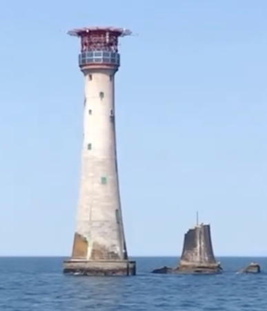
1882 (James Douglass). Station established 1698. Active; focal plane 41 m (135 ft); two quick white flashes, separated by 2.5 s, every 10 s. In addition, a red light (5 s on, 5 s off) is shown to the northwest from a tower window at a focal plane of 28 m (93 ft). 51 m (168 ft) round granite tower, incorporating keeper's quarters, with lantern and a helipad built above the lantern. Tower is unpainted gray stone; lantern and helipad painted red. Fog horn (blast every 30 s). Bridgette Ashton's 2023 photo is at right, Photographer's Resource has an excellent page for the lighthouse, Ron Schroeder has a closeup photo, Richard Knights has another good photo, Trabas has a photo by Kees Aalbersberg, Wikimedia has Steve Fareham's 2012 photo and many historic photos, and Marinas.com has excellent aerial photos, but the lighthouse is not shown in Google's satellite view. This is probably the most famous British lighthouse and indeed one of the most famous lighthouses in the world. The first tower, built of wood, had to be rebuilt one year later and lasted only 4 more years. The third (Rudyerd's Tower), was designed by John Rudyerd and built with alternate courses of oak timbers and granite blocks. Remarkably durable, this tower (the first successful open ocean lighthouse in the world) stood from 1709 until it burned in 1755. The fourth tower was a tapered granite and concrete structure built by John Smeaton. A huge advance in civil engineering, it introduced techniques that became standard in lighthouse construction. Completed in 1759, it stood until cracks in the masonry forced its removal in the 1880s. The upper portion of Smeaton's Tower was rebuilt on Plymouth Hoe (see above) but the base of the original remains next to the current tower. A Fresnel lens was installed in Smeaton's Tower in 1845. The present tower, designed by Sir James Douglass, is built with granite blocks that are interlocked both side to side and above and below, giving the tower exceptional strength. Located on a rock that barely breaks the surface of the sea about 25 km (15 mi) south southwest of Plymouth. Accessible only by boat or helicopter. Site and tower closed. Operator/site manager: Trinity House. . ARLHS ENG-039; Admiralty A0098; NGA 0132.

Eddystone Light, English Channel, May 2023
Instagram photo by Bridgette Ashton

Cornwall Lighthouses

Cornwall occupies the peninsula at the southwestern tip of England, surrounded by the English Channel to the south and the Celtic Sea to the west and north. It is an ancient Celtic homeland, like Brittany, Wales, and Ireland. Today its population is about 570,000. The mainland of Cornwall has a unitary government and the Scilly Isles have a separate unitary government.

St. Austell Area Lighthouses
* [Nailzee Point Fog Signal]
Date unknown (after 1977). Inactive since 2012. 3 m (10 ft) square concrete "pillbox" with a square opening in the front, painted white. Ilya Titov has a street view, a distant aerial view is available, and Google has a satellite view. Located on the south side of the harbor entrance in Looe. Site open, tower closed. ex-Admiralty A0095.
* [Spy House Point (Polperro)]
1911. Active; focal plane 30 m (98 ft); white or red light, depending on direction, 3 s on, 3 s off. 3 m (10 ft) round brick tower with lantern, painted white with black trim. Trabas has a closeup photo, Mark Edgehill has a closeup, Simon Armitage has a street view, and Google has a satellite view. Located at the entrance to the harbor of Polperro, a small port about 10 km (6 mi) east of Fowey. Site open, tower closed. Operator: unknown. . ARLHS ENG-243; Admiralty A0090; NGA 0118.
* [Whitehouse Point]
1892; relocated here in 1904. Active; focal plane 11 m (36 ft); directional light, 1.5 s on, 1.5 s off, showing white over the channel, green to the right and red to the left. 6 m (20 ft) cast iron "drum" tower, with a cylindrical enclosure mounted atop a post and an external ladder to the enclosure, all painted bright red. Not much as a lighthouse but certainly an unusual lightbeacon. Trabas has an excellent photo, Chris Williams has a closeup, and Google has a street view and a satellite view. Located on the west side of the harbor at Fowey. Site open, tower closed. Operator: Fowey Harbour Commissioners. ARLHS ENG-217; Admiralty A0084; NGA 0108.
* St. Catherine's Point (Fowey)
1904. Active; focal plane 28 m (92 ft); directional light, 2 s on, 5 s off; white light is shown to the southeast over the entrance channel to Fowey Harbour, with red to either side. 6 m (20 ft) round cast iron lantern, painted red and standing on a short octagonal concrete base. Trabas has a good photo, Henry Harding has a closeup, and Google has a satellite view. Located on the cliff edge on the west side of the harbor entrance. Accessible by walking the South West Coast Trail. Site open, tower closed. Owner/operator: Fowey Harbour Commissioners. ARLHS ENG-218; Admiralty A0082; NGA 0104.
** [Gribbin Head Daymark]
1832. Never a lighthouse, this is a very large historic daybeacon: a 25 m (84 ft) square stone tower painted with red and white horizontal bands. Diego Taborda has a 2021 photo, Neil Hobbs has a 2007 closeup photo, Paul Love also has a good photo, Jack Bond has a street view, and Google has a satellite view. Located on the headland, about 75 m (250 ft) above the sea about 2 km (1.2 mi) southwest of Fowey. Accessible by walking the South West Coast Trail. Site open, tower open on Sundays in July, August, and early September. Owner/site manager: National Trust. .
* Mevagissey (South Breakwater)
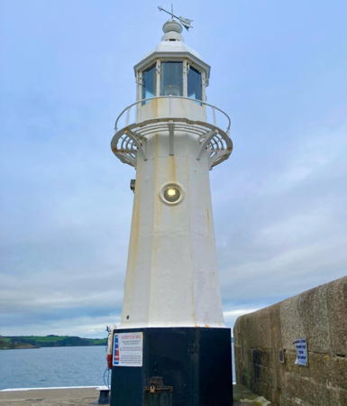
1896. Active; focal plane 9 m (30 ft); white light, 1.5 s on, 2 s off, 1.5 s on, 5 s off. 8 m (27 ft) hexagonal cast iron tower, painted white; base of the tower painted black. Fog horn (blast every 30 s). Roger Marks's photo is at right, Trabas has a closeup photo by Arno Siering, a 2007 photo is available, Marinas.com has aerial photos, and Google has a street view and a satellite view. The light is a sibling of the 1890 St. Ives Light (see below). Located at the end of the south breakwater in Mevagissey, about 7 km (4.5 mi) south of St. Austell. Site open, tower closed. Owner/site manager: Mevagissey Harbour Trustees. . ARLHS ENG-234; Admiralty A0078; NGA 0100.
Mevagissey Light
Mevagissey Light, July 2010
Flickr Creative Commons photo by Roger Marks

Falmouth Area Lighthouses
* St. Anthony (St. Anthony's Head)
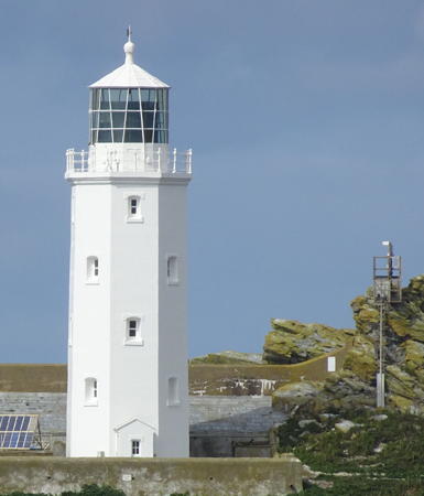
1835. Active; focal plane 22 m (72 ft); white light, 7.5 s on, 7.5 s off; red light is shown to the south southeast over the Manacles Rocks. 19 m (62 ft) octagonal cylindrical stone tower with lantern and gallery attached to 2-story keeper's house; 1st order Fresnel lens. Building painted white; inactive fog signals on the rear of the gallery are black. Fog horn (3 blasts every 30 s). An outbuilding called the Sally Port Cottage is available for holiday accommodations. Jess Bell's 2023 photo is at the top of this page, Photographer's Resource has a several good photos, Trabas has a closeup by Arno Siering, Paul Hart has a closeup photo, and Google has a satellite view. The lighthouse marks the eastern entrance to Carrick Roads, the harbor of Falmouth. Located at the end of Military Road off the A3078 southwest of Portscatho. Parking available. Site and tower closed, but the lighthouse can be viewed at close range. Operator/site manager: Trinity House. . ARLHS ENG-141; Admiralty A0062; NGA 0068.
Black Rock
Date unknown. Active; focal plane about 9 m (30 ft); two white flashes every 10 s. Approx. 9 m (30 ft) mast atop a conical stone tower. The tower is unpained; mast painted black with a red horizontal band. Trabas has Eckhard Meyer's photo and Google has a satellite view. Located on a reef on the west side of the entrance to Falmouth, opposite the St. Anthony's Head lighthouse. Accessible only by boat. Site open, tower closed. Admiralty A0065.15.
**** The Lizard (2) (Twin towers)
1752 (Thomas Fonnereau). Station established 1619. East tower active; focal plane 70 m (230 ft); white flash every 3 s. West tower inactive since 1903. Twin octagonal cylindrical stone towers connected by a 2-story stone keeper's quarters; the east tower is 19 m (62 ft) tall with its lantern, 1st order Fresnel lens, and gallery. The lantern of the west tower has been removed. Building painted white. Fog horn (blast every 30 s). The signal station nearby was built by Lloyd's of London to report ship arrivals. Anabel Baranowska's 2023 photo is at right, Chris Bradley has a photo, Photographer's Resource has an excellent page with numerous photos, Trabas has a closeup photo of the east tower by Klaus Kern, Wikimedia has several photos, Huelse has a historic postcard view, and Google has a street view and an excellent satellite view. The Lizard, a peninsula southeast of Penzance, is the southernmost point of Great Britain; its name does not refer to reptiles but is an English spelling of a Cornish word lysardh meaning a high point or headland. This famous lighthouse has been a traditional landfall for ships arriving in England for more than 250 years. Visitor facilities at the lighthouse were operated by the Trevithick Trust for many years. In 2004 the lighthouse was closed for renovations and during the same year the trust went out of operation. Trinity House then took over the visitor facilities and reopened the lighthouse on 1 May 2005. In July 2009 the Trinity House Lizard Lighthouse Heritage Centre was opened in the station's engine building. Located on the point at the end of the A3083 highway (Lighthouse Road) from Helston. Parking provided. Site open, visitor center and tower open daily in season: check the web site for the current schedule). Operator: Trinity House. Site manager: Lizard Lighthouse Heritage Centre . ARLHS ENG-068; Admiralty A0060; NGA 0064.

East Tower, The Lizard, Landewednack, May 2023
Instagram photo by Anabel Baranowska

Penzance Area Lighthouses
* Marazion (?)
Date unknown. Inactive. Approx. 4 m (13 ft) octagonal brick castellated tower; the light was displayed through a window. Dan Cartwright has a 2021 photo and Google has a satellite view. According to Michael Millichamp lights were shown through a window of the tower, but no evidence has been found that it was ever an official aid to navigation. Located at the end of Leys Lane in Marazion, on Mount's Bay opposite St. Michael's Mount, about 8 km (5 mi) east of Penzance. Site open, tower closed. ARLHS ENG-331.
* Penzance South Pier (3)
1853 (station established 1818). Active; focal plane 11 m (37 ft); flash every 5 s, white to the southeast and red in other directions. 10 m (31 ft) round cylindrical cast iron post with lantern, painted white with a broad black band at the base. Trabas has a closeup photo by Arno Siering, Henry Harding has a 2021 photo, Wikimedia has several good photos, Rob Bastin has a street view, and Google has a satellite view. The tower was prefabricated by the Copperhouse Foundry at Hayle; the original gallery was removed in the 1950s. Located in Penzance at the end of the south pier, also called the Lighthouse Pier, near the Isles of Scilly ferry terminal. Site open, tower closed. Operator/site manager: Cornwall Council (Penzance Harbour). . ARLHS ENG-240; Admiralty A0046; NGA 0048.
* Newlyn Harbour South Pier (2)
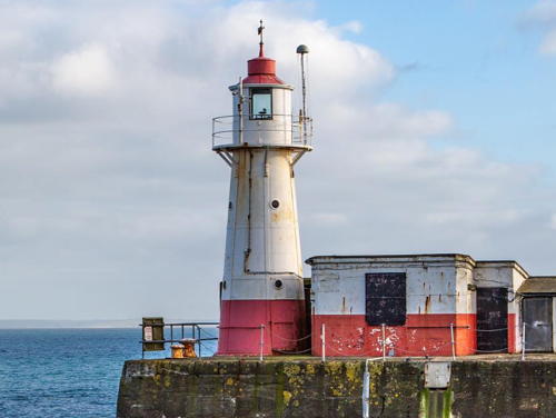
1914 (station established 1887). Active; focal plane 10 m (34 ft); white flash every 5 s. 10 m (34 ft) round cast iron tower, painted white; the top of the lantern is red and there is also a red band at the base of the tower. Ian Robson's 2020 photo is at right, Trabas has a closeup photo by Stephan Hix, Jon Law has a good closeup, and Google has a satellite view and a distant street view. The original light was a cast iron tower very similar to the present light; it was replaced when the pier was extended by 90 ft (27 m). The present light was prefabricated in London by Butler Brothers. Located at the end of the pier in Newlyn, on the south side of Penzance. Accessible by walking the pier. Site open, tower closed. Operator/site manager: Newlyn Pier and Harbour Commission. . ARLHS ENG-236; Admiralty A0038; NGA 0040.

Newlyn Harbour South Pier Light, August 2020
Instagram photo by Ian Robson

Land's End Lighthouses
Land's End is the picturesque and stormy headland at the extreme southwestern tip of Cornwall and of England. Located at the end of the A30 highway, the cape is a popular tourist attraction with a visitors' center and a large parking area.
* Tater Du
1965 (Michael H. Crisp). Active; focal plane 34 m (112 ft); three white flashes, separated by 2.5 s, every 15 s. 15 m (50 ft) round cylindrical concrete block tower with lantern and gallery, painted white, rising from 1-story service building. Fog horn (two blasts every 30 s). Trabas has a closeup by Klaus Kern, Photographer's Resource has an excellent page with numerous photos, Rene Schoeters has a good photo, Tony Kerr has another photo, and Google has a satellite view. The lighthouse was built after the Spanish freighter Juan Ferrar wrecked nearby in 1963 with the loss of 11 lives. The name Tater Du is corrupted Cornish and its original meaning is uncertain. Located on a headland about 6 km (4 mi) southwest of Penzance. The road to the light station is not open to the public but the lighthouse is accessible by hiking about 3 km (2 mi) from Lamorna Cove on the South West Coast Trail. Site open, tower closed. Operator/site manager: Trinity House. . ARLHS ENG-152; Admiralty A0032; NGA 0032.
* [Gwennap Head Range Beacons]
1821. Two 4 m (13 ft) round conical stone daybeacons, 67 m (220 ft) apart. The front beacon is painted bright red, while the rear beacon is painted black with a white horizontal band. Niger Homer has a good photo, Peter King has a 2023 photo, and Google has a satellite view. Built by Trinity House, the beacons warn vessels away from the Runnel Stone, a hazardous pinnacle offshore. Located on Gwennap Head, the southeastern point of Land's End. Accessible by walking the South West Coast Trail. Site open. .
Wolf Rock
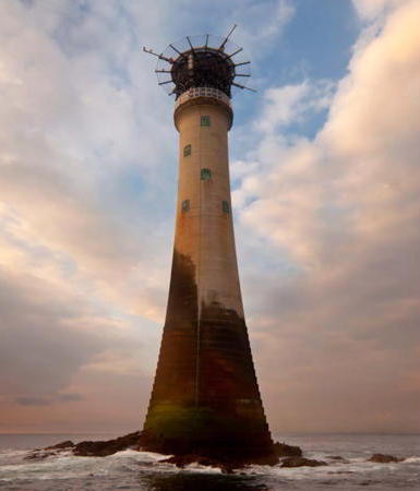
1869 (James Walker and William Douglass). Active; focal plane 34 m (112 ft); white flash every 15 s. 41 m (135 ft) round granite tower, incorporating keeper's quarters, with lantern and a helipad built above the lantern. The tower is unpainted gray stone; lantern painted white. Fog horn (one 2.5 s blast every 30 s). The concrete base of an 1840 daybeacon also survives on the rock. Henry Harding's 2021 photo is at right, Photographer's Resource has a good page for the lighthouse, Simon Clode has a good photo, Gregory Rees has a 2021 photo, Trabas has a closeup photo by Kees Aalbersberg, and Huelse has a historic postcard view, but the lighthouse is not shown in Google's satellite view. This lighthouse took 8 years to build under very severe conditions. The helipad above the lantern, the first of its kind in the world, was added in 1972. Located on a bare rock about 6.5 km (4 mi) southwest of Land's End. Accessible only by helicopter; distantly visible from Gwennap Head. Site and tower closed. Operator/site manager: Trinity House. . ARLHS ENG-170; Admiralty A0030; NGA 0028.

Wolf Rock Light, July 2021
Google Maps photo by Henry Harding
Longships (2)
1873 (James Douglass) (station established 1791). Active; focal plane 35 m (115 ft); red or white light, depending on direction, 5 s on, 5 s off, shown day and night. 35 m (115 ft) round granite tower, incorporating keeper's quarters, with lantern and a helipad built above the lantern. The tower is unpainted gray stone; lantern painted white. Fog horn (blast every 10 s). A 2024 photo by Joseph Jones is at the top of this page, Wikimedia has Lewis Clarke's 2011 photo, Photographer's Resource has a good page for the lighthouse, Trabas has a distant view by Douglas Cameron, Paul Bayfield has a 2008 photo, a 2020 photo shows a helicopter landing or leaving the helipad. Huelse has a historic postcard view, and Google has a satellite view. The original light was 24 m (79 ft) above the sea, but it had to be replaced because storm waves so often obscured the light. Even today great waves sometimes break over the lighthouse: there are dramatic photos taken 10 March 2008 (see the third and fourth row of photos on the page). Located on Carn Bras, largest of the Longships Rocks, about 2 km (1.25 mi) west of Land's End. Accessible only by boat or helicopter; distantly visible from Land's End. Site and tower closed. Operator/site manager: Trinity House. . ARLHS ENG-069; Admiralty A0028; NGA 0024.
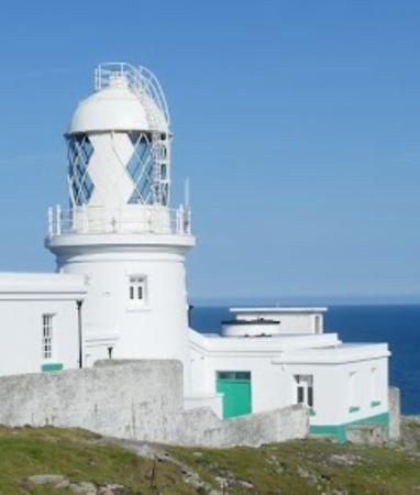
* Pendeen
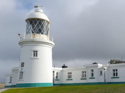
1900. Active; focal plane 59 m (195 ft); four white flashes, separated by 2.2 s, every 15 s. 17 m (56 ft) concrete-clad rubblestone tower, attached to 1-story keeper's houses. Entire building painted white. Original rotating 1st order Fresnel lens in use. Electronic fog horn (blast every 20 s). Original fog signal building with two diaphone horns. The 1-story keeper's house complex has four apartments; two are occupied by attendants and the other two are available for vacation rental. Christianne Cherry's 2022 photo is at right, Trabas has a closeup photo by Arno Siering, Roger Holfert also has a closeup photo, George Charleston has a photo of the station, Huelse has a historic postcard view, and Google has a closeup street view and a fine satellite view. This historic and well-preserved light station is one of the most popular tourist attractions of the Land's End area. Located on the promontory called Pendeen Watch, about 2 km (1.2 mi) north of the B3306 highway at Pendeen. Accessible by road, parking provided. Site open, tower closed. Operator: Trinity House. . ARLHS ENG-100; Admiralty A5670; NGA 6304.

Pendeen Light, Pendeen, October 2022
Google Maps photo by Christianne Cherry

Isles of Scilly Lighthouses
The Isles of Scilly, (pronounced silly in English, syllan in Cornish) are located 45 km (28 mi) southwest of Land's End and are accessible by ferry from Penzance. There are five inhabited islands and about 135 islets and rocks in the group. The permanent population is about 2300. The islanders have their own county council, independent of the Cornwall Council.

Bishop Rock
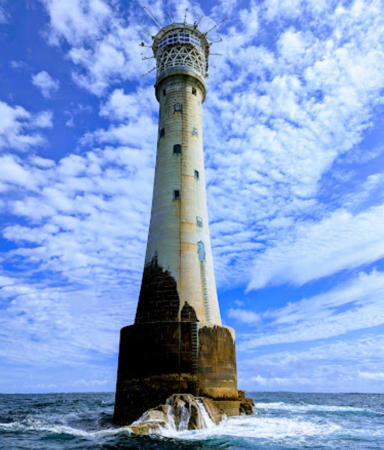
1858 (substantially rebuilt in 1887) (James Walker (1858) and James Douglass (1887)). Active; focal plane 44 m (144 ft); two white flashes every 15 s. 51 m (167 ft) round granite tower, incorporating keeper's quarters, with lantern and a helipad built above the lantern. Tower is unpainted gray stone; lantern and helipad painted white. A hyper-radiant Fresnel lens is in use, giving the light a range of 20 nautical miles (37 km or 23 mi). Fog horn (one long and one short blast every 90 s). Jim MacDonald's 2023 photo is at right, Photographer's Resource has a good page for the lighthouse, Trabas has a small closeup by Joan and Gary Trigwell, a 2021 closeup is available, Murray Nurse also has a closeup, and Google has a satellite view. This is one of the world's most famous and most exposed lighthouses: on one occasion giant waves ripped the fog bell from the gallery. The engineer James Walker first built a 42 m (138 ft) skeletal tower on the reef, believing that the skeletal design would allow waves to pass through the tower. The ocean demonstrated otherwise, destroying the tower in February 1850 before it was completed. Walker then constructed a 35 m (115 ft) masonry tower, completed in September 1858. Its successful construction was rightly considered a triumph of British engineering. Douglass inspected the tower in 1881 and found that it had been damaged by wave action. He ordered the lighthouse to be strengthened and heightened by 12 m (39 ft) by building what amounted to a new tower completely enclosing the old one. A new lantern increased the height by another 4 m (13 ft). The helipad was added in 1973. A giant "double" Fresnel lens, with two lights, was installed when the lighthouse was rebuilt in 1887. Only the lower lens was used most of the time, but both lights were lit in the fog. The upper half of this unusual lens is on display at the National Maritime Museum Cornwall in Falmouth\. Keepers manned the station until December 1992. Keeper's houses for off-duty keepers survive in St. Mary's. Located on a bare rock pinnacle 6 km (4 mi) west of the Isles of Scilly. Accessible only by helicopter; visible distantly from St. Agnes. Site and tower closed. Operator/site manager: Trinity House. . ARLHS ENG-010; Admiralty A0002 (the very first lighthouse in the Admiralty List of Lights & Fog Signals); NGA 0004.

Bishop Rock Light, Isles of Scilly, Augsut 2023
Google Maps photo by Jim MacDonald
* St. Agnes
1680. Inactive since 1911. 18 m (59 ft) round stone tower with lantern and gallery, painted white. Chris Downer has a good photo, the BBC has posted a photo by Beth Hilton, Terry Burgess has another good photo, Andrew Abbott has a street view, and Google has a satellite view. One of the oldest surviving British lighthouses, this tower was built for Trinity House by Capt. Hugh Till and Capt. Symon Bayly. The lighthouse is still owned by Trinity House but the adjacent 2-story keeper's houses are leased as a private residence. The original coal chauffer, an open container used with no lens, is on display at the botanical gardens on the Isle of Tresco. The lighthouse was replaced by the Peninnis Head Light (next entry). Located at the highest point of St. Agnes, southwesternmost of the main Isles of Scilly. Site and tower closed, although the lighthouse can be viewed from nearby. Owner: Trinity House; site manager: private. ARLHS ENG-140.
* Peninnis Head
1911. Active; focal plane 36 m (118 ft); white flash every 20 s. 14 m (46 ft) round steel tower, lower half skeletal and upper half enclosed, with lantern and gallery. Lantern and watch room painted white; skeletal legs and lantern dome painted black. 1-story equipment building. A 2022 photo is at right, Bob Embleton has a good 2008 photo, Trabas has an excellent photo by Arno Siering, Jo Parsons has a good closeup, Andrew Abbott has a street view, and Google has a satellite view. Located at the southernmost point of St. Mary's, the largest of the Isles of Scilly. Accessible by road. Site open, tower closed. Operator/site manager: Trinity House. . ARLHS ENG-102; Admiralty A0006; NGA 0008.
Round Island
1887. Active; focal plane 55 m (180 ft); white flash every 10 s. 19 m (63 ft) round stone tower with lantern and gallery, painted white, attached to a 1-story stone keeper's house. Fog horn (four blasts every 60 s). Jo Parsons has a good photo, Lubo Klobuk has a 2020 view from the sea, Trabas has a very distant view by Arno Siering, and Google has a satellite view. Located on the northernmost of the Isles of Scilly, a bare rocky island northeast of Tresco. Accessible only by boat or helicopter. Site and tower closed. Operator/site manager: Trinity House. ARLHS ENG-118; Admiralty A0018; NGA 0016.
* [St. Martin's Beacon]
1683. Inactive daybeacon. 11 m (36 ft) round granite tower with a cylindrical base 6.4 m (21 ft) high topped by a sharply conical top. Beacon painted with red and white horizontal bands. Nick Weall has a good photo, Jo O'callaghan has a 2021 closeup, Rob Bastin has a street view and Google has a satellite view. Claimed to be Britain's oldest surviving beacon, this historic tower was built by Thomas Ekins. Originally painted white, it was changed to red in the 19th century and to its banded appearance in recent years. Located on the northeastern point of St. Martin's, the northernmost inhabited island of the Isles of Skilly. Site open, tower closed. .

Peninnis Head Light, Isles of Scilly, July 2022
Instagram photo by ellen_3.1
Lightship Sevenstones (Seven Stones)
Station established 1841. Active; focal plane 12 m (39 ft); three white flashes every 30 s. Fog horn (three 2 s blasts every 60 s). Steel lightship; light tower with lantern amidships. Entire vessel painted red. The Trinity House photo shows LV-19 on this station. Alan Denham has a 2005 photo showing LV-20, Wikipedia's page has a photo of LV-7 on the station in 2007, and ShipSpotting.com has a photo showing LV-2 in port with Seven Stones markings. Lightships on this station have been automated and unmanned since 1987. The light marks the western edge of the shipping lanes between the Scilly Isles and Land's End. Located on a reef northeast of the Scilly Isles and due west of Land's End. Site open, vessel closed. ARLHS ENG-124; Admiralty A0020; NGA 0020.

St. Ives Bay Lighthouses
St. Ive's is a resort town and former fishing port, known also as an artists' colony. It has a permanent popultion of about 11,000.

* St. Ives (1)
1831 (James and Edward Harvey). Inactive since 1890. 6 m (20 ft) square cylindrical stone tower with octagonal gallery and a broad observation room instead of a traditional lantern. A fine closeup is available, Wikimedia has a 2010 photo, and Google has a street view and a satellite view. This tower is mounted on the original harbor wall built by John Smeaton in 1770, but the common belief that Smeaton also built the lighthouse is not correct. After deactivation in 1890 the building was used as a store. The lighthouse was restored in the late 1990s after being nearly destroyed by fire in 1996. Located on the waterfront in St. Ive's. Site open, tower closed. Owner/site manager: Cornwall Council. ARLHS ENG-144.
* St. Ives (2)
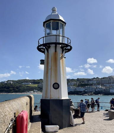
1890. Active; focal plane 8 m (27 ft); two continuous green lights, one above the other. 10.5 m (32 ft) cast iron tower with lantern and gallery mounted on an octagonal stone base. Lighthouse painted white, base black. Tony Perreira's 2022 photo appears at right, Trabas has a closeup photo by Arno Siering, Peter Ford has a 2022 photo, Wikimedia has a 2010 photo, and Google has a street view and a satellite view. This light was prefabricated in Bath by Stothert and Pitt, Ltd. A well known symbol of the town, it was repaired and repainted in the spring of 2016. The lantern from a post light that was near this location for several years in the late 1860s is on display at the St. Ives Museum. Located at the end of the extension (1890) to Smeaton's Pier in St. Ive's; accessible by walking the pier. Operator: Cornwall Council. ARLHS ENG-276; Admiralty A5665; NGA 6296.

St. Ives Light, August 2022
Google Maps photo by Tony Perreira
Hayle Old Rear
Date unknown (station established 1840). Active; focal plane 23 m (75 ft); continuous white light. 4.5 m (15 ft) square wood tower standing on four wood piles. The light is shown through a small opening. Lighthouse painted white with a red horizontal band. Trabas has a photo, Andreas Köhler has a 2018 photo, and Google has a satellite view. The range has been discontinued; the front light was on a similar but smaller structure. Located on the west side of the entrance to the River Hayle, north of Lelant, adjacent to the West Cornwall Golf Club. Site open, tower closed. Admiralty A5658.1; NGA 6292.
Godrevy Island (1)
1859 (James Walker). Inactive since 2012. 26 m (86 ft) octagonal cylindrical stone tower, painted white. Keepers houses demolished; oil house survives. Trabas has Andreas Köhler's 2018 photo is at right, Photographer's Resource has a good page for the station, Wikimedia has a photo, Stuart Graham has a 2019 photo, Tim Hanham has the view from the mainland, Huelse has a historic postcard view, and Google has a satellite view. The author Virginia Woolf spent holidays at Talland House in St. Ives, and her view of this lighthouse inspired the writing of her most famous work, To the Lighthouse (1927). In January 2005 a permit was issued to build apartments that would block this view. The apartments were not built. Soon thereafter Trinity House announced plans to deactivate the light but in August it backed down in the face of widespread protests. In 2012 Trinity House announced once again that the lighthouse would be deactivated and replaced by a smaller light at the end of August. The new light (focal plane 28 m (92 ft); flash every 10 s, white or red depending on direction) is on a post next to the lighthouse; it is seen to the right of the lighthouse in Köhler's photo. The island (but not the lighthouse) was bought by Dennis Arbon, who subsequently donated it to Hall for Cornwall, a local theater organization. In 2009 the Hall placed the land for sale, but the buyer must maintain public access to the lighthouse. In 2014 Trinity House approached local authorities about possibly transferring management of the lighthouse but then changed its mind and announced it would maintain the tower as a daybeacon. Located about 500 m (0.3 mi) off Godrevy Point near Gwithian at the northeastern entrance to St. Ives's Bay. Accessible only by boat, but there are good views from the Southwest Coast Path. Ample parking is available nearby. Site open, tower closed. Owner: Trinity House. Site manager: unknown. . ARLHS ENG-047; ex-Admiralty A5654. Active light: Admiralty A5655; NGA 6284.

Godrevy Island Light, Cornwall, September 2018
photo copyright Andreas Köhler; used by permission

Portreath Beacons
* Portreath
Date unknown. Inactive. Approx. 6 m (20 ft) cylindrical tower topped by a short mast that formerly held a navigation light. Roland Merrick has a photo, Gareth Hood has a street view, and Google has a satellite view. Michael Millichamp rediscovered this forgotten lighthouse in his survey of English lights. It is known locally as the "Monkey Hut." Located at the end of the Landmark Pier in Portreath. Accessible by walking the pier. Site open, tower closed. Owner/site manager: unknown. ARLHS ENG-324.
* [Portreath Beacon]
Date unknown. Daybeacon, never lit. 7.5 m (25 ft) round stone tower, painted white. Ian Garfield has a closeup 2013 photo and Google has a street view and a satellite view. We need information on the history of this beacon, known locally as the Pepperpot. Located on Lighthouse Hill on the east side of the entrance to Portreath. Site open, tower closed.

Newquay and Padstow Lighthouses
* [Newquay Huer's Hut]
Date unknown. A prominent daybeacon, possibly used as a lighthouse. Approx. 7 m (23 ft) whitewashed rubblestone building with a prominent square chimney. The Cornwall Guide also has a nice page for the building, Tim Cracknell has a 2016 closeup photo, David Long has a photo and a second photo of the explanatory plaque, and Google has a street view and a satellite view. This building is reputed to date from the 14th century, although some historians question that early date. It served as a watch station for huers, men hired during the pilchard season to watch for schools of the fish and alert local fishermen to take to the sea if fish were sighted. Lights might also be displayed to assist the boats on their return, although there's no evidence that the building was used otherwise as a lighthouse. Located on a promontory at the entrance to the harbor of Newquay. Site open, tower closed. .
* Trevose Head (High)
1847. Active; focal plane 62 m (204 ft); white flash every 7.5 s. 26.5 m (87 ft) brick tower with lantern and gallery attached to two 1-story keeper's houses. Rotating 1st order Fresnel lens (1913) in use. Fog horn (2 blasts every 30 s). Entire light station painted white. Melissa Zillwood's 2024 photo is at right, Photographer's Resource has several photos, Trabas has a good closeup by Arno Siering, West Country Views has a fine portfolio of photos, Frazer Mountford has a street view, and Google has a good satellite view. Four keeper's cottages are available for vacation rental. In 2016 the surrounding property, some 88 ha (217 acres), was for sale for £4 million. Trevose Head is a peninsula at the northwestern tip of Cornwall. The former low light was discontinued in 1882. Located about 8 km (5 mi) northwest of Padstow. Site and keeper's house open to paying guests, tower closed. The lighthouse can be viewed from nearby on the Southwest Coast Path. Operator/site manager: Trinity House. . ARLHS ENG-157; Admiralty A5638; NGA 6272.
* [Padstow South Quay]
1868. Active; focal plane 7 m (23 ft); two continuous red lights, one above the other. 6 m (20 ft) cast iron lamppost, painted red and topped by short mast. A ladder is attached to provide access to the light. Trabas has a photo by Stephan Hix and Google has a street view and a satellite view. This minor light is of interest as a rare mid-nineteen century pier light. Padstow is a fishing port on the estuary of the River Camel. Located at the end of the south quay of the harbor. Accessible by walking the pier. Site open, tower closed. Operator/site manager: Padstow Harbour Commissioners. Admiralty A5636; NGA 6264.

Trevose Head Light, Padstow, February 2024
Instagram photo by Melissa Zillwood

Devon North Coast (Bristol Channel) Lighthouses

The North Devon coast faces South Wales across the Bristol Channel, a broad inlet of the Celtic Sea leading to the mouth of the River Severn. Before modern times it was often called the Severn Sea, and its Welsh name Môr Hafren means Severn Sea.

Torridge District: Lundy Island Lighthouses
Lundy Island is located in the mouth of the Bristol Channel about 20 km (13 mi) northwest of Hartland Point. The island is accessible by ferry from Bideford or Ilfracombe from late March through the end of October or by helicopter from Hartland Point on Mondays and Fridays during the winter. There is one small settlement on the island, with about 25 residents, and overnight accommodations are available. The entire island is owned by the National Trust and managed by the Landmark Trust.
* Lundy Island South
1897. Active; focal plane 53 m (175 ft); quick white flash every 15 s. 16 m (52 ft) cylindrical brick tower with lantern and gallery attached to two 1-story keeper's houses. Solar-powered lens in the lantern. The fog horn (blast every 25 s) is mounted atop the lantern. All buildings painted white. Photographer's Resource has a page for the lighthouse, Trabas has an excellent photo, Henning Gieseke has a 2020 photo, Mark Jervis has a good 2013 photo, Paul Hollinghurst has a distant street view, and Google has a satellite view. Located atop cliffs at the southern tip of the island, near the ferry terminal, where it is more accessible to visitors than the north light. Site open, tower closed. Operator: Trinity House. . ARLHS ENG-075; Admiralty A5618; NGA 6248.
*** Lundy Island (Old Light)
1820 (Joseph Nelson and Daniel Alexander). Inactive since 1897. 29 m (96 ft) granite tower with lantern and gallery, connected to two 2-story keeper's houses. An additional 1-story keeper's cottage is nearby. The buildings are unpainted stone; lantern painted white. All three keeper's houses are available for vacation rental. Simon Isherwood has a 2023 photo, Shaun Wallin has an excellent closeup, Wikimedia has numerous photos, Paul Hollinghurst has a street view, and Google has a satellite view. Located on Beacon Hill, the highest point of the island. Site open, keeper's houses open to paying guests, tower open for climbing. Owner: Landmark Trust. Site manager: Lundy Island Company. . ARLHS ENG-073.
Lundy Island North
1897. Active; focal plane 48 m (157 ft); quick white flash every 5 s. 17 m (56 ft) cylindrical brick tower with lantern and gallery attached to two 1-story keeper's houses. All buildings painted white. Duncan Cumming's 2021 photo is at right, Photographer's Resource has a page for the lighthouse, Trabas has a great photo, Christine Elliott has also posted a good photo, Wikimedia has photos, Huelse has a historic postcard view, Paul Hollinghurst has a street view, and Google has a satellite view. This light marks the south side of the entrance to the Bristol Channel. When the station was solarized in 1991 the light was moved to the roof of the small fog signal tower on the north side of the lighthouse, as seen in Steve Hodgson's 2007 photo. In September 2018 Trinity House announced plans for a general restoration of the lighthouse that would return the light to the lantern room. Located atop cliffs at the northern tip of the island; accessible by a rough walk of 10 km (6 mi) roundtrip. Site open, tower closed. Operator: Trinity House. ARLHS ENG-074; Admiralty A5616; NGA 6244.

Lundy Island North Light, August 2021
Google Maps photo
by Duncan Cumming

Torridge District: Mainland Lighthouses
Hartland Point
1874 (James Douglass). Inactive since 2012. 18 m (59 ft) brick tower with lantern and gallery, painted white, attached to 2-story service building. The keeper's houses were demolished in 1984 to make room for a helipad. A 2022 photo is at right, Robert Cooper has a photo, Wikimedia has numerous photos, a 2022 photo is available, and Google has a satellite view. A seawall was built in 1925 to protect this clifftop station from erosion of the cliff. In January 2010 Trinity House proposed that the light be deactivated. After many protests it agreed in May to continue the light at reduced power, but the light was finally extinguished early in 2012. The active light is on a short post in front of the lighthouse (focal plane 30 m (98 ft); six quick white flashes every 15 s). In July 2015 Trinity House placed the lighthouse on sale for £450,000. The historic Fresnel lens, removed from the lighthouse, was stolen from a storage facility near Ilfracombe in January 2022. Hartland Point is a right-angled turn in the coastline at the extreme southwestern entrance to Bristol Channel. Located about 5 km (3 mi) northwest of Hartland. The nearest parking is at Titchberry about 2 km (1.25 mi) from the point. Some local guidance may be needed. Site and tower closed. Owner: Trinity House. . ARLHS ENG-051; ex-Admiralty A5622. Active light: Admiralty A5621; NGA 6252.
* Instow Range Front (2)
1990 (station established 1820). Active; focal plane 22 m (72 ft); white light, 5 s on, 1 s off, day and night. 18 m (59 ft) square steel skeletal tower with gallery and a rectangular, vertically-slatted daymark. Entire lighthouse painted white. Trabas has a photo and Google has a street view and a satellite view. The range guides ships through the narrow channel into the River Taw. The original wood lighthouse was replaced after being heavily damaged by a storm in January 1990. Located on the west bank of the Taw on the north side of Instow, adjacent to the clubhouse of the North Devon Cricket Club. Site open, tower closed. Operator: Torridge District Council (Port of Bideford). ARLHS ENG-204; Admiralty A5610; NGA 6232.
* Instow Range Rear (2?)
Date unknown (station established 1820). Active; focal plane 38 m (126 ft); white light, 7.5 s on, 2.5 s off, day and night. 8.5 m (28 ft) square skeletal tower with gallery mounted atop a 1-story equipment hut, painted white. Trabas has Arno Siering's closeup photo, and Google has a street view and a satellite view. Located in the middle of a sheep pasture just off Rectory Lane on the northwest side of Instow, 425 m (1/4 mi) west southwest of the front light. Site open, tower closed. Operator: Torridge District Council (Port of Bideford). ARLHS ENG-254; Admiralty A5610.1; NGA 6236.

Hartland Point Light, Titchberry, May 2022
Google Maps photo by Chart 2021

North Devon District Lighthouses
* [Crow Point (Braunton Sands Low) (2)]
1954 (station established 1820). Active; focal plane 8 m (27 ft); flash every 5 s, white or red depending on direction. 5 m (16 ft) square pyramidal steel skeletal tower, painted white; no lantern. Trabas has a distant photo, Helen Gough has a photo, Simon Birch has a closeup, and Google has a satellite view. Originally there were high and low lighthouses at Braunton Sands; the high light was a remarkable octagonal wood tower mounted atop a 2-story keeper's house. A historic photo is available. These lights were demolished in 1957. Located on a sandy spit just inside the entrance to the River Taw opposite Instow. It should be possible to walk out to the light. Operator: Trinity House. ARLHS ENG-030; Admiralty A5612; NGA 6240.
* Bull Point (3)
1976 (station established 1879). Active; focal plane 54 m (177 ft); three white flashes every 10 s; also a continuous red hazard light is shown westward over Rockham Shoal. 12 m (35 ft) square cylindrical brick tower with lantern and gallery, attached to 1-story utility building. Four keeper's cottages are available for vacation rental. Roger Day's 2023 photo is at right, Photographer's Resource has a good page for the lighthouse, Wikimedia has photos, Trabas has a closeup photo by Arno Siering, a 2022 photo is available, David Lennard has a street view, and Google has a satellite view. Huelse has a historic postcard view of the original lighthouse. This clifftop light station is highly vulnerable to erosion. In September 1972 a large slide destroyed the fog signal building and threatened the lighthouse, forcing Trinity House to replace both structures. A temporary lighthouse (a skeletal tower with lantern and gallery) was relocated to serve while the present lighthouse was designed and built. Located on the point about 2 km (1.2 mi) north of Mortehoe. Accessible by a popular hike from Mortehoe on the South West Coast Path. Site open, keeper's house open to paying guests, tower closed. Operator/site manager: Trinity House. . ARLHS ENG-017; Admiralty A5600; NGA 6228.
* Ilfracombe (Lantern Hill)
1819. Active; focal plane 39 m (127 ft); green flash every 2.5 s. 11 m (37 ft): white lantern mounted atop the 1-1/2 story stone Chapel of St. Nicholas. Trabas has a photo by Arno Siering, a 2021 photo is available, Jill Everington has a view across the harbor, Paul Hollinghurst has a rainy street view, and Google has a satellite view. The chapel dates from about 1320 and navigational lights were shown from it beginning around 1650. The current light tower was added by Trinity House in 1819. Located atop a steeply conical hill above the harbor of Ilfracombe. Site open, chapel open regularly for services, tower closed. Operator: North Devon District Council. . ARLHS ENG-059; Admiralty A5594; NGA 6220.

Bull Point Light, Mortehoe, July 2023
Google Maps photo by Roger Day
* Rhenish Tower
Mid 1800s (rebuilt 1954). Inactive but a decorative light is (sometimes?) displayed; charted as a landmark. Approx. 10 m (33 ft) square unpainted rubblestone tower. Exmoor National Park has a page for the tower, Maurice Clements has a photo, and Google has a street view and a satellite view. This structure was privately built, apparently as a water tower, but there is a strong local tradition that an electric light was shown for some years to guide vessels in the harbor. There's no evidence that it was ever an official aid to navgation. Largely destroyed by a storm in 1952, it was rebuilt in 1954. Located on the quay at Lynmouth. Site open, tower closed. .
* Lynmouth Foreland (Foreland Point)
1900. Active; focal plane 67 m (220 ft); four white flashes, separated by 2.2 s, every 15 s. 15 m (50 ft) cylindrical brick tower with lantern and gallery attached to 1-story keeper's house. 1st order Fresnel lens in use. A photo is at right, Don Cload has a photo, Photographer's Resource has a good page for the lighthouse, Lighthouse Digest has a good photo by John Mobbs, Trabas has a closeup of the lantern, Steve Johnson has another fine closeup, and Google has a satellite view. The keeper's house is available for vacation rental. Land surrounding the lighthouse is included in Exmoor National Park. Located on Foreland Point, a steep headland about 5 km (3 mi) east of Lynton. There is a winding service road to the lighthouse, used by cottage guests, but other visitors generally view the station from above on the South West Coast Path. (It's a long climb down to the lighthouse.) There is a wonderful view across the Bristol Channel to the Welsh coast. Site open, keeper's house open to paying guests, tower closed. Operator: Trinity House. Site manager: National Trust. . ARLHS ENG-044; Admiralty A5590; NGA 6208.

Lynmouth Foreland Light, Lynton, October 2019
Google Maps photo

Information available on lost lighthouses:

Notable faux lighthouses:

Adjoining pages: North: Western England | East: Southern England

Return to the Lighthouse Directory index | Ratings key

Posted November 23, 2004. Checked and revised May 23, 2024. Lighthouses: 48; lightships: 1. Site copyright 2024 Russ Rowlett and the University of North Carolina at Chapel Hill.