Lighthouses of Northern Estonia (Harjumaa)

The Republic of Estonia (Eesti in Estonian) is a small country with a surprisingly long coastline. Surrounded on 2-1/2 sides by water, it faces the Gulf of Riga (Liivi Laht) on the southwest, the Baltic Sea (Läänemere) on the west, and the Gulf of Finland (Soome Lahe) on the north. The country includes two large islands in the Baltic, Saaremaa and Hiiumaa, and countless small islands. To guard these coasts, Estonia has more than 100 lighthouses and a well-developed lighthouse administration.

Estonia's independence is recent. The country was part of the Swedish Empire from 1625 to 1710 and then part of the Russian Empire from 1710 until the end of World War I in 1918. After two decades of independence it was incorporated into the Soviet Union from 1940 to 1990. Thus the older lighthouses are from the Russian Imperial period and some of the newer ones are of Soviet construction. An example from the imperial period appear at right: the old Suurupi lighthouse, built in 1760.

Estonia is divided into 15 counties (maakonnad) and the counties are subdivided into towns (linnad) and rural parishes (vallad). This page includes the lighthouses of the northern (Gulf of Finland) coast in Harjumaa (Harju County). This coastline was known historically as Revalia. Its major port, formerly called Reval, is now the Estonian capital of Tallinn.

Names in curly brackets {} are non-Estonian former names (Swedish or German).

In Estonian a lighthouse is a tuletorn (fire tower), a tulepaak (fire beacon), or a majakas (borrowed from the Finnish word majaka for a lighthouse). A daybeacon is called a päevamärk, saar is an island, poolsaar is a peninsula, madal or parv is shoal, kari is a reef, neem is a cape or headland, väin is a strait, jõgi is a river, and sadam is a port or harbor.

Lighthouses in Estonia were operated previously by the Estonian Maritime Administration (Veeteede Amet, or VTA). In 2021 the functions of VTA were folded into the Estonian Transport Administration (Transpordiamet).

ARLHS numbers are from the ARLHS World List of Lights. VTA numbers are from the web site of the Estonian Maritime Administration. Admiralty numbers are from volume C of the Admiralty List of Lights & Fog Signals. U.S. NGA List numbers are from Publication 116.

General Sources
Navigatsioonimärkide andmekogu (Database of navigation signs)
Copied from the former VTA web site, photos and data for all the VTA beacons.
Eesti Tuletorni Selts
Web site of the Estonian Lighthouse Society (in Estonian).
Insulaar - Aids to Navigation
This web site includes photos and data for navigational aids throughout Estonia.
Online List of Lights - Estonia
Photos by various photographers posted by Alexander Trabas.
Leuchttürme in Estland
Photos by Andreas Köhler taken in the summer of 2016.
Lighthouses in Estonia
Photos by various photographers available from Wikimedia.
World of Lighthouses - Estonia
Photos by various photographers available from Lightphotos.net.
Leuchttürme an der estländischen Ostseeküste
Photos of 8 Estonian lighthouses posted by Bernd Claußen.
Lighthouses Estonia
Photos by Joke Reijnen.
Six Remarkable Estonian Lighthouses
Information posted by Cybernetica AS, an Estonian manufacturer of aids to navigation.
Estonian Lighthouse Postcards
Historic postcard images posted by Michel Forand.
Leuchttürme...auf historischen Postkarten
This page, posted by Klaus Huelse, has 18 historic postcard views of Estonian lighthouses.
List of Lights - Estonia
The official light list for Estonia, with text in both Estonian and English, can be downloaded as a pdf document.
 
GPSNauticalCharts
Navigational chart information for Estonia.
Navionics Charts
Navigational chart for Estonia.


Suurupi Range Rear Light, Suurupi, October 2022
Instagram photo by Tiia Ambur
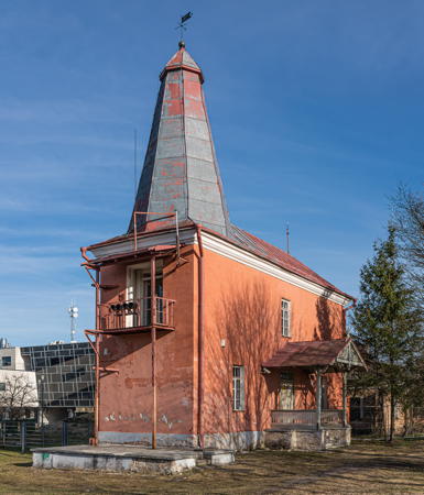

Tallinn Range Front Light, Tallinn, April 2022
Wikimedia Creative Commons photo by A. Savin
Lääne-Harju (West Harju) Parish Lighthouses
The parish capital is Paldiski, a seaport of about 4000 residents. The Soviet Union had a nuclear submarine base at Paldiski from 1962 until the end of Soviet control. In fact, Russian troops remained in Paldiski until Estonian border police took control of the town in 1993, and Russia did not surrender all of the base until 1995. Today Paldiski is a terminal for ferries from Kapellskär in Sweden.

#Risti (Ristina)
1955. Inactive since around 1980; dropped as a daybeacon in 2004 and apparently demolished. 26 m (85 ft) square cylindrical skeletal tower. The tower was covered on all sides by a slatted daymark. Google's indistinct satellite view appears to confirm the removal of the tower. The Wikipedia article says it was demolished in 2004 but Sven Vaarandi has a 2012 photo. Located on a promontory near the village of Ristina, at the western end of Harju County. Site open, tower closed. ex-VTA 408; ex-Admiralty C3762.
Krassi (3?)
2008 (station established by the 1940s). Active; focal plane 13.5 m (44 ft); two white flashes every 7 s. 9 m (30 ft) post, the upper 2/3 surrounded by a large square slatted daymark. Entire lighthouse painted red. Trabas has VTA's photo and Bing has a satellite view. VTA lists 1951 as the station establishment date but lights were listed here as early as 1945. This beacon marks an unstable shoal; at least two earlier beacons were lost to wave action. Located on a sandbar about 5 km (3 mi) west of the Suur-Pakri lighthouse (next entry). Accessible only by boat. VTA 405; Admiralty C3767; NGA 12755.
Suur-Pakri (3?)
2012 (station established 1923). Active; focal plane 13 m (43 ft); two white flashes every 12 s. 11 m (36 ft) round cylindrical white tower, upper portion surrounded by a round vertically slatted daymark structure, upper half red and lower half white. Trabas has VTA's photo, Tarmo Õunap has a photo, Leonid Malikov has a street view, and Google has a satellite view. The previous lighthouse was a square cylindrical skeletal tower, painted red, with a slatted daymark, painted white with a red band at the top. Located at the northwestern tip of Suur-Pakri (Big Pakri) island, about 13 km (8 mi) west of Paldiski. Site status unknown. VTA 404; Admiralty C3768; NGA 12756.
Väike-Pakri (2?)
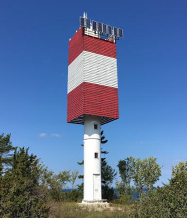
2012 (station established 1938). Active; focal plane 36 m (118 ft); white flash every 6 s. 16 m (52 ft) round cylindrical white tower, upper portion surrounded by a square daymark structure colored red with a white horizontal band. Trabas has VTA's photo (also seen at right), Tarmo Õunap has a photo, and Bing has a distant satellite view. The previous lighthouse was a square cylindrical skeletal tower, painted red, with a slatted daymark, painted white with a red band at the top; a closeup photo of that light is available. A Located on the northeastern tip of Väike-Pakri (Little Pakri) island, about 5 km (3 mi) northwest of Paldiski. Site status unknown. VTA 403; Admiralty C3769; NGA 12758.
* Madise Range Front
1955. Active; focal plane 22 m (72 ft); white light, 1 s on, 1 s off. 20 m (66 ft) square cylindrical steel skeletal tower with gallery, painted red. The front of the tower carries a large slatted daymark, painted white with a black vertical stripe on the range line. Trabas has Klaus Kern's photo and Bing has an indistinct satellite view. This range guides vessels into Paldiski Laht (bay). Located at the southeastern end of the bay. Site status unknown, but it should be easy to view the light; tower closed. VTA 401; Admiralty C3778; NGA 12765.

Väike-Pakri Light, Paldiski
VTA photo
* Madise Range Rear (Madise Kirik)
1955. Active; focal plane 18 m (59 ft) (?); white light, 2 s on, 2 s off. 15 m (49 ft) square church steeple with a tall square pyramidal spire; the light is apparently shown through a window at the top of the tower, below the spire. Trabas has Klaus Kern's photo, Estonian Wikipedia also has a photo, and Google has a street view and a satellite view. The listed focal plane is clearly incorrect, as the church stands atop a steep embankment. The church is the Madise (St. Matthew) Kirik; its tower was built in the 15th century and has always served as a daymark for mariners. Located in Madise, a town at the southeastern end of Paldiski Laht (bay), 600 m (0.37 mi) southeast of the front light. Site open, tower closed. . ARLHS EST-078; VTA 402; Admiralty C3778.1; NGA 12765.1.
* Pakri {Pakerort, Rågö} (2)
Date unknown (station established 1724). Inactive since 1808. Approx. 9 m (30 ft) round rubblestone tower, the stump of the historic 15 m (49 ft) lighthouse. A 1-story wood building atop the old tower is a Soviet-era signal station. Lauri Oherd has a good photo, Wikimedia has a photo, Köhler has a 2016 photo, Google has a good street view, Forand has a historic postcard view of the intact lighthouse, and Google has a satellite view. The first lighthouse was ordered by Tsar Peter the Great, who established a light station here only 6 years after building a naval base nearby at Paldiski. The first lighthouse was 12 m (39 ft) tall; this second one was raised in height by a 23 m (75 ft) stone tower in 1808. Endangered: coastal erosion is threatening the old structure and there are fears it will soon collapse over the cliff. Site open, tower closed.
*** Pakri {Pakerort, Rågö} (4)
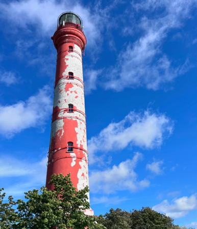
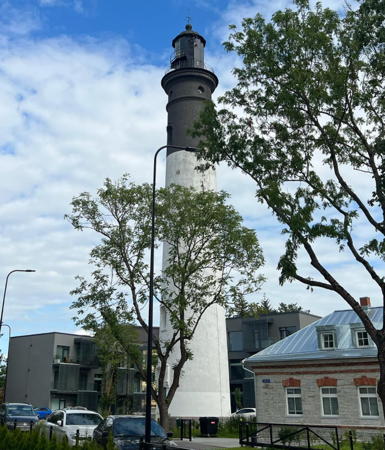
1889 (station established 1724). Active; focal plane 73 m (240 ft); white light, 5 s on, 10 s off. 52 m (171 ft) round red brick tower with lantern and gallery. Tower unpainted; lantern painted black, watch room and gallery red to match the brick. Trabas has the photo from VTA's page, Elena Kolomiets has a 2021 photo showing the tower much in need of repainting, a 2023 photo is available, Estonian Wikipedia has a page for the lighthouse, Forand has a historic postcard view, and Google has a street view and a satellite view. Köhler's 2016 photo shows the lighthouse already in need of repainting. Estonia's tallest lighthouse, this historic tower stands at the tip of a promontory projecting into the Gulf of Finland, making it an important guide for ships proceeding up the Gulf. Huelse has a historic photo of the lighthouse standing near the shorter square lighthouse built in 1808. Located at the tip of Pakri Neem (Cape Pakri) about 3 km (2 mi) northwest of Paldiski. Site open, tower open daily May through September and on weekends the rest of the year. Site manager: Pakri Tuletorn . ARLHS EST-010; VTA 380; Admiralty C3774; NGA 12764.
Pakri Light
Pakri Light, Paldiski, July 2012
ex-Panoramio photo copyright Oleg Ivanov; used by permission
[Laulasmaa]
1951. Daybeacon. 44 m (144 ft) tapered square skeletal tower, painted black. Three sides of upper portion of the tower are covered by a slatted daymark, painted white with a black vertical stripe on each side. Wikimedia has Sven Vaarandi's photo, Lightphotos.net has Andreas Köhler's photo, and Google has an indistinct satellite view. It appears that this tower never carried a light. The tower is now used also for communications including cellphone links. Located 2.8 km (1.75 mi) southeast of Cape Lohusalu, near the village of Laulasmaa. Site open, tower closed. VTA 378.

Harku Parish Lighthouses
** Suurupi {Surupe} Range Rear
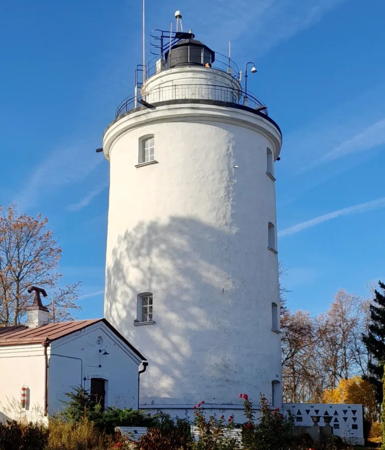
1760. Active; focal plane 66 m (217 ft); white light, 4.5 s on, 1.5 s off, 4.5 s on, 4.5 s off, intensified along the range line. 22 m (72 ft) round old-style stone tower with lantern and double gallery, incorporating 4-story keeper's quarters. Lighthouse painted white with black trim; lantern painted black. Tiia Ambur's 2022 photo is at the top of this page, Trabas has the photo from VTA's page, Sven Vaarandi has a great photo, Köhler has a 2016 photo, Rene Mitt has a street view, Huelse has a historic postcard view, and Google has a satellite view. Built near the end of the reign of Tsarina Elizaveta Petrovna (Elizabeth the Great), this is a magnificent example of classic Russian Imperial lighthouse design. The Ovisi and Slitere lighthouses in Latvia are similar but more than 80 years younger. This lighthouse was substantially rebuilt in 1812 and further renovated in 1858. The round watch room was added in 1951, and the present lantern was new in 1998. For eastbound ships this is a landfall light for Tallinn and for westbound ships it also serves as the rear light of a range guiding vessels through the channel south of the island of Naissaar. Located on the southeast side of Suurupi, a town on a promontory about 20 km (13 mi) west of Tallinn. Site open, tower open but the schedule is unknown. . ARLHS EST-017; VTA 375; Admiralty C3786.1; NGA 12768.
** Suurupi {Surupe} Range Front
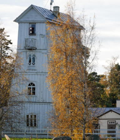
1859. Active; focal plane 18 m (59 ft); white light, 1,5 s on, 1.5 s off, visible only on or close to the range line. 15 m (49 ft) square pyramidal, 4-story wood keeper's house with A-frame roof, painted white. The light was formerly shown through a window on the top floor at one end of the building; it has been moved outside to the windowsill. Vaarandi's photo is at right, Köhler has a 2016 photo, Alexander Antipenko has a 2019 photo, Otto de Voogd has a good photo, Trabas has the photo from VTA's page, and Google has a satellite view. A miraculous survivor of two world wars and over 160 winters, this remarkable lighthouse is a well-known historic landmark on Estonia's coastline. The top floor with its lantern chamber was added in 1885, increasing the tower height by 3.5 m (11.5 ft). Located near the coast about 3 km (2 mi) east of Suurupi and 2.25 km (1.4 mi) east northeast of the rear light. Site open, tower open but the schedule is unknown. . ARLHS EST-012; VTA 374; Admiralty C3786; NGA 12767.

Suurupi Front Light, Suurupi, July 2007
Wikimedia Creative Commons photo by Sven Vaarandi

Viimsi Parish: Naissaar Lighthouses
Naissaar (Nargö in Swedish, Nargen in German) is an island in the Gulf of Finland about 12 km (7.5 mi) northwest of Tallinn. The island is governed as part of Viimsi Parish. The island is strategically important for control of the Gulf, so it has been heavily fortified since at least 1710. Under Soviet rule there was a factory on the island building naval mines. After the collapse of the Soviet Union Russian troops destroyed these facilities, leaving a legacy of soil contamination, before finally departing in 1993. The island is now a nature reserve.

*
Naissaar {Nargö, Nargen} (5)
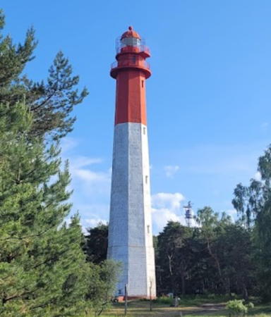
1960 (station established 1788). Active; focal plane 47 m (154 ft); white light, 3 s on, 7 s off. 45 m (148 ft) octagonal concrete tower with lantern and double gallery. Upper 1/3 of lighthouse painted red, lower 2/3 white. Vaarandi's photo (seen at right) also appears on the Estonian Wikipedia page for the lighthouse, Trabas has an excellent photo by Klaus Kern, Elena Koldits has a 2017 photo, Andres Vaatmann has a view from the gallery, and Google has a satellite view. The original wood lighthouse was replaced in 1805. Forand has a historic postcard view of the third (1849) lighthouse, a 38 m (125 ft) stone tower destroyed during World War II, and Huelse has a second postcard view. The present tower replaced a 38 m (125 ft) wooden temporary tower built in 1946. Day tours are available from Tallinn. Located at the northern tip of the island. Site open, tower apparently open for climbing. Site manager: Naissaare Loduspark (Nature Park). ARLHS EST-008; VTA 320; Admiralty C3790; NGA 12772.
* Hülkari (Hülgekari) (2)
1954 (station established 1788). Active; focal plane 18 m (59 ft); white light, 1.5 s on, 4.5 s off. 15 m (49 ft) square skeletal tower with gallery, painted red; the upper 3/5 of the tower is enclosed by a white slatted daymark. Sven Vaarandi has a photo, Andres Vaatmann has a 2016 photo, Trabas has VTA's photo, Marek Tooming has a 2022 view, and Google's satellite view shows the shadow of the tower. Wood lighthouses were built at both ends of Naisaar in 1788, but the southern light was replaced by a rescue station in 1849, and there was no light until 1954. Located at the southeastern tip of Naissaar. Site manager: Naissaare Loduspark (Nature Park). VTA 310; Admiralty C3794; NGA 12776.
Naissaar Light
Naissaar Light, Naissaar, August 2006
Wikimedia Creative Commons photo by Sven Vaarandi

Tallinn City Lighthouses
The capital of Estonia, Tallinn is a city of about 450,000 residents. Historically the city was known as Reval in Swedish, German, and English.
* Kopli Laht (Kopli Bay) Range Rear (2)
1971 (station established 1945). Active; focal plane 20 m (66 ft); red light, 2 s on , 2 s off. 15 m (49 ft) square cylindrical skeletal tower, painted black. The tower carries a rectangular slatted daymark painted white with a red vertical stripe. Sven Vaarandi has a 2010 photo, Köhler has a 2016 photo, Trabas has VTA's photo, and Google has a street view and a satellite view. Kopli Bay is on the west side of the Valjasaar peninsula; this is the entrance range for the bay. The front light is on a steel post. Located at the southeastern end of the bay, about 5 km (3 mi) southwest of Tallinn's waterfront. Site open, tower closed. VTA 356; Admiralty C3799.1; NGA 12781.1.
Vahemadal
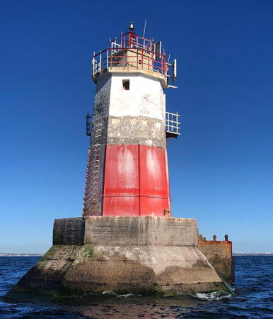
1979. Active; focal plane 14 m (46 ft); continuous red light with a more intense flash every 10 s. 14 m (46 ft) octagonal pyramidal steel tower with double gallery but no lantern, mounted on a pyramidal concrete base. The tower also has a fog whistle, which operates in all weather. Upper half of tower painted white, lower half red; A VTA photo is at right, Trabas has a closeup by Klaus Kern, Larry Myhre has a photo, Lightphotos.net has a good photo, and Bing has a fuzzy satellite view. In Estonian madal is a shoal or bank. Vahemadal, "Gap Shoal," is in the opening between Naissaar and the Valjasaar peninsula. Located on a shoal on the northwestern approach to Tallinn harbor, about 3 km (2 mi) north of the Valjasaar peninsula. Accessible only by boat, but there should be a distant view from shore. Site and tower closed. . ARLHS EST-056; VTA 300; Admiralty C3805; NGA 12793.
Paljassaare (New Fishing Harbor) Range Front
1971. Active; focal plane 28 m (92 ft); red light, 3 s on, 3 s off. 25 m (82 ft) square cylindrical skeletal tower, painted red. The tower carries a diamond-shaped slatted daymark, painted white with a red vertical stripe. Trabas has VTA's photo, Köhler has a 2016 photo, and Google has a street view and a satellite view. Located on the waterfront of the harbor, at the west end of the Tallinn docks. Site and tower closed. VTA 281; Admiralty C3837; NGA 12864.
* Paljassaare (New Fishing Harbor) Range Rear
1971. Active; focal plane 38 m (125 ft); red light, 3 s on, 3 s off. 34 m (112 ft) square cylindrical skeletal tower, painted black. The tower carries a diamond-shaped slatted daymark, painted white with a red vertical stripe. Trabas has VTA's photo, Köhler has a 2016 photo, and Google has a closeup street view and a satellite view. Located beside Paljassaare Street at the rear of the harbor. Site open, tower closed. VTA 282; Admiralty C3837.1; NGA 12868.

Vahemadal Light. Gulf of Finland, October 2017
VTA photo
* [Oleviste Kirik (St. Olaf's Church)]
This church with its immensely tall steeple never had a light, but since the 14th century it has been one of the best known daybeacons of northern Europe. A 2009 photo is available, Köhler has a photo, and Google has a street view and a satellite view. Often struck by lightning, the church has burned and been rebuilt several times. Following the most recent renovation in 1931 the church has a height of 123.7 m (406 ft). At its tallest from 1549 to 1625 it had a height of 159 m (522 ft) and it is believed to have been the tallest building in the world during that period. Located in downtown Tallinn. Site and church open, tower closed. Owner/site manager: Oleviste Kogudus .
* Tallinn {Reval, Katharinenthal} Range Front
1806. Active; focal plane 49 m (161 ft); white or green light, depending on direction, 1.5 s on, 1.5 s off. 18 m (59 ft) octagonal pyramidal wood tower mounted at one end of a 2-story rectangular keeper's house. Entire building painted red. White light is shone on the range line and green to the right. The octagonal pyramid is a daybeacon and there are lights mounted on the balcony railing; however, there is also a 6th order Fresnel lens inside that provides the main light. A photo is at the top of this page, VTA has a page for the lighthouse, Trabas has a photo by Klaus Kern, Werner Vogels has a 2008 photo, Köhler has a 2016 photo, Reijnen has a view from the rear light, Sergei Zajarin has a winter 2018 street view showing the lighthouse in action, and Google has a satellite view. The range guides ships approaching Tallinn in the main channel from the northwest. The pyramidal tower was added in 1839. The house was repaired after being damaged in World War II; it was further renovated in 1959. In 2023 the Transport Administration announced the light needs restoration costing more than €1 million before it can be opened to the public. Located on Valge Street near Kadrioru Park in Tallinn. Site open, tower closed. ARLHS EST-015; VTA 251; Admiralty C3810; NGA 12796.
* Tallinn {Reval, Katharinenthal} Range Rear (2)
1896 (station established 1835). Active; focal plane 80 m (262 ft); whte light, 3 s on, 3 s off, with much more intense light along the range line. 40 m (131 ft) round stone tower with lantern and gallery. Upper 1/3 of lighthouse painted black, lower 2/3 white. A photo is at right, VTA has a page for the lighthouse, Trabas has Reijnen's photo, Liis Roden has a 2007 photo, Köhler has a 2016 photo, Sergei Zajarin has a 2018 drone view, Google has a street view, and Bing has a satellite view. Despite its conspicuous urban location this substantial and historic lighthouse doesn't seem to be as well known as many of the coastal Estonian lighthouses. In 2023 the Transport Administration announced plans to open the lighthouse to the public. Located about 1100 m (0.7 mi) southeast of the front light; visible from the St. Petersburg highway (E-20). Site open, tower closed. . ARLHS EST-018; VTA 252; Admiralty C3810.1; NGA 12800.
* Pirita Range Front
1979. Active; focal plane 11 m (36 ft); red light, 1 s on, 1 s off. 9 m (30 ft) round cylindrical concrete tower surrounded by a series of three circular galleries. No lantern. Tower painted red, galleries white. Trabas has Klaus Kern's photo, Köhler has a 2016 photo, a 2019 photo is available, and Bing has a satellite view. Pirita is an eastern suburb of Tallinn and the terminus for ferries to Naissaar. Located at the end of the main quay at Pirita. Site open, tower closed. ARLHS EST-084; VTA 241; Admiralty C3840.8; NGA 12871.
* Pirita Range Rear
1979. Active; focal plane 31 m (102 ft); red light, 2 s on, 2 s off. 28 m (92 ft) square cylindrical concrete tower rising from a 2-story building. No lantern. Tower painted white. Trabas has VTA's photo, Köhler has a 2016 photo, Google has a street view, and Bing has a satellite view. Located about 400 m (1/4 mi) southeast of the front light in Pirita. Site open, tower closed. ARLHS EST-085; VTA 242; Admiralty C3840.81; NGA 12871.1.
Tallinn Range Rear Light
Tallinn Range Rear Light, Tallinn, September 2012
Wikimedia Creative Commons photo by Mona-Mia

Viimsi Parish: Viimsi Peninsula West Coast Lighthouses
Viimsi Parish includes the northern portion of the Viimsi Peninsula and a number of islands in the Gulf of Finland, including Naissaar (see above) and Prangli (see below). The Viimsi peninsula frames the east side of Tallinna Laht (Tallinn Bay).
* Miiduranna Range Front
1997. Active; focal plane 13 m (43 ft); two green flashes every 3 s. 11 m (36 ft) short skeletal tower mounted atop a 2-story building. The light tower also carries a slatted daymark painted white with a black vertical stripe. Trabas has VTA's photo, Köhler has a 2016 photo, and Google has a satellite view. The Miidurana harbor is on the west side of the Viimsi peninsula a short distance south of the Viimsi range lights. Located on the waterfront. Site open, tower closed. VTA 233; Admiralty C3841.9; NGA 12874.
* Miiduranna Range Rear
1997. Active; focal plane 17 m (56 ft); green light occulting once every 5 s. 12 m (39 ft) light mounted atop a 3-story building; there is also a slatted daymark painted yellow with a black vertical stripe. Trabas has VTA's photo, Köhler has a 2016 photo, and Google has a satellite view. Located 185 m (600 ft) northeast of the front light. Site open, tower closed. VTA 234; Admiralty C3841.91; NGA 12874.1.
* Viimsi Range Front (2)
1927 (station established 1914). Active; focal plane 39 m (128 ft); white light, 1.5 s on, 1.5 s off, synchronized with the rear light and visible only on the range line. 34 m (112 ft) square steel skeletal tower with gallery, painted red. The tower carries a large slatted daymark, painted white with a red vertical stripe on the range line. VTA has a page for the lighthouse, Trabas has Klaus Kern's closeup photo, Köhler has a 2016 photo, and Google has a street view and a satellite view. This range guides vessels approaching Tallinn in the channel south of Naissaar. Located near the waterfront in Viimsi, about 7 km (4 mi) north of Pirita. Site open, tower closed. VTA 231; Admiralty C3804; NGA 12804.
* Viimsi Range Rear (2)
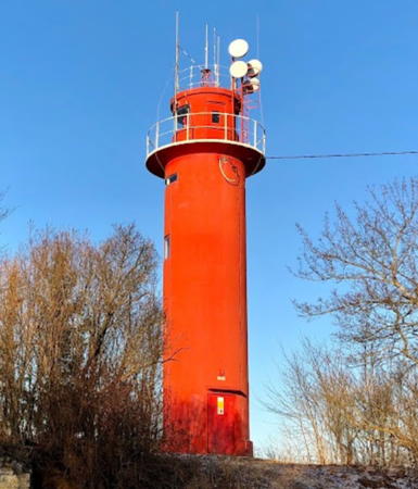
1939 (station established 1914). Active; focal plane 59 m (194 ft); white light, 1.5 s on, 1.5 s off, synchronized with the front light and visible only on the range line. 13 m (43 ft) round cylindrical concrete tower with lantern and gallery. Entire lighthouse painted red. 1-story keeper's house. Denis Nikolajev's 2018 photo is at right, Trabas has the photo from VTA's page, Wikimedia has Sven Vaarandi's excellent photo, Köhler has a 2016 photo, and Bing has a satellite view. Located on a hill about 1.4 km (0.87 mi) east of the front light. Site open, tower closed. ARLHS EST-059; VTA 232; Admiralty C3804.1; NGA 12808.

Viimsi Range Rear Light, Viimsi, January 2018
Google Maps photo by Denis Nikolajev

Tallinn City: Aegna Lighthouse
Aegna {Wulf} (5?)
2009 (station established 1856). Active; focal plane 14 m (46 ft); flash every 4 s, white or red depending on direction. 12.5 m (41 ft) post, the upper 2/3 surrounded by a large rectangular slatted daymark. Daymark and top of the post painted yellow, base of the post red. Wikimedia has a 2013 photo, Trabas has VTA's photo, Roman Jemets has a photo, and Google has a satellite view. The 1995 light was taller (focal plane 22 m (72 ft)). Located at the end of the dangerous Aegna Reef, which extends northward from the end of the Viimsi Peninsula. In the past, there were a number of pyramidal wood beacons in the area, and a photo by Sven Vaarandi (no longer online) showed that at least one has been either preserved or rebuilt. Accessible only by boat. Site open, tower closed. VTA 220; Admiralty C3806; NGA 12788.

Viimsi Parish: Viimsi Peninsula East Coast Lighthouses
Leppneeme Range Rear (2?)
2008. Active; focal plane 12 m (39 ft); white light occulting once every 3 s. 11 m (36 ft) round cylindrical metal tower carrying a large slatted daymark painted red with a white vertical stripe. Tower painted white. Trabas has a VTA photo and Bing has a satellite view. The front light is on a short post. This light appears taller than its listed height. Located on the waterfront of Leppneeme, on the northeast side of the Viimsi Peninsula. Site open, tower closed. VTA 127.1; Admiralty C3851.11; NGA 12879.05.
Karbimadal (ex-Range Front)
1986. Active; focal plane 16 m (52 ft); three quick white flashes followed by one long (2 s) flash every 10 s. 15 m (49 ft) round cylindrical metal tower with double gallery but no lantern. Tower painted red with a white band at the top. Access to the gallery is by an external ladder. A VTA photo is at right, Trabas has another VTA photo, Köhler has a distant view, and Bing has a satellite view. This was the front light of the Tammneeme Range until the rear light was discontinued in 2003. Located on Karbi Shoal (Karbimadal) in the Gulf of Finland about 5.2 km (3.2 mi) east of Tammneeme. Accessible only by boat. Site and tower closed. ARLHS EST-026; VTA 191; Admiralty C3851.2; NGA 12885.
* Tammneeme (Range Rear)
1986. Inactive since 2003 and delisted as a daybeacon in 2011. 40 m (131 ft) slender round steel tower, painted white, with two wing-like black vertical panels, one on either side, along the upper 2/3 of the tower. No lantern. Lightphotos.net has Sven Vaarandi's 2007 photo of the abandoned and rusting lighthouse, and Google has a satellite view and a distant street view. This tower was the rear light of a range, the front light being on the Karbimadal lighthouse. VTA dropped its listing of the tower as a daymark in 2011. Located at Tammneeme, on the east side of the Viimsi peninsula, about 4 km (2.5 mi) east northeast of Viimsi. Site open, tower closed. ARLHS EST-083; ex-VTA 192; ex-Admiralty C3851.21; ex-NGA 12885.1.

Karbimadal Light, Viimsi
VTA photo
* Muuga (Vkhodnoy) Range Front
1986. Active; focal plane 36 m (118 ft); red light, 3 s on, 2 s off. 33 m (108 ft) slender round steel tower, painted white, with two wing-like black vertical panels, one on either side, along the upper 2/3 of the tower. No lantern. Trabas has VTA's photo, Google has a street view, and the light is centered in a Google satellite view. Located on the waterfront in Muuga, near a petroleum tank farm. Site open, tower closed. ARLHS EST-034; VTA 181; Admiralty C3854; NGA 12879.1.
* Muuga (Vkhodnoy) Range Rear
1986. Active; focal plane 54.5 m (179 ft); red light, 3 s on, 2 s off. 48 m (157 ft) slender tapered round steel tower, painted white, with two wing-like black vertical panels, one on either side, along the upper 2/3 of the tower. No lantern. Köhler has a 2016 photo, Wikimedia has Vaarandi's 2008 photo, Trabas has VTA's photo, and Google has a street view and a satellite view. Located in Muuga, 500 m (0.3 mi) south southwest of the front light. Site open, tower closed. ARLHS EST-035; VTA 182; Admiralty C3854.1; NGA 12879.2.

Viimsi Parish: Prangli Area Lighthouses
Prangli is an island in the Gulf of Finland about 15 km (9 mi) northeast of the Viimsi peninsula. The island was settled by Swedes, who called it Vrangö; today it has a small Estonian population and is accessible by passenger ferry from Leppneeme on the northwest side of the Viimsi peninsula. Prangli is governed as part of Viimsi Parish.

Tallinnamadal {Revalstein}
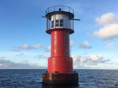
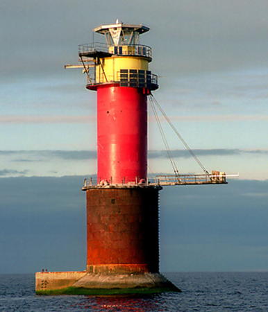
1969 (lightship station established 1858). Active; focal plane 31 m (102 ft); two white flashes every 15 s. 29 m (95 ft) round two-stage cylindrical steel tower with lantern and three galleries, mounted on a concrete pier. Lower stage of lighthouse painted black, upper stage red, watch room yellow. Trabas has VTA's photo (also seen at right), and another photo and a third photo are available. This colorful modern lighthouse marks the dangerous Tallinn Shoal (Tallinnamadal) about 32 km (20 mi) north of the Tallinn waterfront. The shoal was marked by a series of lightships from 1858 until 1950 and then by a buoy until the lighthouse was completed. Construction began in 1960 but was interrupted several times when storms damaged the foundation. Accessible only by boat. Site and tower closed. ARLHS EST-055; VTA 200; Admiralty C3842; NGA 12784.
Tallinnamadal Light
Tallinnamadal Light, Gulf of Finland
Estonian Maritime Administration photo
* Prangli {Wrangelsholm, Prangel, Wrangö} Northwest
1923. Active; focal plane 15 m (49 ft); four quick white flashes every 15 s. 13 m (43 ft) round cylindrical concrete tower with a small gallery but no lantern. Lighthouse painted white. VTA has a page for the lighthouse, Vaarandi has a good 2009 photo, Trabas has a photo by Klaus Kern, another photo is available, and Google has a satellite view. This light was renovated in 2008; Vaarandi has a photo showing the reconstruction in progress. Located at the northwestern tip of the island. Site open, tower closed. ARLHS EST-046; VTA 160; Admiralty C3846; NGA 12880.
* Prangli {Wrangelsholm, Prangel, Wrangö} Southeast
Date unknown. Active; focal plane 30 m (98 ft); four white flashes every 24 s. 20 m (66 ft) square cylindrical skeletal tower with gallery. The upper 2/3 of the tower was formerly enclosed by a white slatted daymark, but following a restoration in 2006 the daymark is now black. Trabas has Klaus Kern's photo, Wikimedia has Vaarandi's photo, and Bing has a satellite view. Vaarandi also has a 2004 photo showing the lighthouse before it was restored. Located at the southeastern tip of the island. Site open, tower closed. VTA 165; Admiralty C3850; NGA 12884.
Keri {Kokskär} (3)
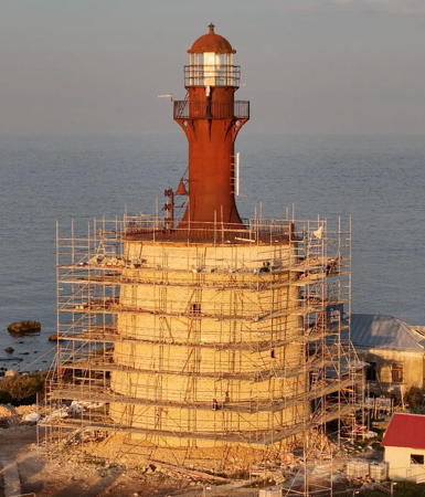
1858 (station established 1724). Active; focal plane 31 m (102 ft); one long (2 s) white flash every 15 s. 31 m (102 ft) two-stage tower: 16 m round cylindrical cast iron tower with lantern and gallery, painted dark red, centered on the top of a 15 m (4 story) old-style stone tower, painted white. Vaarandi's 2007 photo is at right, Maria Vahuri has a 2017 closeup, Riho Tammekand has a 2019 photo, Trabas has an older photo from VTA's page, Forand has a historic postcard view, and Google has a satellite view. Keri is a small island about 8 km (5 mi) north northeast of Prangli; it is the northernmost point of land in this area, so the light is critical for ships bound up or down the Gulf of Finland. The stone lower portion of the lighthouse was built in 1803 and originally carried a wooden tower, which was dismantled in 1854. The "modern" cast iron lighthouse was added in 1858. The lighthouse was renovated in 1959. Endangered by rising sea levels: in 1990 a section of the stone veneer on the northeast side of the base collapsed from wave action. Vaarandi's photo at right and Maria Vahuri's 2017 photo show steel bands that were placed around the tower in 1996 in the effort to strengthen it. Another 2017 photo shows a steel skeletal tower that could perhaps provide a new location for the light, but Raivo Talfeldt's 2022 photo shows that the historic lighthouse is still active. Happily, from 2021 to 2024 the lighthouse has undergone a three-year renovation costing €1.5 million, and volunteers from the Keri Society staff the lighthouse in the summer on continuing restoration projects. Located near the center of the island. Accessible only by boat. Site open, tower closed. . ARLHS EST-027; VTA 155; Admiralty C3844; NGA 12896.
Keri Light
Keri Light, Prangli, 2007
Wikimedia Creative Commons photo by Sven Vaarandi
Aksi (Väike Prangli)
1986. Reactivated (inactive ca. 1998-2007). 15 m (49 ft) round cylindrical steel tower with a very large funnel-shaped topmark in the form of three rings. Tower painted black, topmark white. Estonian Wikipedia has an article with a good photo by Ivo Kruusamägi, Trabas has another VTA photo, Kruusamägi also has a more distant view, and Bing has a satellite view. Aksi is a small island southeast of Prangli, from which it is separated by the narrow Aksi Salm. After being out of service for about a decade, the light was reactivated sometime in late 2007 or early 2008. Accessible only by boat; there should be a distant view from the Prangli ferry. Site open, tower closed. ARLHS EST-081; VTA 175; Admiralty C3850.5; NGA 12900.5.

Jõelähtme Parish Lighthouses
Kallavere Range Front
1986. Active; focal plane 41 m (135 ft); white light, 1 s on, 1 s off. 25 m (82 ft) slender round steel tower, painted white, with two wing-like black vertical panels, one on either side, along the upper 2/3 of the tower. No lantern. VTA has a page for the lighthouse, Trabas has VTA's photo, Vaarandi has a 2008 photo and Google has a satellite view. Located on a hill east of the Muuga harbor facilities. Site and tower closed (private property). ARLHS EST-024; VTA 145; Admiralty C3851.5.
* Kallavere Range Rear
1986. Active; focal plane 60 m (197 ft); white light, 2 s on, 3 s off. 40 m (131 ft) slender round steel tower, painted white, with two wing-like black vertical panels, one on either side, along the upper 2/3 of the tower. No lantern. VTA has a page for the lighthouse, Trabas has VTA's photo, Vaarandi has a 2008 photo, Köhler has a 2016 photo, and Google has a street view and a satellite view. Located in Kallevere, on the east side of the Muuga harbor facilities and about 1.35 km (0.85 mi) south of the front light. Site open, tower closed. ARLHS EST-025; VTA 146; Admiralty C3851.51.
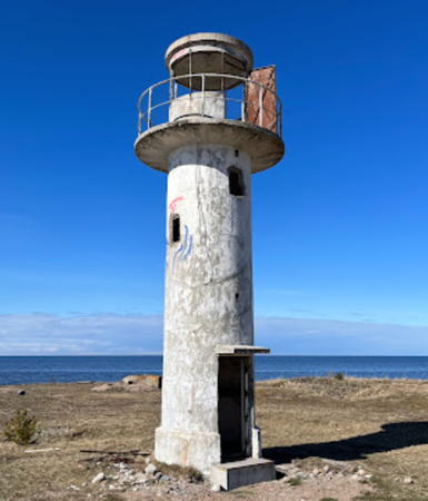
* Ihasalu (Neeme) Range Front
1938. Inactive since around 1990, and delisted as a daybeacon in 2003. 9.5 m (31 ft) round cylindrical concrete tower with lantern and gallery painted white. Endangered; the lighthouse is abandoned and falling into ruin, as seen in Vaarandi's 2007 closeup. Another of Vaarandi's photos is at right, Köhler has a 2016 photo, Oleg Rjumin has a 2022 photo, and Google has a satellite view. Located on a sandy point about 1.5 km (1 mi) northwest of Neeme. Site open, tower closed. . ex-Admiralty C3856.
#[Neeme (Ihasalu) Day Range Rear]
1938 (?). Delisted as a daybeacon in 2003 and demolished sometime after 2006. Approx. 30 m (98 ft) round metal tower with gallery, long covered with rust. Vaarandi has a 2006 photo but the tower is not revealed in Bing's satellite view. No evidence has been found that this substantial tower ever carried a light but it served as the rear tower in a day range. Located in Neeme. Site status unknown.
* Rammu Range Front
1987. Inactive since the 1990s. Approx. 14 m (46 ft) post light; the upper 2/3 of the tower is surrounded by a hexagonal (?) daymark. Kelav Kevad has a photo, Madis Praks has a photo, and Bing has a distant satellite view. These range lights were built very late in the Soviet era and were active for only a few years. Endangered: the tower is rusting rapidly. Located on the southern point of Rammu, an uninhabited island about 8 km (5 mi) northeast of Neeme. Accessible only by boat. Site open, tower closed.
* #Rammu Range Rear
1987. Inactive since the 1990s and collapsed in 2017. This was a 30 m (98 ft) round metal tower with gallery, now covered with rust. A 2009 photo by Kelav Kevad is available and Bing has a satellite view. The lighthouse collapsed during a winter storm on 12 January 2017; Google has a satellite view of the tower on the ground. Located on the east coast of Rammu. Accessible only by boat. Site open, tower closed.
Ihasalu Light
Ihasalu Light, Neeme, September 2007
Wikimedia Creative Commons photo by Sven Vaarandi

Kuusalu Parish Lighthouses
* Juminda (2)
1937 (station established 1931). Active; focal plane 40 m (131 ft); white light, 3 s on, 2 s off, 3 s on, 7 s off. 32 m (105 ft) slender round cylindrical concrete tower with lantern and double gallery. Upper portion of the lighthouse painted red, lower half white. VTA has a page for the lighthouse, Trabas has a photo by Klaus Kern, Janis Kom has a 2019 photo, Margus Kontus has a 2019 drone view, and Bing has a satellite view. Lighthouse Digest has VTA's photo of the original lighthouse, which had a height of 24 m (79 ft). The upper (red) stage of the tower was added in 2006; Vaarandi's 2007 photo shows the extension. The 10 km (6 mi) long Juminda peninsula frames the east side of Kolga Bay; it was the scene of heavy fighting in both world wars. Today, most of the peninsula is included in a national park. Located at the tip of the peninsula. Site open, tower closed. Site manager: Lahemaa Rahvuspark (National Park). . ARLHS EST-022; VTA 110; Admiralty C3860; NGA 12908.
Hara (2)
1909. Inactive since the late 1980s but still listed as a daybeacon (surrounding trees must limit its usefulness). Approx. 13.5 m (44 ft) square skeletal tower with lantern and gallery; lantern originally painted white with a red roof. Endangered. The culture ministry has several photos and Bing has a satellite view. The tower was increased in height in 1954. Located on an island off the southeastern base of the Juminda peninsula. Accessible only by boat. Site status unknown. VTA 115; ex-Admiralty C3862.
Mohni {Ekholm} (2)
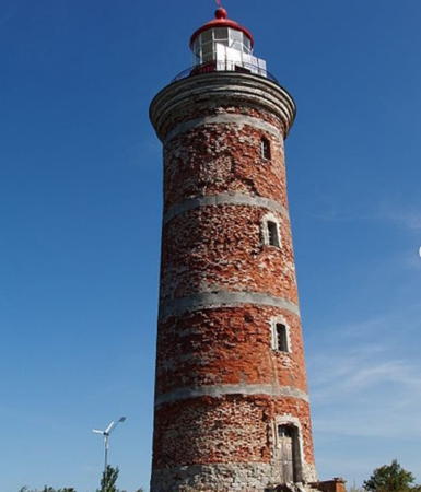
1852 (rebuilt 1871; station established 1806). Active; focal plane 33 m (108 ft); white light, 4 s on, 16 s off. 27 m (89 ft) round brick tower with lantern and gallery. The tower is unpainted red brick; lantern painted red. The lighthouse was increased in height by about 8 m (26 ft) in 1871, when the present lantern was also installed. A 2012 photo by Anita Priks is at right, VTA has a page for the lighthouse, Trabas has a good photo by Klaus Kern, Wikimedia has Ivo Kruusamägi's photo and Vaarandi's 2008 photo, another good photo is available, Lighthouse Digest has an older VTA photo, Huelse has a historic postcard view, Forand has a different postcard view, and Bing has a satellite view. The tower needs restoration to replace spalled brickwork. Mohni is a small island off Cape Purekkari, about 5 km (3 mi) northeast of Vilnistu on the Pärispea peninsula. Although it is included within the borders of Lahemaa National Park, it is privately owned. The owner, a patron of the arts, held an international art festival there in 2003. The lighthouse is located on the northwestern point of the island. Site and tower closed. . ARLHS EST-007; VTA 100; Admiralty C3868; NGA 12912.

Mohni Light, Vilnistu, July 2012
Flickr Creative Commons photo by Anita Priks

Information available on lost lighthouses:

Notable faux lighthouses:

Adjoining pages: North: Russia: Ingria (Gulf of Finland Islands) | East: Eastern Estonia | West: Northwestern Estonia

Return to the Lighthouse Directory index | Ratings key

Posted May 1, 2005. Checked and revised July 9, 2023. Lighthouses: 45. Site copyright 2023 Russ Rowlett and the University of North Carolina at Chapel Hill.