Lighthouses of Southwestern Iran

The Islamic Republic of Iran has a long southern coastline on the Gulf of Oman and Persian Gulf and a much shorter northern coastline on the Caspian Sea. This page is for lighthouses of the southwestern coast on the Persian Gulf; lighthouses of the Gulf of Oman and Strait of Hormuz are on the Southeastern Iran page and the Northern Iran page has the lighthouses of the Caspian coast.

Notes on nomenclature: Historically Iran was called Persia in the west and the word Persian is often used in describing the country's history, culture, and language. The language is also called Fārsī. The Persian Gulf (as it is usually known in the West) is called the Gulf of Fars (Xalij-e Fârs) in Iran and it is usually called the Arabian Gulf in Arabia. The International Hydrographic Organization calls it the Gulf of Iran, and many commentators avoid all nomenclatural problems by calling it simply "The Gulf".

Iran is divided into 31 provinces (ostān) and the provinces are subdivided into counties (shahrestan).

The Persian phrase for a lighthouse is فانوس دریایی (fānoos daryaii, "marine lantern"). Jazīreh is an island, tangeh is a strait, and bandar is a port or harbor.

Navigational aids in Iran are maintained by the Ports and Maritime Organization, an agency of the Ministry of Roads and Urban Development.

ARLHS numbers are from the ARLHS World List of Lights. Admiralty numbers are from volume D of the Admiralty List of Lights & Fog Signals. U.S. NGA List numbers are from Publication 112.

General Sources
World of Lighthouses - Iran
Photos by various photographers available from Lightphotos.net.
Online List of Lights - Iran and Persian Gulf
Photos by various photographers posted by Alexander Trabas.
GPSNauticalCharts
Navigational chart information for Iran.
Navionics Charts
Navigational chart information for Iran.

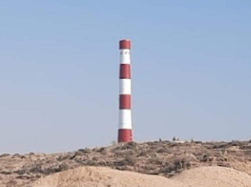
Shidor Light, Persian Gulf, November 2022
Google Maps photo by Sadegh Keighobady

Western Hormozgān Province Lighthouses

Gulf Islands Lighthouses
These small islands in the middle of the Gulf have obvious strategic importance. Until 1971 they were generally attached to Arab states now within the United Arab Emirates. After the British withdrew their influence from the region the islands were occupied quickly by Iran. Because of their sensitive situation they are military areas closed to casual visitation.

Jazīreh-ye Tonb-e Bozorg (Greater Tunb Island) (?)
Date unknown. Active; focal plane 75 m (246 ft); white flash every 10 s. 25 m (82 ft) square pyramidal skeletal tower, painted white. No photo available but Google has an indistinct satellite view. The Greater and Lesser Tunb (or Tonb) Islands are located at a strategic location in the eastern Gulf; the westbound ship channel passes to the north of the islands and the eastbound channel to the south. The islands are claimed by Iran and by the Emirate of Ras al-Khaimah in the United Arab Emirates. Iranian forces occupied the islands when British forces withdrew from the Gulf in 1971. The island has a fishing settlement and several Iranian military installations. Radmehr Jaberi has a very distant view showing the steep hill topped by the light station. Located on the highest point of the island, near the northwestern corner. Site and tower closed. ARLHS IRA-005; Admiralty D7703; NGA 28724.
Jazīreh-ye Tonb-e Kūchek (Lesser Tunb Island)
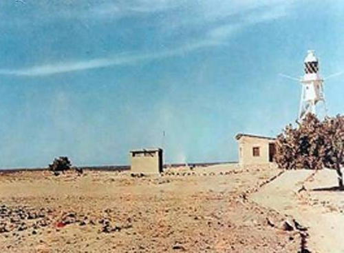
1913. Active; focal plane 25 m (82 ft); two white flashes every 15 s. Approx. 20 m (66 ft) square pyramidal skeletal tower with lantern and gallery, painted white. NGA and the Admiralty describe this light only as a "white beacon." The fuzzy photo at right was posted in 2014 but it's not clear when it was taken. No recent photo available but Google has a satellite view. The lighthouse was built by the British at a time when they dominated the Gulf. The lighthouse was maintained by the Middle East Navigation Aids Service (MENAS) until Iranian authorities took over its operation in 1974. Lesser Tunb is about 20 km (13 mi) west of the better-known Greater Tunb Island (previous entry). Site and tower closed. Admiralty D7704; NGA 28740.

Lesser Tunb Island Light, Persian Gulf
Unattributed photo posted April 2014
Abu Musa
Date unknown. Active; focal plane 130 m (426 ft); white flash every 8 s.No description provided, but Arash Kamangir's photo shows a tower atop a building. Google has a satellite view of the station. Abu Musa is the southernmost of the islands seized by Iran when British forces withdrew from the Gulf in 1971; it is 59 km (37 mi) north of Sharjah, one of the United Arab Emirates. Sharjah and the UAE contunue to claim sovereignty. Located atop Jabal Halwa, the highest point of the island. Site and tower closed. Admiralty D7706; NGA 28744.
Jazīreh-ye Sirrī
Date unknown. Active; focal plane 30 m (98 ft); three white flashes every 15 s. No description available, although a skeletal tower seems likely. No photo available but Google has a satellite view of the listed location. Sirri is an island about 50 km (30 mi) west of Abu Musa. Located at the southeastern end of the island, north of the port facilities. Site and tower closed. Admiralty D7697; NGA 28776.
Jazīreh-ye Banī Forūr (Bani Faror) (2)
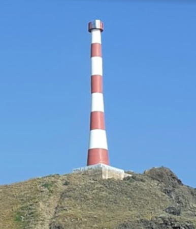
Date unknown. Active; focal plane 44 m (144 ft); white flash every 5 s. Approx. 20 m (66 ft) round concrete tower painted with red and white horizontal bands. Takhor Khan's photo is at right and Bing has a satellite view. Bani Forur is an island about 25 km (15 mi) north of Sirri. Located on heights at the eastern side of the island. Site and tower closed. Admiralty D7696; NGA 28772.
Jazīreh-ye Forūr (Faror) (2)
Date unknown. Active; focal plane 170 m (558 ft); two white flashes every 10 s. 17 m (56 ft) tower rising from a building. NGA lists a red and white skeletal tower but Bing's satellite view shows a more substantial structure. No photo available. Faror is an island, uninhabited except for a govenment outpost, about 22 km (14 mi) south southwest of Cape Bostaneh and 15 km (9 mi) north of Bani Faror. Located on heights in the northeast of the island. Site and tower closed. Admiralty D7695; NGA 28768.

Bandar Lengeh County Lighthouses
Bandar-e Lengeh East Breakwater
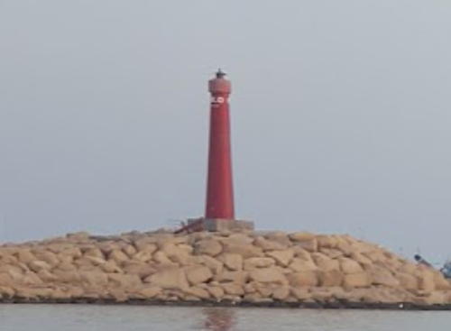
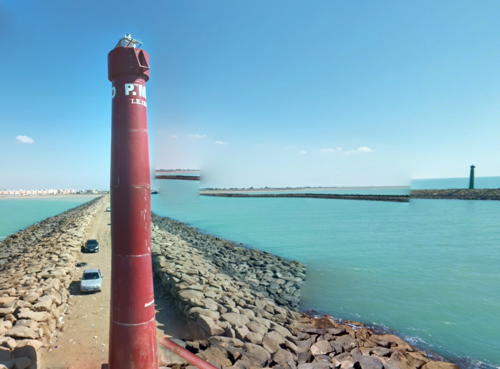
Date unknown. Active; focal plane 9 m (30 ft); green flash every 5 s. 7 m (23 ft) round green fiberglass tower on a square concrete base. A very distant view of the breakwater lights is available (last photo in the first row of thumbnails) and Google has a satellite view. Bandar Lengeh, the county capital, is a city of about 30,000 residents; its port is being developed for "non-oil" exports. Located on the east (main) breakwater of Bandar-e Lengeh. Site status unknown. Admiralty D7699; NGA 28756.
Bandar-e Lengeh West Breakwater
Date unknown. Active; focal plane 9 m (30 ft); red flash every 5 s. 7 m (23 ft) round red fiberglass tower on a square concrete base. A very distant view of the breakwater lights is available (last photo in the first row of thumbnails) and Google has an indistinct satellite view. Located on the west breakwater of Bandar-e Lengeh. Site status unknown. Admiralty D7699.2; NGA 28760.
Ra's-e Bostāneh (Bostaneh, Bustaneh)
Date unknown. Active; focal plane 29 m (95 ft); white flash every 10 s. Approx. 20 m (66 ft) skeletal tower with lantern and gallery. No photo available but Bing has a satellite view. Located on a prominent cape about 5 km (3 mi) west of Bandar-e Bostaneh. Site status unknown. Admiralty D7698; NGA 28764.

Banī Forūr Light, Persian Gulf, March 2020
Google Maps photo by Takhor Khan
Jazīreh-ye Qeys (Kish Island, Qeys Island, Kais Island) (2)
Date unknown. Active; focal plane 39 m (128 ft); three white flashes every 7 s. Described by NGA as a "red and white framework tower." No photo available but Bing has a satellite view. An earlier light was listed in 1942 with a focal plane height of 27 m (89 ft). Kish, located 19 km (12 mi) off Iran's south coast, is a popular resort and free trade zone with an international airport and luxury hotels. The indicated location of the light is west of the airport near the center of the island. Site status unknown. ARLHS IRA-003; ex-Admiralty D7692; NGA 28792.
Māsheh (Kish) West Breakwater
Date unknown. Active; focal plane 9 m (30 ft); green flash every 5 s. 7 m (23 ft) round green fiberglass tower. Hossein Tahouri has a drone view, Hassan Hashempour has a very distant street view of the breakwater lights and Google has an indistinct satellite view. NGA lists the light as "Dih." Māsheh is the very busy ferry port for Kish Island. Located on the west breakwater of Māsheh. Site status unknown. Admiralty D7692.15; NGA 28800.5.
Māsheh (Kish) East Breakwater
Date unknown. Active; focal plane 9 m (30 ft); red flash every 5 s. 7 m (23 ft) round red fiberglass tower. Hossein Tahouri has a drone view, Hassan Hashempour has a very distant street view of the breakwater lights and Google has an indistinct satellite view. NGA has an incorrect Admiralty number for this light. Located on the east breakwater of Māsheh. Site status unknown. Admiralty D7692.1; NGA 28801.
Aftab East Breakwater
Date unknown. Active; focal plane about 12 m (36 ft); green flash every 4 s. Approx. 6 m (20 ft) square pyramidal skeletal tower painted green. Ali Safdarian has a distant photo of the breakwater lights (a small portion is at right) and Google has an indistinct satellite view. Located on the east breakwater of Aftab, the mainland terminal for ferries to Kish. Site status unknown. Admiralty D7690.1; NGA 28803.
Aftab West Breakwater
Date unknown. Active; focal plane about 12 m (36 ft); red flash every 4 s. Approx. 6 m (20 ft) square pyramidal skeletal tower painted red. Ali Safdarian has a distant photo of the breakwater lights and Google has an indistinct satellite view. Located on the west breakwater of Aftab. Site status unknown. Admiralty D7690.2; NGA 28803.1.
Chīrū (Chiruyeh) (2?)
Date unknown. Active; focal plane about 15 m (49 ft); white flash every 5 s. Approx. 12 m (39 ft) skeletal tower. painted black with a broad white horizontal band. The light is on the left in Hadi Karimi's distant 2023 view and Bing has a satellite view. NGA describes this light as being only 2 m (7 ft) tall. Located on a sandy promontory southwest of the village of Chīrū. Site status unknown. Admiralty D7690; NGA 28804.
Jazīreh-ye Hendorabī (Hendorabi Island, Hendarabi)
Date unknown. Active; focal plane 58 m (190 ft); three white flashes every 10 s. Approx. 30 m (98 ft) square pyramidal skeletal tower with gallery. No photo available but Google has a satellite view. Hendorabī is an elliptical island about 8 km (5 mi) by 4 km (2.5 mi), located halfway between Kish and Lavan. Located on the central ridge of the island. Site status unknown. Admiralty D7691; NGA 28808.

East Breakwater Light, Aftab, Hormozgān
Google Maps photo by Ali Safdarian
Ra's-e Nakhilu (2)
Date unknown. Active; focal plane about 20 m (66 ft); two white flashes every 10 s. Approx. 15 m (49 ft) square skeletal tower. No photo available but Google has a satellite view. This light guides vessels in the strait between Hendorabi Island and the mainland. NGA lists a smaller tower. Located on a bluff overlooking the strait. Admiralty D7689; NGA 28812.

Parsian (Gavbandi) County Lighthouses
The name of Gavbandi County was changed to Parsian in 2007.

Jazīreh-ye-Shītvār (Shotur Island, Shidor, Shidvar, Shatur) (2)
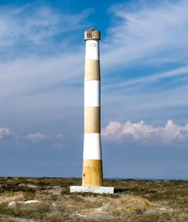
Date unknown. Active; focal plane unknown; two white flashes every 10 s. Approx. 20 m (66 ft) round concrete tower painted with red and white horizontal bands. A sibling of the Banī Forūr Light (see above). Sadegh Keighobady's 2022 photo is at the top of this page, Setareh Taherianalso also has a 2022 photo, Amir Rouhani has a 2021 closeup, and Google has a distant satellite view. The light is described by NGA as a "white beacon." Shītvār is a small island off the eastern end of the much larger Lavan Island. The island is a nature reserve. Located at the west end of the island. Site apparently open, tower closed. Admiralty D7688; NGA 28864.
Jazīreh-ye Lavan (Lavan Island)
Date unknown. Active; focal plane 54 m (177 ft); three white flashes every 12 s. Approx. 40 m (131 ft) square skeletal tower. No photo available but Google has a satellite view. Lavan Island, located off the Iranian coast opposite Qater, is an important oil terminal. Site status unknown. ARLHS IRA-004; Admiralty D7685; NGA 28816.
Shah Allum Shoal (2)
2008(?) (station established 1964). Active; focal plane 35 m (115 ft); two white flashes every 10 s. 35 m (115 ft) skeletal tower mounted on a platform supported by piles. No photo available and the shoal does not appear in Google's satellite view. Shah Allum Shoal is a notoriously dangerous rocky shoal in the center of the Gulf, roughly midway between Qater and Lavan Island. Sailing directions dated 2007 mention the wreckage of the former light structure, probably destroyed by collision with a ship. The shoal was marked by a lightfloat at that time. The present light was announced on international lists in early 2009. Accessible only by boat. Site open, tower closed. Admiralty D7683; NGA 28876.
Bostano
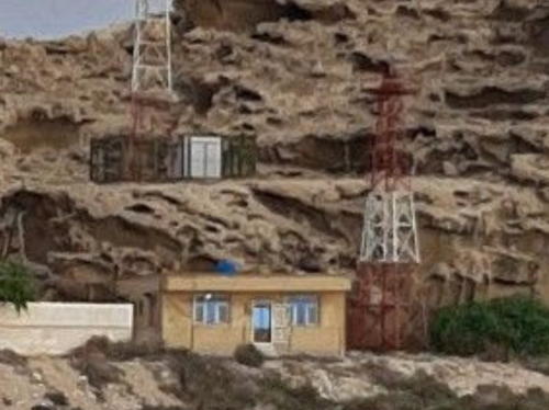
Date unknown. Active; focal plane about 15 m (49 ft); two white flashes every 12 s. Approx. 12 m (39 ft) square skeletal tower painted red with a white horizonal band. Danial Bahraini has the street view seen at right but the tower is inconspicuous in Google's satellite view. Located at a coast guard station at Bostano, a small port in western Parsian County. Site status unknown. Admiralty D7680.5; NGA 28879.
 

Bostano Light, Parsian County, December 2019
Google Maps photo by Danial Bahraini
 

Būshehr Province Lighthouses

Asayuleh County Lighthouses
Ra's-e Nāy Band South
Date unknown. Active; focal plane about 30 m (98 ft); light characteristic unknown. Approx. 20 m (66 ft) pyramidal skeletal tower with lantern, gallery and central cylinder. No photo available but Google has a satellite view. Located northwest of the village of Nay Band and about 5 km (3 mi) southeast of Cape Nayband. Site open, tower closed. Admiralty D7680.
Ra's-e Nāy Band (Nay Band, Cape Nayband) (3?)
2020 or 2021. Active; focal plane 29 m (95 ft); white flash every 15 s. Approx. 22 m (72 ft) round tower colored with red and white horizontal bands. Sasan Akbary's October 2022 photo is at right and Google has a satellite view. This lighthouse replaced a 20 m (66 ft) skeletal tower with lantern, gallery and central cylinder. Part of the older light tower is at the upper left corner of Payam Hamzehali's photo of the cape, Hossein Mohseni has a distant view, and Ehsan Taghipour has a very dark view. An older satellite view suggested there were once two lighthouses here, but Google's current satellite view shows only one. The surrounding area is a national park. Note: NGA lists this light as D7680, and the Admiralty had it with that number as recently as 2011. Located on a prominent and scenic cape south of Asalouyah in southernmost Būshehr Province. Site open, tower closed. Admiralty D7679.8 (ex-D7680); NGA 28880.
Bandar-e Nāy Band
Date unknown. Active; focal plane 9 m (30 ft); two white fkashes every 8 s. Approx. 8 m (26 ft) tower, probably skeletal. No photo available but Bing has an indistinct satellite view. Located on the waterfront of the Nayband fishing port, about 8 km (5 mi) east of the cape. Site open, tower closed. Admiralty D7680.3; NGA 28881.

Cape Nayband Light, Asayuleh County, October 2022
Google Maps photo by Sasan Akbary

Kangan County Lighthouses
Kangan Outer Breakwater
Date unknown. Active; focal plane 12 m (39 ft); green flash every 5 s. 10 m (33 ft) round green tower. A photo of the two breakwater lights is available and Google has a satellite view. Kangan, the county capital, is a city of about 60,000 residents. Located at the end of the outer breakwater of Kangan. Site status unknown. Admiralty D7679.2; NGA 28883.1.
Kangan Inner Breakwater
Date unknown. Active; focal plane 12 m (39 ft); red flash every 5 s. 10 m (33 ft) round red tower. A photo of the two breakwater lights is available (the portion showing this light is at right) and Google has a satellite view. Located at the end of the inner breakwater of Kangan. Site status unknown. Admiralty D7679; NGA 28883.2.

Deyr County Lighthouses
Shilat
Date unknown. Active; focal plane 10 m (33 ft); white flash every 5 s. 10 m (33 ft) square cylindrical skeletal tower. Alireza Darvishi has a distant view and Bing has a distant satellite view. Located in the tiny village of Shilat about 120 km (75 mi) southeast of Būshehr. Site status unknown. Admiralty D7674.6; NGA 28893.
Lavar-e Saheli
Date unknown. Active; focal plane 30 m (98 ft); two white flashes every 6 s. Approx. 15 m (49 ft) skeletal tower. No photo available but Bing has a distant satellite view. Located on a bluff in the village of Saheli. Site status unknown. Admiralty D7674.5; NGA 28895.

Inner Breakwater Light, Kangan, Būshehr
Google Maps photo by Rapid Boy

Tangestan County Lighthouses
Karri (Kalāt)
Date unknown. Active; focal plane 30 m (98 ft); white flash every 5 s. Approx. 27 m (89 ft) square skeletal tower with gallery, painted red with one white horizontal band. A photo is at right and Google has a satellite view. Listed by the Admiralty and NGA as "Kalat" although the lighthouse is not at Kalāt. Located at Karri village, about 90 km (58 mi) south of Būshehr. Site open, tower closed. Admiralty D7674; NGA 28897.
Jazīreh-ye Farsi (Jazīrat al Fārisīyah, Farsi Island)
Around 1947(?). Active; focal plane 28 m (92 ft); white flash every 15 s. 23 m (75 ft) skeletal tower, painted black with a white horizontal band. No photo available and Google has only a very distant satellite view of the island. Farsi is a small island in the center of the Gulf northeast of the Saudi port of Al Jubayl. Farsi and the nearby island of al-Arabiyah were the subject of boundary negotiations between Iran and Saudi Arabia in the 1960s; in 1968 the final agreement assigned Farsi to Iran and al-Arabiyah to Saudi Arabia. The island is occupied by Iranian military forces. Site and tower closed. ARLHS IRA-001; Admiralty D7455; NGA 29364.

Būshehr County Lighthouses
Būshehr (often called Bushire in English) is a major seaport and urban center of southwestern Iran. The city has a metropolitan population of more than 400,000.

Khowr-e-Deyreh (Būshehr Approach) Range Rear
Date unknown. Active; focal plane perhaps 25 m (82 ft); white light, 2 s on, 2 s off. Tall skeletal tower. No photo available but Google has a satellite view. The front light is on a much shorter tower. Located in the Bay of Būshehr north of the city. Accessible only by boat. Site open, tower closed. Admiralty D7671.1; NGA 28908.
Ra's osh Shaţţ (?)
Date unknown. Active; focal plane 21 m (69 ft); white flash every 6 s. No description given, but presumably a skeletal tower. The survival of this lighthouse seems unlikely. No photo available and the light is not seen in Bing's satellite view or Google's indistinct satellite view of the listed location. This is or was presumably a leading light for ships entering Būshehr Bay. It is not charted by Navionics. Located on the north side of the bay about 20 km (13 mi) north of the city. Site status unknown. Admiralty D7670.5; NGA 28902.
Kalat Light
Karri Light, Būshehr Province, April 2011
ex-Panoramio photo copyright smj_rokni; permission requested
Rūd-e Helleh
2017. Active; focal plane about 25 m (82 ft); white flash every 6 s. Approx. 25 m (82 ft) square pyramidal skeletal tower. No photo available but Google has a satellite view. This light is a possible replacement for the Ra's osh Shaţţ light. Located on a swampy point about 40 km (25 mi) northwest of Būshehr. Site status unknown. Admiralty D7669.6.

Ganaveh County Lighthouses
Jazīreh-ye Khārk (Khark Island, Kharg Island, Kharg South Beacon)
Date unknown. Active; focal plane 90 m (295 ft); two white flashes every 12 s. 14 m (46 ft) aluminum skeletal tower. Hossein Mohammadi has a distant street view and Google has an indistinct satellite view. Khark (Kharg), 25 km (15 mi) off the coast north of Būshehr, is the site of a large oil terminal. On a page no longer online the Iranian Oil Terminals Company noted that the usefulness of this light is limited by nearby gas flares and the lights of the terminal installations. Located near the south end of the island. Site status unknown. ARLHS IRA-002; Admiralty D7664.4; NGA 28916.
Jazīreh-ye Khārkū (Kharku Island)
Date unknown. Active; focal plane 18 m (59 ft); three white flashes every 10 s. 16 m (52 ft) aluminum lattice tower. No photo available but Bing has an indistinct satellite view. Khārkū is an uninhabited island to the northeast of Khārk (previous entry). Located at the north end of the island. Site status unknown. Admiralty D7663; NGA 28948.
Bandar-e Kanaveh (Ganaveh) South Breakwater (2?)
Date unknown. Active; focal plane about 16 m (52 ft); two green flashes every 6 s. Approx. 14 m (46 ft) round green metal or fiberglass tower. Amir Hossein Gholizad has a street view across the harbor entrance, this light is at the right edge of the photo at right, and Google has a satellite view. This light replaces a small pierhead light. Ganaveh is a small port and beach resort about 50 km (30 mi) northeast of Khark Island. Located at the end of the south breakwater at Ganaveh. Site status unknown. Admiralty D7662.5; NGA 28951.1.
Bandar-e Kanaveh (Ganaveh) North Breakwater
Date unknown. Active; focal plane about 16 m (52 ft); two red flashes every 6 s. Approx. 14 m (46 ft) round red metal or fiberglass tower. Amir Hossein Gholizad has the closeup street view seen at right and Google has a satellite view. This light replaces a small pierhead light. Ganaveh is a small port and beach resort about 50 km (30 mi) northeast of Khark Island. Located at the end of the south breakwater at Ganaveh. Site status unknown. Admiralty D7662.51; NGA 28951.
#Bandar-e Kanaveh (Ganaveh) (2)
Date unknown. Inactive since 2005. 16 m (52 ft) aluminum lattice tower. No photo available and the tower is not seen in Google's satellite view. The light was discontinued in late 2005 and the tower was probably removed. Located near the beach on the north side of the town. Site status unknown. ex-Admiralty D7662; ex-NGA 28952.

North Breakwater Light, Bandar-e Kanaveh, Būshehr
Google Maps photo by Amirhossein Gholizadeh
 

Information available on lost lighthouses:

Notable faux lighthouses:

Adjoining pages: North: Northern Iran | East: Southeastern Iran | South: United Arab Emirates | Southwest: Kuwait | West: Iraq

Return to the Lighthouse Directory index | Ratings key

Posted October 9, 2010. Checked and revised September 17, 2023. Lighthouses: 42. Site copyright 2023 Russ Rowlett and the University of North Carolina at Chapel Hill.