Lighthouses of Northern Iceland

Iceland is an island nation in the North Atlantic roughly 800 km (500 mi) northwest of Scotland. Settled by Norse explorers around 870, Iceland has had a legislature since 930 and has generally functioned as a self-governing commonwealth, but for centuries it was also part of the Kingdom of Denmark. In 1918 Iceland was granted full autonomy and in 1944 it declared its independence as a republic.

This age includes lighthouses of three of Iceland's eight regions: Vestfirðir (West Fjords), Norðurland Vestra (Western North Coast), and Norðurland Eystra (Eastern North Coast). The north coast of Iceland faces the Greenland Sea to the north and the Denmark Strait or Greenland Strait, separating Iceland and Greenland, to the northwest.

In Icelandic the word for a lighthouse is viti (plural vitar); ey is an island, rif is a reef, nes is a cape, vík or flói is a bay, fjörð is a firth or fjord, sund is a strait, ána is a river, and höfn is a harbor. The Icelandic alphabet includes the old Norse letters "eth" (Ð and ð) and "thorn" (Þ and þ), which are pronounced with the softer and harder forms of the th sound, respectively.

Lighthouses in Iceland are regulated by the Icelandic Transport Authority (Samgöngustofa, or ICETRA), which also maintains and operates the major coastal lights. Local port authorities operate harbor lights.

ARLHS numbers are from the ARLHS World List of Lights. VIT numbers are from the Vitaskrá, the official Icelandic light list. Admiralty numbers are from volume L of the Admiralty List of Lights & Fog Signals. U.S. NGA List numbers are from Publication 115.

General Sources
Sjóminjasafn Íslands - Vitar
Posted by the Icelandic Maritime Museum (Sjóminjasafn Íslands), this site has small photos and historical notes for Iceland's lighthouses.
Isländische Leuchttürme
Photos of 70 Icelandic lighthouses by Klaus Huelse.
Online List of Lights - Iceland
Photos by various photographers posted by Alexander Trabas. The photos for this area are by Ronald Wöhrn, Erich Hartmann, and Eckhard Meyer.
Lighthouse Pages from Anke and Jens - Iceland
Photos and accounts (in English).
Lighthouses in Iceland
Photos available from Wikimedia.
Icelandic lighthouses / Íslenskir vitar
Flickr.com pool for photos of Icelandic lighthouses (well over 1000 photos).
World of Lighthouses - Iceland
Photos available from Lightphotos.net.
Icelandic Lighthouse Society (Íslenska Vitafélagið)
An attractive web site with several photo galleries; primarily in Icelandic.
Vitaskrá 2023
The official Icelandic light list can be downloaded in pdf format. Published by Landhelgisgæsla Íslands, the Icelandic Coast Guard.
Iceland Map and Satellite Image
From Geology.com.
GPSNauticalCharts
Navigational chart information for Iceland.
Navionics Charts
Navigational chart for Iceland.


Grímsey Light, Norðurland Eystra, July 2020
Instagram photo by Hilmar Thor Johannsson

Vestfirðir (Northwest Fjords) Lighthouses

Vestfirðir (Westfjords), in the northwestern corner of Iceland, is a fan-shaped peninsula cut by fjords into many fingers of land. The lighthouses of this dramatic but difficult terrain are poorly known and hard to visit. The permanent population of the region is only about 7100, with Ísafjörður being the largest town.

Breidafjörður Lighthouses
Klofningur (Flatey)
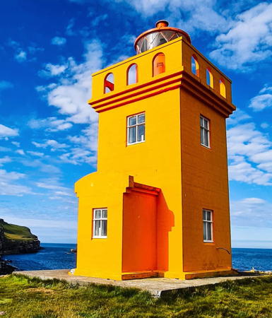
1926. Active; focal plane 15 m (49 ft); two flashes every 15 s, white, red or green depending on direction. 9 m (30 ft) square cylindrical concrete tower with lantern and gallery, painted yellow; lantern painted red. Andrey Sulitskiy has a 2014 photo, Tjerk Bartlema has a good photo, Catriona Walker has a fine 2008 photo, and Bing has an indistinct satellite view. Flatey (Flat Island) is an inhabited island in the northern Breidafjörður about 18 km (11 mi) southeast of Brjánslaekur. The lighthouse is located on Klofningur, a small island about 800 m (1/2 mi) off the entrance to Flatey's harbor. Note: there is another Flatey Light on the northeast coast of Iceland. Accessible only by boat; there are views from the ferry crossing the Breidafjörður from Stykkishölmur to Flatey and Brjánslaekur. Site status unknown. ARLHS ICE-063; VIT-83; Admiralty L4556; NGA 18496.
Skor
1954. Active; focal plane 26 m (85 ft); white flash every 5 s. 5 m (17 ft) square cylindrical concrete tower with lantern, painted yellow according to NGA, but Sigrún Davíðsdóttir's 2011 photo shows that it is now painted white. Hjörtur Sólrúnarson has a 2023 closeup and Google has a distant satellite view. Located on a promontory on the south side of the Látrabjarg peninsula. Probably accessible only by boat. Site open, tower closed. ARLHS ICE-107; VIT-086; Admiralty L4558; NGA 18508.
* Bjargtangar (Látrabjarg) (2)
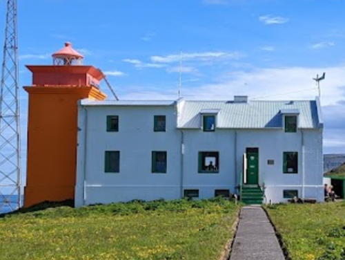
1948 (station established 1913). Active; focal plane 60 m (197 ft); three white flashes every 15 s. 6 m (20 ft) square 2-story concrete building with a lantern on the seaward side of the second floor. The entire building is white. A 2022 photo is at right, the Maritime Museum has a page for the lighthouse, Wikimedia has photos, Trabas has Jim Smith's view from the sea, Jay Colingham has a 2016 street view, a 2021 photo is available, Frank Sæthre has a sunset street view, and Google has a satellite view. This lighthouse marks the westernmost point of Iceland, and thereby the westernmost point of Europe, at longitude 24°32'03" W. Located atop a vertical cliff called Látrabjarg. Accessible by road, but it's a long drive; 4WD strongly recommended. Site open, tower closed. . ARLHS ICE-029; VIT-087; Admiralty L4560; NGA 18512.

Bjargtangar Light, Látrabjarg, August 2022
Instagram photo by lighthouses_of_iceland

Patreksfjörður and Arnarfjörður Lighthouses
* Haanes (Ólafsviti)
1947. Active; focal plane 25 m (82 ft); one long (2 s) flash every 20 s, white, red or green depending on direction. 14 m (46 ft) round concrete tower with lantern and gallery. Tower painted white, lantern red. Giuseppe Gulino has a 2023 photo, Atli Týr Ægisson has a 2008 photo, Dmitry Evdokimov has a distant photo, another photo and a view from the sea is available, and Google has a distant satellite view. This lighthouse guides ships into the Patreksfjörður, the southernmost of a series of fjords cutting into the northwestern peninsula. The lighthouse was built in 1943 with funds provided by Ólaf Jóhannesson, an area merchant, but due to the disruptions of World War II it was not activated until 1947. Located at Hænuvík on the south side of the Patreksfjörður; there is a road about 300 m (1000 ft) above the lighthouse. Site open, tower closed. ARLHS ICE-070; VIT-088; Admiralty L4562; NGA 18516.
Kópanes
1971. Active; focal plane 25 m (82 ft); two white flashes every 5 s. 6 m (20 ft) round lantern mounted at one end of a 1-story concrete fog signal or equipment building. Lantern painted white, building yellow. No photo available but Google has a distant satellite view. Located on a remote cape at the southern entrance to the Arnarfjörður. Accessible only by boat. Site open, tower closed. ARLHS ICE-121; VIT-095.5; Admiralty L4567; NGA 18520.
Langanes (2)
1950 (station established 1910). Active; focal plane 23 m (75 ft); flash every 15 s, white, red or green depending on direction. 5 m (17 ft) 2-story concrete building with a lantern and gallery on the seaward side of the second floor. Lighthouse painted orange (formerly yellow). Peter Grob's 2019 photo is at right, Arnbjörn Jóhannesson has a good photo, Sturla Páll Sturluson has a 2021 photo, and Google has a distant satellite view. Cliffs near this location are famous for birds. Note: this is one of two Langanes (Long Cape) lighthouses in northern Iceland; see near the bottom of this page for the other one. Located on the point of land at the fork of the Arnarfjörður into the branches known as the Suðurfirdir and the Borgarfjörður, about 2.5 km (1.5 mi) west of Laugaböl. Site status unknown. ARLHS ICE-122; VIT-096; Admiralty L4568; NGA 18524.

Langanes Light, Arnarfjörður, August 2019
Google Maps photo by Peter Grob

Drýafjörður and Súgandafjörður Lighthouses
Svalvogar
1920. Active; focal plane 52 m (171 ft); two long flashes every 20 s, white, red or green depending on direction. 6 m (20 ft) square concrete tower with lantern and gallery, painted orange; lantern painted red. Andrea Tonelli has a 2017 photo, Lucio Semboloni has a street view, and Bing has a satellite view. Svalvogar, the mountainous peninsula between the Arnarfjörður and the Drýafjörður, is famous in Icelandic folklore as the setting of the epic Gísla Saga. An unpaved road, popular with adventurous bicyclists, circles the peninsula and passes by the lighthouse. Located at the western tip of the peninsula. Site open, tower closed. . ARLHS ICE-108; VIT-097; Admiralty L4570; NGA 18528.
Fjallaskagi
1954. Active; focal plane 19 m (62 ft); white flash every 5 s. 12 m (39 ft) round concrete tower with lantern and gallery, painted yellow. Alexander Jung has a photo, Bergthor Gunnlaugsson has a very distant photo of the cape in which the lighthouse is barely visible, and Google has a distant satellite view. Located on a cape (kagi) on the north side of the entrance to the Drýafjörður. Probably accessible only by boat. Site status unknown. ARLHS ICE-037; VIT-100; Admiralty L4574; NGA 18536.
[Sauðanes Northwest]
1964. Active; focal plane 46 m (151 ft); white flash every 20 s. 3 m (10 ft) round lantern mounted on an octagonal concrete base. Lantern painted white. A photo is available and Google has a satellite view. This is one of two Sauðanes lighthouses in northern Iceland; the other one is listed near the bottom of this page. Located at the tip of a peninsula about 5 km (3 mi) west of Suðereyi, marking the entrance to the Súgandafjörður. Probably accessible only by boat. Site status unknown. VIT-102; Admiralty L4575; NGA 18544.

Ísafjörður Lighthouses
Göltur (Galtar) (2)
1956 (station established 1920). Active; focal plane 32 m (105 ft); white flash every 5 s. 14 m (46 ft) square concrete tower with lantern and gallery, painted orange. Abandoned 1-1/2 story keeper's house. Ólafur Jonasson has a 2011 photo, Ingvar Hreinsson has a 2002 photo showing the lighthouse painted yellow, a closeup and another photo are available, Trabas has Hartmann's distant view, and Google has a satellite view of the station. This lighthouse stands on a massive cliff, the Stigahlið, on the south side of the entrance to the wide bay of the Ísafjörður. Probably accessible only by boat. Site status unknown. ARLHS ICE-041; VIT-106; Admiralty L4578; NGA 18552.
* Óshólar
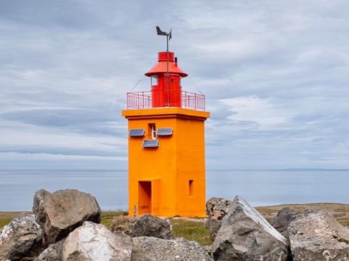
1937. Active; focal plane 25 m (82 ft); three flashes every 20 s, white or red depending on direction. 6 m (20 ft) square stone tower with lantern and gallery. Lighthouse painted orange, lantern red. Christian Bickel's 2011 photo shows this daymark. The lighthouse was formerly painted orange and the lantern yellow; in Huelse's photo the lighthouse color is red-orange. Nora Pajdak's photo is at right, Christian Aubertin also has a 2021 photo, Helena Geri has a photo, Trabas has Hartmann's distant view, Rognvaldur Olafsson has a 2016 street view, and Bing has a satellite view. Located on the south side of the Ísafjörður about 3 km (2 mi) east of Bolungarvík. Accessible by road. Site open, tower closed. . ARLHS ICE-071; VIT-107; Admiralty L4580; NGA 18560.

Óshólar Light, Bolungarvík, July 2021
Instagram photo by Nora Pajdak
* Arnarnes (2)
1921 (station established 1902). Active; focal plane 60 m (197 ft); light 2 s on, 8 s off, white, red or green depending on direction. 6 m (20 ft) square corrugated iron tower with lantern and gallery. Tower painted yellow, lantern red. Huelse has a closeup photo, Trabas has Hartmann's distant view, and Bing has a satellite view. This lighthouse marks the entrance to the Skutulsfjörður from the Ísafjörður. Located atop a steep promontory about 5 km (3 mi) north of Suðavík. Accessible by road: the lighthouse is on a bluff above highway 61. Site open, tower closed. . ARLHS ICE-028; VIT-109; Admiralty L4584; NGA 18612.
Æðey
1949. Active; focal plane 26 m (85 ft); two flashes every 22 s, white, red or green depending on direction. 13 m (43 ft) round stone tower with lantern and gallery. Lighthouse painted white, lantern red. Trabas has Hartmann's distant view and Bing has a satellite view. Æðey is an island off the north shore of the Ísafjörður. This lighthouse was completed in 1944, but it could not be lit until 1949 because lighting equipment was not available during World War II. Located on the southern tip of the island. Site status unknown. ARLHS ICE-001; VIT-127; Admiralty L4582; NGA 18616.
Sléttaeyri (Slettunes)
1949. Active; focal plane 7 m (23 ft); two flashes every 10 s, white, red or green depending on direction. 6 m (20 ft) 2-story concrete building with a lantern and gallery on the seaward side of the second floor. Lighthouse painted yellow. or more recently orange. A closeup photo and another photo are available and Bing has a satellite view. Located on a point of land on the north side of the Ísafjörður near the entrance, about 5 km (3 mi) west of Hesteyri. Accessible only by boat. Site status unknown. ARLHS ICE-126; VIT-128; Admiralty L4600; NGA 18628.
Straumnes Northwest
1919. Active; focal plane 30 m (98 ft); white flash every 4 s. 24 m (79 ft) square pyramidal concrete-covered tower with lantern and gallery. Lighthouse painted yellow, gallery red. A 2023 closeup photo is at right, Lightphotos.net has Bryan Richter's photo, a 2010 photo is available, the Siglingastofnun has a 1999 photo, Trabas has Hartmann's distant view from the sea, and Google has a fuzzy satellite view. The lighthouse was covered with concrete in 1930. This unusual lighthouse stands at the tip of a peninsula marking the northwestern corner of Iceland. It is one of two Straumnes Lights in northern Iceland; the other one is listed near the bottom of this page. Accessible only by boat. Site open, tower closed. ARLHS ICE-088; VIT-129; Admiralty L4604; NGA 18632.

Straumnes Northwest Light, Hornstrandir, June 2023
Google Maps photo by Street Action

Northern Coast Lighthouses
Hornbjarg
1930. Active; focal plane 33 m (108 ft); two white flashes every 20 s. 10 m (33 ft) square cylindrical tower with lantern and gallery, attached to the seaward end of a 2-story Icelandic Coast Guard station. Dominique Sayo's 2022 photo is at right, an excellent closeup photo is available, Asgeir Hoskuldsson has a 2020 photo, Gudmundur Ingimarsson has a nice view of the station, and Google has a distant satellite view. This lighthouse is located a few miles southeast of Horn, the northernmost cape of northwestern Iceland, and only about 17.5 km (11 mi) south of the Arctic Circle. Accessible only by boat. Site open, tower closed. . ARLHS ICE-049; VIT-130; Admiralty L4606; NGA 18636.
Selsker
1947. Active; focal plane 23 m (75 ft); one long (2.2 s) and one short flash every 30 s. 15 m (49 ft) round concrete tower with lantern and gallery, mounted on a round concrete base. Lighthouse painted white, lantern red. Ingvar Hreinsson has a 2000 closeup and a view from the sea, there is a small 2005 photo, the Siglingastofnunhas a photo, and Bing has a satellite view. This lighthouse marks Munaðarnes, a prominent cape on the north coast at the western entrance to the Húnaflói, a broad bay that separates the northwestern fjord region from the rest of northern Iceland. Located on a rocky reef 5 km (3 mi) north northwest of the cape. Accessible only by boat. Site open, tower closed. ARLHS ICE-023; VIT-131; Admiralty L4608; NGA 18640.
* Gjögur
1921. Active; focal plane 40 m (131 ft); four flashes every 30 s, white, red or green depending on direction. 24 m (79 ft) square pyramidal steel skeletal tower with lantern and gallery. Entire lighthouse painted red. Júlíus Ó Ásgeirsson has a photo and a distant view and Bing has a satellite view. Located at the tip of an east-pointing peninsula about 5 km (3 mi) east of Gjögur. Accessible by 4WD. Site open, tower closed. ARLHS ICE-039; VIT-135; Admiralty L4616; NGA 18648.

Hornbjarg Light, Horn, July 2022
Google Maps photo by Dominique Sayo

Drangnes Area Lighthouses
Grímsey í Steingrímsfirði
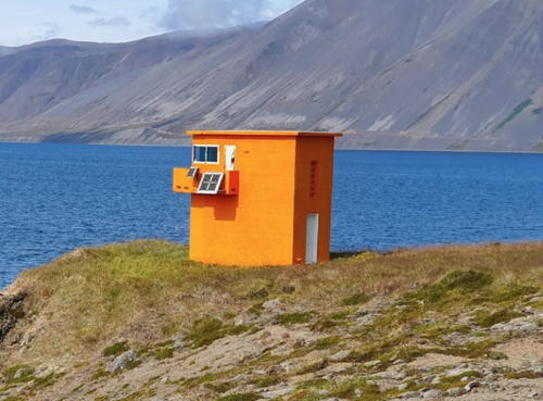
1949. Active; focal plane 82 m (269 ft); flash every 10 s, white, red or green depending on direction. 10 m (33 ft) square cylindrical concrete tower with lantern. Lighthouse painted yellow, lantern red. Willis Chung has a view from the sea, Google has a street view from highway 645 on the mainland, and Bing has a satellite view. Not to be confused with the much better known island of Grímsey in Norðurland Eystra (see below). Grímsey is an island off the north side of the entrance to the Steingrimsfjörður near Drangnes. Located on the highest point of the island. Accessible only by boat. Site open, tower closed. ARLHS ICE-006; VIT-137; Admiralty L4620; NGA 18656.
* [Malarhorn (2)]
1948 (station established 1914). Active; focal plane 27 m (89 ft); two flashes every 15 s, white, red or green depending on direction. 3 m (10 ft) 1-story concrete building; the light is displayed through windows in the front. Lighthouse painted yellow. A closeup 2023 street view and Bing has a satellite view. Located on a promontory on the east side of Drangnes. Accessible by road. Site open, tower closed. ARLHS ICE-123; VIT-138; Admiralty L4622; NGA 18660.
* [Hólmavik]
Date unknown. Active; focal plane 12 m (39 ft); flash every 5 s, white, red or green depending on direction. 3 m (10 ft) round lantern painted yellow. Google has a street view and a distant satellite view. Located on a hillside facing the harbor of Hólmavik. Site open, tower closed. VIT-139; Admiralty L4626; NGA 18664.

Norðurland Vestra (Western Northland) Lighthouses

Norðurland Vestra has a population of about 7800; the largest town is Sauðárkrókur at the head of the Skagafjörður.

Húnaflói Lighthouses
The Húnaflói is the largest bay of Iceland's north coast, about 100 km (60 mi) long and 50 km (30 mi) wide.

*
Skarð (Vatnsnes)
1951. Active; focal plane 52 m (171 ft); three flashes every 30 s, white, red or green depending on direction. 14 m (46 ft) round stone tower with lantern and gallery. Lighthouse painted white, lantern red. Michel Vanesse's photo is at right, Alberto Godino has a lovely view of the lighthouse, a 2021 photo is available, the Maritime Museum has a page for the lighthouse, Sergei Zajarin has a drone view, and Google has a satellite view. This lighthouse has the same design as the 1949 Ædey lighthouse (see above). Located on a bluff marking the east side of the entrance to the Miðfjörður, about 11 km (7 mi) north of Hvammstangi. Site open, tower closed. ARLHS ICE-083; VIT-140; Admiralty L4628; NGA 18672.
* Skagaströnd Range Rear
Date unknown. Active; focal plane 19 m (52 ft); green light occulting once every 5 s. Light mounted on the center of a strikingly modern concrete church tower. Arnbjörn Jóhannesson has a photo, Google has a street view, and Bing has a satellite view. The front light is on a post. Located in the fishing town of Skagaströnd on the east side of the Húnaflói. Site open, tower closed. VIT-142.1; Admiralty L4632.1; NGA 18680.

Skarð Light, Hvammstangi, May 2018
ex-Google Plus photo by Michel Vanesse
* Kálfshamars (Kálfshamarsvík) (2)
1942 (station established 1913). Active; focal plane 23 m (75 ft); two long flashes every 20 s, white, red or green depending on direction. 16 m (52 ft) square cylindrical concrete tower with lantern and gallery. Lighthouse painted white, lantern red. Guðmundur Reynir Kristinsson's 2023 photo is at right, the Maritime Museum has a page for the lighthouse, Kristinn Steinn Traustason has a 2022 photo, Wendy Crockett has a 2008 photo, Vilhjálmur Ingi Vilhjálmsson has a photo, Benjamin Rose has a 2021 closeup, and Google has a distant satellite view. This lighthouse marks the eastern entrance to the broad bay of the Húnaflói. The original lighthouse was similar to the surviving Straumnes Northwest lighthouse (see above). The present lighthouse was completed in 1940, but World War II delayed its lighting equipment. Located about 25 km (15 mi) north of Skagaströnd. Accessible by road. Site open, tower closed. . ARLHS ICE-058; VIT-147; Admiralty L4635; NGA 18684.

Skagafjörður Lighthouses
Skagatá (2)
1935 (station established 1913). Active; focal plane 18 m (59 ft); white flash every 10 s. 9 m (30 ft) square cylindrical concrete tower with lantern and gallery. Lighthouse painted yellow, lantern red. Herdís Steinsdóttir has a photo, Trabas has Jim Smith's photo, Huelse has a distant photo, and Bing has a satellite view. Skagatá is one of several very prominent capes on the north coast of Iceland. Located on the cape, about 80 km (50 mi) northwest of Sauðárkrókur. May be accessible only by boat. Site open, tower closed. ARLHS ICE-082; VIT-148; Admiralty L4636; NGA 18688.
* Sauðárkrókur (Saudarkrokur) Range Front (1)
Date unknown. Inactive. Light formerly mounted on the roof of a church (not on the steeple). Google has a street view and Bing has a satellite view. The light was moved to a skeletal tower nearby (next entry). Sauðárkrókur, at the southwestern end of the Skagafjörður, is one of the largest towns of Iceland's north coast, with a population of about 2700. Located near the center of town. Site open, tower closed.
* Sauðárkrókur (Saudarkrokur) Range Front (2)
Date unknown. Active; focal plane 18 m (59 ft); continuous red light shown only when vessels are expected. Approx. 16 m (52 ft) triangular skeletal tower carrying a red triangular daymark, point up. Google has a street view and Bing has an indistinct satellite view. The rear light is on a post on a hill behind the town. Located off the Freyjugata about 100 m (110 yd) east of the church. Site open, tower closed. VIT-150; Admiralty L4640; NGA 18692.

Kálfshamars Light, Skagaströnd, June 2023
Google Maps photo by Guðmundur Reynir Kristinsson
* Hegranes
1937. Active; focal plane 24 m (79 ft); one long (2 s) flash every 13 s, white, red or green depending on direction. 10 m (33 ft) square cylindrical concrete tower with lantern and gallery. Lighthouse painted yellow, lantern red. The Maritime Museum has a page for the lighthouse, Oli Arnar Brynjarsson has a very distant view from the sea, and Bing has a satellite view. The lighthouse was originally painted white with a red horizontal band; it was repainted in yellow in 1966. Located on a promontory at the southern end of the Skagafjörður, about 5 km (3 mi) east of Sauðárkrókur. Accessible by a walk of about 2 km (1.2 mi); Anke and Jens comment on the spectacular scenery. However, Radek Litersky found the area to be closed as a bird sanctuary in 2017. Site status uncertain. ARLHS ICE-046; VIT-154; Admiralty L4644; NGA 18700.
Málmey
1938. Active; focal plane 66 m (217 ft); two long (1.5 s) flashes every 15 s, white, red or green depending on direction. 9 m (30 ft) square cylindrical concrete tower with lantern and gallery. Lighthouse painted yellow, lantern red. Bing has a satellite view. Málmey is a high island in the eastern entrance to the Skagafjörður; sheer cliffs surround it on all sides. Located on the southeast side of the island. Accessible only by boat. Site status unknown. ARLHS ICE-013; VIT-155; Admiralty L4648; NGA 18712.

Siglufjörður Area Lighthouses
* Straumnes North
1942. Active; focal plane 19 m (62 ft); flash every 6 s, white, red or green depending on direction. 9 m (30 ft) octagonal concrete tower with lantern and gallery. Lighthouse colored with gray and white vertical stripes; lantern painted red. Huelse has a closeup photo, another photo is available, Trabas has Wöhrn's distant view, and Bing has a satellite view. This is one of two Straumnes lighthouses in northern Iceland; the other one is listed above. Both lighthouses have unusual and striking designs. Located on a promontory facing the Arctic, about 15 km (9 mi) northeast of Hofsós. Site open, tower closed. ARLHS ICE-087; VIT-156; Admiralty L4650; NGA 18716.
* Sauðanes North
1934. Active; focal plane 37 m (121 ft); three flashes every 20 s, white or red depending on direction. 10.5 m (35 ft) square cylindrical concrete tower with lantern and gallery, rising from one end of a 1-story concrete keeper's house. Lighthouse painted yellow, lantern red. Saurabh Premraj's photo is at right, the Maritime Museum has a page for the lighthouse, Andrew Linden has a 2022 photo, Lightphotos.net has a photo by Roy Wraanes, Trabas has Wöhrn's closeup photo, M.C. McCarron has a distant photo, and Google has a distant satellite view of the station. This is one of two Sauðanes lighthouses in northern Iceland; the other one is listed above. Located on a cape about 5 km (3 mi) northwest of Siglufjörður. Site open, tower closed. . ARLHS ICE-125; VIT-158; Admiralty L4652; NGA 18720.

Sauðanes North Light, Siglufjörður, May 2018
Google Maps photo by Saurabh Premraj
Selvíkurnef
1930. Active; focal plane 20 m (66 ft); flash every 5 s, white, red or green depending on direction. 8 m (26 ft) stone tower, painted yellow. The lighthouse needs paint in a 2007 closeup photo, a second photo is available, Trabas has Wöhrn's photo, and Google has a satellite view. A 2023 photo shows the lighthouse is surprisingly poor condition. Located on the east side of the Siglufjörður opposite the fishing village of the same name. Site status unknown. ARLHS ICE-077; VIT-159; Admiralty L4654; NGA 18728.
Siglunes
1908. Active; focal plane 46 m (151 ft); white flash every 7.5 s. 12 m (39 ft) square cylindrical concrete tower with lantern and gallery, attached to a 1-story concrete keeper's house. Lighthouse painted yellow, lantern red. Björn Valdimarsson's 2023 photo is at right, Mustafa Bilal also has a 2023 photo, the Maritime Museum has a page for the lighthouse, Ingvar Hreinsson has a photo, another photo is available, and Google has a distant satellite view. A history of the station includes a 1912 photo showing the wood keeper's cottage formerly attached to the tower; it also shows the original daymark, white with a red horizontal band. This is the oldest lighthouse on Iceland's north coast, marking one of several very prominent capes on the coast. The lighthouse was originally equipped with a Fresnel lens that had served in the Reykjanes lighthouse (see the Western Iceland page) since 1897. Removed in 1992, the historic lens is now on display at the Herring Era Museum (Síldarminjasafn Íslands) in Siglufjörður. The Maritime Museum also has a page describing the 100th anniversary of the lighthouse, celebrated in 2008. Located on heights above the cape, about 6 km (3.5 mi) northeast of Siglufjörður. Accessible only by boat. Site status unknown. ARLHS ICE-080; VIT-162; Admiralty L4656; NGA 18732.

Siglunes Light, Siglufjörður, August 2023
Instagram photo by Björn Valdimarsson

Norðurland Eystra (Eastern Northland) Lighthouses

Norðurland Eystra has a population of about 23,000. More than three quarters of the population lives in Akureyri, at the head of the Eyjafjorður.

Eyjafjorður Lighthouses

Brík
1966. Active; focal plane 50 m (164 ft); three white flashes every 10 s. 4 m (13 ft) round white lantern mounted on a concrete base. Valerio Belloni has a closeup photo and Bing has a distant satellite view. The lantern was prefabricated in Norway, where many similar lights are in use. Located on the west side of the entrance to the Olafsfjorður and Eyjafjorður about 3 km (2 mi) northeast of the fishing village of Olafsfjorður. Accessible by a path from the village. Site open, tower closed. VIT-163; Admiralty L4660.6; NGA 18736.
Hrólfssker
1951. Active; focal plane 20 m (66 ft); white flash every 3 s. 16 m (52 ft) round concrete tower with lantern and gallery. The lighthouse is described as gray by NGA but Thomas O'Neil's excellent photo shows it to be painted yellow with a red lantern. Trabas has Renate Riedel's photo. Located on a small island ("Rolf's Skerry") in the center of the entrance to the Eyjafjorður (the island does not appear in Google's satellite view of the fjord). Accessible only by boat; there are distant views from the mainland. Site open, tower closed. ARLHS ICE-052; VIT-165; Admiralty L4658; NGA 18740.
Hrísey
1920. Active; focal plane 114 m (374 ft); flash every 8 s, white, red or green depending on direction. 9 m (30 ft) square cylindrical stone tower with lantern and gallery. Lighthouse painted yellow, lantern red. The Maritime Museum has a page with a photo, a 2008 photo is available, Andri Vidisson has a closeup, Trabas has Hartmann's distant view, and Bing has a fuzzy satellite view. Hrísey is an inhabited island in the Eyjafjorður; 7.5 km (4.7 mi) long, it is the second largest island of Iceland. The population is about 175. Located on a bluff on the northwestern side of the island. Anke and Jens found the area to be closed (private property). ARLHS ICE-051; VIT-166; Admiralty L4660; NGA 18752.
* Hjalteyri
1920. Active; focal plane 14 m (46 ft); two flashes every 20 s, white, red or green depending on direction. 14 m (46 ft) square pyramidal skeletal tower with lantern and gallery, painted red. Léo Guedes has a 2023 photo, Huelse has a closeup, Daníel Starrason has another good photo, Trabas has Hartmann's photo, Google has a distant street view, and Google has a distant satellite view. Hjalteyri is a small village (population about 40) on the west side of the Eyjafjorður, about 20 km (13 mi) north of Akureyri. Located on the point of a spit that protects the village harbor. Site open; Anke and Jens visited in June 2008 and report that the tower can be climbed, but the gallery seemed unsafe. ARLHS ICE-026; VIT-169; Admiralty L4666; NGA 18780.
* Svalbarðseyri
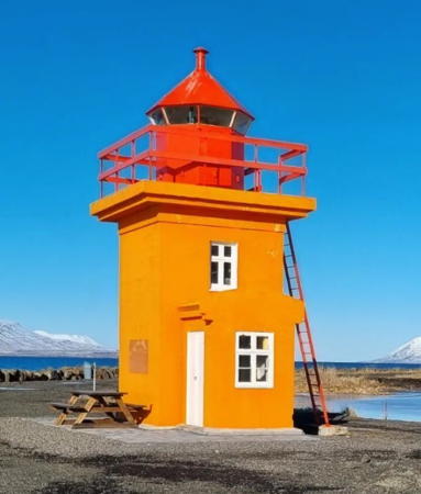
1920. Active; focal plane 9 m (30 ft); one long flash every 6 s, white, red or green depending on direction. 8 m (26 ft) square cylindrical stone tower with lantern and gallery. Lighthouse painted yellow, lantern red. Elva Björk Einarsdóttir's 2024 photo is at right, Stephen Bonnici has a 2022 photo, Lennox Head has a fine 2017 photo, Trabas has Wöhrn's photo, Raoul Brosch has a panoramic view, and Google has a street view and a satellite view. Svalbarðseyri is a small village on the east side of the Eyjafjorður, about 6 km (4 mi) north of Akureyri. Located on the shore on a promontory just north of the village. Accessible by road. Site open, and visitors can climb an external ladder to the gallery. . ARLHS ICE-096; VIT-174; Admiralty L4668; NGA 18788.
Gjögurtá
1970. Active; focal plane 30 m (98 ft); two white flashes every 10 s. 4 m (13 ft) round lantern mounted on a concrete base. Lantern painted white. Trabas has Hartmann's view from the sea and Bing has a fuzzy satellite view. Located on the east side of the entrance to the Eyjafjorður. Accessible only by boat. Site open, tower closed. ARLHS ICE-110; VIT-174.5; Admiralty L4657; NGA 18792.

Svalbarðseyri Light, Akureyri, March 2024
Instagram photo by Elva Björk Einarsdóttir
 

Grímsey Lighthouse
*
Grímsey
1937. Active; focal plane 27 m (89 ft); white light, 4 s on, 16 s off. 9 m (30 ft) square cylindrical concrete tower with lantern and gallery. Lighthouse painted yellow, lantern red. A 2020 closeup is at the top of this page, Jón Ingi Cæsarsson also has a closeup photo, David Minkin has a good photo, Shelley McIntyre has a 2008 photo, and Google has a satellite view. Grímsey is an island precisely on the Arctic Circle, 41 km (25.5 mi) north of the mainland. The island has a permanent population of about 150 and is famous for its huge bird colonies. Grímsey is accessible by air or by ferry from Dalvik. Located on the southeastern tip of the island. Site open, tower closed. . ARLHS ICE-007; VIT-175; Admiralty L4674; NGA 18796.

Húsavík Area Lighthouses
Flatey (2)
1963 (station established 1913). Active; focal plane 27 m (89 ft); three white flashes every 15 s. 9.5 m (31 ft) square cylindrical concrete tower with lantern and gallery. Lighthouse painted yellow, lantern red. Trabas has a commercial calendar photo and Google has a satellite view. Flatey ("Flat Island") is an island in Skjálfandi Bay. There was formerly a settlement on the island, but the last inhabitants departed in 1967. Ecotours visit the island today. Located on the east side of the island, north of the former settlement. Site open, tower closed. ARLHS ICE-005; VIT-176; Admiralty L4678; NGA 18800.
ex-Motorfyrskib III Donna Wood
1918 (Rasmus Møller Værft, Fåborg, Denmark). Decommissioned 1974. This is a Danish 20.4 m (67 ft) oak lightship converted to a 2-masted tall ship. Vessel painted white with gold trim. This lightship served most of its career on the Lappegrund station and the last four years at Halskov Rev. After conversion the ship was formerly based in Copenhagen and available for charter. Since 2015 the ship has been owned by North Sailing and based in Húsavík for tours of Iceland and Greenland waters. North Sailing has a photo of its arrival in Húsavík. Google has a 2023 street view and a satellite view. May sometimes be seen docked in Húsavík.
* Húsavík
1956. Active; focal plane 50 m (164 ft); flash every 2.5 s, white, red or green depending on direction. 12 m (39 ft) semicircular cylindrical concrete tower with lantern and gallery inset in the top. Lighthouse originally painted yellow, but it has weathered to brown in the most of the available photos. Anderson England's 2023 photo is at right, Trabas has Meyer's closeup photo, Huelse has a photo, Kjarten Palsson has another photo, Agnes Heiða Skúladóttir has a 2009 photo, and Google has a satellite view. Húsavík is a fishing port on the east side of Skjálfandi Bay. With a population of about 2400, it is one of the largest and most accessible locations in northeastern Iceland. Located on a promontory on the north side of the entrance to Húsavík harbor, about 2 km (1.2 mi) west of town. Site open, tower closed. . ARLHS ICE-054; VIT-177; Admiralty L4680; NGA 18804.
Lundey
1977. Active; focal plane 46 m (151 ft); white flash every 5 s. 4 m (13 ft) round lantern mounted on a concrete pad. Lantern painted white. Lundey (one of several Icelandic islands of that name) is a flat-topped island about 5 km (3 mi) north of Húsavík. The light is just barely visible near the left end of the island in a distant photo and Google has a satellite view. Accessible only by boat. Site and tower closed. ARLHS ICE-095; VIT-182; Admiralty L4686; NGA 18824.

Húsavík Light, Húsavík, February 2023
Google Maps photo by Anderson England
* Tjörnes
1929. Active; focal plane 35 m (115 ft); two white flashes every 15 s. 12 m (39 ft) square cylindrical concrete tower with lantern and gallery. Lighthouse painted yellow, lantern red. A very tall communications tower looms over the lighthouse, as seen in Huelse's photo and Youra Turceninoff's distant 2023 view. Google has a very distant street view and Bing has a satellite view. This lighthouse marks a prominent cape on the north coast, about 1 km (0.6 mi) northwest of Máná. Accessible by road. Site open, tower closed. ARLHS ICE-092; VIT-183; Admiralty L4688; NGA 18828.
Mánáreyjar
1982. Active; focal plane 43 m (41 ft); white flash every 10 s. 4 m (13 ft) round lantern mounted on a concrete pad. Lantern painted white with a red roof. The lantern is barely visible in Eirik Einarsson's distant view and Bing has a satellite view. Mánáreyjar is a rocky island about 5 km (3 mi) northeast of Tjörnes. Located on the highest point of the island. Accessible only by boat. Site and tower closed. ARLHS ICE-014; VIT-183.2; Admiralty L4689; NGA 18832.
* Kópasker (Grimshafnartangi)
1951. Active; focal plane 21 m (69 ft); one long (1.5 s) flash every 20 s, white, red or green depending on direction. 14 m (46 ft) square cylindrical concrete tower with lantern and gallery. Lighthouse painted white with narrow black vertical stripes, lantern red. Trabas has Renate Riedel's photo, Mustafa Bilal has a 2023 closeup, Lydur Gudmundsson has a photo, Martin Pohl has a 2021 photo, Petr Brož has a good 2009 photo, Huelse also has a photo, and Google has a very distant street view and a distant satellite view. Kópasker is a small fishing port on the east side of the Öxarfjörður and the west side of the Melrakkaslétta, Iceland's northeastern peninsula. Located on a promontory on the north side of the entrance to the harbor of Kópasker. Site open, tower closed. . ARLHS ICE-043; VIT-184; Admiralty L4690; NGA 18836.
* Rauðinúpur (2)
1958 (station established 1929). Active; focal plane 63 m (207 ft); three white flashes, short-long-short (Morse code "R"), every 20 s. 8 m (26 ft) square cylindrical concrete tower with lantern and gallery. Lighthouse painted yellow, lantern red. Haraldur Levi Jonsson has a 2016 photo, Claus Görk has a closeup, Hilma Steinarsdóttir has a distant view, and Google has a distant satellite view. Located on a promontory at the northwestern corner of the Melrakkaslétta, Iceland's northeastern peninsula, marking the entrance to the Öxarfjörður. Accessible by road about 15 km (9 mi) north northwest of Kópasker. Site open, tower closed. . ARLHS ICE-072; VIT-191; Admiralty L4696; NGA 18840.
* Hraunhafnartangi
1951. Active; focal plane 21 m (69 ft); one long and one short flash every 30 s, white or red depending on direction. 19 m (62 ft) square cylindrical concrete tower with lantern and gallery. Lighthouse painted white, lantern red. The design of the building makes it appear at a distance to have one or more black vertical stripes on each face. Ólafur Gauti Sigurðsson's 2023 photo is at right, Huelse has a good photo, Marcel Clarijs also has a good photo, Trabas has Wöhrn's photo, and Bing has a satellite view. This is Iceland's northernmost lighthouse, standing about 800 m (1/2 mi) south of the Arctic Circle at the northeastern tip of the island. Accessible by road about 10 km (6 mi) northwest of Raufarhöfn. Site open, tower closed. . ARLHS ICE-050; VIT-192; Admiralty L4699; NGA 18844.

Hraunhafnartangi Light, Raufarhöfn, August 2023
Instagram photo by Ólafur Gauti Sigurðsson
* Raufarhöfn
1931. Active; focal plane 33 m (108 ft); three flashes every 20 s, white, red or green depending on direction. 10 m (33 ft) square cylindrical concrete tower with lantern and gallery. Lighthouse painted yellow, lantern red. Danni Borgarinsson has a 2023 photo, Huelse has a good photo, Stefan M. Seydel has an excellent closeup, Trabas has Wöhrn's photo, Elva Bra has a fine closeup, and Google has a satellite view. Raufarhöfn is a fishing town near the northeastern corner of Iceland. Located on the east side of the entrance to Raufarhöfn harbor. Accessible by road. Site open, tower closed. ARLHS ICE-073; VIT-193; Admiralty L4700; NGA 18848.
* Raufarhöfn Range Front
Date unknown. Active; focal plane 9 m (30 ft); green light occulting once every 5 s. 3.5 m (12 ft) 1-story equipment shelter. The light was formerly displayed through a window, but it has now been centered on a red triangular daymark on a pole mounted on the roof. The rear light is on a short skeletal tower. Trabas has Wöhrn's photo, Huelse has a photo, and Bing has an indistinct satellite view. Located on the south side of the harbor at Raufarhöfn. Site open, tower closed. VIT-194; Admiralty L4702; NGA 18856.
Melrakkanes
1956. Active; focal plane 23 m (75 ft); flash every 12 s, white or red depending on direction. 12 m (39 ft) semicircular cylindrical concrete tower with lantern and gallery. Lighthouse painted yellow. No photo available but Bing has a satellite view. Located on a cape about 15 km (9 mi) southeast of Raufarhöfn, marking the northern entrance to the bay called the Thistilfjörður. Probably accessible only by boat. Site open, tower closed. ARLHS ICE-068; VIT-197; Admiralty L4706; NGA 18868.

Langanesbyggð Area Lighthouses
Grenjanes
1945. Active; focal plane 25 m (82 ft); one long (2 s) white flash every 20 s. 19 m (62 ft) square cylindrical concrete tower with lantern and gallery. Lighthouse painted white, lantern red. The design of the building makes it appear at a distance to have one or more black vertical stripes on each face. Arnaud van Beek's photo is at right, Ingvar Hreinsson has a 2001 closeup photo and Google has a satellite view. This is one of several lighthouses in Iceland that were built during World War II but not activated until the end of the war. Located on a cape at the east entrance to the Lónafjörður, about 5 km (3 mi) north of the fishing town of Þórshöfn. May be accessible only by boat. Site open, tower closed. ARLHS ICE-042; VIT-205; Admiralty L4710; NGA 18900.

Grenjanes Light, Þórshöfn, August 2018
photo copyright Arnaud van Beek; used by permission
Langanes (Long Cape) (2)
1950 (station established 1914). Active; focal plane 53 m (174 ft); two white flashes every 10 s. 9 m (30 ft) round concrete tower with lantern and gallery. Lighthouse painted white, lantern red. A photo by Michael Brandes is at right, Trabas has Renate Riedel's closeup photo, Kristinn Vilhjálmsson has a closeup photo, Nunni Konn has a photo, Jirka Krcmar has a 2016 photo, Thierry Ruedin has a 2021 photo, Katy Nicolson has a 2009 photo, and Google has a distant satellite view. This lighthouse marks the end of Langanes, a long, narrow peninsula that projects from the northeastern corner of Iceland, posing a great hazard to navigation. Þorvaldur Jónsson built this and several other lighthouses in Iceland. Note: this is one of two Langanes lighthouses in northern Iceland; see near the top of this page for the other one. Site open, tower closed. . ARLHS ICE-111; VIT-206; Admiralty L4712; NGA 18904.

Information available on lost lighthouses:

Notable faux lighthouses:


Langanes Fyr, Langanesbyggð, November 2019
Google Maps photo by Michael Brandes

Adjoining pages: South: East and South Iceland | West: Western Iceland

Return to the Lighthouse Directory index | Ratings key

Posted September 11, 2006. Checked and revised April 5, 2024. Lighthouses: 50; lightships: 1. Site copyright 2024 Russ Rowlett and the University of North Carolina at Chapel Hill.