Jersey is the largest of the Channel Islands, located in the English Channel off the west coast of France's Cotentin Peninsula. Together with a scattering of small islets and reefs it forms the Bailiwick of Jersey, a self-governing British Crown Dependency recognizing the British monarch as its head of state. Jersey is not part of the United Kingdom although its citizens are recognized as British nationals and Britain is responsible for its defense and international representation.
The island is roughly rectangular, 14.5 km (9 mi) long east to west and 8 km (5 mi) wide. Its population is a little over 100,000. St. Helier is the capital and largest town. Jersey is accessible by air or by ferry from several ports in southern England and in neighboring France.
Aids to navigation in Jersey are operated by the local harbor authority, Jersey Harbours.
ARLHS numbers are from the ARLHS World List of Lights. Admiralty numbers are from Volume A of the Admiralty List of Lights & Fog Signals. U.S. NGA numbers are from Publication 114.
- General Sources
- Online List of Lights - Channel Islands
- Photos by various photographers posted by Alexander Trabas. Many of the photos are by Capt. Peter Mosselberger ("Capt. Peter").
- Phares d'Europe
- Photos posted by Robert Carceller and Alain Guyomard as part of their Phares du Monde web site.
- Lighthouses in Jersey
- ARLHS listing for Jersey; members have provided photos of most of the lights.
- Lighthouses in Jersey
- Photos by various photographers available from Wikimedia.
- World of Lighthouses - British Territories in Europe
- Photos by various photographers available from Lightphotos.net.
- Leuchtürme auf Briefmarken
- Lighthouse postage stamps from around the world, including many of the Channel Islands lighthouses, posted by Klaus Huelse. Huelse also has a page of historic postcard views, Britische Leuchttürme auf historischen Postkarten.
- GPSNavigationCharts
- Navigation chart information for Jersey.

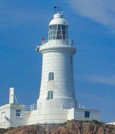
La Corbière Light, St. Brélade, January 2020
Instagram photo by Michael Wetton


