Lighthouses of Japan: Eastern Hokkaidō

The nation of Japan, known in Japanese as Nihon or Nippon (日本), occupies an archipelago off the east coast of Asia. The four main islands are Hokkaidō in the north, Honshū (the largest) in the center, Shikoku in the south, and Kyūshū in the southwest. The country includes thousands of other islands of all sizes; among them the Ryūkyū (Nansei) Islands are a long chain extending to the southwest and including the large island of Okinawa, and the Nanpō Islands are another long chain extending south into the Pacific Ocean. Much of Japan is mountainous but the coastal regions are densely populated and urbanized; the country's population is about 126 million.

Hokkaidō, the northernmost of the four main islands of Japan, is very roughly triangular in shape, facing north on the Sea of Okhotsk, southeast on the Pacific Ocean, and west on the Sea of Japan. It is separated from Honshū to the south by the Tsugaru Strait and from Russian Sakhalin to the north by the La Pérouse or Sōya Strait.

Japan is divided into 47 prefectures. The entire island of Hokkaidō forms a single prefecture, making it by far the largest of the 47. The prefecture is divided into nine administrative regions, called subprefectures in English. The subprefectures of Hokkaidō are similar in size to the prefectures in the other main islands.

This page covers lighthouses of eastern Hokkaidō including the subprefectures of Nemuro, Kushiro, and Tokachi. The easternmost land in Japan, this coast faces east on the Pacific Ocean. In the north the narrow and twisting Nemuro Strait separates Hokkaidō from the Kuril Islands. The southernmost Kurils, including Etorofu, Kunashiri, Shikotan, and the Khabomai Islands, are occupied by Russia but claimed by Japan.

In Japanese, the word for a lighthouse is tōdai or toudai (灯台). The words saki and misaki are for capes and headlands, hana ("nose") is a promontory, hantō is a peninsula, shima (also spelled sima or jima) is an island, bae is a reef, iwa or shi is a rocky reef, amase or se is a shoal, wan is a bay, nada is a sound or basin, kaikyō is a strait, kawa is a river, and or minato is a harbor.

Lighthouses in Japan are operated and maintained by the Japanese Coast Guard's Maritime Safety Agency. Lighthouses in Nemuro Subprefecture are the responsibility of the Nemuro Coast Guard office and those in Kushiro and Tokachi Subprefectures are maintained by the Kushiro office.

ARLHS numbers are from the ARLHS World List of Lights. JCG numbers are the Japanese Coast Guard's light list numbers. Admiralty numbers are from volume M of the Admiralty List of Lights & Fog Signals. U.S. NGA List numbers are from Publication 112.

General Sources
Lighthouses in Japan - Hokkaidō
Photos and data for Hokkaidō lighthouses; mostly in Japanese but the page titles are in English.
Lighthouse-Japan.com - Hokkaidō
Another site with excellent photos and text in Japanese.
Misty's Japanese Lighthouse Tour - Hokkaidō
Photos and brief notes in English.
Form of a Lighthouse
Another site with many photos of lighthouses in northern Japan; cited below as FOAL.
Lighthouse Visits
Another good source of lighthouse photos.
Nemuro Coastal Lighthouses
Posted by the Nemuro Coast Guard Station, this page links to pages for the major lighthouses. Another page links to pages for the breakwater lighthouses.
Nemuro Lighthouse Photo Album
Additional photos posted by the Nemuro Coast Guard Station.
Lighthouses in Hokkaido Prefecture
Photos by various photographers available from Wikimedia.
Japan: Modern Lighthouses
Historic postcard images posted by Michel Forand.
Online List of Lights - Japan
Photos by various photographers posted by Alexander Trabas. Photos for this area were provided by Jim Smith.
Navionics Charts
Navigation chart information for Hokkaidō.

Kushiro
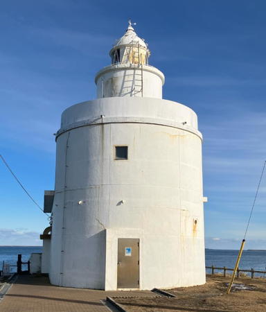
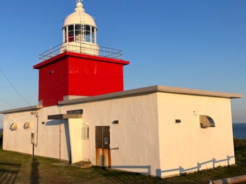
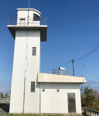
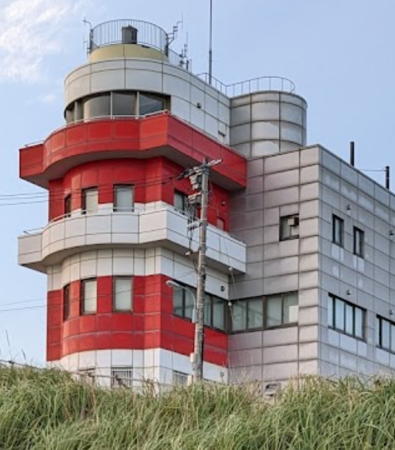
Kushiro Saki Light, Kushiro, May 2011
ex-Panoramio Creative Commons photo by pakku


Tokachi Otsu Light, Toyokoro, July 2017
Google Maps photo by Jerry Weng

Nemuro Subprefecture Lighthouses

Rausu Town (Shiretoko Peninsula East Coast) Lighthouses
The rugged Shiretoko Peninsula projects 70 km (43 mi) into the Sea of Okhotsk, making it a significant obstacle to navigation. The wild outer half of the peninsula is protected as the Shiretoko National Park. In the language of Japan's indigenous Ainu people, shiretoko means "end of the earth." For lighthouses on the west side of the peninsula, see the Northern Hokkaidō page.

*
Chienbetsu (Tienbetsu, Tienbetu) Kō (North Breakwater)
1979. Active; focal plane 14 m (46 ft); two red flashes every 6 s. 11 m (36 ft) round cylindrical concrete tower with lantern and gallery, painted red. FOAL's page has photos and Google has a street view and a satellite view. Located at the end of the north (main) breakwater enclosing the small harbor of Chienbetsu, about 8 km (5 mi) northeast of Rausu. Probably accessible by walking the pier. Site open, tower closed. ARLHS JPN-990; JCG-0217; Admiralty M6861.5; NGA 0428.
* Rausu
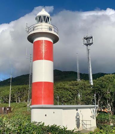
1971. Active; focal plane 87 m (285 ft); white flash every 10 s. 16 m (52 ft) round cylindrical concrete tower with lantern and gallery, attached at one end of a 1-story keeper's house. Tower painted with red and white horizontal bands. A 2013 photo is at right, the Coast Guard has a page for the lighthouse, the Lighthouse-Japan.com site has a good photo, Misty's Tour has a fine closeup, FOAL's page has photos, Yoshiiaki Ishii has a fine 2017 photo, and Google has a street view and a satellite view. Located on a promontory north of Rausu, a port on the east side of the Shiretoko Peninsula, directly opposite Utoro on the west side. The coastal highway tunnels under the light station. Site open, parking available, tower closed. . ARLHS JPN-501; JCG-0216; Admiralty M6858; NGA 0424.
* Rausu Kō West Breakwater
1980. Active; focal plane 12 m (39 ft); green flash every 4 s. 11 m (36 ft) round cylindrical concrete tower with lantern and gallery, painted white. A photo is available; the mountains in the background are on the Russian-occupied island of Kunashir. FOAL's page has photos (seventh row of photos) and Google has a street view and a satellite view. Due to a missing header in the NGA listing ARLHS has this light listed as Matunori West Breakwater. Located at the end of the north inner breakwater at Rausu. Probably accessible by walking the pier. Site open, tower closed. ARLHS JPN-906; JCG-0215; Admiralty M6861.2; NGA 0420.
* Rausu Kō South Inner (No. 2) Breakwater
1970. Active; focal plane 13 m (43 ft); continuous red light with a more intense flash every 6 s. 10 m (33 ft) concrete post attached to a square 1-story concrete equipment shelter. Entire lighthouse is red. FOAL's page has a photo (second and third rows) and Google has a street view and a satellite view. Located at the south end of the inner breakwater at Rausu. Accessible by walking the pier. Site open, tower closed. JCG-0214; Admiralty M6861; NGA 0416.
Rausu Light
Rausu Light, Rausu, July 2013
Wikimedia Creative Commons photo by 星組背番号10
* Rausu Kō South (No. 1) Breakwater
1964. Active; focal plane 12 m (39 ft); green flash every 3 s. 10 m (33 ft) concrete post attached to a square 1-story concrete equipment shelter. Entire lighthouse is white. FOAL's page has a photo (rows 4-6 on the page) and Google has a satellite view and a distant street view. Located at the end of the south breakwater at Rausu. Probably accessible by walking the pier. Site open, tower closed. JCG-0212; Admiralty M6859; NGA 0412.
Matsunori (Matunori) Kō
1964. Active; focal plane 14 m (46 ft); red light, 3 s on, 3 s off. 11 m (36 ft) round hourglass-shaped concrete tower with lantern and gallery, painted red. Matthew Saunders has a photo and a view across the harbor, FOAL's page has a photo, and Google has a satellite view and a distant street view. Located at the end of the north breakwater enclosing the small harbor of Matunori, about 5 km (3 mi) southwest of Rausu. Site status unknown. ARLHS JPN-905; JCG-0211; Admiralty M6857.5; NGA 0404.

Shibetsu Town Lighthouses
* Kunbetsu (Kunbetu)
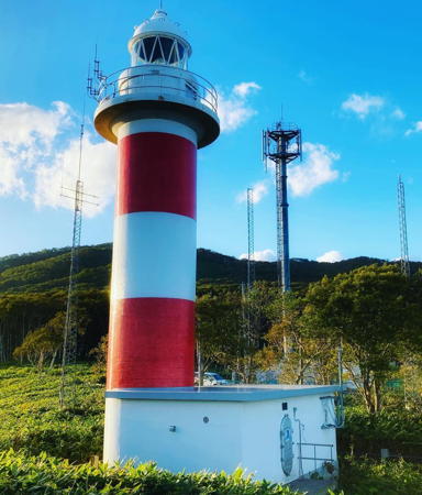
1978. Active; focal plane 54 m (177 ft); white light, occulting once every 8 s. 15 m (49 ft) round cylindrical concrete tower with lantern and gallery, attached at one end of a small equipment shelter. Tower painted with red and white horizontal bands. The Coast Guard has the photo at right and a page for the lighthouse, the Lighthouse-Japan.com site has good photos, Misty's Tour has a distant view, FOAL's page has photos, and Google has a satellite view and a distant street view. Kunbetsu is at the base of the Shiretoko Peninsula and in the westernmost curve of the Nemuro Strait. The lighthouse is located on a steep bluff above the town. Site open but not so easy to find; the access road is unmarked. Tower closed. . ARLHS JPN-302; JCG-0210; Admiralty M6857; NGA 0400.
* Shibetsu (Sibetu) Kō
1980. Active; focal plane 16 m (52 ft); red light, occulting once every 4 s. 11 m (36 ft) round cylindrical concrete tower with lantern and gallery, painted red. FOAL's page has photos and Google has a satellite view and a very distant street view. Located at the end of the north breakwater enclosing the harbor of Shibetsu, on the north side of town. Accessible by walking the pier. Site open, tower closed. ARLHS JPN-970; JCG-0209; Admiralty M6856.7; NGA 0396.
Kunbetsu Light
Kunbetsu Light, Shibetsu, February 2004
Japanese Coast Guard Nemuro Office photo
* Notsuke (Notuke) Saki
1953. Active; focal plane 14 m (46 ft); white light, 3 s on, 3 s off. 12 m (39 ft) round cylindrical concrete tower with lantern and gallery, painted white. The Coast Guard has a page for the light station, Lighthouse of Japan has good photos, Misty's Tour has several photos, FOAL's page has photos, Wikimedia has a 2013 photo, a 2016 closeup is available, Hiroshi Fukuyama has a 2017 street view (a portion is seen at right), and Google has a satellite view. NGA misspells the name as Hutuke Saki. Notsuke Saki is a sand spit about 16 km (10 mi) long projecting southeastward into the Nemuro Strait south of Shibetsu. The light marks this hazard and the narrowest passage of the strait. Russia's Veslovskiy Light on Kunashiri is about 20 km (13 mi) to the northeast. Located at the eastern end of the spit. Parking is available at the end of pavement on highway 950; from here it's about 400 m (1/4 mi) on the unpaved access road to the lighthouse. Site open, tower closed. . ARLHS JPN-436; JCG-0206; Admiralty M6856; NGA 0388.

Betsukai Town Lighthouse
* Odaito Kō
1979. Active; focal plane 13 m (43 ft); continuous green light with a more intense flash every 3 s. 11 m (36 ft) round hourglass-shaped concrete tower with lantern and gallery, painted white. FOAL's page has photos, a distant view is available, and Google has a satellite view and a distant street view. Odaito harbor faces Ryujin Bay, the sound sheltered by the long hook of Notsuke Saki. Located at the end of the central quay of Odiato, about 11 km (7 mi) south of Sibetu. Probably accessible by walking the pier. Site open, tower closed. ARLHS JPN-937; JCG-0205; Admiralty M6856.5; NGA 0392.

Notsuke Saki Light, Shibetsu, October 2017
Google Maps street view by Hiroshi Fukuyama

Nemuro City: North Side Nemuro Peninsula Lighthouses
The Nemuro Peninsula extends eastward into the Pacific for 30 km (19 mi); for most of its length it is about 8 km (5 mi) wide. The entire peninsula is governed as part of Nemuro City. Cape Nosappu, at the tip of the peninsula, is the easternmost point of Hokkaidō and indeed the easternmost point of Japan (not including the southern Kurils occupied by Russia).

Nemuro Kō South Breakwater
1926. Active; focal plane 11 m (36 ft); two green flashes every 6 s. 8 m (26 ft) round concrete tower with lantern and gallery, painted white. FOAL's page has photos, another photo is available, and Google has a satellite view and a distant street view. Klaus Huelse has a historic postcard view of this lighthouse, the oldest harbor light on Japan's north coast. Located at the south end of the long south (really west) breakwater at the south entrance to Nemuro harbor, on the north side of the peninsula. The breakwater is attached to an island, Bentenjima. Accessible only by boat. Site status unknown. JCG-0204; Admiralty M6852; NGA 0432.
* Nemuro Kō North Breakwater
1945. Active; focal plane 14 m (46 ft); continuous green light with a more intense flash every 3 s. 14 m (46 ft) round concrete tower with lantern and gallery, painted white. FOAL's page has photos, a view across the harbor is available, and Google has a satellite view and a distant street view. Located at the end of the short north breakwater at the north entrance to Nemuro harbor. Probably accessible by walking the pier. Site open, tower closed. ARLHS JPN-924; JCG-0203; Admiralty M6850; NGA 0436.
* Nokkamappu Saki
Date unknown. Active; focal plane 21 m (69 ft); two white flashes every 10 s. 11 m (36 ft) octagonal cylindrical concrete tower with lantern and gallery, painted with black and white horizontal bands. Misty's Tour has a good photo in which the dark bands on the tower appear red in the setting sun, FOAL's page has photos, Ken Murakami has a 2017 photo, and Google has a satellite view. Located on a promontory 8 km (5 mi) northeast of Nemuro; accessible by an unpaved road off the main highway to Nosappu Misaki. The trail leading to the lighthouse is marked but no parking is provided there; the nearest parking is about 1.5 km (1 mi) to the east. Site open, tower closed. ARLHS JPN-928; JCG-0202; Admiralty M6847; NGA 0440.
* Nosappu (Noshappu) Misaki (Cape Nosappu, Nemuro) (3)
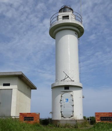
1930 (station established 1872). Active; focal plane 23 m (75 ft); white or red light, depending on direction, 3 s on, 3 s off. 14 m (46 ft) round, broadly cylindrical concrete tower with lantern and gallery, attached to a 1-story keeper's house. Entire lighthouse painted white. The Coast Guard has the photo at right and a good page for the lighthouse, Lighthouse-Japan.com has a portfolio of photos, Wikimedia has several photos, Misty's Tour has a page with a nighttime view, FOAL's page has photos from 2010, Tomoya Nishi has a 2022 street view, and Google has a satellite view. This is one of Japan's oldest and most historic light stations. The original lighthouse, a hexagonal pyramidal wood tower with a small lantern, was built by the British engineer Richard Henry Brunton only four years into the reign of the reform emperor Meiji. A photo of this lighthouse is seen near the bottom of the Coast Guard page. The second lighthouse was a round cylindrical cast iron tower with a first-order lantern. Cape Nosappu (or Nemuro) is the northeastern tip of Hokkaidō and the easternmost point of Japan's major islands. A short distance west of the lighthouse the soaring Tower of Peace provides a high-level observation platform with a broad view of the cape, the Pacific, and the southern Kuril Islands. Accessible by road; parking provided. However, the entrance to the lighthouse from highway 35 does not appear to be marked. Located on the point of the cape, a razor-thin promontory nearly surrounded by water. Site open, tower closed. . ARLHS JPN-431; JCG-0154; Admiralty M6840; NGA 0448.
Cape Nosappu Light
Nosappu Misaki (Nemuro) Light, Nemuro
Japanese Coast Guard Nemuro Office photo
Kaigara Shima (Shell Island)
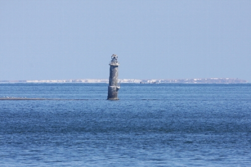
1937. Inactive since 2014 at least but listed with focal plane 17 m (56 ft); white light, 1.5 s on, 3.5 s off. 17 m (56 ft) round cylindrical concrete tower with lantern and gallery. The Coast Guard has a page with several photos including the one at right, two closeup photos show the sad state of the lighthouse, Lighthouse Digest also has a distant photo, and Bing has a satellite view. This is a gravely endangered waveswept lighthouse. Kaigara Shima is a shoal, underwater at high tide, halfway between Cape Nosappu and the nearest island of the Kurils, only 7 km (4.5 mi) away. Obviously it is a major hazard to navigation through this narrow strait. But the Kurils are occupied by Russia and the territorial dispute has prevented the Maritime Safety Agency from rebuilding the lighthouse. The tower has a significant lean and could fall at any time but the Agency has struggled to keep a light lit somewhere on the tower. In August 2023 a Russian Navy crew attached a Russian flag to the lighthouse and shortly thereafrer a Japanese patrol boat reported that the tower appeared to be lit. Located 3.6 km (2.25 mi) northeast of Cape Nosappu. Accessible only by boat; there is a distant view from the cape. Site and tower closed. . ARLHS JPN-209; JCG-0155; Admiralty M6842; NGA 0452.

Nemuro City: South Side Nemuro Peninsula Lighthouses
Habomai Kō South Outer Breakwater
1985. Active; focal plane 13 m (43 ft); green flash every 4 s. 11 m (36 ft) round cylindrical concrete tower with lantern and gallery. Entire lighthouse is white. FOAL's page has photos and Google has a satellite view and a distant street view. Located on the seaward spur of the detached outer breakwater at Habomai, a fishing port about 8 km (5 mi) southeast of Cape Noshappu. Accessible only by boat. Site status unknown. ARLHS JPN-855; JCG-0151.5; Admiralty M6839.2; NGA 0468.

Kaigara Shima Light, Nemuro Strait
Japanese Coast Guard Nemuro Office photo
Habomai Kō South Breakwater
1967. Active; focal plane 12 m (39 ft); green flash every 3 s. 11 m (36 ft) round hourglass-shaped concrete tower with lantern and gallery. Entire lighthouse is white. FOAL's page has photos and Google has a street view and a satellite view. Located at the east end of the detached outer breakwater at Habomai. Accessible only by boat. Site status unknown. ARLHS JPN-856; JCG-0152; Admiralty M6839.4; NGA 0464.
Habomai Moshiri (Mosiri) Shima
1957. Active; focal plane 22 m (72 ft); flash every 5 s, white or red depending on direction. 10 m (33 ft) square cylindrical concrete tower with lantern and gallery. Entire lighthouse is white. FOAL's page has photos, another photo is available, and Google has a satellite view and a very distant street view. Located on a small island just off the southeast coast of the Nemuro Peninsula about 6.5 km (4 mi) southwest of Cape Nosappu. The island is a restricted bird sanctuary. There is a distant view from route 35 along the coast. Site and tower closed. ARLHS JPN-857; JCG-0151; Admiralty M6839; NGA 0460.
* Hanasaki
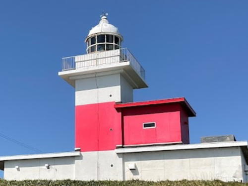
Date unknown (station established 1890). Active; focal plane 31 m (102 ft); white or red light, depending on direction, 6 s on, 2 s off. 10 m (33 ft) square cylindrical concrete tower with lantern and gallery, rising from the seaward end of a 1-story keeper's house. Lighthouse painted with a broad red horizontal band below the gallery. Fog horn (5 s on, 10 s off). A photo is at right, the Coast Guard has a page for the lighthouse, Lighthouse of Japan has good photos, FOAL's page has photos, Takeshi Oshawa has a fine closeup photo, Kimihiro Hashimoto has a 2021 photo, Misty's Tour has two photos, Nori Kaneko has a 2017 street view, and Google has a satellite view. This lighthouse marks the entrance to the harbor of Hanasaki. Located on a promontory on the southeast coast of the Nemuro Peninsula about 1 km (0.6 mi) southeast of Hanasaki and 5 km (3 mi) south of Nemuro. The lighthouse is accessible by car, with ample parking provided. Site open, tower closed. . ARLHS JPN-085; JCG-0150; Admiralty M6836; NGA 0472.
* Hanasaki East Inner Breakwater
1984. Active; focal plane 15 m (49 ft); two red flashes every 6 s. 14 m (46 ft) round cylindrical concrete tower with lantern and gallery, painted red. FOAL's page has photos, and Google has a street view and a satellite view. Located at the end of the original east breakwater of Hanasaki. Probably accessible by walking the pier. Site open, tower closed. ARLHS JPN-864; JCG-0150.2; Admiralty M6837; NGA 0476.
Hanasaki Detached Breakwater
1997. Active; focal plane 15 m (49 ft); green flash every 3 s. 10 m (33 ft) round cylindrical concrete tower with lantern and gallery. Lighthouse painted white. FOAL's page has a photo (last photo on the page) and Google has a satellite view. Located at the southeast end of a detached breakwater protecting the harbor of Hanasaki. Accessible only by boat, but there should be good views from the waterfront and from the Hanasaki lighthouse. Site and tower closed. JCG-0150.21; Admiralty M6837.5; NGA 0474.
Yururi (Yuturi) Shima
1960. Active; focal plane 53 m (174 ft); white flash every 3 s. 13 m (43 ft) octagonal cylindrical concrete tower with lantern and gallery, attached to a small equipment room. Lighthouse painted with black and white horizontal bands. A distant view is available, FOAL's page has distant views (near the bottom of the page), and Google has a satellite view. Yururi Shima is an island off the east side of the Nemuro Peninsula about 8 km (5 mi) south of Hanasaki. The island is a protected wildlife reserve. Located on the west side of the island, marking the passage between the island and the mainland of Hokkaidō. Site and tower closed. . ARLHS JPN-1025; JCG-0149; Admiralty M6835; NGA 0480.

Hanasaki Light, Nemuro, August 2021
Google Maps photo by Kimihiro Hashimoto
Ochiishi (Otiisi) Kō North Breakwater
1982. Active; focal plane 14 m (46 ft); red flash every 3 s. 11 m (36 ft) round cylindrical concrete tower with lantern and gallery. Lighthouse painted red. FOAL's page has a photo, and Google has a satellite view and a very distant street view. Located at the end of the detached north breakwater of Ochiishi Kō, a harbor on the north side of the bay protected by Ochiishi Misaki. Site and tower closed. ARLHS JPN-935; JCG-0148; Admiralty M6834.5; NGA 0484.
Ochiishi (Otiisi) Kō West Breakwater
1998. Active; focal plane 12 m (36 ft); green flash every 3 s. 10 m (33 ft) round cylindrical concrete tower with lantern and gallery. Lighthouse painted white. FOAL's page has a photo, and Google has a satellite view and a distant street view. Located at the end of the west breakwater of Ochiishi Kō. Site and tower closed. ARLHS JPN-936; JCG-0147.9; Admiralty M6834.3; NGA 0486.
* Ochiishi (Otiisi) Misaki (Cape Ochiishi)
1890. Active; focal plane 48 m (157 ft); flash every 8 s, white or red depending on direction. 15 m (49 ft) square cylindrical concrete tower with lantern and gallery, rising from the seaward end of a 1-1/2 story keeper's house. Lighthouse painted with a broad red horizontal band below the gallery; the red band extends across part of the keeper's house. Fog horn (10 s on, 20 s off). A Coast Guard photo is at right and the Coast Guard has a page for the lighthouse, a nice sunset photo is available, Lin Haoping has a 2021 photo, Lighthouse-Japan.com has good photos, Misty's Tour has excellent photos, FOAL's page has photos, Kōichi Yoshinaga has a 2017 street view, and Google has a satellite view. This is a historic lighthouse, marking a cape that is considered to be particularly dangerous because it experiences frequent fogs. A signal station installed here in 1909 played a vital role in trans-Pacific navigation for many years. Charles Lindbergh aimed for this signal station in 1931 when he flew from Alaska to Japan, pioneering the Pacific great circle route to Japan and China. Located on a cape projecting from the southern base of the Nemuro Peninsula about 16 km (10 mi) south of Nemuro and the same distance east of Atsutoko. Accessible by a hiking trail or an unpaved road. Not so easy to find; local guidance may be needed. Site open, tower closed. . ARLHS JPN-496; JCG-0147; Admiralty M6834; NGA 0488.

Ochiishi Misaki Light, Nemuro, 1990s
Japanese Coast Guard photo (no longer online)

Kushiro Subprefecture Lighthouses

Hamanaka Town Lighthouses
* Kiritappu Kō
Date unknown. Active; focal plane 12 m (39 ft); green flash every 4 s. 9.5 m (31 ft) concrete post attached to a square 1-story concrete equipment shelter. Entire lighthouse is white. Google has a satellite view and a distant street view. Located at the end of the east breakwater at Kiritappu, a fishing port on the north side of the Cape Kiritappu peninsula. Probably accessible by walking the pier. Site open, tower closed. JCG-0146; Admiralty M6831; NGA 0496.
* Tōbutsu (Tofutsu) Misaki (Cape Kiritappu)
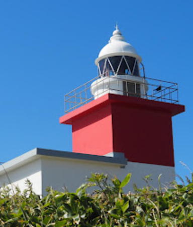
1930. Active; focal plane 49 m (161 ft); flash every 5 s, white or red depending on direction; also a continuous white spotlight (JCG-0145) illuminates the Hikake reef to the northeast. 12 m (39 ft) square cylindrical concrete tower with lantern and gallery, rising from the center of a 1-story concrete keeper's house. Tower painted red, but the lantern and keeper's house are painted white, so the lighthouse appears white with a red horizontal band. Fog horn (10 s on, 20 s off). A photo is at right, FOAL's page has photos, a 2017 closeup is available, Lighthouse-Japan.com has good photos, Kimihiro Hashimoto has a 2021 photo, Hiroshi Fukuyama has a 2017 street view, and Google has a satellite view. Located at the end of a rocky cape 6 km (3.5 mi) long, just east of Hamanaka and about 30 km (19 mi) east of Akkeshi. Accessible by road and a 400 m (1/4 mi) walk; parking provided. Site open, tower closed. . ARLHS JPN-658; JCG-0144; Admiralty M6830; NGA 0492.
Biwase Hana (Biwase Kō)
Date unknown. Active; focal plane 12 m (39 ft); green flash every 3 s. 8.5 m (28 ft) concrete post rising from a square 1-story concrete equipment shelter. Entire lighthouse is white. Lighthouse Visits has a photo and Google has a satellite view. Located at the east end of the detached south breakwater at Biwase, a fishing port sheltered on the south side of Cape Kiritappu peninsula. Accessible only by boat. Site open, tower closed. JCG-0143.7; Admiralty M6830.4; NGA 0498.
Tobutsu Misaki Light
Tōbutsu Misaki Light, Hamanaka, September 2009
Google Maps (ex-Panoramio) photo by ni.na

Akkeshi Town Lighthouses
Akkeshi (Daikoku Shima)
Date unknown (station established 1890). Active; focal plane 112 m (367 ft); white flash every 10 s. 8 m (26 ft) round concrete cylindrical concrete tower with lantern attached to a 1-story equipment room. Entire lighthouse is white. A photo is available (third photo on the page) and Google has a satellite view. Located at the south end of Daikoku Shima, an island in the center of the entrance to Akkeshi bay. Accessible only by boat. Site and tower closed. ARLHS JPN-013; JCG-0141; Admiralty M6828; NGA 0500.
Akkeshi Kō
Date unknown. Active; focal plane 14 m (46 ft); two red flashes every 6 s. 11 m (36 ft) round cylindrical concrete tower with lantern and gallery. Entire lighthouse is red. Trabas has Smith's photo and Google has a satellite view. Located at the north end of the detached outer breakwater of Akkeshi. Site status unknown. ARLHS JPN-844; JCG-0142.5; Admiralty M6829; NGA 0504.

Kushiro Town (Kushiro-chō) Lighthouses
#Konbumori
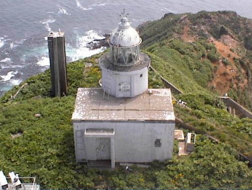
1960. Inactive since 2017 and since removed. 11 m (36 ft) round cylindrical concrete tower with lantern and gallery, painted white with one black horizontal band. A Coast Guard photo is at right, Lighthouse-Japan.com has photos, Misty's Tour has a photo, and FOAL's page has photos. Google's satellite view confirms the removal of the lighthouse. Located on a promontory about 8 km (5 mi) east of Kushiro. Site open, ARLHS JPN-286; ex-JCG-0139; ex-Admiralty M6826; NGA 0508.
* Katsurakoi Kō
Date unknown. Active; focal plane 13 m (43 ft); red flash every 3 s. 11 m (36 ft) round cylindrical concrete tower with lantern and gallery. Entire lighthouse is red. Google has a foggy street view and a satellite view. Located at the end of the east breakwater of Katsurakoi, a harbor about 8 km (5 mi) east of downtown Kushiro. Probably accessible by walking the pier. Site open, tower closed. ARLHS JPN-893; JCG-0138.5; Admiralty M6822; NGA 0512.

Konbumori Light, Kushiro (since removed)
Japanese Coast Guard Kushiro Office photo (no longer online)

Kushiro City (Kushiro-shi) Lighthouses
Kushiro, with a population of about 185,000, is by far the largest and busiest port of eastern Hokkaidō.
* Kushiro Saki (2)
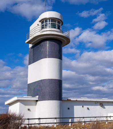
Date unknown (station established 1891). Active; focal plane 51 m (167 ft); white flash every 15 s. 17 m (56 ft) U-shaped cylindrical concrete tower with lantern and gallery, painted white with one red horizontal band. Next to the lighthouse is a taller building that appears to be a signal or harbor control station. A 2011 photo is at the top of this page, Lighthouse-Japan.com has excellent photos, Misty's Tour also has good photos, FOAL's page has photos, Yoshio Mochizuki has a 2020 photo, Trabas has Smith's view from the sea, and Google has a street view and a satellite view. The original lighthouse was an octagonal tower with lantern and gallery. In 2018 the lighthouse was the test site for a new longer-range LED optic design. Located at the western end of a peninsula sheltering the harbor of Kushiro. The entrance to the lighthouse is gated but open to walkers. Site open, tower closed. . ARLHS JPN-316; JCG-0137; Admiralty M6814; NGA 0516.
Kushiro South Breakwater
1920s. Active; focal plane 13 m (43 ft); red light occulting once every 4 s. 13 m (43 ft) round concrete tower with lantern and gallery, painted red. Trabas has Smith's photo, a distant 2010 photo is available, FOAL's page has a 2015 view (halfway down the page, on the left), and Google has a satellite view. Located at the at the original end (now an elbow) of a detached breakwater protecting the eastern (older) harbor of Kushiro. Accessible only by boat. Site and tower closed. ARLHS JPN-976; JCG-0132; Admiralty M6815; NGA 0524.
Kushiro South Detached Breakwater
Date unknown. Active; focal plane 18 m (59 ft); red light, 3 s on, 3 s off. 9 m (30 ft) round cylindrical concrete tower with lantern and gallery. Entire lighthouse is red. Trabas has Smith's photo, FOAL's page has a 2015 view (halfway down the page, on the right), and Google has a satellite view. Located at the end of the detached south breakwater of Kushiro. Accessible only by boat. Site and tower closed. ARLHS JPN-973; JCG-0131; Admiralty M6814.5; NGA 0529.
Kushiro North-South Breakwater South Head
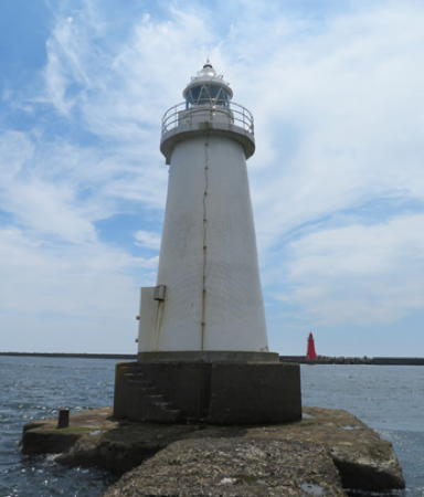
Date unknown. Active; focal plane 12 m (39 ft); two green flashes every 6 s. 11 m (36 ft) round concrete tower with lantern and gallery. Entire lighthouse is white. The Coast Guard's photo is at right, a 2009 sunset photo and a distant 2010 photo are available, Trabas has Smith's photo, FOAL's page has a 2015 view (halfway down the page, on the left), and Google has a satellite view and a very distant street view. The conical design of this lighthouse reflects the old-style design of the south breakwater light. Located at the south end of a detached breakwater protecting the eastern (older) harbor of Kushiro. Accessible only by boat. Site and tower closed. ARLHS JPN-975; JCG-0134; Admiralty M6816; NGA 0536.
Kushiro Breakwater Light
North-South Breakwater South End Light, Kushiro
Japanese Coast Guard Kushiro Office photo (no longer online)
Kushiro North-South Breakwater North Head
Date unknown. Active; focal plane 12 m (39 ft); continuous red light with a more intense flash every 6 s. 11 m (36 ft) round barbell-shaped concrete tower with lantern and gallery. Entire lighthouse is red. Trabas has Smith's photo, FOAL's page has a 2015 view (fourth and fifth rows on the page), and Google has a satellite view. Located at the south end of a detached breakwater protecting the eastern (older) harbor of Kushiro. Accessible only by boat. Site and tower closed. ARLHS JPN-974; JCG-0133; Admiralty M6816.4; NGA 0532.
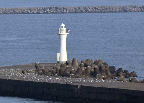
Kushiro Nisi Kō (Nisiko) Breakwater East Head
Date unknown. Active; focal plane 15 m (49 ft); green flash every 3 s. 11 m (36 ft) round hourglass-shaped concrete tower with lantern and gallery. Entire lighthouse is white. Trabas has Smith's photo (also seen at right), FOAL's page has a view (third row of photos, on the left), and Google has a satellite view. Located at the east end of detached breakwater protecting the western harbor of Kushiro. Accessible only by boat. Site and tower closed. ARLHS JPN-925; JCG-0130; Admiralty M6814.4; NGA 0540.

Shiranuka Town Lighthouses
* Shiranuka
Date unknown. Active; focal plane 13 m (43 ft); continuous red light with a more intense flash every 4 s. 11 m (36 ft) round hourglass-shaped concrete tower with lantern and gallery. Entire lighthouse is red. Lighthouse Visits has a page for the lighthouse and Google has a distant street view and a satellite view. Located on the east breakwater of Shiranuka, a harbor about 15 km (9 mi) west of Kushiro. Accessible by walking the pier. Site open, tower closed. ARLHS JPN-969; JCG-0128; Admiralty M6812.4; NGA 0548.

Kushiro Nisi Kō Breakwater East Head Light, Kushiro
photo copyright Jim Smith; used by permission

Tokachi Subprefecture Lighthouses

Tokachi Subprefecture has a rather long coastline, about 100 km (60 mi), but in a rarity for Japan the coast is low and straight, with no capes or natural harbors. As a result Tokachi has few lighthouses.

Toyokoro Town Lighthouse
* Tokachi Ōtsu (Tokati Ōtu)
1964. Active; focal plane 58 m (190 ft); three white flashes every 20 s. 14 m (46 ft) U-shaped cylindrical concrete tower with lantern and gallery, painted with black and white horizontal bands. Jerry Weng's 2017 photo is at the top of this page, Lighthouse-Japan.com has good photos, Misty's Tour has a good photo, FOAL's page has photos, and Google has a satellite view. Ōtsu is a village at the mouth of the Tokachi River, in the center of Hokkaidō's long, gently curved southeastern coast. Located on a bluff above the Pacific about 3 km (2 mi) southwest of the Tokachi River mouth, 35 km (22 mi) southeast of Obihiro and 65 km (40 mi) southwest of Kushiro. Site open, tower closed. . ARLHS JPN-662; JCG-0126; Admiralty M6812; NGA 0552.

Hiroo Town Lighthouses
Tokachi Kō (Hiroo) North Breakwater
Date unknown. Active; focal plane 14 m (46 ft) red flash every 4 s. Approx. 11 m (36 ft) round concrete tower with lantern and gallery, painted red. FOAL's page has a photo (last photo on the page) and Google has a satellite view. Tokachi Kō is a new port developed at Hiroo near the southern end of Tokachi Subprefecture. Located at the end of the north breakwater of the harbor. Site status unknown. JCG-0123.5; Admiralty M6809; NGA 0562.
* Hiroo
1959. Active; focal plane 38 m (125 ft); two white flashes every 15 s. 13 m (43 ft) square concrete tower with lantern and gallery, painted white. A Coast Guard photo is at right, Lighthouse of Japan has good photos, FOAL's page has photos, and Google has a street view and a satellite view. Located at on a bluff in Hiroo, at the south end of Tokachi Kō. Accessible by road. Site open, tower closed. . ARLHS JPN-868; JCG-0122; Admiralty M6807.5; NGA 0556.

Information available on lost lighthouses:

Notable faux lighthouses:

Hiro'o Light
Hiroo Light, Hiroo
Japanese Coast Guard Kushiro Office photo (no longer online)

Adjoining pages: North: Northern Hokkaidō | East: Kuril Islands | South: Southeastern Hokkaidō

Return to the Lighthouse Directory index | Ratings key

Posted June 8, 2006. Checked and revised April 12, 2023. Lighthouses: 44. Site copyright 2023 Russ Rowlett and the University of North Carolina at Chapel Hill.