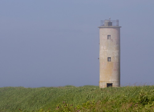
Lighthouses of Russia: Kuril Islands

Russia (Россия, Rossiya in Russian) is by far the world's largest country, spanning a little over 150° in longitude. It is organized as the Russian Federation (Rossiyskaya Federatsiya) with members known as federal subjects (sub'yekty federatsii). Russia is primarily a continental nation but it has important coastlines on the Baltic, Black, and Caspian Seas and very long coastlines on the Arctic Ocean and North Pacific Oceans. To guard these coasts it operates hundreds of lighthouses, many of them historic.

The Kuril Islands are a chain of 56 volcanic islands 1300 km (800 mi) long, stretching from the northern Japanese island of Hokkaido to the tip of the Kamchatka Peninsula and separating the Sea of Okhotsk from the open Pacific Ocean. The islands are thinly populated, having about 19,000 citizens. They are included with the much larger island of Sakhalin in Sakhalin Oblast, one of the members of the Russian Federation.

The history of the Kurils is complex, reflecting a lengthy struggle between Russia and Japan to control these northern territories. In 1855 the two nations agreed in the Treaty of Shimoda that the border between them should fall between the islands of Iturup and Urup. In 1875, in the Treaty of St. Petersburg, Russia gave Japan control of all of the Kurils in return for Russian control of Sakhalin.

During World War II, in the Yalta Agreement of 1943, the Allied Powers agreed that following the war Japan should cede all of the Kurils to the Soviet Union. In the last days of the war, in 1945, Soviet troops occupied the Kurils. In the 1951 Treaty of San Francisco Japan renounced its claims to Sakhalin and the Kurils. However, an independent Japan subsequently declared that this renunciation does not apply to the southern Kurils that were recognized as Japanese back in 1855. In 1956 the Soviet Union offered to return the southernmost Kurils, Shikotan and the Habomai Islands, if Japan would drop its claims to the rest of the chain, but Japan refused, maintaining its claim to Kunashir and Iturup as well. Russia repeated this offer in 2006 but the dispute continues.

Curly braces {} enclose the former Japanese names of some of the lighthouses. The Kurils are called the Chishima Islands in Japan.

The Russian word for a lighthouse is mayak (маяк); ostrov is an island, poluostrov is a peninsula, kosa is a sandy spit, rif is a reef, mys is a cape, bukhta is a bay, zaliv is a larger bay or gulf, proliv is a strait, reka is a river, and gavan' is a harbor.

Russian lighthouses are owned by the Russian Navy and maintained by the Office of Navigation and Oceanography (Управление навигации и океанографии).

ARLHS numbers are from the ARLHS World List of Lights. Admiralty numbers are from volume M of the Admiralty List of Lights & Fog Signals. U.S. NGA List numbers are from Publication 112.

General Sources
Маяки Дальневосточных морей (Lighthouses of the Far Eastern Seas)
This site has historical information (in Russian) on the major lighthouses.
Russian Lighthouse Society
Photos and information on many lighthouses.
World of Lighthouses - Far East of Russia
Photos by various photographers available from Lightphotos.net.
Online List of Lights - Kuril Islands
Photos by various photographers posted by Alexander Trabas.

Mys Kurbatova Light, Shumshu,june 2013
Google Maps photo by Kayaking Kamchatka

Severo-Kurilsky District (Northern Kuril Islands) Lighthouses

Shumshu Lighthouses
Shumshu is the northeasternmost of the Kuril Islands; its northern tip is 11 km (7 mi) across the First Kuril Strait from Cape Lopatka, the southern tip of Kamchatka. The relatively low-lying island has no permanent population today, but it was heavily fortified by Japan during World War II. The Japanese garrison refused to accept the end of the war, requiring Russian forces to invade and conquer the island in late August 1945.

Mys Kurbatova {Kokutanzaki, Kokutan Saki} (2)
1956 (station established 1938). Active; focal plane 61 m (200 ft); red light, 3 s on, 4.5 s off. 15 m (49 ft) hexagonal concrete tower with lantern and gallery, painted red. A 2013 photo at the top of his page, a 2007 closeup photo, an undated closeup, and a wider view all show that the light station has become quite dilapidated. Google has a satellite view of the light station and Wikimedia has a prewar photo of what was then a Japanese lighthouse. The station was strafed by U.S. planes in February 1945. The keepers at this station are now the only residents of Shumshu Island. Located at the northeastern tip of Shumshu, marking the First Kuril Strait between the islands and the Kamchatka Peninsula. Site status unknown. ARLHS ASR-040; Admiralty M8041; NGA 0316.
Mys Chibuynyy {Imai Saki} (2)
1956 (station established 1945). Active; focal plane 105 m (344 ft); white light, 1.5 s on, 4.5 s off. 10 m (33 ft) octagonal cylindrical concrete tower, painted with red and white horizontal bands. Lantern removed. Keeper's house and other station buildings. Lightphotos.net has a view from the sea and Google has a satellite view of the station. Located at the western tip of Shumshu, marking the entrance to the narrow Second Kuril Strait leading to Severo-Kurilsk on Paramushir, the largest settlement of the island chain. Site status unknown. ARLHS ASR-021; Admiralty M8042; NGA 0320.

Atlasova Lighthouse
Atlasova (Poluostrov Vladimira)
Date unknown. Currently inactive but listed with focal plane 13 m (43 ft); white flash every 3 s. Approx. 6 m (20 ft) square cylindrical concrete tower, painted with black and white horizontal bands. Sophie Carr's photo is at right, Andy Wolff has a very distant view, and Bing has a satellite view. Atlasova is a volcanic island northwest of Paramushir. The volcano, Alaid, is the tallest in the Kurils at 2339 m (7674 ft); it is prone to violent eruptions, the most recent being in 1981. There were smaller eruptions as recently as 2012. A Soviet-era fishing village on the southeastern coast of the island has been abandoned, probably since the 1981 eruption at least. Located on the beach near the ruins of the village dock. Accessible only by boat. Site open, tower closed. Admiralty M8041.5; NGA 15522.

Atlasova Light, Atlasova, August 2007
ex-Flickr photo copyright Sophie Carr; used by permission

Paramushir Lighthouses
Paramushir is the largest of the northern Kurils, covering a little more than 2000 square kilometers (780 square miles). Severo-Kurilsk, a town with about 2500 residents, is the administrative center of the northern Kurils.

Opornyy (Severo-Kurilsk) Range Front
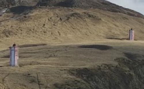
Date unknown. Inactive; listed with focal plane 43 m (141 ft); continuous red light. 8 m (26 ft) octagonal cylindrical concrete tower. Lighthouse (originally, at least) painted white with a red and white daymark on the range line. A photo showing the two range lights is at right (this light is near the left edge) and Google has a satellite view. This is the entrance range for Severo-Kurilsk, a fishing village near the northeastern end of Paramushir. Founded as Kashiwabara, this was formerly the northernmost Japanese settlement in the Kurils. Site open, tower closed. Admiralty M8044; NGA 0322.
Opornyy (Severo-Kurilsk) Range Rear
Date unknown. Inactive; listed with focal plane 78 m (256 ft); continuous red light. 8 m (26 ft) octagonal cylindrical concrete tower. Lighthouse originally painted white with a red and white daymark on the range line. A photo showing the two range lights is at right (this light is near the right edge) and Google has a satellite view. Located 240 m (260 yd) south of the front light. Site open, tower closed. Admiralty M8044.1; NGA 0322.1.

Opornyy Range Lights, Severo-Kurilsk, May 2017
Google Maps photo by Paul C
Mys Levashova
Date unknown. Active; focal plane 78 m (256 ft); white flash every 5 s. 8 m (26 ft) octagonal cylindrical concrete tower, painted with black and white horizontal bands. No photo available but Google has a satellite view. NGA has misplaced this light among the listings for Kamchatka. Located on a promontory on the east side of Paramushir. Site status unknown. Admiralty M8043; NGA 15538.
Mys Okeanskiy (Mys Kokina)
Date unknown. Active; focal plane 82 m (269 ft); white flash every 4 s. Approx. 8 m (26 ft) octagonal cylindrical concrete tower. No photo available but Bing has a satellite view. Located on heights above a promontory on the southeast side of Paramushir. Site status unknown. Admiralty M8045; NGA 0323.
Vasilyeva (Mys Vasilyeva) (2)
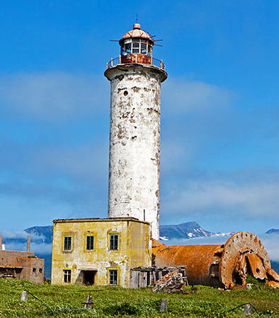
1954 (station established 1940. Active; focal plane 38 m (125 ft); white light, 1.5 s on, 4.5 s off, 3 s on, 6 s off. 24 m (79 ft) round cylindrical concrete tower with lantern and gallery. Tower painted white, lantern red. A photo is at right, Lightphotos.net has Andrey Filonov's 2012 photo, a 2022 photo is available, and Google has a satellite view of the station. This lighthouse was rebuilt after Japanese troops made a largely-successful effort to blow it up near the end of World War II; some of the debris from this effort is seen in Filonov's photo. Located at the southern tip of Paramushir. Site status unknown. ARLHS ASR-070; Admiralty M8046; NGA 0324.
Mys Kapustnyy
Date unknown. Active; focal plane 32 m (105 ft); red flash every 4 s. 12 m (39 ft) octagonal concrete tower, painted with red and white horizontal bands. No photo available and Google has only a very distant satellite view of the cape. Located at the southwestern tip of Paramushir. Site open, tower closed. Admiralty M8047; NGA 0326.

Onekotan Lighthouse
Mys Lisiy (Onekotan)
Date unknown. Inactive; listed with focal plane 57 m (187 ft); white flash every 2.5 s. 8 m (26 ft) octagonal cylindrical concrete tower, painted white. A distant view is available and Bing has a satellite view. Located on a cape on the southeast coast of the island of Onekotan, an uninhabited volcanic island south of Paramushir. Site status unknown. Admiralty M8047.5.

Mys Vasilyeva Light Station, Paramushir
unattributed photo from Маяки CCCP

Matua Lighthouse
Ostrov Toporkovyy (Toporkov) (2)
1981 (station established 1947). Reported extinguished; focal plane 80 m (262 ft); white flash every 5 s. 8 m (26 ft) octagonal cylindrical concrete tower. Lighthouse painted red with a white horizontal band. No photo available but Bing has a satellite view. Lighthouses of the USSR discusses this station (last article on the page). NGA formerly listed a small metal tower. Toporkov is a small island off the east coast of the larger island of Matua (Matsuwa), the location of the very active Sarychev volcano. Located on the highest point of the island. Site open, tower closed. Admiralty M8048; NGA 0340.

Kurilsky District (Central Kuril Islands) Lighthouses

Simushir Lighthouses
Simushir is a large but uninhabited island at the center of the Kuril chain. The island is 59 km (37 mi) long but only about 13 km (8 mi) wide.
Mys Sukhina
1982. Active; focal plane 125 m (410 ft); white flash every 12 s. 13 m (43 ft) octagonal cylindrical concrete tower with lantern and gallery, painted with red and white horizontal bands. No photo available but Google has a satellite view. Lighthouses of the USSR discusses this station (next to last article on the page). This station appears deserted and may be inactive. Located on the southeast side of Simushir. Site status unknown. Admiralty M8049.5; NGA 0346.
Vodopadnyy (Simushir)
Date unknown. Active; focal plane 66 m (217 ft); white flash every 3 s. 8 m (26 ft) octagonal cylindrical concrete tower, painted white. Adjoining keeper's house in ruins. No photo available but Google has a satellite view. This station appears deserted and may be inactive. Located on the north side of the southwestern end of Simushir. Site status unknown. Admiralty M8049; NGA 0344.

Urup Lighthouses

Urup, like Simushir, is an uninhabited volcanic island, 120 km (75 mi) long and 20 km (12.5 mi) wide. The island was the location of Soviet military bases until the breakup of the Soviet Union in 1991.

Mys Chyeryepakha (Mys Cherepakha, Novokuril'skiy) (2)
1978 (station established 1947). Active (?); focal plane 33 m (108 ft); white flash every 5 s. 10 m (33 ft) octagonal cylindrical concrete tower, painted red with a white horizontal band. Bing has a satellite view. Lighthouses of the USSR has an article on this light (second lighthouse on the page) with a black and white photo. The light appears to be abandoned. Located on a promontory on the north side of Urup. Site status unknown. Admiralty M8050.5; NGA 0349.
Urup (Mys Kastrikum)
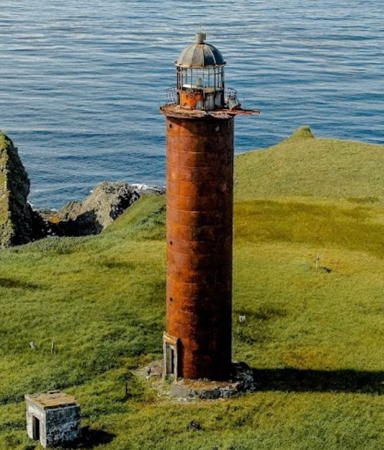
1966. Active (?); focal plane 51 m (167 ft); white light, 4.5 s on, 3 s off. 23 m (75 ft) round cylindrical red concrete block tower with lantern and gallery. Maxim Tarasov's 2021 drone view is at right, Sakh.com posted a 2004 photo, the Lighthouse Society has a page for the lighthouse, and Google has a satellite view. Located at the extreme northeast tip of Urup. Site status unknown. ARLHS ASR-031; Admiralty M8050; NGA 0348.
Van-der-Linda (Mys Van-der-Linda) {Nobunotsu Misaki}
1960. Active; focal plane 112 m (367 ft); white light, 4.5 s on, 7.5 s off. 14 m (46 ft) octagonal concrete tower, painted black with a white horizontal band. Lightphotos.net has a view from the sea and Bing has a satellite view. By mistake the photo on the Lighthouses of the USSR page is of the Kastrikum lighthouse. Located at the extreme southwestern tip of Urup. Site status unknown. ARLHS ASR-069; Admiralty M8051; NGA 0352.

Mys Kastrikum Light, Urop, August 2021
Google Maps photo by Maxim Tarasov

Iturup Lighthouse
Iturup and the other southern Kuril Islands are claimed by Japan in its continuing dispute with Russia. Called Etorofu by Japanese, Iturup is about 200 km (125 mi) long and up to 27 km (17 mi) wide. The town of Kurilsk, on the west coast of the island, is the administrative center for the central Kurils and has a population of about 1600.

Mys Breskens
1967. Active; focal plane 63 m (207 ft); white flash every 3 s. 8 m (26 ft) octagonal cylindrical concrete tower, painted with black and white horizontal bands. No photo available but Google has an indistinct satellite view. Located at the tip of the Chirip Peninsula on the north coast of Iturup. Site status unknown. Admiralty M8051.5; NGA 0354.

Yuzhno-Kurilsky District (Southern Kuril Islands) Lighthouses

Kunashir Lighthouses
Kunashir (Kunashiri in Japanese) is the southernmost island of the main Kuril chain; it is separated from the Japanese island of Hokkaidō by the narrow Nemuro Strait. The island is about 120 km (95 mi) long and up to 30 km (19 mi) wide. It has a population of about 9000, mostly in the town of Yuzhno-Kurilsk, the administrative center for the district.

Lovtsova (Mys Lovtsova) {Atoya Misaki} (2)
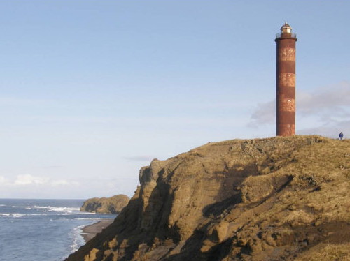
1963 (station established 1899). Active(?); focal plane 71 m (233 ft); white light, 3 s on, 3 s off. 32 m (105 ft) round cylindrical concrete tower with lantern and gallery, painted (originally, at least) with red and white horizontal bands. A photo is at right and Google has a satellite view. Located on the northeastern tip of Kunashir. Site status unknown. ARLHS ASR-044; Admiralty M8058; NGA 0364.
* Yuzhno-Kurilsk (Mys Kuril'skiy)
Date unknown. Active; focal plane 11 m (36 ft); white flash every 6 s. Approx. 9 m (30 ft) rectangular concrete block building with gallery and a short post light on the roof. Lighthouse originally painted black with a white horizontal band, although little or no paint remains. Dmitry Kashkanov has a 2021 street view and Google has an indistinct satellite view. the lighthouse looks abandoned and deteriorated in a closeup 2019 street view by Vladimir Olenin. Located on a spit sheltering the harbor of Yuzhno-Kurilsk, the principal town of Kunashir, on the southeast side of the island. Site open, tower closed. Admiralty M8059; NGA 0366.
Veslovskiy (Mys Veslo)
Date unknown. Active; focal plane 14 m (46 ft); white light, 2 s on, 5 s off. 12 m (39 ft) octagonal wooden tower, painted with black and white horizontal bands. Fog bell (12 strokes every 60 s). Google has a satellite view. This lighthouse marks the eastern entrance of the Nemuro Strait between Kunashir and Hokkaido. Located at the southernmost tip of Kunashir, about 20 km (13 mi) northeast of the Japanese coast. Site status unknown. Admiralty M8060; NGA 0368.
Lovtsova Light
Mys Lovtsova Light, Kunashir, November 2012
photo by Sakhalin Chapter, Russian Geographic Society

Shikotan Lighthouses
Shikotan is an island south of Iturup and southeast of Kunashir. The rugged island is about 32 km (20 mi) long and 10 km (6 mi) wide; it has two small settlements and a population of roughly 2000. Shikotan and the Habomai Islands lie to the east of Kuril archipelago, and it is the Japanese position that they are not part of the Kuril Islands at all and should be considered out islands of Hokkaidō Prefecture.
Malokurilskoye (Malokurilskiy)
Date unknown. Active; focal plane unknown; white flash every 5 s. Approx. 12 m (39 ft) square cylindrical concrete tower with gallery and a small lantern. Lighthouse painted black with a white horizontal band; the lantern is red. Artem Stankevich has 2021 street view and Google has a satellite view. Malokurilskoye is a village of about 1100 residents on the north side of Shikotan. Located on a steep promontory on the west side of the harbor entrance of Malokurilskoye. Site open, tower closed. Admiralty M8054.6; NGA 0379.
Shikotan (Mys Kray Sveta, Shpanberga)
1943 (Japanese). Active; focal plane 65 m (213 ft); white flash every 10 s. 19 m (62 ft) round cylindrical concrete tower with lantern and gallery, attached to a concrete keeper's house. Lighthouse painted white, lantern dome red. A photo is at right, another photo and a third photo are available, as well as a photo taken inside the lantern, Lightphotos.net has a view from the sea, Paul Vint has a 2021 drone view, Alexey Boldyrev has a closeup 2021 street view in heavy fog, and Google has a satellite view of the station. Located on the northeastern tip of Shikotan. Site status unknown. Admiralty M8054; NGA 0372.
Devyatyy {Kamo Shima}
1967. Active; focal plane 65 m (213 ft); white flash every 4 s. 8 m (26 ft) square cylindrical concrete tower, painted white. Lightphotos.net has a view from the sea and Google has a satellite view. Located on an island at the entrance to Bukhta Tserkovnaya, a protected bay on the south coast of Shikotan. Accessible only by boat. Site status unknown. Admiralty M8054.2; NGA 0376.5.

Shpanberga Light Station, Shikotan
unattributed photo from Маяки CCCP

Habomai Islands Lighthouses
The Habomai Islands are a group of small islands between Shikotan and Cape Nosappu, the northeastern tip of the Japanese island of Hokkaidō. The islands are uninhabited except for Russian border guard posts.

Polonskogo {Taraka Shima}
Date unknown. Active; focal plane 29 m (95 ft); white light, 1.5 s on, 4.5 s off. 12 m (39 ft) round concrete tower, painted with red and white horizontal bands. No photo available but Google has a good satellite view. Located on the southeastern tip of Polonskogo, the northernmost of the Habomai islands about 45 km (28 mi) off the northeastern tip of Hokkaido. Site and tower closed. Admiralty M8056; NGA 0384.
Ostrov Zelenyy (Mys Val'tona) {Kokorozashi Hatsu Shima}
Date unknown. Active; focal plane 24 m (79 ft); white flash every 7.5 s. 12 m (39 ft) round concrete tower, painted with black and white horizontal bands. No photo available but Google has a satellite view. Located at the eastern tip of Zelenyy, the island between Yuriy and Polonskogo. Site status unknown. Admiralty M8056.5; NGA 0385.
Ostrov Yuriy {Isami Ryū Shima}
Date unknown. Inactive; listed with focal plane 24 m (79 ft); white flash every 5 s. 12 m (39 ft) round concrete tower, painted with black and white horizontal bands. A closeup photo is available (first photo on the page), Wikimapia has a view from the sea, and Google has a satellite view. Located on a promontory on the north coast of Yuriy, one of the Habomai islands about 25 km (15 mi) off the northeastern tip of Hokkaido. Site and tower closed. Admiralty M8057; NGA 0386.
Bolotnyy (Mys Bolotnyy)
Date unknown. Active; focal plane 22 m (72 ft); one long white flash every 6 s. 12 m (39 ft) round concrete tower, painted white. No closeup photo available but Google has a satellite view. Located on the northeastern tip of Ostrov Tanfil'eva (Suishou Shima), southernmost of the Habomai Islands. Site and tower closed. Admiralty M8057.8; NGA 0456.5.
Zorkiy (Mys Zorkiy, Cape Sharp)
Date unknown. Active; focal plane 12 m (39 ft); red flash every 3 s. 12 m (39 ft) round cylindrical concrete tower, supposedly painted with red and white horizontal bands. Maksim Antipin's photo is at right and Google has a good satellite view. Located on the southern tip of Ostrov Tanfil'eva (Suishou Shima), about 7 km (4.5 mi) from Cape Nosappu, the northeastern tip of Hokkaido. Site and tower closed. Admiralty M8057.6; NGA 0456.
Mys Zorkiy Light
Mys Zorkiy Light, Tanfil'eva, August 2011
ex-Panoramio photo copyright Maksim Antipin; used by permission

Information available on lost lighthouses:

Notable faux lighthouses:

Adjoining pages: North: Kamchatka | South: Eastern Hokkaidō | West: Sakhalin

Return to the Lighthouse Directory index | Ratings key

Posted May 8, 2006. Checked and revised February 25, 2023. Lighthouses: 28. Site copyright 2023 Russ Rowlett and the University of North Carolina at Chapel Hill.