Lighthouses of Japan: Shimane

The nation of Japan, known in Japanese as Nihon or Nippon (日本), occupies an archipelago off the east coast of Asia. The four main islands are Hokkaidō in the north, Honshū (the largest) in the center, Shikoku in the south, and Kyūshū in the southwest. The country includes thousands of other islands of all sizes; among them the Ryūkyū (Nansei) Islands are a long chain extending to the southwest and including the large island of Okinawa, and the Nanpō Islands are another long chain extending south into the Pacific Ocean. Much of Japan is mountainous but the coastal regions are densely populated and urbanized; the country's population is about 126 million.

Japan is divided into 47 prefectures. This page lists lighthouses of the mainland portion of the Japanese prefecture of Shimane, which faces the Sea of Japan on the far southwestern coast of Honshū. This is a rugged and beautiful coast, with many small ports but only a few big ones. Hamada is the most important port in the prefecture. There is a separate page for the Oki Islands, which are governed as part of Shimane prefecture.

In Japanese the word for a lighthouse is tōdai or toudai (灯台). The words saki and misaki are for capes and headlands, hana ("nose") is a promontory, hantō is a peninsula, shima (also spelled sima or jima) is an island, bae is a reef, iwa or shi is a rocky reef, amase or se is a shoal, wan is a bay, nada is a sound or basin, kaikyō is a strait, kawa is a river, and or minato is a harbor.

Lighthouses in Japan are operated and maintained by the Japanese Coast Guard's Maritime Safety Agency. On Honshū there is at least one Coast Guard Section Office in each prefecture, often two or more. Shimane has one office at Hamada, but lights in the eastern half of the prefecture are maintained by the office at Sakai, located just over the border in Tottori Prefecture.

A note on the Sea of Japan/East Sea controversy: The Directory takes no side in any international dispute; it makes use of the terminology, names, and spellings as they currently exist in each area covered. The sea between Japan and Korea is called the Sea of Japan on the pages for Japan and the East Sea on the pages for Korea.

ARLHS numbers are from the ARLHS World List of Lights. JCG numbers are the Japanese Coast Guard's light list numbers. Admiralty numbers are from volume M of the Admiralty List of Lights & Fog Signals. U.S. NGA List numbers are from Publication

General Sources
Lighthouses in Japan - Shimane
A site providing photos and data for most major Japanese lighthouses.
Lighthouse-Japan.com - Shimane
Another comprehensive site with photos and notes from visits to many lighthouses.
Form of a Lighthouse - Shimane
Another site with many photos of Japanese lighthouses, cited below as FOAL.
Lighthouse Visit
Another fine source of lighthouse photos.
Misty's Japanese Lighthouse Tour - Shimane
Photos and a few notes for lighthouses in all parts of the country.
Online List of Lights - Japan
Photos by various photographers posted by Alexander Trabas.
Lighthouses in Shimane Prefecture
Photos by various photographers available from Wikimedia.
Sakaiminato Area Lighthouses
Photos posted by the Sakai Coast Guard Office.
Japan: Modern Lighthouses
Historic postcard views posted by Michel Forand.
Leuchttürme Japans und Koreas auf historischen Postkarten
Historic postcard images posted by Klaus Huelse.
Navionics Charts
Navigation chart for Shimane.

Ōzaki Hana Light
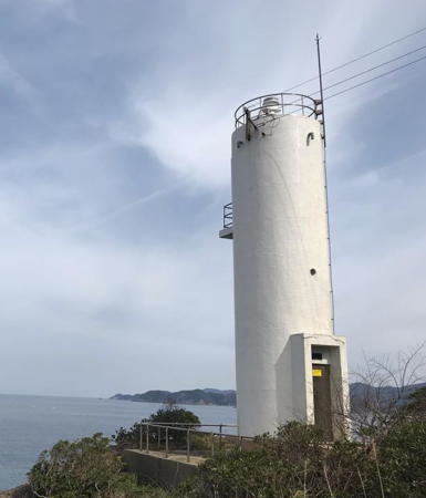
Iwami Ōsaki Hana Light, Gōtsu, August 2012
Flickr photo copyright Shugo Morita; used by permission
Mihonoseki Light
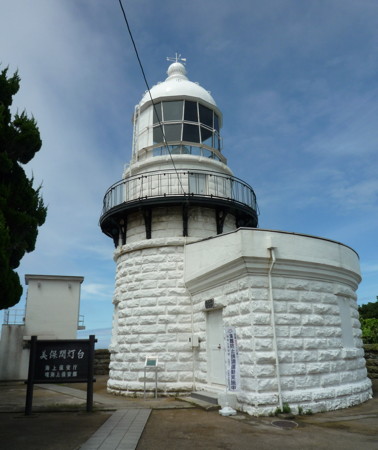
Mihonoseki Light, Matsue, August 2009
Wikimedia Creative Commons photo by Flow in edgewise
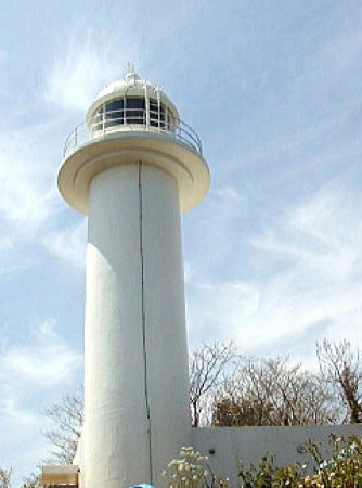
Hamada Coast Guard District Lighthouses

Masuda Lighthouses
* Iinoura Kō
Date unknown. Active; focal plane 15 m (49 ft); continuous red light with two more intense flashes every 10 s. 9.5 m (31 ft) concrete post attached to a 1-story square concrete equipment shelter. Entire structure is red. Trabas has a closeup photo and Google has a street view and a satellite view. Located on the north (main) breakwater of Iinoura harbor. Probably accessible by walking the pier. Site open, tower closed. ARLHS JPN-1553; JCG-0783; Admiralty M7357; NGA 1800.
* Uomachino Hana
1954. Active; focal plane 34 m (112 ft); white light, 3 s on, 3 s off. 11 m (36 ft) round concrete tower centered on a 1-story square concrete equipment building. Entire lighthouse is white. Lighthouse-Japan.com has a page with several photos, Lighthouse Visit also has a page with photos, Trabas has a closeup, Toru Nishioka has a 2021 photo, and Google has a satellite view. Located on a promontory about 10 km (6 mi) north of Masuda. An access road leads to or at least toward the lighthouse, but some local knowledge may be needed to find the location. Site open, tower closed. . ARLHS JPN-718; JCG-0785; Admiralty M7354; NGA 1812.
Taka Shima (Takashima)
Date unknown. Active; focal plane 126 m (413 ft); white flash every 8 s. 15 m (49 ft) round cylindrical concrete tower with lantern and gallery. Entire lighthouse is white. A Coast Guard photo is at right, Robin Halbilson has a 2020 closeup, Trabas has a very distant view, Lighthouse Visit has a distant view (near the bottom of the page) and Google has a satellite view. Taka Shima is a small island 8 km (5 mi) offshore and 16 km (10 mi) north of Masuda. Accessible only by boat. Site status unknown. ARLHS JPN-824; JCG-0786; Admiralty M7352.4; NGA 1804.
* Sutsu (Suttsu) Kō
Date unknown. Active; focal plane 12 m (39 ft); continuous red light with a more intense flash every 6 s. 9.5 m (31 ft) concrete post attached to a square 1-story concrete equipment room. Entire lighthouse is red. Trabas has a closeup photo and Google has a satellite view and a distant street view. Located at the end of the west breakwater of Sutsu harbor, just west of the giant Misumi power plant. Accessible by walking the pier. Site open, tower closed. ARLHS JPN-1578; JCG-0787; Admiralty M7353; NGA 1816.
Taka Shima Light
Taka Shima Light, Masuda
Japanese Coast Guard Hamada Office photo

Hamada Lighthouses
Hamada is a seaport with a population of about 60,000. Connected to Hiroshima by an expressway, it is also a popular beach resort.

Hamada West Outer Breakwater
Date unknown. Active; focal plane about 13 m (43 ft); red flash every 6 s. Approx. 9 m (30 ft) round cylindrical concrete tower with a flared top, attached to a 1-story concrete equipment shelter. Entire structure is red. Trabas has a photo and Google has a satellite view. Located at the north end of a detached breakwater on the west side of Hamada harbor. Accessible only by boat. Site open, tower closed. JCG-0789.1; Admiralty M7349.1.
* Hamada Kō
1975. Active; focal plane 13 m (43 ft); red light, 2 s on, 2 s off. 9.5 m (31 ft) round hourglass-shaped concrete tower. Entire structure is red. Trabas has a photo showing the light under restoration, Lighthouse Visit has photos (last lighthouse in the page) and Google has a satellite view and a very distant street view. Located at the end of a short breakwater at the west end of Hamada harbor. Accessible by walking the pier. Site open, tower closed. ARLHS JPN-1550; JCG-0796; Admiralty M7351; NGA 1848.
Hamada West Breakwater
1993. Active; focal plane 14 m (46 ft); continuous red light with two more intense flashes every 6 s. 9.5 m (31 ft) round cylindrical concrete tower with a flared top, attached to a 1-story concrete equipment shelter. Entire structure is red. Trabas has a closeup photo, this light is on the left in a panoramic view of the harbor, Lighthouse Visit has photos (halfway down the page), and Google has a satellite view and a distant street view. Located at the north end of the main breakwater on the west side of Hamada harbor. Accessible by walking the pier. Site open, tower closed. ARLHS JPN-1552; JCG-0793.5; Admiralty M7349.3; NGA 1838.
Hamada North Detached Breakwater
Date unknown (1993?). Active; focal plane 14 m (46 ft); two green flashes every 6 s. 9.5 m (31 ft) round cylindrical concrete tower with a flared top, attached to a 1-story concrete equipment shelter. Entire structure is white. Trabas has a closeup photo, this light is second from the left in a panoramic view of the harbor, Lighthouse Visit has photos (lower third of the page), and Google has a satellite view and a distant street view. Located at the west end of a detached breakwater on the northwest side of Hamada harbor. Accessible only by boat. Site open, tower closed. ARLHS JPN-1551; JCG-0794; Admiralty M7349.15; NGA 1832.
#Hamada Inner Breakwater (1)
Date unknown. Replaced in 2019; listed with focal plane 14 m (46 ft); red flash every 4 s. This was a 9.5 m (31 ft) round cylindrical concrete tower with a flared top, attached to a 1-story concrete equipment shelter. Entire structure was red. Trabas has a closeup photo, this light is third from the left in a panoramic view of the harbor and Google has a distant street view. However, Google's satellite view shows construction at the end of the breakwater. The active light is now on a post. Located at the north end of a detached inner breakwater at Hamada. Accessible only by boat. Site open, tower closed. JCG-0793; ex-Admiralty M7349.2; NGA 1840.
Hamada North Breakwater
Date unknown. Active; focal plane 14 m (46 ft); green light, 3 s on, 3 s off; in addition, a continuous white spotlight (JCG-0692.1) illuminates a nearby reef. 9.5 m (31 ft) concrete post attached to a square 1-story concrete equipment room. Entire lighthouse is white. Trabas has a closeup photo, this light is on the right in a panoramic view of the harbor, while Google has a satellite view and a distant street view. Located at the west end of the original detached north breakwater of Hamada harbor. Accessible only by boat. Site open, tower closed. JCG-0792; Admiralty M7348.5; NGA 1844.
Uma Shima
1898. Active; focal plane 34 m (112 ft); two white flashes every 12 s; in addition a continuous white spotlight (JCG-0791) illuminates a nearby reef. 10.5 m (31 ft) round brick tower, rising from a 1-story equipment building. Lighthouse painted white. The Coast Guard's photo is at right, Trabas has a photo, Lighthouse Visit has a distant photo, an aerial view is available, and Google has a satellite view. Located on an island at the northern entrance to Hamada harbor. Accessible only by boat. Site status unknown. . ARLHS JPN-713; JCG-0790; Admiralty M7348; NGA 1824.
* Togane Kō
Date unknown. Active; focal plane 12 m (39 ft); continuous red light with a more intense flash every 6 s. 9.5 m (31 ft) concrete post attached to a square 1-story concrete equipment room. Entire lighthouse is red. Trabas has a closeup photo, Lighthouse Visit has a page for the light and Google has a street view and a satellite view. Located on the south breakwater of Togane, a small fishing harbor about 10 km (6 mi) northeast of Hamada harbor. Accessible by walking the pier. Site open, tower closed. ARLHS JPN-1581; JCG-0798; Admiralty M7347.4; NGA 1852.
Uma Shima Light
Uma Shima Light, Hamada
Japanese Coast Guard Hamada Office photo

Gōtsu Lighthouses
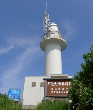
** Iwami Ōsaki Hana
1974. Active; focal plane 72 m (236 ft); white flash every 10 s. 16 m (52 ft) round cylindrical concrete tower with lantern and gallery, attached to a 1-story equipment room. There is also a communications tower on the gallery. Entire lighthouse is white. Shugo Morita's 2012 photo is at the top of this page, Trabas has a good photo, a 2021 closeup is available, Lighthouse-Japan.com has a page with good photos, Lighthouse Visit also has a page, Misty's Tour has another photo, FOAL has additional photos, a 2023 photo is available, and Google has a satellite view. This lighthouse stands atop one of the highest in a series of rocky promontories, separated by long sandy beaches, that punctuate this section of the coast. Located in a park about 10 km (6 mi) northeast of Hamada. Accessible by road and a short hiking trail; parking and restrooms are available. Site open, tower closed. . ARLHS JPN-189; JCG-0799; Admiralty M7347; NGA 1856.
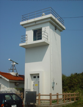
* Gōtsu (Gōsu)
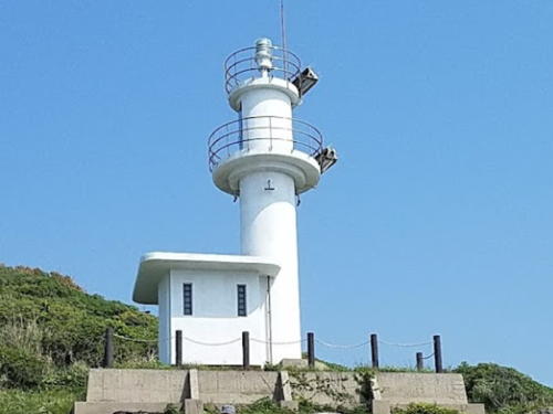
1960. Active; focal plane 65 m (213 ft); white light, 3 s on, 3 s off. 10.5 m (31 ft) square cylindrical concrete tower with double gallery. The light is atop the tower; in addition, a spotlight (JCG-0801) shines through a square window to illuminate the narrow harbor entrance. Entire lighthouse is white. A Coast Guard photo is at right, Trabas has a closeup, Lighthouse-Japan.com has a page with good photos, FOAL's page has photos, Lighthouse Visit has photos, Misty's Tour has another photo, and Google has a satellite view. Located on a steep promontory on the northeast side of Gōtsu. Accessible by road; parking is available but the entrance to the hilltop area is unmarked. Site open, tower closed. . ARLHS JPN-071; JCG-0800; Admiralty M7346.5; NGA 1860.

Ōda Lighthouses
* Yunotsu Breakwater (2)
1963. Active (?); focal plane 12 m (39 ft); continuous green light with a more intense flash every 6 s. 8.5 m (28 ft) concrete post attached to a 1-story square concrete equipment shelter. Entire structure is white. Lighthouse Visit has photos (second half of the page), Trabas has a closeup, FOAL has a distant view (top of the page), and Google has a street view and a satellite view. This light has been dropped from the Admiralty list but is still listed as active by FOAL. Located on the short east breakwater of Yonotsu harbor, a fishing port about 13 km (8 mi) northeast of Gōtsu. Accessible by walking the pier. Site open, tower closed. ARLHS JPN-1585; JCG-0804; ex-Admiralty M7346.2; NGA 1872.
Gōtsu Light
Gōtsu Light, Gōtsu
Japanese Coast Guard Hamada Office photo
* Yunotsu (Yunotu) Kō
1958. Active; focal plane 68 m (223 ft); flash every 2 s, white or red depending on direction. 10 m (33 ft) round concrete tower attached to a square 1-story concrete equipment shelter. Entire lighthouse is white. Trabas has a photo, Lighthouse-Japan.com has a page with photos, Lighthouse Visit has photos, FOAL's page has a closeup (halfway down the page), and Google has a satellite view. Entire lighthouse is white. Located on a forested promonotory north of the breakwater light. The entrance to the forest is marked. Site open, tower closed. ARLHS JPN-765; JCG-0803; Admiralty M7346; NGA 1868.
[Nima Kō]
2013. Active; focal plane 13 m (43 ft); red flash every 3 s. 8 m (26 ft) concrete post attached to a small concrete equipment room. Entire lighthouse is red. Trabas has a closeup photo and Google has a satellite view. Located at the end of the detached west breakwater at the entrance to Nima harbor, a fishing port about 25 km (15 mi) northeast of Gōtsu. Accessible only by boat. Site open, tower closed. ARLHS JPN-1565; JCG-0805; Admiralty M7345; NGA 1876.
#Nima Kō Outer Breakwater
Date unknown. Demolished in 2013. This was a 12 m (39 ft) concrete post attached to a square 1-story concrete equipment shelter. Entire lighthouse was white. Google has a satellite view showing an active light on a small post. In January 2013 the two Nima lights were deactivated and replaced by a new tower on the detached west breakwater (previous entry). Located on the north outer breakwater of Nima harbor, a fishing port about 25 km (15 mi) northeast of Gōtsu. ex-JCG-0805.
#Nima Kō (East Breakwater)
Date unknown. Demolished in 2013. This was a 10 m (33 ft) round concrete tower centered on a 1-story round concrete base. Entire structure was white. Google has a satellite view showing a small post, possibly with a light. Located on the east breakwater of Nima harbor. Accessible by walking the pier. Site open, tower closed. ARLHS JPN-1564; ex-JCG-0806; ex-Admiralty M7344; ex-NGA 1880.
* Isotake Kō (2)
2010. Active; focal plane 14 m (46 ft); red flash every 4 s. 9 m (30 ft) concrete post attached to a square 1-story concrete equipment shelter. The entire lighthouse is red. Trabas has a closeup photo and Google has a street view and a satellite view. In 2010 the former lights at Isotake were replaced by this new light. FOAL's October 2010 photo was taken during this project. Located on a detached breakwater at Isotake harbor. Accessible only by boat. Site open, tower closed. ARLHS JPN-1554; JCG-0808; Admiralty M7343; NGA 1892.
#Isotake Kō (1)
1959. Demolished in 2010. This was a 13 m (43 ft) round cylindrical concrete tower rising from a 1-story equipment shelter. Entire lighthouse was white. Google has a satellite view showing a small post, which apparently does have a light. Formerly located at the end of the west (main) breakwater of Isotake, about 10 km (6 mi) west of Ōda city. Site open. ex-JCG-0808; ex-Admiralty M7343; ex-NGA 1892.
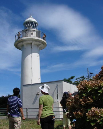
* Ō Misaki
1959. Active; focal plane 69 m (226 ft); white flash every 6 s. 14.5 m (48 ft) round concrete tower with lantern and gallery, attached to a 1-story keeper's house. Entire lighthouse is white. A Coast Guard photo is at right, Trabas has a great photo, Lighthouse-Japan.com has a page with photos, FOAL's page has photos, Lighthouse Visit has photos (lower half of the page), a 2017 photo is available, Saka Geen has a 2021 photo, Misty's Tour has another good photo, and Google has a satellite view. Local school children created and buried a time capsule at the lighthouse to celebrate its 50th anniversary in 1999. Accessible by a short walk from the town, but some local guidance may be needed. Located on a summit on the north side of Isotake harbor. Site open, tower closed. . ARLHS JPN-446; JCG-0810; Admiralty M7342; NGA 1888.
[Kute Kō]
2015. Active; focal plane 13 m (43 ft); green flash every 3 s. 8.5 m (28 ft) concrete post attached to a small concrete equipment room. Entire lighthouse is white. In 2015 the two Kute breakwater lights were replaced by this new light. Trabas has a closeup photo and Google has a satellite view of the new location and also a very distant street view. Located at the end of the detached west breakwater at the entrance to Kute harbor. Accessible only by boat. Site open, tower closed. ARLHS JPN-1560; JCG-0813; Admiralty M7341.2; NGA 1912.
Ō Misaki Light
Open house at Ō Misaki Light, Ōda, 12 August 2011
Japanese Coast Guard Hamada Office photo
#Kute Kō West Breakwater
1968. Removed in 2015. This was a 9.5 m (31 ft) concrete post attached to a 1-story square concrete equipment shelter. Entire structure was red. FOAL's page has photos and Google has a satellite view, but Google's distant street view confirms the removal. Formerly located on the west breakwater of Kute. Site open. ARLHS JPN-1561; ex-JCG-0814; ex-Admiralty M7341; NGA 1904.
#Kute Kō North Breakwater
Date unknown. Removed in 2015. This was a 8.5 m (28 ft) round hourglass-shaped concrete tower. Entire structure was white. FOAL's page has photos and Google has a satellite view. Google's distant street view shows a small post that probably carries a light. Formerly located on the north breakwater of Kute, which appears to be detached. Site open. ex-JCG-0813; ex-Admiralty M7341.2; ex-NGA 1912.
Tategami (Tategami Hana)
1951. Active; focal plane 93 m (305 ft); four white flashes every 15 s. 10 m (33 ft) round hourglass-shaped concrete tower with gallery. Entire lighthouse is white. Lighthouse-Japan.com has a page with good photos, Trabas has a closeup drone view, FOAL's page has a closeup and other photos, Lighthouse Visit also has photos (middle of the page), a 2023 drone view is available, a distant view is available, and Google has a satellite view. Located atop a spectacular vertical cliff and the end of a forested promontory just north of Hane harbor. Hard to find; the Lighthouse-Japan webmaster had great difficulty finding a path to the light. Site open, tower closed. . ARLHS JPN-629; JCG-0817; Admiralty M7338; NGA 1916.

Sakai Coast Guard District Lighthouses

The north coast of Shimane features a steep, forested ridge 65 km (40 mi) long, with the west half of the ridge in Izumo City and the east half in Matsue City. Both ends of the ridge project into the sea forming prominent capes. These capes are the sites of Shimane's best-known lighthouses, Hinomisaki in the west and Mihonoseki in the east.

Izumo Lighthouses
Izumo is a city of about 175,000 residents with a port sheltered by the Hinomisaki cape.

*
Taisha Kō (East Breakwater)
1988. Active; focal plane 13 m (43 ft); red flash every 4 s. 8.5 m (28 ft) concrete post light attached to a 1-story square concrete equipment shelter. Entire structure is red. Trabas has a closeup photo, FOAL's page has photos, Lighthouse Visit has photos (second lighthouse on the page), and Google has a distant street view and a satellite view. Taisha Kō is a small boat harbor on the northwest side of Izumo city. Located at an elbow of the east breakwater, marking the entrance to Taisha harbor. Accessible by walking the pier. Site open, tower closed. ARLHS JPN-1579; JCG-0819; Admiralty M7336.4; NGA 1928.
Taisha Kō Outer Breakwater
Date unknown. Active; focal plane 13 m (43 ft); green flash every 4 s. 10 m (33 ft) concrete post light attached to a 1-story square concrete equipment shelter. Entire structure is white. Trabas has a closeup photo, Lighthouse Visit has photos (first lighthouse on the page), and Google has a satellite view and a street view from an inner breakwater. Located at the south end of the detached outer breakwater of Taisha harbor. Accessible only by boat. Site open, tower closed. ARLHS JPN-1580; JCG-0818; Admiralty M7337; NGA 1932.
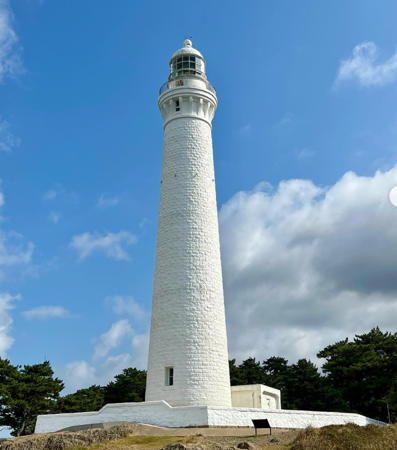
**** Hino Misaki (Hinomisaki, Izumo Hino Misaki)
1903. Active; focal plane 63 m (207 ft); two white flashes followed by one red flash every 20 s. 44 m (145 ft) round stone tower with lantern and gallery, attached to a 1-story keeper's house now used as a visitor center. Entire lighthouse painted white. A photo is at right, Nathan Dickworth has a photo, Trabas has a photo, Lighthouse-Japan.com has a page with photos, a good 2008 photo is available, FOAL's page has photos, Lighthouse Visit also has a page, Wikimedia has many photos, Klaus Huelse has a historic postcard view, Forand has a 1926 postcard view, and Google has a street view and a satellite view. This mighty tower is Japan's tallest lighthouse and certainly one of the country's most famous. It stands on a prominent and dangerous cape about 8 km (5 mi) west of the city of Izumo, marking shoals that extend westward from the cape into the Sea of Japan. Open to visitors, the tower is a very popular tourist attraction. Site open, tower open daily. . ARLHS JPN-201; JCG-0821; Admiralty M7334; NGA 1936.
* Hino Misaki Sakaguri Shoal Beacon
1973. Active; focal plane 36 m (118 ft); continuous white light. 13 m (43 ft) semicircular cylindrical white concrete tower; the light is shown through a window. This tower shines a spotlight on a dangerous reef just off the cape. Trabas has a closeup photo, Lighthouse Visit has photos (bottom of the page), FOAL has a photo (bottom of the page), and Google has a satellite view. Located just northeast of the Hinomisaki lighthouse. Site open, tower closed. JCG-0822; Admiralty M7334.2.
Uryu Kō Entrance Beacon
1983. Active; focal plane 36 m (118 ft); continuous white light. 13 m (43 ft) round cylindrical white concrete tower. Shone through a square window, the light illuminates the narrow entrance to Uryu harbor. FOAL has photos, Lighthouse Visit has photos, Trabas has a drone view, a closeup from the rear is available, and Google has a satellite view. Located at the tip of a promontory on the west side of the harbor entrance. Site open, tower closed. JCG-0822.5; Admiralty M7335; NGA 1940.

Hinomisaki Light, Izumo, November 2023
Instagram photo by beach_lighthouse
Sagiura (2)
Around 2015 (station established 1959). Active; focal plane 57 m (187 ft); white flash every 4 s. 8 m (26 ft) round concrete tower. Entire lighthouse is white. Trabas has a drone view and Google has a satellite view. Yukihiro Matsumura' 2023 photo is at right, Lighthouse-Japan.com has a 2010 photo of the earlier lighthouse, a post attached to a square 1-story concrete equipment shelter, and FOAL has additional photos (second row) also taken in 2010. Located on a promontory on the west side of the entrance to Sagiura Bay. Accessible by a fairly strenuous hiking trail. Site open, tower closed. . ARLHS JPN-522; JCG-0824; Admiralty M7333.5; NGA 1944.
* Uppurui Kō (2?)
Date unknown (station established 1984). Active; focal plane 13 m (43 ft); green light, 3 s on, 3 s off. 9.5 m (31 ft) round concrete tower, flared at the top, connected to a small equipment shelter. FOAL's page for the light has a good photo, Lighthouse Visit has a page with photos, Trabas has a closeup, and Google has a satellite view and a distant street view. Located at the end of the north breakwater at Uppurui. Accessible by walking the pier. Site open, tower closed. JCG-0825.5; Admiralty M7333.2; NGA 1952.
Uppurui (Oppurui) Hana
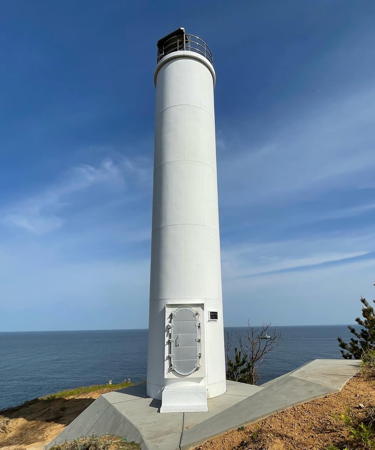
1957. Active; focal plane 65 m (213 ft); three white flashes every 13 s. 6 m (20 ft) round concrete tower with gallery, attached to a small equipment closet. Entire lighthouse is white. Lighthouse-Japan.com has a page with good photos, Lighthouse Visit has a page with photos (lower half of the page), Trabas has a good drone view, a 2022 closeup is available, and Google has a satellite view. Located on a sharp, rocky promontory at the northern entrance to Izumo Bay, about 12 km (7.5 mi) north of the city. Not easy to find but accessible by a hiking trail. Site and tower closed. . ARLHS JPN-720; JCG-0826; Admiralty M7333; NGA 1956.
* Nagaoka (Nagaoga) Hana
1971. Active; focal plane 76 m (249 ft); white light, 3 s on, 3 s off. 10 m (33 ft) round hourglass-shaped concrete tower. Entire lighthouse is white. Trabas has a closeup photo, Lighthouse-Japan.com has a page with photos, FOAL has another page for the lighthouse, Lighthouse Visit also has a page, the Coast Guard has an page with two aerial views (including the one at right), a 2019 view from the beach is available, and Google has a street view and a satellite view. Located on a bluff near Koizu, about 18 km (11 mi) west of Matsue. The light is above the coastal road and is accessible by a stiff climb up a long and rather scary flight of stairs. Site open, tower closed. ARLHS JPN-202; JCG-0827; Admiralty M7331; NGA 1960.
* Koizu Kō (West Breakwater)
1977. Active; focal plane 12 m (39 ft); red flash every 3 s. 8.5 m (28 ft) round hourglass-shaped concrete tower. Entire lighthouse is red. Trabas has a closeup photo, FOAL's page has photos, Lighthouse Visit has photos (lower half of the page), and Google has a street view and a satellite view. Located at the end of the west breakwater at Koizu, a small harbor about 10 km (6 mi) due north of Izumo. Accessible by walking the pier. Site open, tower closed. ARLHS JPN-1558; JCG-0828; Admiralty M7331.5; NGA 1964.

Sagiura Light, Izumo, August 2023
Instagram photo by Yukihiro Matsumura

Matsue Lighthouses
* Etomo Kō South Breakwater
Date unknown. Active; focal plane 11 m (36 ft); continuous red light with a more intense flash every 6 s. 9.5 m (31 ft) concrete post attached to a square 1-story concrete equipment shelter. Entire lighthouse is red. Trabas has a closeup photo, Lighthouse Visit has a photo (last photo on the page), and Google has a satellite view and a distant street view. Located at the end of the south breakwater of Etomo, marking the entrance to the inner (traditional) harbor. Accessible by walking the pier. Site open, tower closed. JCG-0830; Admiralty M7328; NGA 1972.
* Etomo Kō (Oki Breakwater)
1985. Active; focal plane 17 m (56 ft); green light, 3 s on, 3 s off. 14 m (46 ft) round cylindrical concrete tower with lantern and gallery. Entire lighthouse is white. Trabas has a great closeup photo, FOAL's page for the Etomo harbor lighthouses has a photo, Lighthouse Visit has a photo, and Google has a satellite view and a distant street view. Located at the end of the west breakwater of Etomo harbor. Accessible by walking the pier. Site open, tower closed. ARLHS JPN-1567; JCG-0828.5; Admiralty M7327.5; NGA 1968.
* Etomo
1953. Active; focal plane 58 m (190 ft); white light, 5 s on, 3 s off. 9.5 m (31 ft) round concrete tower, rising from a 1-story square concrete equipment house. Entire lighthouse is white. Yukihiro Matsumura' 2023 photo is at right, Trabas has a drone view, Lighthouse-Japan.com has a page with good photos, Lighthouse Visit has a photo (halfway down the page), FOAL has photos (bottom of the page), a 2023 closeup is available, and Google has an indistinct satellite view. Located on a promontory about 2.5 km (1.5 mi) north of Etomo. Apparently accessible by a hiking trail, but local knowledge will be needed. Site open, tower closed. ARLHS JPN-065; JCG-0833; Admiralty M7325; NGA 1976.
#Mitsu (Mizu) Kō West Breakwater
1967. Removed, possibly replaced. This was a 9.5 m (31 ft) concrete post attached to a 1-story square concrete equipment room. Entire lighthouse is red. Trabas has a closeup photo, FOAL has additional photos, Lighthouse Visit has a photo, and Google has a 2019 street view. Google's satellite view confirms the removal of the lighthouse; it my have been replced by a small post light. Located at the end of the west breakwater of Mitsu harbor. Accessible by walking the pier. Site open, tower closed. ARLHS JPN-1563; JCG-0836; ex-Admiralty M7324.6; NGA 1992.
* Mitsu (Mizu) Kō
1967(?). Active; focal plane 14 m (46 ft); green light, 3 s on, 3 s off. 9.5 m (31 ft) concrete post attached to a 1-story square concrete equipment room. Entire lighthouse is white. Trabas has a closeup photo, FOAL has additional photos, Lighthouse Visit has a photo (lower half of the page), and Google has a street view and satellite view. Located at the west end of a detached outer breakwater of Mitsu harbor. Accessible by walking the pier. Site open, tower closed. ARLHS JPN-1562; JCG-0836.5; Admiralty M7324.7; NGA 1988.

Etomo Light, Matsue, August 2023
Instagram photo by Yukihiro Matsumura
* Kaga Kō
Date unknown. Active; focal plane 13 m (43 ft); red flash every 3 s. 10 m (33 ft) concrete post attached to a 1-story concrete equipment room. Entire lighthouse is red. Trabas has a closeup photo, Lighthouse Visit has photos (lower half of the page), and Google has a satellite view and a distant street view. Located at the end of the north breakwater of Kaga port. Accessible by walking the pier. Site open, tower closed. ARLHS JPN-1556; JCG-837.5; Admiralty M7324.5; NGA 1996.
* Kukedo Hana
1952. Active; focal plane 34 m (112 ft); white light occulting once every 4 s. 10 m (33 ft) round cylindrical concrete tower attached to a square 1-story concrete equipment house. Entire lighthouse is white. Yasumasa Miyake has the 2018 photo seen at right, Lighthouse-Japan.com has a page with good photos, FOAL's page also has good photos, Trabas has a closeup photo, Lighthouse Visit has photos, Naohumi Morinaka has a view from the sea, Yuta Komura has a street view from the beach, and Google has a satellite view. This lighthouse occupies a popular viewpoint in what appears to be a nature reserve. Located on a promontory about 10 km (6 mi) north of Matsue. Accessible by a path from the end of the very narrow Sanami road north of Matsue. Site open, tower closed. . ARLHS JPN-298; JCG-0837; Admiralty M7324.4; NGA 2000.
* Tako Hana
1952. Active; focal plane 113 m (371 ft); white flash every 10 s. 7 m (23 ft) round cylindrical concrete tower attached to a small 1-story concrete equipment house. Entire lighthouse is white. A larger square building adjoining the lighthouse carries a tall communications antenna. Yuji Sawai has a 2021 photo showing that the lantern has been removed recently, Trabas has a closeup photo, and Google has a satellite view. The lighthouse marks the northernmost point of the Shimane mainland. Lighthouse-Japan.com has a page with a 2010 closeup photo showing the lighthouse with its lantern, FOAL has a page of 2010 photos, Lighthouse Visit also has a page, and Misty's Tour has another photo. Located on a promontory about 11 km (6.5 mi) north northeast of Matsue. Accessible by road; parking is available close to the lighthouse. . ARLHS JPN-621; JCG-0838; Admiralty M7324; NGA 2004.

Kukedo Hana Light, Matsue, April 2018
Google Maps photo by Yasumasa Miyake
* Sezaki
Date unknown. Active; focal plane 53 m (174 ft); continuous white light. 6 m (20 ft) square white concrete tower; the light is shown through a window. Trabas has a closeup photo and Google has a satellite view. This tower has a powerful spotlight illuminating a nearby reef. Located about 2.5 km (1.5 mi) southeast of Tako Hana. Accessible by road but vegetation hides the lighthouse and the entrance is unmarked. Site open, tower closed. JCG-0839.5; Admiralty M7319.2.
Tsunowa (Tunowa) Hana
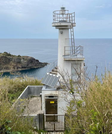
1971. Active; focal plane 34 m (112 ft); white light occulting twice every 6 s; in addition, a continuous white spotlight (JCG-0842) illuminates the nearby Kuroshima reef. 10 m (33 ft) round cylindrical concrete tower. Entire lighthouse is white. This lighthouse is at the end of a long, forested peninsula; it may be accessible by hiking. Gaku Fujihara's photo is at right, Lighthouse-Japan.com has a page with good photos, FOAL has additional photos, Lighthouse Visit has photos (halfway down the page), Trabas has a drone view, and Google has a satellite view. Located about 5 km (3 mi) southeast of Tako Hana. Accessible by a hiking trail, but local knowledge will be needed. Site open, tower closed. . ARLHS JPN-694; JCG-0841; Admiralty M7318.4; NGA 2012.
* Shichirui (Siturui) Kō
Date unknown. Active; focal plane 45 m (148 ft); three white flashes every 13 s. In addition a continuous white spotlight (JCG-0844) illuminates the Fume Shima Beacon to the northeast. 11 m (36 ft) round cylindrical concrete tower, wider at the top, painted with red and white horizontal bands. Trabas has a drone view, Lighthouse Visit has a photo (first lighthouse on the page), FOAL's page for Shichiuri has a photo, and the light appears in a Google satellite view. Located at the tip of a promontory sheltering the harbor of Shichurui, about 8 km (5 mi) west of Mihonoseki. Accessible by a hiking trail. Site open, tower closed. ARLHS JPN-590; JCG-0843; Admiralty M7314; NGA 2016.
Shichirui Kō Detached Breakwater
Date unknown. Active; focal plane 11 m (36 ft); continuous green light with a more intense flash every 5 s. 9.5 m (31 ft) concrete post centered on a 1-story square concrete equipment room. Entire lighthouse is white. Lighthouse Visit has a photo (third lighthouse on the page), FOAL's page for Shichiuri has a photo, Trabas has a closeup photo, and Google has a street view and a satellite view. Located at the north end of the detached breakwater at Shichiuri. Accessible only by boat, but there are good views from ferries sailing from Shichiuri to the Oki Islands. Site open, tower closed. ARLHS JPN-1574; JCG-0846; Admiralty M7315.2; NGA 2024.
Tsuriboko Yama
1958. Active; focal plane 122 m (400 ft); white light, 3 s on, 3 s off. 7.5 m (25 ft) concrete post attached to a 1-story concrete equipment room. Entire lighthouse is white. Trabas has a closeup photo, Lighthouse Visit has a photo (last lighthouse on the page), FOAL's page for Shichiuri has photos (bottom of the page), a closeup is available, and Google has a satellite view. Located on a promontory on the south side of the entrance to the harbor of Shichurui. Accessible by a hiking trail. Site open, tower closed. ARLHS JPN-1583; JCG-0847; Admiralty M7315; NGA 2020.

Tsunowa Hana Light, Matsue, April 2019
Instqgram photo by Gaku Fujihara
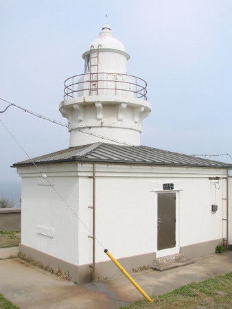
*** Mihonoseki (Jizō Zaki)
1898. Active; focal plane 83 m (272 ft); white flash every 12 s. 14 m (46 ft) round stone tower with lantern and gallery, attached to a semicircular stone keeper's cottage. Entire lighthouse painted white. A photo appears at the top of this page, Trabas has a great closeup, Lighthouse-Japan.com has a page with good photos, Lighthouse Visit also has a page for the lighthouse, another photo and a closeup of the lantern are available, Wikimedia has several photos, Klaus Huelse has a historic postcard view, Forand also has a postcard view, Ryohsuke Torii has a street view, and Google has a fine satellite view. This historic lighthouse has an exceptionally scenic site, even for this scenic coast. It stands at Jizō Zaki, the end of a peninsula sheltering the harbor of Mihonoseki, with a wide view over water in three directions. A lighthouse museum has built built at the site; several Fresnel lenses including a first order lens (quite rare in Japan) are on display. FOAL's page for the lighthouse has photos of the lenses. Accessible by road, it is a very popular tourist attraction. Site open, tower closed but the lighthouse grounds and visitor center/museum are open. . ARLHS JPN-349; JCG-0848; Admiralty M7316; NGA 2172.
[Okino Gozen Shima Beacon]
Date unknown. Active; focal plane about 72 m (236 ft); continuous white light. Approx. 5 m (17 ft) square concrete tower; the light is shown through a square window. This spotlight shines of the Okino Gozen Shima reef, which also has its own lighthouse (next entry). The Coast Guard has a photo (sixth photo on the page), Lighthouse Visit has photos (3/4 the way down the page), and FOAL has another photo (fourth row on the page). Located next to the Mihonoseki lighthouse. Site open, tower closed. JCG-0849.
Okino Gozen Shima
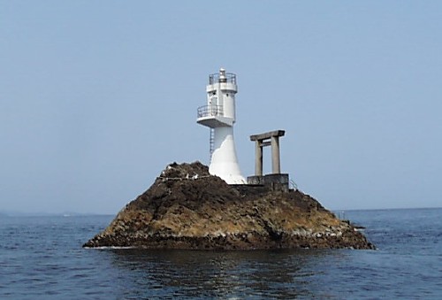
Date unknown. Active; focal plane 14 m (46 ft); white flash every 3 s. 10 m (33 ft) round concrete tower with double gallery. Entire lighthouse is white. A Coast Guard photo is at right, Trabas has a photo, Lighthouse Visit has photos (bottom of the page), FOAL has a distant view (2/3 the way down the page), and Google has a satellite view. A Shinto shrine stands next to this remote light. Located on a dangerous skerry about 4 km (2.5 mi) northeast of Jizō Saki. Accessible only by boat. Site open, tower closed. ARLHS JPN-484; JCG-0850; Admiralty M7315.6; NGA 2168.
Saruga Hana
Date unknown. Active; focal plane 12 m (39 ft); red flash every 3 s. 10 m (33 ft) round cylindrical concrete tower. Entire lighthouse is red. Lighthouse Visit has a page for the lighthouse, FOAL also has a page, Trabas has a closeup, and Google has a street view and a satellite view. This light is on the south side of the Mihonoseki peninsula; it guides vessels in the inner harbor of Sakaiminato, which is across a narrow channel in Tottori Prefecture. NGA misspells the name "Suraga." Located on a forested promontory; there seems to be no easy access. Site status unknown. ARLHS JPN-1577; JCG-0906; Admiralty M7304; NGA 2212.

Okino Gozen Shima Light, Matsue
Japanese Coast Guard Sakai Office photo

Yasugi Lighthouses
The city of Yasugi faces north on Nakaumi, a brackish lake connected to the Sea of Japan by the Sakai Channel, a narrow inlet south of Mihonoseki. Nakaumi is separated from the sea by the city of Sakaiminato, which occupies the Yumigahama Peninsula in Tottori Prefecture.

Kame Shima
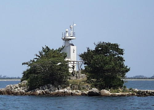
Date unknown. Active; focal plane 12 m (39 ft); white flash every 4 s. 8.5 m (28 ft) concrete post attached to a 1-story concrete equipment room. Entire lighthouse is white. A Coast Guard photo is at right, Lighthouse Visit has a page for the light, FOAL also has a page, Trabas has a closeup, and Google has a satellite view and a distant street view. Located on a small island just off the waterfront of Yasugi. Accessible only by boat. Site status unknown. ARLHS JPN-1590; JCG-0914; Admiralty M7306; NGA 2192.
Yasugi Kō South Breakwater
1962. Active; focal plane 9 m (30 ft); continuous red light with a more intense flash every 5 s. 8.5 m (28 ft) round hourglass-shaped concrete tower. Entire lighthouse is red. Trabas has a closeup photo, Lighthouse Visit has photos (lower half of the page), FOAL also has a photo, and Google has a good street view as well as a satellite view. Located on a short breakwater at the entrance to the traditional inner harbor of Yasugi. Accessible by walking the pier. Site open, tower closed. ARLHS JPN-1600; JCG-0916; Admiralty M7307; NGA 2196.

Information available on lost lighthouses:


Kame Shima Light, Matsue
Japanese Coast Guard Sakai Office photo

Notable faux lighthouses:

Adjoining pages: North: Oki Islands | East: Tottori and Tajima | West: Western Yamaguchi

Return to the Lighthouse Directory index | Ratings key

Posted February 28, 2007. Checked and revised November 16, 2023. Lighthouses: 51. Site copyright 2023 Russ Rowlett and the University of North Carolina at Chapel Hill.