Lighthouses of Japan: Northern Ishikawa

The nation of Japan, known in Japanese as Nihon or Nippon (日本), occupies an archipelago off the east coast of Asia. The four main islands are Hokkaidō in the north, Honshū (the largest) in the center, Shikoku in the south, and Kyūshū in the southwest. The country includes thousands of other islands of all sizes; among them the Ryūkyū (Nansei) Islands are a long chain extending to the southwest and including the large island of Okinawa, and the Nanpō Islands are another long chain extending south into the Pacific Ocean. Much of Japan is mountainous but the coastal regions are densely populated and urbanized; the country's population is about 126 million.

Japan is divided into 47 prefectures. This page lists lighthouses of the northern portion of the prefecture of Ishikawa, located on the western coast of Honshū facing the Sea of Japan. The northern half of Ishikawa is the Noto Peninsula, which projects northward into the Sea of Japan and poses a substantial hazard to navigation. The peninsula is rugged and scenic, very different from the sandy, well-populated shores of the southern half of the prefecture.

In Japanese the word for a lighthouse is tōdai or toudai (灯台). The words saki and misaki are for capes and headlands, hana ("nose") is a promontory, hantō is a peninsula, shima (also spelled sima or jima) is an island, bae is a reef, iwa or shi is a rocky reef, amase or se is a shoal, wan is a bay, nada is a sound or basin, kaikyō is a strait, kawa is a river, and or minato is a harbor.

Lighthouses in Japan are operated and maintained by the Japanese Coast Guard's Maritime Safety Agency. On Honshū there is at least one Coast Guard Section Office in each prefecture, often two or more. In Ishikawa there are two offices, at Kanazawa in the west and Nanao in the east; all the lights on this page are maintained by the Nanao Office.

A note on the Sea of Japan/East Sea controversy: The Directory takes no side in any international dispute; it makes use of the terminology, names, and spellings as they currently exist in each area covered. The sea between Japan and Korea is called the Sea of Japan on the pages for Japan and the East Sea on the pages for Korea.

ARLHS numbers are from the ARLHS World List of Lights. JCG numbers are the Japanese Coast Guard's light list numbers. Admiralty numbers are from volume M of the Admiralty List of Lights & Fog Signals. U.S. NGA List numbers are from Publication 112.

General Sources
Lighthouses in Japan - Ishikawa
A site providing photos and data for most major Japanese lighthouses.
Lighthouse-Japan.com - Ishikawa
Excellent photos with notes (in Japanese) for many of the lighthouses.
Form of a Lighthouse - Ishikawa
Another site with many photos of Japanese lighthouses; this source is cited below as FOAL.
Lighthouse Visit
Another good source of lighthouse photos.
Online List of Lights - Japan
Photos by various photographers posted by Alexander Trabas.
Misty's Japanese Lighthouse Tour
Photos and a few notes for lighthouses in all parts of the country.
Lighthouses in Ishikawa Prefecture
Photos by various photographers available from Wikimedia.
Ninth Region Lighthouse Location Map
This interactive map links to photos and descriptions (in Japanese) of the major lighthouses of the Ninth Coast Guard Region, including Ishikawa, Toyama, and Niigata Prefectures.
Navionics Charts
Navigation chart for western Honshū.


Saruyama Misaki Light, Wajima, March 2016
Japanese Coast Guard photo
Wajima City Mainland Lighthouses
Wajima is a small city of about 30,000 residents occupying the bend of the Noto Peninsula.
* Saruyama Misaki
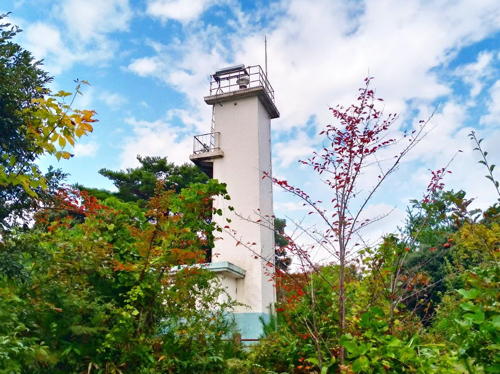
1920. Active; focal plane 219 m (719 ft); four white flashes every 20 s. 17 m (56 ft) round cylindrical concrete tower with lantern and gallery, attached to a large square 1-story keeper's house. Entire lighthouse is white. A Coast Guard photo is at the top of this page, Lighthouses of Japan also has a page for the lighthouse, Lighthouse-Japan.com has a page with good photos, FOAL's page has photos, Trabas has a closeup, Shimizu Akira has a 2016 photo, Misty's Tour has additional photos, a 2021 drone view is available, and Google has a good satellite view. Cape Saruyama is the "joint" of the thumb-shaped Noto Peninsula, where the trend of the land changes from north to northeast. Located on the point of the cape 8 km (5 mi) southwest of Wajima. Accessible by a popular hiking trail. Parking and restroom facilities for the trail are available at the end of a winding mountain road. Site open, tower closed. . ARLHS JPN-538; JCG-1109; Admiralty M7212; NGA 2828.
* Tatsuga Saki (Wajima)
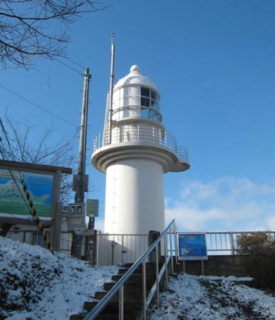
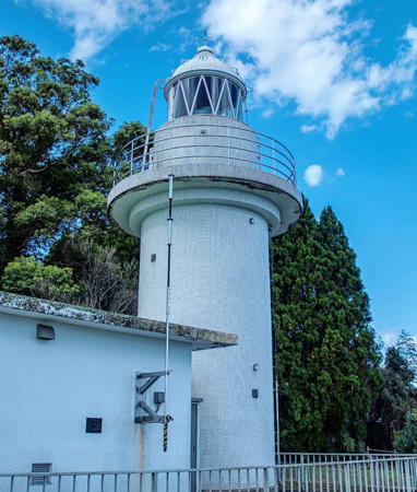
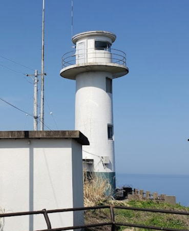
1965. Active; focal plane 66 m (217 ft); white flash every 15 s; also a continuous white spotlight (JCG-1111) illuminates a shoal 750 m (1/2 mi) north. 11 m (36 ft) round cylindrical concrete tower with lantern, gallery, and a semicircular equipment shelter surrounding half of the base. The lighthouse is white except for the blue band at the base. Tsukasa Morisawa's photo is at right, Lighthouses of Japan also has a page for the lighthouse, Lighthouse-Japan.com has a page with good photos, Soichi Ogucci has a 2021 photo, Trabas has a drone view, and Google has a satellite view and a street view at the base of the lighthouse. This lighthouse is built atop a precipitous rocky ridge. Accessible by a trail and a long stone stairway. Located on a promontory on the west side of the harbor of Wajima. Site open, tower closed. . ARLHS JPN-634; JCG-1110; Admiralty M7204; NGA 2836.
Wajima Kō Detached Breakwater
2014. Active; focal plane 15 m (49 ft); two red flashes every 6 s. 9 m (30 ft) round concrete tower with a flared top. Entire lighthouse is red. Lighthouse Visit has a photo but has the JCG numbers for this light and the next one reversed; Trabas has a closeup and Google has a satellite view. The JCG number for this new light was transferred from a white post light seen on a Lighthouse-Japan.com page; that light has apparently been removed. Located on a long detached breakwater sheltering Wajima harbor. Accessible only by boat. Site open, tower closed. JCG-1113; Admiralty M7207; NGA 2844.
* Wajima (Wazima) Kō (Breakwater No. 1)
Date unknown (station established 1927). Active; focal plane 12 m (39 ft); red flash every 3 s. 9.5 m (31 ft) concrete post attached to a square 1-story concrete equipment building. Entire lighthouse is red. Trabas has a closeup photo, FOAL's page has photos, Lighthouse Visit has a photo, Chan Masa has a 2023 photo, and Google has a street view and a satellite view. Located at the end of the west (really north) breakwater of Wajima. Accessible by walking the pier. Site open, tower closed. ARLHS JPN-1238; JCG-1112; Admiralty M7206; NGA 2840.

Tatsuga Saki Light, Wajima, April 2021
Google Maps photo by Tsukasa Morisawa

Nanatsu Shima and Hegura Shima Lighthouses
Nanatsu Shima and Hegura (Hekura) Shima are small islands in the Sea of Japan off the northern end of the Noto Peninsula. Nanatsu Shima is uninhabited and closed to the public as a bird sanctuary. Hegura Shima has a small settlement of abalone divers and is popular as a remote getaway during the summer and as one of Asia's best locations for birding. Boat transportation to the islands can be secured in Wajima. The islands are administered as part of Wajima City.
Nanatsu (Nanatu) Shima
Date unknown. Active; focal plane 66 m (217 ft); white flash every 5 s. 7.5 m (25 ft) square cylindrical concrete tower with lantern and gallery. Entire lighthouse is white. Lighthouse-Japan.com has a page with several views from the sea, Misty's Tour has another view, and Google has a satellite view. Located on the highest point of the island, about 20 km (13 mi) northeast of Wajima. Accessible only by boat, but the island is normally closed to visitors; passenger ferries to Hegura Shima pass close to the island. Site and tower closed. ARLHS JPN-402; JCG-1115; Admiralty M7202; NGA 2852.
* Hegura (Hukura) Shima (1)
1931. Inactive. Approx. 12 m (39 ft) round concrete tower with gallery; lantern removed. Lighthouse painted white. This tower stands close to the newer tower (next entry); it is seen in the Coast Guard's photo and the fourth photo of Lighthouse-Japan.com's page.
*** Hegura (Hukura) Shima (2)
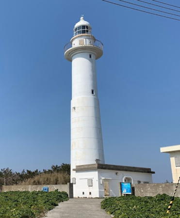
Date unknown (station established 1931). Active; focal plane 43 m (141 ft); two white flashes every 28 s. 33.5 m (110 ft) round concrete tower with lantern and gallery, attached to a small 1-story keeper's house. Entire lighthouse is white. Ryo Kamata's photo is at right, Lighthouses of Japan also has a page for the lighthouse, Lighthouse-Japan.com has a page with excellent photos, Misty's Tour has additional photos, and Google has a street view and a satellite view of the station. This tall lighthouse is the principal landmark and attraction of the island, which is barely 2 km (1.2 mi) in diameter. Located near the center of the island. Site open, tower reported open for a short time each afternoon in season. . ARLHS JPN-102; JCG-1116; Admiralty M7200; NGA 2856.
Hegurashima Kō South (No. 1) Breakwater
1959. Active; focal plane 12 m (39 ft); green flash every 3 s. 10 m (33 ft) white concrete post attached to a square 1-story white concrete equipment building. Google has a satellite view. Located at the east end of the original south breakwater protecting the entrance to the harbor of Hegura Shima. Accessible by walking the pier. Site open, tower closed. ARLHS JPN-1215; JCG-1117; Admiralty M7201; NGA 2860.
Hegurashima Kō (South Outer Breakwater)
Date unknown. Active; focal plane 13 m (43 ft); green flash every 5 s. 9.5 m (31 ft) white concrete post attached to a square 1-story white concrete equipment building. Google has a satellite view. Located at the east end of the detached south outer breakwater protecting the entrance to the harbor of Hegura Shima. Accessible only by boat. Site status unknown. ARLHS JPN-1217; JCG-1118.5; Admiralty M7201.6; NGA 2868.
Hegurashima Kō North (No. 2) Breakwater
Date unknown. Active; focal plane 13 m (43 ft); red flash every 3 s. 8.5 m (28 ft) concrete post attached to a square 1-story concrete equipment building. Entire lighthouse is red. Google has a satellite view. Located at the west end of the original north breakwater protecting the entrance to the harbor of Hegura Shima. Accessible only by boat. Site status unknown. ARLHS JPN-1216; JCG-1118; Admiralty M7201.4; NGA 2864.

Hegura Shima Light, Wajima, March 2021
Google Maps photo by Ryo Kamata

Suzu City Lighthouses
Suzu occupies the extreme tip of the Noto Peninsula. The rugged and mountainous city's population is only about 13,500.
Noto Kura Saki
1956. Active; focal plane 70 m (230 ft); two white flashes every 7 s. 9 m (30 ft) round cylindrical concrete tower with gallery. Entire lighthouse is white. Lighthouse-Japan.com has a page with good photos, FOAL's page has photos, Trabas has a closeup, Misty's Tour has evening photos, Lighthouse Visit has a page with photos, a 2019 closeup is available, and Google has a street view and a satellite view. Located atop a steep promontory near the northern end of the Noto Peninsula, about 13 km (8 mi) northwest of Suzu. The coastal highway tunnels under this headland. Accessible by a hiking trail from either end of the tunnel, but parking is very limited. Site open, tower closed. . ARLHS JPN-433; JCG-1120; Admiralty M7198; NGA 2872.
Takaya Kō
Date unknown. Active; focal plane 17 m (56 ft); red flash every 3 s. 9.5 m (31 ft) round cylindrical concrete tower with a flared top. Entire lighthouse is red. Trabas has a closeup photo, FOAL has a photo, and Google has a street view and a satellite view. Located at the end of the main (west) breakwater at Takaya, a small fishing port at the northern end of the Noto Peninsula. Site and tower closed. ARLHS JPN-1231; JCG-1121; Admiralty M7195.9; NGA 2876.
Yome Guri
Date unknown. Active; focal plane 13 m (43 ft); two white flashes every 8 s. 13 m (43 ft) round cylindrical white concrete tower with gallery mounted on a platform supported by three robust concrete piles. A blogger has several photos (1/3 the way down the page) and another photo is available but Google's satellite view shows nothing at the location. Located on a dangerous shoal in the Sea of Japan about 17 km (10.5 mi) north of the Noto Peninsula. Accessible only by boat. Site open, tower closed. ARLHS JPN-1239; JCG-1119; Admiralty M7199; NGA 2884.
* Rokkō (Rokugo) Saki
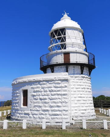
1883. Active; focal plane 48 m (157 ft); white light, 3 s on, 3 s off. 12 m (39 ft) round stone tower with lantern and gallery, attached to a semicircular stone keeper's house. The original 1st order Fresnel lens is in use. Entire lighthouse painted white. A photo is at right, Trabas has a great closeup photo, Kenichi Goto has a 2021 photo, the Lighthouses of Japan site has a page with several photos taken inside and outside of the lighthouse, Lighthouse-Japan.com also has a page with several good photos, FOAL's page has photos, an excellent closeup is available, Misty's Tour has additional photos, and Google has a street view and a satellite view. This historic and picturesque lighthouse stands on the extreme northeastern tip of the Noto Peninsula with a spectacular view of the sea on all sides. Located about 10 km (6 mi) northeast of Suzu. Accessible by a short walk from the town. Site open, tower closed. . ARLHS JPN-510; JCG-1123; Admiralty M7196; NGA 2888.

Rokkō Saki Light, Suzu, July 2021
Google Maps photo by Kenichi Goto
Noroshi (Norosi) Kō
Date unknown. Active; focal plane 13 m (43 ft); red light, 3 s on, 3 s off. 11 m (36 ft) concrete post attached to a square 1-story concrete equipment building. Entire lighthouse is red. Originally this light was at the end of the west breakwater; Lighthouse of Japan has a photo of the light on its old location. Google's satellite view and October 2014 street view show that the light has been moved to the end of a new detached breakwater. Trabas has a closeup photo and FOAL has 2018 photos (bottom of the page). Located at Noroshi, a small fishing port at the northern end of the Noto Peninsula. Site and tower closed. ARLHS JPN-430; JCG-1122; Admiralty M7195.8; NGA 2892.
Himeshima Guri
Date unknown. Active; focal plane 13 m (43 ft); white flash every 4 s. 13 m (43 ft) round concrete tower with gallery. Entire lighthouse is white. Located on a rocky reef a short distance offshore from Zike about 3 km (32 mi) southeast of the Rokkō Saki light. FOAL has 2018 photos (middle of the page), Trabas has a photo, and Google has a satellite view. Accessible only by boat, but easily viewed from shore. Site and tower closed. ARLHS JPN-119; JCG-1201; Admiralty M7195; NGA 2896.
* Ai Saki
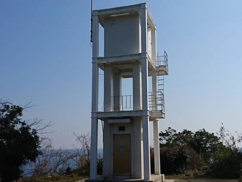
Date unknown (rebuilt 2007?). Active; focal plane 31 m (102 ft); continuous white spotlight. 8.5 m (28 ft) square cylindrical white concrete skeletal tower with enclosed upper and lower portions. A 2019 photo is at right, Trabas has a closeup photo, Lighthouse Visit has several photos and Google has a satellite view. Sakai Construction posted a photo of the lighthouse as an example of its "disaster recovery work," repair of damage from an earthquake that struck this area on 25 March 2007. The light illuminates a reef (Gyozya Guri) about 560 m (1/3 mi) to the east. Located atop a steep bluff at Jike, about 5 km (3 mi) southeast of Rokkō Saki. Site open, tower closed. . ARLHS JPN-768; JCG-1202; Admiralty M7195.4; NGA 2900.

Ai Saki Light, Suzu, March 2019
Instagram photo by toddegree
* Nagate Saki
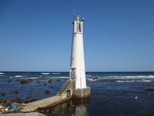
1961. Active; focal plane 16 m (52 ft); white light, 3 s on, 3 s off. 16 m (52 ft) round concrete tower. Entire lighthouse is white. A photo is at right, Trabas has a closeup photo, Lighthouse-Japan.com has a page with several photos, FOAL's page also has photos, a 2021 closeup is available, Misty's Tour has a photo of the lighthouse in action, and Google has a street view and a satellite view. This lighthouse has an unusual design. Located in the surf at the southeastern corner of the end of the Noto Peninsula, about 8 km (5 mi) east of Suzu. Site open, tower closed. . ARLHS JPN-394; JCG-1203; Admiralty M7194; NGA 2904.
Takojima Kō
Date unknown. Active; focal plane 12 m (39 ft); two red flashes every 6 s. 8.5 m (28 ft) concrete post attached to a square 1-story concrete equipment building. Entire lighthouse is red. Trabas has a closeup photo and Google has a satellite view and a distant street view. NGA misspells the name as Takajima. Located at the end of the east (main) breakwater of Takojima harbor. Accessible only by boat. Site status unknown. JCG-1205; Admiralty M7192.4; NGA 2912.

Noto Town Lighthouses
Matsunami Kō
Date unknown. Active; focal plane 12 m (39 ft); green flash every 3 s. 10.5 m (31 ft) concrete post rising from a square 1-story concrete equipment building. Entire lighthouse is white. FOAL's page has good photos, Trabas has a closeup, and Google has a satellite view and a distant street view. Located at the north end of the detached breakwater of Matsunami harbor. Accessible only by boat. Site status unknown. ARLHS JPN-1222; JCG-1207; Admiralty M7190; NGA 2920.

Nagate Saki Light, Suzu, October 2014
Wikimedia Creative Commons photo by Qurren
* [Noto Aka Saki]
1966. Active; focal plane 12 m (39 ft); white light occulting twice every 6 s. 9.5 m (31 ft) white concrete post mounted on a round concrete base. FOAL's page for the light has photos, Ana Kuraki has a 2016 photo, Trabas has a photo, and Google has a satellite view. This small light is in an accessible and very scenic location. Located at the tip of a promontory about 2.5 km (1.5 mi) east of Matsunami. Site open (parking provided), tower closed. . ARLHS JPN-1224; JCG-1208; Admiralty M7189.6; NGA 2924.
* [Noto Joga (Jo-Ga) Saki]
1970. Inactive since 2019. 9.5 m (31 ft) white concrete post rising from a small equipment shelter. FOAL's page has good photos, a 2019 photo is available, and Google has a satellite view. This light is near a campground and is accessible by a short hiking trail. Located at the tip of a promontory about 3 km (1.8 mi) southeast of Matsunami. Site open, tower closed. ARLHS JPN-1225; ex-JCG-1209; ex-Admiralty M7189.4; NGA 2928.
Ogi Kō (Tsukomo Wan) North Breakwater
Date unknown. Active; focal plane 12 m (39 ft); two red flashes every 5 s. 9.5 m (31 ft) concrete post attached to a square 1-story concrete equipment building. Entire lighthouse is red. Trabas has a closeup photo, FOAL's page has photos of both breakwater lights (top of the page), a 2023 view is available, and Google has a satellite view. Note that NGA has confused the two breakwaters in its listings. Located at the end of the detached north breakwater of Ogi harbor. Accessible only by boat. Site open, tower closed. JCG-1211; Admiralty M7189; NGA 2932.
* Ogi Kō (Tsukomo Wan) South Breakwater
Date unknown. Active; focal plane 9 m (30 ft); green flash every 4 s. 8.5 m (38 ft) concrete post attached to a square 1-story concrete equipment building. Entire lighthouse is white. Trabas has a closeup photo, FOAL's page has photos of both breakwater lights (top of the page), and Google has a satellite view. Located at the end of the south breakwater of Ogi harbor. Accessible by walking the pier. Site open, tower closed. ARLHS JPN-688; JCG-1212; Admiralty M7188.4; NGA 2948.
* Inuyama (Noto Ogi Kō)
1950. Active; focal plane 32 m (105 ft); two white flashes every 18 s. 14 m (46 ft) round concrete tower with lantern and gallery, rising from a rectangular 1-story equipment building. Entire lighthouse is white. A closeup photo is at right, Trabas also has a closeup photo, Lighthouses of Japan site has a page for the lighthouse, Lighthouse-Japan.com has a page with several photos, FOAL's page has photos (middle of the page), Misty's Tour has a closeup photo, a 2023 view from the harbor is available, and Google has a street view and a satellite view. This lighthouse is unusual among Japanese harbor lighthouses in being located in the center of the town of Inuyama. Accessible by walking up the steep hill through the surrounding neighborhood; there's no parking near the lighthouse. Site open, tower closed. . ARLHS JPN-1218; JCG-1213; Admiralty M7188; NGA 2944.
Inuyama South Breakwater
Date unknown. Active; focal plane 10 m (33 ft); red flash every 3 s. 8 m (26 ft) concrete post attached to a square 1-story concrete equipment building. Entire lighthouse is red. FOAL has two photos (bottom of the page), Trabas has a photo, and Google has a street view and a satellite view. NGA lists this light as "Motoogi," a garbling of Noto Ogi. Located on the detached breakwater of a small boat harbor on the south side of Inuyama. Accessible only by boat, but easily seen from shore. Site open, tower closed. JCG-1214; Admiralty M7188.1; NGA 2940.
Ushitsu (Usitsu, Usetsu) East (No. 2) Breakwater
Date unknown. Active; focal plane 12 m (39 ft); red light, 3 s on, 3 s off. 9.5 m (31 ft) concrete post attached to a square 1-story concrete equipment building. Entire lighthouse is red. Trabas has a closeup photo, FOAL's page has photos (middle of the page) and Google has a street view and a satellite view. Located in the middle of the east breakwater of Ushitsu harbor. Site status unknown. ARLHS JPN-1236; JCG-1219; Admiralty M7186.2; NGA 2968.

Inuyama Light, Noto, May 2021
Instagram photo by yukihiromatsumura
* Ushitsu (Usitsu, Usetsu)
1963. Active; focal plane 38 m (125 ft); three white flashes every 13 s. 10.5 m (35 ft) square cylindrical concrete tower with gallery, rising from a square 1-story equipment building. Entire lighthouse is white. A 2019 photo is available, Lighthouse-Japan.com has a page with several photos, FOAL's page has photos, Misty's Tour has two photos, Trabas has a photo, and Google has a street view and a satellite view. Located on a hillside above the west side of the harbor of Ushitsu. Site open, tower closed. . ARLHS JPN-728; JCG-1216; Admiralty M7185; NGA 2960.
Ukawa Kō
Date unknown. Active; focal plane 12 m (39 ft); white light, 3 s on, 3 s off. 10 m (33 ft) concrete post rising from a conical concrete base. Entire lighthouse is white. Trabas has a closeup photo, FOAL has photos, another photo is available (#1220, 3/4 the way down the page), and Google has a satellite view. Located on a sharp elbow of the breakwater of Ukawa harbor. Accessible by walking the pier. Site open, tower closed. ARLHS JPN-1235; JCG-1220; Admiralty M7184; NGA 2972.

Anamizu Town Lighthouse
* Anamizu
1966. Active; focal plane 49 m (161 ft); white flash every 3 s. 11 m (36 ft) square cylindrical concrete tower with gallery, rising from a square 1-story equipment building. Lighthouse is white with a blue band at the base. A 2022 photo is at right, Trabas has a good closeup photo, Lighthouse-Japan.com has a page with photos, FOAL's page has photos, and Google has a satellite view. This light is very similar to the Ushitsu lighthouse. Located in Anamizu, a sheltered port town on the east side of the Noto Peninsula. Accessible by a short walk from the parking lot of a hotel called the Oysters Inn (Kaki No Yado). Site open, tower closed. . ARLHS JPN-020; JCG-1221; Admiralty M7183; NGA 2976.

Anamizu Light, Anamizu, October 2022
Instagram photo by naka0514k

Nanao City Lighthouses
Nanao is a port city of about 50,000 residents on the east side of the Noto Peninsula.

Enome Kō East (No. 1) Breakwater
Date unknown. Active; focal plane 12 m (39 ft); two red flashes every 5 s. 9.5 m (31 ft) concrete post attached to a square 1-story concrete equipment building. Entire lighthouse is red. Trabas has a closeup photo and Google has a satellite view. Located at the end of the east (main) breakwater of Enome harbor, near the northeastern point of Noto Shima. Site status unknown. JCG-1223; Admiralty M7173; NGA 2984.
* Katsuo (Kato) Saki
1976. Active; focal plane 11 m (36 ft); continuous white spotlight. 9 m (29 ft) concrete post, attached to a small equipment shelter and carrying a large square lantern room. Entire lighthouse is white. Trabas has a closeup photo, Lighthouse Visit has a photo, a 2019 closeup is available, and Google has an indistinct satellite view. Located south of Enome harbor on the easternmost point of Noto Shima. Site open, tower closed. . JCG-1224; Admiralty M7172.4; NGA 2988.
Noto Shima (Nanao Bay Entrance)
Date unknown. Active; focal plane 18 m (59 ft); continuous light, white red or green depending on direction; also a passing light showing a white flash every 3 s. 14 m (46 ft) round cylindrical concrete tower with two galleries, mounted on a large square concrete base. Entire lighthouse is white. Yukihiro Matsumura's photo is at right, Trabas has a closeup photo, Lighthouse-Japan.com has a page with several photos, FOAL has two additional photos, and Google has a satellite view. The entrance to Nanao Bay is through a narrow strait between Noto Kannon Saki and Noto Shima, a large island. The lighthouse is on a promontory on the south side of Noto Shima about 4 km (2.5 mi) west of Noto Kannon Saki. Accessible only by boat. Site open, tower closed. . ARLHS JPN-791; Passing light JCG-1232.2, Admiralty M7174, NGA 2996; Directional light JCG-1232.5, Admiralty M7174.5, NGA 3000.

Noto Shima Light, Nanao, October 2022
Instagram photo by Yukihiro Matsumura
#Ishisaki Kō
1958. Inactive since 2008 and removed soon thereafter. This was an 8 m (26 ft) post connected to a square 1-story equipment shelter. Entire lighthouse was red. Google's satellite view confirms the removal. The light was replaced by a light on a post at the end of the new detached breakwater; FOAL has photos of the new light (JCG 1247.1). Ishisaki harbor is the fishing port of Nanao, on the west side of the city. Located on the original main breakwater of Ishisaki. Probably accessible by walking the pier. Site open, tower closed. ex-JCG-1247; ex-Admiralty M7182; ex-NGA 3012.
Nanao Me Shima (Meshima)
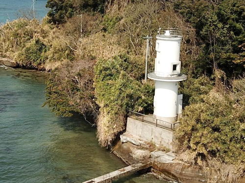
Date unknown. Active; focal plane 13 m (43 ft); two red flashes every 6 s. 10 m (33 ft) round cylindrical concrete tower with double gallery, painted red. Trabas has a photo, Takeharu Goto has a view from the sea, and Google has a satellite view. Located on a rocky reef in Nanao Bay off the Nanao waterfront. Accessible only by boat. Site open, tower closed. JCG-1238; Admiralty M7177; NGA 3004.
* Noto Kannon Saki
1914. Active; focal plane 32 m (105 ft); white flash every 8 s. 12 m (39 ft) round concrete tower with lantern and gallery, rising from a rectangular 1-story equipment building. Entire lighthouse is white. Hideki Matsubara's photo is at right, Trabas has a good photo, the Lighthouses of Japan site has a page for the lighthouse with several photos, Lighthouse-Japan.com also has a good page, FOAL's page has photos of the lighthouse in action, Misty's Tour has another photo, a 2017 closeup is available, and Google has a street view and a satellite view. Not to be confused with the famous Kannon Saki Light at the entrance to Tōkyō Bay, this lighthouse marks the entrance to the sheltered waters of Nanao Bay. Located on the point of the cape about 12 km (7.5 mi) northeast of Nanao. Accessible by road. Site open, tower closed. . ARLHS JPN-432; JCG-1225; Admiralty M7172; NGA 2992.
* #Iori (Inori) Kō (1)
Date unknown. Replaced in 2017. This was a 9 m (30 ft) concrete post attached to a square 1-story concrete equipment building. Entire lighthouse was red. Google has a satellite view but Google's 2023 street view confirms removal of the light. FOAL has photos of the replacement, a post light (focal plane 5 m (17 ft); two red flashes every 5 s); Trabas also has a photo. Located at the end of the north breakwater of Iori harbor, about 10 km (6 mi) south of Kannon Saki. Accessible by walking the pier. Site open, tower closed. ARLHS JPN-173. Active light: JCG-1249; Admiralty M7171; NGA 3020.

Noto Kannon Saki Light, Nanao, October 2020
Instagram photo by Hideki Matsubara

Information available on lost lighthouses:

Notable faux lighthouses:

Adjoining pages: North: Toyama | South: Southern Ishikawa

Return to the Lighthouse Directory index | Ratings key

Posted April 2, 2007. Checked and revised December 27, 2023. Lighthouses: 35. Site copyright 2023 Russ Rowlett and the University of North Carolina at Chapel Hill.