Lighthouses of Japan: Niigata

The nation of Japan, known in Japanese as Nihon or Nippon (日本), occupies an archipelago off the east coast of Asia. The four main islands are Hokkaidō in the north, Honshū (the largest), Shikoku in the south, and Kyūshū in the southwest. The country includes thousands of other islands of all sizes; among them the Ryūkyū (Nansei) Islands are a long chain extending to the southwest and including the large island of Okinawa, and the Nanpō Islands are another long chain extending south into the Pacific Ocean. Much of Japan is mountainous but the coastal regios are densely populated and urbanized; the country's population is about 126 million.

Japan is divided into 47 prefectures. This page describes lighthouses of Niigata Prefecture, facing the Sea of Japan on the northwestern coast of Honshū. In addition to its lengthy coast on the mainland, Niigata Prefecture also includes the large island of Sado Shima to the west.

In Japanese the word for a lighthouse is tōdai or toudai (灯台). The words saki and misaki are for capes and headlands, hana ("nose") is a promontory, hantō is a peninsula, shima (also spelled sima or jima) is an island, bae is a reef, iwa or shi is a rocky reef, amase or se is a shoal, wan is a bay, nada is a sound or basin, kaikyō is a strait, kawa is a river, and or minato is a harbor.

Lighthouses in Japan are operated and maintained by the Japanese Coast Guard's Maritime Safety Agency. On Honshū there is at least one Coast Guard Section Office in each prefecture, often two or more. Niigata Prefecture has a single office at Niigata City.

A note on the Sea of Japan/East Sea controversy: The Directory takes no side in any international dispute; it makes use of the terminology, names, and spellings as they currently exist in each area covered. The sea between Japan and Korea is called the Sea of Japan on the pages for Japan and the East Sea on the pages for Korea.

ARLHS numbers are from the ARLHS World List of Lights. JCG numbers are the Japanese Coast Guard's light list numbers. Admiralty numbers are from volume M of the Admiralty List of Lights & Fog Signals. U.S. NGA List numbers are from Publication 112.

General Sources
Lighthouses in Japan - Niigata
A comprehensive site covering the major lighthouses.
Lighthouse-Japan.com - Niigata
Excellent photos with notes (in Japanese) for most of the lighthouses.
Form of a Lighthouse - Niigata
Another site with many photos of Japanese lighthouses; this source is cited below as FOAL.
Lighthouse Visit
Another good source of lighthouse photos.
Online List of Lights - Japan
Photos by various photographers posted by Alexander Trabas.
Misty's Japanese Lighthouse Tour - Niigata
Photos and a few notes for lighthouses in all parts of the country.
Ninth Region Lighthouse Location Map
This interactive map links to photos and descriptions (in Japanese) of the major lighthouses of the Ninth Coast Guard Region, including Ishikawa, Toyama, and Niigata Prefectures.
Lighthouses in Niigata Prefecture
Photos by various photographers available from Wikimedia.
Japan: Modern Lighthouses
Historic postcard views posted by Michel Forand.
Navionics Charts
Navigation chart for western Honshū.

Niigata West Breakwater Light
Niigata West Breakwater Light, Niigata, September 2008
Flickr photo copyright Fiddian Warman; used by permission
Mainland Lighthouses

Itoigawa City Lighthouses
Himekawa Kō (2) (?)
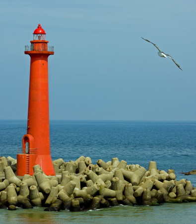
Date unknown. Active; focal plane 17 m (56 ft); red flash every 3 s. 13 m (43 ft) round concrete tower with a flared top. Entire lighthouse is red. Lighthouse Visit has a small 2017 photo and Google has a satellite view and a distant street view. A Notice to Mariners in March 2019 had a height change, so this light may have been replaced at that time. Located at the east end of the detached breakwater off Himekawa, the principal harbor of Itiogawa. Accessible only by boat. Site open, tower closed. JCG-1294; Admiralty M7136.6; NGA 3164.
* [Nō Kō]
1951. Inactive since 2017. 8.5 m (28 ft) concrete post with gallery, attached to a small equipment shelter. Entire lighthouse is white. FOAL has photos (top of the page), a closeup photo is available, Mitsunori Yoshida has an April 2018 street view, and Google has an October 2019 street view and a satellite view. Deactivated harbor lights in Japan are usually removed but a 2021 photo shows the light has remained. Built atop a steep islet, the lighthouse is accessible by an attractive footbridge. Located at Nō, a small port about 20 km (13 mi) east of Itoigawa. Site open, tower closed. ARLHS JPN-423; ex-JCG-1296; ex-Admiralty M7134; NGA 3172.

Jōetsu City Lighthouses
Tsutsuishi Kō (Senzoka Shima)
Date unknown. Active; focal plane 15 m (49 ft); continuous green light with a more intense flash every 5 s. 8.5 m (28 ft) concrete post attached to a square 1-story concrete equipment shelter. Entire lighthouse is white. FOAL has photos and Google has a street view and a satellite view. Located at the end of a breakwater attached to an island (Senzoka Shima) in the harbor entrance of Tsutsuishi. Accessible only by boat. Site open, tower closed. ARLHS JPN-1275; JCG-1298; Admiralty M7133; NGA 3184.
* Torigakubi Misaki
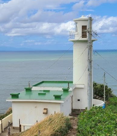
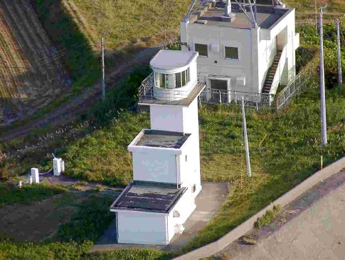
1950. Active; focal plane 82 m (269 ft); white flash every 5 s. 12 m (39 ft) square cylindrical concrete tower with semicircular concrete lantern room and gallery, attached to a 1-1/2 story equipment building. The "stair-step" appearance of this lighthouse is quite unusual. Entire lighthouse is white. A Coast Guard photo is at right, Lighthouses of Japan also has a page for the lighthouse, Lighthouse-Japan.com has a page with several photos, FOAL has additional photos, a closeup is available, and Google has a satellite view and a closeup street view. Located just off highway 87 on a prominent cape about 10 km (6 mi) west of Jōetsu. Accessible by road but parking is limited and the entrance is unmarked. Site open, tower closed. . ARLHS JPN-673; JCG-1301; Admiralty M7132; NGA 3192.
Seki Kawa (Sekikawa)
Date unknown. Active; focal plane 14 m (46 ft); red flash every 3 s. 9.5 m (31 ft) concrete post attached to a square 1-story concrete equipment shelter. Entire lighthouse is red. FOAL has a photo (bottom of the page), Makoto Noda has a very distant street view, and Google has a satellite view. Located on a detached breakwater on the west side of the mouth of the Seki River in Jōetsu. Accessible only by boat. Site and tower closed. JCG-1302; Admiralty M7128; NGA 3196.
Jōetsu (Naoetsu Kō) West Breakwater (3)
2009 (station established 1971). Active; focal plane 18 m (59 ft); red lash every 4 s. 19 m (62 ft) square tapered concrete tower with lantern, gallery, and a tall "dunce-cap" lantern roof. Lighthouse painted red. FOAL has a photo (sixth row, right) and Bing has a satellite view. This lighthouse replaced the 1994 lighthouse, a square tower with lantern and gallery that recalled traditional forms used for several Japanese lighthouses in the early Meiji period (1870s). The Coast Guard has a photo of the 1994 lighthouse and FOAL also has a photo (second row right). Located at the end of the main (west) breakwater of Jōetsu; this curving breakwater stretches about 2750 m (1.7 mi) into the Sea of Japan. Accessible only by boat. Site and tower closed. ARLHS JPN-1264; JCG-1303; Admiralty M7125; NGA 3200.

Torigakubi Misaki Light, Jōetsu
Japanese Coast Guard Ninth Region photo
Jōetsu East Breakwater (2)
Date unknown. Active; focal plane 13 m (43 ft); green flash every 4 s. 9.5 m (31 ft) round concrete tower with a flared top, attached to a small equipment shelter. Entire lighthouse is white. FOAL has a photo (second row of photos, on the left) and Google has a satellite view. Located on the east breakwater of Jōetsu. Site and tower closed (industrial port area). JCG-1303.5; Admiralty M7125.5; NGA 3202.

Kashiwazaki City Lighthouses
Yoneyama Saki (?)
1969. Inactive since 2009. 14.5 m (48 ft) concrete post with double gallery rising from a square 1-story concrete equipment room. Tower painted white with one black horizontal band; equipment room is white. Lighthouse-Japan.com has a page with good photos, FOAL's page has a distant view, and Misty's Tour has another photo, but the tower is hidden in Google's satellite view. We need current information, because it is possible that this light was demolished after being deactivated. Located on a high promontory about 12 km (7.5 mi) southwest of Kashiwazaki. Site open, tower closed. ARLHS JPN-759; ex-JCG-1305; ex-Admiralty M7121; ex-NGA 3208.
Kashiwazaki-Kariwa Nuclear Power Station
Date unknown (early 1980s). Active; focal plane 16 m (52 ft); two red flashes every 7 s. 12 m (39 ft) round concrete tower, painted red. FOAL has a photo and Google has a satellite view. The 7-unit power plant was commissioned in 1985. It was shut down for safety improvements after the great Tōhoku earthquake and tsunami of 11 March 2011. As of May 2022 none of the units had been restarted, but there were plans to restore several in 2023-24. Located at the end of the plant's main breakwater in Kariwa. Site and tower closed. JCG-1306.5; Admiralty M7119.5; NGA 3326.
Shiiya (Siiya) Saki (Kannon Saki) (2)
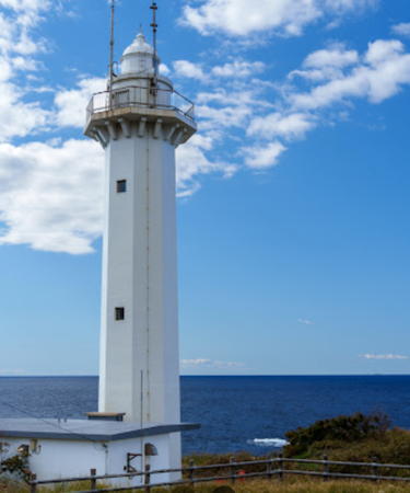
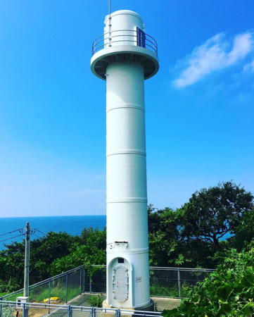
2010 (station established 1955). Active; focal plane about 60 m (197 ft); white flash every 15 s. Approx. 14 m (46 ft) round cylindrical fiberglass and steel tower with lantern room gallery. Entire lighthouse is white. A 2019 photos at right, the Coast Guard has a photo, a 2021 photo is available, FOAL has a page with good photos, the contractor has a photo (bottom of the page), and Google has a satellite view and a distant street view. The photos on Lighthouses of Japan's page and the Misty's Tour photo show the original lighthouse, which was demolished. This lighthouse guides ships approaching the port of Niigata as they enter the Sado Strait between the mainland and Sado Shima. Located on a sharp promontory about 10 km (6 mi) north northwest of Kashiwazaki. Site and tower closed. . ARLHS JPN-556; JCG-1307; Admiralty M7119; NGA 3328.

Izumozaki Town Lighthouses
* Izumozaki Kō Breakwater
1961. Active; focal plane 13 m (43 ft); two red flashes every 5 s. 11 m (36 ft) concrete post centered on a square 1-story concrete equipment shelter. Entire lighthouse is red. FOAL has a photo (lower right on the page), a 2022 photo is available, and Google has a street view and a satellite view. Located at the end of the west breakwater at Izumozaki, about 35 km (22 mi) northeast of Kashiwazaki. Accessible by walking the pier. Site open, tower closed. ARLHS JPN-1263; JCG-1308; Admiralty M7118.4; NGA 3332.
#Izumozaki Kō
Date unknown. Demolished in 2010. This was an 11 m (36 ft) round cylindrical concrete tower, painted black with one yellow horizontal band. FOAL has a 2009 photo (lower left on the page). The light became redundant when an outer breakwater incorporated the shoal it marked. Google's satellite view confirms the removal. Formerly located a short distance off Izumozaki harbor. Site open. ex-JCG-1309; ex-Admiralty M7118.6; ex-NGA 3336.

Shiiya Saki Light, Kashiwazaki, August 2019
Instagram photo by 椎谷鼻灯台 (Shiiyahana Lighthouse)

Nagaoka City Lighthouse
* Teradomari Kō
Date unknown. Active; focal plane 14 m (46 ft); two red flashes every 5 s. 9.5 m (31 ft) concrete post attached to a square 1-story concrete equipment shelter. Entire lighthouse is red. FOAL has a photo and Google has a satellite view. Located at the end of the detached west breakwater at Teradomari, about 50 km (30 mi) southwest of Niigata. Accessible only by boat, but there are good views from ferries between Teradomari and Akadomari on Sado Shima. Site status unknown. ARLHS JPN-1274; JCG-1310; Admiralty M7118; NGA 3340.

Niigata City Lighthouses
* Maze Kō
1969. Active; focal plane 14 m (46 ft); two red flashes every 6 s. 8.5 m (28 ft) concrete post attached to a square 1-story concrete equipment shelter. Entire lighthouse is red. FOAL has a photo and Google has a street view and a satellite view. Located on the west breakwater at Maze, at the western end of Niigata City. Accessible by walking the pier. Site open, tower closed. JCG-1311; Admiralty M7117.4; NGA 3344.
* Kakuta (Kakuda) Misaki
1959. Active; focal plane 50 m (164 ft); two white flashes every 20 s. 12.5 m (41 ft) round cylindrical concrete tower with lantern and gallery, connected to a 1-story concrete keeper's house. Entire lighthouse is white. Suzukaze Aoba's photo is at right, Yutaka Okamoto has a photo, Lighthouses of Japan also has a page for the lighthouse, Lighthouse-Japan.com has a page with several photos, FOAL's page has several good photos, a distant view is available, and Google has a street view and a satellite view. This lighthouse marks a northwestward bulge of the coastline south of Niigata. Located on a spectacular promontory about 20 km (13 mi) southwest of Niigata. The lighthouse is accessible by a very steep stairway; parking is available, but it is a strenuous climb. Site open, tower closed. . ARLHS JPN-213; JCG-1312; Admiralty M7117; NGA 3348.
* Niigata West Breakwater (Niigata Kō) (2)
Date unknown (station established 1925). Active; focal plane 24 m (79 ft); red flash every 6 s. 22 m (72 ft) round concrete tower with lantern and gallery, painted red. Located at the end of the original west breakwater at the mouth of the Shinano River, which forms Niigata West Port. A new detached breakwater has extended the protection for the harbor considerably; the Coast Guard photo was taken before this new breakwater was built. Fiddian Warman's photo is at the top of this page, Lighthouse-Japan.com has a page with good photos, FOAL's page for the Niigata lighthouses has several photos, a 2022 photo is available, and Google has a satellite view of the lighthouse. Forand has a historic postcard view of the original lighthouse. Apparently accessible by walking the breakwater, which is used by fishermen; there's also a good view from ferries between Niigata and Sado Shima. Site open, tower closed. ARLHS JPN-413; JCG-1344; Admiralty M7111.2; NGA 3356.
Niigata No. 2 West Breakwater
Date unknown. Active; focal plane 15 m (49 ft); white flash every 3 s. 12 m (39 ft) round cylindrical concrete tower. Entire lighthouse is red. FOAL's page for the Niigata lighthouses has several photos and Google has a satellite view. This light was relocated recently to the end of a new extension of the breakwater. Located at the end of the west breakwater extension, about 2 km (1.25 mi) north of the older West Breakwater Light. Accessible only by boat; there's also a good view from ferries between Niigata and Sado Shima. Site open, tower closed. JCG-1342.5; Admiralty M7110.5; NGA 3352.

Kakuta Misaki Light, Niigata, September 2023
Google Maps photo by Suzukaze Aoba
Niigata East Breakwater
Date unknown. Active; focal plane 12 m (39 ft); two green flashes every 7 s. 10 m (33 ft) round concrete tower, painted white. A 2009 photo and a distant view from the west breakwater are available, FOAL's page includes two photos (left side, third and sixth rows), a 2022 photo is available, and Google has a satellite view. Located at the end of the relatively short east breakwater at the mouth of the Shinano River. Accessible by walking the pier, although it's a long walk through an industrial zone to reach the pier. Site open, tower closed. JCG-1345; Admiralty M7112; NGA 3360.
* Agano Kawa (Agano River)
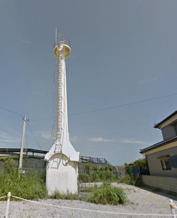
1934. Active; focal plane 16 m (52 ft); white light, 3 s on, 3 s off. 16 m (52 ft) concrete post rising from a square 1-story equipment room. Entire lighthouse is white. FOAL's page for the light has photos and Google has a street view (an older version is seen at right) and a satellite view. This seldom-photographed light has an unusual design. Located beside a waterfront street on the east side of the entrance to the Agano River in Niigata. Site open, tower closed. ARLHS JPN-002; JCG-1350; Admiralty M7109; NGA 3380.
Niigata Higashi West Breakwater
Date unknown. Active; focal plane 12 m (39 ft); red flash every 3 s. 13 m (43 ft) triangular skeletal tower. Entire lighthouse is red. FOAL has distant views (second row right and last two rows on the left) and Google has a satellite view. Located at the end of the long breakwater of Niigata Higashi harbor, an industrial port on the northeast side of the city. Site and tower closed. JCG-1353; Admiralty M7108.4; NGA 3396.
Niigata Higashi East Breakwater
Date unknown. Active; focal plane 12 m (39 ft); green flash every 3 s. 9.5 m (31 ft) concrete post attached to a square 1-story concrete equipment room. Entire lighthouse is white. FOAL has a distant view (fourth row on the left) and Google has a satellite view. Located at the end of the east breakwater of Niigata Higashi harbor. Site and tower closed. JCG-1357.3; Admiralty M7108.2; NGA 3388.

Murakami City Lighthouse
Iwafune Kō Detached Breakwater
Date unknown. Active; focal plane 15 m (49 ft); green flash every 3 s. 10 m (33 ft) round cylindrical concrete tower. Entire lighthouse is white. FOAL's page has photos (center and bottom of the page) and Google has a satellite view. Located at the south end of the detached breakwater of Iwafune harbor in Murakami. Accessible only by boat. Site status unknown. JCG-1357.7; Admiralty M7090.7; NGA 3405.
Iwafune (Iwahune) Kō
1952. Active; focal plane 44 m (144 ft); white light, 3 s on, 3 s off. 12 m (39 ft) square concrete post centered on a square 1-story concrete equipment room. Entire lighthouse is white. Lighthouse-Japan.com has a page with photos, FOAL's page for the lighthouse has several good photos, the tip of the light is visible in a Google street view, and Google has a satellite view. Located on heights north of the harbor of Iwafune. Site status unknown. ARLHS JPN-187; JCG-1359; Admiralty M7090; NGA 3412.

Agano Kawa Light, Niigata, August 2016
Google Maps street view

Sado Shima (Sado City) Lighthouses

Sado Shima (Sado-ga-shima) is an island about 50 km (30 mi) off the mainland coast of Niigata Prefecture. Actually, it is two mountainous islands connected by a low isthmus, so the shape of the island resembles a butterfly. The population is about 48,000. Formerly known for its gold mine (now closed), the island has become a popular resort destination. There is hourly ferry service from Niigata and additional ferry services from Jōetsu and Teradomari. Most visitors arrive by ferry but commuter plane service from Niigata is also available. The island has a fine collection of lighthouses and most of them are readily accessible. The listing of lighthouses is clockwise around the island, starting in the far southwest.

Southwest Coast Lighthouses
** Sawasaki Hana (2)
1987 (station established 1928). Active; focal plane 41 m (135 ft); two white flashes every 30 s. 24 m (79 ft) octagonal cylindrical concrete tower with lantern and gallery, attached to a 1-story concrete keeper's house. Entire lighthouse is white. Kenichi Yuki's photo is at right, Lighthouses of Japan also has a page for the lighthouse, Lighthouse-Japan.com has a page with photos, FOAL has a page with good photos, Misty's Tour has another photo, a 2007 closeup and a 2010 photo are available, and Google has a street view and a satellite view. This lighthouse marks the extreme southwestern tip of Sado Shima, commanding a wide view of the Sea of Japan. The original lighthouse was replaced after being damaged by several earthquakes and storms over its lifetime. Accessible by road; parking is available nearby. Site open; photos of the Fresnel lens suggest that the tower may also be open, at least by arrangement with the attendants. . ARLHS JPN-547; JCG-1313; Admiralty M7103; NGA 3216.
Mano Wan Breakwater
Date unknown. Active; focal plane 10 m (33 ft); two green flashes every 6 s. 9.5 m (31 ft) concrete post attached to a square 1-story concrete equipment shelter. Entire lighthouse is white. FOAL's page for the light has photos and Bing has a satellite view. Mano Bay (Mano Wan) is the embayment on the south side of the "butterfly" of Sado Shima. The light is at the east end of a long detached breakwater that shelters ports on the west side of the bay. Accessible only by boat. Site open, tower closed. ARLHS JPN-1266; JCG-1316; Admiralty M7103.5; NGA 3224.
Futami (Hutami) Kō
1974. Active; focal plane 10 m (33 ft); green flash every 3 s. 8.5 m (28 ft) round concrete tower with a flared top, attached to a square 1-story concrete equipment shelter. Entire lighthouse is white. Google has a satellite view and a distant street view. FOAL's page shows the light under renovation in October 2013. Located at the end of the south (main) breakwater of Futami, about 2.5 km (1.5 mi) northeast of Daiga Hana. Accessible by walking the pier (although it's a long walk). Site open, tower closed. ARLHS JPN-1262; JCG-1317; Admiralty M7103.6; NGA 3228.

Sawasaki Hana Light, Sado Shima, October 2022
Google Maps photo by Kenichi Yuki
Daiga Hana (Taigahana) (2)
1986 (station established 1951). Active; focal plane 46 m (151 ft); white flash every 5 s; also a continuous white spotlight (JCG-1319) illuminates a nearby shoal. 13 m (43 ft) round cylindrical concrete tower with lantern and gallery. Entire lighthouse is white. A 2020 photo is at right, Lighthouses of Japan also has a page for the lighthouse, Lighthouse-Japan.com has a page with several photos, a closeup photo is available, and Google has a satellite view of the station. FOAL's page shows the lighthouse being refurbished and restored in October 2013. According to the Coast Guard the original light was on an unsatisfactory "converted building." Located at the southwestern tip of the northern portion of Sado Shima. Accessible by road. Site and tower closed (the entrance is gated). . ARLHS JPN-050; JCG-1318; Admiralty M7104; NGA 3232.
* Nagate Misaki
1972. Active; focal plane 10 m (33 ft); white flash every 4 s. 9.5 m (31 ft) round hourglass-shaped concrete tower. Entire lighthouse is white. A 2017 photo is available, FOAL's page has a photo, Yukihiro Matsumura has a 2022 closeup, a street view is available, and Google has a satellite view. Located on a rocky point on the northwest side of Inakujira. Site open, tower closed. . ARLHS JPN-1269; JCG-1322; Admiralty M7104.5; NGA 3240.

Northwest Coast Lighthouses
Ichiri (Itiri) Shima
Date unknown. Active; focal plane 20 m (66 ft); two white flashes every 5 s. 20 m (66 ft) concrete post with gallery, mounted on a round concrete pier. Lighthouse painted black with a red horizontal band. FOAL has a closeup photo and Bing has a satellite view. Located on a reef about 2.5 km (1.5 mi) off the waterfront of Aikawa, on the west coast of Sado Shima. Accessible only by boat. Site and tower closed. JCG-1323; Admiralty M7105; NGA 3248.
* Himetsu (Himezu) Kō
1966. Active; focal plane 15 m (49 ft); green light, 3 s on, 3 s off. 9.5 m (31 ft) round hourglass-shaped concrete tower. Entire lighthouse is white. FOAL's page has several photos, Ryohsuke Torii has a distant street view, and Google has a satellite view. At Himetsu a narrow artificial harbor for small craft has been created by a series of breakwaters connecting the high points of a rocky reef. According to the author of Lighthouse-Japan.com, this is a tourist attraction and there is an admission fee for the breakwater. The lighthouse is atop the southernmost rock, near the end of the breakwater. Site open, tower closed. ARLHS JPN-1261; JCG-1324; Admiralty M7106.4; NGA 3252.

Daiga Hana Light, Sado Shima, October 2020
Google Maps photo by sado360v axs
** Sado Ōsaki
1964. Active; focal plane 31 m (102 ft); white flash every 12 s. 10 m (33 ft) round cylindrical concrete tower with lantern and gallery. Entire lighthouse is white. A 2022 photo is at right, Lighthouses of Japan also has a page for the lighthouse, Lighthouse-Japan.com has a page with good photos, FOAL's page also has photos, Misty's Tour has an additional photo, and Google has a closeup street view and a satellite view. This station is in a park and is a well-known and popular attraction; the large building near the lighthouse is a visitor center and aquarium. Located on a rocky promontory about 2.5 km (1.5 mi) north of Himetsu. Accessible by road. Site open, tower closed but there is a wonderful view from the base of the tower. . ARLHS JPN-520; JCG-1325; Admiralty M7106; NGA 3256.
Nyū Saki
1956. Active; focal plane 56 m (184 ft); white light occulting twice every 8 s. 12 m (39 ft) round cylindrical concrete tower with lantern and gallery. Entire lighthouse is white. Lighthouse-Japan.com has a page with several photos, FOAL's page has good photos, and Google has a satellite view and a street view from below the lighthouse. Behind the square window is a spotlight (JCG-1327) that shines on a shoal 1.5 km (0.9 mi) to the northwest. Located on a promontory on the northwest side of Sado Shima. The narrow entrance road to the lighthouse is unmarked; the Lighthouse-Japan webmaster advises hiking up the road, but parking would be a problem. Site open, tower closed. . ARLHS JPN-440; JCG-1326; Admiralty M7107; NGA 3260.
Takachi (Takati) Kō
Date unknown. Active; focal plane 14 m (46 ft); red flash every 3 s. 8.5 m (28 ft) round concrete tower with a flared top, attached to a square 1-story concrete equipment shelter. Entire lighthouse is red. FOAL's page has good photos and Google has a satellite view and a distant street view across the harbor. Located at the northeast end of the detached main breakwater at Takachi, just northeast of Nyū Saki. Accessible only by boat. Site and tower closed. JCG-1328; Admiralty M7107.4; NGA 3264.
* Seki Misaki
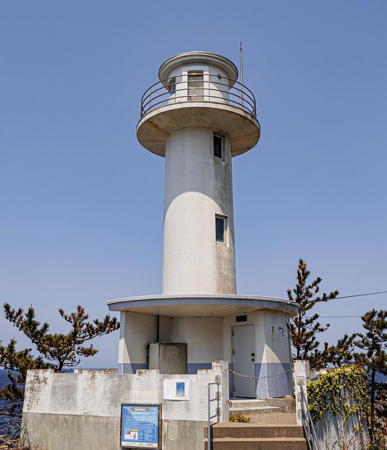
1974. Active; focal plane 145 m (476 ft); white light, 3 s on, 3 s off. 11 m (36 ft) round hourglass-shaped concrete tower with lantern and gallery. Entire lighthouse is white. A 2021 photo is available, Lighthouse-Japan.com has a page with a fine photo, FOAL's page has photos, Misty's Tour has a small photo, and Google has a satellite view. This is the island's highest light. Located on a promontory on the northwest side of Sado Shima. Accessible by road and a short (but steep) hiking trail. Site open, tower closed. . ARLHS JPN-549; JCG-1329; Admiralty M7107.6; NGA 3268.

Sado Ōsaki Light, Sado Shima, May 2022
Instagram photo by ちゑ臧

Northeast Coast Lighthouses
* Hajiki (Haziki) Saki (2)
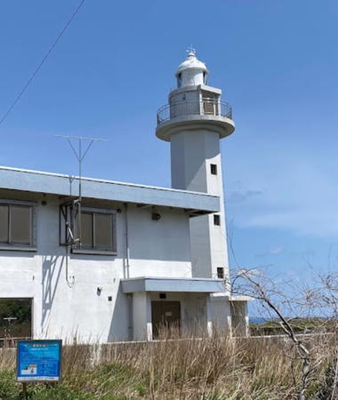
1990 (station established 1919). Active; focal plane 74 m (243 ft); three white flashes every 30 s. 19 m (62 ft) octagonal cylindrical concrete tower with lantern and gallery. Entire lighthouse is white. A 2-story Coast Guard station building adjoins the lighthouse. Makio Matsuda's 2022 photo is at right, Lighthouses of Japan also has a page for the lighthouse, FOAL's page has several good photos, a 2007 closeup is available, Misty's Tour has additional photos, and Google has a street view and a good satellite view. Lighthouse-Japan.com has a page with photos showing the lighthouse under restoration in 2009. Forand has a historic postcard view of the original lighthouse, which was similar in appearance. The station was established after the wreck of the Matsushima Maru in December 1915, in which 30 sailors were lost; the memorial to this loss stands near the lighthouse. The original lighthouse was replaced after being damaged by a 1964 earthquake and many winter storms. This site has a spectacular view of the Sea of Japan. Located on the northern tip of Sado Shima. Accessible by road; parking is available nearby. Site open, tower closed. . ARLHS JPN-1259; JCG-1330; Admiralty M7092; NGA 3272.
Miyano Saki
1980. Active; focal plane 43 m (141 ft); white light, 3 s on, 3 s off. 10.5 m (35 ft) square cylindrical concrete tower. Entire lighthouse is white. Lighthouse-Japan.com has a page with good photos, FOAL's page has photos, and Google has a street view and a satellite view. Located on a promontory on the northeast side of Sado Shima. Accessible by a series of narrow farm roads; local guidance may be needed. Site open, tower closed. . ARLHS JPN-366; JCG-1332; Admiralty M7092.6; NGA 3280.
Ryōtsu Kō (North Breakwater East End)
Date unknown. Active; focal plane 14 m (46 ft); red light, 3 s on, 3 s off. 11 m (36 ft) concrete post centered on a square 1-story concrete equipment room. Entire lighthouse is red. FOAL has a photo (bottom of the page) and Google has a satellite view. Ryōtsu, on the north side of the isthmus joining the two halves of Sado Shima, is the island's principal port. Located at the southeast end of the detached north outer breakwater of Ryōtsu. Accessible only by boat. Site and tower closed, but there's an excellent view from ferries arriving from Niigata. JCG-1335; Admiralty M7095; NGA 3288.

Hajiki Saki Light, Sado Shima, April 2022
Googke Maps photo by Makio Matsuda
Ryōtsu Wan Breakwater
1951. Active; focal plane 19 m (62 ft); red flash every 4 s. 16.5 m (54 ft) round cylindrical concrete tower with a small lantern and gallery, painted red. The lantern and top of the tower are decorated with screens suggesting the headgear worn in the traditional Okesa folk dance of Sado; dolls with similar Okesa hats are a very common souvenir of the island. This detail is seen in FOAL's closeup photos, in the photo on the Lighthouses of Japan page for the lighthouse and in the Misty's Tour photo. Ryohsuke Torii has a good photo, Lighthouse-Japan.com has a page with photos, and Google has a sea view and a satellite view. Located at the east end of the long, detached north breakwater of Ryōtsu. Accessible only by boat. Site and tower closed, but there's an excellent view from ferries arriving from Niigata. ARLHS JPN-1273; JCG-1334; Admiralty M7094; NGA 3292.

Southeast Coast Lighthouses
** Hime Saki
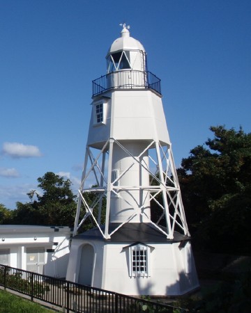
1895. Active; focal plane 42 m (138 ft); white flash every 6 s. 14 m (46 ft) hexagonal pyramidal cast iron skeletal tower with lantern, gallery, enclosed watch room, and an enclosed keeper's house at the base. Entire lighthouse painted white. A 2008 photo is at right, Lighthouses of Japan also has a page for the lighthouse, Lighthouse-Japan.com has a page with excellent photos, FOAL's page has good photos, Misty's Tour has additional photos, a 2022 closeup is available, Juneichi Ishikawa has a street view, and Google has a satellite view. This lighthouse, the only surviving example of its class, is recognized as one of the most historic lighthouses of Japan. It was designed and prefabricated in Japan following a study of European models. The tower was restored in 1994 to prepare it for its 100th anniversary; the restoration was difficult because the original plans were not preserved. The 1-story keeper's house serves now as a visitor center. Located on the northernmost point of Sado Shima's eastern half, where it serves as a landfall light for vessels approaching from the mainland. Accessible by road and a short walk. Site open, tower closed. . ARLHS JPN-116; JCG-1336; Admiralty M7096; NGA 3296.
Zyōga (Jōga) Hana
1966. Active; focal plane 32 m (105 ft); white light occulting twice every 6 s. 10 m (33 ft) square cylindrical concrete tower. Entire lighthouse is white. Lighthouse-Japan.com has a page with good photos, FOAL's page has several photos, and Google has a street view and a satellite view. Accessible by a short walk, but some local guidance will be needed. Located on a promontory on the east side of Sado Shima. Site status unknown. . ARLHS JPN-772; JCG-1338; Admiralty M7097; NGA 3304.
* Kōnose Hana
1952. Active; focal plane 23 m (75 ft); white light, 3 s on, 3 s off. 22 m (72 ft) round concrete tower with lantern and gallery, mounted on a square pyramidal concrete base. Entire lighthouse is white. Lighthouses of Japan also has a page for the lighthouse, Lighthouse-Japan.com has a page with several photos, FOAL's page has photos, a 2022 photo is available, and Google has a street view and a satellite view. The narrowest passage of the Sado Strait is between this lighthouse and the Kakuta Misaki lighthouse on the mainland. Located in a city park at Kōnose on the southeast side of Sado Shima. Site open, tower closed. . ARLHS JPN-274; JCG-1339; Admiralty M7098; NGA 3308.
* Akadomari Kō
1984. Active; focal plane 12 m (39 ft); two green flashes every 7 s. 9.5 m (31 ft) square pyramidal skeletal tower, painted white, adjoining a square 1-story white concrete equipment shelter. FOAL has additional photos, and Google has a satellite view and a distant street view. Akadomari is a terminal for ferries arriving from Teradomari. Located at the end of the south (main) breakwater of Akadomari. Accessible by walking the pier, and there must be good views from the ferries. Site open, tower closed. JCG-1340.1; Admiralty M7100.2; NGA 3312.
Hime Saki Light
Hime Saki Light, Sado Shima, October 2008
Wikimedia public domain photo by soica2001

Awa Shima Lighthouses

Awashimaura Village Lighthouses
Awa Shima is a small island about 16 km (10 mi) off the coast of the northern end of Niigata Prefecture. The island is about 4 km (2.5 mi) in length and has a population of about 350. Passenger ferry service is available from Iwafune. The island is being promoted as a base for recreational deep-sea fishing.

*
Awa Shima Kō East Breakwater
1977. Active; focal plane 13 m (43 ft); green flash every 4 s. 9.5 m (31 ft) concrete post attached to a square 1-story concrete equipment shelter. Entire lighthouse is white. FOAL's page for the light has photos, Kuniyoshi Ikeda has a 2022 closeup street view, and Google has a satellite view and a street view across the harbor. Located at the end of the east (really south) breakwater of Awa Shima harbor. Accessible by walking the pier. Site open, tower closed. JCG-1362; Admiralty M7089.5; NGA 3420.
Awa Shima (Awashima)
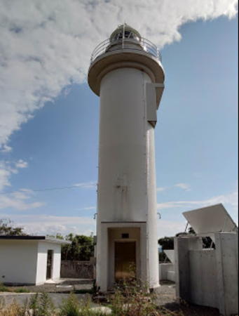
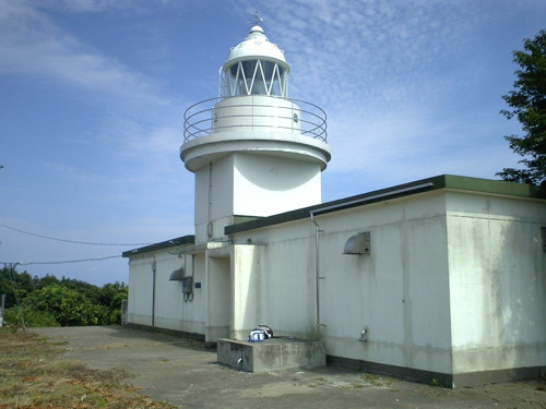
1954. Active; focal plane 274 m (899 ft); white flash every 10 s. 11 m (36 ft) square cylindrical concrete tower rising from a rectangular 1-story concrete equipment building. Entire lighthouse is white. A photo is at right, Lighthouses of Japan also has a page for the lighthouse, Lighthouse-Japan.com has a page with good photos, FOAL's page also has good photos, Hidenori Hashinaka has a 2022 closeup, and Google has a satellite view of the station. This lighthouse's powerful light has a range of 70 km (43.5 mi). Located on Mount Koshibayama, the highest point of the island. Accessible by a twisting mountain road and a hiking trail but there's parking for only two or three cars at the trailhead. Site open, tower closed. ARLHS JPN-032; JCG-1361; Admiralty M7089; NGA 3416.

Information available on lost lighthouses:

  • Niigata (1877-?). This lighthouse was on the west side of the Shinano River; it was replaced eventually by the Niigata West Breakwater Light. Forand has a second postcard view. Findlay's 1879 light list has 1867 as the date of establishment and notes that the light was "seldom exhibited."
Awa Shima Light
Awa Shima Light, Murakami, July 2007
Wikimedia Creative Commons photo by friendD

Notable faux lighthouses:

Adjoining pages: North: Yamagata | South: Toyama

Return to the Lighthouse Directory index | Ratings key

Posted April 2, 2007. Checked and revised January 11, 2024. Lighthouses: 43. Site copyright 2024 Russ Rowlett and the University of North Carolina at Chapel Hill.