Lighthouses of Malaysia: Labuan and Sabah

The nation of Malaysia is in two parts: Peninsular Malaysia (also called West Malaysia or Malaya) on the southern end of the Malay Peninsula and Malaysian Borneo (East Malaysia) on the island of Borneo roughly 700 km (450 mi) to the east. East Malaysia includes two former British colonies, Sarawak and Sabah, plus a smaller territory called Labuan. Another former British protectorate, Brunei, is an independent enclave surrounded by Malaysia. Sarawak was ruled from 1842 to 1946 by Sir James Brooke and his descendents, who were known as the "White Rajahs," while Sabah was controlled by the British North Borneo Company from 1881 to 1946. After a period as crown colonies, both regions became states of Malaysia in 1963.

Malaysia is a federal constitutional monarchy consisting of thirteen states and three federal territories. This page is for the lighthouses of the state of Sabah; there's another page for Sarawak. Also included are lighthouses of Labuan, a federal territory split off from the state of Sabah in 1984. Sabah occupies the northern tip of Borneo, facing northwest on the South China Sea and also northeast on the Sulu Sea. The lighthouses of Sabah are mostly in remote areas, so they attract few visitors and very little is known about them. Information and photos would be very welcome.

The Malay term for a lighthouse is rumah api ("house of fire"); pulau is an island, terumbu is a reef, tanjung is a cape, bukit is a hill, sungai is a river, kuala is the mouth of a river, teluk is a bay, selat is a strait, and pelabuhan is a harbor.

Aids to navigation in Malaysia are the responsibility of the Marine Department (Jabatan Laut). Sarawak and Sabah formerly had their own marine departments but they were merged with the Peninsular Malaya marine department in 2011.

Special thanks to Ezmil Sahrani of GreenFinder Asia for permission to post several of his photos on this page.

ARLHS numbers are from the ARLHS World List of Lights. MY numbers are Malaysian light list numbers, where known. Admiralty numbers are from volume F of the Admiralty List of Lights & Fog Signals. U.S. NGA List numbers are from Publication 112.

General Sources
Lighthouses of Malaysia
Photos posted by Greenfinder.asia, a navigational aids and maritime services company.
Online List of Lights - Malaysia
Photos by various photographers posted by Alexander Trabas. Most of the Sabah photos are by Rainer Arndt.
Lighthouses in Malaysia
Photos by various photographers available from Wikimedia.
Malaysian Lighthouses
Historic postcard views posted by Michel Forand.
GPSNavigationCharts
Navigational chart information for East Malaysia.
Navionics Charts
Navigational chart for East Malaysia.

1916 Batu Tinagat Light, Tawau
photo copyright Ezmil Sahrani; used by permission

Labuan Lighthouses

Labuan is a small archipelago lying north of Brunei and 8 km (5 mi) off the western tip of Sabah. The Sultan of Brunei ceded the islands to Britain in 1846. They were attached to North Borneo (Sabah) in 1890, then to Straits Settlements (Singapore) in 1906. After World War II they were once again attached to North Borneo. In 1984 Sabah ceded the islands to federal control and they were reorganized as a federal territory. They are now a financial center and free trade zone, as well as a popular resort.

Barat Bank (2?)
Date unknown. Active; focal plane 14 m (46 ft); red flash every 3 s. 14 m (46 ft) robust post with two galleries. Greenfinder has a photo but the light is not shown in Bing's satellite view. Located at the southwest end of shoal about 10 km (6 mi) southwest of Pulau Kuraman. Accessible only by boat. Site open, tower closed. Admiralty F1946.9; NGA 24391.
Pulau Kuraman
1897. Active; focal plane 66 m (217 ft); white flash every 5 s. 15 m (49 ft) square pyramidal steel skeletal tower with lantern, gallery, and enclosed watch room. Lighthouse painted white; lantern dome is red. Greenfinder has a large photo, a 2016 photo (second photo on the page) is available, and Google has a satellite view. This lighthouse marks the north side of the entrance to Brunei Bay, serving as a landfall light; it also guides ships approaching the port of Labuan. Located atop a small island about 15 km (9 mi) southwest of Labuan, just off the southwestern tip of Pulau Labuan. Accessible only by boat. Site status unknown. ARLHS EMA-003; Admiralty F1947; NGA 24392.
Tanjung Kubong (Bethune Head)
1973. Removed in 2020. 24 m (79 ft) square pyramidal skeletal tower with gallery, painted white with a red horizontal band. Greenfinder has a closeup photo and Jason Thien has a 2012 view from the sea but the tower is not seen in Google's a satellite view. Located at the northern tip of Pulau Labuan. Site status unknown. ARLHS EMA-015; ex-Admiralty F1948; NGA 24440.
Tanjung Kubong (Bethune Head) North
Date unknown. Active; focal plane about 30 m (98 ft); white light, pattern unknown. Approx. 30 m (98 ft) round cylindrical tower mounted on a round platform supported by numerous piles. Greenfinder has a photo, a 2023 photo is available, and Bing has a satellite view. Located about 2 km (1.25 mi) north of Tanjung Kubong. Accessible only by boat. Site open, tower closed. Admiralty F1947.5.
* Pulau Papan (2)
Date unknown (station established 1897). Inactive since 2007. Approx. 18 m (59 ft) hexagonal steel skeletal tower with gallery and a round enclosed watch room. Lantern removed. Mohamado Sare's photo is at right, Konstantin Aushev has a photo, Ezmil Sahrani has a photo, he also has a closeup, Kian Kiang has a photo, and Google has a satellite view of the station. The original lighthouse was replaced by the taller tower in 2007 but the Marine Department has stated that the older tower will be retained as a historic building. The original lighthouse was described in 1904 as a white wood pyramid. Pulau Papan is a small island off the entrance to Labuan harbor. Located near the west end of the island. Accessible only by boat. Site open, tower closed. ARLHS EMA-027.
* Pulau Papan (3)
2007 (station established 1897). Active; focal plane 37 m (79 ft); white flash every 4 s. Approx. 41 m (135 ft) round steel tower, painted with red and white horizontal bands. Mohamado Sare's photo is at right and Trabas has a very distant view by Bjørn Poulsen. Located next to the historic lighthouse. Accessible only by boat. Site open, tower closed. Admiralty F1949; NGA 24396.
 

Old and new Pulau Papan Lights, Labuan, September 2017
Google Maps photo by Mohamado Sare

Sabah Lighthouses

West Coast Division (South China Sea) Lighthouses
Sungai Klias (Kelias) (2?)
Date unknown. Active; focal plane 13 m (43 ft); quick-flashing green light. 13m (43 ft) 2-stage tower: a post with gallery atop a round concrete tower with gallery. Greenfinder has a photo and Googke has an indistinct satellite view. NGA lists a "green pile." Located on a rocky reef off the entrance to the Kelias River estuary on the mainland east of Pulau Labuan. Accessible only by boat. Site open, tower closed. Admiralty F1953; NGA 24441.
Pulau Tiga (2)
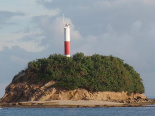
2002 (station established 1974). Active; focal plane 74 m (243 ft); white flash every 10 s. 25 m (82 ft) round steel tower, painted white with one broad red horizontal band. Sahrani's photo is at right and Google has a satellite view. NGA formerly described the original framework tower. In 2000 the first series of the U.S. reality television program Survivor was filmed on Pulau Tiga. The island is a national park and resort accommodations are available; we do not know if it is possible to visit the lighthouse. Located at the highest point of Pulau Tiga, an island at the entrance to Kimanis Bay about 60 km (37.5 mi) southwest of Kota Kinabalu, the capital of Sabah. Accessible only by boat. Site status unknown. ARLHS EMA-020; Admiralty F1955; NGA 24446.
[Pulau Layangan (Sungai Papar)]
2007. Active; focal plane unknown; white flash every 10 s. Approx. 8 m (26 ft) steel post painted with red and white horizontal bands. No photo available but Google has a distant satellite view. Located on a small island about 3 km (2 mi) off Tanjung Papar and the entrance to the Papar River. Accessible only by boat. Site status unknown. Admiralty F1955.8; NGA 24457.
Pulau Mengalum (Mangalum)
Date unknown. Active; focal plane 9 m (30 ft); yellow flash every 5 s. 9 m (30 ft) white concrete tower mounted on a square platform. A very distant street view from the beach is available and Bing has a satellite view. Mengalum is a small island, known for its beach resorts, about 100 km (60 mi) northwest of Kota Kinabalu. Located on the reef off the western tip of the island. Accessible only by boat. Site open, tower closed. Admiralty F1955.81; NGA 24461.
Pulau Mengalum (Mangalum) North
Date unknown. Active; focal plane 9 m (30 ft); two yellow flashes every 5 s. 9 m (30 ft) white concrete tower mounted on a square platform. No photo available but Bing has a satellite view. Located on the reef off the northern tip of the island. Accessible only by boat. Site open, tower closed. Admiralty F1955.82; NGA 24461.5.
Pulau Tiga Light
Pulau Tiga Light, Kuala Penyu
photo copyright Ezmil Sahrani; used by permission
Pulau Gaya (Tanjung Bulijong) (1)
1978. Date unknown. Inactive. Approx. 24 m (79 ft) square skeletal tower. When the present light was built the original light was left standing, although it may be removed later. No photo available but the tower is seen at the right edge of Ezmil Sahrani's photo of the newer tower below right.
Pulau Gaya (Tanjung Bulijong) (2)
2002 (station established 1978). Active; focal plane 168 m (551 ft); white flash every 5 s. 24 m (79 ft) round steel tower, painted white with one broad red horizontal band. Ezmil Sahrani has a closeup photo, Trabas has Arndt's photo and Google has a satellite view of the station. Pulau Gaya is a mountainous island protecting the harbor of Kota Kinabalu, Sabah's capital. The island is accessible by ferry, but the lighthouse is remote. Located at the northwestern tip of the island. Site status unknown. Site manager: Tunku Abdul Rahman National Park. ARLHS EMA-018; Admiralty F1956; NGA 24464.
Pulau Sapangar
Date unknown. Active; focal plane about 12 m (39 ft); red flash every 3 s. Approx. 12 m (39 ft) red mast atop a round gray tower with gallery. Trabas has Arndt's photo and Bing has a distant satellite view. Located just off the southwest tip of Pulau Sapangar marking the north side of the entrance to Teluk Gaya and Kota Kinabalu. Accessible only by boat. Site open, tower closed. Admiralty F1956.3.
Tanjung Dalit
Date unknown. Active; focal plane 8 m (26 ft); white flash every 5 s. 8 m (26 ft) octagonal tower colored with red and white horizonal bans and mounted on a triangular platform supported by piles. Trabas has Arndt's photo and Google has a satellite view. Located just off a forested headland about 25 km (15 mi) north of Kita Kinabalu. Accessible only by boat. Site open, tower closed. Admiralty F1959.82; NGA 24513.
Pulau Usukan (Tanjung Kunit) (2)
1964. Inactive officially since 2014 but possibly reactivated. Approx. 16 m (52 ft) round tower colored red with a white horizontal band. Mateo Iriarte has the 2023 photo seen at right, Bengbeng Gao has a very distant 2017 aerial view, and Google has a satellite view. The light was deactivated in favor of the offshore Slime Rock beacon (Admiralty F1961.3, NGA 24515) but it has solar panels in Iriarte's photo and may still be active. Located at the western tip of Pulau Usukan, an island about 50 km (30 mi) north of Kota Kinabalu. Accessible only by boat. Site status unknown. ex-Admiralty F1961; ex-NGA 24516.

Pulau Usukan Light, Kota Belud, April 2023
Google Maps photo by Mateo Iriarte

Kudat Division Lighthouses
The Kudat Division occupies the northern tip of Borneo and a collection of islands offshore separating the South China Sea from the Sulu Sea. The Balabac Strait, roughly 50 km (30 mi) wide, joins the two seas and separates Sabah from Palawan Province in the Philippines.
Pulau Mantanani
1941. Active; focal plane 50 m (164 ft); long (2 s) white flash every 10 s. 8 m (26 ft) round concrete tower topped by a short skeletal tower. No photo available; trees hide the light in Google's satellite view but it is seen faintly in Bing's satellite view. The original lighthouse was a 5 m (16 ft) round circular concrete structure with a focal plane height of 47 m (154 ft). The height of the lighthouse was raised by the addition of a 3 m (10 ft) skeletal structure. This may have occurred in 1974, the last alteration date listed. The Mantanani Islands are a small group in the South China Sea about 30 km (20 mi) west of Sabah's northern peninsula. Located on Pulau Mantanani Kecil (Little Mantanani), the westernmost island of the group. Accessible only by boat. Site status unknown. ARLHS EMA-016; Admiralty F1962; NGA 24524.
Pulau Kalampunian (2)
2002 (station established 1925). Active; focal plane 28 m (92 ft); long (2.5 s) white flash every 20 s. 15 m (49 ft) round concrete tower, rising from a square 1-story base. Lighthouse painted white with one red horizontal band. Sahrani has a photo (also seen at right), another photo is available, Daniel Sim has a 2023 view from the sea, and Google has a satellite view. The light guides ships into Marudu Bay, a broad inlet that splits northernmost Borneo into two peninsulas. Located on a small island just off Tanjung Simpang, the northernmost tip of Sabah (and of Borneo). Accessible only by boat. Site status unknown. ARLHS EMA-019; Admiralty F1964; NGA 24532.
Pulau Kukuban
1959. Active; focal plane 22 m (72 ft); white flash every 10 s. Approx. 20 m (66 ft) round cylindrical tower, painted with red and white horizontal bands. Greenfinder has a photo, two views from the sea (3/4 the way down the page) are available, and Bing has a satellite view. This light guides vessels in the Malawali Strait, a narrow passage between the mainland and Pulau Banggi. Located on the south side of a small island off the east side of the northernmost tip of Sabah. Accessible only by boat. Site open, tower closed. Admiralty F1978; NGA 24568.

Pulau Kalampunian Light, Kudat Division
photo copyright Ezmil Sahrani; used by permission

Sandakan Division (Sulu Sea): Beluran District Lighthouses
Dampier Reef
Date unknown. Active; focal plane 11 m (36 ft); two white flashes every 8 s. 10 m (33 ft) "beacon" according to NGA; probably a square skeletal tower on a square concrete base, painted black with one red horizontal band. No photo available but Bing has a fuzzy satellite view. The light marks an important hazard in the inside passage thorugh the shoals along the coast. Accessible only by boat. Site open, tower closed. Admiralty F1978.8; NGA 24570.
Pole Reef
Date unknown. Active; focal plane 10 m (33 ft); red flash every 10 s. 10 m (33 ft) round red tower on a square platform. No photo available but Bing has a satellite view. This light guides ships around extensive reefs. Located on a reef in the Sulu Sea about 25 km (15 mi) northeast of Pulau Jambongan. Accessible only by boat. Site open, tower closed. Admiralty F1979.7; NGA 24587.
Pulau Lankayan
Date unknown. Active; focal plane approx. 13 m (43 ft); green flash every 5 s. Approx. 13 m (43 ft) octagonal green concrete post with gallery, mounted on a square platform supported by concrete piles. Sahrani has a good photo and Bing has an indistinct satellite view. Located on a shoal near an islet about 50 km (30 mi) northeast of Beluran. Accessible only by boat. Site open, tower closed. Admiralty F1981; NGA 24593.

Sandakan Division (Sulu Sea): Sandakan District Lighthouses
Pulau Silingaan (Selingan, Siligaan) (1)
1963. Inactive since 2000. Approx. 23 m (85 ft) square skeletal tower painted with red and white horizontal bands. Greenfinder has a photo. ARLHS EMA-006.
Pulau Silingaan (Selingan, Siligaan) (2)
2000 (station established 1963). Active; focal plane 27 m (89 ft); white flash every 10 s. Approx. 23 m (85 ft) round cylindrical tower with gallery, painted with red and white horizontal bands. 1-story equipment shelter in the base of the lighthouse. Sahrani has the photo seen at right and Google has a satellite view. Located on a tiny islet off the entrance to Sandakan, about 19 km (12 mi) northeast of Pulau Berhala. Accessible only by boat. Site status unknown. Site manager: Turtle Islands National Park. ARLHS EMA-006; Admiralty F1982; NGA 24596.

Pulau Silingaan Light, Sandakan Disrict
photo copyright Ezmil Sahrani; used by permission

* Pulau Berhala (2?)
Date unknown (station established 1951). Active; focal plane 194 m (636 ft); white flash every 6.5 s. 20 m (66 ft) square pyramidal skeletal tower with lantern and gallery. Lighthouse painted white, lantern red. No photo available but Google has a satellite view. It's not clear why this lighthouse was dropped from the NGA List. Located atop a spectacular cliff on Pulau Berhala, an island on the north side of the entrance to Sandakan. Boat transportation to the island is available in Sandakan, and there is a hiking trail to the lighthouse, a popular vantage point. Note: There are several lighthouses in Malaysia and Indonesia called Pulau Berhala (Idol Island). Site open, tower status unknown. ARLHS EMA-001; Admiralty F1984; ex-NGA 24604.

Sandakan Division (Sulu Sea): Kinabatangan District Lighthouses
Selat Kinabatangan (Driftwood Point)
1964. Active; focal plane 24 m (79 ft); white flash every 10 s. Approx. 22 m (72 ft) square pyramidal skeletal tower with lantern and gallery, painted with red and white horizontal bands. No photo available but Bing has a good satellite view. Located on the west side of the entrance to the estuary of the Kinabatangan River. Probably accessible only by boat. Site status unknown. ARLHS EMA-021; Admiralty F1987; NGA 24612.
Benrinnes Reef
Date unknown. Active; focal plane 17 m (56 ft); yellow flash every 5 s. 17 m (56 ft) "metal tower," according to NGA. No photo available and the lighthouse is not shown in Google's satellite view. Located on an isolated reef in the Sulu Sea about 40 km (25 mi) northeast of the Kinabatangan River entrance. Accessible only by boat. Site open, tower closed. Admiralty F1987.3; NGA 24614.
Pulau Tambisan West
Date unknown. Active; focal plane 9 m (30 ft); yellow flash every 5 s. 9 m (30 ft) round white concrete tower on a square platform. No photo available but Bing has a satellite view. Located at the edge of a reef on the northwest side of Pulau Tambisan, an island just off the northern point of Tanjung Trang. Accessible only by boat. Site open, tower closed. Admiralty F1987.8; NGA 24617.
Tanjung Terang (Tanjung Trang) (2)
2002 (station established 1923). Active; focal plane 26 m (85 ft); white flash every 6 s. 24 m (79 ft) round steel tower, painted with red and white horizontal bands. Sahrani's photo is at right and Google has a satellite view of the station. This light and the Tanjung Labian light (next entry) mark the end of Sabah's eastern peninsula and guide ships entering the Sibutu Passage between Sabah and the Sulu Islands of the Philippines. Located on Tanjung Trang, the extreme northeastern corner of Borneo. Accessible only by boat. Site open, tower closed. ARLHS EMA-014; Admiralty F1988; NGA 24620.
Tanjung Trang Light
Tanjung Terang Light, Kinabatangan Disrict
photo copyright Ezmil Sahrani; used by permission


Tawau Division: Lahad Datu District Lighthouses
The Tawau Division faces generally southeast on the Celebes Sea; the Lahad Datu District occupies the southern half of Sabah's eastern peninsula
Tanjung Labian (2)
2002 (station established 1923). Active; focal plane 26 m (85 ft); white light, 2 s on, 8 s off. Approx. 22 m (72 ft) round steel tower, painted with red and white horizontal bands. Sahrani has a photo and Google has a satellite view. Located on the southeast side of Sabah's eastern peninsula, about 32 km (20 mi) south of Tanjung Trang. and about 40 km (25 mi) northwest of Sibutu Island in the Philippines. May be accessible only by boat. Site open, tower closed. ARLHS EMA-011; Admiralty F1988.3; NGA 24624.
Tanjung Tungku (2)
Date unknown (station established 1961). Inactive since 2013. 23 m (75 ft) round steel tower painted with red and white horizontal bands. Sahrani has a photo of the original lighthouse, a triangular steel skeletal tower, and Google has a satellite view of the station. Located on a promontory about 80 km (50 mi) east of Lahad Datu. Site open, tower closed. ARLHS EMA-010; ex-Admiralty F1988.6; ex-NGA 24628.
Tanjung Membatu (Bagahak) (2)
Date unknown (station established 1957). Active; focal plane 70 m (230 ft); white flash every 5 s. 11 m (36 ft) round cylindrical fiberglass tower colored with red and white horizontal bands. Sahrani has the photo at right and Bing has a distant satellite view. Greenfinder also has a photo of the earlier tower, an 11 m (36 ft) square pyramidal steel skeletal tower; this tower is not seen in the satellite view and presumably it has been demolished. Located on a bluff about 50 km (30 mi) east of Lahad Datu. Site status unknown. ARLHS EMA-009; Admiralty F1989; NGA 24632.
* Lahad Datu (2)
Date unknown. Active; focal plane about 23 m (75 ft); continuous red light. Approx. 12 m (39 ft) mast atop a small building on piles, all atop a waterfront hotel. M. Khairul Anuar Ahmad Rafiei has a distant photo, Noh Main has a distant view, and Google has an indistinct satellite view. NGA describes a 6 m (20 ft) wood skeletal tower. Located on the waterfront of the district capital of Lahad Datu. Site open, tower closed. Admiralty F1990.5; NGA 24656.
Pulau Kalung Kalungan (Kalunaun)
1959. Active; focal plane 38 m (125 ft); white flash every 10 s. Approx. 12 m (39 ft) square skeletal tower, lower portion enclosed. Tower painted white, enclosed structure red. Greenfinder has a view from the sea and Google has a fuzzy satellite view. Located on an islet in Teluk Darvel (Darvel Bay) about 15 km (9 mi) south of Silam. Accessible only by boat. Site status unknown. ARLHS EMA-002; Admiralty F1991; NGA 24664.

Tanjung Membatu Light, Lahad Datu District
photo copyright Ezmil Sahrani; used by permission

Tawau Division: Semporna District Lighthouses
The Semporna District occupies a triangular peninsula between Teluk Darvel (Darvel Bay) on the north and the open Celebes Sea on the south.

Pulau Mataking (2)
Date unknown (station established 1961). Active; focal plane 27 m (89 ft); white flash every 20 s. 24 m (79 ft) round steel skeletal tower, painted with red and white horizontal bands. A 2023 photo is at right and Google has an indistinct satellite view. Sahrani has a photo of the original lighthouse, a square skeletal tower. The light guides vessels in the Alice Passage around the end of the Semporna peninsula. Pulau Mataking is a popular destination for scuba divers. Located on a small island in the Celebes Sea about 35 km (22 mi) east of Semporna. Accessible only by boat. Site open, tower closed. ARLHS EMA-004; Admiralty F1991.6; NGA 24684.
Pulau Siamil (Si Amil) (2)
Date unknown (station established 1952). Active; focal plane 107 m (351 ft) two white flashes every 15 s. 11 m (36 ft) round steel skeletal tower, painted with red and white horizontal bands. Greenfinder.asia has a photo (probably by Sahrani) and Google has a satellite view. The lighthouse replaced a skeletal tower. Located on a small island in the Celebes Sea at the south end of the Alice Passage about 35 km (22 mi) southeast of Semporna. Accessible only by boat. Site open, tower closed. ARLHS EMA-005; Admiralty F1992; NGA 24688.
[Pulau Ligatan]
1963. Active; focal plane 10 m (33 ft) white flash every 5 s. 8 m (26 ft) square steel skeletal tower, painted with red and white horizontal bands. Greenfinder.asia has a photo and Bing has a satellite view. This light marks the end of a coral reef system stretching southward from Pulau Siamil. Located on an islet in the Celebes Sea about 20 km (13 mi) due south of Pulau Siamil. Accessible only by boat. Site open, tower closed. Admiralty F1992.14; NGA 24700.
Pulau Sipadan
1962. Active; focal plane 24 m (79 ft); three white flashes every 20 s. 22 m (72 ft) square steel skeletal tower, painted white. In the Marine Department photo, the tower has red and white horizontal bands. A distant view from the sea is available and Google has an indistinct satellite view. Pulau Sipadan was the subject of a territorial dispute between Malaysia and Indonesia but in 2002 the International Court of Justice confirmed Malaysia's ownership. Located on a small island in the Celebes Sea about 80 km (50 mi) east southeast of Tawau, near the limit of Malaysian sovereignty. Accessible only by boat. Site status unknown. ARLHS EMA-007; Admiralty F1992.2; NGA 24704.


Pulau Mataking Light, Celebes Sea, July 2023
Google Maps photo by S G

Tawau Division: Tawau District Lighthouses
Batuan Tangan (Hand Rock)
Date unknown. Active; focal plane 7 m (23 ft); red flash every 2 s. 7 m (23 ft) octagonal red concrete post with gallery, mounted on a square platform supported by concrete piles. Sahrani has a good photo but the reef is not seen in Google's satellite view. Located on a shoal in the Celebes Sea about 20 km (13 mi) east southeast of Tawau. Accessible only by boat. Site open, tower closed. Admiralty F1993.5; NGA 24716.
* Batu Tinagat (Kuhara) (1)
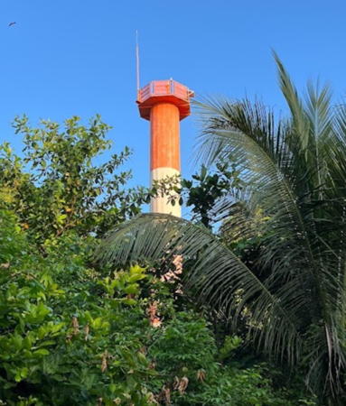
1916. Recently inactive. 9 m (30 ft) round cylindrical cast iron tower with lantern and gallery, painted white; lantern painted red. Sahrani's recent photo at the top of this page shows this historic lighthouse still standing and nicely repainted, and Google has a satellite view. Michel Forand has a historic postcard view. Located on a headland about 10 km (6 mi) east of Tawau. This site should be accessible, as the coastal road passes close to the lighthouse. Site open, tower closed. ARLHS EMA-008.
* Batu Tinagat (Kuhara) (2)
2007 (station established 1916). Active; focal plane approx. 120 m (394 ft); flash every 7.5 s, white or red depending on direction. Approx. 22 m (72 ft) round steel tower, painted with red and white horizontal bands. Sahrani's photo is at right and Google has a satellite view. This lighthouse guides ships into Tawau, the third largest town of Sabah and an important port. Located just above the historic lighthouse. Site open, tower closed. Admiralty F1994; NGA 24728.
Tanjung Adolphy (Adolphy Point)
Date unknown. Active; focal plane 16 m (52 ft); three yellow flashes every 5 s. 16 m (52 ft) white skeletal tower carrying a triangular daymark. No photo available but Google has a fuzzy distant satellite view. The light also functions as the rear beacon of a day range, the front beacon being unlit. The range guides vessels to the north entrance of the Coal Mine Reach, a narrow strait separating Pulau Sebatik from the mainland. Located just off a forested point on the north side of the waterway opposite the village of Wallace Bay. Accessible only by boat. Site open, tower closed. Admiralty F1997; NGA 24736.
Coal Mine Reach (2)
1957. Active; focal plane 20 m (66 ft); white flash every 5 s. Approx. 18 m (59 ft) round steel tower, painted red with one white horizontal band. Greenfinder has a photo and Google has a satellite view. The lighthouse replaced a skeletal tower. This light guides vessels in a narrow strait between Pulau Sebatik and the mainland, southwest of Tawau and close to the Indonesian border. The border between Malaysia and Indonesia bisects Pulau Sebatik. Located near the northwestern tip of Pulau Sebatik. Accessible only by boat. Site status unknown. Admiralty F1999; NGA 24740.

Information available on lost lighthouses:


2007 Batu Tinagat Light, Tawau
photo copyright Ezmil Sahrani; used by permission

Notable faux lighthouses:

Adjoining pages: North: Spratly Islands | Northeast: Southwestern Philippines | East: Zamboanga and Sulu | Southeast: Northeastern Kalimantan | Southwest: Brunei

Return to the Lighthouse Directory index | Ratings key

Posted March 21, 2006. Checked and revised April 24, 2024. Lighthouses: 40. Site copyright 2024 Russ Rowlett and the University of North Carolina at Chapel Hill.