Lighthouses of Norway: Southern Helgeland

The Kingdom of Norway (Norge in Norwegian) is one of the world's most maritime nations. The country is long and narrow, with drowned valleys called fjords that bring the sea far inland in most regions. The mainland coast is estimated to be 2650 km (1650 mi) long and when all the islands and minor indentations are counted the total coastline approaches an astonishing 60,000 km (37,500 mi), long enough the go around the world one and a half times. With such a lengthy and rocky shore it's not surprising that Norway has a large number of lighthouses.

Norway is divided into counties (fylker) and the counties are divided into townships (kommuner). Helgeland is the southernmost district of Norway's Nordland County; roughly speaking, it includes that portion of the country's northwest coast between Trøndelag County (the Trondheim area) and the Arctic Circle. There are no major ports in the district, but there are many small fishing villages. The coastline is quite rugged and deeply indented by many fjords. This page includes lighthouses of six townships in the southern half of Helgeland, from Bindal township northward through Alstahaug and Vefsn.

In Norwegian a lighthouse is a fyrtårn (fire tower) or simply a fyr; a fyrlykt is a beacon and a lyktehus is a lantern. Øy is an island, holmen is an islet, skjær is a skerry (a tiny island or rocky reef), sund is a strait (often between an island and the mainland), bukt is a bay, nes is a headland, and havn is a harbor.

Aids to navigation in Norway are maintained by the Kystverket (Coast Directorate), an agency of the Ministry of Transport and Communications.

ARLHS numbers are from the ARLHS World List of Lights. NF numbers are from the Norsk Fyrliste. Admiralty numbers are from volume L of the Admiralty List of Lights & Fog Signals. U.S. NGA List numbers are from Publication 115.

General Sources
Norsk Fyrhistorisk Forening
News and photos from the Norwegian Lighthouse Association.
Online List of Lights - Norway
Photos by various photographers posted by Alexander Trabas. Many of the photos for this area are by Ronald Wöhrn, Michael Boucher or Arno Siering.
Lighthouse Pages from Anke and Jens - Norway
Excellent photos of more than 60 Norwegian lighthouses.
Norway's Fjorden and Lighthouses
Photos taken by Charles W. Bash on a 2010 cruise from Bergen to North Cape.
Leuchttürme an der norwegischen Küste
Photos posted by Bernd Claußen.
Lighthouses in Nordland
Photos by various photographers available from Wikimedia.
Norwegische Leuchttürme auf historischen Postkarten
Historic postcard images posted by Klaus Huelse.
Liste over Norske Fyr
From Wikipedia, a handy list of Norwegian light stations with their dates of establishment.
Norsk Fyrliste
The official Norwegian light list can be downloaded in .pdf format.
GPSNautical Charts
Navigational chart for Helgeland.
Navionics Charts
Navigation chart for Helgeland.

Bremstein Light
Bremstein Light, Vega
University Library of Tromsø photo (no longer online)


Bindal Lighthouses
Sandvikholmen
Date unknown. Active; focal plane 6.5 m (21 ft); white, red or green light, depending on direction, 3 s on, 3 s off. 6 m (20 ft) square tower with lantern and gallery. Lighthouse painted white, lantern roof red. Google has a distant street view and Bing has a satellite view. Located on the northern tip of an island in a narrow passage of the Sørfjord. Accessible only by boat. Site open, tower closed. NF-572500; Admiralty L2006; NGA 9276.
Bindalsflesa
Date unknown. Active; focal plane 8.5 m (28 ft); two flashes every 10 s, white, red or green depending on direction. 6.5 m (21 ft) concrete post with lantern and gallery. Lighthouse painted white, lantern roof red. No photo available but Google has a satellite view. Located on a skerry about 15 km (9 mi) northwest of Leka. Accessible only by boat. Site open, tower closed. NF-568000; Admiralty L1987; NGA 9228.

Sømna Lighthouses
Krabskjær
Date unknown. Active; focal plane 8 m (26 ft); flash every 5 s, white, red or green depending on direction. 6.5 m (21 ft) concrete post with lantern and gallery. Lighthouse painted white, lantern roof red. No photo available but Bing has an indistinct satellite view. Located on a skerry about 10 km (6 mi) northeast of Bindalsflesa. Accessible only by boat. Site open, tower closed. NF-568500; Admiralty L1988; NGA 9232.
Helgelandsflesa
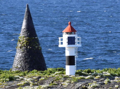
Date unknown. Active; focal plane 10 m (33 ft); flash every 5 s, white, red or green depending on direction. 7 m (23 ft) concrete post with lantern and gallery. Lighthouse painted white with a narrow black horizontal band, lantern roof red. A sharp-pointed conical stone daybeacon, painted black, stands next to the lighthouse. Trabas has Jim Smith's photo seen at right and Google has a satellite view. Located on a skerry about 3 km (2 mi) west of Kvaløy. Accessible only by boat. Site open, tower closed. NF-569500; Admiralty L1992; NGA 9240.
Lyngværgalten (1)
Date unknown. Replaced in 2021 and possibly removed. 9.5 m (31 ft) concrete post with lantern and gallery. Lighthouse painted white, lantern roof red. No photo available but Bing has a satellite view. The light (focal plane 5.5 m (18 ft); green light, 1 s on, 1 s off) is now on a post about 300 m (0.2 mi) northeast; Google has a satellite view. Located on a skerry off the southwest coast of Kvaløy. Accessible only by boat. Site open, tower closed. ex-NF-574100; ex-Admiralty L2016. Active light: NF-574101; Admiralty L2016.2; NGA 9284.
 

Helgelandsflesa Light, Sømna
photo copyright Jim Smith; used by permission

 
* Sømnes (Jarholmen)
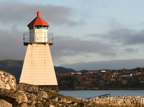
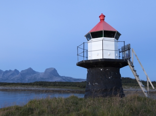
Date unknown (station established 1908). Active; focal plane 8 m (26 ft); white, red or green light depending on direction, occulting once every 6 s. 6 m (20 ft) octagonal pyramidal skeletal tower, covered with white siding, with lantern and gallery. Lighthouse painted white, lantern roof red. Elisabeth Spaans Mork's photo is at right, Trabas has Siering's photo, and Bing has a satellite view. Sømnes is an island in the entrance to Berg harbor from the Brønnøysund; the island is accessible by bridge. Located on the southern tip of the island. Site open, tower closed. NF-584500; Admiralty L2044; NGA 9372.

Brønnøy Lighthouses
Blåbakflua (2)
Date unknown. Active; focal plane 11m (36 ft); white, red or green light depending on direction, occulting twice every 8 s. 11 m (36) concrete post with lantern and gallery. Lighthouse painted white, lantern roof red. No photo available but Google has a distant satellite view. The lantern from the original lighthouse is on display at the Brønnøysund Båtforening (Boat Association) in Brønnøy. Lighthouse painted white, lantern roof red. Located on a skerry about 2.5 km (1.5 mi) northwest of Helløy. Accessible only by boat. Site open, tower closed. NF-577500; Admiralty L2024; NGA 9304.
Fleina
Date unknown. Active; focal plane 12 m (39 ft); white, red or green light depending on direction, 3 s on, 3 s off. 6 m (20 ft) square tower with lantern and gallery. Lighthouse painted white, lantern roof red. No photo available but Google has a distant satellite view. Located at the southwest end of a small island about 1 km (0.6 mi) north of Helløy. Accessible only by boat. Site open, tower closed. NF-577800; Admiralty L2025; NGA 9308.
Sømnes Light
Sømnes Light, Sømna, October 2007
Flickr photo copyright Elisabeth Spaans Mork; used by permission

Uttorgflesa (2)
1955 (station established 1910). Inactive since 2014. 13 m (43 ft) lantern and gallery supported by four concrete piles, standing beside the stone foundation of the original lighthouse (a 2-story wood keeper's house with light tower at one end). Lighthouse painted white, lantern roof red. No photo available but Google has a satellite view. The historic lighthouse was sold in 1955 and removed; we don't know where it went. The original boathouse survives. Located on a low reef about 3.5 km (2 mi) north of the Blåbakflu light. Accessible only by boat. Site open, tower closed. ARLHS NOR-263; ex-NF-578500; ex-Admiralty L2027; ex-NGA 9312.
Ertnbraken (Ertenbraken)
Date unknown. Active; focal plane 12.5 m (41 ft); two flashes every 10 s, white, red or green depending on direction. 14 m (46 ft) concrete post with lantern and gallery. Lighthouse painted white, lantern roof red. No photo available but Bing has a satellite view. Located on the highest of a group of dangerous skerries about 15 km (9 mi) west of Torgnes. Accessible only by boat. Site open, tower closed. NF-583500; Admiralty L2042; NGA 9360.
Arnlangøya
Date unknown. Active; focal plane 9 m (30 ft); white, red or green light depending on direction, occulting three times every 12 s. 5.5 m (19 ft) concrete post with lantern and gallery. Lighthouse painted white, lantern roof red. No photo available but Google has a satellite view. Located at the southwest end of a small island southwest of Torgnes. Accessible only by boat. Site open, tower closed. NF-580000; Admiralty L2031; NGA 9316.
Kversteinen
Date unknown. Active; focal plane 14 m (46 ft); flash every 5 s, white, red or green depending on direction. 7 m (23 ft) square tower with lantern and gallery. Lighthouse painted white, lantern roof red. No photo available but Bing has a distant satellite view. Located on the highest of a group of dangerous skerries about 16 km (10 mi) southwest of Vega. Accessible only by boat. Site open, tower closed. NF-582000; Admiralty L2039; NGA 9352.
Bjørntuva
Date unknown. Active; focal plane 10.5 m (34 ft); white, red or green light, depending on direction, 3 s on, 3 s off. concrete post light with lantern and gallery. Lighthouse painted white, lantern roof red. Trabas has Boucher's photo and Bing has a satellite view. NGA misspells the name "Bjorntua." Located at the northern tip of the island of Torget, about 3.2 km (2 mi) west of Brønnøysund. Accessible only by boat. Site open, tower closed. NF-579300; Admiralty L2029; NGA 9332.
Hestøyodden (1) (?)
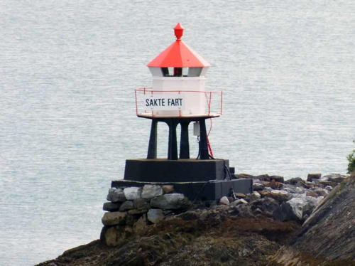
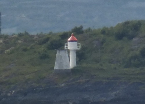
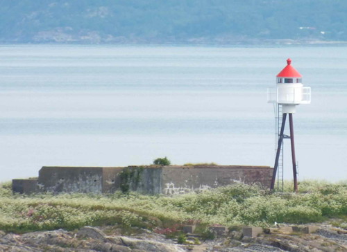
Date unknown (station established 1895). Replaced and possibly removed. 5 m (17 ft) octagonal lantern and gallery mounted on four piles rising from a square stone pier. Lighthouse painted white, lantern roof red. Bash's photo is at right, Trabas has Siering's photo seen at right, another closeup photo is available, Timo Noko has a drone view, and Bing has a satellite view. The light (focal plane 6 m (20 ft); red light, 1 s on, 1 s off) is now on a post. Like most harbor lights in Norway the lighthouse carries the sign sakte fart meaning "slow speed." Located just off the northern tip of Nordøya, marking the narrow northern entrance to the harbor of the town of Brønnøysund. Site open, tower closed. ex-NF-588200. Active light: NF-588202; Admiralty L2064; NGA 9404.

Hesterøyodden Light, Brunnøy, June 2012
photo by Arno Siering; used by permission
Verøya (Værholmen)
Date unknown. Active; focal plane 4 m (13 ft); white, red or green light depending on direction, occulting twice every 8 s. 7 m (23 ft) lantern and gallery on tripod piles. Lantern painted white with a red roof. Trabas has Siering's closeup photo and Google has a satellite view. Located on the southern tip of Værøy, opposite the Hestøyodden light. Accessible only by boat. Site open, tower closed. NF-588700; Admiralty L2070; NGA 9412.
Prestøyan (Østre Prestøy, Brønnøysund) (1) (?)
1862 (relocated here in 1896). Inactive since 1935. Approx. 12 m (39 ft) square cylindrical wood tower attached to the front of a 1-1/2 story wood keeper's house. The lantern has been replaced by a large wood observation room. Lighthouse painted white. Siering's photo is at right, Bash has a 2010 photo, Claußen has a photo, Herman Jelstad has a 2008 view from the sea, and Bing has a satellite view. This lighthouse was built on the island of Buholmen near Brønnøysund, then moved to Østre Prestøy in 1896. There were plans to restore the lighthouse to its original appearance. Sadly, the lighthouse caught fire on 1 October 2014 during the restoration. Although the fire was extingushed the building was heavily damaged. The owners vowed to rebuild it. An Instagram photo posted in August 2020 shows the rebuilt lighthouse. Accessible only by boat. Site open, tower closed. . ARLHS NOR-062.
Prestøyan (Østre Prestøy, Brønnøysund) (2)
1935 (station established 1896). Active; focal plane 8.5 m (28 ft); white, red or green light, depending on direction, occulting three times every 10 s. 6 m (20 ft) skeletal tower, covered with white siding, with lantern and gallery. Lighthouse painted white, lantern roof red. Siering's photo is at right, Trabas has a closeup taken from this photo, Claußen has a photo, and Google has a satellite view. Located in front of the historic lighthouse. Accessible only by boat. Site open, tower closed. NF-589100; Admiralty L2074; NGA 9420.
Strømøyan (Strøymøyene)
Date unknown. Active; focal plane 7.5 m (25 ft); white, red or green light depending on direction, occulting twice every 8 s. 6 m (20 ft) lantern and gallery mounted on a platform supported by four piles. Lighthouse painted white, lantern roof red, piles black. Trabas has Siering's photo and Bing has a satellite view. Located at the southern point of Ytre Strømøy, about 12 km (7.5 mi) north of Brønnøysund. Accessible only by boat. Site open, tower closed. NF-589500; Admiralty L2078; NGA 9424.
Prestøy
Prestøyan Lights, Brønnøysund, July 2012
ex-Panoramio photo copyright Arno Siering; used by permission
Manndauden
Date unknown. Active; focal plane 5.5 m (19 ft); white, red or green light depending on direction, occulting three times every 10 s. 5 m (17 ft) lantern and gallery supported by tripod piles. Lighthouse painted white, lantern roof red, piles black. Trabas has Siering's distant view and Bing has a satellite view. Located on a reef in the Velfjord about 800 m (1/2 mi) east of the ferry terminal at Horn. Accessible only by boat, but there are good views from the ferries between Horn and Anddalsvåg. Site open, tower closed. NF-589700; Admiralty L2080; NGA 9428.

Vega Lighthouses
One of Norway's smallest and least populous municipalities, Vega includes one large island and an archipelago of small islands, the Vegaøyan.

Bremstein
1925. Active; focal plane 40 m (131 ft); three white flashes every 15 s; also a second light at 27 m (89 ft): white, red or green depending on direction, occulting three times every 10 s. 27 m (89 ft) round cast iron tower with lantern and gallery. The lighthouse is unique in having two 2nd order Fresnel lenses, one for each light. Lighthouse painted red with one white horizontal band in the center. 1-1/2 story wood keeper's house, boathouse, and other station buildings. However, the engine house burned to the ground in 1996, and the assistant keeper's house was relocated to Bodø as a private residence. A photo is at the top of this page, The Lighthouse Association has a page for the lighthouse, Ronnie Pedersen has an excellent closeup, another closeup and a drone view are available, and the Bremstein Fyr facebook group has many photos, but Google has only a fuzzy satellite view of the island. The keepers house was leased in 2010 by a preservation organization, and a €1.2 million project restored the building in 2012. The lighthouse was repainted and refurbished in 2020. Located on a small island about 25 km (15 mi) west of Gladstad. Accessible only by boat. Site open, tower closed. Site manager: Bremstein Fyr. ARLHS NOR-007; NF-600000 (main light) and 600010 (second light); Admiralty L2098; NGA 9436.
Bremsteinen (Heimøya)
Date unknown. Active; focal plane 18 m (59 ft); white, red or green light, depending on direction, 3 s on, 3 s off. 7 m (23 ft) square tower with lantern and gallery. Lighthouse painted white, lantern roof red. Geir Hansen has a distant 2021 street view and Google has only a fuzzy satellite view of the island. Located on a largest island of a small group about 13 km (8 mi) northeast of the Bremstein lighthouse. Accessible only by boat. Site open, tower closed. NF-600100; Admiralty L2102; NGA 9440.
Nordholmen
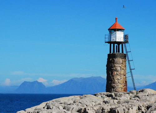
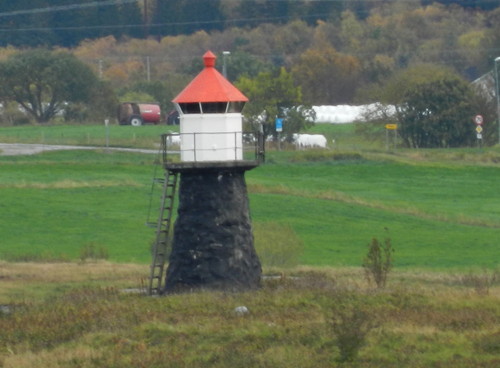
Date unknown. Active; focal plane 13 m (43 ft); white, red or green light, depending on direction, occulting twice every 8 s. 8 m (26 ft) lantern and gallery supported by four piles atop a round rubblestone cairn. Lantern painted white with a red roof, piles painted black, cairn unpainted. Ronny Pedersen's photo is at right and Geir Hansen has a distant 2021 street view but Google has only a fuzzy satellite view of the island. Located on a skerry about 1.2 km (3/4 mi) northeast of the Heimøya light. Accessible only by boat. Site open, tower closed. NF-600200; Admiralty L2104; NGA 9444.
Brynjulfskjær
Date unknown. Active; focal plane 9 m (30 ft); white, red or green light, depending on direction, 3 s on, 3 s off. 9 m (30 ft) round cylindrical stone cairn topped by a lantern supported by four short piles. Lantern painted white with a red roof, piles black; cairn unpainted. No photo available but Google has a satellite view. Located on a skerry about 13 km (12 mi) northeast of Bremstein Fyr. Accessible only by boat. Site open, tower closed. NF-601000; Admiralty L2112; NGA 9456.
Ivarsbraken
Date unknown. Active; focal plane 11.5 m (38 ft); white, red or green light, depending on direction, occulting twice every 8 s. 8.5 m (28 ft) concrete post with lantern and gallery. Lighthouse painted white, lantern roof red. No photo available but Google has a distant satellite view. Located on a skerry 3 km (2 mi) north of Brynjulfskjær. Accessible only by boat. Site open, tower closed. NF-601500; Admiralty L2114; NGA 9460.
Bubraken
Date unknown. Active; focal plane 9.5 m (31 ft); white, red or green light, depending on direction, occulting three times every 12 s. 6 m (20 ft) concrete post with lantern and gallery. Lighthouse painted white, lantern roof red. No photo available but Google has a distant satellite view. Located on a small island 3 km (2 mi) east of Ivarsbraken. Accessible only by boat. Site open, tower closed. NF-601600; Admiralty L2115; NGA 9464.
Nordholmen Light
Nordholmen Light, Vega, July 2008
ex-Panoramio photo copyright Ronny Pedersen; permission requested
Skjærvær (Tennholmen)
Date unknown. Active; focal plane 12.5 m (41 ft); white, red or green light, depending on direction, 3 s on, 3 s off. 6.5 m (21 ft) lantern and gallery supported by four piles. Lantern painted white with a red roof, piles black. No photo available but Google has a very distant satellite view. Skjærvær is a small inhabited island about 16 km (10 mi) northwest of Vega. Located on Tennholmen, a small island just north of Skjærvær harbor. Accessible only by boat. Site open, tower closed. NF-600500; Admiralty L2108; NGA 9448.
Muddværet (Muddvær (2?)
Date unknown. Active; focal plane 9.5 m (31 ft); white, red or green light, depending on direction, 3 s on, 3 s off. 6 m (20 ft) square tower with lantern and gallery. Lighthouse painted white, lantern roof red. No photo available. Google's satellite view shows two towers, indicating the original lighthouse has been replaced. Muddværet is a group of small islands about 4 km (2.5 mi) off the southwestern corner of Vega. Located on Sørleikua, a small island on the west side of the Muddværet group. Accessible only by boat. Site open, tower closed. NF-602000; Admiralty L2116; NGA 9468.
Håbranden
Date unknown. Active; focal plane 9.5 m (31 ft); white, red or green light, depending on direction, 3 s on, 3 s off. 7.5 m (25 ft) lantern and gallery atop a stone cairn. Bjørnar Falk has a distant photo and Bing has a satellite view. Located on a skerry off the southwestern tip of Vega. Accessible only by boat. Site open, tower closed. NF-604100; Admiralty L2128; NGA 9488.
Sundsvoll
Date unknown. Active; focal plane 8 m (26 ft); white, red or green light, depending on direction, 3 s on, 3 s off. 7 m (23 ft) lantern and gallery supported by four piles. Lantern painted white with a red roof, piles black. No photo available but Google has a satellite view. Sundsvoll is a small port on the west coast of Vega. Located on a skerry off Sundsvoll. Accessible only by boat. Site open, tower closed. NF-603500; Admiralty L2122; NGA 9480.
Runden (Hysvær)
Date unknown. Active; focal plane 7 m (23 ft); white, red or green light, depending on direction, 3 s on, 3 s off. 7 m (23 ft) lantern and gallery supported by four piles. Lantern painted white with a red roof, piles black. No photo available but Bing has a satellite view. Hysvær is a large group of small islands off the northwestern corner of Vega; many of the islands have summer cottages. Located on a skerry at the southeastern corner of the Hysvær group. Accessible only by boat. Site open, tower closed. NF-603000; Admiralty L2120; NGA 9476.
Skogsholmen
Date unknown. Active; focal plane 6 m (20 ft); white, red or green light, depending on direction, 3 s on, 3 s off. 6 m (20 ft) concrete post light with lantern and gallery. Lighthouse painted white, lantern roof red. No photo available but Google has a satellite view. Skogsholmen is one of the larger islands in a complex group about 15 km (9 mi) north of Vega. Located on a skerry off the northern tip of Skogsholmen. ccessible only by boat. Site open, tower closed. NF-638500; Admiralty L2268.6; NGA 9544.
Borgskjær (Igerøya)
Date unknown. Active; focal plane 5 m (17 ft); white, red or green light, depending on direction, occulting once every 6 s. 7 m (23 ft) lantern and gallery mounted on a stone cairn. Lantern painted white with a red roof. Trabas has Boucher's photo and Bing has a satellite view. Located on a skerry off the harbor of Igerøya, at the northeastern corner of Vega. Accessible only by boat, but there's a good view from ferries arriving at Igerøya. Site open, tower closed. NF-606550; Admiralty L2138; NGA 9504.
Klabben
Date unknown. Active; focal plane 8 m (26 ft); two flashes every 10 s, white, red or green depending on direction. 10 m (33 ft) lantern and gallery supported by four piles. Lantern painted white with a red roof, piles black. No photo available but Bing has a satellite view. Located on a skerry about 5 km (3 mi) off the southeastern corner of Vega. Accessible only by boat. Site open, tower closed. NF-605200; Admiralty L2132; NGA 9496.
Rotvikodden
Date unknown. Active; focal plane 4.5 m (16 ft); white, red or green light, depending on direction, occulting twice every 8 s. 6.5 m (21 ft) lantern mounted on a platform supported by piles. Lantern painted white with a red roof, piles black. No photo available but Bing has a satellite view. Located at the tip of a promontory on the west side of Ylvingen, an island halfway between Vega and the mainland. Site status unknown. NF-581200; Admiralty L2037; NGA 9348.
Ylvingen (2?)
Date unknown. Active; focal plane 13.5 m (44 ft); white, red or green light, depending on direction, occulting once every 6 s. 7 m (23 ft) concrete post light with lantern and gallery. Lighthouse painted white, lantern roof red. Siering's photo is at right, Trabas has Boucher's photo, and Bing has a satellite view. The square tower next to the light is probably an earlier lighthouse but it may have been only a daybeacon. Located on the southeast side of Ylvingen. Accessible only by boat. Site open, tower closed. NF-581100; Admiralty L2036; NGA 9344.
Ylvingen Light
Ylvingen Light, Vega, July 2012
ex-Panoramio photo copyright Arno Siering; used by permission

Alstahaug Lighthouses
[Skjelva (1)]
1898. Inactive since 1952. Ruins of the original lighthouse, which had a light tower mounted on a 2-story wood keeper's house. Siering's photo is at right. Located on a small island about 3 km (2 mi) southwest of Mindlandet. Accessible only by boat. Site and tower closed. ARLHS NOR-206.
Skjelva (2)
1952 (station established 1898). Active; focal plane 16 m (52 ft); flash every 5 s, white, red or green depending on direction. 12.5 m (41 ft) lantern mounted on an iron tripod. Trabas has a version of Siering's photo (another version seen at right) and Bing has a satellite view. Located on a small island about 3 km (2 mi) southwest of Mindlandet. Accessible only by boat. Site and tower closed. NF-608000; Admiralty L2142; NGA 9564.
Pålholmen
Date unknown. Active; focal plane 8.5 m (28 ft); white, red or green light depending on direction, occulting twice every 8 s. 6 m (20 ft) square tower with lantern and gallery. Lighthouse painted white, lantern roof red. Trabas has Siering's closeup photo and Bing has a satellite view. Located at the north end of an island in the Tjøttafjord, off the north end of Mindlandet and about 3 km (2 mi) east of Tjøtta. Accessible only by boat. Site and tower closed. NF-610500; Admiralty L2152; NGA 9584.
Juldagan (Juledagene)
Date unknown. Active; focal plane 7 m (23 ft); white light, 3 s on, 3 s off. 8.5 m (28 ft) round stone cairn with lantern and gallery. Lantern painted white with a red roof. Trabas has Siering's photo, Bash has a photo, and Bing has a satellite view. Located on a skerry about 10 km (6 mi) northwest of Tjøtta. Accessible only by boat. Site open, tower closed. NF-612200; Admiralty L2158; NGA 9604.
Skjelva Fyr
Skjelva Light, Alstahaug, June 2012
photo copyright Arno Siering; used by permission
Rosøygalten
Date unknown. Active; focal plane 6.5 m (21 ft); white, red or green light depending on direction, occulting twice every 8 s. 9.5 m (31 ft) concrete post with lantern and gallery. Lighthouse painted white, lantern roof red. Trabas has Siering's closeup photo, Bash has a photo, and Bing has a satellite view. Located off the northeastern end of Nordre Rosøya. Accessible only by boat. Site open, tower closed. NF-612400; Admiralty L2160; NGA 9608.
Søre Sørøyholmen
Date unknown. Active; focal plane 7 m (23 ft); white, red or green light depending on direction, 3 s on, 3 s off. 6 m (20 ft) concrete post with lantern and gallery. Lighthouse painted white, lantern roof red. Trabas has Siering's photo, Bash has a photo, and Bing has a satellite view. Located on a small island about 4 km (2.5 mi) west of Søvik. Accessible only by boat. Site open, tower closed. NF-613100; Admiralty L2166; NGA 9616.
Søvik
Date unknown. Active; focal plane 12 m (39 ft); white, red or green light depending on direction, occulting twice every 8 s. 7 m (23 ft) round stone cairn with lantern and gallery. Lantern painted white with a red roof. Michael Boucher's photo is at right, Trabas has Siering's photo, Bash has a photo, and Bing has a satellite view. Located on a small island about 2.5 km (1.5 mi) north of Søvik. Accessible only by boat. Site open, tower closed. NF-613500; Admiralty L2168; NGA 9620.
Sandnessjøen (Helgelandsbase) (2)
Date unknown (station established 1912). Active; focal plane 6 m (20 ft); white, red or green light depending on direction, occulting once every 6 s. 5 m (17 ft) concrete post with lantern and gallery. Lighthouse painted white, lantern roof red. Trabas has Siering's closeup photo, Bash has a photo, and Bing has a satellite view. The light guides ships arriving at Helgelandsbase, a supply depot for oilfields offshore in the Norwegian Sea. The base occupies an artificial island connected to the mainland by a causeway. The original light was on a rock nearby. Located at the tip of the island, near Alstahaug. Site and tower closed, although the light is easily seen from the mainland. Site manager: NorSeaGroup. NF-615100; Admiralty L2178; NGA 9644.
Søvik Fyr
Søvik Light, Alstahaug, September 2011
photo copyright Michael Boucher; used by permission
Buøy (Buøya)
Date unknown. Active; focal plane 11.5 m (38 ft); white, red or green light depending on direction, 3 s on, 3 s off. 6 m (20 ft) lantern and gallery mounted on a stone cairn. Lantern painted white with a red roof. Ingrid Maasik's photo is at right and Bing has a satellite view. Buøy is an island just west of Austbø and about 8 km (5 mi) west of Søvik. Located on the northeastern tip of the island. Accessible only by boat. Site open, tower closed. NF-642500; Admiralty L2274; NGA 9944.

Vefsn Lighthouses
Sørnesskjær
Date unknown. Active; focal plane 6 m (20 ft); white, red or green light depending on direction, occulting twice every 8 s. 6 m (20 ft) square skeletal tower, covered with wood siding, with lantern and gallery. Lighthouse painted white, lantern roof red. Per Atle Eliassen has a 2007 photo and Google has a very distant satellite view of the skerry. Located on a rocky point at the junction of the Vefsnfjord and the Sørfjord, about 15 km (9 mi) northwest of Vefsn. Site open, tower closed. NF-617100; Admiralty L2190; NGA 9676.
Alterneset
Date unknown (station established 1905). Active; focal plane 6 m (20 ft) (?); white or red light depending on direction, occulting once every 6 s. Approx. 10 m (33 ft) lantern and gallery mounted on six wood piles. Lantern painted white with a red roof. Per Atle Eliassen has a 2007 photo but Google has only a distant satellite view. Located off a sharp promontory in the Vefsnfjord about 8 km (5 mi) northwest of Mosjøen. Accessible only by boat. Site open, tower closed. NF-617300; Admiralty L2192; NGA 9680.

Buøy Light, Alstahaug
photo copyright Ingrid Maasik; used by permission

Information available on lost lighthouses:

Notable faux lighthouses:

Adjoining pages: North: Central Helgeland | South: Nord-Trøndelag

Return to the Lighthouse Directory index | Ratings key

Posted August 3, 2006. Checked and revised July 18, 2023. Lighthouses: 45. Site copyright 2023 Russ Rowlett and the University of North Carolina at Chapel Hill.