Lighthouses of the United States: New York City and Hudson River, New York

The United States of America is a federal union of 50 states and a capital district. The northeastern state of New York includes in the southeast the great port and financial center of New York City and Long Island extending to the east of the city; in the west and north it extends to Lakes Erie and Ontario and the lower St. Lawrence River.

Rich in waterways, New York is equally rich in lighthouses. This page lists lighthouses and lightships of New York City and the Hudson River in the southeastern corner of the state. There are additional pages for Western New York, for Central and Northern New York, and for Long Island.

In New York Harbor the Robbins Reef, Great Beds, and Romer Shoal lights are often considered New York lighthouses but they are actually in New Jersey waters.

Navigational aids in lower New York State are operated by the U.S. Coast Guard Sector New York with Aids to Navigation Teams based at Bayonne, New Jersey, and at Saugerties on the Hudson River. However ownership (and sometimes operation) of historic lighthouses has been transferred to local authorities and preservation organizations in many cases.

ARLHS numbers are from the ARLHS World List of Lights. Admiralty numbers are from volume J of the Admiralty List of Lights & Fog Signals. USCG numbers are from Volume I of the USCG Light List.

General Sources
New York Lighthouses
Photos, travel directions, and historical accounts by Kraig Anderson.
New York Lighthouses
A portfolio of photos by Jeremy D'Entremont.
New York Lighthouses
Photos by C.W. Bash.
Online List of Lights - U.S. East Coast
Photos by various photographers posted by Alexander Trabas.
Lighthouses in New York (state)
Photos by various photographers available from Wikimedia.
New York, United States Lighthouses
Aerial photos posted by Marinas.com.
National Lighthouse Museum
The museum occupies a building of the former Lighthouse Depot on Staten Island.
Leuchttürme USA auf historischen Postkarten
Historic postcard images of U.S. lighthouses posted by Klaus Huelse.
U.S. Coast Guard Navigation Center: Light Lists
The USCG Light List can be downloaded in pdf format.
NOAA Nautical Charts
Nautical charts for the coast can be viewed online.
Navionics Charts
Navigation chart for New York.


Saugerties Light, Saugerties, June 2022
Instagram photo by Saugerties Lighthouse
New York City Lighthouses

The City of New York is the most populous city of the United States with a population of more than 8.2 million. The City covers five of New York State's 62 counties; they are usually called boroughs. Kings County (Brooklyn) and Queens County (Queens) are on the western end of Long Island. Bronx County (The Bronx) is on the mainland to the north. New York County (Manhattan), the heart of the city, occupies an island separated from Long Island by the East River, from the Bronx by the narrow channel of the Harlem River, and from New Jersey by the Hudson River. Richmond County (Staten Island) lies to the southwest, across Upper New York Bay and close to the New Jersey shore. New York has been a major port throughout American history, and the Port of New York and New Jersey continues to be the largest port on the U.S. Atlantic coast.

Brooklyn Lighthouses
* Kingsborough Community College
1990. Active (maintained by the college); focal plane 115 ft (35 m); white flash every 4 s. Conical skeletal tower mounted atop the 3-story circular brick Marine Academic Center. Trabas has a good photo and Google has a satellite view. The college has adopted the lighthouse as its logo. Located off Oriental Avenue in the Manhattan Beach section of Brooklyn, marking the north side of Rockaway Inlet. Site open. Owner/site manager: Kingsborough Community College. Admiralty J1096.5; USCG 1-34360.
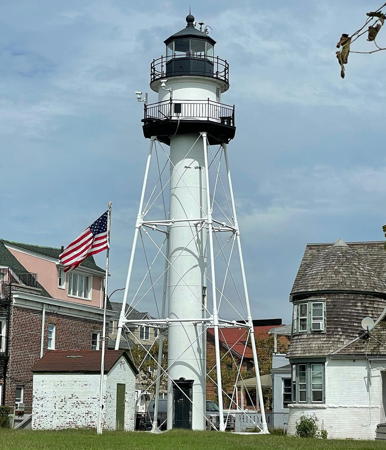
Coney Island (Norton Point)
1890. Active; focal plane 75 ft (23 m); red flash every 5 s, day and night. 75 ft (23 m) square pyramidal skeletal tower with lantern, gallery, and round central cylinder; 190 mm lens (1989). The original 4th order Fresnel lens is on display at the South Street Seaport Museum. Lighthouse painted white, lantern black. The 2-story wood keeper's house (1896) is leased to the Sea Gate Association. Cao Jiaqing's photo is at right, Trabas has a closeup photo by Klaus Potschien, Wikipedia has an article including Jim Henderson's view from the harbor, Wikipedia has photos including a closeup by Jeffrey Lewis Riehle, Marinas.com has aerial photos, Andrew Trapani has a street view, and Google has a satellite view. Frank Schubert, the last keeper, retired officially in 1989 but continued to live in the house and look after the property until his death, in the keeper's house, on 11 December 2003. He had served 43 years at Coney Island. This lighthouse and its twin at Throg's Neck were the first in a series of shorter skeletal towers; similar lights were built at Point Loma in California, Plum Island and La Pointe in Wisconsin, and Duluth Harbor in Minnesota. The Schuberts maitnain the Coney Island Lighthouse web site but no longer have any direct connection to the lighthouse. Lighthouse Digest has printed recollections of an earlier keeper's daughters. Located off Surf Avenue between 47th and 48th Streets in the Sea Gate neighborhood. Site and tower closed (gated neighborhood). Owner: U.S. Coast Guard. Site manager: Sea Gate Association. . ARLHS USA-187; Admiralty J1106; USCG 1-34910.
#Lightship 84 (WAL-509) St. Johns
1907 (Camden NJ: New York Shipbuilding Co.). 135 ft (41 m) 2-masted steel lightship. Decommissioned 1965. The ship sank at its berth. Until recently its masts were above water; Scott Koen has a 2008 photo and there's a web page for the wreck with several photos showing the masts. The masts have now been removed and Google's satellite view no longer shows them. The ship served off the Georgia coast as the Brunswick until that station was discontinued in 1929. LV-84 was then transferred to the St. Johns station off Jacksonville, Florida, for the next 25 years. In 1968 the ship was donated to a seaman's school in Piney Point, Maryland, where it was named the Big Red. In 1987 it was sold and towed to Yonkers, New York, to be a floating restaurant. It sank in 1997; in subsequent years the New York Police Department used it as a practice site for scuba teams. Located at an old pier at the end of Richards Street in the Red Hook neighborhood of Brooklyn. Site closed. ARLHS USA-999.

Coney Island Light, Brooklyn, August 2019
Google Maps photo by Cao Jiaqing
* Poorhouse Flats Range Rear (2)
2019. Active; focal plane 48 ft (14.5 m); green light, 3 s on, 3 s off. 43 ft (13 m) square skeletal tower carrying a rectangular daymark colored green with a red vertical stripe. The tower is at the right in Ed Hafizov's photo, Alexander Kushi-Willis has a street view, and Google has a satellite view. This tower replaced an older skeletal tower; Trabas has a photo of the previous light . The range guides vessels southbound in the East River off the Bellevue neighborhood of Manhattan. Located on the bank of the East River at Bushwick Inlet Park, the foot of 10th Street, in the North Williamsburg neighborhood. Site open, tower closed. Admiralty J0994.1; USCG 1-27330.

Queens Lighthouses
* [Hell Gate (4?)]
Date unknown (station established 1884). Active; focal plane 33 ft (10 m); green flash every 2.5 s. The present light is mounted on one of the outfield light standards of Whitey Ford Field, a New York City park and baseball stadium. Trabas has Michael Boucher's photo and Google has a satellite view. Hell Gate is a narrow passage connecting the East River to Long Island Sound. Its original Dutch name Hellegat means only "open passage," but the swift tidal flow through the strait justifies the more ominous English version. In 1884 a light was placed atop a 255 ft (77 m) square skeletal tower; Google Books has the original account of this project in the Scientific American issue of 22 March 1884 and Anderson has a historic photo. The colossal tower was a failure as a navigational aid, lasting only four years. It was replaced by the modest square pyramidal wood tower seen in the postcard view provided by Michel Forand and a second postcard view posted by Huelse. We don't know when this structure was demolished. Located behind Whitey Ford Field at Hallets Point in the Astoria section of Queens. Site open. Owner/site manager: New York City Parks and Recreation. ARLHS USA-1215; Admiralty J0978; USCG 1-27290.
Whitestone Point (3?)
Date unknown (station established 1889). Active; focal plane 56 ft (17 m); quick-flashing green light. 52 ft (16 m) square cylindrical skeletal tower. Andreas Köhler's photo is at right, Trabas has a photo, Google has a distant street view, and Bing has an aerial view. Sometime after 1908 one or more skeletal towers replaced the original ornate Victorian square pyramidal wood tower. Located just off Whitestone Point, Queens, near Second Avenue and 149th Street, about 0.3 mile (500 m) east of the Bronx-Whitestone Bridge (I-678). Accessible only by boat. Site open, tower closed. Owner/site manager: U.S. Coast Guard. ARLHS USA-889; Admiralty J0936; USCG 1-27215.

Whitestone Point Light, Queens, September 2016
Google Maps photo by Andreas Köhler

The Bronx Lighthouses
* Throg's Neck (5)
1934 (station established 1827). Active; focal plane 60 ft (18 m); continuous red light. Approx. 56 ft (17 m) square cylindrical skeletal tower. The 1-1/2 story wood keeper's house (1884) provides housing for a college faculty member. Trabas has a photo by Michael Boucher (also seen at right) and Google has a satellite view. The original lighthouse was replaced in 1835 by a "temporary" light on the wall of Fort Schuyler. A proper lighthouse, a 62 ft (19 m) pyramidal skeletal tower, was finally built in 1890, but it was replaced in 1905 by a 35 ft (11 m) brick tower because the taller light was found to be in the line of fire of the fort's batteries. The Coast Guard has a historic photo of the keeper's house with the pyramidal skeletal lighthouse of 1890-1905. Located on the campus of the State University of New York Maritime College, at the entrance to the East River from Long Island Sound, and practically in the shadow of the Throgs Neck Bridge (I-295). Site open. Operator: U.S. Coast Guard. Owner/site manager: SUNY Maritime College. ARLHS USA-846; Admiralty J0934; USCG 1-21520.
#North Brother Island
1869. Inactive since 1953. Originally an octagonal wood tower rising from 1-story wood keeper's quarters. Sibling of Colchester Reef VT. The lighthouse has completely collapsed, leaving only the brick oil house standing; it appears that the ruins have been removed in recent years. The fog bell from the station is displayed at the New York City Police Department's Harbor Unit at College Point. The Digest also has a May 2004 article on life at the station, the Coast Guard has a historic photo showing the light station in better days, and Google has a satellite view of the location. The light station was formerly on the Lighthouse Digest Doomsday List, but it was dropped since Doomsday has arrived for it. The island, formerly the site of a city hospital, is located in the East River between Riker's Island and the Bronx. The light station site is at the southwestern tip of the island. There is no longer a light at this location; the modern ship channel is around the opposite end of the island. Accessible only by boat. Site and tower closed. Owner/site manager: City of New York. ARLHS USA-551.
Throgs Neck Light
Throgs Neck Light, Bronx
photo copyright Michael Boucher; used by permission
[South Brother Island]
Date unknown. Active; focal plane 6 m (20 ft); white flash every 2.5b s. 4 m (13 ft) square skeletal tower. Trabas has Michael Boucher's photo, another photo is available, and Google has a street view and a satellite view. What's interesting about this minor light is that there is an inactive fog bell beside the light tower. Formerly a part of Queens County, the island was transferred to The Bronx in 1964. Located at the north point of South Brother Island opposite the North Brother Island lighthouse site. Accessible only by boat. Site and tower closed. Owner/site manager: U.S. Coast Guard. Admiralty J0958; USCG 1-27265.

Manhattan East River Lighthouses
The East River is a tidal strait (not a river) connecting Long Island Sound and Upper New York Bay along the east side of Manhattan Island. The strait is 16 mi (26 km) long, and the section beside Manhattan averages about 1/2 mi (800 m) in width.

*
Blackwell (Roosevelt) Island
1872 (James Renwick, Jr.). Reactivated (inactive 1940s-1998; always unofficial and charted as a landmark); focal plane 52 ft (16 m); continuous white light. 50 ft (15 m) octagonal cylindrical stone tower with lantern and gallery. The tower is unpainted gray stone; lantern painted black. A 2023 photo is at right, Jonathan Austin has a 2023 closeup, Leonardo Giovanardi has a 2018 photo, and Google has a satellite view and a closeup street view showing the light in action. The lighthouse was built for the city of New York by convicts from the city's former Blackwell Island Prison. The lighthouse was restored in 1998, thanks to an anonymous $120,000 donation to the city. In 2022 the Roosevelt Island Operating Corporation spent $3.1 million on a complete restoration. Scott Laine has a 2022 photo showing that the lantern was replaced; the new lantern has a strongly peaked "dunce cap" roof. This led to protests from lighthouse fans and historians since the lantern is not historically accurate. Roosevelt Island, known as Blackwell Island originally and then as Welfare Island from 1921 to 1973, is a narrow island in the East River, 2 miles (3.2 km) long but no more than 800 ft (240 m) wide. The island is part of the borough of Manhattan but the only access is by a bridge at the foot of 36th Street in Queens. Located in Lighthouse Park at the north end of the island. Site open, tower closed. Owner/site manager: Roosevelt Island Operating Corporation. . ARLHS USA-1041.


Blackwell Island Light, East River, August 2023
Instagram photo by New York Landmarks Conservancy

Roosevelt Island Reef (U Thant Island, Belmont Island)
1970s. Active; focal plane 57 ft (17 m); green flash every 4 s. 43 ft (13 m) square cylindrical skeletal tower mounted on a square 1-story white concrete base. Trabas has a closeup photo by Michael Boucher, Akif Sever has a 2017 photo, and Google has a sea view and a satellite view. The island, known officially as Belmont Island, was built with dirt excavated from a subway tunnel under the river; it was named unofficially for U Thant, the United Nations Secretary General from 1961 to 1971. Located on an islet about 1300 ft (400 m) downstream from the southern tip of Roosevelt Island, opposite the United Nations. Accessible only by boat but easy to see from shore. Site open, tower closed. Owner/site manager: U.S. Coast Guard. Admiralty J0990; USCG 1-27315.
* Titanic Memorial
1913. Inactive since 1967. 60 ft (18 m) round steel tower surmounted by a pole carrying a time ball. Entire lighthouse painted white. Rohan Moitra has a 2018 photo, another closeup photo is available and Google has the 2024 street view seen at right and a satellite view. From 1913 to 1967 the time ball dropped each day to signal 12 noon to ships in the harbor. The lighthouse ws originally at the top of the 13-story Seaman's Institute at 25 South Street; the cornerstone of this building was laid on the morning of the day the Titanic struck an iceberg and sank. In 1976, when this building is slated for demolition, the lighthouse was relocated to the entrance to the South Street Seaport Museum. By 2020 the lighthouse had fallen into poor condition and a preservation group, Friends of the Titanic Lighthouse Restoration formed to work for its restoration. Beginning in November 2024 the Seaport Musuem is carrying out a thorough restoration. Located at the intersection of Fulton and Water Streets. Site open, tower closed. Owner/site manager: South Street Seaport Museum (Titanic Memorial Lighthouse). ARLHS USA-1229.
 

Titanic Memorial Light, Manhattan, May 2024
Google Maps street view
 
**** Lightship 87 (WAL-512) Ambrose
1907. Decommissioned 1967. 2-masted steel lightship, length 113 ft (34 m), beam 29 ft (7 m). A 2024 photo by Martin Tesař is at right, Xiqin Ma has a photo, Hisham Alghanim has a 2022 photo, Wikimedia has Joe Mabel's 2013 photo, Google has a street view, and Google has a satellite view. The ship served the Ambrose station off the entrance to New York harbor until 1933, and then it served on the Scotland station off Sandy Hook. LV-87 is the only surviving ship of its class and one of the oldest surviving U.S. lightships. The ship has been moored at South Street Seaport since 1968. The deck was replaced in 1995. In January 2012 the ship was towed to a Staten Island shipyard for much-needed repairs; it returned to its regular berth in March. In August 2017 New York City officials released $4.5 million to fund a complete restoration of the ship. Guided tours daily in the warmer months (requires admission fee to museum). Owner/site manager: South Street Seaport Museum. . ARLHS USA-008.

Governors Island Lighthouses
Governors Island is a 172 acre (70 ha) island located in Upper New York Bay about 1/2 mile (800 m) south of the southern tip of Manhattan. The island is accessible May 1 through October 31 by passenger ferries operating daily from the Battery Maritime Building in Manhattan and on weekends from Pier 6 in the Brooklyn Bridge Park in Brooklyn. The island is included with Manhattan in New York County.

*
Governors Island (Castle Williams) (2?)
Date unknown (station established 1888). Active; focal plane 75 ft (23 m); two continuous red lights, one above the other. Approx. 20 ft (6 m) square skeletal tower mounted atop the walls of Castle Williams. Skeletal tower painted red. Trabas has Michael Boucher's photo, Wikimedia has a photo, and Google has a street view and a satellite view. Castle Williams is a circular sandstone fort completed in 1811. The fort successfully deterred any British attack on New York during the war of 1812; later it served for many years as a military prison. According to Findlay's Lighthouses of the World, there was a fog bell at the fort in 1879 but no light. (The fog signal building was at ground level; it has been demolished.) A U.S. Lighthouse Service 1935 report gives 1888 as the date of establishment for the light. The original light was similar in size and form to the present one. Located at the northwestern tip of the island. Site open, tower closed. Site manager: U.S. National Park Service (Governors Island National Monument). Admiralty J1126; USCG 1-35010.

Lightship 87 (Ambrose), New York, May 2024
Google Maps photo by Martin Tesař
#Governors Island Extension (2?)
Date unknown (station established 1910). Inactive since 2016 and removed by 2018. This was an approx. 43 ft (13 m) square skeletal tower with a concrete central column and a small enclosed shed in the base, adjacent to a square 1-story equipment building. Skeletal tower painted red; the central column and equipment building are white. Trabas has a photo and Google has a 2009 street view but the light is missing from Google's satellite view. The word "extension" refers to the extension of the island southward by fill from subway excavations early in the 1900s. The light was established by contractors building the island; the Lighthouse Board accepted it in 1912. Located at the southwestern tip of the island, across the harbor from the Statue of Liberty. Site open. Site manager: U.S. National Park Service (Governors Island National Monument). ex-Admiralty J1120; ex-USCG 1-35000.

Upper New York Bay Lighthouses
Upper New York Bay is the part of New York Harbor at the mouth of the Hudson River between Manhattan and Staten Island; it is bounded by Brooklyn on the east and the New Jersey cities of Jersey City and Bayonne on the west. By several odd twists of history Liberty Island is part of New York even though the surrounding waters are part of New Jersey. For this reason the Statue of Liberty is considered to be a New York lighthouse while the nearby Robbins Reef Light is a New Jersey lighthouse. To avoid this geographical confusion both lighthouses are described on both pages.
**** Statue of Liberty
1886 (Auguste Bartholdi). Inactive as a lighthouse since 1902; charted as a daybeacon. This 305 ft (93 m) monumental sculpture is well known world wide as a symbol of New York and of the United States. Ricky Phillips has a 2019 photo and Google has a street view from the New Jersey shore, a sea view, and a satellite view. The torch of the statue was originally designed as a navigation beacon and it was so used until 1902. The Statue of Liberty (Liberty Enlightening the World by its official name) is a very popular destination for tourists. Closed after the 9/11 attacks of 2001, the interior of the statue reopened in August 2004. The statue was closed again after its base was flooded by Hurricane Sandy in October 2012; it reopened on Independence Day, 4 July 2013. Located on Liberty Island (formerly Bedloe's Island) in New York Harbor off Jersey City. Although it is surrounded by New Jersey waters, the island is administered by New York. Accessible by passenger ferry (toll) from Battery Park, Manhattan, and from Liberty State Park, Jersey City. Site and statue open daily. Owner: U.S. National Park Service. Site manager: Statue of Liberty National Monument.
Robbin's Reef (Kate's Light) (2)
1883 (atation established 1839). Active; focal plane 56 ft (17 m); green flash every 6 s. 45 ft (14 m) cast iron sparkplug tower with lantern and double gallery, incorporating 3-story keeper's quarters, mounted on a granite caisson; 300 mm lens. Lower half of lighthouse painted brown, upper half white, lantern black. A 2021 photo is at right, Trabas has Rainer Arndt's photo, Tom Link has another good photo, Patrick Dirden has a photo, Rich Goldstein has a distant street view from the New Jersey shore, and Google has a satellite view. This lighthouse is in New Jersey waters. The lighthouse is nicknamed for Kate Walker (1846-1931), its legendary keeper, who tended the light from 1894 to 1919. In 2009 the lighthouse became available for transfer under NHLPA and in 2010 the National Park Service approved its transfer to the Noble Maritime Collection, a Staten Island museum. The ownership transfer occurred in 2011. In October 2012 the lighthouse was heavily damaged by Hurricane Sandy. Volunteers worked for several years with repairs; Lighthouse Digest has a September 2014 report on these efforts. In May 2016 the window covers were removed, allowing light inside for the first time in 50 years. Located off Bayonne about 2 miles (3 km) southwest of the Statue of Liberty. The lighthouse is a familiar sight for passengers of the Staten Island Ferry, which crosses Upper New York Bay to Manhattan (Conn's photo at right was taken from the ferry). The original lighthouse was a 51 ft (16 m) granite tower. Accessible only by boat. Site and tower closed. Owner/site manager: Noble Maritime Collection (Robbins Reef Lighthouse). . ARLHS USA-695; Admiralty J1156; USCG 1-34975.

Robbins Reef Light, Upper New York Bay, July 2021
Instagram photo by New York Landmarks Conservancy

Staten Island and Lower New York Bay Lighthouses
Staten Island is the least populous borough of New Your City, with a population of about 475,000. The island separates Upper New York Bay from Lower New York Bay; the Verrazano-Narrows Bridge (I-278) spans the passage between the two basins, joining Staten Island to Brooklyn. The island is separated from New Jersey by two narrow straits, Kill Van Kull on the north and Arthur Kill on the west (kill here is an old Dutch word for a channel or waterway; it reminds us that New York was the Dutch colony of New Amsterdam until it was captured by British troops in 1664).
#Lightship LV-75 St. Clair
1902. Deactivated 1939. 84 ft (25.6 m) steel lightship; the light was shown from a single mast. The lighthouse had no engine. The Coast Guard has a historic photo. Built by the Johnson Boiler Co. of Ferrysburg, Michigan, the ship served its entire career on Lake St. Clair near Detroit, Michigan. After retirement, it was stripped of its mast and superstructure and served as a barge on the New York State Canal; after 1982 it was in use as a lighter in New York harbor. In the early 2000s it was moored at the Caddell Dry Dock and Repair Co. on Kill Van Kull, the channel along the northern edge of Staten Island. A photo of the ship taken in January 2008 (first photo on the page) is available but according to the Lightship Sailors Association it is no longer there and its whereabouts are unknown. It is unlikely that this ship survives. ARLHS USA-998.
* Fort Wadsworth
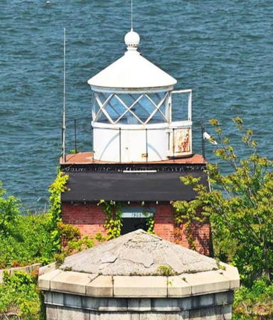
1903. Reactivated (inactive 1965-2005, now unofficial and maintained by the National Park Service; charted as a daybeacon); white light, pattern unknown. 20 ft (6 m) cylindrical lantern, painted white, atop a 1-story square red brick workroom. No keeper's quarters. Luke Crisalli's 2020 photo is at right, Robert English has a good photo, Jeremy D'Entremont has a 2008 photo, Wikimedia has a photo, Davis D. Janowski has a 2021 view from the sea, Marinas.com has aerial photos, Dinesh J. Weerakkody has a street view (with the Manhattan skyline in the left background), and Google has a satellite view. Long in disrepair, the light spent years on the Doomsday List. In 2002 Joe Esposito began a personal campaign to restore the abandoned lighthouse and for several years he spearheaded restoration work by crews of volunteers. Unfortunately, Esposito died in 2005 several months before the tower was relit on September 24. Located on the ramparts of Battery Weed, Fort Wadsworth, Staten Island, almost in the shadow of the Verrazano-Narrows Bridge (I-278). Site open; fort's visitor center open Wednesday through Sunday; tower closed. Owner: U.S. National Park Service. Site manager: Gateway National Recreation Area. ARLHS USA-301.

Fort Wadsworth Light, Staten Island, March 2020
Google Maps photo by Luke Crisalli
* Elm Tree (Swash Channel Range Front) (2)
1939 (station established 1856). Inactive since 1964. 65 ft (20 m) square cylindrical concrete tower with rounded corners. The tower is unpainted. The keeper's house has been demolished. C.W. Bash has a 2008 photo, the tower is at the right edge of another photo, and Google has a street view and an aerial view. The original lighthouse, a hexagonal wood tower, was deactivated and demolished in 1939. The light was moved to this bland building, which carried a green aviation beacon as well as a white navigation light for mariners. Both lights were discontinued in 1964 when the alignment of the range was changed, and the tower has been abandoned since then. The Swash Channel is an alternate entry to New York Bay used by smaller vessels. Located at the southeast end of New Dorp Avenue, Staten Island, in Miller Field, a former U.S. Army air field. Site open, tower closed. Owner: U.S. National Park Service. Site manager: Gateway National Recreation Area. ARLHS USA-272.
* Swash Channel Range Front (3?)
1939 (?). Active; focal plane 80 ft (24 m); continuous white light. Approx. 52 ft (16 m) square skeletal tower. Trabas has a photo and Google has a street view and an aerial view. The rear light is on the tower of the Staten Island lighthouse (see below). Located in Oakwood Beach Park off the end of Roma Avenue, a little less than a mile (1.5 km) southwest of the former location. Site open, tower closed. Admiralty J1082.1; USCG 1-35030.
New Dorp (Swash Channel Range Rear (1))
1856. Inactive since 1964. 40 ft (12 m) square wood cylindrical tower centered on the roof of a 1-1/2 story wood keeper's house. C.W. Bash has a 2008 photo, John Plate has a photo, and Google has a satellite view. Brick oil house. The light, previously shown through a window at the top of the tower, was moved to the Staten Island Light (see below) in 1964. The present owner, John Vokral, bought the abandoned building for $32,000 in 1974 and has restored it to its original appearance. He operates a civil engineering consulting business in the house. Located at 25 Boyle Street, off Richmond Road in the Richmondtown section of Staten Island. Screened by trees, the house is hard to see except in the winter. Site and tower closed. Owner/site manager: private. ARLHS USA-537.
* Staten Island Range Rear
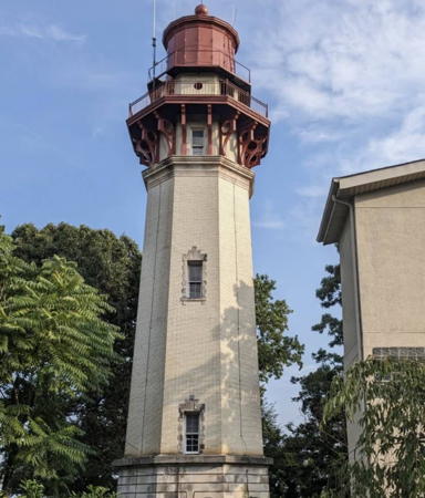
1912. Active; focal plane 231 ft (70 m); continuous white light, day and night, seen only along the Staten Island Range line; also a second continuous white light, focal plane 225 ft (68.5 m), seen only along the Swash Channel Range line. 90 ft (27 m) octagonal brick tower with lantern and gallery; original 2nd order Fresnel lens mounted in the lantern. Lantern painted black; tower is unpainted yellow brick. The brick keeper's house is a private residence. Don Cerati's 2021 photo is at right, Tatiana Hoover has a 2023 photo, C.W. Bash has a 2008 photo, Trabas has a closeup photo by Michael Boucher, Huelse has a historic postcard view, and Google has a street view and a satellite view. An architectural landmark, this is one of the last brick lighthouses built in the U.S. The light's longtime caretaker Joe Esposito retired in 2001, turning his attention thereafter to saving the Fort Wadsworth Light (see above); he passed away in 2005. In 2019 the Coast Guard licensed the National Lighthouse Museum to manage the maintenance of the tower along with Esposito's family. The rest of the property is privately owned. The Staten Island Range guides vessels on Reach B of the Ambrose Channel, the principal entrance channel for New York Harbor. The lighthouse also serves as the rear light for the Swash Channel Range. In 2022 the metalwork on the lighthouse was repainted after lead paint was removed. Located at 398 Edinboro Road, off Richmond Hill Road near La Tourette Park in the Richmondtown section of Staten Island. Site and tower closed (surrounded by private property), but the lighthouse can be seen from the street. Owner (tower): U.S. Coast Guard. Site manager: National Lighthouse Museum. . ARLHS USA-809; Admiralty J1082; USCG 1-34795 (Staten Island Light) and 1-35035 (Swash Channel Range Rear Light).

Staten Island Range Rear Light, Staten Island, June 2021
Instagram photo by Don Cerati
West Bank (Staten Island Range Front)
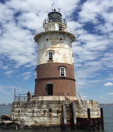
1901. Active; focal plane 69 ft (21 m); red light to the east and white to the west, 3 s on, 3 s off; higher intensity white light on range line. 55 ft (17 m) round cast iron sparkplug tower with lantern and gallery, including a 3-story round keeper's quarters, mounted on a cast iron caisson. Lighthouse painted brown, caisson black. The original 4th order Fresnel lens was removed in 1998. Fog horn (two 2 s blasts every 20 s). Valerie Barile's photo is at right, D'Entremont has a good photo, Trabas has Michael Boucher's photo, Marinas.com has aerial photos, and Bing has a satellite view. In 2007 the lighthouse was available for transfer under NHLPA, but no suitable recipients were identified. In 2008 the lighthouse was sold at auction. The auction closed on August 27 with a high bid of $245,000. However, this deal did not close. In 2010 the lighthouse was back up for auction, and in September it was sold again, this time for $195,000. The buyer, Sheridan Reilly, estimated that it would cost $50,000 just to clean the interior of bird droppings and seal the structure. Located on a reef off South Beach, Staten Island. Accessible only by boat. There are distant views from New Dorp Beach, Staten Island, and from Coney Island, Brooklyn. Site and tower closed. Owner/site manager: private. . ARLHS USA-876; Admiralty J1081.9; USCG 1-34790.
#Old Orchard Shoal (1)
1893. Destroyed by Hurricane Sandy in October 2012. This was a 45 ft (14 m) round cast iron sparkplug tower including 3-story round keeper's quarters, mounted on cast iron caisson; 250 mm lens; the lantern and upper 2/3 of the lighthouse were painted white and the lower 1/3 and caisson black. John Moura has a 2011 photo, D'Entremont has an excellent photo and Marinas.com has aerial photos. Until the 1950s this lighthouse served as the front range light of the Waackaack Range. In 2007 the lighthouse was available for transfer under NHLPA, but no suitable recipients were identified. In 2008 the lighthouse was sold at auction for $235,000. The high bidder was not identified, and an unsuccessful bidder sued to stop the sale. In September 2010 the lighthouse was auctioned again and this time the high bid was only $40,000. The government rejected this bid as being below the minimum value of the propery so a third auction was held and a high bid of $95,000 was secured in December. Sadly, the lighthouse was completely swept away by the record storm surge of Hurricane Sandy on 29 October 2012. The National Lighthouse Museum hopes the salvage the remains, which were located after a lengthy search in June 2013. The lighthouse was replaced by a light on a post (focal plane 20 ft (6 m); white flash every 6 s); Roger King has a photo and Bing has a satellite view. Located on a reef off Great Kills Harbor, Staten Island. Accessible only by boat; there is (or was) a distant view from Great Kills Park, Staten Island. Site and tower closed. Owner/site manager: private. ARLHS USA-565. Active light: Admiralty J1074; USCG 1-35395.

West Bank Light, Lower New York Bay, September 2019
Instagram photo by Valerie Barile
* Princes Bay Range Front
Date unknown. Active; focal plane 70 ft (21 m); quick-flashing red light. 69 ft (21 m) square skeletal tower, painted white. The tower also carries a rectangular daymark painted red with a white vertical stripe. Trabas has Michael Boucher's photo, Louis Rainer has a photo, and Google has a satellite view. The rear light is on a short post. The range guides vessels through a turn in the entrance channel for Raritan Bay, which comes quite close to the shore in this area. Located on the shoreline about 240 ft (75 m) east of the historic Princes Bay Light (next entry). Site and tower closed. Admiralty J1057; USCG 1-36190.
* Princes Bay (John Cardinal O'Connor) (2)
1868 (station established 1828). Inactive since 1922 (briefly reactivated in 2010); charted as a landmark. 40 ft (12 m) round brownstone tower with gallery, lantern removed, attached to a 2-1/2 story Gothic brownstone keeper's house. The Prince's Bay Range Rear Light is on a short mast nearby. A photo is at right, John Loughran has a closeup 2021 photo, Lighthouse Digest has a photo by Jim Crowley, Pedro Hernandez has a closeup photo, and Google has a satellite view. Huelse has a historic postcard view of the lighthouse when it was active. For many years the keeper's house was a Catholic children's home operated by the Mission of the Immaculate Virgin, and a statue of the Virgin Mary stood atop the tower. In 1999 the Trust for Public Land purchased 194 acres (78.5 ha), including the light station, from the Archdiocese of New York. Between 1999 and 2002 the state of New York paid $25 million in several installments to acquire the property as a nature preserve. The lantern may be restored in the future if funding can be found. The light was restored for a short time in 2010; probably it confused mariners following the range. The state has renamed the lighthouse in honor of Catholic cardinal John O'Conner, the Archbishop of New York from 1984 until his death in 2000. The keeper's house has been renovated to serve as a ranger's residence. Located at 6581 Hylan Boulevard near the southwestern tip of Staten Island. Site and tower closed, but the preserve is open and visitors can view the light station from nearby; there is a trail from the parking area for the preserve. Owner: New York State Department of Environmental Conservation. Site manager: Mount Loretto Unique Area. ARLHS USA-673; ex-Admiralty J1056; ex-USCG 1-36193.

Princes Bay Light, Staten Island, August 2018
Facebook photo posted by New York Landmarks Conservancy

Manhattan Hudson River Lighthouses
*** [Lighthouse Tender WAGL-227 Lilac]
1933. Decommissioned 1972. 174.5 ft (53 m) steam-powered steel ship. Hull painted black, superstructure white, funnel orange with a black band at the top. Harvey Barrison has a photo, Hudson River Park has a page for the ship, and Google has a street view and a satellite view. This is the only surviving steam-powered Coast Guard lighthouse tender. It served navigational aids on the Delaware River and Delaware Bay. After the decommissioning the Coast Guard donated the vessel to the Harry Lundeberg School of Seamanship in Piney Point, Maryland, where it served as classroom and dormitory space. In 1984 it was sold to Henry Houck, who had the ship moored on the James River in Virginia. After he died in 2002 his widow sold the ship to the Tug Pegasus Preservation Project, a New York nonprofit, which held the vessel until a new preservation project could be organized. The ship is under restoration, with work continuing to the present day. Moored at Pier 25 in Hudson River Park. Site open; the ship is open for tours on weekend afternoons Memorial Day weekend (late May) through October. Owner/site manager: Lilac Preservation Project.
*** Lightship LV-115 Frying Pan
1913. Decommissioned 1965. 630-ton steel ship, originally with two masts, length 133 ft (40.5 m), beam 30 ft (9 m). The aft mast has been removed. Anderson's page has photos, additional photos are available, and Google has a street view and a satellite view. The ship served at Frying Pan Shoals off Wilmington, North Carolina, and off the Delaware Capes. After deactivation the ship sank twice: at Wilmington in the 1970s and at Whitehaven, Maryland, in 1983. The present owner, John Krevey, rescued the ship from Whitehaven when he bought it in 1987. After two years of restoration work in Baltimore and Philadelphia and installation of a new engine the ship arrived in New York in 1989. The vessel remains operational and it sailed out into the harbor for OpSail 2000. Moored at Pier 66 near 23rd Street, Manhattan; this is one of one of several historic vessels in the city's Hudson River Park. Site open; vessel open daily May through September and sometimes in warm weather in April and October. Owner: private. Site manager: Frying Pan Lightship Restoration . ARLHS USA-311.
** Jeffrey's Hook ("Little Red Lighthouse")
1880 (originally at Sandy Hook Point, New Jersey; relocated to the present site in 1921). Reactivated (inactive 1947-2002, now maintained by the City of New York); red flash every 3 s. 40 ft (12 m) round cast iron tower with lantern and gallery, painted red; lantern painted white; 300 mm lens. Trish Mayo's 2020 photo is at right, Karina del Mar has a 2022 photo, Capt. Gerry Hare has a closeup, Trabas has a photo by Michael Boucher, Ethan Howell has a closeup street view, and Google has a spectacular river view and a good satellite view. The Jeffrey's Hook station was established in 1889 with two small lanterns hung on a post. The present lighthouse was made famous by a children's book, The Little Red Lighthouse and the Great Gray Bridge (1942). The tower was repainted by the New York Landmarks Conservancy in 2000. The New York Historic House Trust held a ceremony to relight the lighthouse on 19 September 2002. Located in the shadow of the George Washington Bridge (I-95) at 178th Street, Manhattan. Accessible from Lafayette Place and 181st Street by a footbridge over the West Side Highway. Site open, guided tours available the first weekend of each month April through October. Owner: City of New York Parks and Recreation. Site manager: Historic House Trust (Little Red Lighthouse). . ARLHS USA-408; Admiralty J1137.9; USCG 1-37668.

Jeffrey's Hook Light and George Washington Bridge, Manhattan,
September 2020; Instagram photo by Trish Mayo

Hudson River Lighthouses

The Hudson River flows north to south in a remarkably straight course through eastern New York State. The lower course of the river is a fjord (a drowned glacial valley), which explains its great depth. The Erie Canal, first opened in 1825, connected the upper Hudson to Lake Erie, providing a navigational route from the Great Lakes to the Atlantic and encouraging the development of New York as a major port. The Erie Canal is now part of the New York State Canal System, providing connections also to Lakes Ontario, Cayuga, Seneca, and Champlain.

Westchester County Lighthouse
Westchester County is entirely on the east bank of the Hudson north of New York City. With a population of about 1 million, it is a principal bedroom community for the city.
** Tarrytown (Kingsland Point, Sleepy Hollow)
1883. Reactivated (inactive 1961-2013); focal plane 54 ft (16.5 m); white flash every 3 s. 60 ft (19 m) round sparkplug tower with lantern and double gallery, including 4-story round keeper's quarters, mounted on cast iron caisson. Tower painted white, lantern black, caisson red. A 2024 photo is at right, Trabas has a closeup photo by Bash, Wikimedia has photos, Flavia Silva has a January 2023 photo, Marinas.com has aerial photos, the Coast Guard has a historic photo, Huelse has a historic postcard view, Christopher Monson has a closeup street view, and Google has a river view and a satellite view. Officially the Tarrytown Light, but everyone calls it the Sleepy Hollow Lighthouse. The lighthouse was prefabricated by the G.W. & F. Smith Iron Co. of Boston. The light was originally a half mile (800 m) from the east shore of the river but landfill in connection with a now-demolished General Electric plant brought the shoreline within a few feet of the lighthouse. The lighthouse has been owned by Westchester County since 1974. Lighthouse Digest has a 1995 article about early restoration of the lighthouse. In 2011 the county and the Village of Tarrytown agreed to an $800,000 plan for complete restoration of the lighthouse. However, the lowest bid received for the project in 2013 was $1.2 million. Although the restoration project remained on hold for years, the lighthouse was relit sometime in 2013. A replica 4th order Fresnel lens was installed in 2015. In July 2021 the county announced it would spend $3.3 million for a complete restoration of the lighthouse. Work on this project began in July 2022; a May 2023 photo shows work in progress and the photo at right shows the results. The lighthouse reopened to guided tours in October 2024. Located off US 9 at the end of Palmer Avenue on the east side of the river in North Tarrytown, about a mile north of the Tappan Zee Bridge (I-87). Parking is available at Kingsland Point Park; a waterfront walkway leads south to the lighthouse, which is reached from shore by a footbridge. Site open, tower open to guided tours on selected weekend dates. Owner: Westchester County Parks. Site manager: Village of Sleepy Hollow (Sleepy Hollow Lighthouse). . ARLHS USA-836; Admiralty J1138.13; USCG 1-37746.

Rockland County Lighthouses
Rockland Lake (2)
1923 (station established 1894). Active; focal plane 50 ft (15 m); white flash every 6 s. 50 ft (15 m) skeletal tower with a central column rising from a square concrete base. Skeletal tower painted black; the base and central column are white. Trabas has a photo by Michael Boucher, Jody Smith has a 2022 photo, Marinas.com has aerial photos, and Google has a satellite view. This skeletal tower replaced a sparkplug lighthouse that was demolished after its foundation failed. Huelse has a historic postcard view of the original lighthouse; notice that the lighthouse already has the lean that proved fatal. Rockland Lake is not really a lake but a broad reach of the Hudson as it emerges from the Catskill Mountains. Located in mid-river opposite Scarborough. Accessible only by boat. Site and tower closed. Owner/site manager: U.S. Coast Guard. ARLHS USA-1217; Admiralty J1138.25; USCG 1-37775.

Tarrytown Light, Sleepy Hollow, April 2024
Instagram photo by Mary Luisa
*** Stony Point (Upper)
1826 (Thomas Phillips). Reactivated (inactive 1925-1995, now unofficial and maintained by the Palisades Interstate Park Commission); focal plane 178 ft (54 m); white flash every 4 s. 30 ft (9 m) octagonal fieldstone tower, 4th order Fresnel lens (on loan from the Hudson River Maritime Museum). 1-1/2 story stone keeper's quarters. Debbie Kevern Bronkema's 2021 photo is at right, David Hughes has a photo and a closeup street view, Carol Bell has a 2023 closeup, Marinas.com has aerial photos, Huelse has a historic postcard view, and Google has a satellite view. One of two Stony Point Lights in New York; see under Lake Ontario Lighthouses on the Central and Northern New York page for the other one. The oldest lighthouse on the Hudson, this is a very rare example of a small early nineteenth century U.S. lighthouse. The Palisades Interstate Park Commission restored the exterior of the tower in 1986 and the interior in 1995. Located on the west side of the river off US 9W in Stony Point. Site open mid April through October (free), tower open to tours Wednesday through Sunday. Owner: Palisades Interstate Park Commission. Site manager: Palisades Park Conservancy (Stony Point Battlefield State Historic Site). . ARLHS USA-923.
Stony Point Lower (2)
1925 (fog bell station established 1890, light established 1902). Active; focal plane 58 ft (18 m); white flash every 4 s. 58 ft (17.5 m) square skeletal tower with a central column rising from a square concrete base. Lighthouse painted white. The tower also carries a diamond-shaped green and white daymark. Trabas has a closeup photo showing the lighthouse covered with rust, Guy Isidore has a 2016 photo, the light is also seen in Marinas.com's aerial photos, the Coast Guard has a historic photo, and Google has a satellite view. Anderson has a historic photo of the 1890 fog bell tower with the light mounted on its roof in 1902. Located on the tip of the point, a sharp promontory on the west side of the river at the northern end of Rockland Lake. Site open, tower closed. Admiralty J1138.6; USCG 1-37895.

Stony Point Light, Stony Point, August 2021
Instagram photo by Debbie Kevern Bronkema

Orange County Lighthouse
[West Point (4?)]
Date unknown (station established 1853). Active; focal plane 12 m (39 ft); quick-flashing green light. Approx. 33 ft (10 m) square cylindrical skeletal tower. Trabas has a photo (taller light on the right, #39) and Google has a river view and an indistinct satellite view. The original lighthouse was replaced by a hexagonal wood tower in 1872. At some later date (we need information!) an octagonal wood tower with lantern and gallery was built. There is a postcard view showing both lighthouses. The modern beacon is known only as Hudson River Light 39. Located on Gee's Point, the easternmost extremity of West Point, below the campus of U.S. Military Academy. Site status unknown. ARLHS USA-879; Admiralty J1139.05; USCG 1-38005.

Ulster County Lighthouses
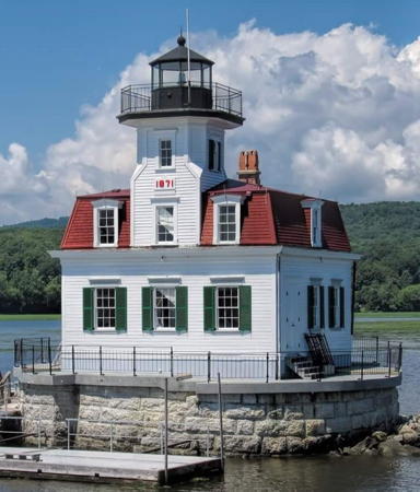
Esopus Meadows (Esopus Island, Middle Hudson River) (2)
1872 (station established 1839). Reactivated (inactive 1965-2003); focal plane 58 ft (18 m); white flash every 4 s. 55 ft (17 m) octagonal wood tower mounted on the roof of a 2-story mansard-style wood keeper's house. A photo is at right, Trabas has a photo, Michael Rider has a good 2017 photo, Marinas.com has aerial photos, and Google has a river view and a satellite view. A sibling of Colchester Reef Light, Vermont. For many years the lighthouse was endangered by ice damage and erosion. Leaning dangerously, it was added to the Lighthouse Digest Doomsday List. A local preservation group, the Save Esopus Lighthouse Commission, formed to save the lighthouse. In 2001 the lighthouse was shored up and leveled, permitting the work of restoring the interior of the building to begin. In November 2002 the state announced a grant of $45,300 to continue work on the foundation. On 31 May 2003 the light was returned to the tower from the skeletal tower where it had been displayed since 1965. Work has continued steadily and the lighthouse has been removed from the Doomsday List. In 2019 the Hudson River Maritime Museum in Kingston began offering solar-powered boat tours to the lighthouse every other Sunday July through September. Located on a tiny island west of the river channel north of Esopus; there is an excellent view from a picnic area of the Esopus Meadows Preserve on Ulster County route 24 about 4 miles (6 km) north of Esopus. Accessible only by boat; tours from the Hudson River Maritime Museum are available (reservations required). Site and tower closed. Owner/site manager: Save Esopus Lighthouse Commission . ARLHS USA-276; Admiralty J1139.7; USCG 1-38155.

Esopus Meadows Light, Esopus, October 2018
Instagram photo by Esopus Meadows Lighthouse
[Rondout Creek (Kingston) (2)]
1867 (station established 1837). Inactive since 1915. Formerly a stone tower attached to keeper's quarters. This lighthouse was demolished in 1953 after its roof collapsed; the stone foundations remain. Anderson has a photo and Google has a satellite view. Located on the south side of the mouth of the creek. Visible from boats. Site open. ARLHS USA-1309.
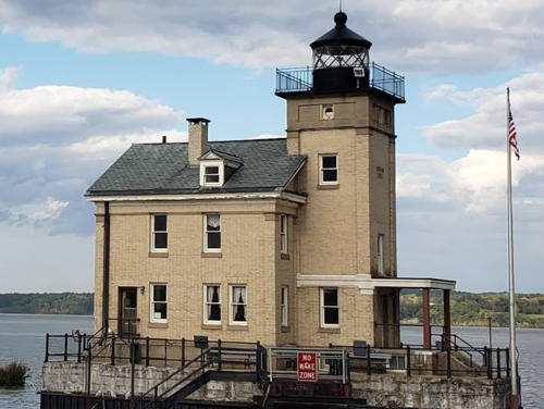
** Rondout Creek (Kingston) (3)
1915. Active; focal plane 52 ft (16 m); white flash every 6 s. 48 ft (15 m) square cylindrical brick tower with lantern and gallery, attached to a 2-1/2 story brick keeper's house; 250 mm lens. The building is unpainted gray stone, lantern and gallery painted black. Ken Marshall's photo is at right, a 2022 photo is available, Sarah Wheeler has a fine 2007 photo, Trabas has a photo, Huelse has a postcard view, and Google has a river view and a satellite view. The lighthouse was restored as a museum in 1984-88 by the City of Kingston and the Hudson River Maritime Museum. Ownership of the lighthouse was transferred to the City of Kingston on 19 June 2002. The city has proposed to build a pedestrian bridge to provide better access to the building; in 2007 it was seeking a federal grant to pay half the estimated $170,000 cost. In 2009 a contract was awarded to replace the windows and repair the entrance to the lighthouse. In 2019 the federal government granted an extension of time for the city to spend $401,736 in Hurricane Sandy relief funds for repairs to the lighthouse. Located at the end of a breakwater in the river off downtown Kingston, on the north side of Rondout Creek. Site open; museum and tower open by guided tours on Thursday through Sunday Memorial Day (late May) through October; also Wednesdays in Juky and August (reservations required). Owner: City of Kingston. Site manager: Hudson River Maritime Museum (Rondout Lighthouse). . ARLHS USA-702; Admiralty J1139.8; USCG 1-38190.

Rondout Creek Light, Kingston, August 2017
Wikimedia Creative Commons photo by Ken Marshall
** Saugerties (2)
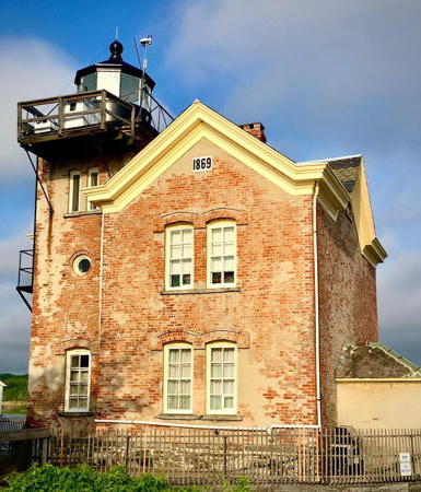
1869 (station established 1836). Reactivated (inactive 1954-1990); focal plane 42 ft (13 m); white light occulting every 4 s. 46 ft (14 m) square cylindrical brick tower with lantern and gallery, attached to a 2-story brick keeper's house. The building is unpainted red brick with white trim, lantern and gallery painted black. A 2022 photo is at the top of this page, Anderson has a page with good photos, Trabas has a closeup photo, a 2023 photo is available, Frank Rocap has a good photo, Lighthouse Digest has a November 2005 story on life at the station, Marinas.com has aerial photos, Huelse has a historic postcard view, Davri Zainoeddin has a 2016 street view, and Google has a satellite view. The lighthouse is in use as a bed and breakfast inn, but it is also open to day visitors. There is a small museum on the second floor; a 4th order Fresnel lens of uncertain origin is displayed. The lighthouse deteriorated after being deactivated and was on the point of being lost when the Saugerties Lighthouse Conservancy purchased it (for $1) in 1986. In four years the Conservancy restored the building and brought it back to life. In 2018 the Village of Saugerties used federal grants to restore and rebuild the seawall and bulkhead protecting the lighthouse. Replacement of the dock is scheduled for 2020. Located on a circular pier just offshore in the river, the lighthouse is accessible by walking the trail through the adjacent Ruth Reynolds Glunt Nature Preserve (named for the Conservancy's founder). Site open (parking near the end of Lighthouse Street, off US 9W in Saugerties); boat shuttle (toll) and guided tours of the tower are available on Sunday afternoons Memorial Day weekend (late May) through Labor Day weekend (early September) (admission fee). Owner/site manager: Saugerties Lighthouse Conservancy . ARLHS USA-739; Admiralty J1140.12; USCG 1-38375.

Columbia County Lighthouses
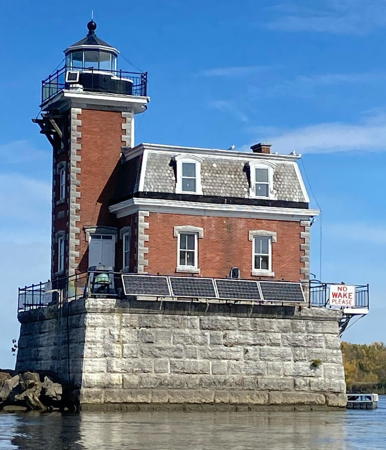
Hudson City (Hudson-Athens)
1874. Active; focal plane 46 ft (15 m); green flash every 2.5 s. 30 ft (9 m) square cylindrical brick tower with lantern and gallery, attached to square 2-story mansard-style brick keeper's house; 300 mm lens. The building is unpainted red brick with white trim, lantern and gallery painted black. The original 5th order Fresnel lens is on display at Mystic Seaport in Connecticut. Working fog bell. A photo is at right, Trabas has a good photo, Bash has a photo, a 2021 photo is available, Marinas.com has aerial photos, Huelse has a historic postcard view, and Google has a river view, a satellite view and a very distant street view. This lighthouse is very similar to the Colchester Reef Light in Vermont and many other lighthouses of New York and southern New England, but it is of brick rather than wood construction. A similar lighthouse was built at Stepping Stones (see above). The original fog bell and its clockwork mechanism are preserved. The Hudson-Athens Lighthouse Preservation Society formed in 1982 and secured a lease of the lighthouse in 1986. In August 2000 the preservation society received title to the lighthouse from the Coast Guard. In October 2003 it was discovered that the foundation of the lighthouse was sagging. The preservation society began a fund drive for repairs. A state grant of $200,000 provided a bit more than half the amount needed. In 2008, the situation having become urgent, the society took a mortgage on the lighthouse so that the repairs could be completed. Fundraising to repay the mortgage is continuing. In 2019 the cable supplying interior power for the lighthouse failed. It is too expensive to replace but there are plans for a solar power array instead. Endangered. In February 2020 the Preservation League of New York State named the lighthouse as one its "Seven to Save." In January 2022 the state parks agency granted $500,000 to replace the roof and stop water intrusion; this is part of phase 1 in a 4-phase restoration that could cost up to $6 million. In 2022 the U.S. Lighthouse Society granted $10,000 to repair the mounting of the fog bell on the exterior of the building. In 2023 engineers said the lighthouse could begin to collapse in as litttle as five years; the cost of restoration was now estimated as $7.5 million. In August the Society received a $20,008 grant to prepare a necessary condition report. In June 2024 Lighthouse Digest added the lighthouse to the Doomsday List. Located on an island in the middle of the river between Athens and Hudson. Accessible only by boat; tours are available on the second and fourth Saturdays, July through October (reservations required; check the Facebook page for details). Owner/site manager: Hudson-Athens Lighthouse Preservation Society . ARLHS USA-391; Admiralty J1140.75; USCG 1-38560.
[Mill Creek (Stuyvesant, Kinderhook) (4?)]
Date unknown (station established 1829). Active; focal plane 41 ft (12.5 m); white flash every 4 s. Approx. 36 ft (11 m) square cylindrical skeletal tower, built a few feet north of the foundations of the historic lighthouse. Trabas has a closeup photo but vegetation hides the tower in Google's satellite view. The first lighthouse was destroyed by ice in 1835, so a second was built. The third (1868) lighthouse was a handsome 2-story brick structure with attached square light tower. Sadly, it was demolished after being decommissioned in 1933. Located on a small island about 1.75 mi (2 km) north of Stuyvesant. Accessible only by boat. Site open, tower closed. ARLHS USA-824; Admiralty J1141.4; USCG 1-38765.

Hudson-Athens Light, Hudson, October 2022
Instagram photo by louiemonkeypest

Greene County Lighthouse
[Rattlesnake Island (Coxsackie) (3?)]
Date unknown (station established 1830). Active; focal plane 41 ft (12.5 m); white flash every 4 s. Approx. 36 ft (11 m) square cylindrical skeletal tower, mounted on the foundations of the historic lighthouse. Trabas has a closeup photo and Google has a river view and an indistinct satellite view. The second (1868) lighthouse was a handsome 2-story brick structure with attached square light tower. Sadly, it was demolished in 1940. The light marks a bend in the river. Located on a small island about 1.75 mi (2 km) north of Coxsackie. Accessible only by boat. Site open, tower closed. ARLHS USA-196; Admiralty J1141.25; USCG 1-38720.

Information available on lost lighthouses:

Notable faux lighthouses:

Adjoining pages: North: Central and Northern New York | East: Connecticut | Southeast: Long Island | South: New Jersey

Return to the Lighthouse Directory index

Checked and revised July 6, 2024. Lighthouses: 30. Lightships: 4. Site copyright 2024 Russ Rowlett and the University of North Carolina at Chapel Hill.