Lighthouses of Russia: Arkhangel'sk

Russia (Россия, Rossiya in Russian) is by far the world's largest country, spanning a little over 150° in longitude. It is organized as the Russian Federation (Rossiyskaya Federatsiya) with members known as federal subjects (sub'yekty federatsii). Russia is primarily a continental nation but it has important coastlines on the Baltic, Black, and Caspian Seas and very long coastlines on the Arctic Ocean and North Pacific Ocean. To guard these coasts it operates hundreds of lighthouses, many of them historic.

The northwestern corner of Russia lies on the Barents Sea, an arm of the Arctic Ocean. The broad, eastward-pointing Kola Peninsula (Kolskiy Poluostrov) separates the Barents Sea from the nearly-enclosed White Sea, which extends southward more than 500 km (300 mi). Arkhangel'sk, located at the southeasternmost point of the White Sea, became Russia's chief port under Ivan the Terrible in the mid 1500s and there has been a lively trade between Western Europe and Arkhangel'sk through these northern waters for almost 500 years.

Arkhangel'sk is the capital of of the vast Arkhangel'sk Oblast, one of the members of the Russian Federation. The approach to Arkhangel'sk is through the twisting channels of the delta of the Northern Dvina (Severnaya Dvina) River. This page lists the many range light towers along these northern waterways.

Broadly speaking, the river has three main branches (distributaries) as it approaches the sea: the Nikol'skiy Branch on the west, the Murmanskiy Branch in the center, and the Korabel'nyy Branch on the east. The Korabel'nyy Branch includes the main channel for oceangoing ships. The Nikol'skiy Branch provides a shortcut between Arkhangel'sk and the naval base at Severodvinsk (lighthouses of Severodvinsk are on the Southern White Sea page).

The Russian word for a lighthouse is mayak (маяк); ostrov is an island, mys is a cape, bukhta or guba is a bay, zaliv is a larger bay or gulf, proliv is a strait, reka is a river, and gavan' is a harbor.

Russian lighthouses are owned by the Russian Navy and maintained by the Navy's Office of Navigation and Oceanography (Управление навигации и океанографии).

ARLHS numbers are from the ARLHS World List of Lights. Russian light list (RU) numbers are from Russian Navy Publication 2105, as reported by the Admiralty. Admiralty numbers are from volume L of the Admiralty List of Lights & Fog Signals. U.S. NGA numbers are from Publication 115. The Russian light list, Огни и знаки (Lights and Signs), is not available online.
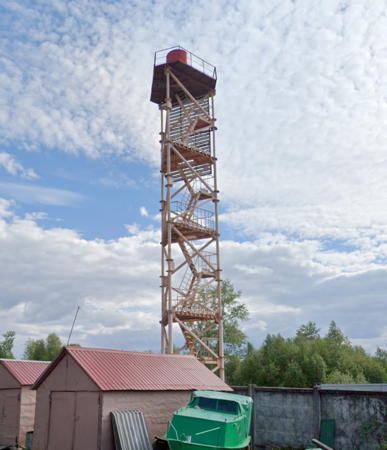
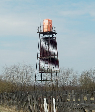
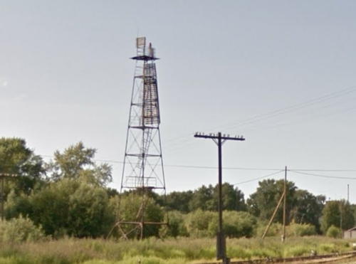
Povrakul'skiy Range Rear Light, Arkhangel'sk, May 2021
Google Maps street view
General Sources
Online List of Lights - Russia - Arctic Sea Coast
Photos by various photographers posted by Alexander Trabas.
World of Lighthouses - Arctic Coast of Russia
Photos available from Lightphotos.net.

Dvina Bay Lighthouses
Yagry
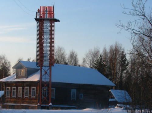
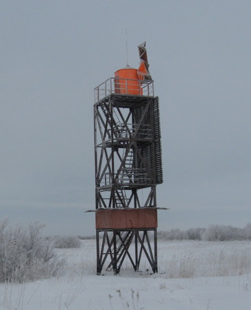
Date unknown. Reactivated; focal plane 24 m (79 ft); white flash every 4 s. 22 m (72 ft) square skeletal tower. A 2018 photo is at right, a second 2018 photo is available, Wikimapia has photos by Yevgeniy Andreev's, Vladimir Novitskiy has a closeup photo, and Google has a satellite view. The tower looks abandoned in many photos but it has been restored to life in recent years. Located on the south side of the entrance to the Nikol'skiy Branch from the White Sea at Yagry, about 16 km (10 mi) north of Severodvinsk. Site open, tower closed. ARLHS ERU-172; RU-4275; Admiralty L6950.
#Ostrov Golets
Date unknown. Inactive and apparently removed in 2013-14. 24 m (79 ft) square skeletal tower carrying a large rectangular red and white daymark. The lighthouse was clearly inactive and abandoned in Aleksandr Maksimov's 2013 photo. Bing has a satellite view. This was removed; there's no trace of it in Google's current satellite view and Sergey Zubarev has a 2014 photo of a pile of wood that may be the remains of the lighthouse. Located at the western point of Golets island, marking the north side of the entrance to the little-used Murmanskiy Branch of the delta. Accessible only by boat. Site status unknown. RU-4142; ex-Admiralty L6960.

Lower Korabel'nyy Branch Lighthouses
For lighthouses of Mudyugskiy Island, on the approaches to the Korabel'nyy Branch, see the Eastern White Sea page.

Lapominka (Lapominskiy) Range Front (2)
Date unknown. Active; focal plane 11 m (36 ft); white flash every 2 s. 10 m (30 ft) square skeletal tower. The upper third of the tower carries a slatted daymark painted black with a white vertical stripe. No photo available but Google has a satellite view. This is the entrance range for the branch, the easternmost mouth of the Dvina. Located on Ostrov Chizhov, a marshy island at the northeastern tip of the Dvina Delta. Accessible only by boat. Site status unknown. RU-3790; Admiralty L6984; NGA 16116.

Yagry Light, Yagry, June 2018
Google Maps photo by Mr Pen
Lapominka (Lapominskiy) Range Rear (2)
Date unknown. Active; focal plane 18 m (56 ft); white flash every 2 s. 16 m (52 ft) square skeletal tower. The upper third of the tower carries a slatted daymark painted black with a white vertical stripe. No photo available but Bing has a satellite view. Located 280 m (920 ft) east southeast of the front light. Accessible only by boat. Site status unknown. RU-3791; Admiralty L6984.1; NGA 16120.
Bakanskiy Range Front
Date unknown. Active; focal plane 17 m (56 ft); red flash every 1.5 s. 15 m (49 ft) square skeletal tower. The upper third of the tower carries a slatted daymark painted black with a white vertical stripe. No photo available but Google has a satellite view. This is an approach range for the river entrance. Located on the east side of the Severnaya Dvina, about 1.5 km (1 mi) southwest of the Lapominka Range Rear Light. Site status unknown. Admiralty L6981; NGA 16100.
Bakanskiy Range Rear
Date unknown. Active; focal plane 29 m (95 ft); red light, 2 s on, 2 s off. 27 m (89 ft) square skeletal tower. The upper third of the tower carries a slatted daymark painted black with a white vertical stripe. No photo available but Google has a satellite view. (Note how a swath of the forest has been cleared to provide visibility for the light.) Located on the east side of the Severnaya Dvina, about 4 km (2.5 mi) northeast of the Vasilyevskiy Range Rear Light. Site status unknown. ARLHS ERU-159; Admiralty L6981.1; NGA 16104.
Vasil'yevskiy Range Front
Date unknown. Active; focal plane 14 m (46 ft); white light, 0.75 s on, 0.75 s off. 12 m (39 ft) square cylindrical skeletal tower with gallery and a red lantern, carrying a black daymark with a white vertical stripe. Mikhail Shishov's photo is at right and Bing has a satellite view of the light. RU-3690; Admiralty L6975; NGA 16064.
Vasil'yevskiy Range Rear
Date unknown. Active; focal plane 33 m (108 ft); continuous white light. 30 m (98 ft) square skeletal tower. The upper third of the tower carries a slatted daymark painted black with a white vertical stripe. No photo available but the tower is seen in a Google satellite view. Located on the east side of the channel, 6.6 km (4.1 mi) south of the front light. Accessible only by boat. Site status unknown. ARLHS ERU-171; RU-3691; Admiralty L6975.1; NGA 16068.
Vasil'yevskiy Range Front Light
Vasil'yevskiy Range Front Light, March 2010
ex-Panoramio photo by Mikhail Shishov

Maymaksa Branch Lighthouses
The Maymaksa Branch lies to the east of the main Korabel'nyy Branch between the city and Lapominka. Ostrov Brevennik and Ostrov Solombala separate the two channels. Industrial areas line the east side of the Maymaksa Branch.

Yakusheva (Ustyanovsky Range Front)
Date unknown. Active; focal plane 19 m (62 ft); white light, 1 s on, 1 s off. 18 m (59 ft) square skeletal tower. The entire front of the tower carries a slatted daymark painted black with a white vertical stripe. No photo available but Google has a satellite view. Located at the northwestern corner of Ostrov Lisunova, a marshy island at the northern tip of the Dvina Delta. Accessible only by boat. Site status unknown. RU-3710; Admiralty L6977; NGA 16080.
Tsiolkevicha (Ustyanovsky Range Rear)
Date unknown. Active; focal plane 28 m (92 ft); quick flashing white light. 27 m (89 ft) square skeletal tower. The upper third of the tower carries a slatted daymark painted black with a white vertical stripe. No photo available but the tower is seen in a Google satellite view. Located on the south side of Ostrov Lisunova, about 1640 m (1 mi) southeast of the front light. Accessible only by boat. Site status unknown. ARLHS ERU-170; Admiralty L6977.1; NGA 16084.
Perekhodnyy Range Rear
Date unknown. Active; focal plane 18 m (56 ft); green light, 1.5 s off, 1.5 s on. 15 m (49 ft) square skeletal tower. The entire front of the tower carries a slatted daymark painted black with a white vertical stripe. No photo available but Google has a satellite view. Located about 1 km (0.6 mi) south of the Lapominka Range Rear Light. Accessible only by boat. Site status unknown. RU-3801; Admiralty L6986.1; NGA 16128.
Reushinskiy Range Front
Date unknown. Active; focal plane 17 m (56 ft); white flash every 2 s. 16 m (52 ft) square skeletal tower with a white square daymark. No photo available but Google has a satellite view. This range guides vessels northbound vessels leaving Arkhangel'sk. Located on the east side of the waterway north of Ostrov Brevennik. Site status unknown. RU-3845; Admiralty L6990.
Reushinskiy Range Rear
Date unknown. Active; focal plane 24 m (79 ft); white flash every 4 s. 24 m (79 ft) square skeletal tower with a white square daymark. No photo available but Google has a satellite view. Located about 500 m (0.3 mi) northeast of the front light. Site status unknown. RU-3846; Admiralty L6990.1.
Ekonomskiy Range Front
Date unknown. Active; focal plane 15 m (49 ft); continuous green light. 12 m (39 ft) square skeletal tower with gallery and a red lantern. The entire front of the tower carries a slatted daymark painted red with a white vertical stripe. The light is in the distance near the center of Konstantin Lukyanova's photo, Nikolay Parukhin has a street view, and Google has a satellite view. Located in Port Ekonomiya, at the northern tip of Ostrov Solombala and the junction of the Maymaksa and Kuznechikha Channels. Site status unknown. RU-3820; Admiralty L6989.
Ekonomskiy Range Rear
Date unknown. Active; focal plane 21 m (69 ft); continuous green light. 18 m (56 ft) square skeletal tower with gallery and a red lantern. The upper half of the tower carries a slatted daymark painted red with a white vertical stripe. Igor' Aleksandrov's photo is at right, the light is near the left edge in Dmitry Kotov's photo, and Google has a satellite view. Located in Port Ekonomiya, 254 m (835 ft) south of the front light. Site status unknown. RU-3821; Admiralty L6989.1.
Ekonomskiy Range Rear Light
Ekonomskiy Range Rear Light, March 2010
ex-Panoramio photo by Igor' Aleksandrov

Chizhovskiy Range Front
Date unknown. Active; focal plane 20 m (66 ft); continuous red light. 18 m (56 ft) triangular skeletal tower with gallery and a red lantern, carrying a red daymark with a white vertical stripe. Alexander Trufanov has a photo, Mikhail Shishov has a distant photo, Alexandr Lobanov has a closeup street view, and Google has a street view and a satellite view. This range guides vessels docking at Port Ekonomiya. Located on the south bank of the waterway about 1.2 km (3/4 mi) southeast of the northern end of the channel. Site status unknown. Admiralty L6988.
Chizhovskiy Range Rear
Date unknown. Active; focal plane 28 m (92 ft); continuous red light. 26 m (85 ft) triangular skeletal tower with gallery and a red lantern, carrying a red daymark with a white vertical stripe. No closeup photo available but Google has a street view and an indistinct satellite view. Located 444 m (1450 ft) southeast of the front light. Site status unknown. Admiralty L6988.1.
Bogoslovskiy Range Common Rear
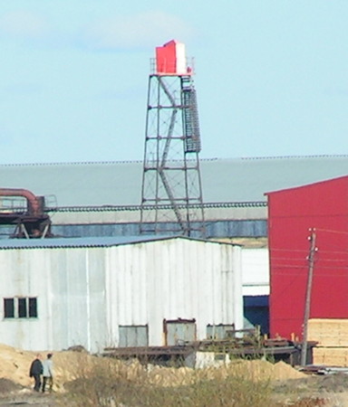
Date unknown. Active; focal plane about 23 m (75 ft); red light, pattern unknown. Approx. 16 m (52 ft) square red skeletal tower carrying red slatted daymarks with white vertical stripes. Sergei Klepikov has the photo seen at right and a second photo showing this light on the right as well as one of the front lights. Google has a satellite view. These ranges guide vessels around a bend in the Kuznechikha Channel east of Port Ekonomiya. Located on the north side of the bend. Site status unknown. Admiralty L6990.71.
Obratnyy Reushinskiy (Reushinskiy Reverse) Range Front
Date unknown. Active; focal plane 12 m (39 ft); continuous red light. 8 m (26 ft) square cylindrical skeletal tower with gallery and a red lantern, carrying a black daymark with a white vertical stripe. No photo available but Google has an indistinct satellite view. Located on the east side of the waterway just north of the village of Ust' Krivyak, about 4 km (2.5 mi) southwest of the northbound range (previous entries). Accessible only by boat. Site status unknown. RU-3850; Admiralty L6991.

Bogoslovskiy Range Common Rear Light, Port Ekonomiya, February 2009
Google Maps photo by Sergei Klepikov
Obratnyy Reushinskiy (Reushinskiy Reverse) Range Rear
Date unknown. Active; focal plane 15 m (49 ft); continuous red light. 11 m (36 ft) square cylindrical skeletal tower with gallery and a red lantern, carrying a black daymark with a white vertical stripe. No photo available but Google has a satellite view. Located about 1 km (0.6 mi) southwest of the front light. Accessible only by boat. Site status unknown. RU-3851; Admiralty L6991.1.
Osinovyy Range Rear
Date unknown. Active; focal plane 17 m (56 ft); continuous green light. 13 m (43 ft) square cylindrical skeletal tower with gallery and a red lantern, carrying a black daymark with a white vertical stripe. No photo available but Google has a satellite view. This range guides northbound vessels. Located in the northern part of the village of Ust' Krivyak. Site probably open, tower closed. RU-3866; Admiralty L6993.5.
Osinovyy Range Front
Date unknown. Active; focal plane 14 m (46 ft); continuous green light. 11 m (36 ft) square cylindrical skeletal tower with gallery and a red lantern, carrying a black daymark with a white vertical stripe. A photo is at right and Google has an indistinct satellite view. This range guides northbound vessels. Located on a pier in Ust' Krivyak. Site probably open, tower closed. RU-3865; Admiralty L6993.4.
Nizhne (Lower) Krivyakskiy Range Front
Date unknown. Active; focal plane 15 m (49 ft); continuous green light. 13 m (43 ft) square cylindrical skeletal tower with gallery and a red lantern, carrying a black daymark with a white vertical stripe. No photo available but Google has a satellite view. This range guides southbound vessels. Located in the center of Ust' Krivyak. Site probably open, tower closed. RU-3855; Admiralty L6992.
Nizhne (Lower) Krivyakskiy Range Rear
Date unknown. Active; focal plane 19 m (62 ft); continuous green light. 16 m (52 ft) square cylindrical skeletal tower with gallery and a red lantern, carrying a black daymark with a white vertical stripe. No photo available but Google has a satellite view. Located in the southern part of Ust' Krivyak. Site probably open, tower closed. RU-3856; Admiralty L6992.1.
Sredne (Middle) Krivyakskiy (No. 8) Range Front
Date unknown. Active; focal plane 17 m (56 ft); continuous red light. 15 m (49 ft) square skeletal tower with gallery and a red lantern, carrying a black daymark with a white vertical stripe. No photo available but Google has a satellite view. This range guides northbound vessels. Located on the waterfront on the east bank of the waterway opposite Ust' Krivyak. Site status unknown. RU-3875; Admiralty L6995.
Osinovyy Range Rear
Osinovyy Range Front Light, May 2005
ex-Panoramio photo copyright Tonych; permission requested
Sredne (Middle) Krivyakskiy (No. 8) Range Rear
Date unknown. Active; focal plane 21 m (69 ft); continuous red light. 19 m (62 ft) square skeletal tower with gallery and a red lantern, carrying a black daymark with a white vertical stripe. No photo available but Google has a satellite view. Located 260 m (850 ft) north of the front light. Site status unknown. RU-3876; Admiralty L6995.1.
Verkhne (Upper) Krivyakskiy (No. 7) Range Front (2)
Around 2021. Active; focal plane 22 m (72 ft); continuous green light. Until 2020 this was a 20 m (66 ft) building with the light mounted on the roof. No photo available but Bing has a satellite view of the building. The building has been demolished; Google's satellite view shows the light is now 70 m (230 ft) to the north on a skeletal tower painted with red and whote horizontal bands. This range guides northbound vessels. Located on the waterfront on the east bank of the waterway about 600 m (0.4 mi) southeast of the middle range front light. Site status unknown. RU-3880; Admiralty L6995.4.
Verkhne (Upper) Krivyakskiy (No. 7) Range Rear
Date unknown. Active; focal plane 25 m (82 ft); continuous green light. 23 m (75 ft) square skeletal tower with gallery and a red lantern, carrying a black daymark with a white vertical stripe. No photo available but Google has an indistinct satellite view. Located 333 m (1090 ft) north of the front light. Site status unknown. RU-3881; Admiralty L6995.5.
Povrakul'skiy (No. 4) Range Front
Date unknown. Active; focal plane 19 m (62 ft); continuous red light. 18 m (59 ft) square skeletal tower with gallery and a red lantern, carrying a black daymark with a white vertical stripe. No photo available but Google has a satellite view. This range guides northbound vessels. Located on the waterfront on the east bank of the waterway. Site status unknown. RU-3895; Admiralty L6998.
Povrakul'skiy (No. 4) Range Rear
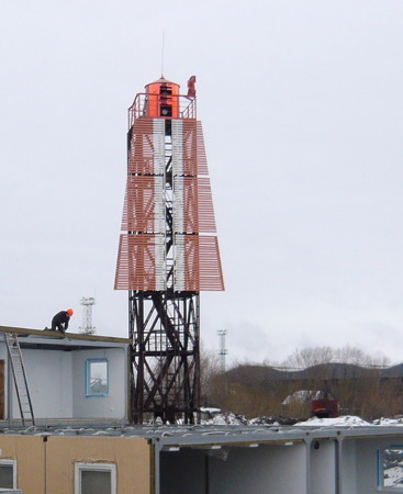
Date unknown. Active; focal plane 27 m (89 ft); continuous red light. 24 m (79 ft) triangular skeletal tower with gallery and a red lantern, carrying a black daymark with a white vertical stripe. This light was relocated about 85 m (280 ft) north about 2016. Google has a 2021 street view (also seen at the top of this page) and a satellite view of the light at its new location. Located 260 m (850 ft) north of the front light. Site status unknown. RU-3896; Admiralty L6998.1.
Nizhne (Lower) Kur'yaretskiy (No. 3) Range Rear
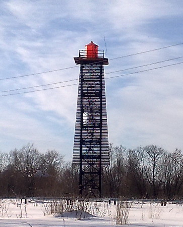
Date unknown. Active; focal plane 21 m (69 ft); continuous red light. 18 m (59 ft) square skeletal tower with gallery and a red lantern, carrying a black daymark with a white vertical stripe. Google has a street view (also seen at right) and a satellite view. This range guides southbound vessels. Located in a residential area on the east bank of the waterway near its south end. Site status unknown, probably open. RU-3901; Admiralty L6998.9.

Nizhne Kur'yaretskiy Range Rear Light, July 2012
Google Maps street view
Kur'yaretskiy Common Front
Date unknown. Active; focal plane 18 m (56 ft); two continuous green lights. 15 m (49 ft) square skeletal tower with gallery and a red lantern, carrying a black daymark with a white vertical stripe. Google has both a street view and a satellite view. Located on the east bank of the waterway near its south end. Site status unknown. RU-3900 (northbound range) and 3905 (northbound range); Admiralty L6999.
Kur'yaretskiy (No. 2) Range Rear
Date unknown. Active; focal plane 22 m (72 ft); continuous red light. 20 m (59 ft) square skeletal tower with gallery and a red lantern, carrying a black daymark with a white vertical stripe. Mikhail Shishov's photo is at right and Google has a street view and a satellite view. This range guides northbound vessels. Located 200 m (650 ft) east of the common front light. Site status unknown, probably open. RU-3906; Admiralty L6999.1.
Brevennikovskiy (No. 1) Range Front
Date unknown. Active; focal plane 17 m (56 ft); continuous green light. 14 m (43 ft) square skeletal tower with gallery and a red lantern, carrying a white daymark with a black vertical stripe. Google has a satellite view and a street view of the two range lights (this one is on the left) from across the channel. This range guides northbound vessels. Located on the waterfront on the west bank of the waterway at a sharp turn in the channel. Site status unknown. RU-3908; Admiralty L7001.
Brevennikovskiy (No. 1) Range Rear
Date unknown. Active; focal plane 20 m (66 ft); continuous green light. 16 m (52 ft) square skeletal tower with gallery and a red lantern, carrying a white daymark with a black vertical stripe. Google has a satellite view and a street view of the two range lights (this one is on the right) from across the channel. Located 200 m (660 ft) north of the front light. Site status unknown. RU-3909; Admiralty L7001.1.
Amosovskiy Range Front
Date unknown. Active; focal plane 12 m (39 ft); continuous red light. 9 m (30 ft) square skeletal tower with gallery, carrying a red daymark with a white vertical stripe. Google has a street view and an indistinct satellite view. This range guides northbound vessels. Located on the waterfront on the east bank of the waterway near its south end. Site status unknown. RU-3910; Admiralty L7002.
Amosovskiy Range Rear
Date unknown. Active; focal plane 25 m (82 ft); continuous red light. 23 m (75 ft) square skeletal tower with gallery, carrying a white daymark with a black vertical stripe. No photo available but Google has a satellite view and a distant street view. Located 315 m (1030 ft) north of the front light. Site status unknown. RU-3911; Admiralty L7002.1.
Kur'yaretskiy Range Rear Light
Kur'yaretskiy Range Rear Light, March 2010
ex-Panoramio photo by Mikhail Shishov

Lower Nikol'skiy Branch Lighthouses
Kegostrovskiy Range Rear
Date unknown. Active (?); focal plane 24 m (79 ft); continuous red light. 22 m (72 ft) square pyramidal skeletal tower carrying a white daymark with a black border. Vladimir Tikh has a distant view and Google has a street view and a good satellite view. This is a downstream range for vessels leaving Arkhangel'sk. Located on the south bank of the branch 580 m (1900 ft) west of the front light (next entry). Site status unknown. RU-4286; Admiralty L7015.41.
Kegostrovskiy Range Front
Date unknown. Active (?); focal plane 17 m (56 ft); red flash every 2.5 s. 15 m (49 ft) square skeletal tower carrying a white daymark with a black border. No photo available but Google has a fuzzy satellite view. Located on the south bank of the branch about 8 km (5 mi) west of Arkhangel'sk. Site status unknown. RU-4283; Admiralty L7015.4.
Zelenetskiy Range Front
Date unknown. Active (?); focal plane 15 m (49 ft); continuous red light. 13 m (43 ft) square skeletal tower with gallery, carrying a slatted daymark and an orange lantern with a black vertical stripe. Jaroslav Kuznetsov's photo is at right but the tower is not seen in Google's satellite view. This range guides vessels arriving in Arkhangel'sk. Located on the south bank of the branch about 5 km (3 mi) west of the Arkhangel'sk waterfront. Site status unknown. RU-4290; Admiralty L7016.
Zelenetskiy Range Rear
Date unknown. Active; focal plane 18 m (56 ft); continuous red light. 17 m (56 ft) square skeletal tower with gallery, carrying a slatted daymark and an orange lantern with a black vertical stripe. Google has a distant street view and a satellite view. Located in an industrial neighborhood on the south bank of the branch 385 m (1260 ft) southeast of the front light. Site status unknown. RU-4291; Admiralty L7016.1.
Verkhne Kegostrovskiy Range Rear
Date unknown. Active; focal plane 19 m (62 ft); red flash every 3 s. 16 m (52 ft) square skeletal tower with gallery, carrying a slatted daymark and an orange lantern with a black vertical stripe. Oleg Himanycha has a photo of the two range lights and Google has a satellite view. This range guides vessels entering the branch from Arkhangel'sk. The range towers were restored in 2011, when the city undertook a project to improve navigation on the Nikol'skiy Branch. Located on the north bank of the branch about 4 km (2.5 mi) west of the Arkhangel'sk waterfront. Site status unknown. RU-4281; Admiralty L7015.1.
Verkhne Kegostrovskiy Range Front
Date unknown. Active; focal plane 14 m (46 ft); red flash every 1.5 s. 13 m (43 ft) square skeletal tower with gallery, carrying a slatted daymark and an orange lantern with a black vertical stripe. Oleg Himanycha has a photo of the two range lights and Google has a satellite view. This range guides vessels entering the branch from Arkhangel'sk. Located on the north bank of the branch 134 m (440 ft) east of the rear light. Site status unknown. RU-4280; Admiralty L7015.
Zelenetskiy Range Front Light
Zelenetskiy Range Front Light, May 2008
ex-Panoramio photo by Jaroslav Kuznetsov

Arkhangel'sk Harbor Lighthouses
Udel'ninskiy Range Front
Date unknown. Active; focal plane 20 m (66 ft); continuous red light. 18 m (56 ft) square skeletal tower with gallery and a red lantern, carrying a black daymark with a white vertical stripe. No photo available but Google has a satellite view. This range guides northbound vessels. Located on the waterfront on the west bank of the waterway at a sharp turn in the channel. Site status unknown. RU-3960; Admiralty L7004.
Udel'ninskiy Range Rear
Date unknown. Active; focal plane 28 m (92 ft); continuous red light. 25 m (82 ft) square skeletal tower with gallery and a red lantern, carrying a black daymark with a white vertical stripe. No photo available but Google has a satellite view. Located 300 m (980 ft) north of the front light. Site status unknown. RU-3961; Admiralty L7004.1.
Bakaritskiy Range Front
Date unknown. Active; focal plane 15 m (49 ft); continuous red light. 10 m (33 ft) lantern mounted on the roof of a large waterfront warehouse. Google has a satellite view. Located on the west side of a side channel of the river just above Arkhangel'sk. Site status unknown. RU-4030; Admiralty L7009.4.
Bakaritskiy Range Rear (?)
Date unknown. Probably removed; listed with focal plane 25 m (82 ft); continuous red light. 21 m (69 ft) square skeletal tower with gallery carrying a red daymark with a white vertical stripe. Google had the former street view seen at right and Bing has a satellite view, but the light is not seen in any recent Google satellite view. Located 480 m (1575 ft) south of the front light. Site status unknown. RU-4031; Admiralty L7009.41.

Bakaritskiy Range Rear Light, July 2012
ex-Google Maps street view

Information available on lost lighthouses:

Adjoining pages: North: Eastern White Sea | West: Southern White Sea

Return to the Lighthouse Directory index | Ratings key

Posted December 7, 2005. Separate page created October 28, 2011. Checked and revised March 28, 2024. Lighthouses: 47. Site copyright 2024 Russ Rowlett and the University of North Carolina at Chapel Hill.