Lighthouses of the United Kingdom: Southwestern Scotland

The United Kingdom (officially the United Kingdom of Great Britain and Northern Ireland) includes England, Scotland, Wales, and Northern Ireland. Occupying the northern third of the island of Great Britain, the kingdom of Scotland has shared its monarch with England since 1603 and has been part of the United Kingdom since 1707. The coastline of the country is deeply cut by inlets, and there are more than 790 islands. The country has a long and distingushed maritime history; many of the most famous British captains and navigators have been Scots.

Scotland was divided historically into 34 counties; the counties no longer have any administrative function although they continue to have cultural significance. Most of them survive as lieutenancy areas, the areas used for the ceremonial lord-lieutenants, the monarch's representatives. Since 1996 the country has been divided into 32 council areas for the purposes of local government. This page covers lighthouses of southwestern Scotland from the Glasgow area southward, including the the south side of the Clyde estuary and the council areas of Renfrewshire, Inverclyde, North Ayrshire, South Ayrshire, and Dumfries and Galloway.

The Scottish word loch is used both for lakes and for inlets of the sea; a firth is a larger bay or strait and a mull is a rounded headland. The Scottish Gaelic phrase for a lighthouse is taigh solais; eilean is an island, sgeir is a skerry or rock, and rubha or àird is a cape or promontory.

The Northern Lighthouse Board , established by an act of Parliament in 1786, manages the major lighthouses of Scotland and the Isle of Man. For five generations engineers of the Stevenson family created for the Board a network of elegant and durable lighthouses famous around the world. Most of these lighthouses remain in service today.

ARLHS numbers are from the ARLHS World List of Lights. Admiralty numbers are from Volume A of the Admiralty List of Lights & Fog Signals. U.S. NGA numbers are from Publication 114.

General Sources
Northern Lighthouse Board - Lighthouse Library
The Board's web site includes information and photos for the major NLB lighthouses.
Michael's Comprehensive List of Scottish Lights
Data and photos posted by Michael Spencer. Section L includes the lights of Ayrshire and Dumfies and Galloway and Section K includes the lights of the Clyde waterway.
UK Lighthouse Tour
A wonderful blog on U.K. lighthouses written by Sarah Kerr.
Lighthouse Archives
Lighthouse information from LighthouseAccommondations.uk.
United Kingdom Lighthouses
Aerial photos posted by Marinas.com.
 
Lighthouses in Scotland
Photos available from Wikimedia; many of these photos were first posted on Geograph.org.uk.
World of Lighthouses - Scotland
Photos by various photographers available from Lightphotos.net.
Online List of Lights - Scotland
Photos by various photographers posted by Alexander Trabas.
The Stevensons
The history of Scotland's remarkable family of lighthouse engineers.
Britische Leuchttürme auf historischen Postkarten
Historic postcard images posted by Klaus Huelse.
GPSNauticalCharts
Nautical chart information for this area.
Navionics Charts
Navigation chart for Scotland.

Cloch Point Light
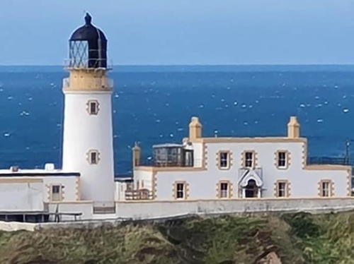
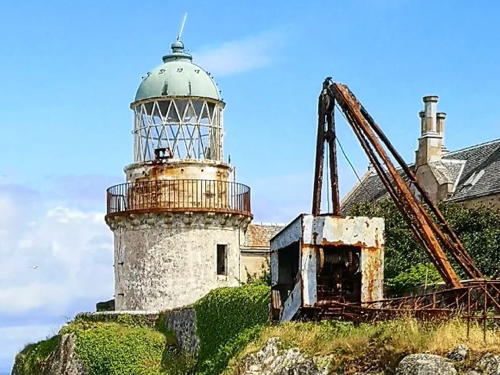
Cloch Point Light, Inverclyde, July 2012
Geograph Creative Commons photo by Thomas Nugent

Dumfries and Galloway Lighthouses

Dumfries and Galloway is a council area located on the north side of Solway Firth, a funnel-shaped inlet of the Irish Sea that separates southwestern Scotland from northwestern England. The modern council area unites the historic counties (and current lieutenancy areas) of Dumfriesshire, Kirkcudbrightshire, and Wigtownshire; the latter two are known collectively as Galloway.

Solway Firth Lighthouses
*** Southerness
1748 (initially an unlit daybeacon; rebuilt in the 1790s and in 1812 by Robert Stevenson). First lit around 1800; inactive 1867-1894 and since 1931. 10 m (33 ft) square cylindrical granite tower with lantern. Tower painted white; lantern is brown. The lantern is inset into the tower with brick behind. A 2020 photo is at right, William Hingston has a 2021 photo, Anne Burgess has a 2009 photo, Walter Baxter has a 2011 photo, Wikimedia has many photos, Marinas.com has aerial photos, and Google has a street view and a satellite view. This unusual, much-altered lighthouse, the second oldest in Scotland, was originally built by the Dumfries Town Council. After the Northern Lighthouse Board declined to accept the lighthouse it was operated by the local navigation authority from 1795 to 1867 and then by a private landowner from 1894 to 1931. The lighthouse has been refurbished and repainted recently by its current owners, who operate a nearby caravan park (RV campground). However, the lighthouse is probably endangered by rising sea level. Located on the beach under the Southerness headland on the north side of Solway Firth, off the A710 highway about 25 km (15 mi) south of Dumfries. Accessible by road. Site open and tower open, although the gallery is unsafe and is closed. Owner/site manager: Lighthouse Leisure Caravan Park. . ARLHS SCO-223.
* Hestan Island (2)
1996 (station established 1893). Active; focal plane 42 m (138 ft); two white flashes every 10 s. 7 m (23 ft) square cylindrical skeletal tower, enclosed by vertically slatted white daymark panels. Walter Baxter has a photo, a closeup is available, and Google has a satellite view. According to Wikipedia's article, a lighthouse was built on the island by Alan Stevenson in 1850, but no source has been found to confirm this and it appears to be an error. The 1893 light was on a "white store house." Hestan is a small island in the mouth of Auchencairn Bay, about 20 km (13 mi) west of Southerness. The island is accessible at low tide by a gravel bar about 800 m (1/2 mile) long. Located on heights on the east side of the island. Site open, tower closed. Operator: Northern Lighthouse Board. ARLHS SCO-095; Admiralty A4640; NGA 4832.
Kirkcudbright Lifeboat House
Date unknown. Active; focal plane 7 m (23 ft); white flash every 3 s. Light mounted atop the 1-story boathouse. Trabas has a photo and Google has a satellite view. The boathouse faces northwest, so the light is useful mostly for vessels outbound from Kirkcudbright. Located on the east shore of Kirkcudbright Bay, a shallow inlet of Solway Firth. Site status unknown. Admiralty A4636.

Southerness Light, Southerness, February 2020
Instagram photo by visitsouthwestscotland
Little Ross Range Front
Date unknown. Active; focal plane 21 m (69 ft); two white flashes every 5 s. 10 m (33 ft) square white solid stone tower; an external ladder provides access to the light. Trabas has a photo and Google has a satellite view. This is an outbound range guiding vessels departing Kirkcudbright Bay. Located at the north end of Little Ross Island, a small island at the western side of the entrance to the bay. Accessible only by boat. Site and tower closed. Admiralty A4633.99; NGA 4827.
Little Ross (Range Rear)
1843 (Alan Stevenson). Active; focal plane 50 m (165 ft); white flash every 5 s. 22 m (66 ft) round masonry tower with lantern and gallery, attached to a 1-story keeper's house. Lighthouse painted white with buff trim; lantern painted black. David Collin's photo is at right, Trabas has a photo, Lighthouse Accommodations has a page for the lighthouse, Neville King has a 2021 drone view, Lighthouse Digest has a historic photo, Marinas.com has aerial photos, and Google has a satellite view of the light station. A notorious crime occurred at this station: assistant keeper Robert Dickson murdered relief keeper Hugh Clark in August 1960. The 4th order Fresnel lens used here was placed on display at the Stewartry Museum in Kirkcudbright in December 2014. The station is now a private residence. In July 2017 the 11.7 ha (29 acre) island and the keeper's house were for sale for £325,000. In January 2023 plans were announced to restore the unroofed keeper's cottages for holiday rental. Located atop a small island at the western side of the entrance to Kirkcudbright Bay. Accessible only by boat. Site and tower closed. Operator: Northern Lighthouse Board. ARLHS SCO-125; Admiralty A4634; NGA 4828.
* Isle of Whithorn
Date unknown. Active; focal plane 20 m (66 ft); flash every 3 s, white or red depending on direction. 4 m (13 ft) square stone tower, painted white. Trabas has a closeup photo, and Google has a satellite view and a closeup street view. According to Mike Garrett, who has a closeup photo, this small tower was formerly a signal tower. Despite its name, Isle of Whithorn is not an island; it is a fishing port at the western entrance to Wigtown Bay. Located on Isle Head, a promontory on the east side of the entrance to the harbor (the promontory was actually an island in the distant past). Site open, tower closed. Operator: Dumfries and Galloway Council Harbours. ARLHS SCO-357; Admiralty A4624.2; NGA 4823.5.
 

Little Ross Light, Kirkcudbright, 2009
Wikimedia Creative Commons photo by David R. Collin
 

Rhins of Galloway Lighthouses

The Rhins of Galloway is a hammerhead-shaped peninsula, the southernmost extension of Scotland. The word rhin is from an old Gaelic word for a promontory or point of land. The peninsula faces County Antrim in Northern Ireland across the North Channel, the strait connecting the Irish Sea to the Atlantic Ocean.
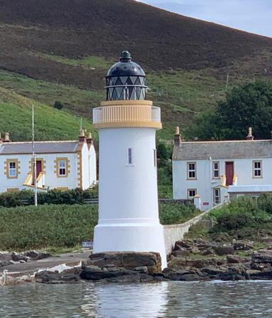
**** Mull of Galloway
1830 (Robert Stevenson). Active; focal plane 99 m (325 ft); white flash every 20 s. 26 m (85 ft) round masonry tower with lantern and gallery, attached to a 1-story keeper's house. Lighthouse painted white with buff trim; lantern painted black. Paul Stevenson's photo is at right, Trabas has a closeup photo by Arno Siering, Marceline Smith has a 2021 photo, Wikimedia has many photos, Lighthouse Accommodations has a page for the light station, Marinas.com has aerial photos, Huelse has a historic postcard view, and Google has a street view and a satellite view. This famous and historic light station stands on the southernmost point of Scotland and at the northern end of the Irish Sea, marking the entrance to the North Channel and to the Solway Firth. It is one of only two Northern Lighthouse Board lighthouses open for climbing. The Mull of Galloway Visitor Centre , adjacent to the light station, occupies a building that originally housed the workers building the lighthouse. The keeper's houses are available for vacation rental . A coffee shop was added to the site in 2004. Much of the surrounding area is a bird sanctuary managed by the Royal Society for the Protection of Birds. In 2013 the Mull of Galloway Trust received a grant of £338,500 to buy the Northern Lighthouse Board's property, except for the lighthouse itself. Note: the word mull is a corruption of a Gaelic word maol for a bare hill or a rounded headland; the Gaelic name of the cape is Maol nan Gall. Located atop a vertical cliff at the southern tip of the Rhins of Galloway about 8 km (5 mi) south of Drummore. Accessible by road, parking provided. Site open, visitor center open daily April through mid September, tower open daily in July and August, also on Saturdays and Sundays mid April through June and in September and October (check the Trust web site for current information). Operator: Northern Lighthouse Board. Site manager: South Rhins Community Development Trust. . ARLHS SCO-144; Admiralty A4610; NGA 4816.
Crammag Head (2)
2009 (station established 1913). Active; focal plane 35 m (115 ft); white flash every 10 s. 7 m (23 ft) round cylindrical fiberglass tower with lantern and gallery, painted white, mounted on a concrete pad. Trabas has Eckhard Meyer's photo, Michael Lindley has a good photo, David Hambidge has a good photo, John Tochel has a 2022 photo, Sarah Kerr has photos and reports on her visits, and Google has a satellite view. The new light was activated in December 2009. Huelse has a historic postcard view of the original lighthouse, a square stone tower. Located on a promontory about 8 km (5 mi) northwest of the Mull of Galloway lighthouse. Site and tower closed (private property). Operator: Northern Lighthouse Board. . ARLHS SCO-055; Admiralty A4608; NGA 4812.
Mull of Galloway Light
Mull of Galloway Light, Drummore, September 2009
Wikimedia Creative Commons photo by Paul Stevenson
* Port Logan
Early 1830s. Long inactive. Approx. 9 m (29 ft) round stone tower with a small stone lantern, attached to part of a ruined stone harbor wall. M. Campbell has a nice closeup, a 2022 photo and a 2008 photo are available, Marinas.com has aerial photos, and Google has a street view and a satellite view. The engineer Thomas Telford designed Port Logan Harbour around 1820 and the lighthouse was added about 10 years later. The picturesque village and its lighthouse became well known when they appeared in a popular BBC television drama series Two Thousand Acres of Sky. Located at the south side of the harbor at Port Logan, about 8 km (5 mi) south of Ardwell. Site open, tower closed. Owner/site manager: unknown. . ARLHS SCO-314.
** Portpatrick (Port Patrick) (3)
1839 (station established 1774). Inactive since 1900; sometimes lit decoratively on holidays. Approx. 11 m (36 ft) round cylindrical brick tower with lantern and gallery. Tower is unpainted yellow brick; lantern painted white with a black roof. Ann Cook has a good 2010 photo (also seen at right), Karl Hillman has a 2022 closeup, a 2008 photo is available, Marinas.com has aerial photos, Huelse has a historic postcard view, Google has a street view, and Bing has a satellite view. In the early 1900s the light was shone landward as a streetlight. The original lighthouse is said to have been dismantled and shipped for reassembly in Sri Lanka, then called Ceylon. The tower is privately owned; Michael Spencer reports that the keys are kept at the Lighthouse Pottery nearby and "polite enquiry will secure their loan." Located on the south side of the harbor entrance in Portpatrick. Site open, tower open by arrangement. Owner/site manager: private. . ARLHS SCO-177.

Portpatrick Light, Portpatrick, September 2010
Geograph Creative Commons photo by Ann Cook
* Portpatrick Range Rear
Date unknown. Active (privately maintained); focal plane 8 m (26 ft); continuous green light. Light attached to the side of a 2-story house on the east side of Main Street, Portpatrick. Trabas has a photo, Google has a street view, and Bing has a satellite view. The front light is on a small post. Located at the intersection of Main Street and Hill Street. Site open, tower closed. Admiralty A4607.1; NGA 4808.
* Killantringan (Black Head)
1900 (David A. Stevenson). Inactive since 2007. 22 m (72 ft) round masonry tower with lantern and gallery, attached to a 1-story keeper's house. Lighthouse painted white with buff trim; lantern painted black. The keeper's house is now a private residence. David Brown's photo is at right, a 2008 photo is available, Wikimedia has photos, Marinas.com has aerial photos, Huelse has a historic postcard view, and Google has a satellite view and a distant street view. In 2015 the keeper's house went on sale for £500,000. As of 2023 the keeper's house is available for vacation rental through Airbnb . Located on Black Head, on the western side of the Rhins of Galloway about 2.5 km (1.5 mi) north of Portpatrick. Accessible by road off the B738 highway; there is also a hiking trail, the first (or last) section of the Southern Upland Way, from Portpatrick. Parking is available at a popular viewpoint about 400 m (1/4 mi) north of the lighthouse. Site appears open and the lighthouse can also be seen from a distance. Tower closed. Owner (lighthouse): Northern Lighthouse Board. Site manager: private. . ARLHS SCO-111; ex-Admiralty A4606; ex-NGA 4800.

Killantringan Light, Portslogan, January 2014
Geograph Creative Commons photo by David Brown
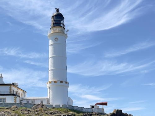
** Corsewall
1817 (Robert Stevenson). Active; focal plane 34 m (112 ft); five white flashes every 30 s. 34 m (112 ft) round masonry tower with lantern and gallery, attached to 2-story keeper's house. Lighthouse painted white with buff trim; lantern painted black. The keeper's house has been converted into a small hotel. A photo by Mary and Angus Hogg is at right (note that the Irish coast is on the horizon to the left of the lighthouse), W.F. Millar has a good photo, Trabas has an excellent closeup photo by Eckhard Meyer, Sharon Thomson has a 2023 photo, Wikimedia has several photos, Marinas.com has aerial photos, Huelse has a historic postcard view, and Google has a street view and a satellite view. This is the landfall light for ferries from Larne and Belfast to Stranraer. In early 2008 the lighthouse and hotel were listed for sale. The hotel was purchased late in 2020 by an English couple, John Harris and Helen Mason; they have renovated and reopened the hotel and may offer tours for the public. Located on the northern tip of the Rhins of Galloway about 8 km (5 mi) northwest of Kirkholm. Accessible by road. Site open, tower closed. Operator: Northern Lighthouse Board. Site manager: Corsewall Lighthouse Hotel . ARLHS SCO-052; Admiralty A4604; NGA 4796.

Loch Ryan Lighthouse
* Loch Ryan (Cairnryan Point)
1847 (Alan Stevenson). Active; focal plane 14 m (46 ft); two red flashes every 10 s. 15 m (49 ft) round masonry tower with lantern and gallery, attached to a 1-story equipment building. Lighthouse painted white with buff trim; lantern painted black. Lighthouse Accommodations also has a page for the lighthouse, Trabas has a good photo, Jean-Claude Lüscher has a 2019 photo, Wikimedia has several photos, Marinas.com has aerial photos, and Google has a street view and a satellite view. Loch Ryan is the bay behind the northern arm of the hammerhead-shaped Rhins of Galloway. The light guides ferries sailing to and from the Cairnryan Ferry Port, with frequent service to Belfast and Larne in Northern Ireland. NLB restored and repainted the lighthouse in 2021. Located on a promontory just off the A77 highway at Cairn Ryan, on the east side of the loch about 2.5 km (1.5 mi) north of the ferry port. Site and tower closed (fenced), but the lighthouse can be seen from nearby. Operator: Northern Lighthouse Board. ARLHS SCO-029; Admiralty A4592; NGA 4784.
Corsewall Light
Corsewall Light, Kirkholm, February 2010
Geograph Creative Commons photo by Mary and Angus Hogg

South Ayrshire Lighthouses

The historic county of Ayrshire faces west on the lower Firth of Clyde, a broad embayment between the mainland and the Kintyre Peninsula. The historic county is now divided into three council areas, South Ayrshire, North Ayrshire, and East Ayrshire. South Ayrshire includes the former Ayrshire distict of Kye and Carrick.

Girvan Area Lighthouses
Ailsa Craig
1886 (Thomas and David Stevenson). Active; focal plane 18 m (60 ft); white flash every 4 s. 11 m (36 ft) round cylindrical masonry tower with lantern and gallery, attached to a 1-story keeper's house complex. The original Fresnel lens is displayed at the Museum of Scottish Lighthouses in Fraserburgh. A photo is at right, Lighthouse Accommodations also has a page for the lighthouse, Jack Boyle has a 2007 photo, Wikimedia has several photos, Darren Eves has a 2018 photo, Trabas has Eckhard Meyer's distant view from the sea, Marinas.com has aerial photos, Huelse has a historic postcard view, and Google has a satellite view of the station. Ailsa Craig is a spectacular conical mountain, the eroded granite plug of a long-extinct (Paleogene) volcano, rising 338 m (1109 ft) above the sea about 15 km (9 mi) west of Girvan. The granite has long been used for curling stones. Pigeons were used to carry messages to and from the lighthouse until 1935. The lighthouse was automated in 1990 and converted to solar power in 2001. The island is privately owned and in 2013 it was for sale for £1.5 million. In 2018 the owner placed the four abandoned keeper's cottages on sale for £175,000. The lighthouse is located at Foreland Point on the eastern side of the island. Accessible only by boat; tours from Girvan are available. Site open, tower closed. Operator: Northern Lighthouse Board. . ARLHS SCO-002; Admiralty A4582; NGA 4768.
* Girvan South Pierhead
Date unknown (around 1890?). Active; focal plane 8 m (26 ft); two continuous green lights, one above the other. 6 m (20 ft) round cast iron tower, painted white. Lantern removed; the lights are mounted on a short mast atop the tower. Trabas has a good closeup, W.F. Millar has a 2007 closeup, Eric Firley also has a photo, Huelse has a historic postcard view, Walter Kreis has a closeup street view, and Google has a satellite view. Located at the end of the breakwater at Girvan; accessible by walking the breakwater. Site open, tower closed. Operator: South Ayrshire Council. ARLHS SCO-296; Admiralty A4588; NGA 4776.

Ailsa Craig Light, Firth of Clyde, April 2011
Geograph Creative Commons photo by Rude Health
Turnberry
1873 (Thomas and David Stevenson). Active; focal plane 29 m (95 ft); white flash every 15 s. 24 m (79 ft) round masonry tower with lantern and gallery, attached to a 2-story keeper's house. Lighthouse painted white with buff trim; lantern painted black. A 2022 photo is at right, Lighthouse Accommodations also has a page for the lighthouse, Trabas has a fine photo, Paul Ainsworth-Lord has a 2019 photo, a 2022 closeup is available, Wikimedia has several distant views, Marinas.com has aerial photos, Huelse has a historic postcard view, Matt Whiting has a 2021 street view, and Google has a satellite view. The lighthouse was built to warn ships away from the Bristo Rock offshore. It now stands on the 10th hole of a large and well known golf resort, site of the Open Championship in 1977, 1986, 1994, and 2009. In May 2012 it was proposed that the lighthouse be deactivated; instead, it was solarized and downgraded in importance in October 2013. Donald Trump purchased the resort in April 2014. In February 2015 the Trump Organization announced plans to renovate the lighthouse for overnight accommodations as part of the resort; completed in June 2016, the lighthouse suite rents for an eye-popping £3500 per night. The keeper's house is a restaurant, the King of Scots. Located just off the A719 coastal road about 1.5 km (1 mi) north of the A77 at Turnberry. Site restricted to resort guests, tower closed. Operator: Northern Lighthouse Board. Site manager: Trump Turnberry Resort. . ARLHS SCO-248; Admiralty A4580; NGA 4772.

Ayr Area Lighthouses
* Dunure Harbour
1811. Inactive since around 1850. 4 m (13 ft) round sandstone tower with an opening on the seaward side; the top of the tower is an open chimney. A fire was built in the tower when vessels were approaching. A stone wall attached to the lighthouse concealed the fire until the vessels were clear of nearby shoals: a very unusual "sectoring" of an open fire light. Ann Cook has a 2013 photo and a more distant view, a closeup of the rear of the tower is available, and Google has a street view and a satellite view. This little tower is a rare survivor of a much earlier day in lighthouse history. Michel Forand spotted photos of this forgotten lighthouse and Michael Spencer visited the site in November 2007 to determine its history. It was abandoned when local coal seams played out in the 1850s and coal was no longer shipped from the harbor. The tower has been placed on the Buildings at Risk Register for Scotland. Located on the west breakwater at Dunure, a village about 8 km (5 mi) southwest of Ayr. ARLHS SCO-372.

Turnberry Light, Turnberry, June 2022
Instagram photo by golfinggirlscotland
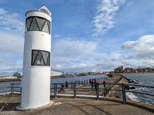
* Ayr South Pier
1877. Active; focal plane 7 m (23 ft); quick-flashing white light; also a continuous green light at 5.5 m (18 ft). 6 m (20 ft) round cylindrical cast iron tower, painted white. The lights are displayed through two windows in the tower. Phil Halson has a 2022 photo, Trabas has a closeup photo, Huelse has a historic postcard view, and Google has a satellite view and a street view from the base of the pier. An unusual old pierhead light. Located at the end of the south breakwater mole at Ayr. Accessible by walking the mole. Site open, tower closed. Operator: Port of Ayr. ARLHS SCO-292; Admiralty A4568; NGA 4760.
Ayr Harbour Range Front (2)
1841 (station established 1790) (Robert Paton). Active; focal plane 10 m (33 ft); continuous red light. 6 m (20 ft) round tower with lantern, mounted on a square stone base. Tower painted red, lantern white; the stone base is unpainted. Trabas has a good photo, Sarah Kerr has a photo shwoing both range lighthouses, and Google has a satellite view. Located at the foot of Harbour Street in Ayr, next to the pilot house. Site and tower closed. Operator: Port of Ayr. ARLHS SCO-293; Admiralty A4574; NGA 4752.
Ayr Harbour Range Rear (2)
1841 (station established 1790) (Robert Paton). Active; focal plane 18 m (58 ft); red light, 8 s on, 2 s off. 22 m (72 ft) round masonry tower with lantern and gallery. Tower unpainted, lantern and gallery painted white. Trabas has a photo by Arno Siering, Gennady Suschenko has a closeup photo, Sarah Kerr has a photo shwoing both range lighthouses, and Google has a street view and a good satellite view. Located at the foot of Harbour Street in Ayr. Site and tower closed but the lighthouse can been from South Harbour Street across the River Ayr. Operator: Port of Ayr. ARLHS SCO-294; Admiralty A4574.1; NGA 4756.
[Ayr North Breakwater (2)]
2019 (?) (station established 1913). Active; focal plane 9 m (30 ft); quick-flashing red light. 5 m (17 ft) post mounted on a square platform supported by piles. This light replaced a square cast iron skeletal tower with enclosed upper portion, painted white. Trabas has Jim Smith's photo and Google has a satellite view. William Reynolds has a 2008 photo of the original lighthouse. Located at the end of a short detached breakwater on the north side of the entrance to Ayr Harbour. Accessible only by boat. Site open, tower closed. Operator: Port of Ayr. Admiralty A4566; NGA 4764.

Troon Area Lighthouses
Lady Isle
1903 (David A. and Charles Stevenson). Active; focal plane 19 m (62 ft); four white flashes every 30 s. Approx. 15 m (49 ft) pyramidal concrete tower with lantern, gallery, and external spiral stairway. Lighthouse painted white with a red vertical stripe on each face. Robert Dawson's photo is at right, Trabas has a view from the sea, Craig Brennan has a 2022 view from the sea, Wikimedia has several photos, Marinas.com has aerial photos, Huelse has a historic postcard view, and Google has a satellite view. Richard Webb's photo was taken in 2000 before the red stripes were added. This is an unusual lighthouse; its cross-section is the shape of a plus sign (+) and the stairway spirals up around an iron pole placed next to the tower. South of the lighthouse (and on the right in Dawson's photo) is a conical 18th century rubblestone tower about 10 m (33 ft) tall that served as a daybeacon before the lighthouse was built. The island is a bird sanctuary owned by David Kennedy, Marquess of Ailsa; landing is forbidden without special permission. Located about 5 km (3 mi) west southwest of Troon. Site and tower closed. Operator: Northern Lighthouse Board. ARLHS SCO-117; Admiralty A4562; NGA 4744.
Troon Pierhead (3)
2010 (station established 1848). Active; focal plane 11 m (36 ft); two flashes, white or green depending on direction, every 6 s. 8 m (26 ft) round cylindrical cast iron tower with lantern and gallery, on a concrete base. Lighthouse painted white with black trim. Rick Waterworth has a photo and Google has a satellite view and a distant street view. Ian Paterson has a 2008 closeup showing the earlier (1904) lighthouse, Trabas has a photo, Marinas.com has aerial photos, and Sarah Charlesworth has a 1973 photo. Located at the end of the west pier, which also functions as a breakwater for Troon Harbour. Accessible by walking the pier. Site and tower closed. Operator: Port of Troon. ARLHS SCO-247; Admiralty A4554; NGA 4732.

Lady Isle Light, Troon, October 2015
Flickr photo copyright Robert Dawson; permission requested

North Ayrshire Lighthouses

The North Ayrshire council area includes, in addition to the northern part of historic Ayrshire, the Isle of Arran and the Cumbrae Islands that were formerly in the historic County of Bute. The current lieutenancy area of Ayrshire and Arran includes these islands as well as all three Ayrshire county area.

Ardrossan Lighthouse
* Ardrossan Pierhead (2)
1898 (station established 1840). Active; focal plane 11 m (36 ft); white or green light, depending on direction, 2 s on, 2 s off. 9 m (29 ft) octagonal cylindrical cast iron tower with lantern and a narrow gallery. mounted on a square black stone base. Lighthouse painted white, lantern roof black. W.F. Millar has a good photo, George Gallagher has a good closeup photo, Trabas has a photo, Marinas.com has good aerial photos, and Google has a street view and a satellite view. Located at the end of the ferry pier in Ardrossan; ferries depart from this pier for Brodick on the Isle of Arran. Accessible by walking the pier. Site open, tower closed. Operator: Clydeport. ARLHS SCO-317; Admiralty A4538; NGA 4704.

Isle of Arran Area Lighthouses
The Isle of Arran is the largest island of the Firth of Clyde. Located on the west side of the firth, it is closer to the Kintyre Peninsula than it is to the rest of North Ayrshire. Arran is accessible by ferry from Ardrossan on the east side of the firth. Its lighthouses, however, are on two smaller islands just offshore: Holy Isle to the east and Pladda to the south.

Pladda (Low)
Early 1790s. Inactive since 1901. 13 m (43 ft) masonry tower with lantern and gallery, painted white with buff trim, located near the base of the high tower. James Stringer's photo is at right and Trabas has an excellent photo by Ina Rendtel. This light was added to distinguish Pladda from other lights along the Clyde. The Northern Lighthouse Board web site records that the lower light was active for more than 100 years, although it does not give exact dates. ARLHS SCO-352.
Pladda (High)
1790 (Thomas Smith). Active; focal plane 40 m (131 ft); three white flashes, separated by 3.1 s, every 30 s. 29 m (95 ft) round masonry tower with lantern and gallery. Lighthouse painted white with buff trim; lantern painted black. 1-story keepers' house and other buildings. The light station guides ships entering the Firth of Clyde. James Stringer's photo is at right, Lighthouse Accommodations also has a page for the lighthouse, Trabas has an excellent photo by Ina Rendtel, Tony Page has a good photo, Wikimedia has distant views, Marinas.com has aerial photos, Huelse has a historic postcard view, and Google has a satellite view. Pladda is a small, teardrop-shaped island about 1.5 km (1 mi) south of Kildonan, off the southern point of the Isle of Arran. The island was sold into private ownership in 1990; in 2022 it was for sale for £350,000. Located on the highest point of the island. Accessible only by boat; there are excellent views from coastal sites throughout the Kildonan area. Site and tower closed. Operator: Northern Lighthouse Board. . ARLHS SCO-172; Admiralty A4326; NGA 4316.

Pladda Light, Firth of Clyde, May 2017
Flickr Creative Commons photo by James Stringer
* Holy Isle Outer (Pillar Rock)
1905 (David A. and Charles Stevenson). Active; focal plane 38 m (124 ft); two white flashes every 20 s. 23 m (75 ft) square cylindrical masonry tower with lantern and gallery. Lighthouse painted white with buff trim; lantern painted black. A photo is at right, Trabas has a closeup photo by Ina Rendtel, Lighthouse Accommodations has a page for the lighthouse, John Wesley Barker has a photo, a closeup is available, L.J. Cunningham has a view from the sea, Huelse has a historic postcard view, and Google has a satellite view. This was the first NLB lighthouse built with a square tower. Holy Isle, located off the east coast of the Isle of Arran, earned its name as the home of St. Molaise in the 6th century. Now it is holy to another religion; since 1992 the entire island has been owned by a Buddhist community. However, visitors are welcomed and there is passenger ferry service from Lamlash. This lighthouse is the third (after Sanda and Pladda) in the series of lights guiding ships into the Firth of Clyde. Located at Pillar Rock Point, the southeastern point of the island, about 1200 m (3/4 mi) northeast of the inner lighthouse. Accessible by hiking trail. Site open, tower closed. Operator: Northern Lighthouse Board. Site manager: Samyé Ling Buddhist Community. ARLHS SCO-100; Admiralty A4330; NGA 4320.
* Holy Isle Inner (Lamlash)
1877 (Thomas and David Stevenson). Active; focal plane 14 m (46 ft); green flash every 3 s. 17 m (56 ft) round cylindrical masonry tower with lantern and gallery. Lighthouse painted white with buff trim; lantern painted black. The keeper's houses are privately owned and occupied by Buddhist monks and nuns. Trabas has a closeup photo by Ina Rendtel, John Duff has a 2007 photo, L.J. Cunningham has a photo, Marinas.com has aerial photos, Huelse has a postcard view dated 1904, and Bing has a satellite view. The previous entry has information on the island. The inner lighthouse is located at the southwestern corner of the island opposite Kingscross Point on Arran; it marks the southern entrance to Lamlash Bay, which separates Holy Isle from the mainland of the Isle of Arran. Site open, tower closed. Operator: Northern Lighthouse Board. Site manager: Samyé Ling Buddhist Community. . ARLHS SCO-101; Admiralty A4332; NGA 4328.

Little Cumbrae Lighthouses
Little Cumbrae is an island in the middle of the entrance to the Upper Clyde estuary from the broader waters of the lower Firth of Clyde. In 2003 the island was purchased by a businessman who intended to build a corporate conference center. These plans did not bear fruit and by September 2005 the island was again for sale with an asking price of £2.5 million. In 2009 the island was sold to Sarwan and Sunita Poddar, who founded the Patanjali Yog Peeth Trust to operate a yoga and meditation center. The trust has a page on the history of the island and its lighthouses.

Holy Isle Outer Light
Holy Isle Outer Light, Holy Isle, July 2010
Flickr Creative Commons photo by secretlondon123

Little Cumbrae (1)
1757. Inactive since 1793. 8.5 m (28 ft) round cylindrical stone tower. Steven Kemp has a closeup 2020 photo, Eddie Dowds has a distant view, and Bing has a satellite view. Intended as a landfall light for the upper Clyde, this is one of the first Scottish lighthouses. An open fire was kept atop the tower. Located on Lighthouse Hill, the highest point of the island, at an elevation of about 123 m (404 ft). Site and tower closed. ARLHS SCO-359.
Little Cumbrae (2)
1793 (Thomas Smith) (station established 1757). Inactive since 1997. 11 m (36 ft) round cylindrical stone tower, unpainted, with lantern and gallery. Doug Lee's photo is at right, Trabas has a view from the sea, Wikimedia has several views, Marinas.com has fine aerial photos, Huelse has a historic postcard view, and Google has a satellite view. Endangered: Peter Ribbeck's 2007 photo and Steven Kemps' 2020 closeup show this lighthouse to be deteriorating and it is certainly threatened by erosion of the cliff face. Robert Stevenson supervised the construction of the 1793 tower, thus inaugurating the Stevenson family's long association with Scottish lighthouses. Located on the west side of the island marking the east side of the entrance to the Clyde estuary. Site and tower closed. ARLHS SCO-316.
Little Cumbrae (3)
1997 (station established 1757). Active; focal plane 28 m (92 ft); white flash every 6 s. 11 m (36 ft) hexagonal cylindrical tower. Richard Webb has a photo, a 2019 photo is available, Steven Morrison has a 2022 photo, the light is at the far right in Trabas's view from the sea, and Google has a satellite view. Located on the west side of the island marking the east side of the entrance to the Clyde estuary. Site and tower closed. Operator: Clydeport. ARLHS SCO-123; Admiralty A4346; NGA 4336.

1793 Little Cumbrae Light, Firth of Clyde, June 2015
Wikimedia Creative Commons photo by Doug Lee

Renfrewshire (Clyde Estuary South Side) Lighthouses

Now divided into three council areas, the historic county (and current lieutenancy area) of Renfrewshire faces north on the upper Firth of Clyde (the estuary of the River Clyde), an estuary leading eastward to the city and port of Glasgow. For lights on the north side of the Clyde, see the Argyll and Bute page.

Inverclyde Lighthouses
Inverclyde ("Mouth of the Clyde") is a small council area at the western end of the historic county of Renfrewshire.
* Cloch Point
1797 (John Clarkson and Thomas Smith). Active; focal plane 24 m (79 ft); white flash every 3 s. Approx. 14 m (46 ft) round cylindrical stone tower attached to 1-1/2 story stone keeper's house. Buildings painted white; tower has a single narrow black horizontal band. The keeper's house was sold as a private residence. Thomas Nugent's photo is at the top of this page, Trabas has a good closeup photo by Arno Siering, Kevin Cotterell has a 2008 photo, Wikimedia has several photos, Huelse has a historic postcard view, and Google has a street view and a satellite view. This historic light station marks a right-angle curve in the Clyde, where the estuary turns from north to east for ships bound for Glasgow. In 2021 the private owners renovated the keeper's house and restored two partially-ruined outbuildings, creating a modern residence. Located just off the A770 highway about 3 km (2 mi) west of Gourock, directly across the Clyde from Dunoon. There is on-street parking beside the lighthouse. Site open, tower closed. Operator: Clydeport. Site manager: private. . ARLHS SCO-047; Admiralty A4404; NGA 4404.
* Clydeport Container Terminal Range Front
Date unknown. Active; focal plane 18 m (59 ft); quick-flashing green light. Approx. 15 m (49 ft) square brick and metal terminal control building. Trabas has a closeup photo, Google has a street view, and Bing has a satellite view. The rear light is on a skeletal communications tower. Located at the west end of the quay at the container ship port in Greenock. Site status unknown, but the building is easy to see from nearby. Admiralty A4442; NGA 4564.
Maurice Clark Point
Date unknown. Active; focal plane 7 m (23 ft); quick-flashing green light. 4 m (13 ft) round cylindrical stone tower, painted green. Lantern removed; the light is shown from a short mast atop the tower. Trabas has a good photo, Spencer has photos, and Bing has a satellite view. Located at the eastern end of the Garvel Embankment, which shelters the eastern harbor at Greenock. Site and tower closed, but the light can easily be seen from the waterfront near the shipyards. Operator: Clydeport. ARLHS SCO-351; Admiralty A4472; NGA 4584.
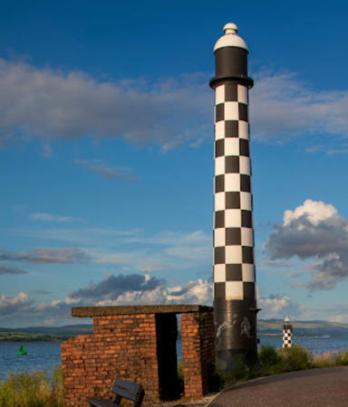
* Steamboat Quay
1921. Active; focal plane 12 m (39 ft); continuous green light. 11 m (36 ft) slender round cylindrical cast iron (?) tower with lantern but no gallery, painted in a black and white checkerboard pattern; lantern dome is white. Trabas has a closeup photo, Peter Goulding has a good photo, Thomas Nugent's photo at right shows the Port Glasgow light in the background, Spencer has photos, and Google has a street view and a satellite view. Located on the quay at Port Glasgow. Site open, tower closed. Operator: Clydeport. ARLHS SCO-312; Admiralty A4478; NGA 4592.
Steamboat Quay Light
Steamboat Quay (foreground) and Port Glasgow Lights, February 2007
Geograph Creative Commons photo by Thomas Nugent
Port Glasgow (2)
1919 (station established 1861). Active; focal plane 7 m (23 ft); continuous green light. 7 m (23 ft) round tower with lantern and a narrow gallery. Lighthouse painted in a black and white checkerboard pattern; lantern dome is white. Trabas has a fine photo, Peter Goulding has a page with good photos, Thomas Nugent has an excellent photo, Spencer has a photo, and Google has a street view and a satellite view. Located on a rocky ledge about 200 m (220 yd) off the Port Glasgow waterfront. Accessible only by boat, but easily seen from the waterfront. Site and tower closed. Operator: Clydeport. ARLHS SCO-311; Admiralty A4476; NGA 4588.

Renfrewshire (Council Area) Lighthouses
Dumbuck (2)
1921 (station established 1868). Active; focal plane 10 m (33 ft); green flash every 2 s. 12 m (39 ft) round cylindrical 2-stage stone tower, painted green. Trabas has a good photo, Richard West has a photo, Spencer has a photo, and Google has a satellite view and a distant street view. Located on the south side of the Clyde channel just above Dumbarton. Accessible only by boat. Site and tower closed. Operator: Clydeport. ARLHS SCO-367; Admiralty A4486; NGA 4600.
* Blythswood (2)
1921 (station established 1905). Active; focal plane 10 m (33 ft); green flash every 2 s. 11 m (36 ft) round cylindrical cast iron tower with lantern and gallery, painted green, mounted on a square concrete platform supported by four concrete piles. Thomas Nugent has a closeup photo (also seen at right), Trabas has a good photo, Spencer has a photo, Al Alexander has a 2019 closeup, and Google has a satellite view. Surrounding the lighthouse is the golf course of the Renfrew Golf Club. Located on the south side of the Clyde just above the confluence of the River Cart in Renfrew. The lighthouse appears to be accessible along a riverfront walkway. Site open, tower closed. Operator: Clydeport. ARLHS SCO-363; Admiralty A4512; NGA 4656.

West Dunbartonshire Lighthouse
[Dalmuir East (3)]
Date unknown (station established 1869). Active; focal plane 10 m (33 ft); red flash every 4 s. 11 m (36 ft) slender red metal tower standing on a short pier. Trabas has a photo, ARLHS has Bill Newman's photo, and Google has a satellite view and a very distant street view. The original lighthouse was a round tower attached to a shed with a metal roof; it was replaced in 1921. Located on the north shore of the Clyde in Clydebank. Site and tower closed. ARLHS SCO-366; Admiralty A4510; NGA 4644.

Blythswood Light, Renfrew, February 2010
Geograph Creative Commons photo by Thomas Nugent

Information available on lost lighthouses:

Notable faux lighthouses:

Adjoining pages: North: Argyll and Bute | South: Northwestern England

Return to the Lighthouse Directory index | Ratings key

Posted October 19, 2004. Checked and revised July 1, 2023. Lighthouses: 39. Site copyright 2023 Russ Rowlett and the University of North Carolina at Chapel Hill.