Lighthouses of the United Kingdom: Northwest England

The United Kingdom (officially the United Kingdom of Great Britain and Northern Ireland) includes England, Scotland, Wales, and Northern Ireland. England is the largest and most populous of the four, occupying more than 62% of the island of Great Britain and with a population of more than 56 million. Separated from the European mainland by the North Sea on the east and the English Channel on the south, it also has coasts facing the Celtic Sea on the southwest and the Irish Sea on the northwest.

Historically England was divided into 39 counties. The Directory pages are organized by the modern division of England into 48 "ceremonial" counties, also called lieutenancy areas because each one has a Lord Lieutenant representing the monarch in that area. For local government the ceremonial counties are subdivided in various ways into council areas.

This page includes lighthouses of England's northwestern coast, facing the Irish Sea in the counties of Merseyside (the Liverpool area), Cheshire, Lancashire, and Cumbria. Trinity House, the traditional English lighthouse agency, operates only one lighthouse on this coast; all the other lighthouses are operated by harbor authorities or have passed into private ownership. Several of the lighthouses are famous but many are not well known at all.

History has not been kind to lighthouses in this area; at least eight major nineteenth century lighthouses in the Liverpool area have been lost. Fortunately, interest in lighthouses has increased in recent years and preservation efforts are underway at several sites.

ARLHS numbers are from the ARLHS World List of Lights. Admiralty numbers are from Volume A of the Admiralty List of Lights & Fog Signals. U.S. NGA numbers are from Publication 114.

General Sources
Online List of Lights - England
Photos by various photographers posted by Alexander Trabas.
Photographers Resource - Lighthouses
A comprehensive guide to British lighthouses, with multiple photos and historical notes for many of the light stations.
Lighthouses of North West England
Photos and information from the Lighthouse Accomodations website.
Trinity House
Chartered by Henry VIII in 1514, Trinity House has built and operated lighthouses in Britain for nearly 500 years.
Lighthouses in England
Photos available from Wikimedia; many of these photos were first posted on Geograph.org.uk.
United Kingdom Lighthouses
Aerial photos posted by Marinas.com.
Britische Leuchttürme auf historischen Postkarten
Historic postcard images posted by Klaus Huelse.
Association of Lighthouse Keepers
Founded by serving and retired keepers, this lighthouse association is open to everyone.
GPSNauticalCharts
Navigational chart for northwest England.
Navionics Charts
Navigational chart for northwest England.


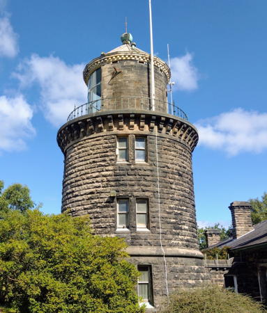
Bidston Hill Light, Wirral, September 2022
Instagram photo by Andrew Broddle
Merseyside (Liverpool Area) Lighthouses

The metropolitan county of Merseyside is centered on both sides of the lower River Mersey and includes the great seaport of Liverpool. The population of the county is approaching 1.5 million. Merseyside is divided into five boroughs.

Wirral Borough Lighthouses
Wirral is the metropolitan borough on the left (west) bank of the Mersey opposite the City of Liverpool. The north coast of the borough faces the Irish Sea between the Mersey and the River Dee. The population of the borough is about 325,000.
[Hilbre Island (2?)]
Date unknown (station established 1927). Active; focal plane 14 m (46 ft); red flash every 3 s. 3 m (10 ft) light mounted on a small steel cabinet. Cabinet painted white. Wikimedia has two photos, Trabas has a distant view, Lighthouse Accommodations has a page with a photo, Peter Hodge has a closeup, and Bing has a satellite view. According to Michael Millichamp the first light was installed by the Mersey Docks and Harbour Company and was originally on a skeletal tower; the present structure was in place at least by 1948. Trinity House assumed responsibility for the light in 1973. Henry Harding has a photo of a historic telegraph station located close to the light. The three Hilbre Islands are located on a sandbar in the mouth of the Dee Estuary off Hoylake. The islands are a local nature reserve. Located near the northern tip of the islands. Accessible only by boat. Operator: Trinity House. Site manager: Wirral Borough Council. Site open, tower closed. ARLHS ENG-223; Admiralty A5115; NGA 5380.
* [West Kirby (Grange Hill) Beacon]
1841. A historic daybeacon, never lit as a lighthouse; charted as a landmark. 18 m (59 ft) unpainted round red sandstone column topped by a sandstone sphere. A closeup photo and a more distant view are available, and Google has a street view and a satellite view. This tower was built on the northern nose of Grange Hill in West Kirby by the Trustees of Liverpool Docks to replace a windmill that collapsed in 1839; mariners had used the windmill as a daymark for many years. Located on Column Road near Beacon Drive in West Kirby, about 2.5 km (1.5 mi) south of Hoylake. Site open, tower closed.
* Hoylake (High) (2)
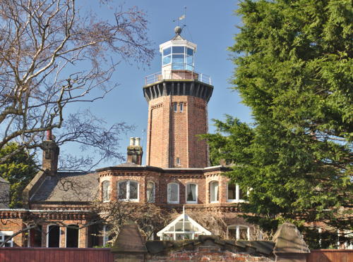
1865 (station established 1764). Inactive since 1886; charted as a landmark. 17 m (55 ft) octagonal brick tower with lantern and gallery, attached to 2-story keeper's house. The tower is unpainted red brick, the gallery is painted black, and the lantern white. A 2020 photo is at right, P. Askew has a 2007 photo, Beverley Cartlidge has a 2008 photo, Wikimedia has several photos, and Google has a street view and a satellite view. A private residence for more than a century, this elegant lighthouse has been maintained in excellent condition by its owners. Located just off Market Street (A553) at Velentia and Lighthouse Roads in Hoylake, on the east side of the entrance to the River Dee. Site and tower closed but the lighthouse can be seen easily from the street. Owner/site manager: private. . ARLHS ENG-055.
 

Hoylake High Light, Wirral, March 2020
Wikimedia Creative Commons photo by Rodhullandemu
** Leasowe
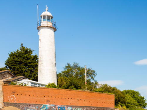
1763. Inactive since 1908; charted as a landmark. 33.5 m (110 ft) round brick tower, painted white;.The oldest lighthouse in the Liverpool area and the oldest brick lighthouse in Britain. A 2023 photo is at right, Sue Adair has a lovely 2009 photo, Wikimedia has numerous photos, Lighthouse Accommodations has a page for the lighthouse, Adair Broughton has a 2006 photo, Huelse has a historic postcard view, and Google has a street view and a satellite view. Ownership of this historic light station was assumed by the Wirral Borough Council in 1988, and restoration has continued since by the Friends of Leasowe Lighthouse. There is a visitor center in the base of the tower and funds are being raised to restore the upper rooms to their original appearance. The visitor center was renovated in 2006 and the 250th anniversary of the lighthouse was celebrated in 2013. Located on Lingham Lane in Leasowe Common in Moreton, about 8 km (5 mi) west of Perch Rock Light; the station is included in the North Wirral Coastal Park. Site open; visitor center open daily; tower open to guided tours on the first and third Sunday afternoon of each month March through October. Parking is available. Owner: Wirral Borough Council. Site manager: Friends of Leasowe Lighthouse . ARLHS ENG-063.
** Bidston Hill (2)
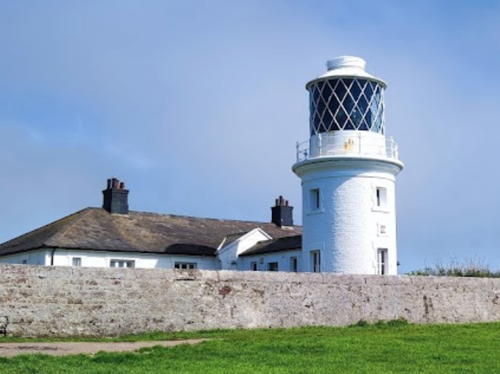
1873 (station established 1771). Inactive since 1913 (a decorative light is often displayed). 21 m (69 ft) round cylindrical sandstone tower with lantern and gallery attached to 1-story stone keeper's house. Andrew Broddle's 2022 photo is at the top of this page, Brian Sayle has a closeup photo, Wikimedia has several photos, Steven McGeary has a 2021 photo, Lighthouse Accommodations has a page for the lighthouse, Huelse has a historic postcard view, and Google has a satellite view. Bidston Hill is more than a mile from the sea, but as the highest hill in the Liverpool area it was the natural site for a landfall light for the Mersey. This famous station played an important role in British scientific history. An astronomical observatory was established here in 1864 and the two telescope domes survive although the instruments have been removed. Meteorological observations began in 1869. In 1924 the Liverpool Tidal Observatory, now the Proudman Oceanographic Laboratory, was moved to the site. Sometime in 2004-05 the laboratory moved to a new site in Liverpool. In 2006 the lighthouse was put up for sale, and in 2011 it was sold to private buyers for £160,000. Located atop the hill in Bidston, just west of Birkenhead. Site and tower generally closed but open for guided tours on the on the second Saturday of each month from May to August. Owner: private. Site manager: Bidston Lighthouse . ARLHS ENG-009.

Leasowe Light, Wirral, March 2023
Instagram photo by chasing_the_dreams
* Perch Rock (New Brighton)
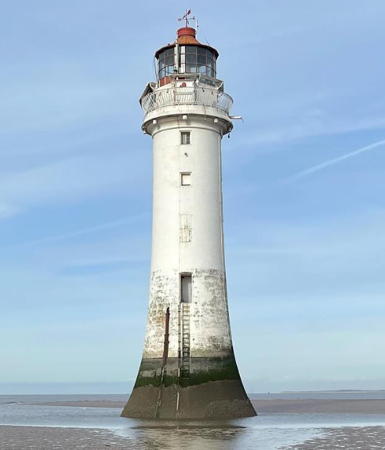
1830. Inactive as an aid to navigation since 1973; the traditional characteristic of two white flashes followed by a red flash is shown, but only over the land. Charted as a landmark. 28.5 m (94 ft) tapered granite tower with lantern and gallery, painted white; lantern painted red. The design of the lighthouse imitates the well-known Eddystone Light in the English Channel. The lower portion of the tower is solid granite; access requires a ladder to reach the doorway 7.5 m (25 ft) above the base. A 2024 photo appears at right, Zaw Naing has a 2022 photo, Stephen Entwistle has a 2007 photo, Wikimedia has numerous photos, the Liverpool Echo has a portfolio of photos by Colin Lane, Marinas.com has aerial photos, Huelse has a historic postcard view, and Google has a street view and a satellite view. The name Perch Rock comes from a perch, a tripod platform carrying a fire, built on the rock in 1683 and frequently repaired or replaced over the years. In the 1820s the City of Liverpool tired of replacing the perch and decided to build the present lighthouse. After deactivation the lighthouse was sold to Norman Kingham, who offered it for a time as a honeymoon accommodation. Lighthouse Digest has Jeremy D'Entremont's August 2001 feature story reporting on a restoration being carried out in that year as a Millennium project. As part of this project, the light was briefly reactivated, displaying a variety of Morse code messages. In late 2015 the New Brighton Coastal Community Team secured £6,000 to reactivate the lighthouse using solar panels, and the tower was relit in April 2016. Trabas has Eckhard Meyer's photo of the active post light (focal plane 4 m (13 ft); two continuous green lights), located at the end of a short breakwater north of the lighthouse. Located just offshore from the Fort Perch Rock, also a privately owned attraction, at the west side of the entrance to the Mersey estuary at New Brighton. It is possible, with caution, to walk to the lighthouse at low tide. Site open, tower closed. Owner/site manager: private. . ARLHS ENG-084; ex-Admiralty A4946. Active light: Admiralty A4952.4; NGA 5215.
* Birkenhead (Woodside Ferry)
1840s (rebuilt 1984). Inactive. Approx. 7 m (23 ft) tapered round concrete tower with a cylindrical domed lantern. Tower painted white, lantern red. In the original configuration the lantern was mounted atop a square bell enclosure as seen in a historic postcard view posted by Huelse. In 1984 the lantern was placed atop a new stone tower at its original location. A closeup is available, Mark Bailey has a 2017 photo, Wikimedia has a 2012 closeup, Uy Hoang has a street view, and Google has a satellite view. Located at the Mersey Ferry terminal in Birkenhead, on the south side of the Mersey (this is the ferry made famous in the 1964 song "Ferry Cross the Mersey" by by Gerry Marsden). Site open, tower closed. Owner: unknown. ARLHS ENG-246.
* Woodside Landing Stage North
Date unknown. Active; focal plane about 12 m (39 ft); three flashing green lights arranged horizontally. 5 m (17 ft) square skeletal tower atop a square equipment shelter. Skeletal tower painted black, equipment shelter red. Trabas has a closeup photo, Uy Hoang has a street view, and Google has a satellite view. A fog bell hangs in the tower but we don't know if it is active. This light is the modern replacement for the historic Birkenhead lighthouse. Located on the northeast corner of the ferry terminal's landing stage. Site open, tower closed. Owner: unknown. Admiralty A4972.1.

Perch Rock Light, Wirral, February 2024
Instagram photo by walkswithmydogwirral

Liverpool City Lighthouses
The City of Liverpool is one of the five metropolitan boroughs of Merseyside. Although the city's modern economy is quite diverse, it remains one of the most important British ports. The population in the borough is about half a million. Liverpool had major two lighthouses in the 19th century but both were lost many years ago as the city developed.
Stalbridge Dock Range Front
Date unknown. Active; focal plane about 20 m (66 ft); continuous red light. Approx. 17 m (56 ft) square skeletal tower with a small equipment shelter in the base. Trabas has a photo but the tower is hard to distinguish in Google's satellite view. The range guides vessels upstream in a channel close to the north bank of the Mersey. Located on a waterfront at the Stalbridge Dock in Garston on the southeast side of Liverpool. Site and tower closed. Admiralty A5022.
Stalbridge Dock Range Rear
Date unknown. Active; focal plane about 27 m (89 ft); continuous red light. Approx. 23 m (75 ft) square skeletal tower with a small equipment shelter in the base. Trabas has a photo but the tower is hard to distinguish in Google's satellite view. Located about 150 m (500 ft) southeast of the front light at the Stalbridge Dock in Garston on the southeast side of Liverpool. Site and tower closed. Admiralty A5022.1.
[Lightfloat Formby]
The unmanned Lightship Formby marked the start of the navigation channel ino Liverpool. The Liverpool Maritime Museum has a historic photo, Jon Young has a photo of a recent lightfloat that broke its anchor chain and washed ashore in November 2005, and David Dixon has a 2016 photo of the active Formby buoy.
Lightfloat Bar
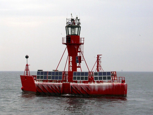
1989. Active; focal plane 11 m (36 ft); white flash every 5 s. 12 m (39 ft) round metal tower with lantern and gallery mounted on a hull. Entire vessel is red. This lightfloat replaced the lightship Bar, which was moored for many years in downtown Liverpool. In September 2016 the Canal and River Trust seized the ship for nonpayment of dockage fees and towed it to a storage location at the Sharpness Docks in Gloucestershire (see the Western England page). Located about 10 km (6 mi) off Formby Point marking the entrance to the Mersey estuary and Liverpool. Accessible only by boat. Site open, vessel closed.

Bar Lightfloat, Mersey Approach
unattributed photo posted first by FuelCellWorks

Cheshire Lighthouses

Historically the Mersey was the border between the counties of Cheshire on the south and Lancashire on the north. In the formation of the ceremonial counties Cheshire lost the Wirral area to the new metropolitan county of Merseyside but gained some territory on the north side of the Mersey in the new borough of Halton. Cheshire is divided into four boroughs, each having its own independent borough council.

Cheshire West and Chester Borough Lighthouse
* Upper Mersey (Ellesmere Port)
1880. Inactive since 1894. 11 m (36 ft) octagonal brick tower with lantern, attached to a 1-story brick pump house. The tower is unpainted red brick; the lantern dome is black. A 2007 photo is available, Wikimedia has a good photo, Cath Simpkins has a 2022 photo, and Google has a street view and a satellite view. This light was built at the junction of the Manchester Ship Canal and the Ellesmere Canal, now part of the Shropshire Union Canal. The lighthouse was restored in 1971 by the Canal and River Trust as part of a large canal museum complex. Located on the south bank of the Manchester Ship Canal at the foot of Lower Mersey Street in Ellesmere Port. The lighthouse is across the entrance to the Ellesmere Canal from the museum complex. Access to the lighthouse itself is through private property and is closed, but there's an excellent view from the museum, which is open daily except closed on Mondays in the winter. Owner/site manager: National Waterways Museum Ellesmere Port. ARLHS ENG-278.

Halton Borough Lighthouse
* Hale Head (2)
1906 (station established 1838). Inactive since 1958. 17.5 m (58 ft) brick tower attached to a 1-story keeper's house. Lighthouse painted white. The house is a private residence. The Fresnel lens from the lighthouse is displayed at the Merseyside Maritime Museum in Liverpool. Henry Harding's 2022 photo is at right, Mike Pennington has another good photo, David Dixon has a good 2012 photo, Wikimedia has several photos including Peter Vardy's fine closeup, Peter Byrne has a street view from the beach, and Google has a satellite view. The lighthouse is clearly endangered by erosion of the river bank; Marinas.com aerial photos show the seawalls that have been built to protect it. Located on a promontory on the north bank of the Mersey about 4 km (2.5 mi) east of Liverpool John Lennon Airport. Accessible by an easy walk of about 1200 m (3/4 mile) from Hale Church. Site and tower closed, but walkers can pass very close to the buildings. Owner/site manager: private. . ARLHS ENG-187.

Hale Head Light, Hale, May 2022
Google Maps photo by Henry Harding

Lancashire Lighthouses

Lancashire is located north of Liverpool between the Mersey and Morecombe Bay; its coast faces west on the Irish Sea. The county is divided into fourteen boroughs; Blackpool and Blackburn with Darwen have unitary authorities and the rest of the county has two-tier government with a county council and twelve borough councils.

Fylde Borough Lighthouse
* Lytham-St.-Anne's (4?) (The White Church)
1998 (the tower was completed in 1912) (station established 1848). Active(?) (privately maintained); focal plane 29 m (95 ft); white light, 3 s on, 3 s off. Approx. 25 m (82 ft) octagonal stone church tower. The church is built of unpainted white stone and is commonly known as the White Church. Trabas has an excellent photo and Google has a street view and a satellite view. The light has been dropped from the Admiralty list but it is charted as active by Navionics. A 22 m (72 ft) stone lighthouse was built on Stanner Point, Lytham, in 1848. Erosion quickly took it to sea and it collapsed in the winter of 1863. A 25 m (82 ft) stone tower replaced it in 1865 but that lighthouse also went to sea and collapsed. Lighthouse Digest has a drawing of the second lighthouse. Subsequently an offshore pile lighthouse known as Peet's Light marked the point; Peter Bond has a photo of the foundation ruins of that light. Installed and maintained by the Ribble Cruising Club, the current light marks the north side of the entrance to the River Ribble. With an offshore beacon it formed a range that was useful to returning sailors. Located on Clifton Drive South at Ansdell Road in Lytham-St.-Anne's. Site open, tower status unknown. Owner/site manager: Fairhaven United Reformed Church . ARLHS ENG-147; ex-Admiralty A4929.3.

Blackpool Borough Lighthouse
The Borough of Blackpool is a unitary (independent) borough including more than half of the west-facing coast of Lancashire as well as the popular seaside resort town of Blackpool itself. The borough has a population of about 140,000.

* Blackpool Tower
Date unknown (tower opened in 1894). Active; focal plane 158 m (518 ft); continuous red light. 158 m (518 ft) square tapered steel observation tower, painted a dark red. Trabas has a photo, Wikimedia has numerous photos, and Google has a street view and a satellite view. This is primarily an aircraft warning light but it also has some navigational value. Inspired by the Eiffel Tower in Paris, the Blackpool Tower has been a leading tourist attraction in northwest England for well over a century. Located on the Blackpool Promenade at Victoria Street, a few blocks south of the North Pier. Site and tower open. Owner/site manager: The Blackpool Tower. Admiralty A4919.

Wyre Borough Lighthouses
Named for the River Wyre, the Wyre borough occupies the south side of lower Morecambe Bay, a broad but shallow inlet of the Irish Sea. West of the mouth of the Wyre the town of Fleetwood is a former fishing and ferry port, although its harbor now serves more recreational than commercial purposes.
Wyre
1840 (Alexander Mitchell). Inactive since 1979. Ruins of a cottage screwpile lighthouse; only the seven screwpile legs and a fragment of the platform survive, as seen in a 2019 photo. The house was destroyed by fire in 1948. A light was maintained atop the platform until 1979. Antony McCann has a 2006 photo and a 2007 closeup, and Arnold Price has a 2002 photo. Pete Skinner has posted a drawing showing the original appearance of the lighthouse, and Huelse has a historic postcard view. Michel Forand contributed to Lighthouse Digest a second postcard view and a plan of the lighthouse. This was the world's first successful screwpile lighthouse, so the site has great significance in lighthouse history. The old light is gravely endangered, and in 2016 efforts by the Fleetwood Civic Society to save it continued to be frustrated by uncertainty over who owns it. On 26 July 2017 one of the legs gave way and the structure partially collapsed. A private Facebook Group monitors the lighthouse. Located on the North Wharf Sandbank at the entrance to the narrow channel to Fleetwood, about 2.5 km (1.5 mi) north of the town. Usually accessible only by boat; every June at an astronomocally low tide there is a public Wreck Trek across the mud flats to the ruins.. Site and tower closed. Owner/site manager: unknown. ARLHS ENG-171; ex-Admiralty A4888.
* Fleetwood Low (Range Front) (Beach Lighthouse)
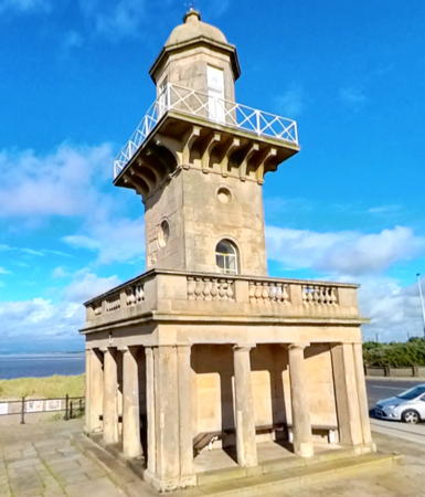
1840 (Decimus Burton). Active; focal plane 14 m (46 ft); green flash every 2 s, visible only on the range line. 13 m (43 ft) square cylindrical stone tower with domed roof and gallery, centered on a colonnaded stone 1-story square building. The light is displayed through a narrow vertical window. Lighthouse unpainted, gallery rail painted white. Yannick Dixon's 2023 street view is at right, Trabas also has a good photo, a 2023 photo is available, Wikimedia has many photos, Lighthouse Accommodations has a page for the two lighthouses, Huelse has a historic postcard view, and Google has a street view and a satellite view. The building has a neoclassical design unusual for a lighthouse. Located on the Esplanade at Albert Street in Fleetwood, on the west side of the mouth of the River Wyre in Fleetwood. Site open, tower closed except during Heritage Open Days in September. Operator: Port of Fleetwood. . ARLHS ENG-195; Admiralty A4892; NGA 5152.
* Fleetwood High (Range Rear) (Pharos Lighthouse)
1840 (Decimus Burton). Active; focal plane 28 m (93 ft); green flash every 4 s, visible only on the range line. 27 m (89 ft) stone tower with domed roof and gallery. Light displayed through a narrow vertical window. Lighthouse unpainted, gallery rail painted white. Trabas has a photo, Sam Beckwith has also posted a good photo, Wikimedia has photos, Huelse has a historic postcard view, and Google has a street view and a satellite view. These two fine lighthouses are among the town's best known architectural monuments. Located in Pharos Place, at the intersection of Pharos and Lower Lune Streets in Fleetwood, 320 m (1050 ft) south of the front light. Site open, tower closed. Operator: Port of Fleetwood. . ARLHS ENG-043; Admiralty A4892.1; NGA 5156.

Fleetwood Lower Light, Fleetwood, August 2023
Google Maps photo by Yannick Dixon

City of Lancaster Lighthouses
The historic city of Lancaster is located on the River Lune; its port facilities are at Glasson Dock at the river's mouth. As a local government district the City of Lancaster covers a much larger area including the entire east coast of Morecambe Bay.
Plover Scar (Range Front)
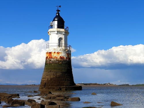
1847. Active; focal plane 6 m (20 ft); white flash every 2 s. 8 m (27 ft) tapered stone tower with lantern and gallery. Tower painted white, lantern black. A keeper's house survives onshore near the ruins of Cockersand Abbey. Dawid Bertrand's photo is at right, Trabas has a photo by Arno Siering, Chris Kirk has a 2008 closeup, David Medcalf has a photo, Ian Taylor has a good 2017 photo, Huelse has a historic postcard view, and Google has a satellite view and a distant street view. The rear range lighthouse was replaced in 1963 by a 15 m (49 ft) skeletal tower; the range has since been discontinued. The lighthouse was heavily damaged in a collision with a ship in March 2016. It was reconstructed in 2017 using as much as possible of the origonal stonework. Located about 400 m (1/4 mile) offshore at the southern entrance to the River Lune about 3 km (2 mi) southwest of Glasson. Accessible only by boat, but easily seen from shore. Site open, tower closed. Operator: Lancaster Port Commission. . ARLHS ENG-315; Admiralty A4876; NGA 5144.
[Cockersands High (Plover Scar Range Rear)]
1847. The lighthouse, a square wood tower, has been demolished, but a 1-story stone keeper's house survives. Google has a street view and a satellite view. Located at the end of Slack Lane facing the Plover Scar lighthouse. Site open. Owner: private. ARLHS ENG-024.
* Glasson Dock
1836. Inactive. 6 m (20 ft) hexagonal tower with lantern rising from a 1-story brick building. Entire lighthouse painted white. Henry Harding has a 2022 closeup photo, Trabas has Eckhard Meyer's photo, Betty Longbottom has a closeup photo, a 2007 photo is available, and Google has an indistinct satellite view. Another photo by Harding shows the active continuous white light on a mast mounted at the end of the waterfront building. This was always a privately maintained light. Located at the end of the east pier at Glasson. Site open, tower closed. ARLHS ENG-046. Active light: Admiralty A4879.2.

Plover Scar Light, River Lune, April 2021
Google Maps photo by Dawid Bertrand
[Heysham South Breakwater]
1929. Active; focal plane 9 m (30 ft); two continuous green lights, one above the other. 6 m (20 ft) post, painted white. Behind the light is the original 4 m (13 ft) cylindrical fog signal building with gallery, painted white; this tower resembles a small lighthouse. Fog siren (blast every 30 s). Trabas has a photo, David Pickavant has a distant street view, and Google has a satellite view. Heysham, on the east coast of Morecambe Bay, is a major ferry terminal with service to Belfast and Warrenpoint in Northern Ireland, to Dublin in the Republic of Ireland, and to Douglas in the Isle of Man. Located at the end of the breakwater; good views from ferries departing Heysham for Ireland and the Isle of Man. Site status unknown; storms have damaged the breakwater and it is not walkable. Operator: Peel Ports Heysham. ARLHS ENG-191; Admiralty A4860; NGA 5124.
* Heysham South Pier
1904. Active; focal plane 9 m (30 ft); green light, 6 s on, 1.5 s off. 6 m (20 ft) cylindrical cast iron tower with lantern and gallery. Tower painted red, lantern and gallery white. Trabas has a good photo, Steve Fareham has a fine photo, Chris Newman has a 2020 photo, Huelse has a historic postcard view, David Pickavant has a street view, and Google has a satellite view. The lighthouse was restored in 2021, as seen in a 2022 photo by Simon Blakeway. Located at the end of the south pier; good views from ferries departing Heysham for Ireland and the Isle of Man. Accessible by walking the pier. Site open, tower closed. Operator: Peel Ports Heysham. ARLHS ENG-192; Admiralty A4863; NGA 5132.
* Near Naze (1)
1904. Inactive since at least 1916. Approx. 9 m (30 ft) round stone tower with gallery, unpainted. A fine closeup is available, Google has a street view and a satellite view. When Heysham Harbour was built in 1904 this lighthouse was apparently built to warn small craft to avoid the adjacent rocky shoal called Near Naze. However, it must have been replaced within a few years by the next lighthouse listed. Located just off Shore Road near the Portway in Heysham. Site open, tower closed.
* [Near Naze (2) (Range Rear)]
Date unknown (by 1916). Inactive for many years. Round stone base of a former 21 m (69 ft) cast iron skeletal tower that served as a rear light for a range whose front light was the Heysham South Pier Light (see above). Light list data indicates the light was in place at least by 1916. The skeletal tower has been removed; what remains is the round stone base of the lighthouse. A photo is available, Steve Fareham has a photo showing what's left of both Near Naze lighthouses, Peter Petralia has another photo of the two lighthouses, and Google has a street view and a satellite view. Located just off Shore Road near the Portway in Heysham. Site open.
* Morecambe (Stone Pier)
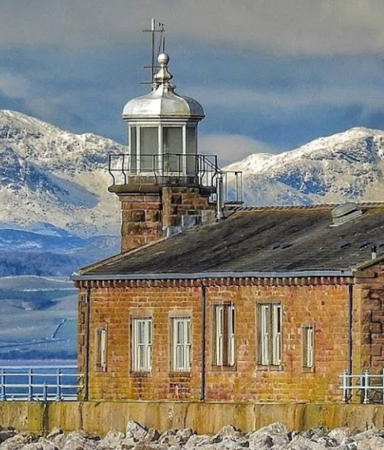
1855. Active; focal plane 12 m (39 ft); white flash every 5 s. 8 m (26 ft) octagonal stone tower with lantern and gallery. Tower unpainted, lantern and gallery painted white. The 1-story stone former railway depot adjacent to the tower has been renovated as a café. A 2020 photo is at right Trabas has a closeup, Linda Hartley has a photo ,Colin Davies has a photo, Marinas.com has aerial photos, and Google has a street view and a satellite view, This lighthouse formerly guided railroad ferries sailing between Morecambe and Ireland. Located at the end of the Stone Pier in Morecambe, a port on Morecambe Bay about 5 km (3 mi) northwest of Lancaster. Site open, café open daily, tower closed. Operator: Lancaster Port Commission. Site manager: The Stone Jetty Cafe. . ARLHS ENG-190; Admiralty A4850.

Morecambe Light, Lancaster, October 2020
Google Maps photo by Stone Jetty Cafe

Lighthouses of Cumbria

A large ceremonial county at the northwestern corner of England, Cumbria was formed in 1974 uniting large parts of the historic counties of Westmoreland and Cumberland. In 2023 the Cumbria County Council was abolished and Cumbria was divided into two unitary (independent) districts called Westmoreland and Furness and Cumberland. Mostly rural, mountainous, and highly scenic, Cumbria faces the Irish Sea to the west and Scotland across the Solway Firth to the north.

Westmoreland and Furness: Barrow-in-Furness Lighthouses
Barrow-in-Furness is a seaport at the tip of the Furness Peninsula on the north side of the entrance to Morecambe Bay. Historically part of Lancashire, it was added to Cumbria in 1974. It is known for its shipyard, which has built most of the modern vessels of the Royal Navy including nuclear submarines.
Foulney Beacon (Walney Channel Middle Range Front) (2?)
Date unknown. Active; focal plane 9 m (30 ft); quick-flashing white light. 8 m (26 ft) round barbell-shaped white fiberglass tower. Trabas has a photo, a 2021 photo is available, Paul Riley also has a 2021 photo, and Google has a satellite view. Located on a sand spit off Rampside, 1.24 km (0.77 mi) south of the rear light (next entry). Accessible only by boat. Site open, tower closed. Operator: Port of Barrow. Admiralty A4824. NGA 5072.
* Rampside (Walney Channel Middle Range Rear)
1875. Active; focal plane 14 m (46 ft); white light, 1 s on, 1 s off. Approx. 16 m (52 ft) slender square cylindrical brick tower with a pyramidal top; light shown through a window. The unpainted tower is built with red and light yellow bricks, giving at a distance the appearance of vertical red and white stripes (one white stripe on each of the four faces). J. Fletcher has a 2022 photo, Trabas has a photo, Ned Trifle has a good 2005 photo, another photo is available, and Google has a street view and a satellite view. Huelse has a historic postcard view, although it's not clear if it shows this tower or a sister tower now lost. This unusual tower, known locally as The Needle, is the only survivor of 13 range lights built on the approaches to Rampside and Barrow in the 1850-1870 period. Slated for demolition, it was saved after Rampside residents worked to have it listed as a historic structure. Located on the shoreline at Rampside, just off the A5087 about 5 km (3 mi) southeast of Barrow-in-Furness. Site open, tower closed. Operator: Port of Barrow. . ARLHS ENG-201; Admiralty A4824.1; NGA 5076.
* Walney (2)
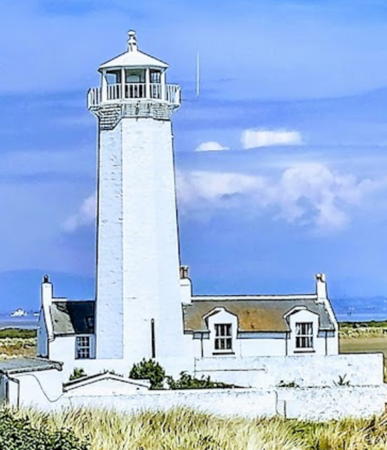
1804 (E. Dawson) (station established 1790). Active; focal plane 21 m (70 ft); one long (1.5 s) white flash every 15 s. 24 m (80 ft) octagonal stone tower with lantern and gallery, painted white. 2-story duplex keeper's house, now a private residence, and other buildings. Karl Hillman's 2022 photo is at right, Trabas has a great closeup photo, David Sykes has a 2016 photo, Anne Lister has a 2008 photo, Marinas.com has aerial photos, Huelse has a postcard view, and Google has a satellite view. Walney Island is a barrier island about 15 km (10 mi) long off the west end of the Furness peninsula. The island is accessible by bridge from Barrow-in-Furness on the A590 highway. The lighthouse was built at the southern tip of the island in 1790, but since then the island has extended itself several miles first south and then east in a long, sandy hook; this extension is now the South Walney Nature Reserve, managed by the Cumbria Wildlife Trust. The last staffed light station in Britain, the lighthouse was finally modernized and automated in 2003. The keeper's house is available for vacation rental. Located near the end of the paved road at South End. Site and tower closed, but the lighthouse can be viewed from nearby, either from the road or the beach. Operator: Lancaster Port Commission. . ARLHS ENG-161; Admiralty A4820; NGA 5052.

Walney Light, Barrow-in-Furness, June 2022
Google Maps photo by Karl Hillman

Cumberland: Irish Sea (Former Copeland Borough) Lighthouses
* Hodbarrow Point (Haverigg, Millom) (1)
1866. Inactive since 1905. Approx. 18 m (59 ft) round stone tower with castellated top and gallery; the light was shown through a window. Andrew Hill has a photo, Bill Wakefield has a closeup of the top of the tower, and Google has a satellite view. This lighthouse was built and operated privately by the Hodbarrow Mining Company to guide ships serving its iron mines in the Haverigg area. The long-abandoned tower is open to the elements and will soon be crumbling into ruins. Located on Hodbarrow Point east of the mining company seawall. Accessible by hiking trail. Site open, tower closed. Owner/site manager: Haverigg Lighthouse Club. ARLHS ENG-193.
* Hodbarrow Point (Haverigg) (2)
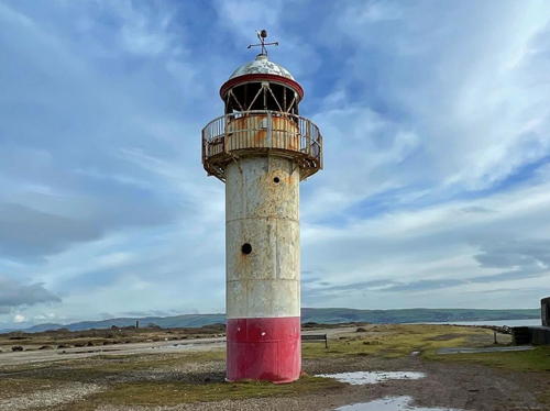
1905. Reactivated (inactive 1949-2003; now privately maintained); focal plane about 12 m (39 ft); white flash every 4 s. 9 m (30 ft) cylindrical cast iron tower with lantern and gallery, painted white with red trim. Alison Smith's 2024 photo is at right,Trabas has a closeup photo, Chris Rose has a 2021 photo, Perry Dark has a 2014 photo, Bill Wakefield has an August 2006 closeup, Huelse has a historic postcard view, and Google has a satellite view. Prefabricated by Cochrane and Co., this lighthouse was built and operated privately by the Hodbarrow Mining Company to guide ships serving its iron mines in the Haverigg area. The lighthouse was placed on an artificial berm built to expand the mining area. The abandoned mines behind the berm have been flooded and are now a bird sanctuary. Efforts to save the abandoned lighthouse began in 1996 and the lighthouse was restored in 2003 by the Haverigg Lighthouse Committee with a grant of £20,000 from the Heritage Lottery Fund. Located on the Duddon Estuary about 800 m (1/2 mi) west of Hodbarrow Point and 1200 m (3/4 mi) southeast of Haverigg; accessible by walking the berm in either direction. Site open, tower closed. Owner: unknown. Site manager: Royal Society for the Protection of Birds (Hodbarrow Nature Reserve). . ARLHS ENG-054; Admiralty A4805.

Hodbarrow Point Light, Haverigg, February 2024
Instagram photo by Alison Smith
* St. Bee's Head (North Head) (2)
1822 (Joseph Nelson) (station established 1718). Active; focal plane 102 m (336 ft); two white flashes, separated by 3 s, every 15 s. 17 m (55 ft) cylindrical stone tower with lantern and gallery. Entire lighthouse painted white. 1st order Fresnel lens in use. 1-story keeper's house. Kaiden Crook's photo is at right, Trabas also has an excellent photo, Nigel Chadwick has a 2009 photo, Lighthouse Accommodations has a page for the lighthouse, Marinas.com has aerial photos, Huelse has a historic postcard view, and Google has a street view and a fine satellite view. This is the only light station in northwestern England operated by Trinity House. The original lighthouse, built by Thomas Lutwige, was a 9 m (30 ft) stone tower lit by a coal fire. It was replaced after being gutted by fire in 1822. The present light was altered, presumably by installation of the current lantern, in 1866. The lighthouse was staffed until it was automated in 1987. Located on a prominent cape about 8 km (5 mi) southwest of Whitehaven, the light station marks the southern entrance to Solway Firth. The Coast to Coast Walk, a cross-England trail, begins near the lighthouse. Accessible by private road; most visitors arrive by the hiking trail from the village of St. Bees, where ample parking is available. Site and tower closed, but good views are available from nearby. Operator: Trinity House. Site manager: private. . ARLHS ENG-142; Admiralty A4710; NGA 4892.
* Whitehaven Old New Quay (Old Outer Quay)
1742 (?). Inactive. Approx. 14 m (46 ft) stone tower, unpainted, with a large window near the top. Humphrey Bolton has a photo, Marinas.com has aerial photos, and Google has a street view and a satellite view. This structure, often called the "Old Lighthouse," was used primarily as a watchtower. The tower was undoubtedly a daybeacon, and Findlay's 1879 list mentions a red light displayed "on Old Quay." Whitehaven is a historic seaport about 8 km (5 mi) northeast of St. Bee's Head. It was active in importing tobacco from the American colonies in the 18th century and it was famously raided by the U.S. captain John Paul Jones in 1778 during the American Revolution. Located on the 17th century Old New Quay, which now encloses the Inner Harbour of Whitehaven. Accessible by walking the quay. Site open, tower status unknown.

St. Bee's Head Light, Whitehaven, May 2023
Google Maps photo
by Kaiden Crook
* Whitehaven West Pier (2)
1839 (station established 1823). Active; focal plane 16 m (52 ft); green flash every 5 s. 14.5 m (47 ft) brick tower with lantern and gallery. Lighthouse painted white with red trim; lantern dome is gray metallic. A 2022 photo is at right, Ian Wright has contributed a photo, Trabas has a photo, the town has a page for the two pier lighthouses, Marinas.com has aerial photos, and Google has a street view and a satellite view. The west pier was built in 1821. According to Findlay's 1879 list, the original light was 11 m (37 ft) tall. In 2013 both pier lighthouses were reported to be in poor condition, suffering from vandalism and much of need of repair and repainting. Steve Fareham's 2014 photo shows disturbing conditions and the lighthouse is in terrible condition in a 2021 photo by Louise Andrews. In late 2019 a £39,700 planning grant began a restoration effort. A £144,000 grant was secured and the two lighthouses were restored in 2021-22. An April 2022 photo shows the dramatic results. Located at the end of the west breakwater at Whitehaven; accessible by walking the breakwater. Site open, tower closed. Operator: Whitehaven Marina. . ARLHS ENG-245; Admiralty A4698; NGA 4880.
* Whitehaven North Pier
1841. Active; focal plane 8 m (26 ft); two continuous red lights, one above the other. 7 m (23 ft) stucco-covered brick tower with castellated top and a gallery midway up the side; the lights are mounted on a mast atop the tower. Lighthouse painted white with red trim. Kate Turner has a closeup 2023 photo, Trabas has a photo, Dave Bevis has a 2010 photo showing both Whitehaven lighthouses, the town has a page for the two pier lighthouses, Marinas.com has aerial photos, and Google has a street view and a satellite view. This lighthouse was built at the same time as the pier. Like the West Pier lighthouse, it was restored in 2021-22. Located at the end of the northeast breakwater at Whitehaven; accessible by walking the breakwater. Site open, tower closed. Operator: Whitehaven Marina. . ARLHS ENG-166; Admiralty A4700; NGA 4884.

Cumberland: Solway Firth (Former Allerdale Borough) Lighthouses
Solway Firth is a large embayment of the Irish Sea that forms part of the border between England and Scotland.

*
Workington
Date unknown (station established 1825). Active; focal plane 11 m (36 ft); white flash every 5 s. 6 m (20 ft) square Coast Guard station with two galleries; the light is shown from a short post. Building painted white. Craig Greenwood has a 2023 photo, Trabas has a photo, Alexander Kapp has a 2007 photo, and Google has a street view and a satellite view. Huelse has a postcard view of an older beacon on the pier. Located at the end of the south breakwater at Workington. Accessible by walking the pier. Site open, tower closed. ARLHS ENG-248; Admiralty A4688; NGA 4864.


Whitehaven West Pier Light,June 2022
Instagram photo
by andrias_adventures

* Workington Range Rear
Date unknown. Active; focal plane 12 m (39 ft); continuous red light. 9 m (30 ft) square pyramidal skeletal tower; the front of the tower carries a large triamgular daymark painted white with a red horizontal band. Trabas has a photo and Google has a street view and a satellite view. This is an entry range for Workington; the front light is on a similar but shorter tower. Located on the west side of the harbor entrance. Site open, tower closed. Admiralty A4692.1; NGA 4872.
* Maryport (2)
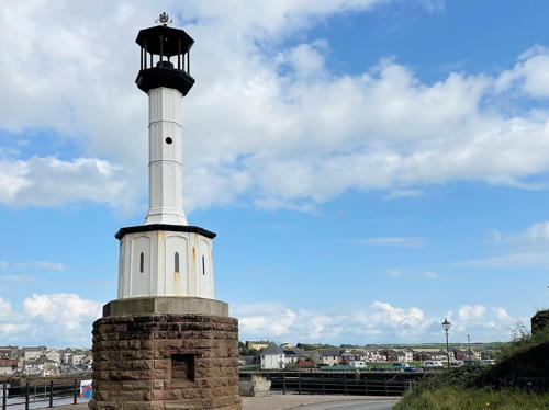
1846 (station established 1796). Inactive since 1996 (since 2017 a decorative light has shone toward the land). 11 m (35 ft) octagonal cylindrical cast iron tower with lantern, mounted on a 1-story octagonal stone base. Base unpainted, tower painted white, lantern black. In this unusual design a slender column supports the lantern and stands on a broad base. A 2023 photo is at right, Ian Wright has contributed a photo, David Briwn has a good 2012 photo, Lighthouse Accommodations has a page for the lighthouse, Marinas.com has aerial photos, and Google has a good street view and a satellite view. This is one of the oldest cast iron lighthouses in the world. The lighthouse was replaced by a short concrete tower and then (1996) by an aluminum tower (next entry). In 2015 the local council applied for a £50,000 grant to restore the lighthouse and in early 2016 the grant was awarded. The restoration was carried out in the fall and the light was relit in a ceremony in May 2017. In February 2018, however, the light failed and rust stains appeared on the tower, leading to a need for additional work. The lighthouse looks great in Ryan Galea's 2021 closeup. Located at the elbow of the west breakwater in Maryport; accessible by walking the pier. Site open, tower closed. Owner/site manager: Maryport Harbour Authority. . ARLHS ENG-080.

1846 Maryport Light, Maryport, July 2023
Instagram photo
by die_hansedeern
* [Maryport (4)] (South Pierhead)
1996 (station established 1796). Active; focal plane 10 m (33 ft); white flash every 1.5 s. 6 m (20 ft) square pyramidal white aluminum tower; no lantern. Ian Wright has contributed a photo, Trabas has a photo, and Google has a distant street view and a satellite view. This light was installed by Trinity House but in May 2010 it was announced that the light would be transferred to local management. The transfer was carried out on 30 November 2011. Located at the end of the west breakwater at Maryport. Accessible by walking the pier. Site open, tower closed. Owner/site manager: Maryport Harbour Authority. Admiralty A4676; NGA 4860.
Lees Scar ("Tommy Legs")
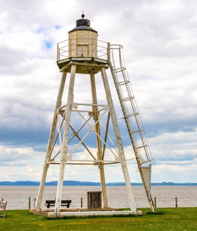
1841. Reactivated (inactive 1938-1959); focal plane 11 m (36 ft); green flash every 10 s. 11 m (36 ft) lantern mounted atop a square pyramidal skeletal tower. Lighthouse painted white. Trabas has a good photo, Phil Williams has a photo, Wikimedia has photos, and Google has a satellite view. The lower half of the skeletal tower formerly supported the platform of a cottage lighthouse. We need more information on the history of this historic and endangered light. Located about 800 m (1/2 mi) south of Silloth. Accessible only by boat. Site open, tower closed. Operator: Port of Silloth. ARLHS ENG-064; Admiralty A4670; NGA 4844.
* East Cote (Eastcote, Skinburness) (4)
1997 (rebuilt 1913 lighthouse; station established 1841). Active; focal plane 15 m (50 ft); continuous green light. 12 m (39 ft) square pyramidal corrugated iron skeletal tower with octagonal lantern and gallery. A 2022 photo is at right, Steve Farehamhas a good 2010 photo, a 2007 photo is available, Trabas has a good photo, and Google has a street view and a satellite view. The lighthouse was formerly the rear light of a range. Several sources have 1841 as the date of the first lighthouse, but a plaque on the tower says that the present light replaced a mobile light installed in 1864. The historic tower was rebuilt on the original plans by Associated British Ports in 1996-97. Located on Skinburness Road about 1 km (2/3 mi) north of the harbor of Silloth, on the south side of Solway Firth. Site open, tower closed. Operator: Port of Silloth. . ARLHS ENG-318; Admiralty A4671; NGA 4848.


East Cote Light, Silloth, May 2022
Instagram photo by Lighthouse Accommodation

Information available on lost lighthouses:

Notable faux lighthouses:

Adjoining pages: North: Southwestern Scotland | South: Wales

Return to the Lighthouse Directory index | Ratings key

Posted November 5, 2005. Checked and revised June 16, 2024. Lighthouses: 33, lightships: 1. Site copyright 2024 Russ Rowlett and the University of North Carolina at Chapel Hill.