Lighthouses of Canada: Southern British Columbia

The territory of British Columbia was originally part of the Oregon Country, the area west of North America's Continental Divide between latitudes 42° and 54°40' North. In the London Convention of 1818 the U.S. and Britain agreed to joint occupation of this territory. The Oregon Treaty of 1846 confirmed British occupation of Vancouver Island and the rest of what became British Columbia; it also set the boundary between the U.S. and British territory at latitude 49° between the Rocky Mountains and the Strait of Georgia. In 1849 the Colony of Vancouver Island was organized, and in 1858 the southern mainland was organized as the Colony of British Columbia. Vancouver Island was merged with British Columbia in 1866 and the enlarged colony assumed its present boundaries.

The nation of Canada was created by the British North America Act in 1867 with Ontario, Québec, New Brunswick, and Nova Scotia as the four original provinces. Manitoba was established as the fifth province in 1870 and British Columbia joined as the sixth province in 1871. Today Canada has ten provinces and three large federal territories in the Arctic.

The rugged and intricate coastline of British Columbia province has about 40 surviving historic lighthouses. Unlike the situation in eastern and central Canada a fair fraction of these light stations are still staffed: Ron Ammundsen, the principal keeper at Quatsino Light, lists 27 staffed light stations in the province. Some of these stations represent the only federal presence in remote and roadless areas of the coast. There was an uproar in 2010-11 when the government proposed destaffing all the stations to save money; eventually the destaffing plan was dropped.

This page includes lighthouses of the southern and more populated part of the province including the Vancouver region of the mainland and Vancouver Island. Lighthouses of the Inside Passage and the Haida Gwaii (Queen Charlotte) Islands are described on the Northern British Columbia page.

Only a handful of these British Columbia lighthouses are accessible by highway; most of them are built on islands or rocky headlands far from the nearest road. But on the BC coast most transportation is by water anyway. The extensive route network of BC Ferries interconnects the coast and many of the lighthouses can be seen from one ferry or another.

Aids to navigation in Canada are maintained by the Canadian Coast Guard. In 2008 Parliament passed the Heritage Lighthouse Protection Act to designate and protect historic lighthouses.

ARLHS numbers are from the ARLHS World List of Lights. CCG numbers are from the Pacific Coast volume of the List of Lights, Buoys, and Fog Signals of Fisheries and Oceans Canada. Admiralty numbers are from volume G of the Admiralty List of Lights & Fog Signals. For lights close to the U.S. border USCG numbers are from volume 6 of the U.S. Coast Guard List of Lights, and U.S. NGA numbers are from Publication 111.

General Sources
British Columbia Canada Lighthouses
Photos and historical accounts for the more accessible lighthouses, posted by Kraig Anderson.
Neal's Lighthouse Blog: BC
Photos and comments by Neal Doan.
Online List of Lights - Canada Pacific Coast
Photos by various photographers posted by Alexander Trabas. Many photos are by Capt. Peter Mosselberger ("Capt. Peter").
Lighthouses in British Columbia
Photos by various photographers available from Wikimedia.
Lighthouses of British Columbia
Photos by Mike Mitchell.
World of Lighthouses - Pacific Coast of Canada
Photos by various photographers available from Lightphotos.net.
British Columbia, Canada Lighthouses
Aerial photos posted by Marinas.com.
Leuchttürme Kanadas auf historischen Postkarten
Historic postcard views posted by Klaus Huelse.
List of Lights, Buoys, and Fog Signals
Official Canadian light lists are available in both pdf and html formats.
NOAA Nautical Charts
U.S. nautical charts also show Canadian lights near the international border.
GPSNavigationCharts
Navigation chart information for the Canadian west coast.
Navionics Charts
Navigation chart for the Canadian west coast.


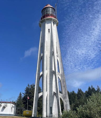
Point Atkinson Light, West Vancouver, August 2023
Instagram photo
by Artur Osmokiesku


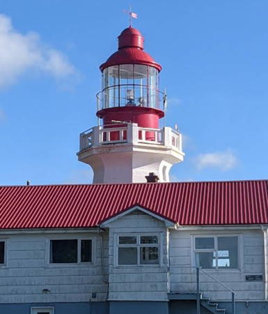
Pachena Point Light, Bamfield, August 2019
Google Maps photo
by Brandon Wu
Interior British Columbia Lighthouses

Kootenay Lake Lighthouses
Kootenay Lake is a long, fjord-like lake in the Rocky Mountains in southeastern British Columbia. The lake is 104 km (65 mi) long and generally only 3-5 km (2-3 mi) wide.
** Pilot Bay
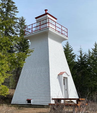
1904. Inactive since 1993. Approx. 7.5 m (25 ft) square pyramidal frame tower with lantern and gallery, painted white with red trim. Teresa Peloso Segstro's photo is at right, Brian Mills has a 2022 photo, a 2019 closeup and a 2007 photo are available, and Google has a satellite view. The Coast Guard repaired the old lighthouse in 1985 and converted it to solar power in 1989. After being deactivated in 1993 the abandoned lighthouse was transferred to BC Parks in 1995, and since then the Friends of West Kootenay Parks Society have worked to restore the tower. The lighthouse was repainted in 2013. Located at the end of a peninsula jutting into the east side of the lake south of Kootenay Bay; accessible from the end of Pilot Bay Road (off BC 3A) by a short hike. Site open; tower and lantern room open when volunteers are present (inquire locally); gallery closed. Owner: BC Parks (Pilot Bay Provincial Park); site manager: Friends of West Kootenay Parks (Pilot Bay Lighthouse). . ARLHS CAN-628.
[Proctor (2)]
Date unknown (station established 1905?). Active; focal plane 6 m (20 ft); white flash every 4 s. 3 m (10 ft) post colored white with a red top. A view from the lake is available and Google has a fuzzy satellite view. Anderson has a distant view and a second view of the original lighthouse. Located on the south side of the entrance to the western arm of Kootenay Lake, about 3 km (2 mi) east of Proctor. Site open, tower closed. CCG P-0010.

Okanagan Lake Lighthouse
Okanagan Lake is a long, fjord-like lake in the Rocky Mountains southeast of Kamloops. The lake is 135 km (84 mi) long and mostly 4-5 km (2.5-3 mi) wide.

[Shorts Point (Fintry)]
Date unknown. Active; focal plane 6 m (20 ft); green flash every 4 s. 6 m (20 ft) round tower mounted on a platform supported by piles. The lighthouse is white with a green band at the top. Michael Russell has a photo, James Paterson has a street view, and Google has a satellite view. Located just off Shorts Point at Fintry, on the west side of the lake. Accessible only by boat but easy to see from shore. Site open, tower closed. Site manager: BC Parks (Fintry Provincial Park). CCG P-0051.7.

Pilot Bay Light, Kootenay Lake, August 2017
Instagram photo
by Teresa Peloso Segstro

Shuswap Lake Lighthouse
Shuswap Lake is located in the Rocky Mountains east of Kamloops. The lake consists of two long, fjord-like lakes that are joined by a short passage called the Cinnemousun Narrows, thus forming an elongated letter H.

[Haven Point]
Date unknown. Active; focal plane 8.5 m (28 ft); quick white flash every 1 s. 6 m (20 ft) round white tower mounted a square concrete base. A pyramidal stone cairn stands next to the tower. A photo (one third the way down the page) is available and Google has a satellite view. Located at Haven Point on the south side of the Cinnemousun Narrows. Accessible only by boat. Site open, tower closed. Site manager: BC Parks (Cinnemousun Narrows Provincial Park). CCG P-0049.

Metro Vancouver Regional District Lighthouses

The Metro Vancouver Regional District surrounds the province's largest city; it includes 21 municipalties and has a population rapidly approaching three million. Its southern edge is the U.S. border.

Delta City Lighthouses
Roberts Bank Entrance (Tsawwassen) Range Rear
Date unknown. Active; focal plane 19 m (62 ft); quick-flashing yellow light. 19 m (62 ft) square skeletal tower carrying a red daymark with a white vertical stripe and mounted on a platform supported by piles. Trabas has Capt. Peter's photo and Google has a satellite view and a distant street view. The range guides vessels entering the Westshore Terminals, a coal exporting facility at Tsawwassen, just north of the U.S. border. The front light is on a similar tower 12.5 m (41 ft) tall. Visible from Roberts Bank Way in Tsawwassen. Site open, tower closed. CCG P-0307.92; Admiralty G5399.1; NGA 13113.1.
Roberts Bank
Date unknown. Active; focal plane 11 m (36 ft); white flash every 4 s. 9 m (30 ft) octagonal concrete tower mounted on a small platform supported by piles. Lighthouse painted white with narrow red horizontal bands. Trabas has Capt. Peter's photo and Bing has a satellite view. Located in the Strait of Georgia about 2 km (1.3 mi) southwest of the Sand Heads lighthouse. Accessible only by boat. Site open, tower closed. CCG P-0309; Admiralty G5400; USCG 6-20470; NGA 13112.

Richmond City (Fraser River) Lighthouses
The Fraser River is the longest river entirely within British Columbia. The lower course of the river is navigable for large ships.
Sand Heads (4)
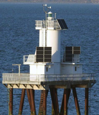
2002 (station established 1884; lightship station established 1866). Active; focal plane 13 m (43 ft); green flash every 5 s. 7.5 m (25 ft) round cylindrical tower with two adjoining 1-story equipment shelters, mounted on a rectangular platform supported by piles. Entire lighthouse is white. Neal Doan has the photo at right and another good photo of the present light, Trabas has Capt. Peter's photo, a 2021 photo is available, and Bing has a satellite view. The history of this station is complex. A lightship was posted here in 1866. The first lighthouse, a wood tower on a screwpile foundation, was deactivated in 1905 due to changes in the channel; lightships served once again until 1956. Lighthouse Digest has a Coast Guard photo of the second (1956) light station. Some time in the 1990s the light was moved to a small, green-topped tower. Located at the end of a long breakwater sheltering the north side of the entrance to the Fraser River. Accessible only by boat. Site open, tower closed. ARLHS CAN-446; CCG P-0311; Admiralty G5401; USCG 6-20480; NGA 13116.
New Cut Outbound Range Rear
Date unknown. Active; focal plane 15 m (49 ft); continuous yellow light. 15 m (49 ft) square skeletal tower carrying a red daymark with a white vertical stripe and mounted on a platform supported by piles. Trabas has Capt. Peter's photo and Google has a satellite view. This range guides vessels leaving the Fraser River. The front light is on a much shorter tower. This is the westernmost of a series of range lights guiding vessels in the river. Located north of the Wing Dam, which flanks the north side of the entrance channel, off Steveston. Accessible only by boat. Site open, tower closed. CCG P-0328, Admiralty G5412.1.

Sand Heads Light, Strait of Georgia, August 2009
photo copyright Neal Doan; used by permission
#U.S. Lightship 76 (WAL-504) Relief
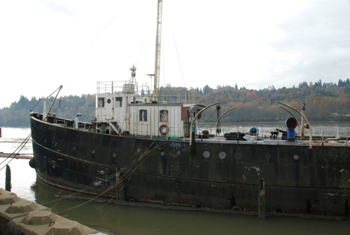
1904. Decommissioned 1960. This was a 39.5 m (129.5 ft) steel lightship, originally 2-masted but modified from its original appearance. Hull painted black, superstructure white. Jim Smith's photo is at right. Built by Burlee Drydock Co. of New York, the ship made the long voyage around Cape Horn and served its entire career as the relief lightship for the U.S. Pacific coast. After plans to make it a museum ship at Seattle fell through, the ship was renamed Claire Anne and served as a coastal freighter. Later it also worked as a fishing boat in Alaska. Kent Staudinger was the manager and part owner of the vessel from 1980. In 2003 Rick Bennett of the USCG Lightship Sailors Association rediscovered the ship, now called the Maudi Morgan, stripped of its original masts and working as a fishing boat based near Vancouver. In 2005 the ship was reported in poor condition, barely seaworthy. In 2007 the ship was sold and in August 2008 it was towed up the Fraser River to Mission, about 50 km (30 mi) east of Vancouver. In 2013 the owner's son told the Lightship Sailors Association the ship would probably have to be scuttled, but Smith found it still afloat in November 2014 and reported that the owner still hoped to restore it. Little was done, however, and the ship sank at its berth on 23 March 2017. Formerly moored at the end of McLean Street, on the north side of the Fraser off the Lougheed Highway (BC 7); Google has a satellite view of the former location. Owner/site manager: private.
Lightship LV-76 Relief
U.S. Lightship LV-76, Fraser River, November 2014
photo copyright Jim Smith; used by permission

Vancouver City Lighthouses
Vancouver, the largest city and principal port of western Canada, is built on the Burrard Peninsula with Burrard Inlet (the city's harbor) to the north and the Fraser River (the province's longest river) to the south. The populaation of the city proper was over 662,000 in the 2021 census.

Spanish Bank No. 2
Date unknown. Active; focal plane 7 m (23 ft); two red flashes every 6 s. 7 m (23 ft) tall 9-pile wood platfirm carrying a round tower; tower painted white with a red top. Trabas has Capt. Peter's photo, Kai Vermehr has a very distant street view, and Google has a satellite view. The Spanish Bank is a large shoal area, much of it exposed at low tides, on the south side of the entrance to Burrard Inlet. Located at the northwestern end of the bank. Accessible only by boat but easily seen at a distance from shore. CCG P-0386.3; Admiralty G5426.8; NGA 13086.
Spanish Bank
Date unknown. Active; focal plane 7 m (23 ft); white flash every 4 s. 7 m (23 ft) tall 9-pile wood platfirm carrying a round tower; tower painted white with a red top. Trabas has Capt. Peter's photo and Google has a street view and an indistinct satellite view. Located at the edge of the Spanish Bank shoals about 1.3 km (0.8 mi) east southeast of the Spanish Bank No. 2 Light. Accessible only by boat but easily seen from shore. CCG P-0387.01; Admiralty G5426.6; NGA 13087.
* Prospect Point (2)
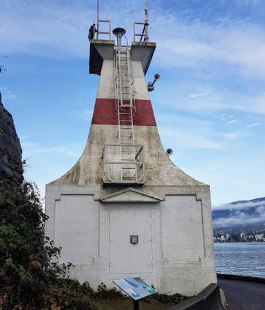
1948 (station established 1898). Active; focal plane 11.5 m (38 ft); red light, 1 s on, 1 s off. 8 m (27 ft) strongly tapered square tower on a 1-story square workroom. No lantern. Lighthouse painted white with a single red horizontal band. Piotr Biedacha has the 2019 photo seen at right, C.M. Hanchey has a photo, Imran Ali has a good closeup, Trabas has Capt. Peter's photo, Elena Vozdvizhenskaia has a 2021 drone view, and Google has a closeup street view and a satellite view. Anderson has a historic photo of the original lighthouse, which had a lantern atop a keeper's house. For many years keepers were also responsible for operating a signal station regulating traffic through the narrow passage known as First Narrows. Located on the point on the south side of Vancouver Harbour a short distance west of the Lion's Gate Bridge (BC 99). Accessible by walking the seawall from parking areas in Stanley Park. Site open, tower closed. Owner: Canadian Coast Guard. Site manager: Vancouver Board of Parks and Recreation (Stanley Park). . ARLHS CAN-1308; CCG P-0392, Admiralty G5434, NGA 12988.

Prospect Point Light, Vancouver, November 2019
Google Maps photo by Piotr Biedacha
* Brockton Point (2)
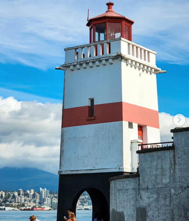
1915 (William P. Anderson) (station established 1890). Inactive since 2008; a decorative light may be displayed. 10.5 m (35 ft) square tower with lantern and gallery, mounted on an arched base that allows walkers on the seawall to walk under the tower. Tower painted white with one horizontal red band; lantern painted red, arched base black. The keeper's house was demolished in the late 1950s. A 2021 closeup is at right, Victor Jianto also has a 2021 photo, Stew Merkel has a good photo, Wikimedia has photos, Marinas.com has aerial photos, Huelse has a historic postcard view, and Google has a street view and a satellite view. This readily accessible lighthouse, located in the middle of British Columbia's largest city, is probably the best known and most photographed lighthouse in the province. Ownership of the lighthouse was transferrede to the city in 2006. In 2009 the federal government provided $2 million for a complete restoration of the lighthouse. Located on the point on the south side of Vancouver Harbour east of the Lion's Gate Bridge (BC 99) and about 2.5 km (1.5 mi) east of Prospect Point Light. It's a pleasant walk of 5 km (3 mi) along the seawall from this lighthouse to Prospect Point and back. Site open, tower closed. Owner/site manager: Vancouver Board of Parks and Recreation (Stanley Park). . ARLHS CAN-060; ex-CCG P-0402, ex-Admiralty G5447, ex-NGA 13004.
Burnaby Shoal
Date unknown. Active; focal plane 9 m (30 ft); quick-flashing red light. 9 m (30 ft) round cylindrical tower, white with a red top, mounted on a round cylindrical concrete pier. Trabas has Matthew Yuen's photo, and Bing has a satellite view. Located on a shoal about 2.5 km (1.5 mi) southeast of Brockton Point. Accessible only by boat. Site open, tower closed. CCG P-0403, Admiralty G5448, NGA 13008.

North Vancouver District Lighthouse
[Calamity Point (2?)]
Date unknown. Active; focal plane 5 m (17 ft); white flash every 4 s. 5 m (17 ft) round tower painted white with a green top and mounted on a platform supported by 16 wood piles. Trabas has Capt. Peter's photo, Lightphotos.net also has a photo, and Bing has a satellite view. The beacon here was formerly tended by the Brockton Point keeper. Located on the north side of Burrard Inlet about 800 m (1/2 mi) east of the Lion's Gate Bridge. Accessible only by boat. Site open, tower closed. CCG P-0395, Admiralty G5442, NGA 13000


Brockton Point Light, Vancouver, February 2021
Google Maps photo by 吉达星


West Vancouver District Lighthouses
[First Narrows (Capilano) (4)]
Date unknown (station established 1913). Active; focal plane 7.5 m (25 ft); green light, 1 s on, 1 s off. 7.5 m (25 ft) post mounted on piles. Trabas has Rainer Arndt's photo, and Google has a satellite view. The original light, mounted on a tank, was replaced by a light atop a wood keeper's house in 1915. The lighthouse was burned in 1969 and replaced by a small concrete tower. Located just off the end of a spit on the east side of the mouth of the Capilano River, directly opposite the Prospect Point lighthouse. Accessible only by boat. Site open, tower closed. ARLHS CAN-415; CCG P-0394, Admiralty G5435, NGA 12984.
Point Atkinson (2)
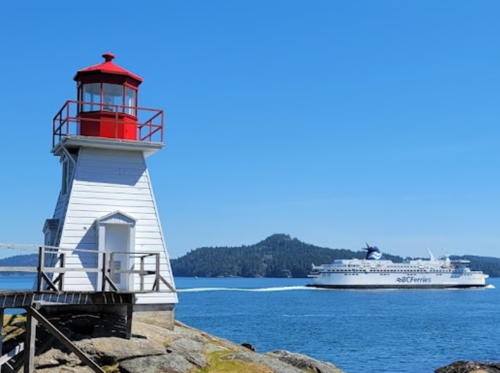
1912 (William P. Anderson) (station established 1875). Active; focal plane 33 m (108 ft); two white flashes every 5 s. 18 m (60 ft) octagonal concrete tower with 6 ribs, lantern and gallery. Tower painted white; lantern, gallery, and watch room painted red. Artur Osmokiesku's 2023 photo is at the top of this page, Oakwood Welsh has a 2022 photo, Andrea Wren has a good photo, Michael Malone has a 2018 photo, Trabas has Capt. Peter's photo, Wikimedia has several photos, Marinas.com has aerial photos, Huelse has a historic postcard view, Devon Montgomery has a street view, and Google has a satellite view. Huelse also has a postcard view of the 1875 lighthouse. For U.S. television viewers, this is the lighthouse featured in the mystery series Harper's Island in 2008-09. The lighthouse marks the north side of the entrance to Vancouver Harbour. In 1998 the West Vancouver Historical Society formed the Point Atkinson Lighthouse Society (PALS) to work on behalf of the station and in 2008 PALS applied for a provincial grant to study restoration of the station. By 2013 there was grave concern about its deteriorating condition, as the district and federal governments began to discuss its future. So far it seems that very little has come of these discussions. In 2014 the district government applied for Heritage status for the lighthouse and in 2015 PALS filed a business plan for management of the station. This application is still pending. The original light station reservation is now a municipal park; an 800 m (1/2 mi) hiking trail (steep on the return) leads to a good vantage point for viewing the lighthouse. The park entrance is on Beach Drive off Marine Drive in West Vancouver. Site and tower closed. Owner: Canadian Coast Guard. Site manager: District of West Vancouver (Lighthouse Park). . ARLHS CAN-387; CCG P-0386; Admiralty G5426; USCG 6-20500; NGA 12972.

Upper Strait of Georgia East Side Lighthouses

Sunshine Coast Regional District Lighthouse
* Gibsons Landing
Date unknown. Active; focal plane 5 m (16 ft); red flash every 4 s. Light mounted atop a gazebo. Trabas has Smith's photo and Google has a satellite view. Located at the end of the north pier at the marina in Gibsons, a popular resort community accessible by ferry from Vancouver. Site open, tower closed. CCG P-0431; Admiralty G5420.5; NGA 12908.
White Islets
Date unknown. Active; focal plane 11 m (35 ft); white flash every 4 s. 8 m (26 ft) round white tower mounted on a robust square concrete base. Jouma Mülhem has a 2021 photo, Shayne Johnson has a more distant view, and Google has a satellite view. Located on the largest of a group of rocky islets about 2.5 km (1.5 mi) off Mission Point. Accessible only by boat. Site open, tower closed. CCG P-0448; Admiralty G5502; NGA 12888.
[Selma Park Breakwater]
Date unknown. Active; focal plane 8 m (26 ft); red flash every 4 s. 6 m (20 ft) round tower painted white with a red band at the top. Google has a street view and an indistinct satellite view. Located on the south side of Sechelt, a district municipality with a population of about 10,000. Accessible only by boat (the breakwater is not walkable). Site open, tower closed. CCG P-0448.5; Admiralty G5502.4; NGA 12892.
Merry Island (2)
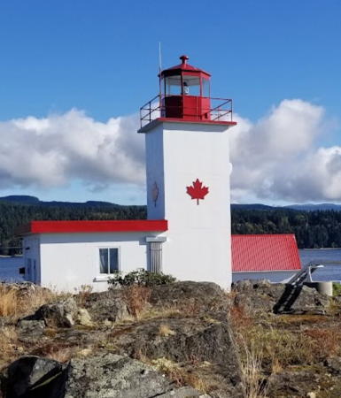
1966 (station established 1902). Active; focal plane 18 m (60 ft); white flash every 15 s. 12 m (40 ft) square cylindrical tower with lantern and gallery, attached to a 1-story fog signal building. Lighthouse painted white with a red maple-leaf emblem on each face; lantern and gallery painted red. Staffed light station with a 2-story red-roofed keeper's house and other buildings. A photo by Casey Gaetz is at right, Doan has a photo, Don and Kathy Richards have an excellent drone view, Trabas has Jim Smith's photo, a distant view is available, Marinas.com has aerial photos, and Google has a satellite view. Except for the light station, the island is privately owned. Located on the southeastern end of the island about 5 km (3 mi) south of the town of Halfmoon Bay on the mainland side of the Strait. Accessible only by boat; should be visible distantly from Welcome Beach, off BC 101 south of Halfmoon Bay. Site and tower closed. Owner/site manager: Canadian Coast Guard. . ARLHS CAN-314; CCG P-0449, Admiralty G5510, NGA 12776.

Merry Island Light, Strait of Georgia, October 2017
Google Maps photo by Casey Gaetz

Qathet (Powell River) Regional District Lighthouses
[Sangster Island]
Date unknown. Active; focal plane 17 m (56 ft); quick-flashing red light. 5 m (17 ft) round tower painted white with a red top. The tower was all white in a 2008 photo. Google has an indistinct satellite view. This light stands opposite the Ballenas Island lighthouse (see below) in marking a narrow passage in the Strait of Georgia. Located at the southeastern tip of a small island south of the larger Lasqueti Island. Accessible only by boat. Site open, tower closed. CCG P-0490.3; Admiralty G5508.5, NGA 12864.
Sisters Islets (2)
1967 (station established 1898). Active; focal plane 21 m (70 ft); two white flashes every 15 s. Approx. 18 m (60 ft) narrow round cylindrical concrete tower with lantern and gallery, flared at the top, painted white; lantern painted red. The lighthouse was automated in 1996, and the keeper's house is boarded up and probably endangered. A 2021 drone view is at right, Taras Tereshchak has a 2018 street view, Trabas has Rainer Arndt's view from the sea, Marinas.com has excellent aerial photos, and Bing has a satellite view of the station. The original lighthouse had a lantern atop a 2-story keeper's house. The light guides vessels through a passage between Lasqueti Island on the east and Hornby Island on the west. Located on a small island off the west end of Lasqueti Island and about 15 km (10 mi) north of Qualicum Beach. Accessible only by boat. Site and tower closed. Owner/site manager: Canadian Coast Guard. ARLHS CAN-462; CCG P-0493, Admiralty G5529, NGA 12852.
* Savary Island Wharf
Date unknown. Active; focal plane 6 m (20 ft); white flash every 4 s. Light on a short mast atop a 1-story wood shed. A distant 2022 view is available and Google has a closeup street view and a satellite view. Savary Island is a resort community near the northern end of the Strait of Georgia, accessible by passenger ferry from Lund. The permanent population is barely 100 but there can be more than 2000 vacationers in the summer. Located at the end of the ferry pier near the western end of the island. Site and tower closed. Owner/site manager: unknown. CCG P-0478.5, Admiralty G5567, NGA 12620.

Sisters Islets Light, Strait of Georgia, August 2021
Google Maps photo by Ron

Vancouver Island Lighthouses

Vancouver Island is the largest island of western North America, 460 km (290 mi) long and as much as 100 km (62 mi) wide. The island is oriented southeast to northwest. The northern end is separated from the mainland by the narrow waters of the Inside Passage, while the southern end lies west of the broad Strait of Georgia. The Strait of Juan de Fuca separates the southern end of the island from the U.S. state of Washington. Victoria, the capital of British Columbia, is at the southeastern tip of the island. There are good roads along the Strait of Georgia from Victoria to Campbell River and along the south coast from Victoria to Port Renfrew, but the northern and western coasts are more difficult to reach. Lighthouses are listed clockwise around the island, starting on the east coast on the upper Strait of Georgia.

Strait of Georgia West Side Lighthouses

Comox Valley Regional District Lighthouse
Comox Bar Range Front
Date unknown. Active; focal plane 11 m (36 ft); yellow light, 3/4 s on, 3/4 s off. 8 m (26 ft) square pyramidal skeletal tower carrying a daymark colored white with a red vertical stripe. Google has a street view and a satellite view. The rear light is on a similar tower in a residential area 284 m (310 yd) southwest. Located behind the house at 4274 Kilmarnock Drive in Courtenay. Site and tower closed (private property). CCG P-0501, Admiralty G5542, NGA 12804.
Chrome Island (Yellow Island) Range Rear (3)
1989 (station established 1891). Active; focal plane 22 m (72 ft); continuous yellow light visible only on the range line; also a general-navigation light, white flash every 5 s. 7.5 m (25 ft) round concrete tower with lantern and gallery, painted white; lantern and gallery painted red. Staffed light station with 1-story red-roofed keeper's house and other buildings. A photo is at right, Trabas has Jim Smith's closeup photo, Scott Fitz has a photo of the station, Wikimedia has the photo at right and several distant views, Marinas.com has fine aerial photos, and Google has a satellite view. This range guides vessels eastward around the south end of Denman Island. The original light was a square wood tower attached to a keeper's house. It was replaced in 1898 by a pair of range lights and then in 1922 by a skeletal tower with enclosed gallery and watch room. The 1891 lantern was transferred to the 1898 rear tower, to the 1922 tower, and then to a new lighthouse at Port Alberni (see below). Anderson has a historic photo of the 1898 front light, a small square wood tower. The modern front light is on a short tower 93 m (305 ft) west of the lighthouse, close to one of the station buildings. Located on a small island just off Boyle Point, the southern point of Denman Island about 1.5 km (1 mi) east of Deep Bay; there is an excellent view of the light station from Boyle Point Provincial Park. Accessible only by boat. Site and tower closed. Owner/site manager: Canadian Coast Guard. . ARLHS CAN-137; CCG P-0496, Admiralty G5532.1, NGA 12832.

Chrome Island Light, Strait of Georgia, April 2012
Wikimedia Creative Commons photo by Wasrts

Nanaimo Regional District Lighthouses
Nanaimo (pronounced "na-NY-moh") is a city of about 90,000 residents located directly across the Strait of Georgia from Vancouver. The city has a fine protected harbor and is often called the Harbour City.
Ballenas Islands (Parksville) (2)
1917 (station established 1900, relocated 1912). Active; focal plane 21 m (70 ft); white flash every 10 s. 11 m (35 ft) octagonal concrete tower with lantern and gallery, painted white; lantern and gallery painted red. Automated station; the status of the keeper's house is not clear. Mitchell has an excellent closeup, in which it appears that the light is now mounted on the gallery. Taras Tereshchak has a 2018 photo and a street view, Marinas.com has aerial photos, and Bing has a satellite view. The original lighthouse, a square wood tower, was built on South Ballenas Island in 1900, but the station was disassembled and relocated to North Ballenas in 1912. Except for the light station the island is privately owned. Located on the north point of North Ballenas Island in the Strait about 8 km (5 mi) east of Parksville. Accessible only by boat. Site and tower closed. Owner/site manager: Canadian Coast Guard. ARLHS CAN-018; CCG P-0490, Admiralty G5508, NGA 12868.
Entrance Island (Nanaimo) (2)
About 1970 (station established 1876). Active; focal plane 19 m (62 ft); white flash every 5 s. 14 m (45 ft) round cylindrical concrete tower, painted white; lantern and gallery painted red. Staffed light station with 2-story red-roofed keeper's house and other buildings. A photo by Louise Janes is at right, John Alexander has a closeup photo, Jerry Clark has a 2023 photo, Trabas has Matthew Yuen's view from the sea, C.M. Hanchey has a photo, Marinas.com has aerial photos, and Google has a satellite view. Anderson has a historic photo of the original lighthouse, a square wood tower attached to a 1-1/2 story keeper's house. In September 2009 the government announced that the station would be destaffed to cut costs. Fortunately this did not happen, and in February 2015 a keeper at the station saved the lives of nine people whose boat capsized off the island. Located on a small island off the mouth of Nanaimo Harbour, about 13 km (8 mi) east of the city. Accessible only by boat; visible from ferries entering and leaving the harbor. Site and tower closed. Owner/site manager: Canadian Coast Guard. ARLHS CAN-171; CCG P-0435; Admiralty G5488; USCG 6-20540; NGA 13300.
* Gallows Point (4?)
Date unknown (station established 1902). Active; focal plane 7 m (23 ft); white light, 1 s on, 1 s off. 7 m (23 ft) square cylindrical cabinet, painted white, centered on a robust square stone pier. 1-story Edwardian keeper's cottage onshore. A closeup 2016 photo is available and Google has a satellite view. The first light, a square white tower on piles, was installed by the New Vancouver Coal Mining and Land Company, which mined coal nearby. Sometime in 2015-16 the present light replaced a round tower painted white with a red top; Wilf Ratzburg has a good 2009 photo of that light. Sharron Murray has a 2017 photo of the keeper's house. Built around 1912, the house is leased by the city to a local service group and is available for meetings and special events. The grounds are open as the Gallows Point Light Park. Located just off the southern tip of Protection Island, which shelters the waterfront of Nanaimo. Site open, tower closed. Owner (tower): Canadian Coast Guard. Keeper's house owner/site manager: City of Nanaimo. ARLHS CAN-191; CCG P-0439; Admiralty G5492: USCG 6-20460; NGA 13268.

Entrance Island Light, Nanaimo, April 2012
Wikimedia Creative Commons photo by Louise Janes

Capital Regional District Lighthouses

Southern Gulf Islands Area Lighthouses
The Southern Gulf Islands lie off the southeast coast of Vancouver Island between Nanaimo and Sidney. The international boundary between the U.S. and Canada runs northward through the Haro Strait off Victoria and then sharply eastward through Boundary Pass, which separates the Southern Gulf Islands of British Columbia from the San Juan Islands in the U.S. state of Washington. This boundary was established in 1859 after a tense international dispute known locally as the Pig War (a pig was the only casualty in this conflict).

[Porlier Pass Range Front (Race Point) (2)]
1996 (station established 1902). Active; focal plane 7 m (23 ft); continuous yellow light. 6 m (20 ft) round cylindrical tower adjacent to a 1-story equipment shelter. Trabas has Jim Smith's photo, Anderson has a photo, a view from the sea is available, and Google has a satellite view. The original light was a 1-story square wood tower with an octagonal wood lantern. Sadly this unusual beacon was demolished in 1996. Porlier Pass is a narrow and dangerous passage between Valdes and Galiano Islands; the range guides westbound vessels approaching the pass. The lighthouse is accessible by a hiking trail. Located on Race Point at the northern tip of Galiano Island. Owner: Canadian Coast Guard. Site manager: BC Parks (Dionisio Point Provincial Park). ARLHS CAN-1130; CCG P-0288, Admiralty G5394, USCG 20435; NGA 13408.
* Porlier Pass Range Rear (Virago Point)
Date unknown (station established 1902). Active; focal plane 10 m (34 ft); continuous yellow light. 7.5 m (25 ft) square pyramidal wood tower with lantern and gallery, painted white; lantern and gallery painted red. Karl Agre has a photo, a 2016 closeup is available, Marinas.com has aerial photos, and Google has a satellite view. A descendent of one of the keepers has posted recollections of life at this station. Located at the northwest end of Galiano Island, which is accessible by ferry from several locations. The lighthouse is accessible by a short hiking trail. Owner: Canadian Coast Guard. Site manager: BC Parks (Dionisio Point Provincial Park). ARLHS CAN-403; CCG P-0289, Admiralty G5394.1, USCG 6-20440; NGA 13412.
[Bare Point (Chemainus Bay) (3)]
Around 1980 (station established 1897). Active; focal plane 9.5 m (31 ft); green flash every 4 s. 7 m (23 ft) cylindrical tower painted white with a green top. Wilf Ratzburg has a photo, Trabas has a view from the sea by Günther Hess, and Google has a satellite view. The original lighthouse had a lantern atop a 2-story keeper's house. The lighthouse was automated after the keeper was found dead at his post in 1926. The building deteriorated and was demolished about 1940, replaced by a skeletal tower. Bare Point is now occupied by a Shell Canada oil terminal. Located at the tip of a sharp promontory sheltering the harbor of Chemainus. Site status unknown. ARLHS CAN-019; CCG P-0280, Admiralty G5384, USCG 6-20385; NGA 13356.
* Active Pass (Georgina Point, Mayne Island) (2)
1940 (station established 1885). Inactive since 1969. 2-story wood keeper's house; the light was formerly shown from a lantern mounted at the peak of the roof. A 2022 photo is at right, Trabas has Klaus Kern's photo, a 2022 photo is available, Marinas.com has aerial photos, and Google has a street view and a satellite view. Lighthouse Digest has a postcard view of the original (1885) lighthouse, a square pyramidal wood tower attached to a keeper's cottage. In 1969 the lantern was removed and the light moved to a separate tower (next entry). This lighthouse marks the entry to Active Pass, a deep but twisting channel between Galiano and Mayne Islands; the channel leads from the Strait of Georgia south through the islands to Swartz Bay. The light station grounds are now a park maintained by the Mayne Island community. In 2014 the light station was recognized as a heritage lighthouse under HLPA. Located off Waugh Road on the northern tip of Mayne Island, which is accessible by ferry from Tsawwassen on the mainland or Swartz Bay on Vancouver Island. Also visible from the ferries crossing the Strait of Georgia from Tsawwassen to Swartz Bay. Site open, tower closed. Owner/site manager: Parks Canada (Gulf Islands National Park Reserve).
* Active Pass (Georgina Point, Mayne Island) (3)
1969 (station established 1885). Active; focal plane 17.5 m (57 ft); white flash every 10 s. 11 m (35 ft) round cylindrical tower with lantern and gallery, painted white; lantern and gallery painted red. Rick Leche's photo is at right, a 2021 photo is available, Google has a closeup street view and Mitchell has a great closeup. Site open, tower closed. Owner: Canadian Coast Guard. Site manager: Parks Canada (Gulf Islands National Park Reserve). . ARLHS CAN-002; CCG P-0275, Admiralty G5360, USCG 6-20370; NGA 13480.

Active Pass Light, Mayne Island, July 2022
Google Maps photo
by lb
Portlock Point (2)
1987 (station established 1895). Active; focal plane 15.5 m (51 ft); quick-flashing white light. 7.5 m (25 ft) square pyramidal wood tower with lantern and gallery, painted white; lantern and gallery painted red. A 2023 photo is at right, Rick Leche has a good photo, Mitchell has a closeup, Trabas has a good photo by Matthew Yuen, Wikimedia has several photos, Marinas.com has aerial photos, and Google has a satellite view. Huelse has a postcard view of the original lighthouse, which was taller (15 m (48 ft)). The light was automated after a kerosene explosion killed the keeper and destroyed the keeper's house in 1964. Ownership of the light station was transferred to Parks Canada in 2006. The lighthouse was repainted and refurbished in 2019. Located at the eastern end of Prevost Island about 5 miles south of Active Pass as the ferry runs. Accessible only by boat (most of Prevost Island is privately owned); visible from the ferries crossing the Strait of Georgia from Tsawwassen on the mainland to Swartz Bay on Vancouver Island. Site and tower closed. Operator: Canadian Coast Guard. Owner/site manager: Parks Canada (Gulf Islands National Park Reserve). . ARLHS CAN-411; CCG P-0267, Admiralty G5368, USCG 6-20325; NGA 13504.
* East Point (Saturna Island) (2)
1948 (station established 1888). Active; focal plane 37 m (121 ft); white flash every 15 s; also a continuous red light at a focal plane of 31 m (102 ft) covering nearby shoals. 14 m (45 ft) square steel skeletal tower, painted red. Modern 1-story keeper's house (1960) and fog signal building. Trabas has an excellent photo by Capt. Peter, Terrie Lee Birston has a 2016 photo, and Google has a satellite view. This light and the Patos Island Lighthouse in the U.S. (see the Puget Sound and San Juan Islands page) frame the northern entrance to Boundary Pass from the Strait of Georgia. The original lighthouse was a 19 m (60 ft) square wood tower attached to a keeper's house. Ownership of the light station was transferred to Parks Canada in 2006; the keeper's house is in use as a park staff residence. Saturna Island is accessible by ferries from Mayne Island; it has a permanent population of about 350. Located, as its name implies, at the eastern end of Saturna Island. Site open, tower closed. Owner/site manager: Parks Canada (Gulf Islands National Park Reserve). ARLHS CAN-448; CCG P-0264, Admiralty G5358, USCG 6-19810; NGA 13596.

Portlock Point Light, Prevost Island, April 2023
Google Maps photo
by lesGéo TrouveTout

Victoria Area Lighthouses
Victoria, the capital of British Columbia, is a city of about 90,000 residents. Founded as Fort Victoria in 1843, it is the oldest city of western Canada.

Kelp Reefs
Date unknown. Active; focal plane 11 m (36 ft); quick-flashing white light. 11 m (36 ft) octagonal cylindrical white tower mounted on a robust concrete pier. Trabas has Capt. Peter's closeup photo (with a bald eagle atop the light) and Bing has a satellite view. Located on the west side of the Haro Strait north of Victoria. Accessible only by boat. Site open, tower closed. CCG P-0224, Admiralty G5337, USCG 6-19710; NGA 13628.
Zero Rock
Date unknown. Active; focal plane 8.5 m (28 ft); white flash every 4 s. 8.5 m (28 ft) square cylindrical white tower mounted on a robust concrete pier. Trabas has Capt. Peter's photo and Google has a satellite view. This light is directly across the Haro Strait from the Lime Kiln Lighthouse in the U.S. Located on the west side of the strait north of Victoria. Accessible only by boat. Site open, tower closed. CCG P-0223, Admiralty G5336, USCG 6-19705; NGA 13632.
Discovery Island (2)
1958 (?) (station established 1886). Inactive since 1970. 2-story wood keeper's house; the light was shown from a lantern at the peak of the roof. A photo is at right. The original lighthouse was a square wood tower attached at one end of a 1-1/2 story wood keeper's house; it is not clear when that lighthouse was replaced. The original lantern was saved and is on display at the Coast Guard base in Victoria (see below). Located adjacent to the present lighthouse. Site open, tower closed. Owner: Canadian Coast Guard. Site manager: BC Parks (Discovery Island Marine Provincial Park).
Discovery Island (3)
1970s (station established 1886). Active; focal plane 28 m (93 ft); white flash every 5 s. 11.5 m (38 ft) round cylindrical tower with lantern and gallery, painted white; lantern painted red. The 2-story wood keeper's house survives. A portion of Colin Stepney's 2020 photo is at right, Mitchell has a good photo, Chelsea Stanley has a closeup of a bald eagle perched atop the lantern, Trabas has Capt. Peter's photo, Marinas.com has aerial photos, and Google has a satellite view. Most of Discovery Island is a provincial park with a primitive campground and hiking trails. Access is mostly by sea kayak, as there is no protected landing for boats. Located at Sea Bird Point on the eastern end of the island about 5 km (3 mi) east of Victoria, marking the junction of the Haro Strait and the Strait of Juan de Fuca. Site open, tower closed. Owner: Canadian Coast Guard. Site manager: BC Parks (Discovery Island Marine Provincial Park). ARLHS CAN-160; CCG P-0216, Admiralty G5334, USCG 6-16270 (=6-19685); NGA 13684.

Discovery Island Light, Discovery Island, July 2020
Google Maps photo by Colin Stepney
[Fiddle Reef (2)]
1978 (station established 1898). Active; focal plane 7 m (23 ft); quick flash every 1 s, white or red depending on direction. 5 m (17 ft) round white fiberglass tower, centered on a square stone pier. Trabas has Rainer Arndt's photo and Google has a satellite view. The present light stands on the pier of the original lighthouse, a square wood "pepperpot" tower with lantern and gallery. That lighthouse was demolished in 1978. Located on a reef about 1 km (0.6 mi) offshore from the Oak Bay section of Victoria. Accessible only by boat. Site open, tower closed. ARLHS CAN-175; CCG P-0215, Admiralty G5332, NGA 13692.
[Trial Islands (1)]
1906. 2-story red-roofed keeper's house; the light tower was mounted at the peak of the roof, as seen in Huelse's postcard view. Ramjheetun Elodie's photo is at right. The keeper's house remains in service and Lighthouse Digest has Eric Manchester's 2002 article on longtime keeper Ian McNeil. Located adjacent to the present lighthouse.
Trial Islands (2)
1970 (station established 1906). Active; focal plane 28 m (93 ft); green flash every 5 s. 13 m (42 ft) round cylindrical tower with lantern and gallery, painted white; lantern painted red. Ramjheetun Elodie's photo is at right, Mitchell has an excellent closeup photo of the light station, Trabas has Capt. Peter's closeup photo, Udo Stevens has a sunset photo of the light in action, Wikimedia has distant views, Marinas.com has aerial photos, and Google has a satellite view. In September 2009 the government announced that the station would be destaffed to cut costs; these plans were dropped in 2010. Located at the south end of Trial Island off Gonzales Point, the southeastern corner of Victoria City. Accessible only by boat; visible distantly from Beach Drive near Anderson Hill Park in the southern part of Victoria. Site and tower closed. Owner/site manager: Canadian Coast Guard. . ARLHS CAN-506; CCG P-0212, Admiralty G5328, USCG 6-16265; NGA 13700.
[#Trial Islands (1) (lantern)]
1906. Inactive since 1970. Removed in 1970, the original lantern and 4th order Fresnel lens from the 1906 lighthouse were for many years on display in Bastion Square outside the Maritime Museum of British Columbia in Victoria. Google has a satellite view of that location but Google's street view shows that the lantern was removed when the museum moved to 744 Douglas Street. We need information on the current location of the lantern and lens. Site open. Owner/site manager: Maritime Museum of British Columbia.
Trial Islands Light
Trial Islands Light, Victoria, August 2009
Flickr Creative Commons photo by Ramjheetun Elodie
* [Discovery Island (2) (lantern)]
1958. Inactive since the 1970s. The octagonal lantern from the second lighthouse is on display at the Canadian Coast Guard station at 25 Huron Street in Victoria. Google has a street view and a satellite view. Site open. Owner/site manager: Canadian Coast Guard Regional Operations Centre.
Brotchie Ledge (2)
1989 (station established 1898). Active; focal plane 12 m (39 ft); green flash every 4 s. 12 m (39 ft) round fiberglass tower mounted on a conical concrete pier. The fiberglass tower is white with a green band at the top. Trabas has Rainer Arndt's photo, Yvonne Fried has a more distant view, and Bing has a distant satellite view. Brotchie Ledge, a famous and dangerous obstruction in the approach to Victoria, is named for Captain William Brotchie, who wrecked his ship Albion on the rock in 1849. Buoys were placed as early as 1843 to warn navigators away from the ledge. An effort to build a caisson lighthouse failed in 1897 when a storm overturned the caisson, so the following year a concrete beacon was built instead. Located about 1200 m (3/4 mi) south of the entrance to Victoria harbor. Accessible only by boat. Site open, tower closed. . CCG P-0205, Admiralty G5310, USCG 6-16260; NGA 13704.
* Ogden Point Breakwater
1917. Active; focal plane 12 m (39 ft); quick-flashing red light. 7 m (23 ft) square tapered concrete tower, painted white with a broad red band at the base. Chris Campbell has a photo, Yi Bao has a 2021 photo, Emily Norton has a 2008 closeup, Trabas has a photo by Selector Jonathan Photography, Darren Yarmack has a 2017 street view, and Google has a satellite view. Located at the end of the breakwater on the east side of the entrance to Victoria harbor. Accessible by walking the breakwater, which is equipped with handrails and is a popular attraction. There's also a view from cruise ships arriving in Victoria. Site open, tower closed. . CCG P-0204, Admiralty G5312, USCG 6-16250; NGA 13708.
[Berens Island (3?)]
Date unknown (station established 1876). Active; focal plane 6 m (20 ft); quick-flashing green light. In addition, a quick-flashing white aeronautical light is activated when a seaplane is landing or taking off. 6 m (20 ft) post mounted on a small stone pier. Trabas has Rainer Arndt's photo, and Google has a satellite view. The original lighthouse was a square tower attached to a keeper's house; a historic photo is available. That lighthouse was demolished in 1925. Located on an island on the west side of Victoria Harbour. Accessible only by boat. Site open, tower closed. ARLHS CAN-032; CCG P-0206, Admiralty G5312.4, NGA 13712.

Colwood City Lighthouse
*** Fisgard
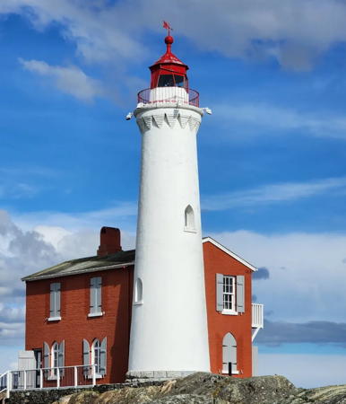
1860. Active; focal plane 21.5 m (71 ft); white or red light (depending on direction), 2 s on, 2 s off. 14.5 m (48 ft) round brick tower with lantern and gallery, painted white; lantern painted red. Tower floodlit at night. Lighthouse attached to the original 2-story brick keeper's house, which is painted bright red. This is the oldest lighthouse in British Columbia and a national historic site. The keeper's house is operated as a lighthouse museum. C.M. Hanchey's photo is at right, Trabas has Charles Bash's photo, Wikimedia has numerous photos, Boris Gjenero has a photo, Lighthouse Digest has Jeremy D'Entremont's 2002 article on the history of the station, and Google has a street view and a satellite view. In June 2009 the federal government appropriated $1.56 million to restore the lighthouse. Work was completed in time for the celebration of the 150th anniversary of the light in 2010. Located on a small island, connected to the mainland by a causeway, at the western entrance to Esquimalt Harbour, off Ocean Boulevard in Colwood west of Victoria. Site open; museum open daily (entry fee); tower closed. Owner: Parks Canada. Site manager: Fort Rodd Hill and Fisgard Lighthouse National Historic Sites . ARLHS CAN-176; CCG P-0197, Admiralty G5306, USCG 6-16245; NGA 13740.
Fisgard Light
Fisgard Light, Colwood, August 2010
Flickr Creative Commons photo
by C.M. Hanchey

Metchosin District Lighthouse
Race Rocks (Great Race Rock)
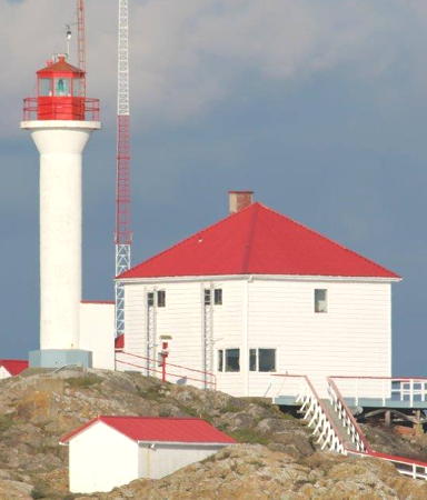
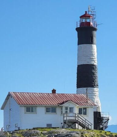
1861. Active; focal plane 36 m (118 ft); white flash every 10 s. 24.5 m (80 ft) round "Imperial" stone tower with lantern and gallery, painted with black and white horizontal bands; lantern painted red. Fog horn (three 2 s blasts every 60 s). The original keeper's house was demolished in 1972 but the more modern light station buildings (built in 1951 and 1966) have been in use as an ecological research station since 1997. A 2023 photo is at right, Cliff Hellis has a photo, Pete Hanson has a good closeup photo, Trabas has Capt. Peter's photo, Bruce Xiao has a 2021 photo, Jeff Lorton has a lovely panoramic view, Anderson's page has good photos, Wikimedia has photos, Marinas.com has aerial photos, and Google has a satellite view. This light, the second oldest lighthouse of the Canadian Pacific, marks the southernmost point of Vancouver Island. The lantern was replaced in 1925. The lighthouse was restored and repainted in 2009 in time for its 150th anniversary celebration in 2010. Pearson College leases the station and has established an endowment fund to maintain it. Located on Great Race Rock, a small island in the Strait of Juan de Fuca about 15 km (9 mi) southwest of Victoria. Accessible only by boat. Site and tower closed (special permission is required to land on the island). Owner: Candian Coast Guard, leased to Pearson College. Site manager: Race Rocks Ecological Reserve. . ARLHS CAN-426; CCG P-0189, Admiralty G5300, USCG 6-16225; NGA 13760.

Sooke District Lighthouses
* [Estevan Point/Triangle Island (lantern and lens)]
1910. First-order Fresnel lens and round cast iron lantern, painted red, mounted on a short white tower similar to the Triangle Island Light tower. Anderson has photos on his page for Triangle Island Light, a 2007 closeup photo is available, and Google has an excellent street view and a satellite view. This historic lens was used from 1910 to 1918 at Triangle Island Light. In 1920 it was relocated to the Estevan Point Light, where it remained in service until the 1980s. In 2004 it was donated to the Sooke Region Museum. Located at 2070 Phillips Road in Sooke. Site and museum open daily, tower closed. Owner/site manager: Sooke Region Museum and Visitor Centre .
* [Whiffin Spit (3?)]
Date unknown (station established 1906). Active; focal plane 6.5 m (21 ft); quick white flash every 1 s. 6 m (20 ft) round cylindrical fiberglass tower adjacent to a rectangular 1-story concrete equipment shelter. Lighthouse painted white with one green horizontal band near the top of the tower. Fog horn (3 s blast every 30 s) activated only on radio request. The station also includes an automatic weather station. Trabas has Jim Smith's closeup photo, Fred Van Strien has a photo, and Google has a street view and a distant satellite view. Little is known about the history of this station. Located at the end of the 1.5 km (1 mi) long Whiffin Spit, which nearly closes the entrance to the harbor of Sooke. Accessible by walking the spit (about 1.2 km (3/4 mi) one way). Site open, tower closed. Owner: Canadian Coast Guard. Site manager: District of Sooke (Whiffin Spit Park). CCG P-0188, Admiralty G5296, USCG 6-16210; NGA 13772.

Race Rocks Light, Strait of Juan de Fuca, April 2023
Google Maps photo by happy yogi

Strait of Juan de Fuca Area Lighthouse
* Sheringham Point
1912 (William P. Anderson). Active; focal plane 22 m (72 ft); green flash every 15 s. 19.5 m (64 ft) hexagonal concrete tower with lantern and gallery, painted white; lantern and gallery are red. Cindy Andrie's 2019 photo is at right, Anderson's page has photos, Mike Bingley has a closeup photo, Robyn Hanson has a good 2007 photo, Wikimedia has a photo, Trabas has Alfonso Biescas Vignau's photo, Kesariya Suri has a 2021 photo, Marinas.com has aerial photos, S.D. Konkle has a 2017 closeup street view, and Google has a satellite view. The Sheringham Point Lighthouse Preservation Society was formed in 2003 to work for preservation of the lighthouse within a proposed 4.5 ha (10 acre) park. In early 2008 the Department of Fisheries and Oceans completed a land swap with a neighboring landowner to make the park possible. The next step came in 2011 when DFO declared the light station surplus property so that it can be transferred to a local government agency. In 2010 there was concern about inappropriate development when Western Forest Products decided to sell a much larger tract of 2300 ha (5700 acres) surrounding the lighthouse. In 2015 the lighthouse received heritage designation. The first phase of restoration, including safety and access improvements and restoration of power to the lighthouse, began in the fall of 2016. In 2017 the Society received a gift of $550,000 from the Westway Foundation, the largest private gift ever received by a Canadian lighthouse. Restoration work continued through 2018 and will be completed with the return of the station's Fresnel lens, now at the Sooke Region Museum. Located on a rocky promontory at the end of Sheringham Point Road off BC 14 in Shirley, about 16 km (10 mi) west of Sooke. Site and tower closed (fenced), but it is possible to walk close to the lighthouse. Owner: Canadian Coast Guard. Site manager: Sheringham Point Lighthouse Preservation Society . ARLHS CAN-458; CCG P-0186, Admiralty G5292, USCG 6-16195; NGA 13800.

Sheringham Point Light, Strait of Juan de Fuca, May 2019
Flickr Creative Commons photo by Cindy Andrie

Pacific Coast Lighthouses

Cowichan Valley Regional District Lighthouse
Carmanah Point (2)
1920 (station established 1891). Active; focal plane 55.5 m (182 ft); white flash every 5 s. 11 m (36 ft) octagonal pyramidal concrete tower with lantern and gallery, painted white with red trim; lantern painted red. Staffed light station with a 1-story, red-roofed keeper's house and other buildings. Brandon Wu's photo is at right, Christine Rondeau has a good closeup photo, Jeff Vomastic has a 2021 photo, Wikimedia has a 1994 photo by Mike Beauregard, Trabas has Michael Boucher's distant view from the sea, Marinas.com has aerial photos, and Google has a satellite view. This lighthouse marks the northern entrance to the Strait of Juan de Fuca, which leads to Seattle and Vancouver. The original lighthouse was a square wood tower attached to the keeper's house. Located on the West Coast Trail in the Pacific Rim National Park Reserve about 20 km (13 mi) northwest of the Gordon River Trailhead near Port Renfrew. Site open, tower closed. Owner/site manager: Canadian Coast Guard. . ARLHS CAN-120; CCG P-0180, Admiralty G5288, USCG 6-0770 (=6-16140); NGA 13820.

Alberni-Clayoquot Regional District Lighthouses
Pachena Point
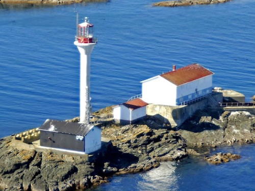
1908. Active; focal plane 47 m (154 ft); two white flashes every 7.5 s. 20 m (66 ft) octagonal wood tower with lantern and gallery; original 1st order Fresnel lens in use. Lighthouse painted white, lantern red. Staffed light station with two 2-story keeper's houses and other buildings. Brandon Wu's photo is at the top of this page, Trabas has Jim Smith's excellent photo, Jason Kurylo has a closeup photo, Desmond Carroll has a 2019 photo, Mitchell has an aerial view, Marinas.com also has aerial photos, Huelse has a historic postcard view, and Google has a satellite view. A historic station, little changed in more than a century. The Coast Guard carried out a major restoration of the lighthouse in 2015-16. Located atop a cliff on the West Coast Trail in the Pacific Rim National Park Reserve about 15 km (9 mi) south of Bamfield. Site open, tower closed. Owner/site manager: Canadian Coast Guard. . ARLHS CAN-362; CCG P-0178, Admiralty G5280, USCG 6-0780;NGA 13828.
Cape Beale (2)
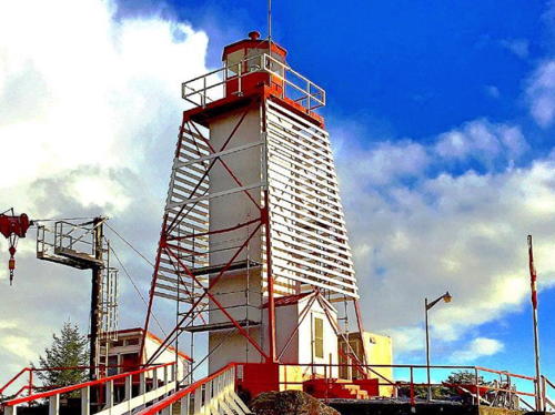
1958 (station established 1874). Active; focal plane 51 m (167 ft); continuous red or white light (depending on direction) with a brighter flash every 5 s. 10 m (33 ft) square pyramidal steel skeletal tower with square central cylinder, lantern and gallery, and a slatted white daymark on three sides. The tower, lantern and gallery are painted red. This is a staffed light station with several red-roofed buildings. Trabas has Jim Smith's closeup photo, Clay Dean has a photo, Marinas.com has aerial photos, and Google has a satellite view of the station. The station is located within the Pacific Rim National Park Reserve at the southern entrance to Barkley Sound. Accessible via hiking trails leading from the area of Bamfield. Site open, and keepers sometimes will accompany visitors in climbing the tower. Owner/site manager: Canadian Coast Guard. . ARLHS CAN-091; CCG P-0176, Admiralty G5256, USCG 6-0790; NGA 13836.

Carmanah Point Light, Port Renfrew, August 2019
Google Maps photo by Brandon Wu
*** Port Alberni
2001. Active (privately maintained); focal plane about 13 m (43 ft); white flash every 12 s. Approx. 11 m (36 ft) square pyramidal wood tower with lantern and gallery, rising from a 1-story museum building. Lighthouse painted white, lantern and gallery red. Trabas has Jim Smith's closeup photo, R.B. Sampson has a closeup photo of the top of the tower, Marinas.com has aerial photos, and Google has a street view and a satellite view. This new lighthouse carries the original 1891 lantern of the Chrome Island Light (see above). The lighthouse was renovated in 2022 with repairs to the roof and replacement of shingles damaged by vandals. Located on an elbow of the quay of the small boat harbor in Port Alberni, at the head of the Alberni Inlet, a 40 km (25 mi) long fjord. Site open, museum open daily late June through early September, tower status unknown. Owner/site manager: Port Alberni Maritime Discovery Centre . CCG P-0167; Admiralty G5275.8.
* Amphitrite Point (2)
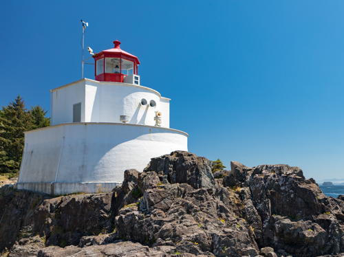
1915 (station established 1906). Active; focal plane 15 m (50 ft); white flash every 12 s. 6 m (20 ft) structure: lantern centered atop a 2-story service building. Building painted white, lantern red. Fog horn (2 s blast every 20 s). Andreina Schoeberlein's photo is at right, Mitchell also has a closeup photo, Trabas has Eckhard Meyer's closeup photo, Tyler Doose has a 2021 photo, Marinas.com has aerial photos, Steven Elliott has a street view, and Google has a satellite view. The original lighthouse was destroyed by a tsunami on 2 January 1914. In fact the area around the lighthouse is dangerous in heavy surf at any time. A Coast Guard Vessel Management Control Centre is adjacent to the light station. In 2020 the municipality received $1 million in federal and provincial grants to renovate the keeper's house as a multi-purpose community center. Located at the south end of the town of Ucluelet, off BC 4 at the northern entrance to Barkley Sound. Parking nearby. Site open, tower closed. Owner/site manager: Canadian Coast Guard. . ARLHS CAN-010; CCG P-0135, Admiralty G5246, USCG 6-0810; NGA 14000.
Lennard Island (2)
Date unknown (station established 1904). Active; focal plane 35 m (115 ft); white flash every 10 s. 18 m (58 ft) round "apple-core" cylindrical fiberglass tower, flared at top and bottom, with lantern and gallery. Tower painted white, lantern and gallery red. This is an active Coast Guard station with half a dozen red-roofed buildings. Liam McNeil has a photo, Laurent Soulie has a 2020 photo, Trabas has a distant view by Günther Hess, Lighthouse Digest has Eric Manchester's 2002 feature article on life at the station, Marinas.com has aerial photos, and Google has a satellite view of the station. The present lighthouse replaced the original octagonal wood tower; it was prefabricated and airlifted to the station by helicopter. The original keeper's house was replaced after it burned to the ground in 1927. Located on an island at the entrance to Clayoquot Sound. Accessible only by boat. Site open, tower closed. Owner/site manager: Canadian Coast Guard. . ARLHS CAN-273; CCG P-0134, Admiralty G5242, USCG 6-0820; NGA 14004.

Amphitrite Point Light, Ucluelet, July 2017
Flickr Creative Commons photo
by Andreina Schoeberlein
Estevan Point
1910 (William P. Anderson). Active; focal plane 37.5 m (123 ft); two white flashes, separated by 5 s, every 15 s. 30.5 m (100 ft) octagonal concrete tower with flying buttresses, lantern and gallery. Lighthouse painted white, lantern red. The 1st order Chance Brothers Fresnel lens, removed in the 1980s, was donated to the Sooke Region Museum (see above) in 2004 along with its lantern, which was originally installed at Triangle Island (see below). Estevan Point is an active Coast Guard station with half a dozen red-roofed buildings and several communication towers. Tim Gage's photo is at right, Trabas has Jim Smith's closeup photo, Hans Selde has a photo, Jeff Vomastic has a 2021 drone view, and Bing has a satellite view. The Japanese submarine I-26 shelled the light station in June 1942 but no damage was done. In 2014 the light station was recognized as a heritage lighthouse under HLPA. The lighthouse marks a prominent headland about 30 km (20 mi) south of Nootka Light, surrounded by the Hesquiat Peninsula Provincial Park. Accessible only by boat. Site open, tower closed. Owner/site manager: Canadian Coast Guard. . ARLHS CAN-173; CCG P-0114, Admiralty G5224, USCG 6-0850; NGA 14084.

Strathcona Regional District Lighthouse
* Nootka (2)
1958 (station established 1911). Active; focal plane 31 m (101 ft); white flash every 12 s. Square pyramidal steel skeletal tower with square central cylinder, lantern, and gallery. Skeletal framework, lantern and gallery painted red; central cylinder painted white. Staffed light station with several 2-story red-roofed buildings, boathouse, and helipad. Trabas has a fine photo by Eckhard Meyer, Gayle Wigmore has a 2019 photo, another photo of the station is available, there's a nice view (2/3 of the way down the page), Marinas.com has aerial photos, and Google has a street view and a satellite view. A nearby monument marks the discovery of Nootka Sound by Capt. James Cook in 1778. The lighthouse is a twin of the Cape Beale Light (see above). Anderson has a historic photo of the original lighthouse, which had a lantern atop a 2-story keeper's house. Located at the southeastern tip of Nootka Island marking the northern entrance to Nootka Sound. The station is adjacent to the Mowachaht/Muchalaht First Nation settlement of Yuquot, which is accessible in the summer by tour boat from Gold River at the end of BC 28. Site open, tower closed. Owner/site manager: Canadian Coast Guard. . ARLHS CAN-343; CCG P-0105, Admiralty G5219, USCG 6-0860; NGA 14088.

Estevan Point Light, Hesquiat Peninsula, August 2015
ex-Flickr Creative Commons photo
by Tim Gage

Mount Waddington Regional District Lighthouses
Quatsino (Kains Island) (3)
1977 (station established 1907). Active; focal plane 28 m (93 ft); white flash every 5 s. Approx. 7.5 m (25 ft) round cylindrical concrete tower, attached to a 1-story equipment building. Lighthouse painted white. This is a staffed light station with a 2-story, red-roofed keeper's house and other buildings. Lighthouse Digest has a good Coast Guard photo, Marinas.com has aerial photos, and Google has a satellite view of the station. The station was established with a temporary light. Anderson has a historic photo of its replacement (1910), which had a lantern atop a 2-story keeper's house. Located on Kains Island at the entrance to Quatsino Sound about 55 km (35 mi) southeast of Cape Scott. Accessible only by boat. Site and tower closed. Owner/site manager: Canadian Coast Guard. ARLHS CAN-423; CCG P-0068, Admiralty G5178, USCG 6-0925; NGA 14276.
Cape Scott (3)
1981 (station established 1927). Active; focal plane 70 m (229 ft); white flash every 10 s. 9 m (29 ft) square steel skeletal tower with lantern and gallery; lantern painted red. Active Coast Guard station with several red-roofed buildings. Su-Laine Yeo Brodsky's photo is at right, Lighthouse Digest has a good photo by Harvey Humchitt, Wikimedia has John Freeland's photo, Thomas & Jenna Elwood have a 2020 closeup, Marinas.com has aerial photos, and Bing has a satellite view of the station. The original mast light was replaced in 1960 by a skeletal tower built on the foundation of a World War II radar installation. The lighthouse is surrounded by Cape Scott Provincial Park. Located at the northwestern tip of Vancouver Island. Accessible by a 65 km (40 mi) drive on a gravel road from Port Hardy (4WD suggested), followed by a hike of 24 km (15 mi). Site open, and visitors can climb to the gallery of the tower. Owner/site manager: Canadian Coast Guard. . ARLHS CAN-107; CCG P-0066, Admiralty G5172, USCG 6-0930; NGA 14336.
Triangle Island
1910. Inactive since 1919. 8 m (26 ft) round concrete tower with eight ribs. Mitchell has a closeup photo and Bing has a distant satellite view. Built at 207 m (680 ft) above sea level, this light proved to be useless in foggy weather; in addition, there was a disaster in November 1918 when the supply ship Galiano sank in heavy seas after departing the station. The lantern and 1st order Fresnel lens were relocated in 1919 to Estevan Point Light. Removed to storage in the 1980s, they were donated in 2004 to the Sooke Region Museum in Sooke (see above). The island has large seabird populations and is now the Anne Vallee Provincial Ecological Reserve. Located atop an island about 50 km (30 mi) northwest of Cape Scott, Vancouver Island. Accessible only by boat in dangerous seas. Site and tower closed. Owner: BC Parks. Site manager: Lanz and Cox Islands Provincial Park. ARLHS CAN-507.
Cape Scott Light
Cape Scott Light, Cape Scott Provincial Park, June 2009
Flickr Creative Commons photo by Su-Laine Yeo Brodsky

Information available on lost lighthouses:

Adjoining pages: North: Northern British Columbia | South: Puget Sound and San Juan Islands | Southwest: Western Washington

Return to the Lighthouse Directory index | Ratings key

Posted January 14, 2004. Checked and revised January 31, 2024. Lighthouses: 47, lightships: 1. Site copyright 2024 Russ Rowlett and the University of North Carolina at Chapel Hill.