Lighthouses of Northwestern Colombia

The Republic of Colombia occupies the northwestern corner of South America. Connected to North America by the Isthmus of Panama, Colombia has coasts facing west on the Pacific Ocean and northwest on the Caribbean Sea. Colombia was colonized by Spain early in the 16th century and was ruled as part of the Viceroyalty of New Granada until the viceroyalty won its independence in a complex struggle in 1810-1819. The former viceroyalty, known as Gran Colombia, fell apart in 1831, creating the nations of Colombia, Venezuela, and Ecuador. Colombia continued to include the area of Panama until that country became independent in 1903.

Colombia is divided into 33 departments (departamentos). This page includes the lighthouses of the five mainland departments of the western section of the Colombian Caribbean; there are separate pages for Northeastern Colombia, for the Pacific Coast, and for the Caribbean island department of San Andrés and Providencia.

The word for a lighthouse is faro in Spanish; smaller lighthouses are often called balizas (beacons). In Spanish isla is an island, cabo is a cape, punta is a promontory or point of land, péñon is a rock, arrecife is a reef, bahía is a bay, ría is an estuary or inlet, estrecho is a strait, río is a river, and puerto is a port or harbor.

Aids to navigation in Colombia are owned by the Autoridad Marítima Colombia and maintained by the Dirección General Marítima (DIMAR).

ARLHS numbers are from the ARLHS World List of Lights. DIMAR numbers are from DIMAR's Lista de Luces de la República de Colombia. Admiralty numbers are from volume J of the Admiralty List of Lights & Fog Signals and U.S. NGA numbers are from Publication 110.

General Sources
Online List of Lights - Colombia - North Coast
Photos by Capts. Peter Mosselberger and Theo Hinrichs and by Michael Boucher, posted by Alexander Trabas.
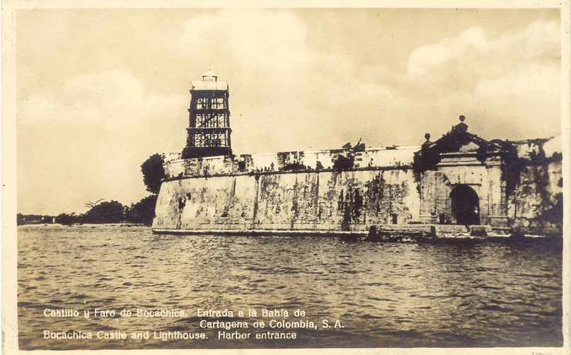
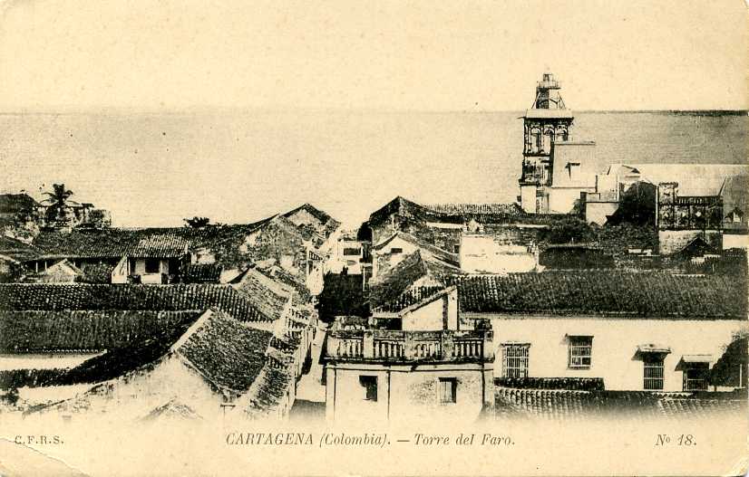
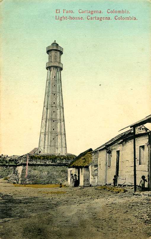
Faros antiguos en Cartagena
Posted by the Cartagena newspaper El Universal, this article by Jorge Sanduval Duque describes the early lighthouses of Cartagena.
Lighthouses in Colombia
Photos by various photographers available from Wikimedia.
World of Lighthouses - Colombia
Photos by various photographers available from Lightphotos.net.
Leuchttürme Südamerikas auf historischen Postkarten
Historic postcard views posted by Klaus Huelse.
Google Maps
Satellite view of Colombia's northwest coast.


Castillo Grande Light, Cartagena, October 2024
ex-Google Maps photo by Lavi Shiffman

Chocó Department Lighthouses
Bordering Panamá, the Chocó Department has a long coast facing west on the Pacific Ocean but it also has a short coast on the Caribbean. Lighthouses of its Pacific coast are described on the Western Colombia page. The lighthouses of northern Chocó and Antioquia are on the Gulf of Urubá, an inlet of the Caribbean Sea about 75 km (46 mi) long and up to 35 km (22 mi) wide.

Cabo Tiburón
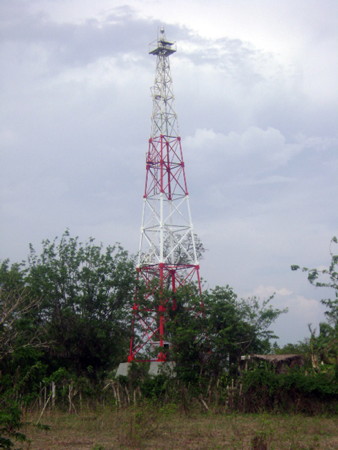
Date unknown. Active; focal plane 104 m (341 ft); two white flashes every 15 s. 18 m (59 ft) square skeletal tower, painted with red and white horizontal bands. A photo is at right and Google has a distant satellite view. This lighthouse marks the Panamanian border and the west side of the entrance of the Gulf of Urabá. Site status unknown. ARLHS COL-017; DIMAR-055; Admiralty J6144; NGA 16632.
* Acandí
Date unknown. Active; focal plane 27 m (89 ft); two white flashes every 10 s. 12 m (39 ft) square skeletal tower, painted with red and white horizontal bands. A distant photo is available and Google has an indistinct satellite view. Acandí is a town of about 10,000 residents at the northwestern corner of the Gulf of Urabá. Located on a small island at the northern entrance to Acandí. Site open, tower closed. DIMAR-058; Admiralty J6144.5; NGA 16635.

Antioquia Department Lighthouses
Antioquia is primarily an inland region encompassing the northern Andes mountains. Its capital Medellín is Columbia's second largest city. Urabá Antioquia, a subregion of the department, extends narrowly to include the south end and west coast of the Gulf of Urabá.

Matuntugo
2001. Active; focal plane 40 m (131 ft); three white flashes every 8 s. Approx. 35 m (115 ft) square skeletal communications tower, painted with red and white horizontal bands. No photo available but Google has a satellite view. Located at Matuntugo on the west side of the Gulf of Urabá. Site status unknown. ARLHS COL-030; DIMAR-052; Admiralty J6147.8 (ex-J6148); NGA 16639.
Isla de los Muertos
Date unknown. Active; focal plane 22 m (72 ft); white flash every 6 s. 19 m (62 ft) skeletal tower mounted on a small concrete equipment shelter. Tower painted with red and white horizontal bands. No photo available but Google has a satellite view. Located on a low promontory about 2.5 km (1.5 mi) east of Matuntugo. Accessible only by boat. Site status unknown. ARLHS COL-027; DIMAR-054; Admiralty J6147; NGA 16636.
Bocas del Leoncito
Date unknown. Active; focal plane 13.5 m (44 ft); two white flashes every 8 s. 12 m (39 ft) square pyramidal skeletal tower, painted with red and white horizontal bands and mounted on a square concrete platform supported by piles. No photo available but Bing has a distant satellite view. Located at one of the mouths of the Río Leoncito delta, the southwest corner of the Gulf of Urabá. Site status unknown. DIMAR-053; Admiralty J6148.5; NGA 16650.

Cabo Tiburón Light, Chocó
DIMAR photo
Bocas del Río Léon
Date unknown. Active; focal plane 15 m (49 ft); white flash every 8 s. 12 m (39 ft) square pyramidal skeletal tower, painted with red and white horizontal bands. No photo available but Google has a satellite view. This light guides ships to a new port being developed by Antioquia. Located on the east side of the entrance to the Río Léon, at the southeastern corner of the Gulf of Urabá. Accessible only by boat. Site status unknown. DIMAR-051; Admiralty J6149.5; NGA 16651.
Puerto Antioquia
Date unknown. Active; focal plane at least 20 m (66 ft); continuous red light. Tower painted with red and white or black and white bands. No photo available but Google has a satellite view. Located in the new Puerto Antioquia. Site status unknown. Admiralty J6150.51.
Punta las Vacas (Turbo)
Date unknown. Active; focal plane 18 m (59 ft); white flash every 6 s. 16 m (52 ft) skeletal mast mounted on a small concrete equipment shelter. Tower painted with red and white horizontal bands. A photo is at right and Google has a satellite view. A city with about 175,000 residents, Turbo is the regional capital and the northern terminus of the Pan-American Highway in South America. Located a short distance southwest of a Colombian military base on the south side of Turbo, on the east side of the Gulf of Urabá. Site and tower closed. ARLHS COL-043; DIMAR-050; Admiralty J6149; NGA 16648.
Punta Yarumal
2001. Active; focal plane 20 m (66 ft); white flash every 5 s. 18 m (59 ft) square skeletal tower, mounted on a square 1-story concrete equipment building. Lighthouse painted with red and white horizontal bands. No photo available but Google has a satellite view. Located at the tip of a long spit on the north side of Turbo. Site status unknown. ARLHS COL-049; DIMAR-051; Admiralty J6147.5; NGA 16638.
Punta Caimán (?)
2001. Probably inactive but listed with focal plane 18 m (59 ft); white flash every 7.5 s. No photo available and trees hide the tower in Bing's satellite view. The light has been dropped from the Admiralty list butit is still listed by NGA. Located on a prominent cape on the east side of the Gulf of Urabá, about 25 km (15 mi) north of Turbo. Site status unknown. ARLHS COL-035; DIMAR-048; ex-Admiralty J6146.5; NGA 16652.
Punta Arenas Norte
Date unknown. Active; focal plane 20 m (66 ft); white flash every 9 s. 18 m (59 ft) square skeletal tower, painted with red and white horizontal bands. No photo available but Google has a distant satellite view. Located on a prominent cape at the east side of the entrance of the Gulf of Urabá. Site status unknown. DIMAR-047; Admiralty J6146; NGA 16656.

Punta las Vacas Light, Turbo
DIMAR photo

Punta Caribaná (Cerro del Águila)
Date unknown. Active; focal plane 84 m (276 ft); one long (1.2 s) white flash every 12 s. 4 m (13 ft) square pyramidal skeletal tower. Jorge Vasquez has a 2019 photo, Miguel Idárraga has a 2021 closeup and a photo of the view from the lighthouse, and Google has a satellite view. Located on a prominent cape at the east side of the entrance of the Gulf of Urabá. Site status unknown. ARLHS COL-018; DIMAR-046; Admiralty J6145; NGA 16660.

Córdoba Department Lighthouses
Isla Tortuguilla
Date unknown. Active; focal plane 21 m (69 ft); white flash every 10 s. 18 m (59 ft) square skeletal tower, painted with red and white horizontal bands. Carolina Muñoz has the 2021 photo seen at right, Eymer Cordero has a 2017 photo, and the light is barely visible in Bing's satellite view. Located on a small island about 8 km (5 mi) offshore near Puerto Escondido. Accessible only by boat. Site open, tower closed. ARLHS COL-053; DIMAR-045; Admiralty J6151; NGA 16662.
** Isla Fuerte (2)
1968 (station established 1939). Active; focal plane 40 m (131 ft); white flash every 10 s. 33 m (108 ft) square pyramidal steel skeletal tower with gallery, painted with red and white horizontal bands. Robinson Rua has a closeup 2020 photo, Kevin Plata has a 2025 photo, Ulugh Muztagh has a 2017 photo, DIMAR has a photo, and Google has a distant satellite view. Isla Fuerte is an island about 10 km (6 mi) off the coast at the southern entrance to the Golfo de Morrosquillo. Resorts on the island are popular with scuba divers. Located on the east side of the island. Site open, tower open for climbing. ARLHS COL-025; DIMAR-044; Admiralty J6152; NGA 16664.

Sucre Department Lighthouses
Sucre Department has only a short mainland coast but it includes the Islas de San Bernardo, an archipelago of ten islands that has become a popular tourist destination.

Roca Morrosquillo (2) (?)
Date unknown. Apparently inactive . 14 m (46 ft) square skeletal tower, painted with red and white horizontal bands, mounted on a square concrete platform supported by piles. No photo available and the reef is not shown in Google's satellite view. NGA describes a 6 m (20 ft) tower. This light has been dropped from the Admiralty and NGA lists. Located on a shoal at the southwestern extremity of the Islas de San Bernardo. Accessible only by boat. Site open, tower closed. ARLHS COL-067; DIMAR-043; ex-Admiralty J6154.5; ex-NGA 16678.

Isla Tortuguilla Light, Córdoba, November 2021
Google Maps photo by Carolina Muñoz
#Punta de Piedra
Date unknown. Inactive since 2013 and since removed. 4 m (13 ft) triangular skeletal tower, painted with red and white horizontal bands, mounted atop a 10-story condo building. Google has a 2014 street view and a satellite view. Located in the Punta de Piedra resort area, about 130 km (80 mi) south of Cartagena. Site open, tower closed. ARLHS COL-061; ex-DIMAR-045; ex-Admiralty J6153.9; ex-NGA 16672.
Isla Ceycén
Date unknown. Active; focal plane 24 m (79 ft); white flash every 3 s. 18 m (59 ft) skeletal tower, painted with red and white horizontal bands. No photo available but Google has an indistinct satellite view. Located on a small island at the southern end of the Islas de San Bernardo. Accessible only by boat. Site status unknown. ARLHS COL-023; DIMAR-042; Admiralty J6156; NGA 16679.
* Isla Múcura
Date unknown. Active; focal plane 24 m (79 ft); two white flashes every 10 s. 18 m (59 ft) square skeletal tower, painted with red and white horizontal bands. A 2021 photo is available, Ricardo Lopera Jaramillo has a street view (the tower is behind the tree!), and the tower is barely visible in Google's satellite view. Isla Múcura is a small island resort in the Islas de San Bernardo, about 80 km (50 mi) southwest of Cartagena. Accessible only by boat. Site status unknown. ARLHS COL-029; DIMAR-040; Admiralty J6157; NGA 16680.

Bolivar Department (Cartagena Area) Lighthouses
Founded in 1533, Cartagena is one of the oldest cities of the Americas. In the 16th and 17th centuries it was the principal port shipping South American gold to Spain. This made it a common target for pirates and raiders from England and other European countries. Today it is Colombia's largest Caribbean port with a population of about one million. It is also an important tourist destination and a frequent port of call for cruise ships.

Isla Arena (Isla Arenas)
Date unknown. Active; focal plane 22 m (72 ft); white flash every 15 s. 18 m (56 ft) square skeletal tower painted with red and white horizontal bands. Kelvin Quintero Peña has a 2021 drone view and Rogério Duailibe has a 2020 street view, but the tower is not conspicuous in Google's satellite view. Located on a small island in the Islas del Rosario, just off the tip of the Barú Peninsula. Accessible only by boat. Site status unknown. DIMAR-041; Admiralty J6159; NGA 16684.
Isla del Rosario
Date unknown. Active; focal plane 14 m (46 ft); white flash every 5 s. 14 m (46 ft) square skeletal tower painted with red and white horizontal bands, standing on a square concrete pad. A photo is at right and Google has an indistinct satellite view. Located on a rocky reef at the extreme western end of the Islas del Rosario. Accessible only by boat. Site open, tower closed. DIMAR-039; Admiralty J6159.7; NGA 16687.1.
Isla del Tesoro
Date unknown (station established 1922). Active; focal plane 34 m (112 ft); three white flashes every 12 s. 34 m (112 ft) square skeletal tower painted with red and white horizontal bands, mounted on a square concrete platform supported by piles. Trabas has Capt. Peter's distant 2006 view from the sea and Google has a satellite view. Located on a small island on the north side of the Islas del Rosario, about 25 km (15 mi) southwest of Cartagena. Accessible only by boat. Site status unknown. ARLHS COL-009; DIMAR-038; Admiralty J6160; NGA 16688.
Banco Salmedina (3?)
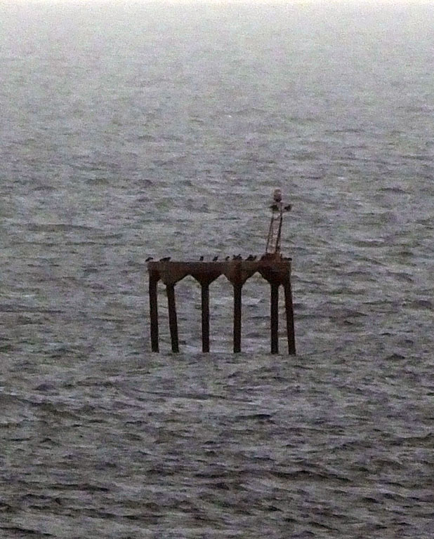
Date unknown (station established 1937). Inactive since 2018. Light mounted on a concrete platform supported by piles. This light marks the beginning of the approach to Cartagena. A 22 m (72 ft) tower was installed in 1978. However, the tall tower was removed and replaced by a light on a short stand; Trabas has a photo by Capt. Peter but the reef is not shown in Google's satellite view. Located on a low bank about 8 km (5 mi) off the coast and 16 km (10 mi) west of Cartagena. Accessible only by boat. Site status unknown. ARLHS COL-012; ex-DIMAR-036; ex-Admiralty J6164; ex-NGA 16728.

Isla del Rosario Light, Islas del Rosario
DIMAR photo
Isla Tierra Bomba
Date unknown. Active; focal plane 107 m (351 ft); two white flashes every 3.5 s. Approx. 30 m (98 ft) square skeletal tower painted with red and white horizontal bands. Trabas has Capt. Peter's 2017 photo seen at right and Google has a satellite view. Tierra Bomba is a large island sheltering the harbor of Cartagena. Located on one of the highest points of the island. Site and tower closed. ARLHS COL-037; DIMAR-037; Admiralty J6166; NGA 16700.
#Bocachica Channel No. 2 (Range B Rear)
Date unknown. Inactive since 2012 and later removed. 33 m (108 ft) square pyramidal skeletal tower, painted with red and white horizontal bands. No photo available but Google has a satellite view. This range guided vessels in the main channel into Cartagena harbor, south of Isla Tierra Bomba. Located just offshore at a petroleum tank farm. Site and tower closed. ex-DIMAR-189; ex-Admiralty J6166.67; ex-NGA 16708.1.
Puerto Mamonal (Port Mamonal) (Leading Light)
Date unknown. Active (privately maintained); focal plane 25 m (82 ft); quick flash every 1 s, white, red or green depending on direction. Approx. 22 m (72 ft) square skeletal tower painted with red and white horizontal bands and carrying a daymark painted white with a red vertical stripe. Trabas has Capt. Peter's 2019 photo and Google has a satellite view. This was originally the rear light of the entrance range for the commercial harbor of Cartagena; the front light was removed after the leading light was installed. Located at a coal terminal on the south side of Cartagena. Site and tower closed. Admiralty J6166.96.
#Isla de Manzanillo (ENAP) Range Front (2?)
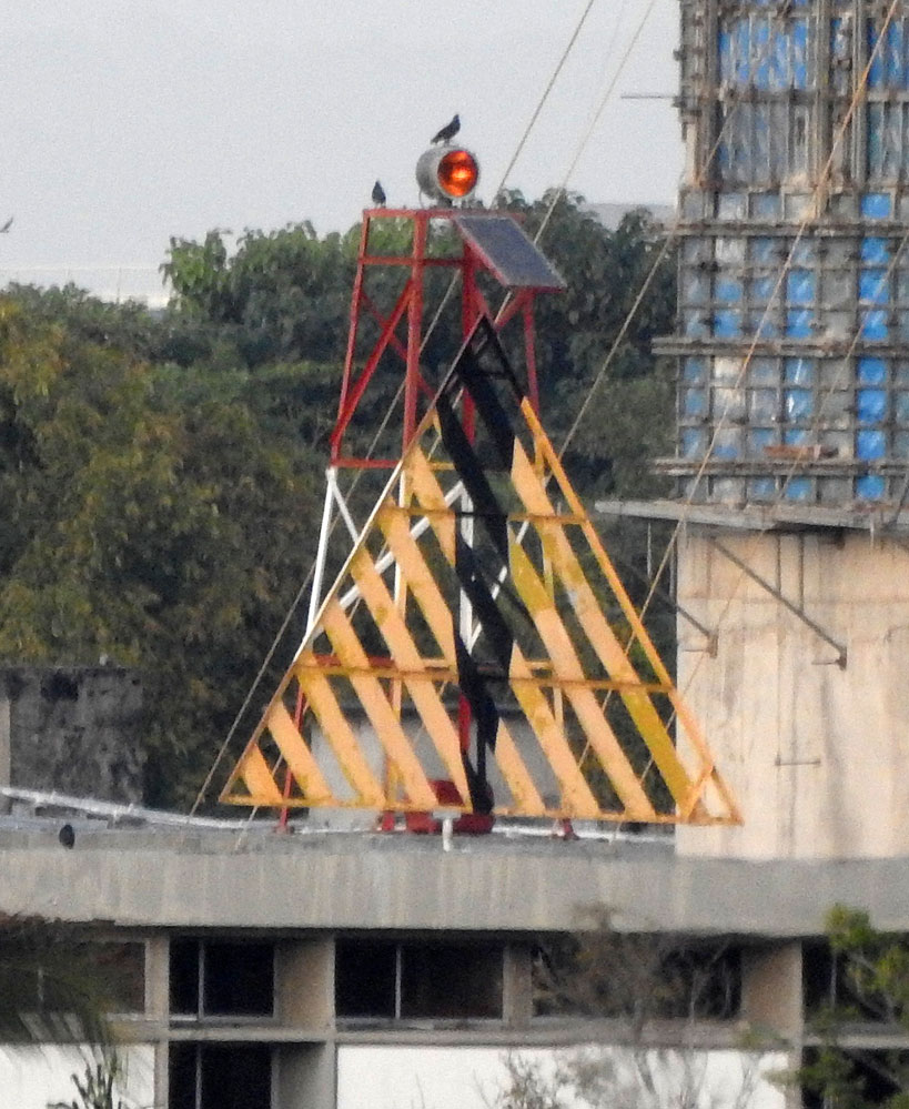
Date unknown. Removed. 10 m (33 ft) square skeletal tower painted red with a white horizontal band; in front of the tower is a triangular slatted daymark painted yellow with a black vertical stripe. The tower was mounted on one of the buildings of the Colombian Naval Academy; Trabas has Capt. Peter's photo and Google has a satellite view of the location. The building has been rebuilt and the the light has been removed. The range guides vessels northward inside Cartagena harbor. Site and tower closed. Site manager: Escuela Naval de Cadetes Almirante Padilla (ENAP). DIMAR-293; ex-Admiralty J6167.65; NGA 16725.5.
#Isla de Manzanillo (ENAP) Range Rear
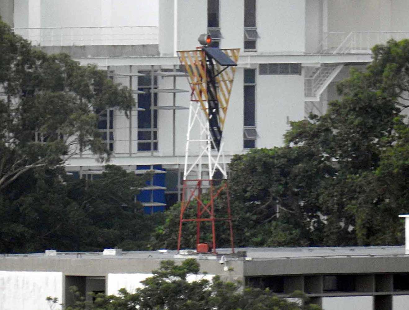
Date unknown. Active; focal plane 22 m (72 ft); quick-flashing yellow light. 10 m (33 ft) square skeletal tower painted red with a white horizontal band and carrying triangular slatted daymark painted yellow with a black vertical stripe. The tower was mounted on one of the buildings of the Colombian Naval Academy. Trabas has Boucher's photo and Google has a satellite view of the location. The building has been rebuilt and the the light has been removed. Site and tower closed. Site manager: Escuela Naval de Cadetes Almirante Padilla (ENAP). ex-DIMAR-292; ex-Admiralty J6167.66; NGA 16725.51.

Isla Tierra Bomba Light, Cartagena, January 2017
photo copyright Capt. Peter Mosselberger; used by permission
Naval Base ARC Bolivar
Date unknown. Inactive and probably removed. This was a 35 m (115 ft) square skeletal tower painted with red and white horizontal bands. Trabas has Capt. Peter's photo and Google has a 2019 street view and a satellite view. ARC is the common acronym for the Colombian Navy (Armada Nacional de la República de Colombia). The light has been dropped from the Admiralty list. Located in the naval base on the waterfront of Cartagena's inner harbor. Site and tower closed (military base). DIMAR-296; ex-Admiralty J6167.4.
Castillo Grande (Cartagena)
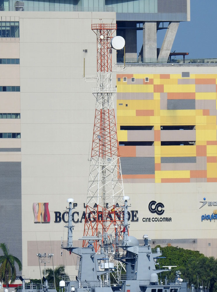
1973. Active; focal plane 24 m (79 ft); white flash every 7 s. 22 m (72 ft) unpainted round concrete block tower with lantern and gallery. Lantern painted white. A 3rd (?) order Fresnel lens is in use. Lavi Shiffman's 2024 photo is seen at the top of this page, Trabas has Capt. Peter's 2021 photo, Nihaar Gupta has a 2006 photo, Martin Mobers has a 2015 photo, Manuel Fernando Castro Martinez has a distant street view, and Google has a satellite view. Castillo Grande is an upscale neighborhood accessible to tourists. Located in the naval officer's club at the end of a peninsula sheltering the inner harbor of Cartagena. Site and tower closed (naval base) but the lighthouse can be seen at a distance. ARLHS COL-035; DIMAR-035; Admiralty J6167.6; NGA 16726.
* Punta Canoas (Punta Canoa)
Date unknown. Active; focal plane 96 m (315 ft); two white flashes every 20 s. 12 m (39 ft) square skeletal tower, painted with red and white horizontal bands. Trabas has Capt. Peter's 2017 photo, Miguel Antonio Perez Blanco has a 2026 view, and Google has a satellite view. Located on a steep bluff overlooking the Caribbean about 25 km (15 mi) north of Cartagena. Site open, tower closed. ARLHS COL-036; DIMAR-034; Admiralty J6174; NGA 16736.
Galerazamba (Punta Galera) (3)
Date unknown (station established 1921). Active; focal plane 12 m (39 ft); white flash every 6 s. Approx. 10 m (33 ft) round fiberglass (?) tower colored with red and white horizontal bands. Luis Daniel Torres Acosta's 2023 photo is at right, Diego Rojas has a 2026 photo, and Google has a satellite view and a distant street view. This tower replaced the 1968 lighthouse, an 18 m (59 ft) square pyramidal skeletal tower mounted atop a square 1-story equipment building. Older light lists have a light about 10 km (6 mi) southwest of the present location, established in 1888. Located on a headland about halfway between Cartagena and Barranquilla. Site and tower closed. ARLHS COL-026; DIMAR-033; Admiralty J6176; NGA 16740.

Galerazamba Light, Cartagena, April 2023
Google Maps photo by Luis Daniel Torres Acosta

Information available on lost lighthouses:

Adjoining pages: Northeast: Northeastern Colombia | Southwest: Western Colombia | West: Northern Panama | Northwest: San Andrés and Providencia

Return to the Lighthouse Directory index | Ratings key

Posted February 13, 2004. Checked and revised July 27, 2026. Lighthouses: 31. Site copyright 2026 Russ Rowlett and the University of North Carolina at Chapel Hill.