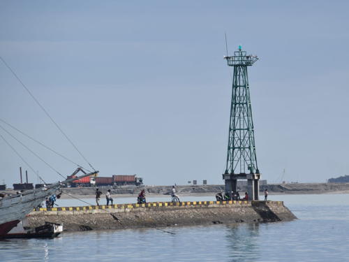
Lighthouses of Indonesia: South Sulawesi (Celebes) Mainland

The Republic of Indonesia has been independent since 1945 after having been the Dutch East Indies for more than 350 years. It is a huge country, stretching along both sides of the Equator for more than 46 degrees of longitude (roughly 5100 km or 3200 miles). Comprised of some 17,000 islands (more than 6000 inhabited islands), it has hundreds of major aids to navigation. This is one of eight pages for lighthouses of Sulawesi (Celebes), a major island in the northern part of the country.

Shaped like an artistically drawn letter K, Sulawesi consists mostly of four narrow peninsulas. The Makassar Strait separates Sulawesi from Kalimantan (Borneo) to the west. The Celebes Sea is north of the island, the Molucca Sea is on the northeast, the Banda Sea is to the southeast, and the Flores Sea is on the south.

Indonesia is divided into 38 provinces and the provinces are subdivided into regencies (kabupaten). This page covers the mainland regencies of South Sulawesi Province, including the well-populated southern peninsula. The South Sulawesi Islands page covers a large number of islands in the Flores Sea, Java Sea, and Strait of Makassar that also belong to the province.

The Indonesian word for a lighthouse is mercusuar or (in two words) mercu suar. The phrase menara suar, which includes the Arabic word menara, is sometimes used instead. Tanjung and ujung are words for capes, bukit is a hill, pulau is an island, selat is a strait, karang is a reef, sungai is a river, muara is an estuary, teluk is a bay or harbor, and pelabuhan is a port.

Aids to navigation in Indonesia are operated and maintained by the Directorate of Marine Navigation within the Directorate General of Sea Transportation.

ARLHS numbers are from the ARLHS World List of Lights. Admiralty numbers are from volumes F and Q of the Admiralty List of Lights & Fog Signals. U.S. NGA List numbers are from Publication 112.

General Sources
Online List of Lights - Indonesia
Photos by various photographers posted by Alexander Trabas; photos for this area are by Jim Smith.
Indonesian Lighthouses
Historic postcard views from the collection of Michel Forand.
World of Lighthouses - Indonesia
Photos by various photographers available from Lightphotos.net.
Sulawesi Map
A useful map from orangesmile.com.
Navionics Charts
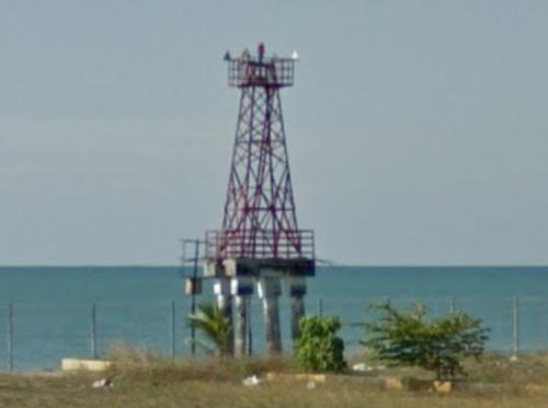
Navigation chart for Sulawesi.

Tanjung Papanambeja Light, Bulukumba, May 2016
Google Maps street view

Gulf of Boni Lighthouses

The Gulf of Boni (Teluk Bone) is a broad arm of the Banda Sea separating the southern and southeastern peninsulas of Sulawesi. The north and west shores of the Gulf are in South Sulawesi Province. Lighthouses of the east coast of the Gulf are described on the Southeast Sulawesi page.

Luwu Timur (East Luwu) Regency Lighthouses
Pulau Bulu Bulu (Bulu Pulu, Bulupolo)
Date unknown. Active; focal plane 18 m (59 ft); white flash every 3 s. Approx. 15 m (49 ft) "white beacon." No photo available; Bing's satellite view suggests a white fiberglass or concrete tower. Located at the east end of Pulau Bulu Bulu, a forested island projecting into the northeastern embayment of the Gulf of Boni. Accessible only by boat. Site status unknown. Admiralty Q1545.6; NGA 25400.
* [Tanjung Mangkasa]
Date unknown. Active; focal plane about 8 m (26 ft); red light, pattern unknown. Approx. 6 m (20 ft) yellow skeletal mast. Samsul Bahri has a photo but the small light is not seen in Google's satellite view of the pier. Located on the pier at the Tanjung Mangkasa port, on the south side of the entrance to Teluk Usu, a bay at the northeastern corner of the Gulf of Boni. Site open, tower closed. Admiralty Q1545.3.
Pulau Mori (2?)
Date unknown. Active; focal plane 10 m (33 ft); white flash every 5 s. 7 m (23 ft) round barbell-shaped white fiberglass tower. No photo available but Google has a satellite view. NGA lists a white mast for this light. Located at the southern tip of a small island in the entrance to Teluk Usu. Accessible only by boat. Site status unknown. Admiralty Q1545; NGA 25404.

Luwu Utara (North Luwu) Regency Lighthouse
* Munte
2021. Active (?); focal plane about 33 m (180 ft); white light, pattern unknown. Approx. 30 m (98 ft) octagonal concrete tower with lantern and gallery. Tower painted whote, lantern red. Irfan Ben's Novemnber 2020 photo is at right and a 2022 photo is available, but the tower is too new to appear in Google's satellite view. The lighthouse was built in 2020 as part of the development of a new port at Munte, the first modern port in the regency. Located at the base of the Munte pier. Site open, tower closed. Not listed by the Admiralty.
 

Munte Light, Munte, November 2020
Google Maps photo by Irfan Ben

Palopo City Lighthouses
* Palopo (Tanjung Ringgit)
Date unknown. Active; focal plane 14 m (46 ft); white flash every 3 s. 8 m (26 ft) square skeletal tower, painted white and mounted on a square concrete base. Ishak Bocha has a 2017 photo and Google has a street view and an indistinct satellite view. Located at the end of the main quay at Palopo, a city of 190,000 residents at the northwestern corner of the Gulf of Boni. Site open, tower closed. Admiralty Q1544; NGA 25390.
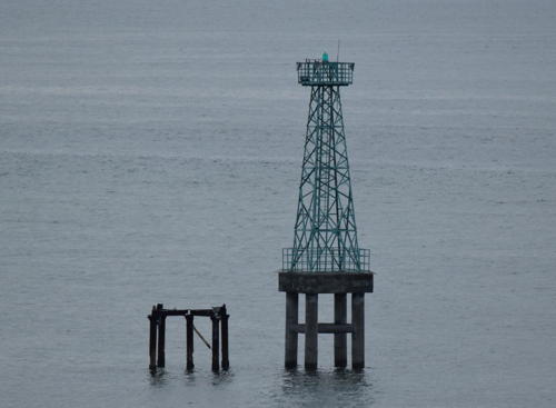
Palopo North
Date unknown. Active; focal plane about 15 m (49 ft); green light, pattern unknown. Approx. 15 m (49 ft) square green skeletal tower on a square platform supported by piles. No photo available and the light is not shown in Google's satellite view. Located on a shoal about 3 km (2 mi) east of the Palopo pier. Accessible only by boat. Site open, tower closed. Admiralty Q15434.5
Palopo South
Date unknown. Active; focal plane about 15 m (49 ft); red flash every 4 s. Approx. 15 m (49 ft) square red skeletal tower on a square platform supported by piles. Google has a distant satellite view and a very distant street view from the Palopo pier. Located on a shoal about 1 km (0.6 mi) east southeast of the Palopo pier. Accessible only by boat. Site open, tower closed. Admiralty Q1543.

Luwu Regency Lighthouse
Tanjung Jene
Date unknown. Active; focal plane 15 m (49 ft) (?); white flash every 5 s. 20 m (66 ft) square white skeletal tower mounted on a platform supported by piles. No photo available but Google has a distant satellite view. Located off a swampy point of land about 30 km (19 mi) southeast of Palopo. Accessible only by boat. Site open, tower closed. Admiralty Q1542; NGA 25388.

Wajo Regency Lighthouse
* Pelabuhan Siwa
Date unknown. Active; focal plane about 20 m (66 ft); white flash every 5 s (?). Approx. 16 m (52 ft) square white skeletal tower. Google has a street view (a portion is also seen at right) but the tower is hard to find in Google's satellite view. Located on the ferry pier at Siwa. Site open, tower closed. Admiralty Q1541.6; NGA 25386.

Pelabuhan Siwa Light, Siwa, June 2017
Google Maps street view

Bone Regency Lighthouses
Tanjung Lameriki
Date unknown. Active; focal plane 34 m (112 ft); white flash every 10 s. 30 m (98 ft) octagonal concrete tower with lantern and gallery, painted white. No photo available but Google has a satellite view. Located on a low point of land on the central west coast of the Gulf of Boni, about 45 km (28 mi) north of Macoppe. Site status unknown. ARLHS IDO-306; Admiralty Q1541.3; NGA 25473.
Karang Torea
Date unknown. Active; focal plane 8 m (26 ft); green flash every 3 s. 8 m (26 ft) square green skeletal tower mounted on a square platform supported by piles. No photo available but Bing has a satellite view. This light and the next one frame a passage through the north end of the extsnive reef system of the southwestern Gulf of Boni, leading to the port of Bajoe. Located at the east end of the Torea reef about 8 km (5 mi) northeast of Bajoe. Accessible only by boat. Site open, tower closed. Admiralty Q1541.1; NGA 25472.5.
Karang Totopele
Date unknown. Active; focal plane 8 m (26 ft); red flash every 3 s. 8 m (26 ft) square red skeletal tower mounted on a square platform supported by piles. No photo available but Google has a satellite view. Located on the north side of the Totopele reef about 2 km (1.25 mi) southeast of the Torea light. Accessible only by boat. Site open, tower closed. Admiralty Q1541; NGA 25472.
Bajoe (Bajowe) Approach
Date unknown. Active; focal plane 8 m (26 ft); green flash every 3 s. 8 m (26 ft) square green skeletal tower mounted on a square platform supported by piles. No photo available but Bing has a satellite view. Located about 2.5 km (1.5 mi) east of the Bajoe pier. Accessible only by boat. Site open, tower closed. Admiralty Q1540.95; NGA 25471.
* Bajoe (Bajowe)
Date unknown. Active; focal plane 8 m (26 ft); red flash every 4 s. 8 m (26 ft) square skeletal tower mounted on a square platform supported by piles. Rumah Dongeng has a 2018 photo and Google has a street view and an indistinct satellite view. Bajoe is the port for Watampone, a city of 80,000 residents that is the capital of Bone Regency. Located at the ferry terminal at the end of the long pier of Bajoe. Site open, tower closed. Admiralty Q1540.9; NGA 25470.5.
* [Tanjung Patiro]
Date unknown. Active; focal plane about 13 m (43 ft); white light, pattern unknown. Approx. 13 m (43 ft) white post on a small platform suppported by piles. A photo is available and Google has a satellite view. Located beside the pier at the port of Patiro Bajo. Site open, tower closed. Admiralty Q1540.8.

Bajoe Light, Bajoe, July 2019
Google Maps street view

Sinjai Regency Lighthouses
Karang Limpogeh
Date unknown. Active; focal plane 15 m (49 ft); white flash every 3 s. 15 m (49 ft) square white skeletal tower mounted on a square platform supported by piles. No photo available but Bing has a distant satellite view. This light guides ships around the very large area of shoals and reefs in the southwestern Gulf of Boni. Accessible only by boat. Site open, tower closed. Admiralty Q1540; NGA 25470.
* [Pelabuhan Sinjai]
Date unknown. Active; focal plane about 12 m (39 ft); white light, pattern unknown. Approx. 7 m (23 ft) white post. Ichsan Asfaril Hidayat has a photo, a street view is available, and Bing has a satellite view. Located beside the port office on the pier in Sinjai. Site open, tower closed. Admiralty Q1540.5.
Karang Malamala
Date unknown. Active; focal plane about 12 m (39 ft); red light, pattern unknown. Approx. 12 m (39 ft) tower, probably a barbell-shaped foberglass tower, on a plat form supported by piles. No photo available but Bing has a distant satellite view. This light guides vessels through a reef on the approach to Sinjai. Located about 20 km (13 mi) southeast of Sinjai. Accessible only by boat. Site open, tower closed. Admiralty Q1540.45.
 

South Coast (Flores Sea) Lighthouses


Bulukumba Regency Lighthouses
Bulukumba is a city of about 80,000 residents at the end of Sulawesi's southern peninsula.

*
Bira Port (Lasa) South Breakwater
Date unknown. Active; focal plane about 15 m (49 ft); red light, pattern unknown. Approx. 12 m (39 ft) square skeletal tower, painted red and mounted on a platform support by piles. Singgih Afifa Putra has a photo, Imam Budiman has a distant view from shore, and Google has a distant street view and an indistinct satellite view. Muhammad Yusril has a photo that also shows the north breakwater light on a green mast and Ikhwan Mahmud has a photo of a white post light on the waterfront; these lights are not listed by the Admiralty. Located just off the end of the south breakwater at Bira, a ferry port at the southeastern tip of Sulawesi's southern peninsula, opposite Pulau Selayer (see South Sulawesi Islands). Accessible only by boat but easily seen from nearby. Site open, tower closed. Admiralty Q1534.
* Bulukumba (Kalumeme)
Date unknown. Active; focal plane 13 m (43 ft); white flash every 5 s. 10 m (30 ft) round barbell-shaped white fiberglass tower. Heru Purwanto's closeup photo is at right, the tower is seen behind the building in Anto Muhammad Julianto's 2022 photo, and Google has a street view and a satellite view. Located adjacent to the ferry terminal in Bulukumba. Site open, tower closed. Admiralty Q1532.5; NGA 25411.
Bulukumba South
Date unknown. Active; focal plane about 14 m (46 ft); red light, pattern unknown. Approx. 14 m (46 ft) square skeletal tower mounted on a platform supported by piles. Entire lighthouse is red. Hamdan Salim has a distant view from shore (distant tower near the left edge of the photo) and Google has a satellite view and a distant street view. Located on a shoal about 1 km (0.6 mi) south southwest of the Bulukumba ferry terminal. Accessible only by boat. Site open, tower closed. Admiralty Q1533.3.
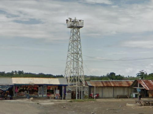
Tanjung Papanambeja (Bulukumba) (2)
Date unknown (station established 1904). Active; focal plane 26 m (85 ft); four white flashes every 20 s. 24 m (79 ft) square skeletal tower with lantern and gallery, painted white. A 2016 Google street view is at the top of this page and Google also has a 2019 street view and a satellite view. The original tower had a height of 13 m (43 ft). Located on a promontory on the southwest side of Bulukumba. Site status unknown. ARLHS IDO-121; Admiralty Q1532; NGA 25412.

Bulukumba Light, Bulukumba, September 2006
ex-Google Plus photo by Heru Purwanto

Bantaeng Regency Lighthouse
* Bantaeng
Date unknown. Active; focal plane about 13 m (43 ft); light characteristic unknown. Approx. 12 m (39 ft) square skeletal tower with gallery, painted white, mounted on a square concrete base supported by piles. Asrul Noer's photo is at right and Google has a street view and a satellite view. Located at the base of a long pier at Bantaeng. Site open, tower closed. Not listed by the Admiralty.

Jeneponto Regency Lighthouses
Teluk Jeneponto
Date unknown. Active; focal plane about 15 m (49 ft); light characteristic unknown. Approx. 15 m (49 ft) round barbell-shaped white fiberglass tower mounted on a concrete platform supported by piles. No photo available but Google has an indistinct satellite view. Located on the east side of the entrance to the bay of Jeneponto. Accessible only by boat. Site open, tower closed. Admiralty Q1531.
* Jeneponto (Jene Ponto)
Date unknown. Active; focal plane about 13 m (43 ft); light characteristic unknown. Approx. 12 m (39 ft) square skeletal tower with gallery, painted white, mounted on a square concrete base supported by piles. Aswin Bahar has a photo and Google has a street view and an indistinct satellite view. Located near the base of a long pier at Jeneponto. Site open, tower closed. Admiralty Q1530.
* Tanjung Bulu Bulu
Date unknown. Active; focal plane 42 m (138 ft); white flash every 10 s. Approx. 40 m (131 ft) square skeletal tower with lantern and gallery, painted white. Several coast guard station buildings. No photo available but Google has a satellite view of the station. Located at the southern tip of the Southern Peninsula near Binamu. Accessible by road. Site probably open, tower closed. Admiralty Q1528; NGA 25414.
Bosowa Energy Terminal
2017. Active; focal plane about 35 m (115 ft); Approx. 30 m (98 ft) square white skeletal tower. No photo available but Google has a satellite view. Located on the waterfront of a power plant, inaugurated in 2017, on the east side of Teluk Laikang, a semicircular bay at the southwestern corner of the Southern Peninsula. Site and tower closed. Admiralty Q1518.88.
Kaili Light
Bantaeng Light, Bantaeng, February 2009
ex-Panoramio photo copyright Asrul Noel; permission requested

West Coast (Makassar Strait) Lighthouses

Takalar Regency Lighthouses
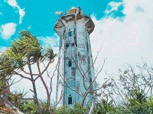
Pulau Tanakeke
Date unknown. Active; focal plane 24 m (79 ft); white flash every 10 s. 20 m (66 ft) octagonal white concrete tower with lantern and gallery. A photo is at right and Bing has a satellite view. Pulau Tanakeke is a populated island about 15 km (9 mi) southwest of Patalasang, on the southwestern tip of Sulawesi. Located at the southern tip of the island. ARLHS IDO-250; Admiralty Q1518.5; NGA 25421.
Tompotana (Pulau Tanakeke East)
Date unknown. Active; focal plane about 16 m (52 ft); light characteristic unknown. Approx. 16 m (52 ft) square white skeletal tower mounted on a platform supported by piles. No photo available but Google has a satellite view. Located off the east coast of Pulau Tanakeke. Accessible only by boat. Site open, tower closed. Admiralty Q1519; NGA 25422.
Pulau Dayangdayangan (2)
Date unknown (station established 1893). Active; focal plane 42 m (138 ft); white flash every 5 s. 30 m (98 ft) square skeletal tower with gallery, painted white. Several coast guard station buildings. A distant view from the sea and a closeup video are available, The lighthouse also appears at 0:50 in a YouTube video and Bing has a satellite view. The original lighthouse had a focal plane height of 32 m (105 ft). Located on a small island about 10 km (6 mi) northwest of Pulau Tanakeke. Accessible only by boat. Site status unknown. ARLHS IDO-196; Admiralty Q1518; NGA 25424.
Taka Gosseya (Taka Gosseiya)
Date unknown. Active; focal plane 15 m (49 ft); white flash every 5 s. 15 m (49 ft) "white beacon," probably a skeletal tower mounted on a platform supported by piles. No photo available and the tower is not seen in Google's satellite view. Located on a reef about 20 km (13 mi) west northwest of Pulau Dayangdayangan. Accessible only by boat. Site open, tower closed. Admiralty Q1517.5; NGA 25424.5.

Pulau Tanakeke Light, Takalar, June 2019
Facebook photo by ippangelk
Pulau Sangrabengi
Date unknown. Active; focal plane about 16 m (52 ft); white light, pattern unknown. Approx. 16 m (52 ft) square white skeletal tower mounted on a platform supported by piles. The lighthouse is at far left in a view by Adhyl Arz and toward the right in a second distant view; Bing has a satellite view. Located west of Pulau Sangrabengi, a small island off the town of Galesong. Accessible only by boat. Site open, tower closed. Admiralty Q1518.3.

Makassar City Lighthouses
Makassar is the capital of South Sulawesi, by far the largest city of the island, and the fifth largest city of Indonesia; the metropolitan area has a population of about 2 million. In 1971 the city's name was changed to Ujung Pandang. This proved to be very unpopular and in 1999 the name Makassar was reinstated.

Kodingareng (Kudingareng) Lompo
Date unknown. Active; focal plane 41 m (135 ft); four white flashes every 27 s. 40 m (131 ft) square skeletal tower with lantern and gallery, painted white; lantern painted red. Trabas has Rainer Arndt's photo, Helmi Herman has a 2019 photo, Imam Setiagunawan has a 2023 closeup, and Google has an indistinct satellite view. Located at the south end of a small but densely populated island about 15 km (9 mi) west of Makassar. Accessible only by boat. Site status unknown. ARLHS IDO-023; Admiralty Q1517; NGA 25432.
Pulau Samalona
Date unknown. Active; focal plane 15 m (49 ft); two green flashes every 5 s. 15 m (49 ft) square skeletal tower, painted white and mounted on a square platform supported by piles. Trabas has a portion of Smith's photo (also seen at right) and Google has a distant satellite view. For large vessels the approach to Makassar is first south of Kudingareng Lompo and then north of Pulau Samalong. Located at the north end of the reef surrounding Pulau Samalona, an islet about 8 km (5 mi) west of the Makassar waterfront. Accessible only by boat. Site open, tower closed. Admiralty Q1511; NGA 25436.

Pulau Samalona Light, Makassar, January 2019
contributed photo by Jim Smith; used by permission
Makassar Entrance South Side (2)
2018. Active; focal plane 15 m (49 ft); green flash every 3 s. 15 m (49 ft) square skeletal tower with gallery painted green. Trabas has Smith's photo, Valentino Karol Dien has a 2023 photo, and Google has a satellite view. This light replaced a round barbell-shaped tower, which was still present when Jim Smith visited in January 2019 but was later removed. The entrance to the harbor of Makassar is through a narrow opening in a fringing reef that protects the port from storms. Located on the south side of this entrance. Accessible only by boat. Site open, tower closed. Admiralty Q1514; NGA 25448.
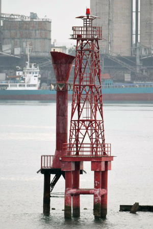
Makassar Entrance North Side (2)
2018. Active; focal plane 15 m (49 ft); red flash every 4 s. 15 m (49 ft) square skeletal tower with gallery painted red. Trabas has Smith's photo (also seen at right) and Google has a satellite view. This light replaced a round barbell-shaped tower, which was still present when Jim Smith visited in January 2019 but has since been removed. Located on the north side of the harbor entrance. Accessible only by boat. Site open, tower closed. Admiralty Q1513; NGA 25444.
Makassar Harbor Entrance
Date unknown. Active; focal plane about 12 m (39 ft); green light, pattern unknown. Approx. 12 m (39 ft) square green skeletal tower on a platform supported by piles. Trabas has Smith's photo and Google has a satellite view. This light marks the end of a shoal that obstructs vessels moving within the harbor. Located about 500 m (0.3 mi) off the Makassar Quay. Accessible only by boat. Site open, tower closed. Admiralty Q1514.5.
* Makassar Quay
Date unknown. Inactive since 2020. Triangular skeletal tower, painted red with a white horizontal band, mounted atop a waterfront building. Reesnal Mozaik has a 2019 photo, Aswn Bahar has a 2016 photo and Google has a satellite view. Located at the south end of the main quay of Makassar harbor. Site open, tower closed. ex-Admiralty Q1515; ex-NGA 25452.
* Makassar
2018 (?). Active; focal plane about 40 m (131 ft); white flash every 3 s (?). Light mounted atop the harbor control building. Trabas has Smith's photo, another photo is available and Google has a satellite view. Located on the main quay of Makassar harbor. Site open, tower closed. Admiralty Q1515; NGA 25452 (?).

Entrance North Light, Makassar, January 2019
photo copyright Jim Smith; used by permission
Agampencara (3?)
Date unknown. Active; focal plane about 22 m (72 ft); green flash every 5 s. Approx. 20 m (66 ft) square skeletal tower with gallery, painted green, mounted on a square concrete base supported by piles. Trabas has a portion of Smith's photo seen at right and Google has a satellite view. NGA calls this the Paotere light and lists its height as 8 m (26 ft). The current light replaced a skeletal tower about 14 m (46 ft) high. Located at the end of the west breakwater of the Paotere fishing harbor on the north side of Makassar. Accessible by walking the pier. Site open, tower closed. Admiralty Q1510.5; NGA 25458.
Paotere (2?)
Date unknown. Active; focal plane about 20 m (66 ft); red flash every 5 s. Approx. 14 m (46 ft) square skeletal tower with gallery, painted red, mounted on a square concrete base supported by piles. Trabas has Smith's photo and Google has a satellite view. Located just off the end of the east breakwater of the Paotere fishing harbor. Accessible only by boat. Site open, tower closed. Admiralty Q1510.43.

Pangkajene Dan Kepulauan Regency: Mainland Lighthouse
The Pangkajene Dan Kepulauan (Pangkajene and Islands) Regency has a mainland territory north of Makassar, but it also includes numerous islands to the south and southwest. Lighthouses of those islands are described on the South Sulawesi Islands page.

* Maccini Baji
Date unknown. Active; focal plane about 16 m (52 ft); light characteristic unknown. Approx. 14 m (46 ft) square white skeletal tower. Fer Raintung has a photo, a view from the sea is available, and Google has a satellite view. Located on the pier at Maccini Baji, a small port about 35 km (22 mi) north of Makassar. Site open, tower closed. Not listed by the Admiralty.

Agampencara Light, Makassar, January 2019
contributed photo by Jim Smith; used by permission

Barru Regency Lighthouses
Gorongkong
Date unknown. Active; focal plane 24 m (79 ft); white flash every 5 s. 20 m (66 ft) square white skeletal tower with gallery mounted on a concrete platform supported by piles. Muhammad Gaus has a 2018 photo (a portion is seen at right) and Google has a satellite view. Gorongkong is the site of a large cement plant. Located beside the pier at Gorongkong. Site status unknown. Admiralty Q1506.7.
Gorongkong West
Date unknown. Active; focal plane about 12 m (39 ft); six white flashes followed by one long white flash every 10 s. Approx. 12 m (39 ft) square skeletal tower, upper half painted yellow and lower half black. No photo available but Bing has a fuzzy satellite view. Located at the south end of reefs obstructing the approach to Gorongkong. Accessible only by boat. Site open, tower closed. Admiralty Q1506.9.
Karang Tomisa
Date unknown. Active; focal plane about 12 m (39 ft); white light, pattern unknown. Approx. 12 m (39 ft) square skeletal tower, painted black with one red horizontal band, on a platform supported by piles. No photo available but Bing has a fuzzy satellite view. Located beyond the west edge of extensive reefs northwest of Gorongkong. Accessible only by boat. Site open, tower closed. Admiralty Q1506.8.
Teluk Sido Approach
Date unknown. Active; focal plane about 12 m (39 ft); green light, pattern unknown. Approx. 12 m (39 ft) square skeletal tower, painted green, on a platform supported by piles. No photo available but Bing has a fuzzy satellite view. Located on a reef off the south side of the entrance to Sido Bay. Accessible only by boat. Site open, tower closed. Admiralty Q1506.6; NGA 25474.5.

Garongkong Light, Garongkong, May 2018
Google Maps photo by Muhammad Gaus
Teluk Sido Entrance South
Date unknown. Active; focal plane about 12 m (39 ft); green light, pattern unknown. Approx. 12 m (39 ft) square skeletal tower, painted green, on a platform supported by piles. No photo available but Bing has a fuzzy satellite view. Located on a reef on the south side of the entrance to Sido Bay. Accessible only by boat. Site open, tower closed. Admiralty Q1506.54.
Teluk Sido Entrance North
Date unknown. Active; focal plane about 12 m (39 ft); red light, pattern unknown. Approx. 12 m (39 ft) square skeletal tower, painted red, on a platform supported by piles. No photo available but Bing has a fuzzy satellite view. Located on a reef on the north side of the entrance to Sido Bay. Accessible only by boat. Site open, tower closed. Admiralty Q1506.5.
* Awerange (Awarange)
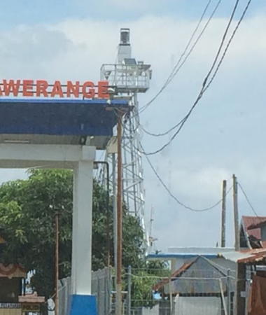
Date unknown. Active; focal plane 12 m (39 ft); white flash every 5 s. 10 m (33 ft) square white skeletal tower with gallery. Rizky Juliyanto has a photo (a portion is seen at right) and Supardi Syam has a distant view but the tower is hard to spot in Google's satellite view. Located at the ferry terminal in Awerange, a village on the north side of Sido Bay. Site open, tower closed. Admiralty Q1506.55.

Parepare City Lighthouses
Tanjung Lero
Date unknown. Active; focal plane 14 m (46 ft); red flash every 5 s. 14 m (46 ft) square white skeletal tower with gallery mounted on a concrete platform supported by piles. No photo but Bing has a satellite view. Parepare is a seaport with about 130,000 residents about 155 km (96 mi) north of Makassar. Located on a reef about 250 m (0.15 mi) off the north side of the entrance to Parepare Bay. Accessible only by boat. Site open, tower closed. Admiralty Q1506; NGA 25476.
Karang Tete (2?)
Date unknown. Active; focal plane about 12 m (39 ft); red flash every 4 s. Approx. 12 m (39 ft) square red skeletal tower on a platform supported by piles. No photo but Bing has a satellite view. A 2006 Australian Notice to Mariners described the tower height as 5 m, clearly less than the height of the present tower. Located on a reef about 800 m (1/2 mi) southwest of the Parepare ferry terminal. Accessible only by boat. Site open, tower closed. Admiralty Q1506.25.

Awerange Light, Awerange, March 2017
Google Maps photo by Rizky Juliyanto

Information available on lost lighthouses:

Notable faux lighthouses:

Adjoining pages: North: Western Sulawesi | East: Southeastern Sulawesi | South: South Sulawesi Islands

Return to the Lighthouse Directory index | Ratings key

Posted December 18, 2008. Checked and revised July 21, 2023. Lighthouses: 48. Site copyright 2023 Russ Rowlett and the University of North Carolina at Chapel Hill.