Lighthouses of Indonesia: Southeast Sulawesi (Celebes)

The Republic of Indonesia has been independent since 1945 after having been the Dutch East Indies for more than 350 years. It is a huge country, stretching along both sides of the Equator for more than 46 degrees of longitude (roughly 5100 km or 3200 miles). Comprised of some 17,000 islands (more than 6000 inhabited islands), it has hundreds of major aids to navigation.

Sulawesi (Celebes) is a major island in the northern part of the country. Shaped like an artistically drawn letter K, Sulawesi consists mostly of four narrow peninsulas. The Makassar Strait separates Sulawesi from Kalimantan (Borneo) to the west. The Celebes Sea is north of the island, the Molucca Sea is on the northeast, the Banda Sea is to the southeast, and the Flores Sea is on the south.

Indonesia is divided into 38 provinces and the provinces are subdivided into regencies (kabupaten). This page covers the lighthouses of the mainland regencies of Southeast Sulawesi (Sulawesi Tenggara) Province. The Southeast Sulawesi Islands page includes the remaining lighthouses of the province, located in the Buton, Muna, and Wakatobi Islands.

In Indonesian a lighthouse is a mercusuar or a menara suar. Tanjung is a cape, ujung is a headland or point of land, bukit is a hill, sungai is a river, kuala or muara is an estuary or river mouth, pulau is an island, karang is a reef, batu is a rock, laut is a sea, selat is a strait, teluk is a bay, pelabuhan is a harbor, and labuhan is a port.

Aids to navigation in Indonesia are operated and maintained by the Directorate of Marine Navigation within the Directorate General of Sea Transportation.

ARLHS numbers are from the ARLHS World List of Lights. Admiralty numbers are from volumes F and Q of the Admiralty List of Lights & Fog Signals. U.S. NGA List numbers are from Publication 112.

General Sources
Online List of Lights - Indonesia
Photos by various photographers posted by Alexander Trabas.
Indonesian Lighthouses
Historic postcard views from the collection of Michel Forand.
World of Lighthouses - Indonesia
Photos by various photographers available from Lightphotos.net.
Sulawesi Map
A useful map from orangesmile.com.
Navionics Charts
Navigation chart for Sulawesi.

Pomalaa Light, Pomalaa, March 2019
Google Maps photo by Rantau Siregar
Konawe Utara (North Konawe) Regency Lighthouses
Pulau Dehaan (Pulau Labengki Kecil)
2007. Active; focal plane 55 m (180 ft); four white flashes every 10 s. Approx. 40 m (131 ft) white concrete tower. Bambang Yutriono has the drone view at right, a 2020 photo, and a street view from the nearby beach. Bing has a satellite view. Located on a small island off the eastern tip of the larger Pulau Labengi, about 65 km (40 mi) north of Kendari. Accessible only by boat. Site status unknown. Admiralty Q1559.97; NGA 25278.5.
Teluk Lasolo
Date unknown. Active; focal plane about 13 m (43 ft); green light, pattern unknown. Tower, form unknown, on a platform supported by piles. No photo available and the light is not shown in Bing's satellite view. Located in Lasolo Bay about 2 km (1.25 mi) northeast of Molawe. Accessible only by boat. Site open, tower closed. Admiralty Q1559.975.
Molawe
Date unknown. Active; focal plane about 20 m (66 ft); white light, pattern unknown. Approx. 19 m (62 ft) square skeletal tower with gallery painted white. Hariono Selamet has a photo, Dhani Agung has a 2021 photo, and Google has a satellite view. Located at a small harbor near the north end of Lasolo Bay. Site open, tower closed. Admiralty Q1559.98.

Konawe Regency Lighthouse
Konawe
Date unknown. Active; focal plane 15 m (49 ft); white flash every 5 s. 10 m (33 ft) square skeletal tower with gallery, painted white. A drone view is available (lighthouse on the right) and Google has a street view and an indistinct satellite view. Located at a small harbor about 15 km (9 mi) north of Kendari. Site open, tower closed. Admiralty Q1562.5.

Pulau Dehaan Light, Konawe Utara, August 2020
Google Maps drone view by Bambang Yutriono

Kendari City: Northside Lighthouses
Kendari is a port city on the east coast and the capital of Southeast Sulawesi province. It is the fourth largest city of Sulawesi, with a population of about 360,000.

Kendari Fuel Depot
Date unknown. Active; focal plane about 16 m (52 ft); white light, pattern unknown. Approx. 13 m (43 ft) square pyramidal skeletal tower covered with white siding. A drone view is available and Google has an indistinct satellite view. Located in front of the easternmost tank at the fuel depot on the north side of the entrance to the Kendari estuary. Site and tower closed. Admiralty Q1560.08.
Teluk Kendari No. 1 (Range Front)
Date unknown. Active; focal plane 9 m (30 ft); white light, 2 s on, 2 s off. 10 m (33 ft) square skeletal tower with gallery, painted white. Jl. R. E. Martadinata has a street view and Google has a satellite view. Located off the ferry terminal at Kendari. Accessible only by boat, but easily seen from shore or from ferries. Site open, tower closed. Admiralty Q1560.3; NGA 25290.
Teluk Kendari No. 2 (Range Rear)
Date unknown. Active; focal plane 11 m (36 ft); white light, 1 s on, 1 s off. 12 m (39 ft) square skeletal tower with gallery, painted white. Jl. R. E. Martadinata has a street view and Google has a satellite view. Located 130 m (430 ft) west of the front light. Accessible only by boat, but easily seen from shore or from ferries. Site open, tower closed. Admiralty Q1560.31; NGA 25290.2.
Tanjung Kendari (?)
Date unknown. Active; focal plane 12 m (39 ft); green flash every 2 s. 12 m (39 ft) square skeletal tower with gallery, painted green. No photo available; No photo available and the Google satellite view appears to show a much smaller beacon. NGA describes the beacon as red, with a red flash, but this can't be correct for a beacon on the starboard side of the entrance. Located just off the north bank of the estuary at a sharp bend, close to the district navigation office. Accessible only by boat. Site open, tower closed. Admiralty Q1560.05; NGA 25296.
* Pelabuhan Kendari
Date unknown. Active; focal plane about 14 m (43 ft); white light, pattern unknown. Approx. 12 m (39 ft) round white fiberglass tower with a flared top. Google has the street view seen at right and an indistinct satellite view. Located at the east end of the quay of the Kendari passenger terminal, on the north side of the estuary just west of the cable-stayed bridge over the waterway. Site open, tower closed. Admiralty Q1562; NGA 25308.
 

Pelabuhan Kendari Light, Kendari, August 2022
Google Maps street view
 

Kendari City: Southside Lighthouses
Tanjung Kendari No. 5 (Range Front)
Date unknown. Active; focal plane 15 m (49 ft); white light, 2 s on, 2 s off. 12 m (39 ft) square skeletal tower with gallery, painted white. Google has a street view and a satellite view. Located on the south side of the Kendari estuary. Site open, tower closed. Admiralty Q1560.5.
Tanjung Kendari No. 6 (Range Rear)
Date unknown. Active; focal plane 16 m (52 ft); white light, 1 s on, 1 s off. 16 m (52 ft) square skeletal tower with gallery, painted white. Moch Said S. Sirate's photo is at right and Google has a street view and a satellite view. Located about 130 m (430 ft) southwest of the front light, adjacent to a bridge on the south side of the Kendari estuary. Site open, tower closed. Admiralty Q1560.51.
Bungku Toko
Date unknown. Active; focal plane about 14 m (46 ft); red or white light depending on direction, pattern unknown. Approx. 11 m (36 ft) square pyramidal tower. Entire lighthouse is red. This is a leading light for outbound vessels. The light is centered, between lights 3 and 5, in Google's street view and Google also has a satellite view. Located just offshore in a sharp bend of the estuary between lights 3 and 5. Site open, tower closed. Admiralty Q1560.45.
Tanjung Kendari No. 3 (Range Front)
Date unknown. Active; focal plane 14 m (46 ft); white light, 1 s on, 1 s off. 15 m (49 ft) square skeletal tower with gallery, painted white. Google has a street view and a satellite view. This is a downstream range guiding vessels leaving Kendari. Located on the south side of the Kendari estuary. Site open, tower closed. Admiralty Q1560.4.
Tanjung Kendari No. 4 (Range Rear)
Date unknown. Active; focal plane 16 m (52 ft); white light, 1 s on, 1 s off. 16 m (52 ft) square skeletal tower with gallery, painted white. Google has an indistinct satellite view and a street view through trees. Located a short distance southeast of the front light. Site open, tower closed. Admiralty Q1560.41.

Kendari No. 6 Light, Kendari, October 2013
ex-Panoramio Creative Commons photo by Moch Said S. Sirate

Kabupaten Konawe (Konawe Islands) Regency Lighthouses
This regency is essentially coincident with Pulau Wawonii (also spelled Wowoni), a roughly heart-shaped island about 30 km (20 mi) in diameter located southeast of Kendari.

Langara (Langgarabugis)
Date unknown. Active; focal plane about 18 m (59 ft); white light, pattern unknown. Approx. 16 m (52 ft) square white skeletal tower with lantern and gallery. No photo available but Google has a satellite view. Located on the quay at Langara, the ferry port for Pulau Wowonii, at the northwestern side of the island. Site status unknown. Admiralty Q1559.73.
Pulau Wowoni (Tanjung Pamali)
Date unknown. Active; focal plane 44 m (144 ft); four white flashes every 20 s. Approx. 38 m (125 ft) square skeletal tower with lantern and gallery. Tower painted white. Coast guard station with staff quarters and other buildings. Mokry Tyov has a closeup and a view from the sea, the lighthouse is visible in a very distant view from the sea and Google has a satellite view. Located at the northern tip of the island. Accessible only by boat. Site status unknown. Admiralty Q1559.7; NGA 25288.
Tanjung Watutembatu
Date unknown. Active; focal plane 65 m (213 ft); four white flashes every 10 s. 40 m (131 ft) skeletal tower, painted white. Several coast guard station buildings. Mursal Fauzka has a very distant view (lighthouse near the left edge of the photo) and Google has a satellite view. This light stands on a promontory at the easternmost tip of the island. Site status unknown. ARLHS IDO-334; Admiralty Q1559.9; NGA 25289.

Konawe Selatan (South Konawe) Regency Lighthouses
Gosong Sappajambi (Sappa Djawbi Bank)
Date unknown. Active; focal plane 15 m (49 ft); red flash every 6 s. 15 m (49 ft) red tower on a platform supported by piles. No photo available but Bing has a distant satellite view. Located on a reef on the south side of the approach to Kendari, about 8 km (5 mi) east of the estuary entrance. Accessible only by boat. Site open, tower closed. Admiralty Q1559.5; NGA 25284.
Teluk Wawosungu
Date unknown. Active; focal plane about 14 m (46 ft); white light, pattern unknown. Approx. 14 m (46 ft) barbell-shaped tower on a platform supported by piles. No photo available but Bing has a satellite view. Located on a reef about 8 km (5mi) northeast of the new port of Lapuko. Accessible only by boat. Site open, tower closed. Admiralty Q1558.8.
* Lapuko
2019. Active; focal plane 21 m (69 ft); white flash every 3 s. 20 m (66 ft) square skeletal tower painted white. Tommy Patra has a 2021 photo at right, Muhammad Said Laode has a 2020 photo, and Google has a satellite view. Located on the wharf at Lapuko, a new port at the south end of Staring Bay southeast of Kendari. Site open, tower closed. Admiralty Q1558.75.

Lapuko Light, Konawe Selatan, October 2021
Google Maps photo by Oleg Peronkov
Campada South
Date unknown. Active; focal plane 17 m (56 ft); red flash every 4 s. 17 m (56 ft) square skeletal tower, painted red, mounted on a square platform supported by piles. No photo available, but Bing has an indistinct satellite view. Located at the south end of a reef on the west side of the strait separating Wowoni from the mainland. Accessible only by boat. Site open, tower closed. Admiralty Q1558.7; NGA 25310.
* [Pelabuhan Amolengo Kolono Timur]
Date unknown. Active; focal plane about 12 m (39 ft); white light, pattern unknown. Approx. 10 m (33 ft) steel mast. Adi Arfandi has a distant view but the mast is inconspicuous in Google's satellite view. Located at a ferry terminal on the southeastern tip of Sulawesi opposite Pulau Buton. Site open, tower closed. Not listed by the Admiralty.
Torobulu (Turubulu) Approach
Date unknown. Active; focal plane about 12 m (39 ft); red light, pattern unknown. Approx. 12 m (39 ft) square pyramidal skeletal tower, painted red. A 2018 photo is available and Bing has a distant satellite view. Located on the port side of the approach about 500 m (0.3 mi) south of the Torobolu pier. Accessible only by boat. Site open, tower closed. Admiralty Q1549.41.
* Torobulu (Turubulu)
Date unknown. Active; focal plane 13 m (43 ft); white flash every 3 s. Approx. 11 m (36 ft) square pyramidal skeletal tower, painted white. Respati Dwind's photo is at right, Sopian Hermanto has a closeup 2018 photo, Adi Arfandi has a distant view from the sea, and Google has a street view and a satellite view. Located at the base of the ferry pier at Torobulu, a small port on the north side of Tioro Strait opposite Pulau Muna. Site open, tower closed. Admiralty Q1549.4; NGA 25317.2.
Torobulu Light, Torobulu, September 2019
Google Maps photo by Respati Dwind

Bombana Regency: Mainland Lighthouses
Bombana Regency includes the southwestern end of the Southeast Sulawesi Peninsula plus all but the southernmost part of Pulau Kabeana to the south. Kabaena is a substantial island, about 40 km (25 mi) long by 25 km (16 mi) wide, lying west of Pulau Muna. The island is thinly populated with about 25,000 residents.
* [Kasipute (Kasihputeh)]
Date unknown. Active; focal plane about 13 m (43 ft); white light, pattern unknown. Approx. 13 m (43 ft) white mast on a platform supported by piles. Budi Setiawan has a 2022 photo, Ando Abdur Razzaq has a distant view and Google has an indistinct satellite view. Located at the ferry terminal in Kasipute, a port facing the west end of the Muna Strait. Site open, tower closed. Not listed by the Admiralty.
Pulau Mangatah
Date unknown. Active; focal plane 12 m (39 ft); six quick white flashes followed by one long white flash every 15 s. 12 m (39 ft) tower on a platform supported by piles. Upper half of the tower painted yellow, lower half black. No photo available but Google has a satellite view. Located off the east side of Pulau Mangatah, marking the southwestern tip of the Bombana mainland. Accessible only by boat. Site open, tower closed. Admiralty Q1549.25; NGA 25319.05.
* [Pelabuhan Batu Putih]
Date unknown. Active; focal plane about 12 m (39 ft); white light, pattern unknown. Approx. 10 m (33 ft) steel mast. Saindra Prajna has a 2022 photo but this new port is not seen at all in Google's satellite view. Located at a small port on the east side of Teluk Paroa, an inlet about 15 km (9 mi) east of Boeapinang. Site open, tower closed. Not listed by the Admiralty.
* Buapinang (Boeapinang)
Date unknown. Active; focal plane 12 m (39 ft); white flash every 3 s. Approx. 10 m (33 ft) square white skeletal tower. Google has a street view (a portion is seen at right) and a satellite view. Located midway on the long pier at Buapinang, a town at the southwestern tip of Sulawesi's southeastern peninsula. Site open, tower closed. Admiralty Q1549; NGA 25373.

Buapinang Light, Buapinang, March 2016
Google Maps street view

Bombana Regency: Pulau Kabaena Lighthouses
Pulau Sogori
Date unknown. Active; focal plane 12 m (39 ft); two white flashes every 5 s. 12 m (39 ft) square pyramidal skeletal tower, painted white and mounted on a square platform supported by piles. No photo available but Bing has a distant satellite view. Located on the west side of a large reef off the central west coast of the island, about 30 km (19 mi) southwest of Sikeli. Accessible only by boat. Site open, tower closed. Admiralty Q1554.1; NGA 25354.
* Sikeli (Tanjung Malate) (2)
Date unknown (recent). Active; focal plane 12 m (39 ft); white flash every 3 s. Approx. 10 m (33 ft) round barbell-shaped white fiberglass tower. Oleg Peronkov has a photo (a portion is at right) and the light is centered in Bing's satellite view. The previous lighthouse was a square white skeletal tower. Located on the waterfront at Sikeli, the principal port of Pulau Kabaena, on the central west coast of the island. Site open, tower closed. Admiralty Q1554.2; NGA 25353.5.
Tanjung Pising
Date unknown. Active; focal plane 14 m (46 ft); two white flashes every 6 s. Approx. 12 m (39 ft) white concrete column with gallery. No photo available but Google has a satellite view. Located on the northern tip of Pulau Kabaena. Accessible only by boat. Site open, tower closed. Admiralty Q1554; NGA 25353.
* [Pelabuhan Pising]
Date unknown. Active; focal plane about 12 m (39 ft); white light, pattern unknown. Approx. 10 m (33 ft) steel mast. A 2020 photo is available and Google has a satellite view. Located on the quay of the Tanjung Pising ferry terminal about 3 km (2 mi) south of the cape. Site open, tower closed. Not listed by the Admiralty.

Kolaka Regency (Gulf of Boni) Lighthouses
The Gulf of Boni separates the Southeast and South Sulawesi peninsulas. Kolaka is the principal town on the east side of the gulf and the west side of the Southeast Sulawesi peninsula; ferries cross the gulf from Kolaka to Watampone in South Sulawesi.

* Pomalaa
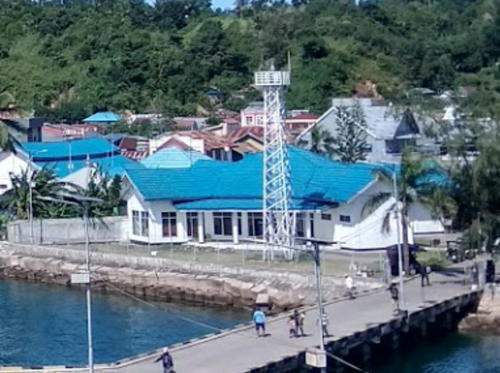
Date unknown. Active; focal plane about 20 m (66 ft); white light, pattern unknown. Approx. 17 m (56 ft) round barbell-shaped white tower standing atop a 1-story building. Rantau Siregar has the 2019 closeup photo seen at the top of this page, Ombi Saputra has a sunset photo, and Google has a satellite view. Located on the wharf at Pomalaa, a port about 10 km (6 mi) south of Kolaka. Site open, tower closed. Admiralty Q1548.455.

Sikeli Light, Pulau Kabaena, November 2018
Google Maps photo by Oleg Peronkov
* Kolaka Pier (Pelabuhan Penyebrangan) (2)
Date unknown. Active; focal plane 17 m (56 ft); yellow flash every 3 s. 15 m (49 ft) square white concrete post centered on a square 1-story base. Sigit Harjanto has the 2023 photo at right and Google has a street view and a satellite view. The remaining lights in this section guide ferries crossing the Gulf of Boni to and from Kolaka. Located on the east pier at Kolaka. Site open, tower closed. Admiralty Q1547.9; NGA 25360.
Karang Kolaka (2)
Date unknown. Active; focal plane about 14 m (46 ft); two red flashes every 6 s. Approx. 14 m (46 ft) square red skeletal tower on a platform supported by piles. No photo available but Google has a satellite view. NGA lists a tower only 6 m (20 ft) tall. Located at the south edge of a shoal about 1 km (0.6 mi) west of the Kolaka Pier. Accessible only by boat. Site status unknown. Admiralty Q1548; NGA 25356.
[Karang Bingkoka (2)]
Date unknown. Active; focal plane about 13 m (43 ft); green flash every 5 s. Approx. 13 m (43 ft) post on a platform supported by piles. No photo available but Google has a satellite view. Located on a shoal about 4 km (2.5 mi) west of the Kolaka Pier. Accessible only by boat. Site status unknown. Admiralty Q1548.3; NGA 25364.
Lambacina (Lambasina) Besar
Date unknown. Active; focal plane 12 m (39 ft); white flash every 5 s. 12.5 m (41 ft) square pyramidal skeletal tower, painted white and mounted on a square platform supported by piles. No photo available but Google has a satellite view. Located on a reef off the northern tip of Pulau Lambacina, about 25 km (15 mi) west of Kolaka. Accessible only by boat. Site status unknown. Admiralty Q1548.7; NGA 25372.
Lambacina (Lambasina) Kecil
Date unknown. Active; focal plane 60 m (197 ft); two white flashes every 8 s. 30 m (98 ft) square skeletal tower with gallery, painted white. No photo available but Google has a good satellite view. Located on a small island in the Gulf of Boni off the west end of Pulau Lambacina, about 30 km (19 mi) west of Kolaka. Accessible only by boat. Site status unknown. Admiralty Q1548.6; NGA 25370.

Kolaka Pier Light, Kolaka, May 2023
Google Maps photo by Sigit Harjanto
Karang Rosamari
Date unknown. Active; focal plane 12 m (39 ft); two white flashes every 5 s. 12 m (39 ft) square white skeletal tower on a platform supported by piles. No photo available but Bing has a satellite view. Located on an isolated reef in the Gulf of Boni about 15 km (9 mi) west of Pulau Lambacina Kecil. Accessible only by boat. Site status unknown. Admiralty Q1548.65; NGA 25370.5.

Information available on lost lighthouses:

Notable faux lighthouses:

Adjoining pages: North: Eastern Sulawesi | East: North Maluku | Southeast: Southeast Sulawesi Islands | South: Lombok and Sumbawa | West: South Sulawesi Mainland

Return to the Lighthouse Directory index | Ratings key

Posted December 18, 2008. Checked and revised July 8, 2023. Lighthouses: 34. Site copyright 2023 Russ Rowlett and the University of North Carolina at Chapel Hill.