Lighthouses of Japan: Onomichi Area

The nation of Japan, known in Japanese as Nihon or Nippon (日本), occupies an archipelago off the east coast of Asia. The four main islands are Hokkaidō in the north, Honshū (the largest) in the center, Shikoku in the south, and Kyūshū in the southwest. The country includes thousands of other islands of all sizes; among them the Ryūkyū (Nansei) Islands are a long chain extending to the southwest and including the large island of Okinawa, and the Nanpō Islands are another long chain extending south into the Pacific Ocean. Much of Japan is mountainous but the coastal regions are densely populated and urbanized; the country's population is about 126 million.

Japan is divided into 47 prefectures. This page lists lighthouses of the eastern section of Hiroshima Prefecture, including the three cities of Fukuyama, Onomichi, and Mihara. This is approximately the area of the historic Bingo Province. Hiroshima Prefecture faces south on the Seto Inland Sea (Seto Naikai), a network of sounds and channels separating Honshū from Shikoku. The Onomichi area faces Bingo Nada, a roughly circular basin in the central Seto Inland Sea.

In Japanese the word for a lighthouse is tōdai or toudai (灯台). The words saki and misaki are for capes and headlands, hana ("nose") is a promontory, hantō is a peninsula, shima (also spelled sima or jima) is an island, bae is a reef, iwa or shi is a rocky reef, amase or se is a shoal, wan is a bay, nada is a sound or basin, kaikyō is a strait, kawa is a river, and or minato is a harbor.

Lighthouses in Japan are operated and maintained by the Japanese Coast Guard's Maritime Safety Agency. On Honshū there is at least one Coast Guard Section Office in each prefecture, often two or more. Hiroshima Prefecture has three offices, at Onomichi, Kure and Hiroshima. This page includes the lighthouses of the Onomichi Coast Guard District.

ARLHS numbers are from the ARLHS World List of Lights. JCG numbers are the Japanese Coast Guard's light list numbers. Admiralty numbers are from volume M of the Admiralty List of Lights & Fog Signals. U.S. NGA List numbers are from Publication 112.

General Sources
Lighthouses in Japan - Hiroshima
A site providing photos and data for most major Japanese lighthouses.
Lighthouse-Japan.com - Hiroshima
Another comprehensive site with photos and notes from visits to many lighthouses.
Online List of Lights - Japan
Photos by Alexander Trabas.
Form of a Lighthouse - Hiroshima
A large and growing web site based on recent visits; cited below as FOAL.
Lighthouse Visit
Another site with photos of Hiroshima lighthouses.
Misty's Japanese Lighthouse Tour - Hiroshima
Photos and a few notes for lighthouses in all parts of the country.
Meiji Era Lighthouses in the Sixth Region
Photos of historic lighthouses posted by the Coast Guard Sixth Region.
Onomichi Area Lighthouses
Photos and descriptions of major lighthouses posted by the Onomichi Coast Guard Office.
Lighthouses in Hiroshima Prefecture
Photos available from Wikimedia.
Japan: Modern Lighthouses
Historic postcard views posted by Michel Forand.
Navionics Charts
Navigation chart for the Inland Sea.


Kosagi Shima Light, Mihara, August 2023
Instagram photo by Yukihiro Matsumura

Fukuyama City Lighthouses
Fukuyama is a city of nearly half a million residents, the second largest city of Hiroshima Prefecture after Hiroshima itself.

Konoishi (Kono Isi)
Date unknown. Active; focal plane 14 m (46 ft); two white flashes every 5 s. 12 m (39 ft) round concrete tower with two galleries, mounted on a concrete pier. Lighthouse painted black with one red horizontal band. Trabas has a distant photo and Google has a satellite view. This light marks a dangerous reef close to a major shipping channel; it appears that its height was increased by adding the upper stage. Located on a reef about 5 km (3 mi) southeast of Tomo harbor. Accessible only by boat. Site open, tower closed. JCG-4414; Admiralty M5730; NGA 8392.
* Tomonoura
Date unknown. Active (unofficial); focal plane 10 m (33 ft); a decorative continuous white light is displayed and charted by Navionics. 7 m (23 ft) square unpainted stone tower with a traditional lantern. A photo is at right, a 2011 closeup photo and a second closeup are available, FOAL's Tomonoura page has photos, and Google has a satellite view and a partially obscured street view. This historic tower, called an ishidoro, is an example of the traditional lanterns that marked many Japanese harbors before the Meiji Restoration of 1868 began the modernization of the country. Located on the waterfront of Tomonoura. Site open, tower closed.
Tomo (Tomonoura, Fukuyama) Kō
Date unknown. Active; focal plane 12 m (39 ft); green flash every 3 s. 8.5 m (28 ft) concrete post attached to a square 1-story concrete equipment shelter. Entire lighthouse is white. A photo is available, Trabas has a closeup photo, Lighthouse Visit has a page with a photo, FOAL's Tomonoura page has photos, and Google has a satellite view and a distant street view. Located at the east end of the detached breakwater protecting Tomo (Tomonoura) harbor in Fukuyama. Accessible only by boat. Site open, tower closed. JCG-4442; Admiralty M5729.4; NGA 8412.
* Tamatsu Shima Breakwater
Date unknown. Active; focal plane 12 m (39 ft); green light, 3 s on, 3 s off. 8.5 m (28 ft) round concrete tower, flared at the top. Entire lighthouse is white. Trabas has a closeup photo, FOAL's Tomonoura page has photos, Lighthouse Visit has a page with a photo, and Google has a satellite view. Located at the end of a breakwater extending from Tamatsu Shima, a small island also connected to the mainland by a breakwater. Accessible by walking the piers. Site open, tower closed. ARLHS JPN-1767; JCG-4443; Admiralty M5729.6; NGA 8416.
Aburasho (Abura Syo)
Date unknown. Active; focal plane 8 m (26 ft); two white flashes every 5 s. 6 m (20 ft) round cylindrical concrete tower, mounted on a concrete pier. Lighthouse painted black with one red horizontal band. Trabas has a good photo, Lighthouse Visit has a page with a photo, a 2023 photo is available, and Google has a satellite view. Located on a reef about 1.6 km (1 mi) east of Abuto Saki. Accessible only by boat. Site open, tower closed. JCG-4444; Admiralty M5729; NGA 8420.

Tomonoura Light, Tomonoura, October 2008
Wikimedia Creative Commons photo by 663highland
* Abuto Saki
1958. Active; focal plane 88 m (289 ft); white light, 3 s on, 3 s off. 9 m (30 ft) round cylindrical concrete tower with gallery. Entire lighthouse is white. Lighthouse-Japan.com has a page with photos, Lighthouse Visit also has a page, FOAL has photos (halfway down the page), Trabas has a photo, Kiso has a closeup, and Google has a satellite view. This lighthouse is at the tip of a peninsula marking a narrow strait between the mainland and the island of Tajima Shima. Located about 15 km (9 mi) southeast of Onomichi. Accessible by road; limited parking available. Site open, tower closed. . ARLHS JPN-001; JCG-4445; Admiralty M5728.5; NGA 8424.
Hakosaki Kō Breakwater
1990 (relocated in 1997). Active; focal plane 14 m (46 ft); red flash every 3 s. 8 m (28 ft) concrete post light mounted atop a square 1-story concrete equipment room. Entire lighthouse painted red. The Coast Guard has a page for the lighthouse, Trabas has a closeup photo, Lighthouse Visit has a page with photos, FOAL has photos, and Google has a street view and a satellite view. The light was originally located at the south end of the main detached breakwater of Hakosaki Kō, on the south side of Tajima; it was relocated to the south end of an additional detached breakwater built to provide more protection to the harbor entrance. Note: not to be confused with the much better known Hako Saki Light in Kagawa Prefecture on the other side of the Inland Sea. Accessible only by boat. Site and tower closed. ARLHS JPN-1730; JCG-4446; Admiralty M5728.7; NGA 8428.
Onozowai (Ono Zowai)
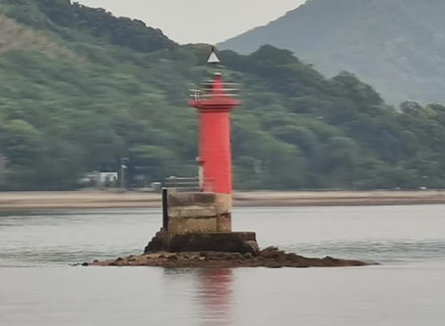
Date unknown. Active; focal plane 10 m (33 ft); one long and two short red flashes every 8 s. 10 m (33 ft) round cylindrical concrete tower, mounted on a concrete pier. Entire lighthouse is red. Kenichiro Asai's photo is at right, Trabas has a closeup photo, Lighthouse Visit has a page with photos, FOAL has a photo (upper left), and Google has a satellite view. Located on a reef off the north coast of Tajima. Accessible only by boat. Site open, tower closed. JCG-4448; Admiralty M5727; NGA 8436.
Kurikuwazowai (Kurikuwa Zowai)
Date unknown. Active; focal plane 9.5 m (31 ft); one long and two short green flashes every 8 s. 7 m (23 ft) round cylindrical concrete tower, mounted on a concrete pier. Entire lighthouse is green. Trabas has a closeup photo, FOAL has a photo (lower right), Kenichiro Asai has a 2023 photo, and Google has a satellite view. Located on a reef just off the waterfront of Tsuneishi harbor. Accessible only by boat. Site open, tower closed. JCG-4449; Admiralty M5726; NGA 8440.
 

Onozuwai Light, Fukuyama, May 2021
Google Maps photo by Kenichiro Asai
Katakirazowai (Katakira Zowai)
Date unknown. Active; focal plane 9.5 mm (31 ft); two white flashes every 5 s. 8 m (26 ft) round cylindrical concrete tower, mounted on a concrete pier. Lighthouse painted black with a red horizontal band. Trabas has a closeup photo, Lighthouse Visit has a page with photos, FOAL has a photo (upper right), and Google has a satellite view. Located on a reef off the east coast of Momojima, an island to the west of Tajima. Accessible only by boat. Site open, tower closed. JCG-4450; Admiralty M5725; NGA 8444.

Onomichi City Lighthouses
Onomichi is a city of about 130,000 residents on the west side of Fukuyama. The city is partly on the mainland and includes several large islands eparated by narrow channels.
* Onomichi (Onomiti, Koutashima)
1933. Active; focal plane 33 m (108 ft); white flash every 4 s. 11 m (36 ft) round 2-stage cylindrical concrete tower with double gallery. Entire lighthouse painted white. Lighthouse-Japan.com has a page with photos, FOAL has a page with a photo, Trabas has a photo, Lighthouse Visit also has a page, a closeup is available, M. Terada has a nighttime photo showing the tower floodlit, and Google has a sea view and a satellite view. The western entrance to the harbor of Onomichi is through a narrow channel between the mainland and the island of Mukai Shima. This lighthouse is on the south side of the channel (on the island) as a leading light to guide ships through the channel. The island is accessible by a bridge, and the lighthouse is reached by a steep walkway; parking is limited. Site open, tower closed. ARLHS JPN-491; JCG-4460; Admiralty M5722; NGA 8452.
* Ushino (Usino) Ura
1957. Active; focal plane 28 m (92 ft); white light, 3 s on, 3 s off. 11 m (33 ft) narrow round concrete tower with gallery, mounted atop a square 1-story concrete equipment room. Entire lighthouse painted white. Lighthouse-Japan.com has a page with a photo, Trabas has a photo, FOAL has a page with excellent photos, Lighthouse Visit also has a page, another photo is available, and Google has a street view and a satellite view. Located near the northwestern point of Mukai Shima, marking the entrance to the strait leading to Onomichi. Site open, tower closed. ARLHS JPN-727; JCG-4461; Admiralty M5723; NGA 8456.
*** Ōhama Saki
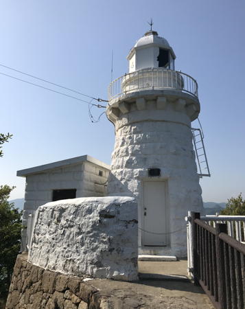
1897. Reactivated (inactive 1910-1954); focal plane 18 m (59 ft); white or red light, depending on direction, 3 s on, 3 s off. 9 m (30 ft) round stone tower with lantern and gallery. Entire lighthouse painted white. A photo is at right, Lighthouse-Japan.com has a page with good photos, FOAL has a page with many photos, Misty's Tour has another photo, another closeup is available, Trabas has a closeup, Keiji Funabashi has a 2022 photo, the Coast Guard has a page with several small photos, Lighthouse Visit also has a page with photos, and Google has a satellite view. The lighthouse is just north of the Innoshima Bridge, one of nine bridges on the Nishi-Seto Expressway connecting Honshū and Shikoku. The bridge connects Mukai Shima to Inno Shima. When the lighthouse was deactivated in 1910 the station was converted to a tidal signal station. Recently the old tidal station has been converted to a popular lighthouse museum. As a result, this relatively minor light is now one of the best known lighthouses of the Inland Sea. The original lantern of the Tyōdayū Syo light is displayed on the grounds. The lighthouse is located on a promontory on the east side of the island of Inno Shima, just north of the Innoshima Bridge. Site open, museum and tower open daily. . ARLHS JPN-453; JCG-4468; Admiralty M5724; NGA 8468.

Ōhama Saki Light, Onomichi, April 2018
Wikimedia Creative Commons photo by そらみみ (Soromimi)

Mihara City Lighthouses
Mihara is a city of about 100,000 residents. Formerly a fishing port, it is now home to several industries.
Tyōdayū (Chōdayū) Syo
1894 (daybeacon established 1880; rebuilt in 1921). Active; focal plane 9 m (28 ft); quick-flashing white light. 11 m (36 ft) round strongly conical stone tower attached to a small equipment room, mounted on a stone and concrete pier. Upper half of tower painted black, lower half yellow. FOAL has photos, Lighthouse Visit has a page with photos, Kenichiro Asai has a 2023 photo, Trabas has a distant photo, and Google has a satellite view. In 1894 a lantern was added to the beacon. In 1921 the tower was rebuilt to accommodate an acetylene-powered light. The original lantern is now displayed at the Ōhama Saki Lighthouse Museum, and the present light is powered by batteries. Located on a shoal about 3 km (2 mi) northwest of the Ōhama Saki Light. Accessible only by boat. Site and tower closed. ARLHS JPN-706; JCG-4471; Admiralty M5720; NGA 8472.
Hakan Shima
Date unknown. Active; focal plane 10 m (33 ft); nine quick white flashes every 15 s. 8 m (26 ft) round cylindrical concrete tower mounted on a concrete pier. Lighthouse painted yellow with one black horizontal band. Lighthouse Visit has a page with a photo, Trabas has a distant photo, FOAL has photos (second row right and bottom row left), and Google has a satellite view. Accessible only by boat. Site open, tower closed. JCG-4472; Admiralty M5719; NGA 8476.
#Matsuhama Kō Detached Breakwater
Date unknown. This was an approx. 9 m (30 ft) concrete post attached to a square 1-story equipment shelter. Entire lighthouse was white. Google has a November 2013 street view but Google's satellite view shows that the light has been replaced by a light on a post. Formerly located at the south end of a detached breakwater at the entrance to the Itozaki harbor in western Onomichi. Site open.
* Sagi Shima
Date unknown. Active; focal plane 27 m (89 ft); white light occulting once every 8 s. 7 m (23 ft) round white concrete tower. A photo is at right, Trabas has a distant photo, Lighthouse-Japan.com has a page with photos, Lighthouse Visit has photos (halfway down the page), and Google has a satellite view. The lighthouse was refurbushed and repainted in 2023. Sagi Shima is an island northwest of Inno Shima and south of the port of Mihara. The island is accessible by ferry. The lighthouse is surrounded by a public park and picnic area, popular for the scenic view. Located at the northeastern point of the island. Site open, tower closed. . ARLHS JPN-521; JCG-4473; Admiralty M5718; NGA 8480.

Sagi Shima Light, Mihara, July 2023
Google Maps photo by hi kamo
Kosagi Shima
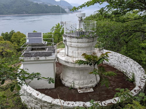
1896. Active; focal plane 24 m (79 ft); white flash every 4 s. 6.5 m (21 ft) round stone tower with lantern and gallery. Entire lighthouse painted white. Yukihiro Matsumura's photo is seen at the top of this page, Lighthouse-Japan.com has a page with photos, Trabas has a view, Lighthouse Visit has a photo (second lighthouse on the page), a nice 2017 closeup and a 2023 photo are available, and Google has a satellite view. Clearly a sibling of the better known Ōhama Saki Light. This lighthouse is located on a small island off the northwestern tip of Sagi Shima. Site status unknown; the island is probably accessible by ferry. . ARLHS JPN-289; JCG-4475; Admiralty M5716; NGA 8488.
Toramaru Sho (Toramaru Syo)
Date unknown. Active; focal plane 10 m (33 ft); one long and one short red flash every 8 s. 7.5 m (25 ft) round cylindrical concrete tower mounted on a concrete pier. Entire lighthouse is red. Trabas has a photo and Google has a satellite view. Located off a promontory on the west side of Sagi Shima. Accessible only by boat. Site open, tower closed. JCG-4476; Admiralty M5715; NGA 8492.
* Kōne Shima
1897. Active; focal plane 45 m (148 ft); white light, 4 s on, 4 s off. 4.3 m (14 ft) round stone tower with double gallery; the lantern has been removed and replaced by a short post light. Entire lighthouse painted white. A photo is at right, Trabas has a photo, Lighthouse-Japan.com has a page with photos, FOAL has a page with closeup photos, Lighthouse Visit also has a page, and Google has a satellite view. A diminutive sibling of the Ōhama Shima and Kosagi Shima Lights. Kōne Shima is an island west of Sagi Shima, accessible by bridge. Located at the northern tip of the island. Some local guidance may be needed, as the unpaved road leading to the lighthouse is unmarked. Site open, tower closed. . ARLHS JPN-273; JCG-4477; Admiralty M5714; NGA 8496.

Kōne Shima Light, Onomichi, May 2021
Google Maps photo by oyajigag rider

Information available on lost lighthouses:

Notable faux lighthouses:

Adjoining pages: East: Okayama | South: Northern Ehime | West: Kure and Hiroshima

Return to the Lighthouse Directory index | Ratings key

Posted January 25, 2007. Checked and revised October 19, 2023. Lighthouses: 20. Site copyright 2023 Russ Rowlett and the University of North Carolina at Chapel Hill.