Lighthouses of Japan: Aomori

The nation of Japan, known in Japanese as Nihon or Nippon (日本), occupies an archipelago off the east coast of Asia. The four main islands are Hokkaidō in the north, Honshū (the largest) in the center, Shikoku in the south, and Kyūshū in the southwest. The country includes thousands of other islands of all sizes; among them the Ryūkyū (Nansei) Islands are a long chain extending to the southwest and including the large island of Okinawa, and the Nanpō Islands are another long chain extending south into the Pacific Ocean. Much of Japan is mountainous but the coastal regions are densely populated and urbanized; the country's population is about 126 million.

Japan is divided into 47 prefectures. This page describes lighthouses of Aomori Prefecture, located at the northern end of Honshū. Aomori faces Hokkaidō across the Tsugaru Strait, connecting the Sea of Japan on the west to the open Pacific Ocean on the east. This scenic coastline includes several of Japan's most famous lighthouses.

The east coast of Aomori Prefecture was impacted heavily by the great earthquake and tsunami of 11 March 2011. Most of the lighthouses are high enough above the sea to escape the tsunami; they were damaged by the earthquake but have been returned to service. Many harbor lights, however, were damaged or destroyed by the tsunami.

In Japanese the word for a lighthouse is tōdai or toudai (灯台). The words saki and misaki are for capes and headlands, hana ("nose") is a promontory, hantō is a peninsula, shima (also spelled sima or jima) is an island, bae is a reef, iwa or shi is a rocky reef, amase or se is a shoal, wan is a bay, nada is a sound or basin, kaikyō is a strait, kawa is a river, and or minato is a harbor.

Lighthouses in Japan are operated and maintained by the Japanese Coast Guard's Maritime Safety Agency. On Honshū there is usually one Coast Guard Section Office in each prefecture. Aomori Prefecture has such a long coastline that it has two section offices, one in Aomori and one in Hachinohe.

A note on the Sea of Japan/East Sea controversy: The Directory takes no side in any international dispute; it makes use of the terminology, names, and spellings as they currently exist in each area covered. The sea between Japan and Korea is called the Sea of Japan on the pages for Japan and the East Sea on the pages for Korea.

ARLHS numbers are from the ARLHS World List of Lights. JCG numbers are the Japanese Coast Guard's light list numbers. Admiralty numbers are from volume M of the Admiralty List of Lights & Fog Signals. U.S. NGA List numbers are from Publication 112.

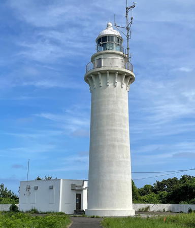
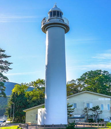
Tappi Saki Light, Sotogahama, May 2021
Google Maps photo by Ken Tanoue
General Sources
Lighthouses in Japan - Aomori
A site providing photos and data for most major Japanese lighthouses.
Lighthouse-Japan.com - Aomori
Another comprehensive site with photos and notes from visits to many lighthouses.
Form of a Lighthouse - Aomori Prefecture
This web site, cited below as FOAL, has photos for many lighthouses in Aomori.
Misty's Japanese Lighthouse Tour -Aomori
Photos and brief notes in English for lighthouses in all parts of the country.
Second Region Lighthouse Story
Posted by the Coast Guard region office in Aomori, an interactive map linking to information on the major lighthouses.
Lighthouses in Aomori Prefecture
Photos by various photographers available from Wikimedia.
Online List of Lights - Japan
Photos by various photographers posted by Alexander Trabas. Photos for Aomori are by Jim Smith.
Navionics Charts
Navigation chart for Aomori.
 

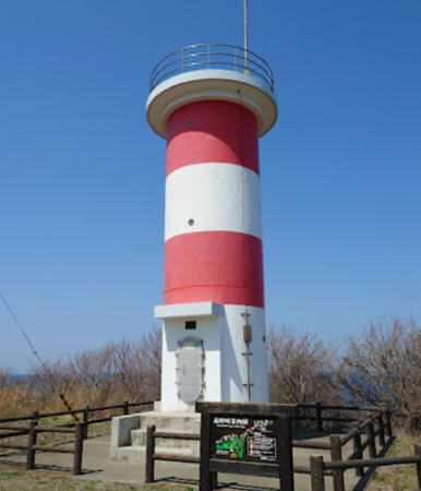
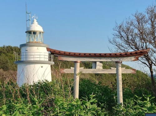
Torii Saki Light, Fukaura, June 2021
Google Maps photo by Satoru Inomata
 

Aomori Coast Guard District: Sea of Japan Lighthouses

Fukaura Town Lighthouses
* Iwasaki Kō (Sawabe Breakwater)
Date unknown. Active; focal plane 15 m (49 ft); continuous green light with a more intense flash every 3 s. 8.5 m (28 ft) concrete post attached to a square 1-story concrete equipment shelter. Entire lighthouse is white. Google has a street view and a satellite view. Located at the end of the breakwater pier of Sawabe harbor. Accessible by walking the pier. Site open, tower closed. ARLHS JPN-190; JCG-1424; Admiralty M7055.14; NGA 3648.
Kyuroku Shima
1959. Active; focal plane 20 m (66 ft); white flash every 8 s. 19 m (62 ft) round cylindrical concrete tower with lantern and gallery. Entire lighthouse painted white. A photo and a second photo are available but the reef is not visible in Google's satellite view. Located on an exposed, rocky reef in the Sea of Japan about 45 km (28 mi) west of Iwasaki. Site open, tower closed. ARLHS JPN-1073; JCG-1426; Admiralty M7055.2; NGA 3640.
* Henashi Saki
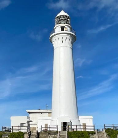
1941. Active; focal plane 68 m (223 ft); white flash every 10 s. 24 m (79 ft) round cylindrical concrete tower with lantern and gallery, attached to a small 1-story equipment building. 2nd order (?) Fresnel lens in use. Entire lighthouse painted white. The Coast Guard has the photo at right and a short page for the lighthouse, Yuuki Sato has a 2021 photo, FOAL's page has good photos, Lighthouses-Japan.com also has a photo, Misty's Tour has a small photo, and Google has a street view and a satellite view. This lighthouse marks a prominent cape about 100 km (60 mi) southwest of the Tsugaru Strait. Located on the point of the cape, south of the village of Henashi and about 7 km (4.5 mi) west of Iwasaki. Accessible by road and a short walk, but the entrance is poorly marked and no parking is provided. Site open, tower closed. . ARLHS JPN-104; JCG-1425; Admiralty M7055; NGA 3652.
Fukaura West Breakwater
1981. Active; focal plane 15 m (49 ft); red flash every 3 s. 11 m (36 ft) round cylindrical concrete tower with lantern and gallery. Entire lighthouse is red. A very distant view, a view from shore (last photo on the page), and a 2021 drone view are available, and Google has a satellite view and a distant street view. Located at the north head of the detached west breakwater at Fukaura. Accessible only by boat. Site and tower closed. ARLHS JPN-1052; JCG-1429; Admiralty M7054.4; NGA 3658.
Fukaura East (Outer) Breakwater
Date unknown. Active; focal plane 12 m (39 ft); continuous green light with a more intense flash every 6 s. 11 m (36 ft) round cylindrical concrete tower. Entire lighthouse is white. A very distant view, a view from shore (last photo on the page), and a 2021 drone view are available, and Google has a satellite view and a distant street view. Located at the north head of the detached east breakwater at Fukaura. Accessible only by boat. Site and tower closed. ARLHS JPN-1054; JCG-1428; Admiralty M7054; NGA 3660.
Henashi Saki Light
Henashi Saki Light, Fukaura
Japanese Coast Guard Second District photo
* Torii Saki
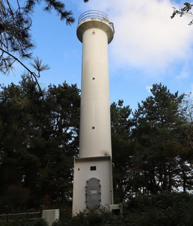
1966. Active; focal plane 27 m (89 ft); two white flashes every 8 s. 10 m (33 ft) round concrete tower with two galleries, mounted atop a square 1-story concrete equipment room. No lantern. The lighthouse also has a continuous white spotlight illuminating an offshore reef. Lighthouse painted with red and white horizontal bands. Satoru Inomata's photo is at the top of this page, Lighthouse-Japan.com has a page with good photos, FOAL's page has many photos, Misty's Tour has two good closeup photos, a distant view and a sunset view are available, and Google has a street view and a satellite view. The lighthouse stands on a large rock just offshore, connected to the mainland by a long concrete walkway. Located at a turning point of the coast about 20 km (13 mi) northeast of Henashi Saki. Accessible by a short walk from the harbor, where parking is available. Site open, tower closed. . ARLHS JPN-674; JCG-1430 (main light) and 1431 (spotlight); Admiralty M7053.8; NGA 3664.
* Ōtose (Odose) Saki
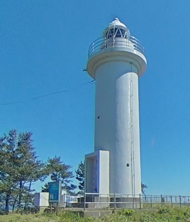
1962. Active; focal plane 54 m (177 ft); white flash every 12 s. 13 m (43 ft) round cylindrical concrete tower with lantern and gallery, attached to a small 1-story equipment building. Entire lighthouse painted white. A photo is at right, FOAL's page has many photos, Lighthouses of Japan also has a page for the lighthouse, Misty's Tour has a small photo, and Google has a street view and a satellite view. Located on a bluff at a promontory about 25 km (15 mi) west of Ajigasawa. Accessible by road; parking provided. Site open, tower closed. . ARLHS JPN-470; JCG-1432; Admiralty M7053.6; NGA 3668.

Ajigasawa Town Lighthouses
* Ajigasawa (Azigasawa) Kō (West Breakwater)
1938. Active; focal plane 13 m (43 ft); red light, 3 s on, 3 s off. 11 m (36 ft) round cylindrical concrete tower with lantern and gallery. Entire lighthouse painted red. Google has a satellite view. Located on the outer breakwater at Ajigasawa. Accessible by walking the pier. Site open, tower closed. ARLHS JPN-1051; JCG-1433; Admiralty M7052; NGA 3672.
* Ajigasawa (Azigasawa) East Breakwater
Date unknown. Active; focal plane 11 m (36 ft); green flash every 3 s. 9.5 m (31 ft) concrete post attached to a square 1-story concrete equipment shelter. Entire lighthouse is white. Google has a street view and a satellite view. Located at the end of the east breakwater at Ajigasawa. Accessible by walking the pier. Site open, tower closed. JCG-1434; Admiralty M7053; NGA 3676.

Goshogawara City Lighthouse
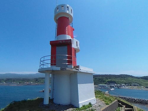
* Jūsan Kō South Jetty
Date unknown. Active; focal plane 10 m (33 ft); red flash every 3 s. 7 m (23 ft) concrete post attached to a square 1-story concrete equipment shelter. Entire lighthouse is red. A 2022 photo and a closeup street view are available and Google has a satellite view and a distant street view. The Iwaki River, the longest river of Aomori Prefecture, drains into a lagoon (Lake Jūsan) which is connected to the sea through a narrow inlet called Mitoguchi. Located on the short jetty on the south side of the inlet. Accessible by walking the jetty. Site open, tower closed. ARLHS JPN-1064; JCG-1435; Admiralty M7048; NGA 3680.
Ōtose Saki Light
Ōtose Saki Light, Fukaura
Japanese Coast Guard photo

Nakadomari Town Lighthouses
Kodomari Misaki South
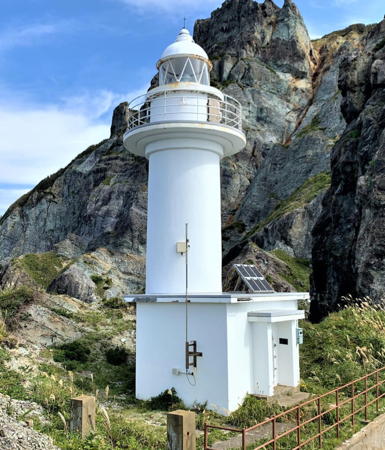
1965. Active; focal plane 78 m (256 ft); white light, 3 s on, 3 s off. 13 m (43 ft) round cylindrical concrete tower with lantern and gallery, mounted on a small 1-story equipment building. Entire lighthouse painted white. John Smith's 2020 photo is at right, a 2022 photo and a closeup photo are available, and Google has a satellite view. Kodomari Misaki is a mountainous peninsula that projects about 5 km (3 mi) into the Sea of Japan, threatening the southwestern approach to Tsugaru Strait. Located on the point of the cape, about 7 km (4.5 mi) west of Kodomari. It's possible for a determined lighthouse fan to reach the lighthouse by walking from the end of the coastal road west of Shirowamisaki, scrambling along a rocky beach, and climbing a very long stairway to the lighthouse. Site open, tower closed. . ARLHS JPN-281; JCG-1437; Admiralty M6673; NGA 3688.
Kodomari Misaki North
Date unknown. Active; focal plane 89 m (292 ft); white flash every 4 s. 10 m (33 ft) concrete post rising from a square 1-story concrete equipment room. Entire lighthouse painted white. Lighthouse-Japan.com has a page with good photos, a 2019 photo is available, Takeshi Yamada has a 2021 photo, and Google has a satellite view. Located on the northwestern point of the Kodomari Misaki peninsula. The Lighthouse-Japan webmaster was able to reach the lighthouse by a rather strenuous 5 km (3 mi) trail from the Kodomari fishing port. Site open, tower closed. ARLHS JPN-788; JCG-1438; Admiralty M6672; NGA 3692.
* Kodomari Kō North Breakwater (2)
Date unknown (1975?) (station established 1935). Active; focal plane 13 m (43 ft); red flash every 3 s. 9 m (30 ft) concrete post centered on a square 1-story concrete equipment shelter. Entire lighthouse is red. FOAL has another 2011 photo (lower right on the page), and Google has a satellite view. The light was relocated when the breakwater was extended in 2015. Located near the end of the long north (really west) breakwater of Kodomari, in the lee of Kodomari Misaki. Accessible by walking the pier (a half-mile walk). Site open, tower closed. ARLHS JPN-1068; JCG-1439; Admiralty M6668; NGA 3696.

Kodomari Misaki South Light, Nakadomari, June 2018
ex-Google Plus photo by Eric Meng
#Kodomari Kō East Breakwater
1975. Removed in 2014. This was an 8.5 m (28 ft) concrete post centered on a square 1-story concrete equipment shelter. Entire lighthouse was white. FOAL has another photo (secoind row, left) and Google has a May 2014 street view, but Bing's satellite view confirms the removal. The light became redundant when the harbor was expanded; it was deactivated in September 2014. Located on the east inner breakwater of Kodomari. Accessible by walking the pier. Site open, tower closed. ARLHS JPN-1067; ex-JCG-1440; ex-Admiralty M6670; ex-NGA 3700.

Aomori Coast Guard District: Western Tsugaru Strait Lighthouses

Western Sotogahama Town (Minmaya) Lighthouses
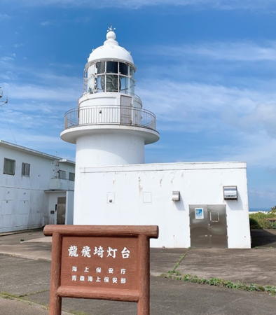
* Tappi Saki
1932. Active; focal plane 119 m (390 ft); two white flashes every 20 s. 14 m (46 ft) round cylindrical tower with lantern and gallery mounted atop a 2-story crew quarters building. The lighthouse has what appears to be a 2nd order Fresnel lens. Entire lighthouse painted white. Ken Tanoue's photo is at the top of this page, Lighthouse-Japan.com has a page with good photos, Souzou Cotory has a 2007 closeup, Misty's Tour has photos, FOAL's page has additional photos, Trabas has Smith's distant view, and Google has a street view and a satellite view. This lighthouse and the Shirakami Misaki Light at the southernmost tip of Hokkaidō light the western entrance to Tsugaru Strait. The opening is about 19 km (12 mi) wide, well within the 50 km (31 mi) range of this powerful lighthouse. The lighthouse also serves as a signal and traffic control station for shipping through the strait. Located on the point of the cape, about 8 km (5 mi) northwest of Minmaya. Accessible by road; ample parking provided. Site open, tower closed. Site manager: Tsugaru Quasi-National Park. . ARLHS JPN-627; JCG-1501; Admiralty M6662; NGA 3704.
* Minmaya Kō
1935. Active; focal plane 13 m (43 ft); red light, 3 s on, 3 s off. 9 m (30 ft) round cylindrical concrete tower with gallery but no lantern, painted red. FOAL's page has photos, Matsumoto-Pota Masa has a view from the sea, a distant view is available, and Google has a satellite view. Located at the end of the outer breakwater at Minmaya, a small port about 5 km (3 mi) southeast of Tappi Saki. Site and tower closed. ARLHS JPN-1074; JCG-1502; Admiralty M6658; NGA 3708.

Imabetsu Town Lighthouses
* Takano Saki (2)
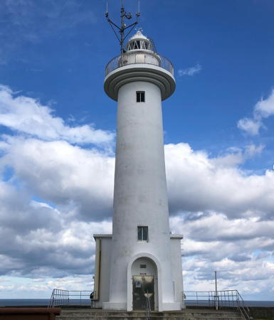
Around 2004 (station established 1966). Active; focal plane 35 m (115 ft); white light, 3 s on, 3 s off. 10 m (33 ft) round cylindrical concrete tower with gallery but no lantern, painted with red and white horizontal bands. A photo is at right, Masahiro Yamada has a 2022 photo, FOAL's page has photos, Trabas has Smith's distant view, and Google has a satellite view and a closeup street view. The Lighthouse of Japan photo and the Misty's Tour photo (the latter taken in 2002) show the original lighthouse. This lighthouse guides ships toward the entrance from Tsugaru Strait into Aomori Bay. The cape is a very popular vantage point commanding a wide view of the strait. Located on a promontory about 7 km (4.5 mi) northwest of Tairadate. Accessible by road; parking is available. Site open, tower closed. Site manager: Tsugaru Quasi-National Park. . ARLHS JPN-617; JCG-1503; Admiralty M6657; NGA 3712.

Takano Saki Light, Imabetsu, May 2019
Google Maps photo by mxa03032

Aomori Coast Guard District: Mutsu Bay Lighthouses

Mutsu Bay is a butterfly-shaped bay roughly 40 km (25 mi) long from west to east. At its northwestern corner the bay is connected to Tsugaru Strait by the 10 km (6 mi) wide Tairadate Strait. On its south side the mountainous Natsudomari Peninsula separates Mutsu Bay into its eastern and western basins. The western basin is called Aomori Bay and the eastern basin is called Noheji Bay.

Eastern Sotogahama Town (Kanita) Lighthouses
* Tairadate (Myojin Saki)
1899. Active; focal plane 23 m (75 ft); white flash every 5 s. 22 m (72 ft) round cylindrical tower with lantern and gallery. Entire lighthouse painted white. Modern 1-story keeper's house. Lighthouse-Japan.com has a page with excellent photos, FOAL's page has photos, Misty's Tour has a photo, a 2021 photo and a 2013 photo are available, Trabas has Smith's distant view, and Google has a street view (also seen at right) and a satellite view. Tairadate is a port on the west side of the entrance to Mutsu Bay. Located on Myojin Saki, a point of land on the north side of the town of Tairadate. Accessible by road. Site open, tower closed. . ARLHS JPN-800; JCG-1504; Admiralty M6654; NGA 3716.
* Tairadate Kō
1966. Active; focal plane 9.5 m (31 ft); green flash every 8 s. 8.5 m (28 ft) concrete post rising from one corner of a square 1-story concrete equipment shelter. Entire lighthouse is white. FOAL's page has photos and Google has a distant street view and a distant satellite view. Located at the end of the "east" (really south) breakwater of Tairadate harbor. Accessible by walking the pier. Site open, tower closed. ARLHS JPN-1095; JCG-1505; Admiralty M6656; NGA 3720.
* Kanita Kō
1967. Active; focal plane 13 m (43 ft); green light, 3 s on, 3 s off. 11 m (36 ft) round cylindrical tower with lantern and gallery, painted white. FOAL's page has photos, a 2020 closeup is available, Trabas has Smith's distant view, a drone view is available, and Google has a street view across the harbor and a satellite view. The Admiralty misspells the name as Kaniata. Located at the end of the south breakwater of Kanita harbor in Sotogahama, on the west side of Mutsu Bay about 25 km (15 mi) north of Aomori. Accessible by walking the pier. Site open, tower closed. ARLHS JPN-1066; JCG-1506; Admiralty M6651; NGA 3724.

Aomori City Lighthouses
#Aomori Kō Timber Port West Breakwater
1968. Inactive since 2012 and removed thereafter. This was an 8.5 m (28 ft) concrete post attached to a square 1-story concrete equipment shelter. Entire lighthouse was red. Google has a street view confirming the removal and a satellite view of the location. Formerly located on a breakwater on the west side of Aomori harbor. Site open. ex-JCG-1508; ex-Admiralty M6650; ex-NGA 3730.


Tairadate Light, Sotogahama, June 2014
Google Maps street view

#Aomori Okidate Wharf West Breakwater
Date unknown. Removed in 2019. This was a 9.5 m (31 ft) concrete post attached to a square 1-story concrete equipment shelter. Entire lighthouse painted red. Trabas has Smith's 2016 photo and FOAL has 2012 and 2016 photos (bottom of the page). Google's satellite view shows that the light was removed and Satoru Inomata's 2021 street view does not show a light on the breakwater. Located on the west breakwater protecting the ferry terminal in Aomori harbor. Site and tower closed, but there's a good view from ferries. ex-JCG-1512.5; ex-Admiralty M6648; ex-NGA 3731.
Aomori Port Aburakawa North Breakwater East End
2019. Active; focal plane 12 m (41 ft); red flash every 4 s. Approx. 10 m (33 ft) concrete post attached to a square 1-story concrete equipment shelter. Entire lighthouse painted red. Trabas has Smith's photo, FOAL has 2019 photos (top of the page), and Google has a satellite view. This light is the replacement for the Okidate Wharf West Breakwater Light (previous entry); NGA has the new location but still calls it the West Breakwater light. Located at the east end of a detached breakwater at the entrance to Aomori harbor. Accessible only by boat. JCG-1512.5; Admiralty M6648; NGA 3731.
 
* Aomori Kō (Breakwater West)
1961. Active; focal plane 13 m (43 ft); green flash every 3 s. 12 m (39 ft) round broadly conical tower with lantern and gallery; the lantern has a sharply peaked roof that continues the conical profile of the structire. Entire lighthouse covered with white tiles. Trabas has Smith's photo (also seen at right), the Coast Guard has a page for the lighthouse, Sophiep Tran has a closeup photo, a 2016 closeup photo and a view from across the harbor are available, Satoru Inomata has a closeup 2021 street view, and Google has a satellite view. This unusual lighthouse is a landmark in Aomori harbor, the departure point for ferries crossing Tsugaru Strait to Hokkaidō. The Japanese name translates as "breakwater west lighthouse" and the light seems to be known locally as the West Lighthouse (西灯台), but NGA lists it as "north breakwater, north head." (Aomori has half a dozen breakwaters, so perhaps some confusion is inevitable.) Accessible by walking the breakwater; Kudō Shiai has a photo showing the approach from a waterfront park. Site and tower closed. . ARLHS JPN-1050; JCG-1522; Admiralty M6646; NGA 3731.5.
Aomori Kō East Breakwater West End
Date unknown. Active; focal plane 11 m (36 ft); three green flashes every 12 s. 10 m (33 ft) concrete post attached to a square 1-story concrete equipment shelter. Entire lighthouse painted white. Trabas has Smith's photo, FOAL has a photo (halfway down the page) and Google has a satellite view and a very distant street view. Located at the west end of the detached breakwater protecting the eastern part of Aomori harbor. Accessible only by boat. Site and tower closed. JCG-1520; Admiralty M6647.5; NGA 3734.

West Breakwater Light, Aomori, 2016
photo copyright Jim Smith; used by permission

Hiranai Town Lighthouses
These lighthouses are on the Natsudomari Peninsula, the northern end of the Ōu Mountains. The peninsula separates Mutsu Bay into its eastern and western basins.
Moura Kō Breakwater
2000. Active; focal plane 12 m (39 ft)); green light, 3 s on, 3 s off. 11 m (36 ft) round cylindrical tower with lantern and gallery, painted white. A 2020 photo is available and Google has a satellite view and a distant street view. Located at the end of the north breakwater at Moura Kō about 13 km (8 mi) northeast of Aomori. Site and tower closed. ARLHS JPN-1075; JCG-1530; Admiralty M6643.5; NGA 3740.
Mutsu (Mutu) Ōshima
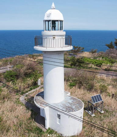
1949. Active; focal plane 42 m (138 ft); white flash every 7 s. 10 m (33 ft) concrete tower with lantern and gallery, painted white. A 2022 photo is at right, Yasuko Hirata has a 2018 closeup photo, a 2022 closeup is available, Wikimedia has a 2018 photo, Don Boyd has a 1965 photo, and Google has a street view and a satellite view. Located on Mutsu Ōshima, a small island off the tip of the Natsudomari Peninsula, about 23 km (14 mi) northeast of Aomori. The island is connected to the mainland by a footbridge, and a trail leads to the lighthouse, but one visitor found the trail to be overgrown and difficult to follow. Site status unknown. . ARLHS JPN-382; JCG-1531; Admiralty M6643; NGA 3760.
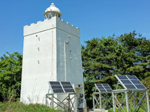
* Yasui Saki
1949. Active; focal plane 25 m (82 ft); white light, 2 s on, 2 s off. 12 m (39 ft) robust square concrete tower with lantern and a castellated gallery. Entire lighthouse painted white. A nice 2018 photo and a 2019 closeup photo are available and Google has a street view and a satellite view. This is a very unusual design. Located on a promontory in Higashidaki on the west side of East Mutsu Bay about 5 km (3 mi) north of Hiranai. Accessible by road, but no parking is provided at the lighthouse. Site open, tower closed. . ARLHS JPN-754; JCG-1533; Admiralty M6642; NGA 3768.

Mutsu Ōshima Light, Hiranai, May 2022
Google Maps photo by Quappi S.

Noheji Town Lighthouse
Noheji Kō
1954. Active; focal plane 12 m (39 ft); two red flashes every 6 s. 11 m (36 ft) round cylindrical tower with lantern and gallery, painted red. The town has the photo at right, the Coast Guard has a photo of the lighthouse in action, and Google has a distant street view and a satellite view. The mountain in the photo at right is Mount Osore ("Mount Dread"), a dormant volcano on the Shimokita Peninsula. Located at the end of the west breakwater of Noheji, a port at the south end of Noheji Bay. Site and tower closed. ARLHS JPN-1078; JCG-1535; Admiralty M6641; NGA 3780.

Southern Mutsu City (Shimokita Peninsula) Lighthouses
Occupying the northeastern corner of Honshū, the Shimokita Peninsula is shaped like an ax being swung to the west. The peninsula is connected to the rest of Honshū by a narrow isthmus (the ax handle) along the east side of Mutsu Bay.

Ominato Kō
Date unknown. Active; focal plane 10 m (33 ft); red light occulting once every 4 s. 8.5 m (28 ft) concrete post attached to a square 1-story concrete equipment shelter. Entire lighthouse painted red. Google has a distant satellite view. Located on the east (main) breakwater protecting the entrance to Ominato, the harbor district of Mutsu City, at the extreme northeastern corner of Mutsu Bay. Site and tower closed, although the light can be seen from nearby. ARLHS JPN-1087; JCG-1538; Admiralty M6640.2; NGA 3802.
Noheji Kō Light
Noheji Kō Light, Noheji, March 2012
Noheji Town photo by Sato (no longer online)
* Kuro Saki (Mutsu Kuro Saki) (2)
1986 (station established 1945). Active; focal plane 22 m (72 ft); white flash every 4 s. 12 m (39 ft) round concrete tower with flared top and gallery, but no lantern. Lighthouse painted white with one black horizontal band. FOAL's page has good photos, a 2020 closeup is available, and Google has a satellite view. The original lighthouse was a square 2-story concrete tower. Located on a promontory midway on the north side of East Mutsu Bay, about 20 km (13 mi) southwest of Mutsu. Site open, tower closed. . ARLHS JPN-1072; JCG-1541; Admiralty M6640; NGA 3804.
Wakinosawa Kō
Date unknown. Active; focal plane 12 m (39 ft); red flash every 3 s. 10 m (33 ft) concrete post attached to a square 1-story concrete equipment shelter. Entire lighthouse is red. A view from the bay is available and Google has a street view across the harbor and a distant satellite view. Wakinosawa, near the southwestern tip of the Shimokita Peninsula, is the terminal for ferries crossing the mouth of Mutsu Bay to Kanita. Located on the east (main) breakwater protecting the entrance to Wakinosawa. Site status unknown. ARLHS JPN-1097; JCG-1543; Admiralty M6638.4; NGA 3809.
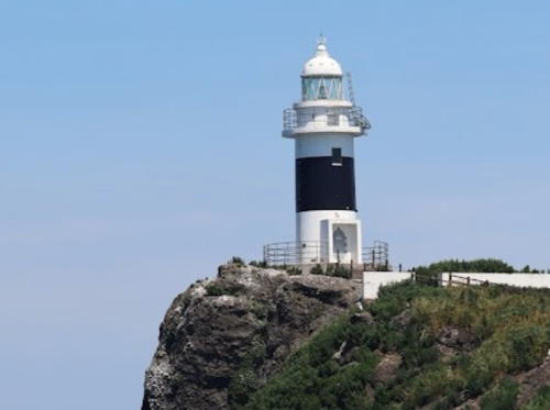
Mutsu Benten Shima
1945. Active; focal plane 36 m (118 ft); two white flashes every 7 s. 12 m (39 ft) round cylindrical concrete tower with lantern and gallery, mounted on a circular concrete base. Lighthouse painted white with a broad black horizontal band. A photo is at right, Trabas has Smith's distant view from a passing ship, a similar view is available, FOAL's page includes a closeup photo (second row on the page), and Google has a satellite view. Benten Shima is a huge rock just off the tip of the Shimokita Peninsula. As the photos show, the island looks remarkably like a giant whale. The light guides ships entering or leaving the eastern lobe of the bay. Accessible only by boat. Site and tower closed. ARLHS JPN-044; JCG-1544; Admiralty M6638; NGA 3810.

Mutsu Benten Shima Light, Mutsu, October 2022
Google Maps photo by Kiriya 111

Aomori Coast Guard District: Central Tsugaru Strait Lighthouses

Sai Town Lighthouses
Sai is a village on the rugged west coast of the Shimokita Peninsula, facing the Tsugaru Strait.

Oyo Shima (Oyojima)
Date unknown. Active; focal plane 19 m (62 ft); white flash every 3 s. 9.5 m (31 ft) round cylindrical concrete tower rising from a round 1-story concrete equipment shelter. Entire lighthouse is white. A 2023 photo is available and Google has a very distant street view from shore but the tower is not seen in Bing's satellite view. Located on an islet about 1 km (0.6 mi) offshore and 6 km (3.5 mi) south of Sai harbor. Accessible only by boat. Site status unknown. ARLHS JPN-1088; JCG-1545; Admiralty M6637; NGA 3812.
Sai Kō
1997. Active; focal plane 13 m (43 ft); two red flashes every 6 s. 9 m (30 ft) round concrete tower with flared top and gallery, but no lantern. Lighthouse painted red. Noboru Saso has a 2022 photo and Google has a satellite view and a street view across the harbor. Located at the end of the main breakwater at Sai, a small port about 13 km (8 mi) southwest of Ōma. Site and tower closed. ARLHS JPN-1089; JCG-1547.3; Admiralty M6636.7; NGA 3816.

Ōma Town Lighthouses
Ōma occupies the northwestern tip of the Shimokita Peninsula, facing the Tsugaru Strait. Ferries cross the strait from Ōma to Hakodate, Hokkaidō.

*
Ōma Kō West Breakwater
1961. Active; focal plane 13 m (43 ft); red light, 3 s on, 3 s off. 9.5 m (31 ft) concrete post attached to a square 1-story concrete equipment shelter. Entire lighthouse is red. FOAL has a photo (2/3 the way down the page) and Google has a satellite view and a distant street view across the harbor. Located on the west breakwater of the traditional harbor of Ōma (not the ferry harbor). Accessible by walking the pier. Site open, tower closed. JCG-1549; Admiralty M6636; NGA 3828.2.
Ōma Saki
1921. Active; focal plane 36 m (118 ft); three white flashes every 30 s. 25 m (82 ft) round cylindrical concrete tower rising from one corner of a 2-story keeper's house. Tower painted with black and white horizontal bands. Fog horn (one 10 s blast every 50 s). Taichiro Kogawa's photo is at right, Lighthouse of Japan has a page with several photos, FOAL's page has photos, Hiroyuki Watanabe has a 2023 photo, Misty's Tour has a small photo, and Google has a satellite view and a distant street view from the mainland. This lighthouse marks the northernmost point of Honshū and the narrowest point of the Tsugaru Strait; from here it is 18 km (11 mi) north to Siokubi Misaki, Hokkaidō. Located on a small island off the point of the cape near the town of Ōma. Accessible only by boat. Site and tower closed. . ARLHS JPN-2636; JCG-1550; Admiralty M6634.5; NGA 3832.
Genbei Sho (Genbei Syo)
Date unknown. Active; focal plane 7 m (23 ft); two white flashes every 5 s. 7 m (23 ft) post rising from a 1-story equipment shelter. Lighthouse painted black with one red horizontal band. The light is seen in Wikimedia's photo of the Ōma Saki lighthouse, Itsuki Toyo hass a distant photo, and Google has a satellite view and a distant street view from the mainland. Located on a reef midway in the channel between the mainland and the island of the Ōma Saki lighthouse. Accessible only by boat. Site open, tower closed. JCG-1551; Admiralty M6635; NGA 3830.

Ōma Saki Light, Higashidōri, August 2012
Google Maps photo by Taichiro Kogawa

Hachinohe Coast Guard District: Eastern Tsugaru Strait Lighthouses

Northern Mutsu City Lighthouses
Ohata Kō East Breakwater
1979. Active; focal plane 11 m (36 ft); green light, 3 s on, 3 s off. 9 m (30 ft) concrete post attached to a square 1-story concrete equipment shelter. Entire lighthouse is white. Google has a street view and a satellite view. Located on the east breakwater of the original harbor (now the west harbor) at Ohata, about 12 km (7.5 mi) north of Mutsu. Site status unknown. ARLHS JPN-1079; JCG-1552; Admiralty M6632; NGA 3840.
Ohata Kō First East Breakwater
1979. Active; focal plane 15 m (49 ft); continuous red light with a more intense flash every 4 s. 11 m (36 ft) round concrete tower with flared top and gallery, but no lantern. Entire lighthouse is red. Google has a satellite view and a distant street view across the harbor. Located at the east end of the main breakwater at Ohata. Site status unknown. ARLHS JPN-1080; JCG-1554; Admiralty M6633.5; NGA 3836.
Sekinehama Kō West Breakwater
Date unknown. Active; focal plane 14 m (46 ft); red flash every 4 s. 9.5 m (31 ft) concrete post attached to a square 1-story concrete equipment shelter. Entire lighthouse is red. FOAL has a photo (halfway down the page, on the right) and Google has a satellite view. Located at the east end of the detached breakwater of Sekinehama. Accessible only by boat. Site and tower closed. JCG-1554.2; Admiralty M6631.5; NGA 3846.
Sekinehama Kō East Breakwater
Date unknown. Active; focal plane 14 m (46 ft); green flash every 4 s. 10 m (33 ft) concrete post attached to a square 1-story concrete equipment shelter. Entire lighthouse is white. FOAL has a photo (bottom of the page, on the right), and Google has a satellite view. Located on the east breakwater of Sekinehama. Site and tower closed. JCG-1554.4; Admiralty M6631.6; NGA 3846.5.

Hachinohe Coast Guard District: Pacific Coast Lighthouses

Higashidōri Town Lighthouses
Shiriya (Shiriyamisaki) Kō
Date unknown. Active; focal plane 14 m (46 ft); green flash every 4 s. 9.5 m (31 ft) concrete post attached to a square 1-story concrete equipment shelter. Entire lighthouse is white. FOAL has a photo, and Google has a satellite view and a very distant street view. The Shiriya harbor was built as a harbor of refuge for vessels escaping North Pacific storms. This light was relocated recently when an extension of the breakwater doubled its length. Located at the end of the east breakwater of Shiriya harbor. Site and tower closed. ARLHS JPN-1093; JCG-1555; Admiralty M6631; NGA 3848.
* Shiriya (Siriya) Saki
1876. Active; focal plane 46 m (151 ft); white flash every 10 s; also a continuous white spotlight illuminates a reef 1.4 km (0.9 mi) to the northeast. 33 m (108 ft) round brick tower with lantern and gallery, attached to a 2-story keeper's house. Entire lighthouse painted white. Yari Hotaka's photo is at right, Daisuke Aoki has a 2021 photo, Lighthouses in Japan has a fine photo, FOAL has additional photos, a good closeup photo is available, and Google has a street view and a satellite view. The lighthouse stands at the northeastern tip of Honshū, marking the eastern entrance to Tsugaru Strait. This tall, handsome tower, one of Japan's best known lighthouses, stands at the end of a picturesque peninsula famous for an endangered herd of feral horses. One of the few tall brick lighthouses in Japan, it was restored in 1951. Accessible by road, but parking may be limited. Located at the tip of Cape Shiriya. Site open, tower closed. . ARLHS JPN-581; JCG-1601 (general light) and 1602 (spotlight); Admiralty M6630; NGA 3852.

Shiriya Saki Light, Shimokita, November 2011
Flickr Creative Commons photo by Yari Hotaka
Shiranuka Detached Breakwater
2019. Active; focal plane 16 m (52 ft); two green flashes every 6 s. 11 m (36 ft) concrete post centered on a square 1-story equipment shelter. Entire lighthouse is white. FOAL has July 2019 photos (1/3 the way down the page) and Bing has a satellite view but the light had not yet been built at the time of Google's satellite view. This light replaced a similar light on the port's south breakwater. Located at the north end of a new detached breakwater protecting the harbor of Shiranuka, a small port about 25 km (15 mi) south of Shiriya Saki. Accessible only by boat. Site open, tower closed. JCG-1603.5; Admiralty M6628.3.
* Shiranuka (Siranuka) (2)
Date unknown (station established 1931). Active; focal plane 38 m (125 ft); white flash every 4 s. 14 m (46 ft) round cylindrical concrete tower with lantern and gallery. A continuous white spotlight (JCG 1604.1) that formerly illuminated the nearby South Breakwater was deactivated in 2019. Entire lighthouse painted white. A portion of Satoru Inomata's 2021 street view is at right, Lighthouse of Japan has a page with good photos, Lighthouses in Japan has a good photo, FOAL's page has photos, and Google has a satellite view . Accessible by road and a short walk, but the road to the light is not marked. Located on a bluff on the south side of Shiranuka harbor. Site open, tower closed. . ARLHS JPN-578; JCG-1604; Admiralty M6628; NGA 3860.
Mutsu Ogawara Kō
Date unknown. Active; focal plane 16 m (52 ft); continuous green light with two more intense flashes every 7 s. 13 m (43 ft) round cylindrical white concrete tower. Google has a good satellite view. Located on the south breakwater of Ogawara harbor, about 50 km (30 mi) north of Misawa. Site status unknown; this area appears to be closed. ARLHS JPN-1076; JCG-1609.4; Admiralty M6627.3; NGA 3878.

Misawa City Lighthouse
* Mutsu Shiogama (2?)
Date unknown. Active; focal plane 31 m (102 ft); white light, 3 s on, 3 s off. 15 m (49 ft) round cylindrical white concrete tower. A photo is below right, Tomio Tatsumi has a photo, a 2020 closeup is available, and Google has a satellite view. NGA lists a skeletal tower for this light. The lighthouse is in a park but the entrance is unmarked. Located in the village of Shiogama, about 30 km (19 mi) north of Hochinohe. Site open, tower closed. . JCG-1610; Admiralty M6627; NGA 3880.

Shirinuka Light, Shirinuka, July 2021
Google Maps street view by Satoru Inomata

Hachinohe City Lighthouses
Hachinohe is a city of about 225,000 residents. It is an important seaport handling containerships and oil tankers.

Hachitaro (Hachinohe) North Breakwater (2)
2013 (station establishment date unknown). Active; focal plane 18 m (59 ft); two red flashes every 9 s. 16 m (52 ft) round cylindrical concrete tower with lantern and gallery. Entire lighthouse is red. FOAL has a photo (fourth row, on the left) and Google has a satellite view. This lighthouse was damaged by the tsunami in March 2011; it was repaired and reactivated in March 2013. Located at the end of the north breakwater of Hachinohe (Google's views show that much of this breakwater was broken and underwater even before the tsunami). Accessible only by boat. Site status unknown. ARLHS JPN-1056; JCG-1612; Admiralty M6624.8; NGA 3904.
Hachitaro (Hachinohe) Kō Detached Outer Breakwater
Date unknown. Active; focal plane 17 m (56 ft); two green flashes every 6 s. 16 m (52 ft) round cylindrical concrete tower with lantern and gallery. Entire lighthouse is white. FOAL has a photo (fourth row, on the right) is available and Google has a satellite view. Located on the detached outer breakwater of Hachinohe, about 400 m (1/4 mi) from the north end. Accessible only by boat. Site status unknown. ARLHS JPN-1055; JCG-1611.8; Admiralty M6624.85; NGA 3906.
Hachitaro (Hachinohe, Hatitaro) East Breakwater
Date unknown. Active; focal plane 15 m (49 ft); two green flashes every 9 s. 10 m (33 ft) concrete post rising from a a square 1-story concrete equipment room. Entire lighthouse is white. FOAL has a photo (halfway down the page, on the left) and Google has a satellite view. Located at the end of a long pier in Hachinohe harbor. Site status unknown. ARLHS JPN-1058; JCG-1613; Admiralty M6625.5; NGA 3908.
* Hachinohe Toyosu (Aomori) Breakwater
Date unknown. Active; focal plane 13 m (43 ft); red flash every 5 s. 9.5 m (31 ft) round concrete tower, flared at the top, attached to a small concrete equipment room. Entire lighthouse is red. FOAL's page has photos (2/3 the way down the page, on the right) and Google has a street view and a satellite view. Located at the end of a short breakwater on the east side of Toyosu wharf in Hachinohe. Accessible by walking the pier. Site open, tower closed. JCG-1618; Admiralty M6623.6; NGA 3922.
 

Mitsu Shiogama Light, Mitsawa, November 2021
Instagram photo by peugeot208de
 
Hachitaro (Hachinohe, Hatitaro) Middle Breakwater West End
Date unknown. Active; focal plane 13 m (43 ft); green flash every 5 s. 9.5 m (31 ft) concrete post rising from a square 1-story concrete equipment room. Entire lighthouse is white. FOAL has a photo (a little over halfway down the page on the left) and Google has a satellite view, and the top of the light is seen in a street view. Located at the west end of the detached inner breakwater at Hachinohe. Accessible only by boat. Site status unknown. JCG-1617; Admiralty M6623.2; NGA 3928.
Hachitaro (Hachinohe, Hatitaro) Middle Breakwater East End
Date unknown. Active; focal plane 15 m (49 ft); red flash every 3 s. 10 m (33 ft) concrete post rising from a a square 1-story concrete equipment room. Entire lighthouse is red. FOAL has a photo (3/4 the way down the page, on the left), and Google has a satellite view. Located at the east end of the detached inner breakwater at Hachinohe. Accessible only by boat. Site status unknown. JCG-1621; Admiralty M6623; NGA 3924.
* Hachinohe Kabushima Jetty
1963. Active; focal plane 10 m (33 ft); continuous green light with a more intense flash every 6 s. 8.5 m (28 ft) concrete post rising from a a square 1-story concrete equipment room. Entire lighthouse is white. FOAL has photos (2nd and 3rd from last rows on the page) and Google has a street view and a satellite view. Located at the end of short jetty at the east end of Hachinohe harbor. Accessible by walking the pier. Site open, tower closed. ARLHS JPN-1065; JCG-1623; Admiralty M6624.4; NGA 3940.
Hachinohe Ō Saki
Date unknown. Active; focal plane 22 m (72 ft); continuous white spotlight illuminating the Hinode Iwa reef 430 m (1/4 mi) to the north. 8.5 m (28 ft) concrete post supporting a square spotlight enclosure and with several equipment closets at the base. Entire lighthouse is white. Gonzaburou Kitakaze has a 2021 photo and Google has a street view and a satellite view. Located on a promontory at the eastern extremity of Hachinohe harbor. Site open, tower closed. JCG-1624; Admiralty M6621; NGA 3900.
* Samekado
1938. Active; focal plane 58 m (190 ft); white flash every 8 s. 23 m (75 ft) round concrete tower with lantern and gallery, attached to a 2-story equipment building. Entire lighthouse painted white. A photo is at right, a fine closeup is available, Lighthouses in Japan has a good photo, FOAL's page has photos, Torajiro Kuruma has a 2021 photo, and Google has a street view and a good satellite view. This lighthouse is the landfall light for the port city of Hachinohe. Accessible by road; the entrance road is gated but appears to be open to walkers. Located on a promontory about 5 km (3 mi) east of Hachinohe. Site open, tower closed. . ARLHS JPN-535; JCG-1625; Admiralty M6620; NGA 3896.
Samekado Light
Samekado Saki Light, Hachinohe, April 2013
Wikimedia Creative Commons photo by Matsucommatsu

Hashikami Town Lighthouse
* Hashikami (Hasikami, Hajikami)
1959. Active; focal plane 22 m (72 ft); white flash every 4 s. 11 m (36 ft) round cylindrical concrete tower with gallery but no lantern, mounted on a 1-story equipment room. Entire lighthouse painted white. Lighthouses of Japan has a good photo, Hiroshi Yoshida has a 2021 closeup, a 2011 photo is available, and Google has a street view and a satellite view. The lighthouse is in a small park behind an elementary school. Located on a bluff north of the port of Taneichi, very close to the prefectural border, about 15 km (9 mi) southeast of Hachinohe. Site open, tower closed. . ARLHS JPN-088; JCG-1626; Admiralty M6618; NGA 3944.

Information available on lost lighthouses:

Notable faux lighthouses:

Adjoining pages: North: Southern Hokkaidō | Southeast: Iwate | Southwest: Akita

Return to the Lighthouse Directory index | Ratings key

Posted August 15, 2006. Checked and revised June 2, 2023. Lighthouses: 56. Site copyright 2023 Russ Rowlett and the University of North Carolina at Chapel Hill.