Lighthouses of Japan: Kumamoto Mainland

The nation of Japan, known in Japanese as Nihon or Nippon (日本), occupies an archipelago off the east coast of Asia. The four main islands are Hokkaidō in the north, Honshū (the largest), Shikoku in the south, and Kyūshū in the southwest. The country includes thousands of other islands of all sizes; among them the Ryūkyū (Nansei) Islands are a long chain extending to the southwest and including the large island of Okinawa, and the Nanpō Islands are another long chain extending south into the Pacific Ocean. Much of Japan is mountainous but the coastal regions are densely populated and urbanized; the country's population is about 126 million.

Located at the southwestern end of the Japanese archipelago, the island of Kyūshū is divided into seven prefectures. This page includes those lighthouses of Kumamoto Prefecture that are on the mainland of Kyūshū. Most of the prefecture's lighthouses are in the Amakusa Islands, which lie to the southwest separating Yatsushiro Bay from Ariake Bay.

Also included on this page are several lighthouses on Ariake Bay that are located in Fukuoka and Saga Prefectures, respectively. Fukuoka and Saga have many other lighthouses on their northern coasts, and those lighthouses are listed on the Fukuoka and Saga pages.

In Japanese, the word for a lighthouse is tōdai or toudai (灯台). The words saki and misaki are for capes and headlands, hana ("nose") is a promontory, hantō is a peninsula, shima (also spelled sima or jima) is an island, bae is a reef, iwa or shi is a rocky reef, amase or se is a shoal, wan is a bay, nada is a sound or basin, kaikyō is a strait, kawa is a river, and or minato is a harbor.

Lighthouses in Japan are operated and maintained by the Japanese Coast Guard's Maritime Safety Agency. There is at least one Coast Guard Section Office in each prefecture, often two or more. Kumamoto Prefecture has one station, at Kumamoto City. However, the last seven lighthouses on this page are maintained by the office at Miike in neighboring Fukuota Prefecture.

ARLHS numbers are from the ARLHS World List of Lights. JCG numbers are the Japanese Coast Guard's light list numbers. Admiralty numbers are from volume M of the Admiralty List of Lights & Fog Signals. U.S. NGA List numbers are from Publication 112.

General Sources
Lighthouses in Japan
This site has photos and data for the major lighthouses. There are pages for each prefecture: Kumamoto, Fukuoka, and Saga.
Our Lighthouses of Kumamoto Prefecture
A comprehensive collection of photos of Kumamoto lighthouses, but note that lighthouses of the Amakusa area are on the site's home page. There are companion pages for Saga and Fukuoka prefectures.
Lighthouse of Japan
Another comprehensive site, with many photos and pages for each prefecture: Kumamoto | Fukuoka | Saga.
Form of a Lighthouse - Kumamoto
Another site with many photos of Japanese lighthouses, cited below as FOAL. There are also pages for Saga and Fukuoka prefectures.
Lighthouse Visits
This site has photos for many lighthouses in this area.
Region Ten Lighthouses
Information and photos posted by the Tenth Coast Guard Region office, which is responsible for Kumamoto Prefecture.
Kumamoto Prefecture Lighthouses
Information posted by the Kumamoto Coast Guard Office. The office also has a gallery of photos.
Miike Area Lighthouses
Information and photos posted by the Miike Coast Guard Office.
Online List of Lights - Japan
Photos posted by Alexander Trabas.
Navionics Charts
Navigational chart for southern Kyūshū.
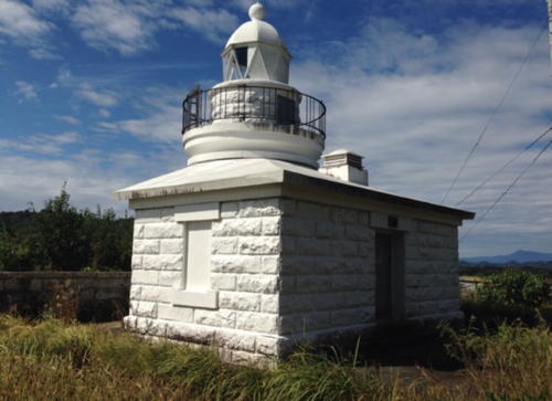

Tobase Shima Light, Uki, December 2018
Google Maps photo by gun miike
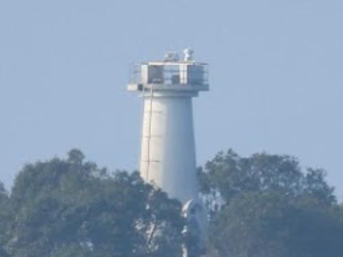

Higo Okino Shima Light, Ashikita, February 2020
Google Maps photo by S. Katsuragu
Yatsushiro Sea Lighthouses

The Yatsushiro Sea (also called Yatsushiro Bay) is a protected bay separating the island of Kyūshū from the Amakusa Islands.

Minamata City Lighthouse
Koiji Shima (Minamata Kō)
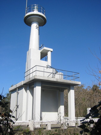
1957. Active; focal plane 32 m (105 ft); white flash every 3 s. 11 m (36 ft) concrete post rising from a 1-story concrete equipment building. Entire lighthouse is white. A Coast Guard photo is at right, FOAL's page has distant views, Trabas has a distant view, and Google has a satellite view. Located on the western tip of Koiji Shima, an island off Minamata harbor. Accessible only by boat. Site open, tower closed. ARLHS JPN-2100; JCG-6542; Admiralty M5134; NGA 11212.

Ashikita Town Lighthouses
* Egushi Kō
1965. Active; focal plane 11 m (36 ft); continuous red light with a more intense flash every 6 s. 8.5 m (28 ft) concrete post attached to a square 1-story concrete equipment shelter. Entire lighthouse is red. Trabas has a photo, Lighthouse Visits has a page for the light, FOAL also has a page, a 2020 photo is available, and Google has a satellite view and a distant street view. Located on a breakwater on the west side of the entrance to Egushi. Accessible by walking the pier. ARLHS JPN-2088; JCG-6538; Admiralty M5137.4; NGA 11236.
Higo Okino Shima
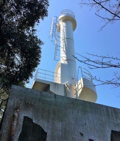
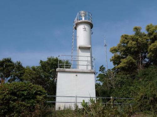
Date unknown. Active; focal plane 24 m (79 ft); white flash every 3 s. 8 m (25 ft) round concrete tower. Entire lighthouse is white. Part of S. Katsuragi's 2020 view is at the top of this page, a Coast Guard photo is available, Trabas has a photo, FOAL's page has distant views, nd Google has a satellite view. Located in Yatsushiro Bay about 1.5 km (1 mi) northwest of the Egushi lighthouse. Accessible only by boat. Site open, tower closed. ARLHS JPN-2092; JCG-6537; Admiralty M5137.47; NGA 11240.

Yatsushiro City Lighthouses
Yatsushiro Kō Breakwater
Date unknown. Active; focal plane 13 m (43 ft); two red flashes every 8 s. 9.5 m (31 ft) round concrete tower. Entire lighthouse is red. Trabas has a photo, Lighthouse Visits has a page for the light, FOAL also has a page, and Google has a satellite view and a very distant street view. Located at the end of a short breakwater on the south side of the entrance to Yatsushiro, a city of about 125,000 residents on the upper east side of Yatsushiro Bay. Site and tower closed, but there's a good view from ferries crossing Yatsushiro Bay between Yatsushiro and Amakusa. ARLHS JPN-2116; JCG-6532; Admiralty M5142.4; NGA 11304.
Yatsushiro Kō Groin
Date unknown. Active; focal plane 13 m (43 ft); green flash every 3 s. 9.5 m (31 ft) round concrete tower mounted on a square platform supported by piles. Lighthouse is white. Trabas has a good photo, FOAL's page has good photos, Lighthouse Visits also has a page for the light, and Google has a satellite view. Located at the end of a partially-submerged training wall in Yatsushiro harbor. Accessible only by boat. Site open, tower closed. ARLHS JPN-2115; JCG-6524; Admiralty M5142; NGA 11308.
Koiji Shima Light
Koiji Shima Light, Minamata
Japanese Coast Guard Kumamoto Office photo

Uki City Lighthouses
Uki, a city of about 60,000 residents, occupies the north shore of Yatsushiro Bay.
Mifune (Mihune) Se
1980. Active; focal plane 12 m (39 ft); one short and one long red flash every 8 s. 12 m (39 ft) round concrete tower with double gallery mounted on a concrete pier; an adjoining pier has steps for access to the light. The tower is red. Trabas has a photo, FOAL's page has photos, and Google has a satellite view. Located about 800 m (1/2 mi) offshore at the head of Yatsushiro Bay west of Uki. Accessible only by boat, but there is an excellent view from highway 266, which is very close to the shore in this area. Site open, tower closed. JCG-6436; Admiralty M5143.2; NGA 11564.
Tobase Shima
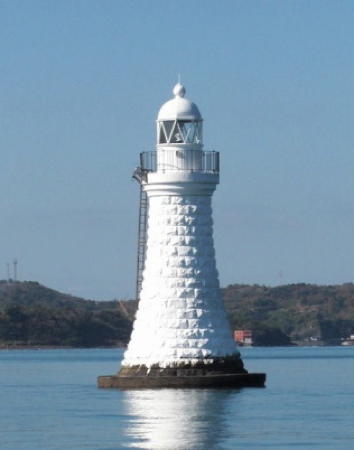
1898. Active; focal plane 33 m (108 ft); white light, 3 s off, 3 s on. 8 m (26 ft) round stone tower with lantern and gallery, attached to a small 1-story stone keeper's cottage. Entire lighthouse painted white. A 2018 photo at the top of this page, a 2024 photo is available, Our Lighthouses has a page with excellent photos, FOAL's page also has good photos, the Coast Guard has a page for the lighthouse, Lighthouse Visits has a page for the lighthouse, Trabas has a photo, and Google has a satellite view. This is one in a chain of Yatsushiro Bay lighthouses built shortly after Japan took control of Taiwan. The lighthouse marks the entrance from Yatsushiro Bay to the narrow Misumi Strait, the northern entrance to the bay. In 2009 a modern LED optic was installed and the original Fresnel lens was placed on display at the Ryujokan Museum in Uki. Located at the southern tip of Tobase Shima, an island about 9 km (6.5 mi) southeast of Misumi. Accessible by a hiking trail (local guidance needed; a 2010 visitor reports some difficulty locating the lighthouse). Site open, tower closed. . ARLHS JPN-655; JCG-6434; Admiralty M5143; NGA 11556.
Tera Shima
1898. Active; focal plane 10 m (33 ft); flash every 3 s, white or red depending on direction. 11 m (36 ft) round tapered stone tower with lantern and gallery, painted white. A Coast Guard photo appears at right, the Coast Guard has a second photo, Our Lighthouses has a page with excellent photos, FOAL's page also has good photos, Lighthouse Visits has a page for the lighthouse, Trabas has a photo, and Google has a satellite view. Another in the chain of Yatsushiro Bay lighthouses built shortly after Japan took control of Taiwan. Located off the northeastern tip of an island in the Misumi Strait, about 2.5 km (1.5 mi) south of the city. The lighthouse appears to be accessible, at least at low tide. Site open, tower closed. . JCG-6432; Admiralty M5164; NGA 11552.
Misumi Kō (Ninai Shima)
1962. Active; focal plane 12 m (39 ft); two white flashes every 6 s. 9.5 m (31 ft) concrete post attached to a square 1-story concrete equipment shelter. Entire lighthouse is white. Our Lighthouses has a page with photos, FOAL has photos, Lighthouse Visits also has a page for the lighthouse, another page is available, Trabas has a photo, Kenichiro Asai has a 2022 photo, and Google has a satellite view. Located on an islet at the western end of Ninai Shima in the middle of Misumi Strait, on the west side of the city. Accessible only by boat. Site status unknown. ARLHS JPN-2101; JCG-6429; Admiralty M5162; NGA 11548.

Tera Shima Light, Uki
Japanese Coast Guard photo

Ariake Sea Lighthouses

North of the Yatsushiro Sea, the Ariake Sea (also called Ariake Bay) is the largest bay in Kyūshū. It is crescent shaped, about 80 km (50 mi) long and generally 15-25 km (9-15 mi) wide. Kumamoto Prefecture includes the lower 2/3 of the east coast of the bay.

Uto City Lighthouses
Ōdo Kō
1972. Active; focal plane 12 m (39 ft); green flash every 3 s. 10 m (33 ft) tapered square skeletal tower, painted white. Trabas has a photo, FOAL has photos, and Google has a satellite view and a distant street view. Located at the end of a long training wall at Ōdo harbor. Accessible in very calm weather by walking the pier, but it is a long walk. Site open, tower closed. JCG-6427; Admiralty M5167; NGA 11588.
Sumiyoshi (Sumiyosi)
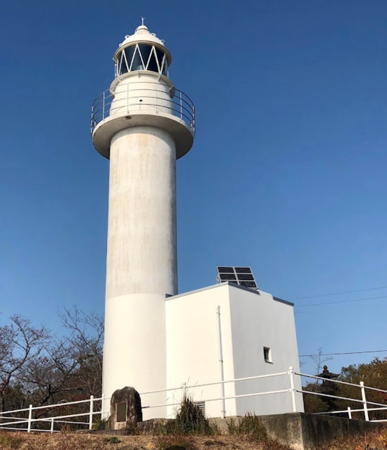
1933. Active; focal plane 40 m (131 ft); white light, 3 s on , 3 s off. 17 m (56 ft) round tower rising from a 1-story concrete building. Entire lighthouse is white. A photo is at right, Coast Guard has a page for the lighthouse, Our Lighthouses has a page with good photos, FOAL's page has many photos, Lighthouse-Japan.com also has a page with a photo, Kawabata Takayuki has a closeup, Trabas has a drone view, Yūji Umezaki has a 2021 closeup, and Google has a satellite view and a closeup street view. Located on a promontory on the south side of the entrance to Sumiyoshi, the port district of Uto. Accessible by a walking path within a city park. Site open, tower closed. ARLHS JPN-598; JCG-6426; Admiralty M5168; NGA 11592.

Kumamoto City Lighthouses
The prefectural capital of Kumamoto is a city of about 750,000 residents on the east side of Ariake Bay.

*
Hyakkan (Hyakkanishi) Kō
1952. Active; focal plane 13 m (43 ft); white light occulting once every 8 s. 8.5 m (28 ft) round concrete tower with double gallery, mounted on a square pyramidal concrete pier. Entire lighthouse is white. Trabas has a photo, Lighthouse-Japan.com has a page with a good photo, FOAL has closeup photos, Our Lighthouses also has a page with photos, a 2020 closeup is available, and Google has a satellite view and a distant street view. Hyakkan is the harbor associated with the prefectural capital, Kumamoto. Located on a point of land at the north side of the entrance to the harbor. Site open, tower closed. . ARLHS JPN-149; JCG-6423; Admiralty M5170; NGA 11596.
Higoshioya (Higo Sioyo) Kō
1971. Active; focal plane 13 m (43 ft); two red flashes every 8 s. 8.5 m (28 ft) square pyramidal skeletal tower with gallery, painted red. Trabas has a photo, FOAL has photos, a closeup 2023 photo is available, Google has a satellite view and a very distant street view. Located on the south breakwater of Higoshioya harbor in the Kawachi district of Kumamoto. Apparently accessible by walking the pier, but it would be a long walk. Site open, tower closed. ARLHS JPN-2174; JCG-6421; Admiralty M5171; NGA 11600.

Sumiyoshi Light, Uto, March 2019
Google Maps photo by Sunrise-kun
Kawachi (Kawati)
1935. Active; focal plane 46 m (151 ft); white flash every 4 s. 10 m (33 ft) square concrete tower with gallery, flared at the top. Entire lighthouse is white. Lighthouse-Japan.com has a page with photos, FOAL's page has good photos, Our Lighthouses also has a page with photos, Trabas has a photo, a 2017 closeup is available, and Google has a satellite view. Located on a bluff south of the entrance to Kawachi harbor, about 10 km (6 mi) west northwest of Kumamoto. Accessible by a short walk up the hill; limited parking is available. Site open, tower closed. . ARLHS JPN-250; JCG-6420; Admiralty M5172; NGA 11604.

The remaining lighthouses on this page are maintained by the Miike Coast Guard Office.

Nagasu Town Lighthouse
Nagasu Kō
1981. Active; focal plane 13 m (43 ft); green light, 3 s on, 3 s off. 8.5 m (26 ft) concrete post attached to a square 1-story concrete equipment room. Entire lighthouse is white. The Coast Guard has a small photo (#30 on the page), Lighthouse Visits has a page for the light, FOAL has photos, Trabas has a photo, and Google has a satellite view. Located at the end of the main (north) breakwater of Nagasu. Site status unknown. ARLHS JPN-2103; JCG-6416; Admiralty M5173.2; NGA 11616.

Arao City Lighthouse
*
Miike Kō (Yotsuyama)
1951. Active; focal plane 65 m (213 ft); white flash every 10 s. 15 m (49 ft) round cylindrical concrete tower with lantern and gallery, rising from a 1-story concrete service building. Entire lighthouse is white. Hara Kazu's 2019 photo is at right, Lighthouse-Japan.com has a page with good photos, Our Lighthouses also has a page with photos, FOAL's page has photos, Trabas has a photo, Mov Nishida has a street view, and Google has a satellite view. Miike Kō is the port for the city of Ōmuta, on the northeast side of Ariake Bay. Ōmuta is in Fukuoka Prefecture, but the lighthouse is 400 m (1/4 mi) across the line in Kumamoto Prefecture. Located atop a hill, Yotsuyama, on the south side of the harbor area. Site open, tower closed. . JCG-6414; Admiralty M5174; NGA 11628.

Miike Kō Light, Arao, December 2019
Google Maps photo by Hara Kazu

Fukuoka Prefecture: Ariake Sea Lighthouses

Ōmuta City Lighthouse
Miike (Ōmuta) Groin (2)
Date unknown (station established 1908). Active; focal plane 14 m (46 ft); green flash every 3 s. 11 m (43 ft) concrete post attached to a square 1-story concrete equipment room, centered on a large round stone pier. Entire lighthouse is white. Trabas has a photo, a good closeup is available, FOAL has photos, and Google has a satellite view. Located at the end of a long groin on the north side of the entrance to Ōmuta, a city of about 115,000 residents. Accessible only by boat (the groin is not walkable). Site status unknown. JCG-6412; Admiralty M5175; NGA 11636.

Yanagawa City Lighthouse
Chikugo (Tikugo)
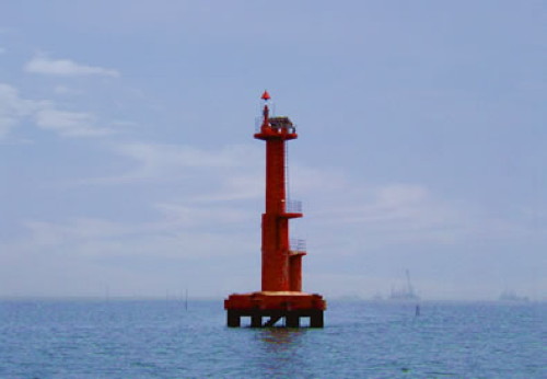
Date unknown (station established 1936). Active; focal plane 16 m (52 ft); one long and three short red flashes every 8 s. 14 m (46 ft) round concrete tower attached to a small equipment shelter and mounted on a square platform supported by piles. Entire lighthouse is red. A Coast Guard photo is at right, Trabas has a photo, the Coast Guard also has a small photo (#17 on the page), and Bing has a satellite view. Located on a shoal about 4 km (2.5 mi) southwest of Yanagawa harbor. Accessible only by boat. Site open, tower closed. JCG-6407; Admiralty M5175.8; NGA 11704.
Chikugo Light
Chikugo Light, Yanagawa
Japanese Coast Guard Miike Office photo

Saga Prefecture: Ariake Sea Lighthouses

Tara Town Lighthouses
Okikami Se
Date unknown. Active; focal plane 13 m (43 ft); two white flashes every 5 s. 10 m (33 ft) post attached to a 1-story equipment shelter and mounted on a round concrete base. Lighthouse painted black with one red horizontal band. Trabas has a photo, the Coast Guard also has a small photo (#15 on the page), and Bing has a satellite view. Located on a reef near the northern end of Ariake Bay. Accessible only by boat. Site open, tower closed. JCG-6392; Admiralty M5177; NGA 11660.
Kame Se
1958. Active; focal plane 10 m (33 ft); two white flashes every 5 s. 9 m (30 ft) two-stage concrete tower, painted black with one red horizontal band. Trabas has a photo, FOAL has two good photos, Lighthouse Visits has a page for the light, and Google has a satellite view and a street view from shore. Located in the center of the entrance to Tara harbor. Accessible only by boat, but easily seen from shore. Site open, and nothing prevents climbing on the tower. JCG-6391; Admiralty M5178.5; NGA 11656.
Tsuru Se (Tsuruse) (2)
1970 (station established 1945). Active; focal plane unknown; continuous white spotlight. Approx. 16 m (52 ft) round concrete tower carrying a large round concrete lantern structure; the light is shown through a window. A closeup 2022 photo is available, the Coast Guard has a small photo (#26 on the page), Lighthouse Visits has a page with photos, FOAL has photos (bottom of the page), another photo (1/4 the way down the page) is available, Trabas has a drone view, and Google has a satellite view. Site open, tower closed. JCG-6390; Admiralty M5178.8.
* Yatō Hana
1954. Active; focal plane 38 m (125 ft); white flash every 3 s. 9 m (30 ft) concrete post attached to a small 1-story concrete equipment room. Entire lighthouse is white. A 2022 photo is at right, Lighthouse-Japan.com has a page with photos, Our Lighthouses also has a page with photos, FOAL also has photos, Trabas has a photo, and Google has a satellite view and a distant street view. The light marks the north side of the entrance to Isahaya Bay, an embayment on the west side of Ariake Bay. Located about 20 km (13 mi) northeast of Isahaya. Site open, tower closed. . ARLHS JPN-755; JCG-6388; Admiralty M5179; NGA 11644.

Yato Hana Light, Tara, May 2022
Google Maps photo by Aku Taka

Information available on lost lighthouses:

Notable faux lighthouses:

Adjoining pages: South: Kushikino Area | Southwest: Amakusa Islands | West: Nagasaki Area

Return to the Lighthouse Directory index | Ratings key

Posted July 23, 2007. Checked and revised April 15, 2024. Lighthouses: 22. Site copyright 2024 Russ Rowlett and the University of North Carolina at Chapel Hill.