Lighthouses of Japan: Imabari Area (Northern Ehime)

The nation of Japan, known in Japanese as Nihon or Nippon (日本), occupies an archipelago off the east coast of Asia. The four main islands are Hokkaidō in the north, Honshū (the largest), Shikoku in the south, and Kyūshū in the southwest. The country includes thousands of other islands of all sizes; among them the Ryūkyū (Nansei) Islands are a long chain extending to the southwest and including the large island of Okinawa, and the Nanpō Islands are another long chain extending south into the Pacific Ocean. Much of Japan is mountainous but the coastal regions are densely populated and urbanized; the country's population is about 126 million.

Smallest of the Japanese main islands, Shikoku is divided into four prefectures. This page includes lighthouses of northern Ehime Prefecture, a coastline facing north on the Seto Inland Sea. This is a scenic and well populated coast with numerous harbors.

In Japanese the word for a lighthouse is tōdai or toudai (灯台). The words saki and misaki are for capes and headlands, hana ("nose") is a promontory, hantō is a peninsula, shima (also spelled sima or jima) is an island, bae is a reef, iwa or shi is a rocky reef, amase or se is a shoal, wan is a bay, nada is a sound or basin, kaikyō is a strait, kawa is a river, and or minato is a harbor.

Lighthouses in Japan are operated and maintained by the Japanese Coast Guard's Maritime Safety Agency. There is at least one Coast Guard Section Office in each prefecture, often two or more. Lighthouses in northern Ehime are managed by the office at Imabari, except for some of the lights of Kamijima Town that are managed by the Onomichi office in Hiroshima prefecture.

ARLHS numbers are from the ARLHS World List of Lights. JCG numbers are the Japanese Coast Guard's light list numbers. Admiralty numbers are from volume M of the Admiralty List of Lights & Fog Signals. U.S. NGA List numbers are from Publication 112.

General Sources
Lighthouses in Japan - Ehime
A site with photos and data covering the major lighthouses.
Lighthouse of Japan - Ehime
Another comprehensive site, in Japanese, with many photos.
Form of a Lighthouse - Ehime
Another site with many photos of Japanese lighthouses, cited below as FOAL.
Lighthouse Visits
This site has photos for many lighthouses in this area.
Online List of Lights - Japan
Photos posted by Alexander Trabas.
Misty's Japanese Lighthouse Tour - Ehime
Photos and a few notes in English for lighthouses in all parts of the country.
Imabari Coast Guard Office - Aids to Navigation
Interactive map linking to pages for the lighthouses.
Meiji Lighthouses of the Sixth Region
Posted by the Sixth Coast Guard Region, information and photos concerning lighthouses built in the Meiji period (1868-1912).
Lighthouses in Ehime Prefecture
Photos available from Wikimedia.
Navionics Charts
Navigation chart for northern Shikoku.
Ōge Shima Light
Ōge Shima Light, Imabari
Japanese Coast Guard Sixth Region photo
Imabari City Lighthouses

Imabari is a city near the end of the Kurushima peninsula, which projects northward into the Seto Inland Sea. The Kurushima Strait, a busy and hazardous passage, connects Aki Bay west of the peninsula to Bingo Bay on the east.

Western Imabari Lighthouses
* Kikuma Kō
1930. Active; focal plane 11 m (36 ft); two red flashes every 6 s. 9.5 m (31 ft) concrete post attached to a square 1-story concrete equipment building. Entire lighthouse is red. Trabas has a photo, Lighthouse-Japan.com has a page for the light, Lighthouse Visit also has a page, and Google has a satellite view. Located at the end of the main breakwater of Kikuma, a fishing harbor in southwestern Imabari. Accessible by walking the pier. Site open, tower closed. ARLHS JPN-2391; JCG-4634; Admiralty M5446; NGA 8790.
* Kurushima Kazitori Hana
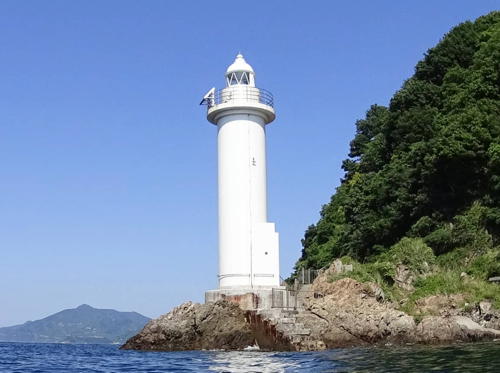
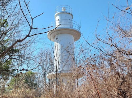
1962. Active; focal plane 33 m (108 ft); two short white flashes followed one long white flash, every 15 s. 11 m (36 ft) round cylindrical concrete tower with double gallery. Entire lighthouse is white. Jo Momoda 's 2024 photo is at right, Lighthouse Visit has a page with a closeup photo, the Coast Guard has a page, Misty's Tour has a photo, Trabas has a very distant view, Nago Imasara has a 2022 closeup, a 2021 drone view is available, and Google has a satellite view. Kazitori Hana is a peninsula that projects westward into the Inland Sea about 7 km (4.5 mi) west of Imabari. The Kazitori Hana Sea Berth, a deepwater terminal for oil tankers, has been developed on the north side of the peninsula. This lighthouse is located on a headland on the west side of that harbor. Accessible by highway 301, a very narrow and winding road; the entrance to the road is well marked but there's no mention of the lighthouse. Site open, tower closed. . ARLHS JPN-311; JCG-4618; Admiralty M5450; NGA 8772.
Nishiura (Nisiura) Oki
1966. Active; focal plane 10 m (33 ft); two red flashes, one short and one long, every 8 s. 9 m (30 ft)round cylindrical concrete tower with double gallery. Entire lighthouse painted red. Lighthouse Visit has a page with photos, FOAL has photos (at the bottom of the page), Trabas has a foggy photo, and Google has a satellite view and a distant street view. Located about 200 m (220 yd) offshore and 1.5 km (1 mi) south of the tip of the Kurushima peninsula. Accessible only by boat. Site and tower closed. JCG-4617; Admiralty M5452; NGA 8764.

Kazitori Hana Light, Imabari, February 2024
Google Maps photo by Jo Momoda

Ōge Shima Lighthouses
Ōge Shima is a relatively small island about 11 km (6.5 mi) north of Imabari. It is well north of the east-west channels of the Kurushima Strait, but it marks a narrow passage in the old ferry route across the Seto Inland Sea from Imabari on Shikoku to Takehara on Honshū. For some reason the two lighthouses of the island are separated by several pages in the NGA listings; they are not even in the same section!

Ōge Shima
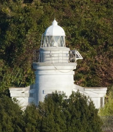
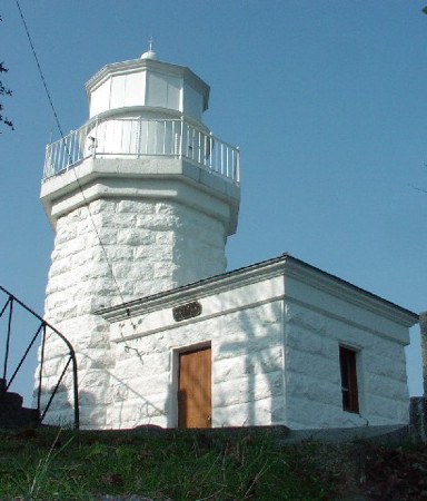
1897. Active; focal plane 35 m (115 ft); white flash every 5 s. 9 m (30 ft) octagonal stone tower with lantern and gallery, attached to a small 1-story stone keeper's cottage. Entire lighthouse painted white. A Coast Guard photo is at the top of this page, Lighthouse Visit has a page with several photos, the Coast Guard also has a page with a nice photo, FOAL has a page with photos, Imari Sinpei has a 2020 closeup, and Google has a satellite view. Located on a sharp promontory on the west side of the island. Accessible by a short walk from the south end of the harbor. Site open, tower closed. . JCG-4488; Admiralty M5700; NGA 8524.
Agono Hana (Ago No Hana)
1988. Active; focal plane 17 m (56 ft); white light, 3 s on, 3 s off. 15 m (49 ft) round cylindrical concrete tower with lantern and gallery. Entire lighthouse is white. Masanari Kobayashi's photo is at right, FOAL has a page with photos, Lighthouse Visit also has a page, Trabas has a view from the sea, the Coast Guard's page lacks a photo, Sohiro Okamoto has a 2020 photo, and Google has a satellite view. Located at the extreme southeastern tip of Ōge Shima, about 2000 m (1.2 mi) southeast of the historic lighthouse. Accessible by a walk of about 1.5 km (1 mi) from the village. Site open, tower closed. . ARLHS JPN-779; JCG-4488.3; Admiralty M5700.5; NGA 8746.

Agono Hana Light, Imabari, June 2021
Google Maps photo by Masanari Kobayashi

Kurushima Strait Lighthouses
The Kuroshoma Strait joins two of the main basins of the Seto Inland Sea, Iyo Bay (Iyonada) to the west and Aki Bay (Akinada) to the east.

Ikada Iso
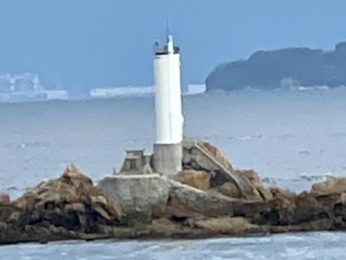
Date unknown (station established 1915). Active; focal plane 13 m (43 ft); one long and two short red flashes every 8 s. 11 m (36 ft) round cylindrical concrete tower with double gallery. Entire lighthouse painted red. FOAL has photos (top of the page), Trabas has a foggy photo, the Coast Guard's page has a closeup, Lighthouse Visit has a photo (second lighthouse on the page), and Google has a satellite view. This lighthouse marks an especially narrow passage in the Inland Sea, where vessels round the tip of the Kurushima peninsula, a sharp promontory north of Imabari. Located on a bare rock about 1.2 km (3/4 mi) northwest of the promontory and 7 km (4.5 mi) northwest of Imabari. Accessible only by boat. Site and tower closed. ARLHS JPN-783; JCG-4616; Admiralty M5454; NGA 8760.
Hiro Se (Namikata Kō)
1963. Active; focal plane 10 m (33 ft); two white flashes every 5 s. 8 m (26 ft) round cylindrical concrete tower with double gallery. Lighthouse painted black with one red horizontal band. Trabas has a photo, Lighthouse Visit has photos, FOAL's page has photos (halfway down the page), Kenichiro Asai has a 2023 photo, and Google has a satellite view. Located on a rock off the harbor of Namikata, about 4 km (2.5 mi) northwest of Imabari. Accessible only by boat. Site and tower closed. JCG-4614; Admiralty M5459.4; NGA 8752.
Naka Iso (Nakano Iso, Kurushima Naka Iso)
1960. Active; focal plane 10 m (33 ft); one short and one long green flash every 8 s. 8 m (26 ft) round cylindrical concrete tower with gallery. Lighthouse painted green. In the background of the linked photo is the Kurushima-Kaikyō (Kurushima Strait) Bridge, a series of three suspension bridges that is part of the Western Seto Expressway joining Honshū and Shikoku. The Coast Guard page has a photo, Trabas has a photo, FOAL has a photo, Lighthouse Visit has a photo (second lighthouse on the page), Kenichiro Asai has a 2023 photo, and Google has a satellite view. Located on a rock northwest of the bridge and northeast of Namikata. Accessible only by boat. Site and tower closed. ARLHS JPN-790; JCG-4613; Admiralty M5459.3; NGA 8748.
O Shima
1960. Active; focal plane 17 m (56 ft); four red flashes, in a long-short-long-short pattern (Morse code "C"), every 13 s. 13 m (43 ft) round cylindrical concrete tower with gallery. Lighthouse painted red. S. Katsuragi has the 2020 photo at right, is at right, Trabas has a photo, Lighthouse Visit has a photo, FOAL has a photo, and Google has a satellite view. This lighthouse marks the inside of a 90° turn for vessels in the main channel of the Kuroshima Strait. Located on a rock just off the northeast point of O Shima -- not the big Ōshima (see below) but a much smaller island on the northwest side of the Kurushima-Kaikyō bridge. Accessible only by boat. Site and tower closed. ARLHS JPN-792; JCG-4612; Admiralty M5458; NGA 8744.

O Shima Light, Imabari, November 2020
Google Maps photo by S. Katsuragi

Hakata Shima Lighthouses
Hakata Shima is an island east of Omi Shima and north of O Shima. The Nishiseto Expressway crosses the island, bridging to both of the neighboring islands.

Shimo Komaruko Shima (Simo Komaru Koshima)
1962. Active; focal plane 21 m (69 ft); two white flashes every 7 s. 8.5 m (28 ft) concrete post attached to a square 1-story concrete equipment room. Entire lighthouse is white. Trabas has a photo, Nobita Hige has a distant view, and Google has a satellite view. Located on an island in the narrow channel separating Hakata Shima and Uma Shima, two islands north of Ōshima. Accessible only by boat. Site open, tower closed. ARLHS JPN-2420; JCG-4517; Admiralty M5481; NGA 8580.
Funaore (Hunaore) Iwa
1945. Active; focal plane 12 m (39 ft); one short and one long red flash every 8 s. 8.5 m (28 ft) round concrete tower with a flared top, mounted on a large concrete pier. Entire lighthouse is red. Trabas has a closeup, Lighthouse Visit has a photo (2/3 the way down the page), FOAL has closeup photos (halfway down the page), Kenichiro Asai has a 2023 photo, and Google has a satellite view. Located on a reef outside Hakata harbor, on the south side of Hakata Shima. Accessible only by boat. Site open, tower closed. JCG-4515; Admiralty M5478; NGA 8572.
#Hakata Kō
1939. Removed in 2020. 8.5 m (28 ft) concrete post attached to a square 1-story concrete equipment room. Entire lighthouse is white. Lighthouse Visit has a 2015 photo (1/3 the way down the page) and FOAL has a 2017 photo. Google's satellite view confirms the removal of the light. The light was deactivated in March 2020. Located at the end of the main breakwater of Hakata harbor, on the east side of the island. Site status unknown. ex-JCG-4513; ex-Admiralty M5476; NGA 8564.
Mutsu Se
1945. Active; focal plane 11 m (36 ft); three quick white flashes every 10 s. 8 m (26 ft) round concrete tower, mounted on a concrete pier. Lighthouse painted black with one yellow horizontal band. Trabas has a closeup photo, FOAL's page has photos, Lighthouse Visit has a photo (halfway down the page), Kenichiro Asai has a 2023 photo, and Google has a satellite view. Located on a reef off the southeastern tip of Hakata Shima. Accessible only by boat. Site open, tower closed. JCG-4514; Admiralty M5477; NGA 8568.
Niwatori Ko Shima
1945. Active; focal plane 15 m (49 ft); white flash every 4 s. 6 m (20 ft) round white concrete tower. Trabas has a closeup photo, FOAL has a page for the light, Lighthouse Visit has a photo (last lighthouse on the page), Kenichiro Asai has a 2023 photo, and Google has a satellite view. Located on a reef off the southern tip of Hakata Shima. Accessible only by boat. Site open, tower closed. JCG-4516; Admiralty M5479; NGA 8576.

Ōshima Lighthouses
Ōshima is a large island crossed by the Nishiseto Expressway between Shikoku and Honshū. The Kurushima-Kaikyō (Kurushima Strait) Bridge connects Ōshima to Imabari.

Nakato Shima
1900. Reactivated (inactive 1990-2012); focal plane 40 m (131 ft); flash every 12 s, alternately green and white. Approx. 8 m (26 ft) round stone tower with lantern and gallery, attached to a 1-story stone keeper's house. Lighthouse painted white. S. Katsuragi has the 2023 photo at right, Trabas has a photo, Lighthouse Visit has a page, FOAL has a photo (bottom of the page), and Google has a satellite view and a distant street view from the bridge. The inactive lighthouse remained in use as a tide signal station helping to direct traffic in the strong tidal currents of the crowded Kurushima Strait. Located at the west end of an island in the passage between Ōshima and Uma Shima. Accessible only by boat. Site status unknown. . JCG-4606.3; Admiralty M5461.5.

Nakato Shima Light, Imabari, October 2023
Google Maps photo by S. Katsuragi
Watamaki Iso
1965. Active; focal plane 9 m (30 ft); two white flashes every 5 s. 9 m (30 ft) round cylindrical concrete tower with gallery, mounted on a small concrete pier. Lighthouse painted black with one red horizontal band. Trabas has a closeup photo, FOAL has a photo (bottom of the page), Lighthouse Visit has a photo (next to last lighthouse on the page), and Google has a satellite view. Located on a shoal in the entrance to Yoshiumi harbor, on the west side of Ōshima. Accessible only by boat. Site open, tower closed. JCG-4521; Admiralty M5480.4; NGA 8588.
* Kayatomari Hana
1955. Active; focal plane 31 m (102 ft); white flash every 4 s. 8 m (26 ft) square cylindrical white concrete tower with gallery. The Coast Guard page has a photo, Trabas has a closeup, FOAL's page has good photos, Lighthouse Visit has photos (halfway down the page), and Google has a street view and a satellite view. Located beside the coastal highway on the northwestern point of Ōshima. Limited on-street parking available. Site open, tower closed. ARLHS JPN-252; JCG-4519; Admiralty M5480; NGA 8584.
Ryuzin (Ryujin) Shima (2)
Date unknown (station established 1917). Active; focal plane 16 m (52 ft); white flash every 3 s. 9 m (30 ft) round concrete tower. Entire lighthouse is white. Katsuyuki Murakami's 2022 photo is at right, FOAL's page has photos, Lighthouse Visit also has photos, Trabas has a photo showing the light under restoration (or installation), and Google has a satellite view. The Coast Guard's photo shows an earlier light with double gallery. Located on a skerry off the southern tip of Ōshima. Accessible only by boat. Site open, tower closed. ARLHS JPN-518; JCG-4604; Admiralty M5464; NGA 8712.

Ryuzin Shima Light, Imabari, July 2022
Google Maps photo by Katsuyuki Murakami

Uma Shima Lighthouses
Uma Shima is a small island in the Kurushima Strait. The main shipping channel of the Kuroshima Strait passes through the narrow gap between Uma Shima and the mainland. The Kurushima-Kaikyo (Kurushima Strait) Bridge crosses the island; there is an exit to the island and a parking area is provided. Hiking trails lead to the four lighthouses.
* Uzu Hana
1938. Active; focal plane 31 m (102 ft); white light occulting twice every 6 s. 14 m (46 ft) round concrete tower with lantern and gallery. Entire lighthouse is white. A 2023 photo is at right, the Coast Guard page also has a photo, Trabas has a photo, Lighthouses of Japan also has a page for the lighthouse, FOAL's page has photos, Lighthouse Visit has photos (first lighthouse on the page), Misty's Tour has a photo, and Google has a satellite view and a distant street view from the nearby bridge. This lighthouse stands on the southern tip of Uma Shima. The lighthouse is accessible by a hiking trail. Site open, tower closed. . ARLHS JPN-736; JCG-4609; Admiralty M5460; NGA 8732.
* Koura Saki
1960. Active; focal plane 26 m (85 ft); white light occulting once every 4 s. 8.5 m (28 ft) concrete post light attached to a square 1-story concrete equipment room. Entire lighthouse is white. The Coast Guard page has a photo, Trabas has a photo, FOAL's page has good photos, Lighthouses of Japan also has a page for the lighthouse, Lighthouse Visit has photos (second lighthouse on the page), Misty's Tour has a photo, Yuji Fukami has a closeup street view, and Google has a satellite view. This lighthouse stands on the western tip of Uma Shima. The lighthouse is accessible by a hiking trail and commands a spectacular view of the strait and the bridge. Site open, tower closed. ARLHS JPN-292; JCG-4610; Admiralty M5459.7; NGA 8736.
* Shūno Saki
2011. Active; focal plane 64 m (210 ft); one red and one green flash every 6 s. 9.5 m (31 ft) round cylindrical white concrete tower. Trabas has a photo, FOAL has a page with good photos, Lighthouse Visit has photos (third lighthouse on the page), Yuji Fukami has a closeup street view, and Google has a satellite view and a distant street view from the nearby bridge. Located on the northern tip of Uma Shima. Accessible by road and a hiking trail. Site open, tower closed. . JCG-4610.5; Admiralty M5459.
* Nagase Hana
1961. Active; focal plane 35 m (115 ft); white light, 3 s on, 3 s off. 8 m (26 ft) square cylindrical concrete tower with double gallery. Entire lighthouse is white. Lighthouses of Japan also has a page for the lighthouse, the Coast Guard page has a good photo, Trabas has a photo, Lighthouse Visit has photos (last lighthouse on the page), a 2023 closeup is available, Misty's Tour has a photo, Yuji Fukami has a street view, and Google has a satellite view. This lighthouse stands on the eastern tip of Uma Shima. The lighthouse is accessible by a hiking trail. Site open, tower closed. . ARLHS JPN-392; JCG-4611; Admiralty M5461; NGA 8740.

Uzu Hana Light, Imabari, July 2023
Google Maps photo by shige

Imabari Harbor Lighthouses
Ama Se (Kuroshima Amase)
1965. Active; focal plane 10 m (33 ft); red flash every 3 s. 10 m (33 ft) round concrete tower with double gallery, mounted on a round conical stone pier. Entire lighthouse is red. Trabas has a photo, FOAL has a photo (bottom of the page, on the right), Lighthouse Visit has a photo (second lighthouse on the page), Kenichiro Asai has a 2023 photo, and Google has a satellite view and a distant street view. Located about 250 m (1/6 mi) south of the Imabari end of the Kurushima-Kaikyo (Kurushima Strait) Bridge. Accessible only by boat, but easily seen from shore. Site open, tower closed. JCG-4608; Admiralty M5463; NGA 8728.
Shiro Ishi (Kurushima Shiroishi)
Date unknown. Active; focal plane 13 m (43 ft); red flash every 3 s. 13 m (43 ft) round cylindrical concrete tower with double gallery. Lighthouse painted red. This lighthouse is listed by NGA only as "Kuru Sima." Trabas has a photo, FOAL has a photo (bottom of the page, on the left), Lighthouse Visit has a photo (first lighthouse on the page), Kenichiro Asai has a 2023 photo, and Google has a satellite view and a distant street view. Located on a rock off the harbor of Imabari. Accessible only by boat. Site and tower closed. JCG-4607; Admiralty M5462; NGA 8724.
Imabari Kō (East Breakwater)
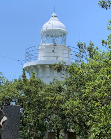
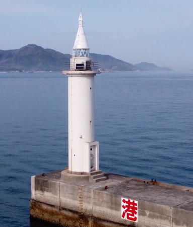
Date unknown (station established 1925). Active; focal plane 18 m (59 ft); green light, 3 s on, 3 s off. 18 m (59 ft) round cylindrical concrete tower with lantern, gallery, and a tall "dunce cap" roof. Entire lighthouse is white. A 2023 photo is at right, the Coast Guard has a page with a good photo, Lighthouse-Japan.com has a page with good photos, Trabas has a photo, Lighthouse Visit has a photo (top of the page), FOAL has photos (top of the page), Aaron Quigley has a photo, and Google has a satellite view. Located at the end of the main breakwater of Imabari harbor. Site and tower closed. . ARLHS JPN-785; JCG-4601; Admiralty M5467; NGA 8700.
Imabari Kō Kurashiki Breakwater
1978. Active; focal plane 16 m (52 ft); green flash every 4 s. 14 m (46 ft) round cylindrical concrete tower with lantern and gallery. Entire lighthouse is white. The Coast Guard page has a photo, Trabas has a photo, FOAL has a good page with several photos, Lighthouse Visit has a photo (bottom of the page), Kenichiro Asai has a 2023 photo, and Google has a satellite view. Located at the end of the breakwater for Imabari's south harbor. Site status unknown. ARLHS JPN-2376; JCG-4603; Admiralty M5468.5; NGA 8708.
Okino Se
1982. Active; focal plane 15 m (49 ft); two white flashes every 5 s. 13 m (43 ft) round vase-shaped concrete tower, painted black with one red horizontal band. Lighthouse Visit has a distant view (second photo on the page), Trabas also has a distant view, and Google has a satellite view. Located on a reef off the southeast coast of Ōshima, about 10 km (6 mi) east of the Kuroshima Strait. Accessible only by boat. Site open, tower closed. JCG-4567; Admiralty M5470.3; NGA 8696.
Higi (Hiki) Shima
1975. Active; focal plane 71 m (233 ft); white flash every 3 s. 14 m (46 ft) round cylindrical concrete tower. Entire lighthouse is white. Lighthouse Visit has a distant view (third photo on the page), Trabas also has a distant view, FOAL has a distant view from the sea (bottom of the page), and Google has a satellite view. Higi Shima is a small island about 8 km (5 mi) off Imabari harbor. Located at the highest point of the island, near the west end. Accessible only by boat. Site status unknown. ARLHS JPN-2369; JCG-4566; Admiralty M5470; NGA 8692.

Imabari Kō Light, Imabari, March 2023
Instagram photo by toshi_phare_
Kona Se (relocated)
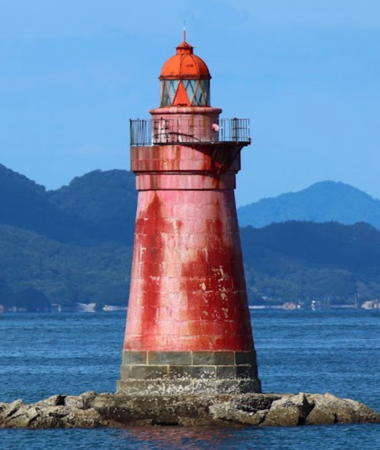
1902. Inactive since 1964. Approx. 15 m (49 ft) round stone tower with lantern and gallery. Entire lighthose painted red. Shojiro Tsuda's photo is at right and Google has an indistinct satellite view. If I understand FOAL's account correctly the lighthouse was originally built on a reef in the Kuroshima Strait and was relocated to its present location after the reef was destroyed by dredging. Located on a shoal about 300 m (0.2 mi) off Karako Beach in southern Imabari. Accessible only by boat. Site open, tower closed.

Eastern Ehime (Hiuchi Bay) Lighthouses

Saijō City Lighthouses
Nyūgawa Kō West Breakwater
1977. Active; focal plane 13 m (43 ft); three red flashes every 12 s. 9.5 m (31 ft) concrete post attached to a square 1-story concrete equipment building. Entire lighthouse is red. FOAL has a page for the two breakwater lights, Trabas has a photo, Lighthouse Visit has a photo, and Google has a satellite view. Located on a detached breakwater on the west side of the entrance to Nyūgawa harbor. Accessible only by boat. Site status unknown. ARLHS JPN-2411; JCG-4561; Admiralty M5470.5; NGA 8688.
Nyūgawa Kō East Breakwater
1995. Active; focal plane 13 m (43 ft); three green flashes every 12 s. 8.5 m (28 ft) round concrete tower, flared at the top. Entire lighthouse is white. FOAL has a page for the two breakwater lights, Trabas has a photo, Lighthouse Visit has a photo, and Google has a satellite view. Located on a detached breakwater on the east side of the entrance to Nyūgawa harbor. Accessible only by boat. Site status unknown. ARLHS JPN-2410; JCG-4560.8; Admiralty M5470.6; NGA 8687.

Niihama City Lighthouses
* Niihama Kō West Breakwater (2)
Date unknown (station established 1937). Active; focal plane 13 m (43 ft); red light, 3 s on, 3 s off. 11 m (36 ft) round cylindrical tower mounted on a square concrete platform. Entire lighthouse is red. Yogi Atsuchi has a 2017 photo, FOAL has a page for the two breakwater lights, Trabas has a photo, Lighthouse Visit has a photo, and Google has a satellite view. This light replaced a hexagonal skeletal tower (see below). Located at the end of a short breakwater on the west side of the entrance to Niihama harbor. Accessible by walking the pier. Site open, tower closed. ARLHS JPN-414; JCG-4542; Admiralty M5473; NGA 8660.

Kona Se Light, Imabari, October 2018
Google Maps photo by Shojiro Tsuda
Niihama Kō East Breakwater (2)
Date unknown (station established 1937). Active; focal plane 13 m (43 ft); two green flashes every 6 s. 11 m (36 ft) round cylindrical tower mounted on a square concrete platform. Entire lighthouse is white. Trabas has a photo, FOAL has a page for the two breakwater lights, Lighthouse Visit has a photo, and Google has a satellite view. This light replaced a hexagonal skeletal tower (see below). Located at the end of a short breakwater on the east side of the entrance to Niihama harbor. Site status unknown (industrial area). JCG-4541; Admiralty M5472; NGA 8656.
* Habu Saki (Niihama Kō)
1969. Active; focal plane 53 m (174 ft); three white flashes every 13 s. 11 m (36 ft) round conical concrete tower with double gallery. Entire lighthouse is white. Yukihiro Matsumura's 2023 photo is at right, Trabas has a similar closeup, Lighthouse Visit has a page for the lighthouse, FOAL also has a page, Nokia Funoji has a 2017 closeup, Yuki Ochi has a 2021 closeup, and Google has a satellite view. Located on a steep promontory between Niihama's two principal harbors. Accessible by a short hiking trail from the harbor just to the west; the trail entrance is marked. Site open, tower closed. . ARLHS JPN-2368; JCG-4555; Admiralty M5475; NGA 8684.
* [Niihama Kō Breakwaters (1) Lanterns]
1937. Two round lanterns, one red and one white, from the original Niihama breakwater lighthouses. The lanterns were saved and are mounted on square stone bases at the entrance to Niihama Marine Park. Google has a street view and a satellite view. Located at the park entrance at the foot of the east slope of the Habu Saki promontory. Site open.
Takihama Kō West Breakwater
1997. Active; focal plane 12 m (39 ft); red light, 2 s on, 2 s off. 8.5 m (28 ft) concrete post attached to a square 1-story concrete equipment building. Entire lighthouse is red. Trabas has a photo, FOAL has a page for the two breakwater lights, Lighthouse Visit has a photo, and Google has a satellite view. Located on the west breakwater of Takihama harbor, just east of Habu Saki. May be accessible by walking the pier. Site status unknown. JCG-4554.4; Admiralty M5475.2; NGA 8686.5.
Takihama Kō East Breakwater
1990. Active; focal plane 12 m (39 ft); continuous green light with two more intense flashes every 7 s. 8.5 m (28 ft) concrete post attached to a square 1-story concrete equipment building. Entire lighthouse is white. FOAL has a page for the two breakwater lights, Trabas has a closeup photo, Lighthouse Visit has a photo, a 2022 photo is avilable, and Google has a satellite view. Located on the east breakwater of Takihama harbor. Site status unknown (industrial area). ARLHS JPN-2423; JCG-4554.3; Admiralty M5475.4; NGA 8686.

Shikokuchūō City Lighthouses
Mishima Kō Outer Breakwater
1990. Active; focal plane 11 m (36 ft); two red flashes every 6 s. 8.5 m (28 ft) concrete post attached to a square 1-story concrete equipment building. Entire lighthouse is red. Lighthouse Visit has a photo, Trabas has a photo, FOAL's page has distant photos, and Google has a satellite view. Located on the north end of the detached breakwater of Mishima harbor. Accessible only by boat. Site status unknown (industrial area). ARLHS JPN-2396; JCG-4536.6; Admiralty M5484.6; NGA 8647.

Habu Saki Light, Niihama, November 2023
Instagram photo by Yukihiro Matsumura

Kawanoe Kō Outer Breakwater
1994. Active; focal plane 13 m (43 ft); two red flashes every 5 s. 8.5 m (28 ft) concrete post attached to a square 1-story concrete equipment building. Entire lighthouse is red. Trabas has a closeup photo, Lighthouse Visit has a photo, Google has a satellite view. Located on the north end of the detached breakwater of Kawanoe harbor. Accessible only by boat. Site status unknown (industrial area). ARLHS JPN-2388; JCG-4535.5; Admiralty M5488.5; NGA 8645.

Kamijima Town Lighthouses
Kamijima Town consists of several islands on the north side of the Seto Inland Sea, northeast of Hakata Shima and just off the coast of Honshū. Some of these lighthouses are managed by the nearby Onomichi Coast Guard Office on Honshū.

Mitoko Iso
Date unknown. Active; focal plane 9.5 m (31 ft); one short and one long red flash every 8 s. 8 m (26 ft) round cylindrical concrete tower with double gallery, mounted on a concrete pier. Entire lighthouse is red. Trabas has a good photo, Lighthouse Visit has a photo (halfway down the page), and Google has a satellite view. Located on a reef off the western tip of Iwagi Shima. Accessible only by boat. Site status unknown. Site manager: Onomichi Coast Guard Office. JCG-4506; Admiralty M5711.4; NGA 8540.
Takaikami (Taki Kami) Shima
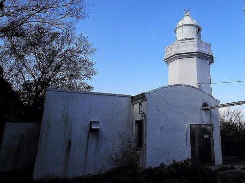
1921. Active; focal plane 135 m (443 ft); three flashes every 10 s, the flashes in a 2+1 pattern, a group of three red flashes alternating with a group of three white flashes. 12 m (39 ft) octagonal concrete tower with lantern and gallery, attached to a 1-story concrete keeper's house. Entire lighthouse is white. A 2021 photo is at right, the Coast Guard page has a photo, S. Katsuragi has a 2020 closeup, Yumi Nosuke has a drone view, Trabas has a distant view from the sea, and Google has a satellite view. Located on an isolated high island in central Hiuchi Bay, about 25 km (15 mi) north of Niihama. Accessible only by boat. Site status unknown. Site manager: Imabari Coast Guard Office. . ARLHS JPN-616; JCG-4402; Admiralty M5482; NGA 8384.

Takaikami Light, Kamijima, October 2021
Instagram photo by yuzu_majakka
Hyakkan Shima
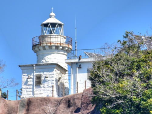
1894. Active; focal plane 75 m (246 ft); white flash every 10 s. 9 m (30 ft) round stone tower with lantern and gallery, attached to a 1-story keeper's house. Entire lighthouse painted white. Shunsuke Tsuji's 2021 photo is at right, FOAL has a page with good 2017 photos, Trabas has a distant view, and Google has a satellite view. Hyakken Shima is at the northern edge of Hiuchi Bay, about 28 km (18 mi) north of Niihama and only 12 km (7.5 mi) south southeast of Onomichi in Hiroshima Prefecture, Honshū. In fact, although it is located in Ehime Prefecture, this light is maintained by the Onomichi Coast Guard Office. Located on the summit of the island. Accessible only by boat. Site status unknown. Site manager: Onomichi Coast Guard Office. ARLHS JPN-150; JCG-4462; Admiralty M5728; NGA 8460.

Information available on lost lighthouses:

Notable faux lighthouses:


Hyakkan Shima Light, Kamijima, January 2021
Instagram photo by Shunsuke Tsuji

Adjoining pages: North: Okayama | East: Kagawa | West: Central Ehime

Return to the Lighthouse Directory index | Ratings key

Posted May 28, 2007. Checked and revised March 4, 2024. Lighthouses: 41. Site copyright 2024 Russ Rowlett and the University of North Carolina at Chapel Hill.