Lighthouses of Japan: Kagawa

The nation of Japan, known in Japanese as Nihon or Nippon (日本), occupies an archipelago off the east coast of Asia. The four main islands are Hokkaidō in the north, Honshū (the largest), Shikoku in the south, and Kyūshū in the southwest. The country includes thousands of other islands of all sizes; among them the Ryūkyū (Nansei) Islands are a long chain extending to the southwest and including the large island of Okinawa, and the Nanpō Islands are another long chain extending south into the Pacific Ocean. Much of Japan is mountainous but the coastal regions are densely populated and urbanized; the country's population is about 126 million.

Smallest of the Japanese main islands, Shikoku is divided into four of Japan's 47 prefectures. This page includes lighthouses of Kagawa Prefecture at the northeastern end of the island. Facing north on the Seto Inland Sea, Kagawa has many ports both large and small between its prominent and scenic headlands. Takamatsu, the capital of the prefecture, is also the largest port.

In Japanese the word for a lighthouse is tōdai or toudai (灯台). The words saki and misaki are for capes and headlands, hana ("nose") is a promontory, hantō is a peninsula, shima (also spelled sima or jima) is an island, bae is a reef, iwa or shi is a rocky reef, amase or se is a shoal, wan is a bay, nada is a sound or basin, kaikyō is a strait, kawa is a river, and or minato is a harbor.

Lighthouses in Japan are operated and maintained by the Japanese Coast Guard's Maritime Safety Agency. There is at least one Coast Guard Section Office in each prefecture, often two or more. Kagama has one office, at Takamatsu. Several of the prefecture's island lighthouses are maintained by the Tamano office on the north side of the Seto Inland Sea in Honshū.

ARLHS numbers are from the ARLHS World List of Lights. JCG numbers are the Japanese Coast Guard's light list numbers. Admiralty numbers are from volume M of the Admiralty List of Lights & Fog Signals. U.S. NGA List numbers are from Publication 112.

General Sources
Lighthouses in Japan - Kagawa
A comprehensive site covering the major lighthouses.
Lighthouse of Japan - Kagawa
Excellent photos with notes (in Japanese) for most of the lighthouses.
Form of a Lighthouse - Kagawa
Another site with photos of Japanese lighthouses; this source is cited below as FOAL.
Lighthouse Visit
Another good source of lighthouse photos.
Online List of Lights - Japan
Photos by various photographers posted by Alexander Trabas.
Misty's Japanese Lighthouse Tour - Kagawa
Photos and a few notes in English for lighthouses in all parts of the country.
Lighthouses in Kagawa Prefecture
Photos by various photographers available from Wikimedia.
Meiji Lighthouses of the Sixth Region
Posted by the Sixth Coast Guard Region, information and photos concerning lighthouses built in the Meiji period (1868-1912).
Navionics Charts
Navigation chart for the Kagama area.


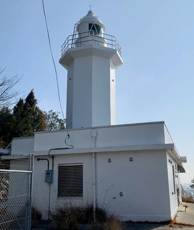
Ogi Shima Light, Takamatsu, November 2015
Wikimedia Creative Commons photo by J屋嶋の仙人
Kan'onji City Lighthouses
* Sanuki Toyohama Kō (West Breakwater)
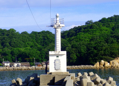
1955. Active; focal plane 11 m (36 ft); red light, 3 s on, 1 s off. 8 m (26 ft) concrete post rising from a square 1-story concrete equipment shelter. Entire lighthouse is red. Trabas has a closeup photo, FOAL's page has photos, and Google has a street view and a satellite view. Located at the end of the west (really south) breakwater of Toyohama harbor, in southern Kan'onji. Accessible by walking the pier. Site open, tower closed. ARLHS JPN-2467; JCG-4533; Admiralty M5490; NGA 8636.
* Kan'onji (Kanonzi) South Breakwater
Date unknown (station established 1929). Active; focal plane 12 m (39 ft); red light, 3 s on, 3 s off. 9 m (30 ft) concrete post rising from a square 1-story concrete equipment shelter. Entire lighthouse is red. Trabas has a closeup photo, FOAL's page has photos, Tadashi Kawata has a 2019 photo, there's a photo of the light in action, and Google has a street view and a satellite view. Located at the end of the south breakwater at Kan'onji. Accessible by walking the pier. Site open, tower closed. JCG-4529; Admiralty M5495; NGA 8612.
Ibuki Kō (Aka Saki)
1959. Active; focal plane 13 m (43 ft); white flash every 3 s. 11 m (36 ft) concrete post rising from a square 1-story concrete equipment shelter. Entire lighthouse is white. Trabas has a distant view and Google has a street view and a satellite view. Located at the elbow of the outer breakwater at Ibukijima, an island 11 km (7 mi) west of the Kan'onji waterfront. Site status unknown, but there must be a good view from ferries arriving at the island. ARLHS JPN-2432; JCG-4532; Admiralty M5483; NGA 8624.
#Muromoto Kō
1963. Inactive since 2011 and subsequently demolished. This was a 9 m (30 ft) concrete post rising from a square 1-story concrete equipment shelter. Entire lighthouse was white. Google's satellite view confirms the removal of the light. Located at the end of the north breakwater of the the Muromoto harbor in northern Kan'onji. Accessible by walking the pier. Site open, tower closed. ARLHS JPN-2457; ex-JCG-4526; ex-Admiralty M5497; ex-NGA 8600.

Mitoyo City Lighthouses
* Namari Kō
1964. Active; focal plane 13 m (43 ft); continuous green light with a more intense flash every 6 s. 9 m (30 ft) concrete post rising from a square 1-story concrete equipment shelter. Entire lighthouse is white. A 2011 photo is at right, Trabas has a closeup photo, Lighthouse Visit's page has a good photo, FOAL's page has photos, and Google has a distant street view and a satellite view. Located at the end of the north breakwater at Namari, about 3 km (2 mi) southwest of Sanuki Misaki. Accessible by walking the pier. Site open, tower closed. ARLHS JPN-2458; JCG-4524; Admiralty M5498; NGA 8592.
Namari Kō Light
Namari Kō Light, Mitoyo, June 2011
ex-Panoramio photo copyright mandegan; used by permission
Sanuki Misaki
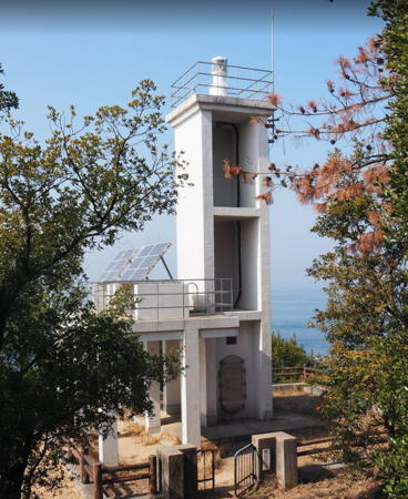
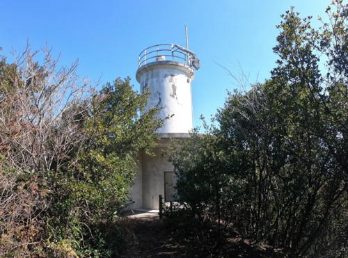
1959. Active; focal plane 70 m (230 ft); white light, 4 s on, 4 s off. 11 m (36 ft) square concrete skeletal tower with gallery, rising from a square 1-story concrete equipment room. The tower of this unusual lighthouse has two open sides and two solid sides. Entire lighthouse is white. Tadashi Kawata's photo is at right, Lighthouse-Japan.com has a page with several photos, Trabas has a closeup photo, FOAL's page has closeup photos, Lighthouse Visit has a page with photos, Ei Yamanaka has a street view, and Google has a satellite view. Sanuki Misaki is the tip of a 10 km (6 mi) long peninsula that juts northwestward into the Inland Sea west of Zentsuji. The peninsula forms the northeastern edge of Hiuchi Bay and is an important obstacle to navigation. Located on the cape, about 20 km (13 mi) northwest of Zentsuji. Accessible by a hiking trail. Site open, tower closed. . ARLHS JPN-536; JCG-4348; Admiralty M5499; NGA 8376.
* Hako Saki
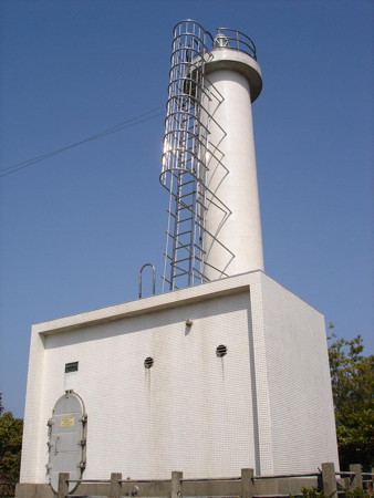
1965. Active; focal plane 25 m (82 ft); white flash every 3 s. 8 m (26 ft) round cylindrical concrete tower covered with white tile. Trabas has a closeup photo, Lighthouse Visit has photos, FOAL's page has closeup photos, a 2018 closeup and a 2021 closeup are available, and Google has a satellite view. Located on a sharp promontory about 4 km (2.5 mi) east of Sanuki Misaki. Accessible by a short walk. Site open, tower closed. ARLHS JPN-080; JCG-4347; Admiralty M5501; NGA 8372.
Mitawa Iwa
Date unknown. Active; focal plane 10 m (33 ft); one short and one long red flash every 8 s. 10 m (33 ft) round cylindrical concrete tower with gallery, mounted on a stone pier. Entire lighthouse is red. Trabas has a closeup photo, Lighthouse Visit has another photo, FOAL's page has photos, and Google has a street view and a satellite view. Located in Takuma Bay at the entrance to Takuma port. Accessible only by boat. Site open, tower closed. JCG-4346; Admiralty M5509; NGA 8364.
Hutaomote (Futaomote) Shima
1938. Active; focal plane 30 m (98 ft); white flash every 3 s. 10 m (33 ft) round concrete tower with flared top and gallery, attached to a 1-story concrete equipment room. Entire lighthouse is white. Hiroshi Hada has a closeup 2021 photo, Trabas has a photo, a distant view is available, and Google has a satellite view. Located on an island about 11 km (6.5 mi) northwest of Marugame. Accessible only by boat. Site status unknown. JCG-4231; Admiralty M5502; NGA 8252.

Sanuki Misaki Light, Mitoyo, February 2018
Google Maps photo by Tadashi Kawata

Tadotsu Town Lighthouses
* Sanagi Kō
Date unknown. Active; focal plane 12 m (39 ft); continuous red light with a more intense flash every 4 s. 8.5 m (28 ft) concrete post rising from a square 1-story concrete equipment shelter. Entire lighthouse is red. Ngọc Thúy Lê has a 2023 photo, Kazuya Saito has a 2017 photo, and Google has a satellite view. Sanagi Shima is an island in the middle of the Seto Inland Sea about 20 km (12.5 mi) northwest of Tadotsu. The island is accessible by ferry. Located at the end of the north (main) breakwater of Sanagi harbor. Accessible by walking the pier. Site open, tower closed. ARLHS JPN-2462; JCG-4269; Admiralty M5502.5; NGA 8264.
Takami Kō
1977. Active; focal plane 12 m (39 ft); three green flashes every 12 s. 9.5 m (31 ft) concrete post rising from a square 1-story concrete equipment shelter. Entire lighthouse is white. Trabas has a distant view, S. Katsuragi has a 2020 closeup, and Google has a street view and a satellite view. Located at the end of the south (main) breakwater of the harbor of Takami Shima, an island about 12 km (7.5 mi) northwest of the Tadotsu waterfront. The island is accessible by passenger ferry from Tadotsu. Probably accessible by walking the pier, but it's a long and unprotected walk. Site open, tower closed. JCG-4229; Admiralty M5503.5; NGA 8244.
Itamochi (Itamoti) Hana (Takami Shima)
Date unknown. Active; focal plane 11 m (36 ft); white light occulting once every 4 s. 8.5 m (28 ft) round cylindrical concrete tower attached to a small equipment shelter. Entire lighthouse is white. S. Katsuragi has a 2020 closeup, Lighthouse Visit has a photo (halfway down the page), and Google has a satellite view. Located at the northwestern tip of Takami Shima. It's a rough walk on a stony beach to reach the lighthouse. Site open, tower closed. ARLHS JPN-2446; JCG-4230; Admiralty M5503; NGA 8248.
Tadotsu (Tadotu) Kō Outer Breakwater
Date unknown. Active; focal plane 11 m (36 ft); red light occulting once every 4 s. 8 m (26 ft) concrete post rising from a square 1-story concrete equipment shelter. Entire lighthouse is red. Trabas has a closeup photo, Lighthouse Visit has a photo (halfway down the page), and Google has a satellite view. Located at the end of the outer breakwater of Tadotsu's extended harbor. Site status unknown. ARLHS JPN-2473; JCG-4338; Admiralty M5512; NGA 8352.
#Tadotsu (Tadotu) Kō Inner Harbor West Breakwater
Date unknown. Inactive since 2009. This was a 9.5 m (31 ft) concrete post rising from a square 1-story concrete equipment shelter. Entire lighthouse was red. It's clear from Bing's satellite view that the lighthouse has been removed. The extension of the harbor made this light obsolete. Located on the short west breakwater of the inner harbor of Tadotsu. Site status unknown. ARLHS JPN-2472; ex-JCG-4337; ex-Admiralty M5514; ex-NGA 8352.
* Tadotsu (Tadotu) Kō Inner Harbor East Breakwater
1949. Active; focal plane 10 m (33 ft); green light, 3 s on, 3 s off. 9 m (30 ft) concrete post rising from a square 1-story concrete equipment shelter. Entire lighthouse is white. Trabas has a closeup photo, FOAL's Tadotsu page has photos, a 2022 photo is available, and Google has a street view and a satellite view. Located at the end of the east breakwater of the the traditional harbor (now the inner harbor) of Tadotsu. Accessible by walking the pier. Site open, tower closed. ARLHS JPN-2471; JCG-4336; Admiralty M5515; NGA 8348.

Marugame City Lighthouses
Habushi (Habusi) Iwa
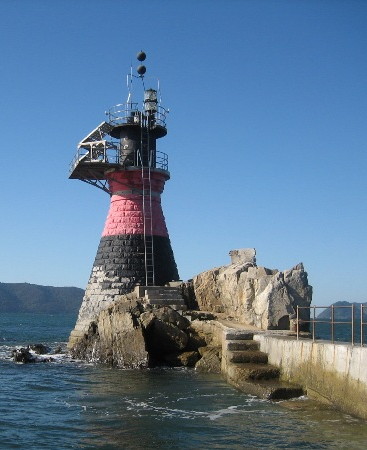
Date unknown. Active; focal plane 15 m (49 ft); two white flashes every 5 s. 15 m (49 ft) round stone tower with double gallery and an enclosed equipment cabinet between the galleries. Lighthouse painted black with one red horizontal band. A Coast Guard photo is at right, Lighthouse Visit has a photo (halfway down the page), Trabas has a distant view, Kenichiro Asai has a 2022 photo, Hitoshi Matsuzawa has a 2023 photo, and Google has a satellite view. Located on an isolated rock in the Inland Sea about 10 km (6 mi) northwest of Marugame. Accessible only by boat. Site and tower closed. JCG-4228; Admiralty M5504; NGA 8240.
Habushi Iwa Light
Habushi Iwa Light, Marugame
Japanese Coast Guard photo
Enoura Kō
Date unknown. Active; focal plane 13 m (43 ft); green light, 3 s on, 3 s off. 9.5 m (31 ft) concrete post rising from a square 1-story concrete equipment shelter. Entire lighthouse is white. Trabas has a distant view and Google has a satellite view. Enoura is the port of Hiro Shima (the island, not the city!), an island in the Seto Inland Sea. The island is about 5 km (3 mi) in diameter and about 8 km (5 mi) northwest of Marugame. Located at the end of a the detached outer breakwater of Enoura. Accessible only by boat, but there's a good view from ferries arriving at the island from Marugame. Site open, tower closed. JCG-4227; Admiralty M5504.5; NGA 8236.
Ushi Shima (Ushijima, Usi Sima)
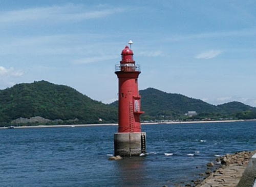
1934. Active; focal plane 14 m (46 ft); one long and two short red flashes every 10 s. 15 m (49 ft) round cylindrical concrete tower with lantern and gallery. Entire lighthouse is red. A view from shore is at right, David Jenkins has the 2018 photo at right, Lighthouse Visit has a page for the lighthouse, Trabas has a photo, Azusa Himeno has a 2021 photo, and Google has a satellite view. This lighthouse guides vessels through a narrow strait between Ushi Shima and Hon Shima, two islands in the Seto Inland Sea north of Marugame. Located off the end of a short breakwater at the northern tip of Ushi Shima. Accessible only by boat. Site open, tower closed. JCG-4225; Admiralty M5506; NGA 8232.
* Marugame Showamachi (Syowamati) Breakwater
1972. Active; focal plane 12 m (39 ft); red light occulting twice every 6 s. 9.5 m (31 ft) concrete post rising from a square 1-story concrete equipment shelter. Entire lighthouse is red. Trabas has a closeup photo, Lighthouse Visit has a photo (halfway down the page), and Google has a satellite view and a very distant street view. Located at the end of the short west breakwater of Showamachi harbor, the western basin of Marugame harbor. Accessible by walking the pier. Site open, tower closed. ARLHS JPN-2470; JCG-4335; Admiralty M5518; NGA 8344.

Ushi Shima Light, Marugame, August 2018
Google Maps photo by David Jenkins
* Marugame Kō
1972. Active; focal plane 12 m (39 ft); two red flashes every 6 s. 8 m (26 ft) concrete post rising from a square 1-story concrete equipment shelter. Entire lighthouse is red. Trabas has a closeup photo, FOAL's page has photos, and Google has a satellite view. Located at the end of a short pier at the west side of the entrance to Marugame harbor. Accessible by walking the pier. Site open, tower closed. ARLHS JPN-2452; JCG-4331; Admiralty M5520.8; NGA 8340.

Sakaide City Lighthouses
* Nabe Shima
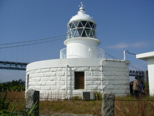
1872 (Richard Henry Brunton). Active; focal plane 29 m (95 ft); continuous light, 8 s red followed by 8 s green. 10 m (33 ft) round cylindrical stone tower rising from a 1-story semicircular stone keeper's house. Entire lighthouse painted white. A photo is at right, FOAL has photos (halfway down the page), Lighthouse-Japan.com has a page with excellent photos. Trabas has a photo, Misty's Tour has another photo, a 2022 photo is available, and Google has a satellite view. In the background of the photos we see part of the Great Seto Bridge, a 13.1 km (8.2 mi) series of eleven suspension bridges that span the narrowest section of the Seto Inland Sea. The lighthouse is accessible from the big bridge via an off ramp and a short causeway. Located on a small island near the center of the Great Seto crossing, about 8 km (5 mi) north of Sakaide. Site open, tower closed. . ARLHS JPN-387; JCG-4202; Admiralty M5533; NGA 8216.
Kosei Shima
1968. Active; focal plane 27 m (89 ft); white flash every 3 s. 12 m (39 ft) round cylindrical concrete tower with two galleries. Entire lighthouse is white. Trabas has a distant view, Kenichiro Asai has a 2021 view from the sea, and Google has a satellite view. This light helps guide vessels in the Bisan-Seto strait, one of the most dangerous passages of the Inland Sea. Located on an island about 6 km (3.5 mi) northeast of Sakaide. Accessible only by boat. Site status unknown. ARLHS JPN-2448; JCG-4201; Admiralty M5535; NGA 8212.
Sakaide Kō
Date unknown. Active; focal plane 11 m (36 ft); two red flashes every 6 s. 8.5 m (28 ft) round strongly conical concrete tower attached to a 1-story equipment shelter. Entire lighthouse is red. Trabas has a closeup photo and Google has a satellite view. Located on the northeast corner of one of the quays of Sakaide harbor. Site and tower closed (industrial area). ARLHS JPN-528; JCG-4305; Admiralty M5524; NGA 8320.
Nabe Shima Light
Nabe Shima Light, Sakaide
Japanese Coast Guard photo
Kozuti Shima
Date unknown. Active; focal plane 15 m (49 ft); white light, 3 s on, 3 s off. 13 m (43 ft) round cylindrical concrete tower. Entire lighthouse is white. Trabas has a distant view, Kenichiro Asai has a 2021 view from the sea, and Google has a satellite view. Located on the northern tip of an island just off the mainland of Shikoku about 12 km (7.5 mi) northeast of Sakaide and the same distance northwest of Takamatsu. Accessible only by boat. Site and tower closed. ARLHS JPN-2450; JCG-4096; Admiralty M5536; NGA 8208.

Takamatsu City Lighthouses
The prefectural capital of Takamatsu is a city of about 420,000 residents. It is an important port and the terminal for ferries to many of the islands of the Seto Inland Sea.
#Kozai Kō
1961. Inactive since 2010 and subsequently removed. This was a 9 m (30 ft) concrete post rising from a square 1-story concrete equipment shelter. Entire lighthouse was red. Google's satellite view and 2012 street view confirm the removal of the red light; the street view shows the white post light on the east breakwater. Located at the end of the west breakwater of Kozai harbor on the west side of Takamatsu. Accessible by walking the pier. Site open, tower closed. ARLHS JPN-2449; ex-JCG-4094; ex-Admiralty M5539.5; ex-NGA 8206.
* [Megi Kō South Breakwater]
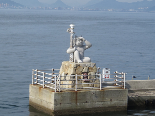
1998. Active; focal plane 7 m (23 ft); green flash every 3 s. 4 m (13 ft) post mounted on a square pyramidal rubblestone base. A sandstone sculpture of a short demon, shading his eyes with one hand and with the other arm wrapped around the post, sits atop the stone base. Post and sculpture painted white; the base is unpainted. A photo is at right, Lighthouse Visit has good photos (halfway down the page), FOAL's Megi page also has photos (bottom of the page), Trabas has a view from the rear, and Google has a street view and a satellite view, although the light is too small to be seen clearly. The statue depicts an oni, a horned troll common in Japanese folklore. Located at the end of the south breakwater of Megi Kō, on the east coast of the island of Megi Shima, about 4 km (2.5 mi) north of Takamatsu. The island is accessible by ferry from Takamatsu. Site open, tower closed. ARLHS JPN-2453; JCG-4073.1; Admiralty M5539.25; NGA 8155.
* Megi Shima (Hotsuchi Hana)
Date unknown (station established 1956). Active; focal plane 46 m (151 ft); white light, 3 s on, 3 s off. 10 m (33 ft) round cylindrical white fiberglass tower. Lighthouse Visit has photos, a 2015 closeup is available, Trabas has a photo, FOAL's Megi page also has photos, Tetsuya Uesugi has a 2021 photo, and Google has a satellite view. Located at the southern tip of the island; accessible by a short hiking trail, but parking is limited. Site open, tower closed. ARLHS JPN-340; JCG-4074; Admiralty M5539; NGA 8160.

Megi Kō South Breakwater Light, Takamatsu, July 2017
ex-Google Plus photo by Hyeonghu Group
* Takamatsu Tamamo Breakwater (2)
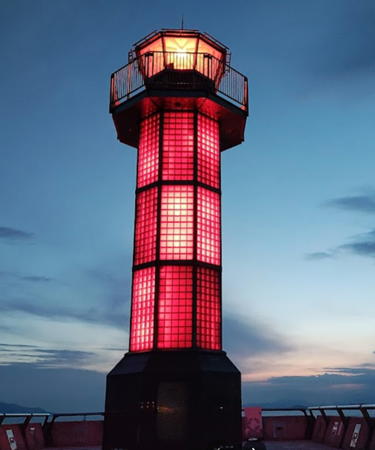
1998 (station established 1964). Active; focal plane 17 m (56 ft); red light, 3 s on, 3 s off. 14 m (46 ft) octagonal cylindrical steel tower with lantern and gallery. Entire lighthouse painted red. This remarkable lighthouse is covered with glass tiles that are lit from within in unison with the main light in the lantern, so the entire tower displays the light characteristic of red, 3 s on, 3 s off. Shūji Ōtani's photo is at right, Misty's Tour has a photo of the light in action, Lighthouse Visit's Takamatsu page has photos (halfway diwn the page), Trabas has a closeup photo, FOAL has good photos (lower half of the page), and Google has a street view and a satellite view. Located at the end of the 500 m (1650 ft) main breakwater of Takamatsu, marking the west side of the entrance to the harbor. The pier is designed for pedestrians and is a popular walk. Site open, tower closed. . ARLHS JPN-2477; JCG-4082; Admiralty M5541.6; NGA 8176.
#Takamatsu Aosa Hana East Breakwater
1961. Inactive since 2010 and probably removed. This was a 9.5 m (31 ft) concrete post rising from a square 1-story concrete equipment shelter. Bing has a satellite view of the former location at the end of a short breakwater on the east side of Takamatsu harbor. Site open. ARLHS JPN-2478; ex-JCG-4085; ex-Admiralty M5542.12; ex-NGA 8188.
Takamatsu Asahimachi Breakwater
Date unknown. Active; focal plane 12 m (39 ft); red light occulting twice every 6 s. 9.5 m (31 ft) concrete post light rising from a square 1-story concrete equipment shelter. Entire lighthouse is red. Trabas has a closeup photo, Lighthouse Visit's Takamatsu page has photos (third lighthouse on the page), FOAL has a photo (sixth row, right), and Google has a satellite view and a distant sea view. Located at the end of the main east breakwater of Takamatsu harbor. Site and tower closed. ARLHS JPN-2434; JCG-4081; Admiralty M5541; NGA 8172.
Takamatsu Detached Breakwater Southwest Head
Date unknown. Active; focal plane 13 m (43 ft); green light, 3 s on, 3 s off. 11 m (36 ft) round concrete tower with a flared top, attached to a small equipment shelter. Entire lighthouse is white. A 2015 view from the sea is available, Lighthouse Visit's Takamatsu page has photos (second lighthouse on the page), FOAL also has photos (third and fourth rows), Trabas has a closeup photo, and Google has a sea view and a satellite view. Located at the southwest end of the detached breakwater of Takamatsu, halfway between the Tamano and Asahimachi breakwater lights. Accessible only by boat. Site and tower closed. ARLHS JPN-2475; JCG-4080; Admiralty M5540.9; NGA 8168.

Tamamo Breakwater Light, Takamatsu, July 2022
ex-Google Maps photo by Shūji Ōtani
Takamatsu Detached Breakwater Northeast Head
Date unknown. Active; focal plane 16 m (52 ft); red light occulting once every 8 s. 14 m (46 ft) round cylindrical concrete tower with lantern and gallery. Entire lighthouse is red. Trabas has a closeup photo, FOAL has photos (third and fourth rows), and Google has a satellite view and a distant sea view. Located at the northeast end of the detached breakwater of Takamatsu. Accessible only by boat. Site and tower closed. ARLHS JPN-2474; JCG-4079; Admiralty M5540.8; NGA 8164.
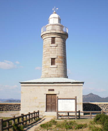
*** Ogi Shima (Ogijima)
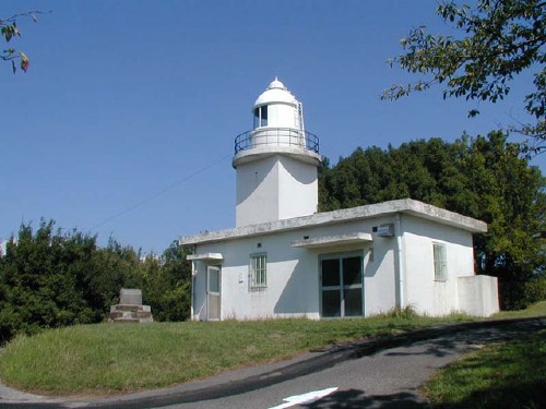
1895. Active; focal plane 16 m (52 ft); flash every 10 s, white, red or green depending on direction. 14 m (46 ft) round granite tower with lantern and gallery, rising from a small 1-story granite equipment building. The 1-story stone keeper's house has been reopened as a lighthouse museum. The tower is unpainted granite (unusual for Japan); lantern and gallery painted white. This is one of only two or three unpainted lighthouses in Japan. A photo is also at the top of this page, Lighthouse-Japan.com has a page with photos, Lighthouse Visit has a page with many photos (some inside the museum), FOAL has a good page with many photos, the Coast Guard has a panoramic view of the station, and Google has a street view and a satellite view. Ogi Shima is an island north of Megi Shima near the center of the Inland Sea. The main ship channel makes a sharp turn in front of the lighthouse, so historically this was one of the most important lighthouses of the Inland Sea. Located on the northern tip of the island, which is accessible by ferry from Takamatsu. Site open; museum open daily early June through early November; tower status unknown. . ARLHS JPN-474; JCG-4067; Admiralty M5538; NGA 8144.
* Ōkuno Shima (relocated)
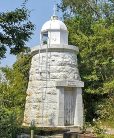
1894. Inactive. 3.5 m (12 ft) round stone tower with lantern, painted white. Wikimedia has a photo, Kevin Bunch has a good photo and Google has a street view (a portion is seen at right) and a satellite view. This diminutive lighthouse is on display at Shikoku Mura (Shikoku Village), an architectural museum in Takamatsu. The museum also has several keepers houses from historic lighthouses. Ōkuno Shima is an island of the Inland Sea in Hiroshima Prefecture. There is an active 1892 lighthouse at the southern tip of the island, so this smaller light must have been at a different location, perhaps at the northern tip. The museum is on the southern slope of Mount Yashima, about 5 km (3 mi) east of the harbor area. Site open, tower closed. Owner/site manager: Shikoku Mura.
Aji (Azi) Kō
Date unknown. Active; focal plane 12 m (39 ft); red light, 2 s on, 2 s off. 9.5 m (31 ft) concrete post rising from a square 1-story concrete equipment shelter. Entire lighthouse is red. Trabas has a closeup photo, Lighthouse Visit has a photo (second lighthouse on the page), and Google has a satellite view and a distant street view from across the harbor. Located at the north end of a detached breakwater at Aji harbor. Site and tower closed. ARLHS JPN-2435; JCG-4065; Admiralty M5545; NGA 8136.

Ōkuno Shima Light, Takamatsu, 2015
Google Maps street view by 屋島登山
Aji (Azi) Siraisi Syō
1978. Active; focal plane 58 m (190 ft); continuous white light. 6 m (20 ft) round cylindrical concrete tower; a spotlight is displayed through a square window. Entire lighthouse is white. Trabas has a closeup photo, Lighthouse Visit has a photo (first lighthouse on the page), and Google has a satellite view. The spotlight illuminates a dangerous rock (Siraisi Syō) in the channel just offshore. NGA considers the light to be secondary to the Inagi Shima Light (see below), so it does not list it separately. Located on a sharp, steep promontory of the Shikoku mainland about 10 km (6 mi) northeast of Takamatsu. Site status unknown. ARLHS JPN-037; JCG-4064; Admiralty M5545.3.
Kanawa Iwa
1927. Active; focal plane 14 m (46 ft); one short and one long red flash every 8 s. 12 m (39 ft) post light centered on a round cylindrical concrete tower, mounted on a concrete pier. Entire lighthouse is red. FOAL has a distant view (next to last row), Trabas has a photo, and Google has a satellite view. Located on a shoal on the south side of the main shipping channel in the Inland Sea. Accessible only by boat. Site open, tower closed. JCG-4062; Admiralty M5546; NGA 8132.
Inagi Shima
1972. Active; focal plane 33 m (108 ft); white flash every 3 s. 12 m (39 ft) round concrete tower with gallery. Entire lighthouse is white. S. Katsuragi has a 2021 photo (also seen at right), Lighthouse Visit has a page for the light, Trabas has a photo, and Google has a satellite view. This lighthouse guides vessels in a narrow channel that hooks around a sharp promontory on the north coast of Shikoku about 10 km (6 mi) northeast of Takamatsu. It is located on the southern tip of Inagi Shima, a small island only 1 km (0.6 mi) off the promontory. The Azi Siraisi Syo spotlight (previous entry) is on the other side of the strait. Accessible only by boat. Site status unknown. ARLHS JPN-164; JCG-4061; Admiralty M5545.6; NGA 8128.

Inagi Shima Light, Takamatsu, December 2021
Google Maps photo by S. Katsuragi
Mure Kō
1958. Active; focal plane 11 m (36 ft); red light, 4 s on, 1 s off. 10 m (33 ft) concrete post rising from a square 1-story concrete equipment shelter. Entire lighthouse is red. Trabas has a closeup photo, FOAL has a page with several photos, and Google has a satellite view and a street view across the harbor. Located at the end of the north breakwater at Sanuki-Mure, a harbor in southeastern Takamatsu. Accessible by walking the pier. Site open, tower closed. ARLHS JPN-2456; JCG-4060; Admiralty M5546.5; NGA 8124.
 

Sanuki City Lighthouse
* Shido (Sido) Kō
1961. Active; focal plane 11 m (36 ft); red light, 2 s on, 2 s off. 9 m (30 ft) concrete post rising from a square 1-story concrete equipment shelter. Entire lighthouse is red. Trabas has a closeup photo, FOAL's page has good photos, and Google has a satellite view and a distant street view across the harbor. Located at the end of the main breakwater of Shido harbor, the principal harbor for Sanuki. Accessible by walking the pier. Site open, tower closed. ARLHS JPN-2468; JCG-4059; Admiralty M5546.8; NGA 8120.
* Umaga Hana
1963. Active; focal plane 57 m (187 ft); white flash every 10 s. 11 m (36 ft) square cylindrical concrete tower with lantern and gallery, attached to a 1-story concrete equipment room. Entire lighthouse is white. A Coast Guard photo is at right, Trabas has a closeup photo, Lighthouse-Japan.com has a page with good photos, Lighthouse Visit also has a page, FOAL's page has good photos, and Google has a satellite view. The light station is surrounded by a well-known golf course. Located on a prominent cape about 25 km (15 mi) east of Takamatsu. Site status unknown. Site manager: Sanuki Country Club. . ARLHS JPN-714; JCG-3978; Admiralty M5549.6; NGA 8032.

Higashikagama City Lighthouses
Sanbonmatsu Kō Detached Breakwater
Date unknown. Active; focal plane 11 m (36 ft); green flash every 3 s. 8.5 m (28 ft) concrete post light rising from a square 1-story concrete equipment shelter. Entire lighthouse is white. Trabas has a closeup photo, FOAL has photos (bottom of the page), and Google has a satellite view and a distant street view. Located at the northwest end of a short detached breakwater of Sandonmatsu harbor, the principal harbor for Higashikagama. Accessible only by boat. Site open, tower closed. ARLHS JPN-2463; JCG-3977; Admiralty M5550.3; NGA 8028.
Umaga Hana Light
Umaga Hana Light, Sanuki
Japanese Coast Guard photo (no longer online)
* Hiketa Hana
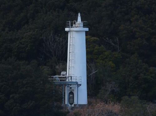
1954. Active; focal plane 75 m (246 ft); white light, 3 s on, 3 s off. 8 m (26 ft) round cylindrical concrete tower, attached to a semicircular concrete equipment room. Entire lighthouse is white. Yoshihiro Shimazu's photo is at right, Trabas has a closeup photo, FOAL's page for the lighthouse has closeup photos, Lighthouse Visit's page also has photos, Neko Kiji has a 2016 closeup, Misty's Tour has a photo, and Google has a satellite view of the station. The lighthouse is in a prefectural forest preserve and near the site of a 15th century castle. Located on a wooded promontory on the north side of Hiketa, a city at the eastern end of Kagawa Prefecture. Accessible by hiking trails. Site open, tower closed. Site manager: Shiroyama Forest Park. . ARLHS JPN-114; JCG-3972; Admiralty M5550.5; NGA 8008.
* Hiketa Kō
1962. Active; focal plane 10 m (33 ft); green flash every 5 s. 8.5 m (26 ft) concrete post attached to a square 1-story concrete equipment shelter. Entire lighthouse is white. Trabas has a closeup photo, FOAL's page for the Hiketa lights has photos (2/3 the way down the page), Lighthouse Visit also has a photo (2/3 the way down the page), and Google has a street view and a satellite view. Located at the end of the south breakwater of Hiketa's traditional port, in the lee of Hiketa Hana. Accessible by walking the pier. Site open, tower closed. ARLHS JPN-2437; JCG-3973; Admiralty M5550.7; NGA 8012.
* Hiketa Kō North Breakwater
1976. Active; focal plane 12 m (39 ft); red light, 3 s on, 3 s off. 8.5 m (26 ft) concrete post attached to a square 1-story concrete equipment shelter. Entire lighthouse is red. Trabas has a closeup photo, FOAL's page for the Hiketa lights has photos (bottom of the page), Lighthouse Visit also has a photo (bottom of the page), and Google has a street view and a satellite view. Located at the end of the long north breakwater of Hiketa's modern port. Accessible by walking the pier. Site open, tower closed. ARLHS JPN-2531; JCG-3974; Admiralty M5550.6; NGA 8016.

Hiketa Hana Light, Higashikagama, February 2019
Google Maps photo by Yoshihiro Shimazu

Shōdo Islands Lighthouses

These islands, forming the Kagawa and Shōzu Districts, lie well to the north of Shikoku, some of them quite close to the Honshū side of the Inland Sea. The islands of Naoshima and Shōdoshima are popular resorts accessible by ferries from Takamatsu or from Uno, Honshū.

Naoshima Town Lighthouses
Naoshima is an island town located on the north side of the Seto Inland Sea off the harbor of Tamano in Okayama Prefecture. Because of this proximity to Honshū lights in Naoshima are managed by the Tamano Coast Guard Office.

Hokake Ishi (Hokakeishi)
1949. Inactive but maintained officially as a daybeacon. 13.5 m (44 ft) round concrete tower, upper half conical, mounted on a round concrete pier. Lighthouse painted black with one red horizontal band. Lighthouse Visit has photos (lower half of the page), FOAL also has photos (bottom of the page), and Google has a satellite view. Located about 2.5 km (1.5 mi) off the southwestern coast of Naoshima. Accessible only by boat, but easily seen from ferries between Tamano and Takamatsu. Site open, tower closed. JCG-4041.
Manaita Ishi (Manaitaishi)
Date unknown. Active; focal plane 13 m (43 ft); one short and one long green flash every 8 s. 13 m (43 ft) round cylindrical concrete tower. Entire lighthouse is green. FOAL has photos (bottom of the page) and Bing has a satellite view. Located about 1.5 km (1 mi) off the southwestern coast of Naoshima and 1 km (0.6 mi) northeast of the Hokake Ishi light. Accessible only by boat, but easily seen from ferries between Tamano and Takamatsu. Site open, tower closed. JCG-4040; Admiralty M5746; NGA 8094.
Kazura Shima
Date unknown. Active; focal plane 23 m (75 ft); two white flashes every 6 s. 11 m (36 ft) post centered on a round 1-story concrete equipment shelter. Entire lighthouse is white. FOAL also has photos (top of the page) and Google has a satellite view. Located on the southern tip of Kazura Shima, an island off the west side of Naoshima. Site status unknown. JCG-4038; Admiralty M5739; NGA 8086.
Kurakake Hana
Date unknown. Active; focal plane 57 m (187 ft); white light, 3 s on, 3 s off. 11m (36 ft) round cylindrical concrete tower with gallery, rising from a 1-story concrete equipment room. Entire lighthouse is white. A Coast Guard photo is at right, a 2022 drone view is available, and Google has a satellite view. Located on the southern tip of Ishima, an island about 15 km (9 mi) north of Takamatsu and 5 km (3 mi) southeast of the Honshū coast. Site status unknown. ARLHS JPN-305; JCG-4025; Admiralty M5747.6; NGA 8064.
Kurakake Hana Light
Kurakake Hana Light, Kagawa District
Japanese Coast Guard Tamano Office photo
Shōdoshima is the second largest island of the Inland Sea, about 25 km (15 mi) long and up to 12 km (7.5 mi) wide, with a population of about 35,000. A popular tourist destination readily accessible by ferries from Takamatu on Shikoku and Okayama on Honshū, it is divided into two towns: Tonoshō in the west and Shōdoshima in the east.

Tonoshō Town Lighthouses
Ieura Kō (Teshima)
Date unknown. Active; focal plane 12 m (39 ft); two green flashes every 6 s. 8.5 m (28 ft) concrete post attached to a square 1-story concrete equipment shelter. Entire lighthouse is white. A view from the sea is available and Google has a satellite view. Located at the west end of the detached outer breakwater of Ieura harbor, on the north coast of the island of Teshima. Accessible only by boat. Site open, tower closed. ARLHS JPN-2444; JCG-4023.1; Admiralty M5748.3; NGA 8060.
Sanuki Chiburi (Tiburi) Shima
Date unknown. Active; focal plane 22 m (72 ft); two white flashes every 7 s. 8.5 m (26 ft) concrete post rising from a square 1-story concrete equipment shelter. Entire lighthouse is white. FOAL has a page for the light, a 2023 closeup photo and another closeup (a little over halfway down the page) are available, and Google has a satellite view. Located on an island off the northwestern tip of Shōdoshima. Accessible only by boat. Site open, tower closed. ARLHS JPN-2466; JCG-3941; Admiralty M5547; NGA 7916.

Shōdoshima Town Lighthouses
O Iso (Oiso, Koiso, Naoshima O Iso)
Date unknown. Active; focal plane 15 m (49 ft); two white flashes every 5 s. 12 m (39 ft) round cylindrical concrete tower with double gallery, mounted on a concrete base. Lighthouse painted black with one red horizontal band. Lighthouse Visit has a page for the lighthouse, FOAL has a photo (last row, right), and Google has a satellite view. Located on a skerry off the northeastern point of Shōdoshima. Accessible only by boat. Site open, tower closed. ARLHS JPN-477; JCG-3937; Admiralty M5547.55; NGA 7904.
Fukuda Kō
Date unknown. Active; focal plane 11 m (36 ft); continuous red light with a more intense flash every 5 s. 8.5 m (26 ft) concrete post rising from a square 1-story concrete equipment shelter. Entire lighthouse is red. FOAL has photos, a view from an arriving ship is available, and Google has a street view and a satellite view. Located at the end of the main breakwater of Fukuda harbor, on the northeast coast of Shōdoshima. Site status unknown. JCG-3938; Admiralty M5547.6; NGA 7908.

Ōkado Hana Light, Shōdoshima, October 2018
Google Maps street view by Pakkyamara
* Ōkado Hana
1913. Active; focal plane 64 m (210 ft); white light, 3 s on, 3 s off. 13 m (43 ft) octagonal cylindrical concrete tower with lantern and gallery, attached to a 1-story concrete equipment room. Entire lighthouse is white. A photo is above right, Lighthouse-Japan.com has a page with photos, FOAL's page has many photos, Lighthouse Visit's page has good photos, Misty's Tour has another photo, and Google has a satellite view and a closeup street view. Located at the southeastern point of Shōdoshima. Accessible by road. . ARLHS JPN-457; JCG-3934; Admiralty M5548; NGA 7896.
* Zizo (Jizo) Saki (Zizo Ga Saki)
1951. Active; focal plane 67 m (220 ft); two white flashes every 7 s. 13 m (43 ft) octagonal cylindrical concrete tower with lantern and gallery, rising from a 1-story concrete keeper's house. Entire lighthouse painted white; the Lighthouses of Japan photo shows the lantern painted red, but it is white in other available photos. Yukihiro Matsumura' 2023 photo is at right,Lighthouse-Japan.com has a page with several photos, Lighthouse Visit has a page with several good photos, Trabas has a distant view, FOAL also has a page with photos, and Google has a street view and a satellite view. Located at the southernmost point of Shōdoshima. Accessible by road. The Misty's Tour webmaster found the site to be closed but she was able to photograph the lighthouse from outside the fence. . ARLHS JPN-769; JCG-3950; Admiralty M5549; NGA 7928.

Information available on lost lighthouses:

Notable faux lighthouses:


Zizo Saki Light, Shōdoshima, September 2023
Instagram photo by Yukihiro Matsumura

Adjoining pages: North: Okayama | East: Tokushima | South: Kōchi | West: Northern Ehime

Return to the Lighthouse Directory index | Ratings key

Posted April 23, 2007. Checked and revised January 19, 2024. Lighthouses: 54. Site copyright 2024 Russ Rowlett and the University of North Carolina at Chapel Hill.