Lighthouses of Malaysia: West Malaysia South Coast

The nation of Malaysia is in two parts: Peninsular Malaysia (also called West Malaysia or Malaya) on the southern end of the Malay Peninsula and Malaysian Borneo (East Malaysia) on the island of Borneo roughly 700 km (450 mi) to the east. West Malaysia is the former Federation of Malaya, a union of 11 states placed under British protectorate in the late 1800s. Malaya became independent in 1957. In 1963 the British granted independence to Malaysia, a new country formed by uniting Malaya, Singapore, Sarawak, and Sabah (North Borneo). Singapore, a predominantly Chinese city just off the tip of Malay Peninsula, left the union in 1965 and has been independent since.

Malaya faces one of the world's most important waterways, often called simply The Straits. The Strait of Malacca opens westward to the Indian Ocean and separates Malaya from the Indonesian island of Sumatra. At its southeastern end the Strait of Malacca joins the Singapore Strait, which connects to the Natuna Sea, South China Sea and Pacific Ocean.

Malaysia is a federal constitutional monarchy consisting of thirteen states and three federal territories. This page describes lighthouses of the south coast of the Malay Peninsula, facing the Strait of Malacca in the states of Johor, Melaka, Negeri Sembilan, and Selangor.

The Malay term for a lighthouse is rumah api ("house of fire"); pulau is an island, terumbu is a reef, tanjung is a cape, bukit is a hill, sungai is a river, kuala is the mouth of a river, teluk is a bay, selat is a strait, and pelabuhan is a harbor.

Aids to navigation in Malaysia (except for Pulau Pisang) are the responsibility of the Marine Department (Jabatan Laut). Aids to navigation in the heavily-traveled Strait of Malacca are regulated by the Malacca Strait Council, a consortium of the maritime authorities of Singapore, Malaysia, and Indonesia.

ARLHS numbers are from the ARLHS World List of Lights. Admiralty numbers are from volume F of the Admiralty List of Lights & Fog Signals. U.S. NGA List numbers are from Publication 112.

General Sources
Lighthouses of Malaysia
Photos posted by Greenfinder.asia, a navigational aids and maritime services company.
Online List of Lights - Malaysia - Malacca Strait and Johor Strait
Photos by various photographers posted by Alexander Trabas. Most of the photos for this area are by Jim Smith, Capt. Theo Hinrichs ("Capt. Theo"), or Rainer Arndt.
Lighthouses in Malaysia
Photos by various photographers available from Wikimedia.
World of Lighthouses - Malaysia
Photos by various photographers available from Lightphotos.net.
Malaysia
Historic postcard views posted by Michel Forand.
Leuchttürme Asiens, Australiens, und Ozeaniens auf historischen Postkarten
Historic postcard views posted by Klaus Huelse.
GPSNauticalCharts
Navigational chart information for the Malacca Strait.
Navionics Charts
Navigational chart for Malaysia.
Kuala Selangor Light, Kuala Selangor, May 2022
Google Maps photo by pawieification

Johor Lighthouses

Johor state occupies the southern tip of the Malay Peninsula opposite Singapore. The state has an east coast on the South China Sea and a west coast on the Strait of Malacca. Lighthouses of the east coast are described on the Southeast West Malayasia page. Prior to the arrival of the British the Sultanate of Johor controlled a large area of the Malay Peninsula as well as the Riau Islands and portions of Sumatra in what is now Indonesia.

Pontian District (Southern Johor) Lighthouses
Pulau Merambong
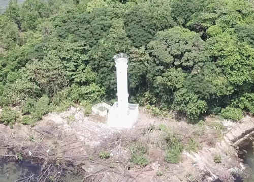
Date unknown. Active; focal plane 23 m (75 ft); white flash every 5 s. Approx. 20 m (66 ft) round cylindrical white concrere tower. Simon Tong has a good drone view (a portion is at right), a view from the sea is available, and Google has a satellite view. Located on a small island just off the Singapore shore in the entrance to the Johor Strait. Accessible only by boat. Site status unknown. Admiralty F1680; NGA 21686.
Tanjung Pelepas (Leading Light)
Date unknown. Active; focal plane 19 m (62 ft); white, red or green light depending on direction, 5 s on, 5 s off. Approx. 15 m (49 ft) round white metal tower carrying a large slatted daymark painted white with a black vertical stripe. Greenfinder has a photo and Google has a satellite view. The light guides vessels arriving at the Port of Tanjung Pelepas, a large containership port on the north side of the Johor Strait separating Malaysia from Singapore. Located at the tip of the cape near the southeast corner of the port. Site and tower closed. Admiralty F1678; NGA 21686.1.
Tanjung Piai
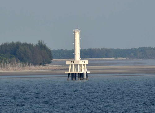
Date unknown. Active; focal plane 15 m (49 ft); white flash every 3 s. 15 m (49 ft) round cylindrical fiberglass tower on a triangular platform supported by four piles. Greenfinder has a photo, Smith has a view of the light from the sea, and Google has a distant satellite view. Tanjung (Cape) Piai, marked by this relatively modest modern light, is the southernmost tip of the mainland of Asia, 139 km (86 mi) north of the equator. This lighthouse also marks the west side of the entrance to Johore Strait, which separates Malaysia from Singapore. The area is a national park, with a jetty extending from the cape and a monument at its end marking the end of the continent. Aslam Yusof has a street view taken at the monument. Located a short distance offshore, about 5 km (3 mi) south of Serkat. Accessible only by boat; there is a distant view from the observation platform at the tip of the cape. Site open, tower closed. ARLHS WMA-026; Admiralty F1674.5; NGA 22586.

Pulau Merambong Light, Johor Strait, September 2018
ex-Google Plus drone view by Simon Tong
Pengkalan Penghulu
Date unknown. Active; focal plane 9 m (30 ft); two green flashes every 5 s. 9 m (30 ft) white fiberglass post on a hexagonal platform supported by piles. Greenfinder has a photo and Google has a satellite view. Located about 800 m (1/2 mi) off Kampong Serkat and about 4 km (2.5 mi) northwest of Tanjung Piai. Accessible only by boat. Site open, tower closed. Admiralty F1676.5; NGA 21686.5.
Pulau Pisang
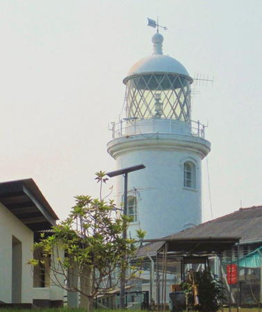
1914. Active; focal plane 150 m (492 ft); white flash every 10 s. 16 m (52 ft) round cylindrical cast iron tower, attached to a 1-story keeper's house. The original 1st order Fresnel lens was replaced with a 4th order lens in 1967. Lighthouse painted white. Mohamad Amirul Syafiq has the 2020 photo seen at right, a 2019 photo is available, a 2018 photo is available, Trabas has Capt. Theo's view from the sea, Forand has a historic postcard view and Google has a good satellite view. The lighthouse stands atop a wooded island on the east side of the shipping channel in the Strait of Malacca. The British government of Singapore, then part of the British colony of Straits Settlements, obtained the land for the light station and its access road in an agreement with the Sultan of Johore in 1900. Singapore's continued operation of the light is the cause of some friction with Malaysia, but Singapore recognizes Malaysian sovereignty over the island. In May 2008, after Malaysia lost its case before the International Court of Justice for sovereignty over the Horsburgh lighthouse islet, Malaysian MPs began calling for negotiations with Singapore about transferring the lighthouse to Malaysian control. In 2010 Malaysia formally annexed the island to Johor State and announced that Singapore workers sent to maintain the lighthouse must first register with Malaysian authorities at Pontian. Located on the highest point of Pulau Pisang, about 15 km (9 mi) east of Pontian Kechin. Accessible only by boat. Site and tower closed. Owner/operator: Maritime and Port Authority of Singapore. ARLHS WMA-010; Admiralty F1668; NGA 21692.
Mudah Selatan (Mudah Shoal South)
Date unknown (recent). Active; focal plane 25 m (82 ft); three white flashes every 15 s. 25 m (82 ft) round cylindrical fiberglass tower mounted on a concrete platform on pilings. A series of shock absorbing structures is built beside the lighthouse as protection against collision with ships. Entire lighthouse is white. Greenfinder has a photo and Trabas has Capt. Theo's photo, but the light is not shown in Google's satellite view. Located about 13 km (8 mi) southwest of Pulau Pisang marking the southeastern toe of the long Mudah shoal separating the westbound and eastbound shipping lanes in the Strait of Malacca. Accessible only by boat. Site open, tower closed. ARLHS WMA-028; Admiralty F1669; NGA 21690.

Pulau Pisang Light, Strait of Malacca, August 2020
Google Maps photo by Mohamad Amirul Syafiq
Panjang Selatan
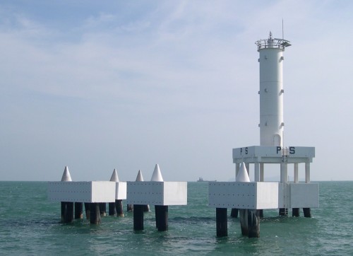
Date unknown (recent). Active; focal plane 26 m (85 ft); white flash every 5 s. 26 m (85 ft) round cylindrical fiberglass tower mounted on a square concrete platform on pilings. A series of shock absorbing structures is built beside the lighthouse as protection against collision with ships. Entire lighthouse is white. The Arsea Group's photo is at right, Trabas has Capt. Theo's photo, and Greenfinder has a photo, but the light is not shown in Google's satellite view. Located about 19 km (12 mi) southwest of Pulau Pisang on the south side of the shipping lanes in the Strait of Malacca. Accessible only by boat. Site open, tower closed. ARLHS WMA-027; Admiralty F1669.1; NGA 21691.
Sungai Benut
Date unknown. Active; focal plane 12.5 m (41 ft); white flash every 10 s. 12.5 m (41 ft) white skeletal tower on a triangular platform supported by piles. No photo available but Google has a distant satellite view. Located about 2 km (1.25 mi) off the mouth of the Benut River. Accessible only by boat. Site open, tower closed. Admiralty F1660; NGA 21696.
Mudah Utara (Mudah Shoal North) (2)
2009 (station establishment date unknown). Active; focal plane 30 m (98 ft); two white flashes every 6 s. 30 m (98 ft) round cylindrical fiberglass tower mounted on a square concrete platform on pilings. A series of shock absorbing structures is built beside the lighthouse as protection against collision with ships. Entire lighthouse is white. Trabas has Smith's photo and Greenfinder has a photo but the light is not shown in Google's satellite view. The original lighthouse was destroyed sometime in the third quarter of 2008, presumably by collision with a ship, but the light was replaced by late 2009. This light is very similar to the Tompok Utara and Mudah Selatan lights. Located near the northwestern toe of the long Mudah shoal in the center of the westbound shipping lane in the Strait of Malacca. Accessible only by boat. Site open. Admiralty F1655; NGA 21701.
Panjang Selatan Light
Panjang Selatan Light, Strait of Malacca
photo copyright The Arsea Group; permission requested

Batu Pahat District Lighthouses
Panjang Utara
Date unknown (recent). Active; focal plane 28 m (92 ft); two white flashes every 10 s. 28 m (92 ft) round cylindrical fiberglass tower mounted on a square concrete platform on pilings. A series of shock absorbing structures is built beside the lighthouse as protection against collision with ships. Entire lighthouse is white. Greenfinder has a photo but the light is not shown in Google's satellite view. Located about 19 km (12 mi) west of the Mudah Utara light, marking a shoal of the south side of the shipping lanes in the Strait of Malacca. Accessible only by boat. Site open, tower closed. Admiralty F1654; NGA 21703.
Parit Botak
Date unknown. Active; focal plane 11 m (36 ft); green flash every 7 s. 11 m (36 ft) fiberglass post carrying a large triangular daymark and mounted on a triangular platform supported by piles. Google has a satellite view and a distant sea view. Located about 1 km (0.6 mi) off Senggarang. Accessible only by boat. Site open, tower closed. Admiralty F1657; NGA 21699.
[Kuala Sungai Ayam]
Date unknown. Active; focal plane 12 m (39 ft); red flash every 4 s. 12 m (39 ft) fiberglass post carrying a large square daymark and mounted on a triangular platform supported by piles. Google has a satellite view and a distant sea view. Located about 1 km (0.6 mi) west of the swampy point of Tanjung Laboh. Accessible only by boat. Site open, tower closed. Admiralty F1653.5; NGA 21703.5.
Pulau Sialu (Sungai Batu Pahat)
1913. Reactivated (inactive 1978-?); focal plane 17 m (56 ft); white flash every 3 s. 15 m (49 ft) masonry tower with gallery, painted white. The lantern has been removed. A photo is at right, Mohd Razali Hamid has a 2008 photo, Greenfinder has a photo, Matthew Chia has a 2023 photo, a distant view from the sea is available, and Google has a satellite view. Pulau Sialu is a small, uninhabited island off the Batu Pahat estuary. The historic lighthouse was deactivated in favor of the Bukit Segenting lighthouse in 1978 but it is back on the Malaysian light list. Michael Ong Eng Hui has a photo showing both lighthouses. More information on this station is needed. Accessible only by boat. Site status unknown. . ARLHS WMA-012; Admiralty F1652; NGA 21708.

Pulau Sialu Light, Batu Pahat, 2013
Wikimapia Creative Commons photo by alternator
* Bukit Segenting (Segenting Hill)
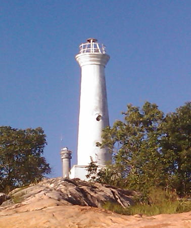
1978. Active; focal plane 86 m (282 ft); four white flashes every 30 s. 14 m (46 ft) round cylindrical concrete tower with lantern and gallery, attached to a small 1-story equipment room. Lighthouse painted white. Greenfinder's photo is at right, Michael Ong Eng Hui has a 2009 photo, Marine Traffic has a collection of Ong's photos, Benard Kok has a 2023 drone view, Angelica Wooley has a distant photo, and Google has a satellite view. In 2020 Greenfinder replaced the older optic with an LED lamp. In both photos the lighthouse is dwarfed by a large VTS (maritime traffic control) tower. ILocated on Tanjung Api Api, a promontory overlooking the Strait of Malacca about 12 km (7.5 mi) southwest of Batu Pahat. Site open, tower closed. . ARLHS WMA-002; Admiralty F1652.5; NGA 21712.

Muar District Lighthouses
Tanjung Tohor
Date unknown. Active; focal plane 16 m (52 ft); white flash every 5 s. 16 m (52 ft) round cylindrical fiberglass tower on a platform supported by four piles. Entire lighthouse is white. Greenfinder has a photo and Google has a distant satellite view. Located off Tanjung Tohor, about 15 km (9 mi) southeast of Parit Jawa. Accessible only by boat. Site open, tower closed. Admiralty F1650; NGA 21716.
Parit Jawa
Date unknown. Active; focal plane 11 m (36 ft); red flash every 4 s. 11 m (36 ft) fiberglass post light with gallery mounted on a square concrete pier. The lighthouse is white with a red band around the gallery. Greenfinder has a photo and Google has a distant satellite view. Located a short distance off the coast at Parit Jawa, northwest of Batu Pahat. Accessible only by boat. Site open, tower closed. Admiralty F1648; NGA 21718.

Tangkak District Lighthouse
Kuala Muar
Date unknown. Active; focal plane 12.5 m (41 ft); white flash every 10 s. 12 m (39 ft) square pyramidal white skeletal tower supported by concrete piles. A distant photo is available and Google has a satellite view. Muar is a city of about 350,000 residents on the south bank of the Muar River, the border between Johor and Melaka. Located on the north side of the mouth of the Muar River. Accessible only by boat. Site open, tower closed. Admiralty F1646; NGA 21724.

Bukit Segenting Light, Batu Pahat, posted September 2020
Greenfinder.asia photo

Melaka (Malacca) Lighthouses

Malacca was by far the oldest European colony in the Straits area (and it gave its name to the Strait). It was conquered by Portugal in 1511 and then by Dutch forces in 1624. The British took control through the Anglo-Dutch Treaty of 1824. From 1867 until World War II Melaka was part of the crown colony of Straits Settlements. Its capital Malacca City has a population approachingt 600,000.

Melaka Tengah (Central Melaka) District Lighthouses
Pulau Undan
1880. Active; focal plane 53 m (174 ft); two white flashes every 15 s. 15 m (49 ft) octagonal cylindrical masonry tower with lantern and gallery, rising from a 2-story keeper's house. Light tower painted red, keeper's house white. In a photo the red lighthouse is much shorter than the neighboring maritime communications tower. Greenfinder has a photo, Stanley Lim has a photo, Trabas has Arndt's very distant view from the sea, Forand has a historic postcard view, and Bing has an indistinct satellite view of the station. Located atop an island in the Strait of Malacca about 25 km (15 mi) southeast of Melaka (Malacca). Accessible only by boat. Site and tower closed. ARLHS WMA-013; Admiralty F1644; NGA 21728.
Umbai (Kuala Umbai)
Date unknown. Active; focal plane 10 m (33 ft); green flash every 5 s. 10 m (33 ft) cylindrical tower with gallery, mounted on a concrete platform supported by concrete piles. Entire lighthouse is white. Greenfinder has a photo, Ben Sharif has a photo, and Google has a satellite view and a distant sea view. Located about 300 m (330 yd) off the entrance to the small harbor of Umbai, a town about 10 km (6 mi) east of Malacca. Accessible only by boat. Site open, tower closed. Admiralty F1642; NGA 21730.
Pulau Panjang
Date unknown. Active; focal plane 5.5 m (18 ft); red flash every 5 s. 5.5 m (18 ft) square concrete pillar on a conical concrete base. Entire lighthouse is white. Trabas has Smith's photo but the light is not shown in Google's satellite view. Located at the west end of a reef about 5 km (3 mi) southeast of the entrance to Melaka harbor. Accessible only by boat. Site open, tower closed. Admiralty F1640; NGA 21732.
Batu Gelama
Date unknown. Active; focal plane 4 m (13 ft); white flash every 5 s. 4 m (13 ft) round cylindrical white concrete tower on a square concrete pier. Trabas has Arndt's photo, Jason Tiu has a 2020 photo, and Google has a satellite view. Located on a shoal off the Melaka waterfront. Accessible only by boat. Site open, tower closed. Admiralty F1633; NGA 21734.
* Malacca (St. Paul's Church)
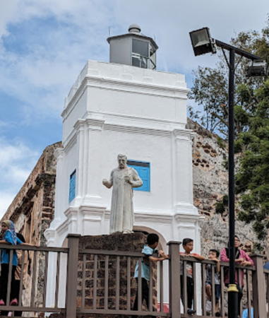
1849. Inactive. Approx. 13 m (43 ft) square masonry tower with lantern and gallery mounted on an arched base. Lighthouse painted white. Jerry Chien's 2024 photo is at right, Balaji Dutt has a photo, Wikimedia has Rudolph Furtado's photo, Matthew Yau has a good photo, and Google has a street view and a satellite view. Hindia Belanda's 2021 photo showed the tower imuch n need of repainting. but Tote Varisorn's October 2022 photo shows it nicely restored. The lighthouse stands next to the ruins of St. Paul's Church, built by the Portuguese in the 16th century (St. Francis Xavier preached there) and renamed by the Dutch, who ruled Malacca from 1641 through most of the 18th century. Located atop St. Paul's Hill on the south side of the harbor of Melaka, as the city's name is now spelled. Site open, tower closed. ARLHS WMA-029.

Malacca Light, Malacca, January 2024
Google Maps photo by Jerry Chien
Kuala Melaka (Malacca Entrance)
Date unknown. Active; focal plane 10.5 m (34 ft); red flash every 4 s. 10.5 m (34 ft) round cylindrical fiberglass tower, carrying a square red daymark around the top, on a platform supported by four piles. Trabas has Smith's photo and Google has a satellite view. Located in the entrance to Melaka harbor. Accessible only by boat. Site open, tower closed. Admiralty F1637; NGA 21735.
Sungai Baru
Date unknown. Active; focal plane 13.5 m (45 ft); red flash every 4 s. 11 m (36 ft) round white tower. Fazlee Abd Rahim has a photo, Smkab Ayer Baloi has a closeup, and Google has a satellite view. Located on a short pier at Sungai Baru, about 30 km (19 mi) northwest of downtown Malacca City. Site status unknown. Admiralty F1627.6; NGA 21746.

Alor Gajah District Lighthouse
*** Tanjung Tuan (Cape Rachado)
1863. Active; focal plane 118 m (387 ft); three white flashes every 15 s. 24 m (79 ft) round masonry tower with lantern and gallery, painted white. 1st order Fresnel lens in use. Original 1-story masonry keeper's house. A modern concrete tower, built in 1990, carries radar to monitor ship traffic in the narrow Strait of Malacca. Anthony Johnson's 2022 photo is at right, Auria Abraham has a closeup photo, Horng Yih Wong has another good photo, Wikimedia has a photo, Greenfinder has a photo, a 2016 photo by Etienne Valois is available, the lighthouse appeared on a commemorative postal sheet, Forand has a historic postcard view, K.P. Lai has a closeup 2019 street view, Intan Sofea Azmi has a 2020 drone view of the station, and Google has a satellite view. This is Malaysia's oldest active lighthouse and probably its most important; it stands at the end of a prominent ridge jutting out into the Strait at the northern end of the narrower part of the waterway. The coast of Sumatra, on the other side of the strait, can be seen from the top of the lighthouse. The forested ridge has long been recognized as one of the country's most important forest and wildlife reserves. The site figures in Malay legends and history; the 15th century warrior Hang Tuah is said to have meditated here and left his footprint in a boulder. According to other local accounts the Portuguese built a lighthouse here in the 1500s and the Dutch built another in 1817; we have no verification of these claims. The British annexed the cape to the Malacca colony before building the lighthouse, with the result that the cape today remains an exclave of Melaka state despite being surrounded by the state of Negeri Sembilan. The exclave is protected as a state forest park with several popular hiking trails. Access to the lighthouse is by walking the access road, a distance about 2 km (1.25 mi); the lighthouse is a very popular attraction and parking is likely to be difficult to find at the entrance. Located on a very prominent cape about 20 km (13 mi) south of Port Dickson. Site open, tower open for climbing by arrangement with the keepers. . ARLHS WMA-003; Admiralty F1626; NGA 21748.

Tanjung Tuan (Cape Rachado) Light, August 2022
Google Maps photo by Anthony Johnson

Negeri Sembilan Lighthouses

Negeri Sembilan ("nine villages") is mostly an inland state; it has a short coast on the Strait of Malacca including the seaport of Port Dickson. Arang is the former Malay name of Port Dickson.

Port Dickson District Lighthouses
Pulau Arang-Arang
Date unknown. Active; focal plane 27 m (89 ft); white flash every 10 s. Decscribed by NGA as a white skeletal tower. No photo available and the light is not shown in Google's satellite view of the listed location. An element of mystery: the Admiralty and NGA list the light as Pulau Arang Southwest Side, but the listed location is on the southeast side of the island, a small, heavily forested island about 800 m (1/2 mi) off the waterfront of Port Dickson. Site status unknown. Admiralty F1622; NGA 21764.
Arang
Date unknown. Active; focal plane about 20 m (66 ft); two white flashes every 8 s. Approx. 20 m (66 ft) round hourglass-shaped tower, mounted on a square concrete platform supported by concrete piles. According to NGA the tower is now painted black with one red horizontal band; it was all white in Greenfinder's closeup photo (seen at right). Google has a satellite view. Located 800 m (1/2 mi) southwest of Pulau Arang, marking the entrance to the harbor of Port Dickson. Accessible only by boat. Site open, tower closed. Admiralty F1622.5; NGA 21760.
Sepang Outer
Date unknown. Active; focal plane 15 m (49 ft); green flash every 2 s. 15 m (49 ft) square skeletal tower, painted white and carrying a green triangular daymark, mounted on a square platform supported by piles. Greenfinder has a photo but the light is not shown in Bing's satellite view. Located about 4 km (2.5 mi) south of the entrance to the Sepang estuary. Accessible only by boat. Site status unknown. Admiralty F1620.5; NGA 21771.
Kuala Sepang Besar (Sepang Inner)
Date unknown. Active; focal plane 19 m (62 ft); quick-flashing white light. 19 m (62 ft) skeletal tower, painted white, mounted on a square platform supported by piles. Greenfinder has a closeup photo, a 2022 photo is available, and Google has a satellite view. Located just offfshore at a large coal-fired power plant west of Port Dickson and just east of the Selangor border. Accessible only by boat. Site status unknown. Admiralty F1620; NGA 21772.
 

Arang Light, Port Dickson
Greenfinder.asia photo
 

Selangor Lighthouses

The state of Selangor includes the central west coast of Malaya and surrounds the federal district of Kuala Lampur, the national capital. With a population of about 6.5 million it is Malaysia's most populous state. Klang (formerly spelled Kelang) is a former capital of Selangor state and the largest port of Malaysia. The city has a population of about 750,000. The port is sheltered behind marshy islands with its principal entrance from the north and a secondary entrance from the south.

Kuala Langat District (Southern Selangor) Lighthouses
Sepat
Date unknown. Active; focal plane 14 m (46 ft); quick-flashing white light. 14 m (46 ft) round tower supported by a robust pile. Upper half of the tower painted black, lower half yellow. Greenfinder has a photo and Trabas has Capt. Theo's photo, but the lighthouse is not shown in Google's satellite view. Located on a shoal on the south side of the shipping lanes in the Strait of Malacca about 16 km (10 mi) southwest of Tanjung Gebang. Accessible only by boat. Site open, tower closed. Admiralty F1619.4; NGA 21774.
Tanjung Gebang
Date unknown. Active; focal plane 28 m (92 ft); white flash every 4 s. 28 m (98 ft) round concrete tower, mounted on a platform supported by piles. Greenfinder has a photo, Trabas has Smith's photo, and Google has a satellite view and a sea view taken from a kayak. Located a short distance off a headland about 15 km (9 mi) south of Banting. Accessible only by boat. Site open, tower closed. Admiralty F1619; NGA 21776.
* Bukit Jugra (Jugra Hill)
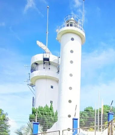
1976. Active; focal plane 146 m (479 ft); white flash every 10 s. 25 m (82 ft) round cylindrical concrete tower with lantern and gallery. A second concrete tower carries radar to monitor ship traffic. Jeffrey Tan's 2023 photo is at right, Tian Yake has a photo and a closeup, Greenfinder also has a closeup, Joy Hon has a 2021 photo, and Google has a street view and a satellite view. Located on a conspicuous hill on the east side of a river at Permatang Pasir. Site open, tower closed. ARLHS WMA-001; Admiralty F1614; NGA 21780.
[Kuala Langat (Tanjung Tonkah) (2)]
Date unknown. Active; focal plane about 12 m (39 ft); green flash every 5 s. Approx. 12 m (39 ft) white post on a triangular platform supported by piles. A photo is available and Bing has a fuzzy satellite view. NGA lists a much smaller light. Located in the entrance to the Langat River. Accessible only by boat. Site open, tower closed. Admiralty F1614.5; NGA 21782.

Bukit Jugra Light, Permatang Pasir, May 2023
Google Maps photo by Jeffrey Tan
Tanjung Rhu (Tanjung Ru) (2)
2016. Active; focal plane 29 m (95 ft); white flash every 5 s. 29 m (95 ft) round cylindrical fiberglass tower mounted on a square platform supported by piles. Trabas has Smith's photo (also seen at right), Greenfinder has a closeup, and Google has a satellite view. The original lighthouse, a 24 m (79 ft) round fiberglass tower mounted on a square concrete pier, was demolished or destroyed in 2010. Located in shallows about 1 km (0.6 mi) west of Tanjung (Cape) Rhu, the western tip of Pulau Carey, about 25 km (15 mi) southwest of Klang. Accessible only by boat. Site open, tower closed. Admiralty F1610; NGA 21804 (ex-21803).

Klang District Lighthouses
Tanjung Mahang Range Front
Date unknown. Active; focal plane 19 m (62 ft); quick-flashing white light. 19 m (62 ft) square pyramidal skeletal tower, mounted on a platform supported by piles. Lighthouse painted white. The tower also carries a white triangular daymark, point up. Trabas has Arndt's photo, Greenfinder has a photo showing both range lights, and Google has a satellite view. This is the southern entrance range for Klang. Located off the southern tip of Pulau Che Mat Zin, 180 m (200 yd) south of the rear light. Accessible only by boat. Site open, tower closed. Admiralty F1609; NGA 21806.
Tanjung Mahang Range Rear
Date unknown. Active; focal plane 26 m (85 ft); red light, 2 s on, 2 s off. 25 m (82 ft) square pyramidal skeletal tower, mounted on a platform supported by piles. Lighthouse painted white. The tower also carries a white triangular daymark, point down. Trabas has Arndt's photo, Greenfinder has a photo showing both range lights, and Google has a satellite view. Located on the southern tip of Pulau Che Mat Zin, about 40 km (25 mi) southwest of downtown Klang. Accessible only by boat. Site open, tower closed. Admiralty F1609.1; NGA 21806.1.

Tanjung Rhu Light, Klang, February 2019
photo copyright James Smith; used by permission
#Klang First Point (1)
Date unknown. Replaced. This was a 17 m (56 ft) round hourglass-shaped concrete tower, mounted on a platform supported by four concrete piles. Mohd Nor Azmil Abdul Rahman has a 2008 photo and Google has a satellite view. Smith found in 2015 that this light had been replaced by a buoy. In 2016 a new, smaller light on a post (focal plane 11 m (36 ft); red flash every 4 s) was installed; Trabas has Smith's photo. Located on the west side of the Klang entrance channel about 1200 m (3/4 mi) northeast of the Tanjung Mahang range lights. Accessible only by boat. Site open, tower closed. Admiralty F1608; NGA 21808.
Tanjung Sarang Lang (2)
2018. Active; focal plane 26 m (85 ft); two white flashes every 10 s. 25 m (82 ft) square skeletal tower mounted on a platform supported by piles. Lighthouse painted white. Trabas has Smith's photo a(also seen at right) nnd Bing has a satellite view. Located on the eastern point of Pulau Klang, opposite the inner harbor of the city. Accessible only by boat. Site open, tower closed. Admiralty F1594; NGA 21820.
* Marine Department Signal Station
Date unknown. Active; focal plane 28 m (92 ft); flashing red light. Light mounted atop the 5-story Marine Department building in Klang (this is the national headquarters of the department). Rener Tan has a 2021 drone view and Google has a street view and a satellite view. Located on the Klang River on the north side of the harbor area. Site open, tower closed. Admiralty F1597; NGA 21826.
* Tanjung Harapan
Date unknown. Active; focal plane 11 m (36 ft); red flash every 5 s. 11 m (36 ft) white concrete post carrying a large gallery and mounted on a platform supported by three piles. Gallery painted red as a daymark. Greenfinder has a photo, Trabas has Arndt's closeup photo, Yok Kwee Tan has a 2023 photo, and Google has a street view and a satellite view. Located just offshore on the north side of the entrance to the inner harbor of Port Klang. Accessible only by boat but easily seen from shore. Site open, tower closed. Admiralty F1595; NGA 21834.

Tanjung Sarang Lang Light, Klang, February 2019
photo copyright James Smith; used by permission
Tanjung Tentaram
Date unknown. Active; focal plane 10 m (33 ft); red flash every 3 s. 10 m (33 ft) white concrete post carrying a large box-like red daymark and mounted on a platform supported by three piles. Ong Jit Tuck has a photo and Google has a distant satellite view. Located off the southwestern tip of Pulau Ketam, an island west of Pulau Klang. Accessible only by boat. Site open, tower closed. Admiralty F1612; NGA 21800.

One Fathom Bank Lighthouses
One Fathom Bank is a notorious shoal in the Strait of Malacca off the port of Klang. (One fathom is a depth of only 6 ft or 1.8 m.) Shipping is crowded together in the Strait by the limited amount of deep water available so a traffic separation scheme (TSS) is in place. Vessels headed southeast keep to the Indonesian side and those headed northwest keep to the Malaysian side. A chart is available. The lights in this section are important markers for the TSS.

One Fathom Bank (Permatang Sedepa) (3)
1907 (station established 1852). Inactive since 1999. Approx. 27 m (89 ft) octagonal skeletal cast iron tower with lantern, gallery, and enclosed upper portion, mounted atop a 2-story octagonal keeper's house standing on piles. In fact there are two lanterns, with a newer and smaller one raised above the original first-order lantern by an octagonal skeletal extension. The lighthouse was orginally painted with red and white horizontal bands; today the keeper's house and cast iron skeletal sections and painted white and the upper extension is black. Mohd Ezwan Ghazali's 2017 photo at right shows this lighthouse in the foreground, Trabas has Capt. Theo's photo of the two lighthouses, Wikimedia has a good closeup, Greenfinder has a closeup, Huelse has a historic photo, and the lighthouse was featured on a 2004 postage stamp. This historic lighthouse was restored in 2004-05. The original lighthouse was replaced by a screwpile lighthouse in 1874. Accessible only by boat. Site open, tower closed. ARLHS WMA-030.

1907 One Fathom Bank Light, Strait of Malacca, Light, Klang, July 2017
Google Maps photo by Mohd Ezwan Ghazali
One Fathom Bank (Permatang Sedepa) (4)
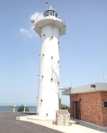
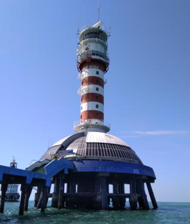
1999 (station established 1852). Active; focal plane 43 m (141 ft); four white flashes every 20 s. 43 m (141 ft) round cylindrical steel tower with lantern and triple gallery, rising from the center of a dome-shaped equipment shelter, mounted on a circular platform supported by pilings. Light tower painted with red and white horizontal bands. A 2018 photo is at right, Trabas has Capt. Theo's photo of the two lighthouses, Wikimedia has a photo, Akmar Yaakub has a closeup, and Greenfinder has a more distant view, but the lighthouses are not shown in Google's satellite view. The base of the lighthouse has accommodations visited by sport fishermen. The lighthouse is on the north (Malaysian) side of the northwestbound channel, near the southeast end. Located on the shoal, about 30 km (20 mi) west southwest of the Klang Delta. Accessible only by boat. Site open, tower closed. . ARLHS WMA-007; Admiralty F1616; NGA 21784.
One Fathom Bank North
2009. Active; focal plane 30 m (98 ft); white flash every 3 s. 30 m (98 ft) round fiberglass tower on a platform supported by piles. Trabas has Capt. Theo's photo and Greenfinder has a photo, but the lighthouse is not shown in Google's satellite view. This light is on the north side of the northwestbound channel, near the northwest end. Located about 20 km (12.5 mi) northwest of the original One Fathom Bank lighthouse. Accessible only by boat. Site open, tower closed. Admiralty F1616.5; NGA 21795.
One Fathom Bank Southbound East Beacon
Date unknown. Inactive since 2019. 13 m (43 ft) beacon, upper half painted yellow and lower half black. No photo available and the light is not shown in Bing's satellite view. The exit from the southbound channel is quite narrow; it is marked by this light and the next two. Located 9.4 km (5.8 mi) southwest of the One Fathom Bank lighthouse. Accessible only by boat. Site open, tower closed. ex-Admiralty F1617; NGA 21788.
One Fathom Bank Southbound South Beacon
Date unknown. Active; focal plane 13 m (43 ft); quick-flashing white light 13 m (43 ft) beacon, upper half painted black and lower half yellow. Trabas has Capt. Theo's photo but the light is not shown in Bing's satellite view. Located 10.5 km (6.5 mi) southwest of the One Fathom Bank lighthouse. Accessible only by boat. Site open, tower closed. Admiralty F1617.2; NGA 21792.
One Fathom Bank Southbound West Beacon
Date unknown. Active; focal plane 11 m (36 ft); quick-flashing white light 11 m (36 ft) beacon, painted yellow. Trabas has Capt. Theo's photo but the light is not shown in Bing's satellite view. Located 13.8 km (8.6 mi) west southwest of the One Fathom Bank lighthouse. Accessible only by boat. Site open, tower closed. Admiralty F1617.4; NGA 21794.

1999 One Fathom Bank Light, Strait of Malacca, February 2018
Google Maps photo by Miestoo

Kuala Selangor District (Northern Selangor) Lighthouses
Pulau Angsa
1887. Active; focal plane 36 m (118 ft); flash every 10 s, white or red depending on direction. 11 m (36 ft) round masonry tower with lantern and gallery, painted white. Keeper's house and a modern concrete radar tower that dwarfs the lighthouse. Anjung Teknik's 2020 drone view is at right, the Marine Department has an older photo, Trabas has Arndt's view from the sea, Patrick Costello has a 2011 view from the sea, another distant view is available, and Google has a satellite view. This light marks the beginning of the northern approach to Klang. Located atop a small island about 40 km (25 mi) northwest of Port Klang and 25 km (15 mi) south of Kuala Selangor. Accessible only by boat; water taxi service is available from Klang. Site open, tower closed. ARLHS WMA-008; Admiralty F1586; NGA 21848.
Batuan (Batu) Penyu (2)
Date unknown. Active; focal plane about 20 m (66 ft); two white flashes every 5 s. Approx. 20 m (66 ft) round cylindrical fiberglass tower mounted on a square platform supported by piles. Greenfinder has a photo and Karthik Kulkarni has a very distant sea view, but the lighthouse is not shown in Google's satellite view. The Admiralty and NGA list a tower only 6 m (20 ft) tall. Located on a shoal about 4 km (2.5 mi) north of Pulau Angsa. Accessible only by boat. Site open, tower closed. Admiralty F1584; NGA 21851.
Kuala Sungai Buloh
Date unknown. Active; focal plane 14 m (46 ft); white flash every 3 s. 14 m (46 ft) round cylindrical fiberglass tower mounted on a square platform supported by piles. No photo available but Google has a distant satellite view. Located about 2 km (1.25 mi) offshore and 10 km (6 mi) south of Kuala Selangor. Accessible only by boat. Site open, tower closed. Admiralty F1585; NGA 21856.
** Kuala Selangor (Altingsburg, Bukit Melawati)
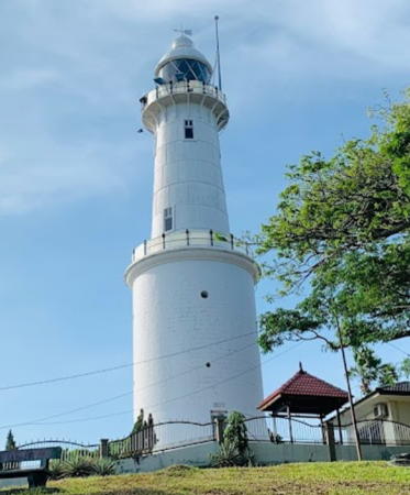
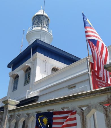
1907. Active; focal plane 73 m (240 ft); two white flashes every 15 s. 27 m (89 ft) round two-stage tower with lantern and gallery, painted white. The lower half of the tower is cylindrical masonry, and the upper half is a conical cast iron tower. A 2022 photo appears at the top of the page, Greenfinder has a photo, S.J. Liew has a good closeup, another closeup photo, a 2022 photo, and a 2010 photo are available, Nur Syuhada has a drone view, and Google has a street view and a satellite view. The lighthouse stands on the hill known as Bukit Melawati, in the center of a 250 ha (600 acre) nature reserve adjoining the town of Kuala Selangor. Ruins of the Dutch Fort Altingsburg, built in 1784, can be seen near the lighthouse, and the historical museum of Kuala Selangor is adjacent to the light station. The road to the lighthouse is closed on weekends due to limited parking, but trams are provided. Site open, tower closed. . ARLHS WMA-005; Admiralty F1578; NGA 21860.

Pulau Angsa Light, Kuala Selangor, October 2020
Facebook photo by Anjung Teknik
Permatang Angsa (Angsa Bank)
Date unknown. Active; focal plane 22 m (72 ft); quick-flashing white light. 22 m (72 ft) round tower, upper half painted black, lower half yellow. Greenfinder has a closeup photo and Bing has a satellite view. Located on a shoal off Tanjung Karong, about 40 km (25 mi) northwest of Kuala Selangor. Accessible only by boat. Site open, tower closed. Admiralty F1580; NGA 21861.
Sungai Sekinchan
Date unknown. Active; focal plane 11 m (36 ft); green flash every 4 s. 11 m (36 ft) white fiberglass tower on a platform supported by piles. Azraie Ruslim has a very distant drone view and Bing has a satellite view. Located about 1 km (0.6 mi) off the waterfront of Sekinchan, a fishing town in norther Selangor. Accessible only by boat. Site open, tower closed. Admiralty F1576.1.

Information available on lost lighthouses:

Notable faux lighthouses:

Adjoining pages: North: West Malaysia West Coast | South: Singapore | West: Eastern Sumatra

Return to the Lighthouse Directory index | Ratings key

Posted March 12, 2006. Checked and revised May 19, 2024. Lighthouses: 54. Site copyright 2024 Russ Rowlett and the University of North Carolina at Chapel Hill.