Lighthouses of Canada: Southeastern Newfoundland

Newfoundland and Labrador -- including both the Island of Newfoundland and the mainland territory of Labrador -- is the easternmost province of Canada. During the 17th century Newfoundland attracted both French and British fishermen, but France ceded its settlements to Britain in 1713. Long governed as a British colony, Newfoundland became a self-governing dominion under the British Crown in 1907 but gave up its dominion status in 1934, during the Great Depression. Newfoundland then joined Canada as the tenth province in 1949 following a referendum the previous year. The name of the province was changed from Newfoundland to Newfoundland and Labrador in 2001.

The north coast of the Island of Newfoundland faces the Labrador Sea and the east and south coasts face the open North Atlantic Ocean. The west coast faces the Gulf of Saint Lawrence. The Cabot Strait separates Newfoundland from Nova Scotia to the southwest and the Strait of Belle Isle separates the Island of Newfoundland from Labrador on the northwest. This page lists lighthouses of the deeply-dissected southeastern corner of Newfoundland: the Bonavista, Bay de Verde, Avalon, and Burin Peninsulas. Lighthouses of the rest of the island are on the Southwestern Newfoundland and Northern Newfoundland pages.

Having a rocky and much-indented coast, Newfoundland established a large number of light stations, many of which remain active today. Until quite recently nearly all the lighthouses remained in the care of the Canadian Coast Guard's Newfoundland and Labrador Region. Now preservation organizations are beginning to appear in many communities.

Newfoundland is accessible by air and by Marine Atlantic ferries from North Sydney, Nova Scotia. Ferry service is available year-round between North Sydney and Port aux Basques and in the summer between North Sydney and Argentia.

CCG numbers are from the Newfoundland volume of the List of Lights, Buoys, and Fog Signals of Fisheries and Oceans Canada. ARLHS numbers are from the ARLHS World List of Lights. Admiralty numbers are from Volume H of the Admiralty List of Lights & Fog Signals. U.S. NGA numbers are from Publication 110.

General Sources
Newfoundland Canada Lighthouses
Photos and information posted by Kraig Anderson.
Newfoundland Lighthouses
Photos by Karen Chappell and Joe Dawson.
Newfoundland Lighthouses
10 fine photos by Karl Josker.
Lighthouses of Newfoundland and Labrador
Photos available on Flickr.com.
Litehouseman's Newfoundland Lighthouses
A fine collection of 37 photos by "Litehouseman."
Photos by Roger Etcheberry
Newfoundland lighthouse photos posted on MarineTraffic.com
Lighthouses in Newfoundland and Labrador
Photos available from Wikimedia.
Online List of Lights - Northern and Eastern Canada
Photos by various photographers posted by Alexander Trabas. Photos for this area are by Brigitte Adam and Douglas Cameron.
Leuchttürme Kanadas auf historischen Postkarten
Historic postcard views posted by Klaus Huelse.
List of Lights, Buoys, and Fog Signals
Official Canadian light lists.
GPSNauticalCharts
Nautical chart for Newfoundland.
Navionics Charts
Nautical chart for Newfoundland.


Cape Pine Light, Trepassy, July 2008
Wikimedia Creative Commons photo by Nilfanion


1836 Cape Spear Light, St. John's, April 2015
Flickr Creative Commons photo by Ming Li

Bonavista Peninsula Lighthouses
The Bonavista Peninsula projects northeastward from the east coast of Newfoundland. The peninsula is about 85 km (53 mi) long, separating Bonavista Bay to the north from Trinity Bay to the south.

*
Kings Cove Head
1893. Active; focal plane 54 m (176 ft); white flash every 4 s. 11 m (36 ft) round cast iron tower with lantern and gallery, painted white. The keeper's house has been demolished. The tower was prefabricated in England by Chance Brothers. Trabas has Adam's closeup photo, Colin Hill has a 2021 photo, Wikimedia has a good photo by John King, a fine closeup photo is available, and Google has a distant satellite view. Located on a headland near the town of King's Cove; the town, on NF 235 southwest of Bonavista, holds a lighthouse festival the first weekend of August. Accessible by a hiking trail from town (the trail is rated "moderate"). Site open, tower closed. Site manager: Canadian Coast Guard. . ARLHS CAN-662; CCG N-443; Admiralty H0540; NGA 1620.
[Squarry Island (Bonavista) (2?)]
Date unknown (station established 1905). Inactive since 2016. 5 m (16 ft) square skeletal tower carrying a slated daymark painted with red and white horizontal bands. Geoff Smith has a distant view from the sea and Google has an indistinct satellite view. The original lighthouse was a 7 m (22 ft) square pyramidal wood tower; it was reported destroyed in 1966. Located on an islet in the entrance to Bonavista harbor. Accessible only by boat. Site open, tower closed. ex-CCG N-446; ex-Admiralty H0537; ex-NGA 1632.
**** Cape Bonavista (1)
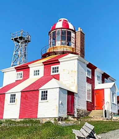
1843. Inactive since 1966. 11 m (36 ft) round cylindrical stone tower with lantern and gallery, rising from a 2-story stone keeper's house. A very rare 1816 catoptric light, with six reflectors, is installed in the lantern. Lighthouse and lantern painted with vertical red and white stripes. Three additional dwellings and other buildings. Kevin Hogg's photo is at right, Robert Hiscock has a good photo, Josker's photo shows the modern tower behind the lighthouse, Wikimedia has several photos, Trabas has Tom Chisholm's closeup photo, and Google has a street view and a satellite view. This historic light station has been restored to its appearance during the 1870s. Restoration was delayed by a fire set by lightning on 3 August 2001 but the project was completed by reinstallation of the restored catoptric light in September 2003. The lighting apparatus used in Scotland from 1816 and transferred here in 1895 is on display. Located on the point of the cape, about 7 km (4.5 mi) north of Bonavista. Accessible by road; parking provided. Site open; museum and tower open daily mid May through mid October and by appointment in the winter. Owner: Province of Newfoundland and Labrador. Site manager: Cape Bonavista Lighthouse Provincial Historic Site. . ARLHS CAN-093.
* Cape Bonavista (2)
1966 (station established 1843). Active; focal plane 51 m (166 ft); white flash every 10 s. 12 m (40 ft) square pyramidal skeletal tower with gallery. Fog horn (blast every 30 s). A photo is at right and Trabas has Tom Chisholm's closeup photo. Located next to the historic lighthouse. Site open, tower closed. CCG N-449; Admiralty H0536; NGA 1644.
Manuel Island
1918. Inactive. 5 m (16 ft) round cylindrical cast iron tower with lantern and gallery, painted white; lantern roof painted red. Trabas has Adam's closeup photo and Bing has a satellite view. Located 400 m (1/4 mile) off Courage's Point in Catalina Harbour, south of Bonavista. Accessible only by boat. Site open, tower closed. Site manager: Canadian Coast Guard. ARLHS CAN-693; ex-CCG N-458; ex-Admiralty H0528; NGA 1668.

Cape Bonavista Light, Bonavista, September 2019
Google Maps photo by Kevin Hogg
Green Island (Catalina)
1857. Apparently inactive; listed with focal plane 28 m (92 ft); three white flashes every 12 s. 9 m (30 ft) octagonal cylindrical tower with lantern and gallery, stone encased in concrete. Lighthouse painted white with vertical red striping on the lantern dome and a narrow horizontal red band around the gallery. Fog horn (blast every 60 s). 1-story modern keeper's house and two utility buildings, plus a helipad. A 2021 photo is available, Trabas has Darlene Chisholm's photo, Lighthouse Digest has a 1989 Coast Guard photo, and Google has a satellite view. The tower originally rose from the center of a 1-1/2 story wood keeper's house. In 1956 the house was removed and the tower was encased in concrete. The lighthouse was granted Heritage status in 2015. Chisholm's photo shows the active light on a small skeletal tower next to the lighthouse, but the official list has not been changed. Note there is another Green Island Light on the south coast (see below). Located on an island at the southern entrance to Catalina Harbour. Accessible only by boat. Site open, tower closed. Site manager: Canadian Coast Guard. ARLHS CAN-687; CCG N-453; Admiralty H0526; NGA 1648.
* [Horse Chops (fog signal)]
Date unknown. Active fog horn; one 4 s blast every 60 s. 10.5 m (34 ft) round tower, painted in a red and white spiral pattern. 1-story building that housed the original fog signal. Jerzy Rudz has a photo, Barrie McBride has a street view, and Google has a satellite view. Located on a promontory on the north side of the entrance to Trinity Bay, about 15 km (9 mi) east of Port Rexton. Accessible by road. Site manager: Canadian Coast Guard. CCG N-463; Admiralty H0522; NGA 1692.
*** Fort Point (Admiral's Point) (4)
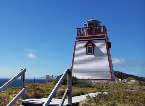
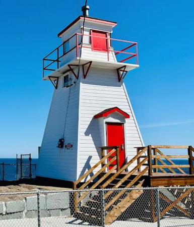
2003 (station established 1874). Active; focal plane 24 m (79 ft); white flash every 5 s. 8 m (26 ft) square pyramidal tower with lantern and gallery. Lighthouse painted white with red trim; the octagonal lantern is unpainted gray metallic. Fog horn (blast every 20 s). A 2019 photo is at right, Trabas has Adam's closeup photo, a 2007 closeup and a more distant view are available, Etcheberry has a photo, and Bing has a satellite view. The original lighthouse here was a 12 m (40 ft) square wood tower. The second lighthouse was a 7 m (23 ft) cast iron tower erected in 1921; Anderson has a Coast Guard photo of the first two lighthouses. The second (taller) lighthouse was replaced by a skeletal tower in the late 1980s and then by the present lighthouse. The light station occupies the site of a historic fort. In 2011 one of the two keeper's cottages was converted to a museum with exhibits on the history of the fort and the light station; the other keeper's house is occupied by Coast Guard staff. Sibling of the Fox Point Light (see the Northern Newfoundland page). Located on at the end of a long, narrow peninsula on the south side of the entrance to Trinity Harbour. Site open, museum open daily mid May to mid October, tower closed. Site manager: Trinity Historical Society (Fort Point Military Site). . ARLHS CAN-746; CCG N-462; Admiralty H0520; NGA 1696.

Fort Point Light, Trinity, June 2019
Google Maps photo by Tom D.
Ragged Islands
1910. Active; focal plane 34 m (112 ft); white flash every 4 s. 4.5 m (15 ft) round tower painted with red and white horizontal bands. No photo available and Google has only an indistinct satellite view. It is not certain if the present light is the original light, which was described as a 5 m round tower with lantern and gallery. Photo needed! Located on a small island on the west side of Trinity Bay about 25 km (15 mi) southwest of Horse Chops. Accessible only by boat. Site open, tower closed. CCG N-464; Admiralty H0518; NGA 1700.
Random Head Harbour
1895. Active; focal plane 38 m (126 ft); red flash every 3 s. 10 m (34 ft) round cylindrical cast iron tower with lantern and gallery; solar-powered lens. Lighthouse painted in a red and white checkered pattern; lantern roof is red. Lighthouse Digest has a good photo, the Southwest Arm Historical Society has a page on the lighthouse and its history, Trabas has Darlene Chisholm's distant view from the sea, and Google has a satellite view. The keeper's house and other station buildings have all been demolished. This lighthouse was intended for Heart's Content (next entry) but was diverted to Random Head. The tower was refurbished in the late 1980s and restored in 2009. Located at East Random Head on Motion Island in Trinity Bay east of Hickman's Harbour. Gypsy Sea Adventures has tours from Hickmand's Harbour that pass the lighthouse and might be willing to stop there; one of their videos has a good view of the lighthouse. Otherwise accessible only by helicopter or by boat. Visible distantly from the cliff tops at Random Head. Site and tower closed. Site manager: Canadian Coast Guard. ARLHS CAN-667; CCG N-465; Admiralty H0514; NGA 1704.

Bay de Verde Peninsula Lighthouses
The Bay de Verde Peninsula is the northernmost finger of the much-dissected Avalon Peninsula. The peninsula, some 90 km (55 mi) long, separates Trinity Bay on the west from Conception Bay on the east.

*
Heart's Content
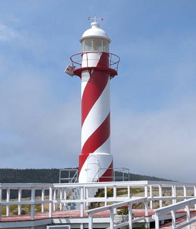
1901. Active; focal plane 25 m (83 ft); white light, 4 s on, 2 s off. 9 m (30 ft) round cylindrical cast iron tower with lantern and gallery, painted in a red and white spiral (candy-stripe) pattern; lantern roof is white. The keeper's house and other station buildings have all been demolished. Susan Auld's photo is at right, Bailey Parsons has a 2021 photo, Susan Auld has a 2017 photo, Trabas has Darlene Chisholm's closeup, Sean Davidson also has a photo, an excellent 2006 photo is available, and Google has a street view and a satellite view. A crew was ready to install a lighthouse at Heart's Content in 1894 when an order came to build the lighthouse at Random Head (see above). Heart's Content had to wait until 1901 for its lighthouse. The lighthouse must have been repainted in early 2010. Ownership was transferred to the Town of Hearts Content in September 2017. Located at the northern entrance to the harbor of Heart's Content, on the east side of Trinity Bay. Accessible by road. Site open, tower closed. Owner/site manager: Town of Hearts Content . ARLHS CAN-543; CCG N-468; Admiralty H0510; NGA 1716.

Heart's Content Light, Heart's Content, July 2017
Google Maps photo by Susan Auld
[Jeans Head (New Perlican) (2?)]
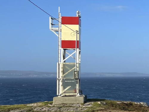
Date unknown (station established 1915). Active; focal plane 48.5 m (159 ft); white flash every 4 s. 4.5 m (15 ft) square skeletal tower carrying a daymark colored with a red and a white horizontal band. Google has an indistinct satellite view. The original octagonal wood lighthouse survived at least through the late 1950s. The town of New Perlican maintains a hiking trail to the point. Located on a promontory on the north side of the entrance to the harbor of New Perlican, on the east side of Trinity Bay. Site status unknown. CCG N-469; Admiralty H0506; NGA 1724.
* Hant's Harbour (2)
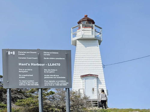
1957 (station established 1881). Active; focal plane 20 m (65 ft); white light, 3 s on, 3 s off. 9 m (30 ft) square pyramidal wood tower with lantern and gallery, painted white; lantern roof is red. The lantern is the 1881 original, but the keeper's house and other station buildings were all demolished in 1957. John Van Hal's photo is at right, Jürgen Schley has a 2018 photo, Trabas has Tom Chisholm's photo, Litehouseman has a good 2007 photo, a 2017 photo is available, Keung Leung has a 2022 photo, and Google has a distant satellite view. Located on a promontory on the east side of the entrance to Hant's Harbour, on the east side of Trinity Bay. Accessible by a short walk from town, and there is a picnic area adjacent to the lighthouse. Site open, tower closed. Site manager: Canadian Coast Guard. . ARLHS CAN-688; CCG N-470; Admiralty H0504; NGA 1728.
[Old Perlican (3)]
Date unknown (station established 1910). Active; focal plane 38.5 m (126 ft); white flash every 3 s. 7 m (23 ft) square skeletal tower carrying a daymark colored white with two red horizontal bands. The Town of Old Perlican has a photo and Bing has a satellite view. The original octagonal wood lighthouse survived at least to 1960; it was rpelaced by a round tower. Located on an island sheltering the harbor of Old Perlican, on the east side of Trinity Bay near the entrance. Accessible only by boat. Site status unknown. CCG N-471; Admiralty H0502; NGA 1732.
Baccalieu Island (1)
1859 (Robert Oke). Inactive since the early 1990s. 11 m (36 ft) round cylindrical brick tower, enclosed by iron plates since 1893, with lantern and gallery. The lighthouse has a weathered, rusty color. The lantern was prefabricated in Edinburgh, Scotland, by lighthouse engineers David and Thomas Stevenson. The keeper's house and other station buildings have all been demolished. A 2004 photo is available, and Bing has a satellite view. This historic lighthouse is critically endangered by its remote location and lack of maintenance. Located at the north end of Baccalieu Island off the tip of the Bay de Verde Peninsula. Accessible only by helicopter or boat in heavy seas. Site closed May through October (the island is an important bird nesting area); tower closed. Site manager: Baccalieu Island Ecological Reserve. ARLHS CAN-671.

Hant's Harbour Light, Hant's Harbour, August 2012
ex-Panoramio photo copyright John Van Hal; used by permission
Baccalieu Island (2)
Early 1990s. Active; focal plane 166 m (544 ft); white flash every 6 s. 13.5 m (45 ft) triangular cylindrical steel skeletal tower. Located next to the historic lighthouse. CCG N-472; Admiralty H0498; NGA 1736.
[Baccalieu Island Southwest Point (2)]
Date unknown (fog signal station established 1906, light tower added 1953). Active; focal plane 53 m (175 ft); white flash every 10 s. 3.5 m (12 ft) square cylindrical skeletal tower, wrapped with a daymark colored white with red bands at the top and bottom. Fog horn (4 s blast every 60 s). 1-story keeper's house and one utility building. Bing has a distant satellite view. Located at the southwest end of the island. Accessible only by helicopter or boat in heavy seas. Site closed May through October (the island is an important bird nesting area); tower closed. Site manager: Baccalieu Island Ecological Reserve. ARLHS CAN-672; CCG N-473; Admiralty H0500; NGA 1740.
* [Western Bay Head (2?)]
1968 (?) (lightstation established 1912, fog signal station 1901). Active; focal plane 29 m (95 ft); white light, 7.5 s on, 2.5 s off. 6.5 m (21 ft) skeletal tower carrying a daymark colored red with a white horizontal band. Mohammad Shahab has a 2022 photo, a 2021 street view is available, and Google has a satellite view. The lighthouse added to this fog signal station in 1911 was demolished in 1968. Accessible by the Western Bay Boardwalk, an 800 m (1/2 mi) walk from the village of Western Bay. Located on a sharp promontory on the east side of the peninsula about 40 km (25 mi) north of Harbour Grace. Accessible by a hiking trail. Site open, tower closed. CCG N-475; Admiralty H0494; NGA 1744.
[Carbonear Island (2?)]
Date unknown (station established 1878). Active; focal plane 54 m (177 ft); white flash every 6 s. 4.5 m (15 ft) skeletal tower carrying a daymark colored red with a white horizontal band. A 2014 photo is available but the small tower is inconspicuous in Google's satellite view. Margaret Ayad's 2010 photo shows foundation ruins from the original lighthouse, a square tower rising from a keeper's house. This lighthouse survived into the 1950s. Located on an island off the entrance to Carbonear, a town about 13 km (8 mi) north of Harbour Grace. Accessible by a hiking trail. Site open, tower closed. CCG N-477; Admiralty H0490; NGA 1752.
* [Point of Beach Sector]
Around 2000. Active; focal plane 14 m (46 ft); continuous light, red, white, green or alternating red/white or green/white, depending on direction. 6 m (20 ft) square cylindrical skeletal tower. Enuguu Macpa has a distant view but it's hard to see the small tower in Google's satellite view. This light replaced the Harbour Grace Harbour lighthouse (next entry). Located at the foot of Cochrane Street on the north side of Harbour Grace Harbour. Site open, tower closed. CCG N-481.1; Admiralty H0487; NGA 1768.
* Harbour Grace Harbour (2) (relocated)
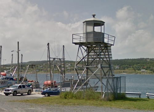
Date unknown (station established 1850). Inactive since about 2000. 6 m (20 ft) square skeletal tower with lantern and gallery, painted gray. The tower also has a slatted daymark, painted white. Google has a street view (a portion is seen at right) and a distant satellite view. The original lighthouse, built by Michael Kearny, was a hexagonal wood tower centered on a hexagonal 1-story cottage. A distant photo of that lighthouse is available. The light was on Point of Beach, at the entrance to the harbor. The second lighthouse was relocated to the south side of the harbor after being replaced by the Point of Beach Sector Light (previous entry). Site open, tower closed. ex-CCG N-481.

Harbour Grace Harbour Light, Harbour Grace, July 2013
Google Maps street view
[Harbour Grace Islands (3)]
Date unknown (station established 1837). Active; focal plane 41.5 m (136 ft); white flash every 4 s. 4.5 m (15 ft) skeletal tower carrying a daymark colored red with a white horizontal band. No photo available but Google has an indistinct satellite view. This is Newfoundland's third oldest light station. The original lighthouse was replaced by a square pyramidal stone tower in 1923. Located on an island off the entrance to Harbour Grace. Accessible only by boat. Site open, tower closed. CCG N-479; Admiralty H0484; NGA 1760.
Green Point (Bay Roberts)
1883. Active; focal plane 17 m (56 ft); white light, 2 s on, 8 s off. 9 m (30 ft) cylindrical cast iron tower with lantern and gallery, painted with red and white horizontal bands; lantern roof is white. The keeper's house was demolished in the 1930s. A 2019 photo is at right, Mike Warren has a 2022 photo, Trabas has Tom Chisholm's closeup, Lynette Stamp has a 2017 photo, Steve Huether has a street view, and Google has a distant satellite view. The lighthouse was granted National Heritage status in December 2017. In August 2019 the local heritage society finished repainting the lighthouse just in time to recieve ownership of the building. Located on a headland on the east side of Bay Roberts, on Conception Bay. Accessible by a rough road (4WD recommended) leading 2.5 km (1.5 mi) from Hibb's Cove. Site open, tower closed. Owner/site manager: Port de Grave Peninsula Heritage Society . ARLHS CAN-659; CCG N-486; Admiralty H0482; NGA 1784.
Brigus (North Head)
1885. Active; focal plane 34 m (113 ft); white flash every 3 s. 9 m (31 ft) cylindrical cast iron tower with lantern and gallery, painted with vertical red and white stripes. The keeper's house was demolished after the light was electrified in 1931. Lightphotos.net has a closeup photo, Simon Bonisteel has a photo, Gabriel Sindol has a 2019 photo, and Google has a distant satellite view. Located on North Head, at the entrance to Brigus Harbour on the southwest coast of Conception Bay. The lighthouse is 6 km (3.6 mi) from town. A hiking trail, described as "moderately challenging," provides access to the lighthouse. Site open, tower closed. Site manager: Canadian Coast Guard. . ARLHS CAN-832; CCG N-488; Admiralty H0478; NGA 1788.
[Salmon Cove Point (2?)]
Date unknown (station established 1908). Active; focal plane 26 m (85 ft); white flash every 5 s. 6.5 m (21 ft) skeletal tower carrying a daymark colored with red and white horizontal bands. No photo available but Bing has an indistinct satellite view. The original square wood lighthouse survived at least to the 1950s. Located on a sharp promontory on the south coast of Conception Bay, at the base of the Bay de Verde Peninsula. Site status unknown. CCG N-491; Admiralty H0475; NGA 1796.

Green Point Light, Bay Roberts, August 2019
photo posted to Facebook by PGP Heritage Society

St. John's Area (Northern Avalon Peninsula) Lighthouses
St. John's is the capital and largest city of Newfoundland and Labrador, with an urban population of more than 100,000 and a metropolitan population of more than 200,000. It has been an important fishing port since the mid 17th century.
** Bell Island (2)
1966 (station established 1940). Active; focal plane 53 m (173 ft); white light, 1 s on, 5 s off. 9 m (30 ft) square cylindrical wood tower with lantern and gallery, rising from one corner of a square 1-story wood fog signal building. Lighthouse painted white; lantern is gray metallic. Fog horn (blast every 30 s). 1-story keeper's house. Douglas Sprott's photo is at right, Kevin Stoyles has a closeup 2021 photo, Doug Mercer has a 2002 closeup photo, Litehouseman has an excellent 2007 photo, and Google has a street view and a satellite view. Rapid erosion of the cliff face at this station required replacement of the original lighthouse in 1966, and in 2004 both the lighthouse and the keeper's house were relocated 200 m (660 ft) inland to avoid continuing erosion. The 2007 photo shows that the lighthouse has been covered with new siding. In 2014 the keeper's house was renovated as a café and visitor center. Located at the northeast tip of Bell Island in Conception Bay. Accessible by a short gravel road (parking provided); the island is accessible by car ferry from Portugal Cove. Site open, keeper's house open daily during the summer season, tower closed. Owner: Canadian Coast Guard; site manager: Tourism Bell Island . ARLHS CAN-673; CCG N-493; Admiralty H0470; NGA 1836.
Cape St. Francis (2)
1957 (station established 1877). Active; focal plane 29 m (95 ft); white flash every 5 s. Lantern mounted on a concrete 1-story fog signal building. Building painted white with one broad red vertical stripe; lantern is gray metallic. In 1993 the keeper's house was removed in favor of a helipad. Trabas has Adam's photo, a photo and a 2007 closeup of the lantern are available, and Google has a satellite view. Located on the cape marking the southern entrance to Conception Bay. Accessible by hiking the 5.5 km (3.4 mi) Biscan Cove Path from Pouch Cove. Site open (the building is fenced), tower closed. Site manager: Canadian Coast Guard. ARLHS CAN-835; CCG N-499; Admiralty H0468; NGA 1844.
Bell Island Light
Bell Island Light, Bell Island, 2007
Flickr Creative Commons photo by Douglas Sprott
Chain Rock
1925. Active; focal plane 6 m (20 ft); red flash every 3 s. 4 m (13 ft) octagonal pyramidal stone tower, upper half painted red and lower half white, mounted on a pentagonal concrete pier. Trabas has Tom Chisholm's closeup photo, Paul Green has a 2011 photo, and Google has a street view and a satellite view. This tiny but historic light is located off Signal Hill in the narrow entrance to the harbor of St. John's. Accessible only by boat, but easily seen from shore on either side of the entrance. Site open, tower closed. CCG N-500; Admiralty H0460; NGA 1856.
* St. John's Harbour Range Front (3?)
Date unknown (station established 1902). Active; focal plane 28.5 m (90 ft); continuous green light. 27 m (89 ft) square skeletal tower, painted with red and white horizontal bands and carrying a rectangular slatted daymark painted white with a red vertical stripe. Trabas has Cameron's closeup photo and Google has a street view and a satellite view. The range guides vessels through the harbor entrance. The light was originally on a mast; later it was on the roof of a waterfront building. Located in Harbourside Park at 80 Water Street on the downtown St. John's waterfront. Site open, tower closed. CCG N-504; Admiralty H0459; NGA 1860.
* St. John's Harbour Range Rear (2?)
Date unknown (station established 1902). Active; focal plane 59 m (194 ft); continuous green light. Light mounted on a square former church tower above a daymark painted white with a red vertical stripe. Trabas has Cameron's closeup photo and Google has a street view and a satellite view. Built in 1892, the church building has been renovated as the Chapel Hill Condominiums. It is recognized as a Municipal Heritage Structure. Located at Chapel Street and Queens Road, 430 m (1/4 mi) west of the front light. Site open, tower closed. CCG N-505; Admiralty H0459.1; NGA 1864.
* Fort Amherst (3)
1951 (station established 1813). Active; focal plane 40 m (132 ft); white light, 1 s on, 14 s off. 8 m (25 ft) square pyramidal wood tower with lantern and gallery, painted white; lantern roof is red. Fog horn (blast every 20 s). 1-1/2 story and 1-story keeper's houses (1951) and 1-story fog signal building. A 2023 photo by Noah Tews is at right, Camus Duke has a 2021 photo, Mark Veitch has a closeup and a view of the station, Trabas has Cameron's closeup, Wikimedia has photos, Brian Carey has a closeup street view, and Google has a satellite view. This is Newfoundland's oldest active light station. The original light was on a stone tower inside the fort. Today only foundations remain of the fort and the 1852 lighthouse, seen in a postcard view posted by Huelse. The City of St. John's took ownership of the light station in 1995. The keeper's houses are leased from the city and available for overnight accommodations. The lighthouse was granted Heritage status in 2015. Located on the south side of the entrance to the harbor of St. John's, Newfoundland's capital city. Accessible by car at the end of Fort Amherst Road. Site open, tower closed. Owner/site manager: City of St. John's. . ARLHS CAN-683; CCG N-506; Admiralty H0458; NGA 1848.

Fort Amherst Light, St. John's, April 2023
Google Maps photo by Noah Tews
**** Cape Spear (1)
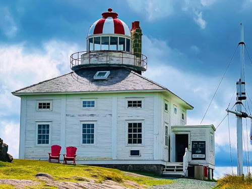
1836 (Nicholas Croke and William Parker). Inactive since 1955. 11 m (35 ft) octagonal stone tower with lantern and gallery, projecting from the center of a square keeper's house. House and tower painted white; lantern dome has vertical red and white stripes. Ming Li's photo appears at the top of this page, Edward Baldwin has a 2021 photo, an excellent 2006 photo is available, Wikimedia has photos, Huelse has a historic postcard view, Jon Tyler has a winter street view, and Google has a satellite view. This is Newfoundland's oldest standing lighthouse and second oldest light station. Parks Canada has restored the lighthouse to its 1839 appearance. After deactivation the Coast Guard proposed to demolish the lighthouse, but it was saved by a storm of public protests. Parks Canada began a five-year restoration in 1977 and the National Historic Site was dedicated by Prince Charles and Princess Diana in 1983. The lighthouse was repaired and repainted after suffering minor damage in Hurricane Leslie in September 2012. The lighthouse was granted Heritage status in 2015. The lighthouse was closed for the 2018-19 seasons for a restoration of the dome and other necessary repairs. Located southeast of St. John's at the end of NF 11 (Cape Spear Drive). Site open; visitor facilities and tower normally open daily mid May through mid October. Owner/site manager: Parks Canada (Cape Spear Lighthouse National Historic Site). . ARLHS CAN-748.
* Cape Spear (2)
1955. Active; focal plane 71 m (233 ft); three white flashes (separated by 3 s) every 15s. 11 m (35 ft) octagonal concrete tower with lantern and gallery, painted white. Fog horn (4 s blast every 60 s). 1-1/2 story keeper's house (1955) and several utility buildings. A Fresnel lens (1912), transferred from the older lighthouse, is in use. Ned Zimmerman has a nice sunrise photo, Trabas has Cameron's closeup, Karin Thomeier has a 2008 photo, Eric Bernier has a 2022 photo, Huelse has a historic postcard view, and Google has a street view and a satellite view. This is the easternmost lighthouse in North America, standing in longitude 52° 37.3' W. Located about 180 m (200 yd) northeast of the original lighthouse. Site open, this tower is closed. Site manager: Parks Canada (Cape Spear Lighthouse National Historic Site). ARLHS CAN-148; CCG N-507; Admiralty H0454; NGA 1868.

1955 Cape Spear Light, St. John's, August 2012
Wikimedia Creative Commons photo by Robthepiper

Cape Race Area (Southern Avalon Peninsula) Lighthouses
Cape Race is the southeastern tip of Newfoundland. Projecting far into the Atlantic, it is one of the most important headlands of North America. The name actually comes from the Portuguese word raso, "flat," because the surrounding land is flat. One of the earliest wireless (radio) stations, established on the cape in 1904, played a major role in spreading word of the sinking of the liner Titanic in 1912.
Bay Bulls (Bull Head)
1908. Active; focal plane 60 m (197 ft); white flash every 6 s. 11.5 m (38 ft) round cast iron tower with lantern and gallery, painted white. The keeper's house and other station buildings have all been demolished. Tony Mackenzie has a January 2019 photo, Trabas has Adam's photo, Litehouseman has a 2007 closeup, and Google has a satellite view. Located on the north side of the entrance to Bay Bulls Harbour. Accessible by a hike 5 km (3 mi) on the Spout Path from Bay Bulls, which is on NF 10 south of St. John's; the trail is part of the East Coast Trail. Site manager: Canadian Coast Guard. . ARLHS CAN-650; CCG N-508; Admiralty H0452; NGA 1872.
** Ferryland Head
1871. Active; focal plane 58 m (190 ft); white flash every 6 s. 14 m (46 ft) round cylindrical tower with lantern and gallery, originally brick but encased in iron since 1892. The original lighting apparatus is on display at the Ferryland Museum in town. Tower painted red, lantern white with a red roof. Geoff Smith's photo is at right, Wikimedia has several fine photos, Carol James has a 2022 closeup, Hal Miller has a 2007 photo, Huelse has a historic postcard view, Stephen Galbraith has a street view, and Google has a satellite view. The original 1-1/2 story keeper's house is now owned by a local development association, which has leased it as a café offering picnic lunches to visitors (lunches can be enjoyed inside the house when the weather is unsuitable for eating outside). The society has renovated the exterior of the house and the Coast Guard refurbished the tower in the mid 1990s. In August 2012 ownership of the station was transferred to the Town of Ferryland. Located on a headland at the end of a long peninsula extending east of Ferryland. The town is accessible via NF 10 from St. John's; the light station is accessible at the end of an easily walked 2.5 km (1.5 mi) trail. Lunch reservations are essential and need to be made well in advance. Site open, café open daily mid June through September, tower closed. Owner: Town of Ferryland . Site manager: Lighthouse Picnics . ARLHS CAN-656; CCG N-509; Admiralty H0450; NGA 1876.
Ferryland
Ferryland Head Light, Ferryland, 2007
contributed photo copyright Geoff Smith; used by permission
[Bear Cove Point (Fermeuse) (3)]
Around 2011 (station established 1914). Active; focal plane 33 m (108 ft); white flash every 5 s. 3 m (10 ft) square skeletal tower carrying a daymark with red and white horizontal bands. Fog horn (4 s blast every 60 s). 1-story wood keeper's house in poor condition. Fog horn (4 s blast every 60 s). Google has a satellite view. The original lighthouse had a lantern mounted on the keeper's house. The second lighthouse (1961?) was a 7 m (23 ft) pyramidal skeletal tower with lantern and gallery. John Clay found the lantern of the second lighthouse on the ground in Renews in 2015. Located on a headland about 10 km (6 mi) south of Ferryland and 7 km (4 mi) southeast of Fermeuse. Accessible only by a private gravel road from Renews, southeast of Fermeuse. Site and tower closed. ARLHS CAN-1326; CCG N-512; Admiralty H0448; NGA 1884.
** Cape Race (2)
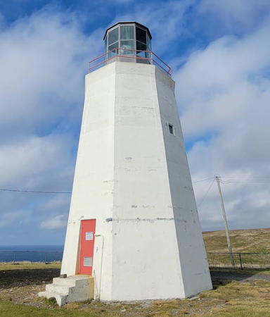
1907 (station established 1856). Active; focal plane 52 m (170 ft); white flash every 7.5 s. 29 m (96 ft) cylindrical concrete tower with lantern and gallery, painted white; lantern is red. The original Chance Brothers hyperradiant Fresnel lens (larger than 1st order) is still in use; one of fewer than a dozen ever built, the lens has a range of 24 miles. Fog horn (2 blasts every 60 s). Two keeper's houses and several utility buildings. A photo is at right, Douglas Sprott has a closeup photo, Robert Kruk has a 2022 photo, Trabas has Tom Chisholm's closeup, Litehouseman has a good 2006 photo, Wikimedia has photos, and Google has a street view and a satellite view. The original 1856 lighthouse was relocated, first to Cape North, Nova Scotia, and then in 1980 to Ottawa, where it is on display outside the Canada Science and Technology Museum. This light station, the first landfall for ships bound to Canada from Europe, has an importance in Canadian lighthouse history similar to the importance of Cape Hatteras Light in the U.S. When it was built it was the world's most powerful lighthouse at 1.5 million candlepower. The station played a key role in communications for decades and in 1912 it received the SOS call from the Titanic; the Myrick Wireless Interpretation Centre is a replica of the wireless station. Cape Race has been designated a national historic site but the park is undeveloped as yet. Cape Race Heritage, Inc., is working on restoration plans. The exterior of the tower, which had weathered badly, was restored in 1996-97. In 2004 the lighthouse was opened for tours. The lighthouse was granted Heritage status in 2015. In 2018 the lighthouse was closed to tours pending cleanup of a mercury spill inside the lantern. Located on the southeasternmost point of Newfoundland; accessible by a 20 km (12.5 mi) gravel road (4WD strongly recommended). (A contract to improve the road was awarded in 2017, but only 7 km (4 mi) will be paved and the rest will remain gravel.) Site open, tower closed. Site manager: Cape Race National Historic Site. . ARLHS CAN-118; CCG N-001; Admiralty H0444; NGA 1904.
Cape Race Light
Cape Race Light, Cape Race, November 2007
Wikimedia Creative Commons photo by JMPLTNP2012
* Powles Head (3)
1960 (station established 1902). Active (?); focal plane 31 m (101 ft); white light, 1 s on, 9 s off. 9 m (30 ft) square cylindrical tower with lantern and gallery, rising from one corner of a square 1-story fog signal building. Entire building painted white; lantern is red. Fog horn (blast every 30 s). 1-story keeper's house (1961), occupied by a keeper, and several utility buildings. Christian Yuan's 2022 photo is at right, Barry Krawchuk has a 2019 photo, a view of the station is available and Google has a satellite view. The light appears active in the 2019 photo but the Coast Guard lists a 2.4 m (8 ft) tower. Located on a headland at the eastern entrance to the harbor of Trepassy, west of Cape Race. Accessible by 5 km (3 mi) gravel road (walking or 4WD recommended). Site open, tower closed. Site manager: Canadian Coast Guard. . ARLHS CAN-698; CCG N-005; Admiralty H0442; NGA 1908.
* Cape Pine
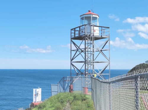
1851 (Alexander Gordon). Active; focal plane 96 m (314 ft); white flash every 5 s. 15 m (50 ft) old-style round cast iron tower, painted with red and white horizontal bands; lantern is white. Fog horn (blast every 60 s). Two 1-story keeper's houses (1950s), one occupied by a keeper, and several utility buildings. A photo is at the top of this page, Wayne Craik has a 2018 photo, Wayne Guzzwell has a 2019 closeup, and Google has a satellite view of the station. The original keeper's house was demolished in the 1950s when the modern housing was built. The lighthouse was painted in the spring of 2007; before and after photos are available. The lighthouse was designated a National Historic Site in 1974. Located on a prominent cape about 25 km (15 mi) southwest of Trepassy. Accessible by an 8 km (5 mi) gravel road (walking or 4WD recommended). Site open, tower closed. Site manager: Canadian Coast Guard. . ARLHS CAN-653; CCG N-006; Admiralty H0440; NGA 1920.
* La Haye Point (4)
1990s (station established 1883). Active; focal plane 19 m (62 ft); white flash every 6 s. 9.5 m (31 ft) square cylindrical skeletal tower with lantern and gallery. The lighthouse is unpainted gray metallic. Fog horn (3 s blast every 30 s). Google has a satellite view and a very distant street view. The original lighthouse, an 8.5 m (28 ft) cast iron tower, was demolished in 1963. Located at the end of Gulch Road on a point marking the south side of the entrance to St. Mary's Harbour, about 2.5 km (1.5 mi) west of the town of St. Mary's. Accessible by road. Site open, tower closed. ARLHS CAN-1445; CCG N-008; Admiralty H0436; NGA 1932.

Powles Head Light, Trepassys, October 2022
Google Maps photo by Christian Yuan

Placentia Area Lighthouses
Placentia is a historic fishing port on the west side of the Avalon Peninsula. In the 17th century it was for many years the capital of French Canada and in more recent years it was a center for cod fishing on the Grand Banks. Today it has about 3500 residents.
Cape St. Mary's
1860 (much modified). Active; focal plane 96 m (314 ft); white flash every 5 s. 17 m (55 ft) octagonal concrete tower with lantern and gallery, painted white. Fog horn (3 s blast every 30 s). Three 1-story keeper's houses (1959 and 1963) and utility buildings; one keeper's house is occupied by a resident attendant and the others provide housing for the surrounding ecological reserve. Charif Haidar's photo is at right, Ken Cheng has a 2019 photo, Stephanie Fraser has a 2021 closeup, and Google has a street view and a satellite view. This lighthouse began life as a round brick tower but the brick weathered rapidly. The tower was coated with cement in 1869 and then covered with iron in 1885. In the mid 1950s, the rusted iron was removed and the lighthouse was surrounded with the current octagonal concrete tower. The lighthouse was granted Heritage status in 2015. Located at the extreme point of the cape, south of St. Bride's, marking the southwestern tip of the Avalon Peninsula. Accessible by a single-lane paved road 13 km (8 mi) long. Site open, tower closed. Site manager: Cape St. Mary's Ecological Reserve. ARLHS CAN-721; CCG N-014; Admiralty H0432; NGA 1952.
Point Verde (5)
1990 (station established 1879). Active; focal plane 30 m (98 ft), white flash every 5 s. 11 m (37 ft) square cylindrical steel skeletal tower supporting an enclosed lantern; lantern painted white. Fog horn (4 s blast every 60 s). Ian Turton has another good photo, a closeup is available, Henri Gamache has a view from the beach, and Google has a satellite view. Anderson has Coast Guard photos of the first, second (1920), third (1930s), fourth (1975), and current lighthouses. The 1975 lighthouse was a 6 m (20 ft) fiberglass tower that had to be removed due to shoreline erosion. Located on the point at the southern entrance to Placentia Roads from Placentia Bay, about 3 km (2 mi) west of the city of Placentia. Site and tower closed. Site manager: Canadian Coast Guard. ARLHS CAN-807; CCG N-016; Admiralty H0422; NGA 1960.
* [Placentia Harbour Range Front (3?)]
Date unknown (station established 1913). Active; focal plane 6 m (20 ft); continuous red light. 4.5 m (15 ft) square skeletal tower carrying a daymark colored white with a red vertical stripe. Google has a street view and an indistinct satellite view. Another street view shows both range lights from the rear. The original lighthouse was a square pepperpot tower. Located on the beach beside Beach Road on the north side of Placentia. Site open, tower closed. CCG N-017; Admiralty H0424; NGA 1964.
* [Placentia Harbour Range Rear (2?)]
Date unknown (station established 1913). Active; focal plane 13 m (43 ft); continuous red light. 7 m (23 ft) square skeletal tower carrying a daymark colored white with a red vertical stripe. Google has a street view and an indistinct satellite view. The original lighthouse was a square pepperpot tower. Located beside Beach Road on the north side of Placentia. Site open, tower closed. CCG N-018; Admiralty H0424.1; NGA 1968.

Cape St. Mary's Light, St. Bride's, October 2022
Google Maps photo by Charif Haidar
* Argentia Harbour Range Rear
Date unknown. Active; focal plane 15.5 m (51 ft); continuous green light. 12.5 m (41 ft) square cylindrical skeletal tower carring a daymark colored red with a white vertical stripe. Google has a street view and a distant satellite view. This is the entrance range for Argentia Harbour. Located off Charter Avenue on the south side of the harbor. Site open, tower closed. CCG N-30; Admiralty H0410.1; NGA 2008.
* Come by Chance Harbour Range Front
1970s (?). Active; focal plane 30 m (98 ft); continuous white light. 20 m (66 ft) square skeletal tower carrying a slatted daymark painted red with a white vertical stripe. No photo available but Google has a distant satellite view. The range guides vessels approaching Come by Chance, at the northern head of Placentia Bay. The village is the site of Newfoundland's only oil refinery. Located on a low headland just north of the refinery. Accessible by road. Site open, tower closed. CCG N-039.41; Admiralty H0394.5; NGA 2024.
* Come by Chance Harbour Range Rear
1970s (?). Active; focal plane 61.5 m (202 ft); continuous white light. 20 m (66 ft) square skeletal tower carrying a slatted daymark painted red with a white vertical stripe. No photo available but Google has a distant satellite view. Located 484 m (0.3 mi) north of the front light. Site status unknown. CCG N-039.42; Admiralty H0394.51; NGA 2028.

Burin Peninsula East Coast Lighthouses
The boot-shaped Burin Peninsula extends to the southwest from the main island of Newfoundland west of the Avalon Peninsula, separating Fortune Bay on the west from Placentia Bay on the east. It is about 130 km (80 mi) long and between 15 and 30 km (9 to 19 mi) in width.

[Red Island (2?)]
Date unknown (station established 1930). Active; focal plane 16 m (52 ft); white flash every 3 s. 4.5 m (15 ft) square skeletal tower carrying a daymark colored white with a red vertical stripe. No photo available but Google has a distant satellite view. No remains of the original pepperpot tower can be seen. Located on a promontory sheltering the harbor of Red Island, in Placentia Bay northwest of Placentia. Accessible only by boat. Site status unknown. CCG N-049; Admiralty H0400; NGA 2056.
Marticot Island (3)
1990s (station established 1909). Active; focal plane 27 m (89 ft); white flash every 15 s. 9.5 m (31 ft) square cylindrical skeletal tower with lantern and gallery. The lighthouse is unpainted gray metallic. Fog horn (blast every 30 s). Sibling of La Haye Point. Etcheberry has a distant view from the sea and Google has a distant satellite view of the station. The original lighthouse was an octagonal wood tower attached to a keeper's house; it was demolished in 1961 and replaced by a lantern mounted on the fog signal building. The present light was in place by 1998. Located on an island off the west shore of Placentia Bay about 4 km (2.5 mi) southwest of Little Paradise. Accessible only by boat. Site status unknown. Site manager: Canadian Coast Guard. ARLHS CAN-694; CCG N-050; Admiralty H0386; NGA 2060.
* [Long Island (1) lantern]
1903. Lantern from the original Long Island lighthouse (see below). When the lighthouse was demolished in 2004 the lantern was saved and placed beside the Petit Forte road. Google has a street view and a satellite view. Located about 1.6 km (1 mi) north of the village of Peteit Forte. Site open, picnic tables and a nice view provided.
* Petit Forte (1 or 2) (?)
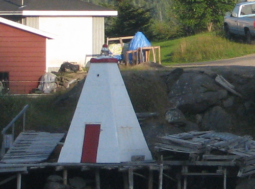
Date unknown (station established 1929). Inactive. Approx. 6 m (20 ft) square pyramidal tower, painted white with red trim. Lily Fox's photo is seen at right, and Google has a street view and an indistinct satellite view. We are much in need of information on the history of this little lighthouse, which has apparently been relocated to a wharf on the south side of the harbor of Petit Forte, across from the ferry dock. Site open, tower closed.

Mystery Light at Petit Forte, 2009
ex-Panoramio photo copyright Lily Fox; used by permission
#Long Island (1)
1903. Demolished after being deactivated in 2004. This was a 14 m (45 ft) round cylindrical cast iron tower, painted white. The active light (focal plane 72 m (237 ft); white light, 1 s on, 5 s off) was moved to a small skeletal tower; Anderson has a photo. Bing has a very distant satellite view. The lantern from the historic lighthouse was saved and relocated to Petit Forte (see above). Located on the south end of the island, on the west side of Placentia Bay. Accessible only by boat. Site open, tower closed. Site manager: Canadian Coast Guard. ARLHS CAN-692. Active light: CCG N-052; Admiralty H0380; NGA 2068.
* Tides Cove Point (3)
1993 (station established 1915). Active; focal plane 33.5 m (110 ft); white flash every 6 s. 9.5 m (31 ft) square skeletal tower with lantern and gallery. Fog horn (one 4 s blast every 60 s). David Bishop's photo is at right, Celine Alegre has a photo, David Bishop has a 2021 photo, and Google has a satellite view. This light is similar to the La Haye Point and Marticot Island lights. The original lighthouse had a lantern mounted at one corner of a 1-story wood fog signal building; this was replaced later with a lantern on a concrete fog signal building. Located 2.5 km (1.5 mi) northeast of Fox Cove on the east side of the Burin Peninsula. Site open, tower closed. Site manager: Canadian Coast Guard. ARLHS CAN-1341; CCG N-065; Admiralty H0372; NGA 2100.
[Dodding Head (Burin Island) (3)]
Date unknown (station established 1858). Active; focal plane 97.5 m (320 ft); white flash every 6 s. 4 m (13 ft) square skeletal tower carrying a daymark colored red with a white horizontal band. No photo available but Bing has an indistinct satellite view that shows the foundation ruins of the previous lighthouse. The original lighthouse was replaced by a small square pyramidal wood tower in 1926. Located at the eastern tip of Burin Island, on the north side of the entrance to Burin Harbour. Accessible only by boat. Site status unknown. CCG N-068; Admiralty H0368; NGA 2108.
 

Tides Cove Point Light, Fox Cove, July 2021
Google Maps photo by David Bishop
 
#Little Burin Island (2)
1950s (station established 1915). Inactive since 1977 and demolished in recent years. The white octagonal lantern was mounted on the roof of the former fog signal building. The light was abandoned after being damaged in a storm in 1977. The active light (focal plane 26 m (85 ft); white light, 2 s on, 8 s off) is on a 6 m (20 ft) aluminum skeletal tower. Fog horn (blast every 30 s). The dilapidated 2-story keeper's house was demolished in 2014. Google has a satellite view of the station. Located on the east side of the island, near the entrance to Burin Harbour. Accessible only by boat. Site open, tower closed. Site manager: Canadian Coast Guard. ARLHS CAN-691; CCG N-071; Admiralty H0364.1; NGA 2120.
[Corbin (2?)] (?)
Date unknown (station established 1927). Inactive and possibly removed. 5 m (17 ft) square skeletal tower carrying a daymark colored red with a white horizontal band. No photo available but Google has a distant satellite view. The original lighthouse was a square pepperpot tower; foundation ruins of the keeper's house apparently survive. Located on Long Point, a promontory sheltering the harbor of Corbib. Site status unknown. Site manager: Canadian Coast Guard. ex-CCG N-072; ex-Admiralty H0362; NGA 2124.

Burin Peninsula South Coast Lighthouses
* Middle Head (St. Lawrence Point) (3)
Date unknown (fog signal station established 1912, light added 1915). Active; focal plane 27 m (89 ft); white flash every 15 s. 9.5 m (31 ft) square cylindrical skeletal tower with lantern and gallery. The lighthouse is unpainted gray metallic. Fog horn (3 s blast every 30 s). Google has a satellite view. This light is similar to the La Haye Point and Marticot Island lights. Located on the promontory separating Great and Little St. Lawrence Harbours, about 8 km (5 mi) southeast of St. Lawrence. Site open, tower closed. Site manager: Canadian Coast Guard. ARLHS CAN-843; CCG N-073; Admiralty H0360; NGA 2128.
* Allan's Island (Lamaline) (5)
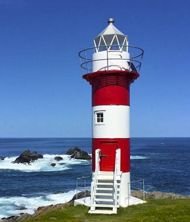
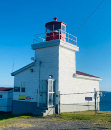
Around 2004 (station established 1880). Active; focal plane 19.5 m (64 ft); white flash every 4 s. 11 m (36 ft) square tower with lantern and gallery. Lighthouse white with red trim; lantern is gray metallic. Fog horn (one 3 s blast every 30 s). A 2017 photo is available, Etcheberry has a photo, and Google has a satellite view. The original lighthouse, a wood pepperpot tower, was replaced in 1920 by a round cast iron tower. In 1927 wood range lighthouses were installed and a square pyramidal tower was built in 1953. The current light is a twin of the Fortune Head Light shown at right. Located at the southeastern tip of Allan's Island, which shelters the harbor of Lamaline. Accessible by a road that crosses a causeway to the island. Site open, tower closed. ARLHS CAN-670; CCG N-076; Admiralty H0350; NGA 2140.
Allan's Island Light
Fortune Head Light, Fortune, August 2009
Flickr Creative Commons photo by Stephen Anthony

Burin Peninsula West Coast Lighthouses
[Green Island (Fortune Bay) (4)]
1993 (station established 1908). Active; focal plane 45 m (149 ft); white flash every 10 s. 6 m (20 ft) square cylindrical aluminum skeletal tower carrying a daymark colored red with a white horizontal band. Fog horn (4 s blast every 60 s). 1-story keeper's house and three utility buildings. The Coast Guard has a Facebook video with a view of the station and Google has a satellite view. The original cast iron lighthouse was replaced by a skeletal tower in 1955. This is a staffed Coast Guard station. This Green Island is in Fortune Bay, halfway between the Burin Peninsula and the French island of St. Pierre. There is another Green Island Light at Catalina (see above). Located on the summit of the island. Accessible only by boat. Site open, tower closed. Site manager: Canadian Coast Guard. ARLHS CAN-658; CCG N-100; Admiralty H0348; NGA 2156.
* Fortune Head (3)
Date unknown (around 2002?) (station established 1911). Active; focal plane 24 m (79 ft); white flash every 5 s. 9 m (30 ft) square pyramidal tower with lantern and gallery. Lighthouse painted white with red trim; the octagonal lantern is unpainted gray metallic. Fog horn (3 s blast every 30 s). Stephen Anthony's photo is above right, Litehouseman has a photo, Etcheberry has a photo, Jacqueline Jefferies has a 2021 view, and Bing has a satellite view. This is a staffed station which also serves as the visitor center for the Fortune Head Ecological Reserve. Trails exploring the reserve begin at the light station parking lot. Located on a promontory about 1.6 km (1 mi) west of Fortune. Site open, tower closed. Site manager: Canadian Coast Guard. . ARLHS CAN-1284; CCG N-102; Admiralty H0325; NGA 2228.
* Grand Bank (East Pier) (2)
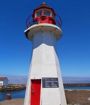
1922 (station established 1890). Active; focal plane 8 m (27 ft); white flash every 4 s.7 m (23 ft) octagonal concrete tower with lantern and gallery, painted white; lantern is red. Rajpreet Gill is a 2021 closeup, Litehouseman has an excellent closeup, Stephen Anthony has a 2009 view from the sea, Lighthouse Digest also has a photo, and Google has a satellite view. Anderson has a 1919 photo of the original lighthouse and a 1920 photo showing that the siding was removed in that year. The name of the town is written on the tower in red letters. In 2014 ownership of the lighthouse was being transferred, presumably to the town. Located at the end of the south breakwater in Grand Bank, a town on the west side of the Burin Peninsula. Site and tower closed, but there are good views from the waterfront. Site manager: Town of Grand Bank. ARLHS CAN-686; CCG N-106; Admiralty H0322; NGA 2248.
* Garnish
1885. Inactive since 1991. 6 m (20 ft) square pyramidal wood tower with lantern and gallery, painted white with red trim. Active light (focal plane 8 m (28 ft); red flash every 3 s) on a 3.5 m (12 ft) square skeletal tower. Douglas Sprott's photo is at right and Google has a street view and a satellite view. Located on the quay at Garnish, a village on the northwestern shore of the Burin Peninsula. Site open, tower closed. Site manager: Garnish Heritage Society. ARLHS CAN-685. Active light: CCG N-112; Admiralty H0318; NGA 2264.
Garnish Light
Garnish Light, Garnish, circa 2007
Flickr Creative Commons photo by Douglas Sprott

Information available on lost lighthouses:

Notable faux lighthouses:

Adjoining pages: North: Northern Newfoundland | Southwest: St.-Pierre and Miquelon | Northwest: Southeastern Newfoundland

Return to the Lighthouse Directory index

Posted December 2002. Checked and revised July 3, 2023. Lighthouses: 45. Site copyright 2023 Russ Rowlett and the University of North Carolina at Chapel Hill.