Lighthouses of Canada: Cape Breton Island, Nova Scotia

The nation of Canada was created by the British North America Act in 1867 with Ontario, Québec, New Brunswick, and Nova Scotia as the four original provinces. Nova Scotia is the province at the extreme southeastern corner of Canada. The southern and eastern parts of the province lie on a peninsula facing the Atlantic to the east and the Bay of Fundy to the west. To the north the peninsula is joined to the rest of Canada by an isthmus that separates the Bay of Fundy on the south from Northumberland Strait and the Gulf of St. Lawrence on the north. Cape Breton Island lies to the northeast, separated from the main part of the province by the narrow Strait of Canso. The island faces Northumberland Strait on the southwest, the Gulf of St. Lawrence to the northwest, Cabot Strait to the north, the open Atlantic Ocean to the east, and the Strait of Canso and Chedabucto Bay to the south.

Cape Breton Island is nearly divided north to south by the intricate waterways of the Bras d'Or Lake, actually a small, brackish inland sea. At the south the St. Peters Canal joins Bras d'Or Lake to the Atlantic, completing the separation of the island.

In the 17th century Nova Scotia was called Acadia as a part of New France, the French empire in North America. Britain conquered Acadia in 1710 during Queen Anne's War and established the Nova Scotia colony in the peninsula. Cape Breton Island continued as a French colony until it was also conquered by Britain in 1758 during the Seven Years War (1756-63).

Cape Breton Island is divided into four county-level units: the county municipalities of Inverness, Victoria, and Richmond and the Cape Breton Island Regional Municipality.

Aids to navigation in Canada are maintained by the Canadian Coast Guard. In 2008, Parliament passed the Heritage Lighthouse Protection Act to designate and protect historic lighthouses.

CCG numbers are from the Atlantic Coast volume of the List of Lights, Buoys, and Fog Signals of Fisheries and Oceans Canada. ARLHS numbers are from the ARLHS World List of Lights. Admiralty numbers are from Volume H of the Admiralty List of Lights & Fog Signals. U.S. NGA numbers are from Publication 110.

General Sources
Nova Scotia Lighthouse Preservation Society
This outstanding web site has a wealth of photos, information, and news.
Nova Scotia Canada Lighthouses
Excellent photos plus historical and visitor information from Kraig Anderson's LighthouseFriends.com web site.
Nova Scotia
Lighthouse photos from visits by C.W. Bash in 2008.
Lighthouses in Nova Scotia
Photos available from Wikimedia; included is a large collection of photos by Dennis Jarvis (several appear on this page).
Leuchttürme an der kanadischen Ostküste
Photos of Nova Scotia lighthouses taken in 2004 by Bernd Claußen.
World of Lighthouses - Canada Atlantic Coast
Photos by various photographers available from Lightphotos.net.
Online List of Lights - Canada
Photos by various photographers posted by Alexander Trabas.
Lighthouses in Nova Scotia, Canada
Aerial photos posted by Marinas.com.
Leuchttürme Kanadas auf historischen Postkarten
Historic postcard views posted by Klaus Huelse.
List of Lights, Buoys, and Fog Signals
Official light lists from the Canadian Coast Guard.
GPSNauticalCharts
Navigational chart information for Cape Breton Island.
Navionics Charts
Navigation chart for the island.


Louisbourg Light, Louisbourg, August 2022
Instagram photo by Roy Tanaka

Caveau Point Range Rear
Light, Mabou Harbour, June 2022
Google Maps photo by Alain Quevillon
Inverness County Lighthouses

Great Bras d'Or Lake Lighthouse
Cameron Island
1903 (relocated here in 1977). Active; focal plane 9 m (30 ft); green flash every 4 s. 8.5 m (28 ft) square wood tower, painted white. Lantern removed in 1977. Darin Guthro has a 2016 photo and Google has a satellite view. Originally the front light of the Clarke Cove Range, the lighthouse guides vessels through a narrow passage between Cameron Island and George Island to the village of Marble Mountain. Cameron is a small island in West Bay, the southwestern corner of Bras d'Or Lake. Located at the northeast end of the island. Accessible only by boat. Site status unknown. Owner/site manager: Canadian Coast Guard. ARLHS CAN-069; CCG A-838; Admiralty H0832; NGA 9057.

West Coast (Gulf of St. Lawrence) Lighthouses
Henry Island
1902 (Joseph MacDonald). Active; focal plane 61 m (200 ft); white flash every 4 s. 16 m (53 ft) octagonal pyramidal wood tower with lantern and gallery. The eight vertical faces are painted alternately red and white; the lantern is painted red. The original 1-1/2 story wood keeper's house, recently restored, is used as a private summer residence. Darin Guthro's photo is at right, the NSLPS page has a photo, Marinas.com has aerial photos, and Bing has a satellite view. In 2015 the preservation society won $20,000 in the National Trust Lighthouse Matters competition. Located on the west side of the island facing St. George's Bay. Site and tower generally closed (the island is privately owned), but tours to the island and lighthouse are available during the summer. Accessible only by boat. Site and tower closed. Site manager: private. ARLHS CAN-227; CCG A-881; Admiralty H1222; NGA 8720.
*** Mabou Harbour (2)
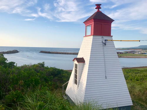
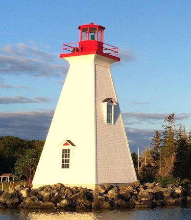
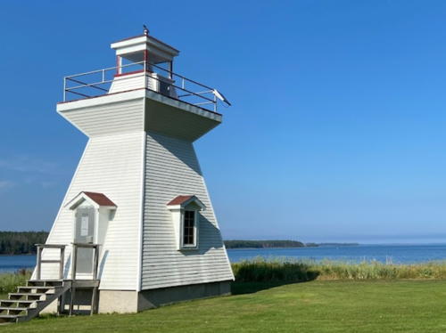
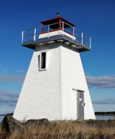
1908 (station established 1884). Active; focal plane 14 m (46 ft); continuous green light. 14 m (47 ft) square pyramidal wood tower with lantern and gallery, painted white; lantern is red. Jarvis has a photo, Bash has a photo, Trabas has Klaus Potschien's photo, Glen Smith has a 2021 photo, Marinas.com has aerial photos, and Google has a satellite view and a distant street view. Originally built as the rear light of a range; the front light was discontinued in 1987. Since 1998 the lighthouse serves as the Mabou Harbour Museum and Tourist Centre. The Coast Guard proposed to extinguish the light in 2001 but they were dissuaded by local protests. Located on the waterfront at Mabou Harbour. Site and tower open. Owner: Canadian Coast Guard. Site manager: Mabou Harbour Authority. . ARLHS CAN-291; CCG A-876; Admiralty H1216.1; NGA 8748.
Margaree Island (Sea Wolf Island) (2)
1958 (station established 1854). Active; focal plane 91 m (298 ft); white flash every 4 s. 8 m (27 ft) octagonal concrete tower with lantern and gallery, painted white; lantern painted red. The NSLPS page has a photo, Patrick Michael has a photo, Marinas.com has aerial photos, and Google has a distant satellite view. The island, 4 km (2.5 mi) offshore in the Gulf of St. Lawrence, is mostly ringed by sheer cliffs. Located at the highest point of the island. Accessible only by helicopter; there are no safe areas for landing a boat. Site and tower closed. Owner: Canadian Coast Guard. Site manager: Environment and Climate Change Canada (Sea Wolf Island National Wildlife Area). ARLHS CAN-305; CCG A-874; Admiralty H1208; NGA 8760.

Henry Island Light, Henry Island, August 2017
Google Maps photo by Darin Guthro
* Margaree Harbour Range Front
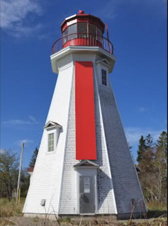
1900. Active; focal plane 15 m (49 ft); continuous yellow light. 4.5 m (15 ft) square pyramidal wood tower with lantern, painted white with a red vertical stripe on the range line. A 2020 photo is at right, Jarvis' has a 2011 photo of both range lights , Bash has a 2008 photo, Trabas has Klaus Potschien's photo, Marinas.com has aerial photos, and Google has a distant satellite view of both range lights. The Margaree Harbour Heritage Lighthouses Group works for the preservation of the two range lighthouses. In October 2017 DFO removed lead-contaminated soil from around the lighthouses, a necessary step before the lights can be transferred to the Lighthouses Group. In 2018 the Coast Guard worked to restore and repaint both lighthouses. The rotten shingles were removed and towers clad in plywood; the Lighthouses Group plans to install historically accurate shingles over the plywood after ownership is transferred. The two lighthouses received designation as Heritage Lighthouses in May 2019. Located off Margaree Harbour Shore Road. Site status uncertain, but the lighthouses can be seen from nearby. Tower closed. Owner/site manager: Canadian Coast Guard. ARLHS CAN-607; CCG A-872; Admiralty H1202; NGA 8764.
* Margaree Harbour Range Rear
1900. Active; focal plane 21 m (68 ft); continuous yellow light. 6 m (20 ft) square pyramidal wood tower with lantern, painted white with a red vertical stripe on the range line. The prervation group has a good photo, Jarvis has a photo of both range lights Bash has a 2008 photo, Trabas also has Bash's photo, Marinas.com has aerial photos, and Google has a distant satellite view of both range lights. The Margaree Harbour Heritage Lighthouses Group works for the preservation of the two range lighthouses. Located off Margaree Harbour Shore Road. Site status uncertain, but the lighthouses can be seen from nearby. Tower closed. Owner/site manager: Canadian Coast Guard. ARLHS CAN-304; CCG A-873; Admiralty H1202.1; NGA 8768.

Range Front Light, Margaree Harbour, September 2020
Save the Margaree Harbour Lighthouses photo
* Enragée Point (Cape Enragée, Chéticamp) (2)
1957 (station established 1937). Active; focal plane 22.5 m (74 ft); three white flashes, separated by 4 s, every 24 s. 13 m (42 ft) octagonal concrete tower with lantern and gallery, painted white; lantern painted red. Fog horn (3 s blast every 30 s). 1-1/2 story keeper's house and several utility buildings. A 2023 photo by Cheryl Judkins is at right, Jarvis has a photo, Trabas has Klaus Potschien's photo, Bash has a photo, Kevin Pollock has a good photo, Jean Boileau has a 2021 closeup, Marinas.com has aerial photos, Rene Babin has a street view, and Google has a satellite view. The original lighthouse was destroyed by fire in October 1956. The lighthouse received designation as a Heritage Lighthouse in August 2019. Note: There is also a Cape Enragé lighthouse in southern New Brunswick. Located on the northwest point of Chéticamp Island, which is connected to the mainland south of Chéticamp by a narrow bar. Accessible by a short hike across the island. Site open, tower closed. Owner/site manager: Canadian Coast Guard. . ARLHS CAN-170; CCG A-867; Admiralty H1188; NGA 8800.
* Chéticamp Harbour Range Front (2)
1894 (station established 1890). Inactive since 1986. 7 m (23 ft) square pyramidal wood tower with lantern. The lighthouse was originally painted white with red trim, and the lantern was painted red. P. Kramer has a 2003 photo showing this pattern. In 2005 the lighthouse was repainted in with red, white, and blue horizontal bands, as seen in a 2005 photo by Mark Luukkonen. Bash's 2008 photo shows another repainting, white with a blue lantern and a red lantern roof. Nathalie D'Auteuil's 2018 photo and Google's November 2022 street view shows the red, white and blue pattern again. Google also has a fuzzy satellite view. The lighthouse was relocated in 1914 and again in 1950 due to changes in the channel alignment. It was replaced until 2014 by a sector light (next entry). Located just off the waterfront in the center of Chéticamp. Site and tower open. Owner/site manager: Village of Chéticamp. . ARLHS CAN-135.
* [Chéticamp Harbour Sector]
1986. Inactive since 2014. 7.5 m (25 ft) round fiberglass tower colored white with a red band at the top. Anderson has a 2012 photo; Google has a 2022 street view but the small tower is hard to see in Google's distant satellite view. Located at the Quai Matthieu parking area on the waterfront street about 335 m (0.21 mi) southwest of the historic lighthouse. Site and tower open. Owner/site manager: Village of Chéticamp. ex-Admiralty H1189; NGA 8798.

Enragée Point Light, Chéticamp, May 2023
Google Maps photo by Cheryl Judkins
*[Caveau Point Range Front (3)]
1976(?) (station established 1897). Active; focal plane 17 m (56 ft); continuous red light. 6.5 m (21 ft) triangular skeletal mast carrying a long daymark painted white with a red vertical stripe. Bash has a photo, Trabas also has Bash's photo, and Google has a street view and a satellite view. This is an approach range for Chéticamp, guiding vessels between the north end of Chéticamp Island and the Caveau Shoal. Located on a promontory about 800 m (1/2 mi) north of Chéticamp. Site and tower closed (private property). Owner: Canadian Coast Guard. Site manager: private. Owner/site manager: Canadian Coast Guard. ARLHS CAN-1314; CCG A-862; Admiralty H1182; NGA 8804.
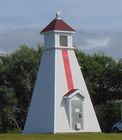
* Caveau Point Range Rear (3)
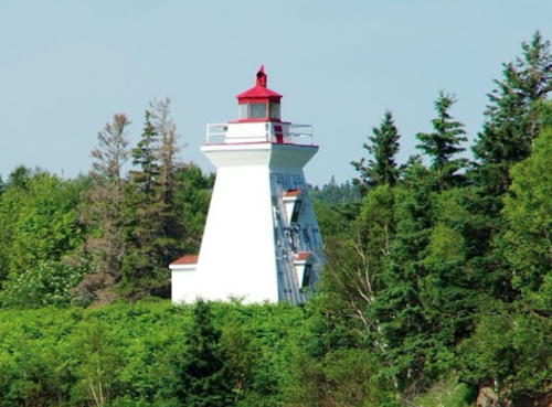
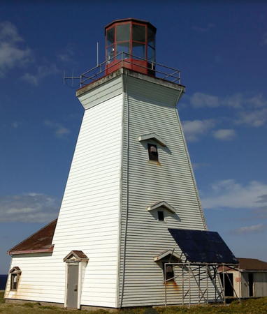
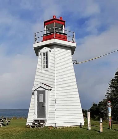
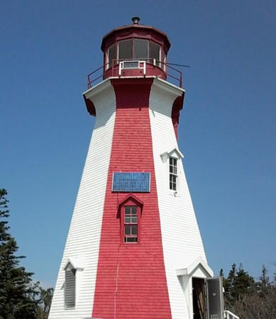
Around 1990 (station established 1897). Active; focal plane 31 m (103 ft); continuous red light. 8 m (27 ft) square pyramidal wood tower, painted white with a red vertical stripe on the range line; the lantern roof is also red. A photo by Alain Quevillon is at the top of this page, Bash has a 2008 photo, Trabas has Klaus Potschien's photo, Marinas.com has aerial photos misidentified as "Chéticamp Harbour Light," and Google has a 2022 street view and a satellite view. Jarvis's 2011 photo shows the lighthouse freshly repainted. In 1976 both the front range light and the rear light were moved to skeletal towers and the original lighthouses were demolished. Located on the north side of Chéticamp; visible from the Cabot Trail (highway 19). Site and tower closed (private property) but the lighthouse can be seen from the road. Owner: Canadian Coast Guard. Site manager: private. ARLHS CAN-123; CCG A-863; Admiralty H1182.1; NGA 8808.
[Cape St. Lawrence (Phantom Point) (3)]
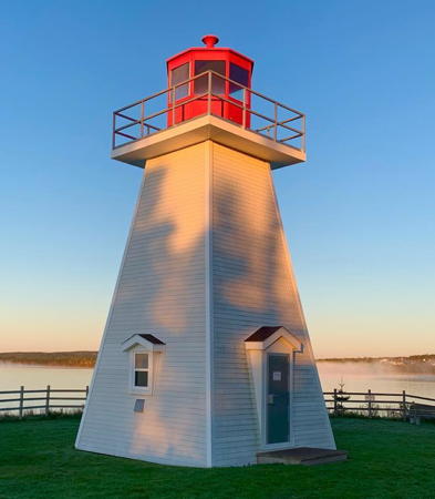
Date unknown (station established 1889). Active; focal plane 27 m (89 ft); white light, 2 s on, 10 s off. 6.5 m (22 ft) square cylindrical skeletal tower carrying a daymark colored red with a broad white horizontal band. Foundation ruins of the second (1952) lighthouse are behind the present tower. Hubert Trapp has a 2022 photo, Hermann Käser has a 2021 street view, and Bing has a satellite view. Located at the northwestern tip of Cape Breton Island, about 20 km (13 mi) west of Cape North. Site open, tower closed. ARLHS CAN-1368; CCG A-860; Admiralty H0874; NGA 8832.

Victoria County Lighthouses

St. Paul Island Lighthouses
St. Paul Island is in Cabot Strait about 25 km (15 mi) northeast of Cape North and about 70 km (45 mi) southwest of Cape Race, Newfoundland. It is not inhabited and landing requires special permission from the Coast Guard.

[St. Paul Island South Point (St. Paul Island Southwest (3) (?)]
1964 (station established 1831). Inactive since 2015 and probably removed. 6 m (20 ft) cylindrical steel tower, painted white with a single red band at the top; no lantern. The 2-story wood hip-roofed keeper's house (1912) has collapsed. Wikimedia has a photo and Google has a satellite view of the station. The original wood lighthouse at this station burned in 1916. It was replaced by a cylindrical steel lighthouse, which was relocated first to the Coast Guard station in Dartmouth and more recently to Dingwall (see below). Lighthouse Digest has Duane Traver's excellent article on the history of the island and light station. Located at the southwestern tip of the island. Owner/site manager: Canadian Coast Guard. ARLHS STP-001; ex-CCG A-1477; ex-Admiralty H0876; ex-NGA 8852.
St. Paul Island North Point (2)
1962 (station established 1839). Inactive since 2015. 14 m (46 ft) octagonal concrete tower, with lantern and gallery, painted white; lantern is red. The NSLPS page has a photo, Lighthouse Digest has Duane Traver's excellent article on the history of the island and light station, and Google has a satellite view. Clearly endangered. This historic light station guards the southern entrance to the Gulf of St. Lawrence from the Atlantic. Located on a rocky islet just off the northeastern end of the island. Site and tower closed. Owner/site manager: Canadian Coast Guard. ARLHS STP-002; ex-CCG A-1476; ex-Admiralty H0878; ex-NGA 8856.

Cape North Area Lighthouses
Cape North (4)
2010 (station established 1876). Active; focal plane 34 m (112 ft); white light, 2 s on, 6 s off. 14.5 m (48 ft) square skeletal tower; the tower carries a slatted daymark colored with red and white horizontal bands. Fog horn (6 s blast every 60 s). A 2014 street view is available, Andrew Ferguson has a 2020 photo, and Google has a satellite view of the station. This light replaced the third (1980) lighthouse, a square pyramidal tower attached to a 1-story service building. Marinas.com has good aerial photos of the former light, and Anderson has a photo of the former lighthouse toppled during the replacement. The second lighthouse here (1907-1980) was the 1856 cast iron tower relocated from Cape Race, Newfoundland; this lighthouse was relocated a second time in 1980 and is now on display at the Canada Science and Technology Museum in Ottawa, Ontario. This light marks the northern extremity of Cape Breton Island but it is actually located on Money Point, 1.6 km (1 mi) south southeast of the point of the cape. The light station is accessible by 4WD from the Cabot Trail spur at Bay St. Lawrence, but the last few miles require hiking down a steep and rough trail. Site and tower closed. Owner/site manager: Canadian Coast Guard. ARLHS CAN-103; CCG A-854; Admiralty H0872; NGA 8848.
* St. Paul Island South Point (St. Paul Island Southwest) (2) (relocated to Dingwall)
1916. Inactive since 1964. 9 m (30 ft) cylindrical steel tower, painted white, with a lantern painted red. The abandoned tower was relocated in 1981 to the dockside parking lot of the Coast Guard station in Dartmouth. The original lantern had deteriorated beyond the possibility of salvage, so a replica was built to house the original 4th order Fresnel lens. The St. Paul Island Historical Society asked to move this lighthouse to a museum at Dingwall, the Cape Breton Island town closest to St. Paul Island. In October 2010 officials announced agreement on making the move. The lighthouse was disassembled and transported by flatbed truck to Dingwall, where it was reassembled in the summer of 2011. Katie Fougere's 2023 photo is at right, Jarvis has a 2011 photo, Renate Bongertman has a 2016 photo, Matthew Gardiner has a photo, and Google has a satellite view. Located adjacent to the St. Paul Island Museum, on the south side of Dingwall Harbour in Dingwall, about 20 km (13 mi) south of Cape North. Site open, tower closed. Owner/site manager: St. Paul Island Lighthouse .

St. Paul Island South Point Light, Dingwall, July 2023
Instagram photo by Katie Fougere
*** Neil's Harbour
1899. Active; focal plane 18 m (59 ft); continuous white light. 13 m (43 ft) square pyramidal wood tower, painted white; lantern is red. Jane Scott's 2022 photo is at right, Angelo DeVita has a 2019 closeup photo, Bash has a 2008 photo, Trabas has a photo, Wikimedia has a 2010 photo, and Google has a street view and a satellite view. Located at the end of Lighthouse Road in Neil's Harbour. Since 1998 the local fire department has operated an ice cream shop in the lighthouse during the summer months. The Neil’s Harbour New Haven Development Association is working for the preservation of this lighthouse. In 2015 the association won $10,000 in the National Trust Lighthouse Matters competition. Site open, tower closed. Owner: Canadian Coast Guard. Site manager: Neil's Harbour Fire Department. . ARLHS CAN-339; CCG A-851; Admiralty H0866; NGA 8880.
Ingonish Island (2)
1954 (station established 1871). Inactive since 1987. Square 1-story wood building; the lantern, formerly centered on the roof, has been removed. 1-1/2 story keeper's house in very poor condition. A view from the sea is available and Google has a satellite view showing the keeper's house; the lighthouse building is 20 m to the north. Gravely endangered. The original lighthouse, a 1-1/2 story keeper's house with a square light tower rising "church"-style at one end, was demolished in 1954. The light station property was transferred to Parks Canada in 1974 but nothing has been done to preserve the structures. Located on an island 800 m (1/2 mi) off Ingonish. Accessible only by boat. Site open, tower closed. Owner/site manager: Parks Canada (Cape Breton Highlands National Park). ARLHS CAN-1221.
[Ingonish Harbour (South Ingonish Harbour) (2?)]
Date unknown (station established 1912). Active; focal plane 7 m (23 ft); whote light, 2 s on, 2 s off. 5 m (17 ft) square cylindrical skeletal tower formerly carrying a daymark colored red with a broad white horizontal band. Bash has a photo, Trabas has a photo, and Bing has a satellite view. The original Ingonish Harbour light station was on the south side of the entrance, but the modern light is on the north side. It was replaced in 1956 with a skeletal tower having an enclosed lower section. In 1983 the historic lighthouse was overturned and destroyed by a storm surge. The original light on the north side of the entrance was described as a mast with a shed at the base. South Ingonish Harbour is entered through a narrow break in a barrier beach. Site open, tower closed. Owner/site manager: Canadian Coast Guard. CCG A-847; Admiralty H0858.


Neil's Harbour Light, Neil's Harbour, December 2022
Instagram photo by Jane Scott


St. Ann's Bay Lighthouses
Munroe Point
1906. Inactive since the early 1960s. 9.5 m (32 ft) square pyramidal wood tower, painted white with red trim. The lantern has been replaced with a square wood room having ordinary windows. Anderson has a page for the lighthouse, Wikimedia has a closeup 2020 photo by Dennis Jarvis, a view from the sea is available, and Google has a satellite view. This lighthouse had been available for summer rental by the week but in 2008 its web page was withdrawn. After the lighthouse was sold in 2018 the new owners made it available for vacation rental through Airbnb. Located on a promontory on the west side of St. Ann's Bay. Site and tower oprn only to renters. Owner/site manager: private. ARLHS CAN-1307.
#Ciboux Island (4)
1980 (station established 1863). Inactive since 2017 and later removed. This was a 9 m (30 ft) fiberglass tower, painted white with two horizontal red bands. NSLPS has a distant view by Kathy Brown and Google has a satellite view. Nova Scotia Archives has a 1937 photo of the original lighthouse, an octagonal wood tower with lantern and gallery. The second (1939) lighthouse was replaced by a skeletal tower in 1971. It appears that the 1980 light tower stood inside the foundation ruins of the 1939 lighthouse. Located at the northern end of the island, in St. Ann's Bay off the Bras d'Or entrances. Accessible only by boat. Site open, tower closed. Owner/site manager: Canadian Coast Guard. ARLHS CAN-139; ex-CCG A-844; ex-Admiralty H0856; ex-NGA 8904.

Bras d'Or Lake West Side Lighthouses
* Kidston Island (Baddeck) (2)
1911 (station established 1875). Active; focal plane 13.5 m (44 ft); green light, 2 s on, 10 s off. 14.5 m (47 ft) square pyramidal wood tower with lantern and gallery, painted white with red trim; lantern is red. A 2022 photo is at right, Bash has a 2008 photo, Trabas has Klaus Potschien's photo, there's another good 2008 photo, Bill Orme has a 2019 closeup, Peter Graham has a view from the lake, Marinas.com has aerial photos, Huelse has a historic postcard view, and Google has a street view and a satellite view. Ownership of the lighthouse was transferred to the town of Baddeck in 2005. The town carried out a restoration of the lighthouse in 2013-14. The original lighthouse, a similar but shorter tower, was not demolished until 1959. Located on the eastern end of the island at the entrance to Baddeck Harbour, St. Patrick's Channel. Accessible only by boat, but visible from the Baddeck waterfront. The local Lions Club operates a free ferry service to the island in July and August. Site open, tower closed. Owner/site manager: Victoria County. . ARLHS CAN-261; CCG A-815; Admiralty H0800; NGA 8996.

Kidston Island Light, Baddeck, April 2022
Instagram photo by Baddeck Waterfront
Kidston Island West End
1976. Active; focal plane 13.5 m (44 ft); red flash every 6 s. 10.5 m (35 ft) fiberglass tower, painted white with two horizontal red bands. Trabas has Klaus Potschien's photo and Google has a distant satellite view. Located at the west end of Kidston Island, marking the south entrance to Baddeck. Accessible only by boat. Site open, tower closed. Owner/site manager: Canadian Coast Guard. ARLHS CAN-862; CCG A-815.1; Admiralty H0801; NGA 9000.
*Gillis Point
1895. Inactive since 2011. 11 m (37 ft) square pyramidal wood tower with lantern and gallery. The tower is covered with white vinyl siding; the lantern is painted red. The 2-story wood keeper's house, formerly attached, was removed in 1978. The lighthouse is in poor condition in Anderson's photos but it looks better in Ken Heaton's 2011 view from the lake. Ken Ashland's photo is at right, Marinas.com has aerial photos, and Google has a satellite view. The lighthouse was granted National Heritage status in December 2017. Located at the entrance to Maskell's Harbour from Great Bras d'Or Lake. Accessible by a short walk from Washabuck Road, 8 km (5 mi) off NS 223. Site open, tower closed. Owner/site manager: Society for the Preservation of the Gillis Point Lighthouse. ARLHS CAN-201; ex-CCG A-832; ex-Admiralty H0812; ex-NGA 9044.
#Little Narrows (2)
1980 (station established 1881). Inactive since 2010 and removed in 2012. This was a 10 m (33 ft) fiberglass tower painted white with two horizontal red bands. Google has a satellite view of the location. In May 2013 Anderson found the tower lying on the ground and shortly thereafter it was removed. Little Narrows is a strait connecting the St. Patrick Channel to Whycocomagh Bay. Located on the east side of the strait about 800 m (1/2 mi) north of the Little Narrows ferry. Site status unknown. Owner/site manager: Canadian Coast Guard. ARLHS CAN-280; ex-Admiralty H0804; ex-NGA 9036.


Gillis Point Light, Bras d'Or Lake, July 2011
Google Maps photo by Ken Ashland


Grand Narrows Area Lighthouses
* [Derby Point (2?)]
Date unknown (station established 1884). Active; focal plane 16 m (52 ft); red flash every 4 s. 7 m (23 ft) triangular skeletal tower with enclosed lower portion, carrying a daymark colored red with a white horizontal band. No photo available but Google has a satellite view. The original lighthouse was a 12 m (38 ft) square wood tower. Located beside Derby Point Road on the east side of the southern entrance to the Grand Narrows (Barra Strait), the strait connecting the northern southern basins of the Great Bras d'Or Lakes. Site open, tower closed. Owner/site manager: Canadian Coast Guard. ARLHS CAN-1196; CCG A-835; Admiralty H0822; NGA 9056.

Great Bras d'Or Entrance (Boularderie Island) Lighthouses
* Man of War Point (2) (relocated)
1925 (station established 1912). Inactive since 1997. Approx. 7.5 m (25 ft) square pyramidal wood tower with lantern and gallery. Lantern removed 1971. In 2001 the lighthouse was dismantled and in two pieces; it was relocated 400 m (1/4 mi) inland and reassembled. Bash's 2008 photo showed the lighthouse to be in good condition. Google has an indistinct satellite view of the tower. The original lantern was removed in 1971; Lighthouse Digest has Bob Crawford's photo of the truncated tower. The present owners have added a replica lantern. Located in a forest off Man of War Point Road 400 m (1/4 mi) south of the point; the lighthouse is on private property next to an art gallery. The 26 hectare (65 acre) property including the lighthouse and art gallery was for sale for $895,000 in 2012. Site and tower closed but the lighthouse can be seen from the road. Owner/site manager: private. ARLHS CAN-301.
* Man of War Point Range Rear
1976. Active; focal plane 28.5 m (94 ft); continuous yellow light. 20 m (66 ft) triangular cylindrical skeletal tower carrying a slatted daymark painted white with a red vertical stripe. Trabas has a photo, Anderson has a photo, and Google has a satellite view. The front light is on a similar tower about half as tall. Located on the point, about 400 m (1/4 mi) north of the historic lighthouse. Site open, tower closed. Owner/site manager: Canadian Coast Guard. CCG A-809.8; Admiralty H0792.1; NGA 8982.
* McNeil Beach (Boularderie Island) (2)
1909 (station established 1884). Inactive 1955-1962 and since 1965. 10 m (33 ft) square pyramidal wood tower with lantern and gallery, painted white with red trim; lantern roof is red. Bash has a 2008 photo, Jordan Crowe has a 2010 closeup, Jarvis has a 2011 photo, NSLPS has a photo, Huelse has a postcard view, Marinas.com has aerial photos, and Google has a distant street view and a satellite view. Endangered: with rising sea levels the beach has eroded away bringing the water close to the lighthouse, and winter nor'easters force water into the bay. The light became redundant after the Seal Island Bridge (NS 105) was built across Great Bras d'Or Lake. Keilor Bentley purchased the lighthouse for $250 in 1965. In 1998 he deeded the lighthouse to Acadia University. Michel Forand visited the lighthouse in September 2005 and found it to be in very poor condition, but shortly thereafter it was restored with funds from the J.M. Kaplan Fund. Lacking any long-term use for the lighthouse, the university returned the deed to Bentley. Restoration efforts began in 2004, led by Dr. Ron Stewart for the Boularderie Island Historical Society. Bentley died in 2015, leaving the lighthouse to his daughter Jean Laing, who offered to donate the lighthouse to the Society. Located a few hundred meters southwest of the east end of the bridge; accessible by a hiking path. Site open (but note that the trail descends through private property), tower closed. Owner: Boularderie Island Historical Society (Boularderie Island Lighthouse Preservation Project). . ARLHS CAN-295.

McNeil Beach Light, Boularderie Island, J2018
Cape Breton Post photo
Great Bras d'Or (Noir Point) Range Front
1903. Active; focal plane 16 m (52 ft); continuous green light. 9.5 m (32 ft) square pyramidal wood tower with lantern and gallery, painted white with a red vertical stripe on the range line. Jarvis has a good photo, Trabas has Klaus Potschien's photo, Marinas.com has aerial photos, and Google has a satellite view. This is an entrance range for the Bras d'Or Lakes. Located at Noire Point at the end of Browns Lane, off Old Route Five in Great Bras d'Or. Site and tower closed (private property). Owner/site manager: Canadian Coast Guard. ARLHS CAN-209; CCG A-803; Admiralty H0782; NGA 8932.
* Great Bras d'Or (Noir Point) Range Rear
1903. Active; focal plane 19 m (63 ft); continuous green light. 16 m (54 ft) square pyramidal wood tower with lantern and gallery, painted white with a red vertical stripe on the range line. Bash has a 2008 photo,Trabas has Klaus Potschien's photo, Jarvis has a more distant photo, Leah Luker has a 2022 photo, Marinas.com has aerial photos, and Google has a satellite view. Located on Richards Lane off Great Bras d'Or Ferry Road in Great Bras d'Or. Site open, tower closed. Owner/site manager: Canadian Coast Guard. ARLHS CAN-606; CCG A-804; Admiralty H0782.1; NGA 8936.
* Black Rock Point (2) (relocated)
1937 (station established 1868). Inactive since 1978. 10.5 m (34 ft) square lantern centered on the roof of a 2-story wood keeper's house. Building painted white with red vertical stripes and red trim; lantern roof is red. Google has a satellite view. The lighthouse was sold in 1979 and relocated as a private residence. Located on the north side of Penny Road, off Black Rock Road about 1 km (0.6 mi) southwest of the present lighthouse. Site and tower closed, but the lighthouse can be viewed from the road. Owner/site manager: private (Island Lights Inc.). ARLHS CAN-1289.
* Black Rock Point (3)
1978 (station established 1868). Active; focal plane 23.5 m (77 ft); white light, 2 s on, 4 s off. 10.5 m (35 ft) square cylindrical wood tower with lantern and gallery attached to a 1-story fog signal building. Lighthouse painted white; lantern and gallery are red. Fog horn (3 s blast every 30 s). 50 m (165 ft) west of the lighthouse, the Black Rock Point Sector Light (continuous light, white, red or green depending on direction; CCG A-800; Admiralty H0779; NGA 8920) is mounted on a small skeletal tower. James Hosking's photo is at right, Jarvis has a 2011 photo, Bash has a 2008 photo, Trabas has a photo, Jenny Chaisson has a 2022 photo, Marinas.com has aerial photos, and Google has a satellite view. Originally this light carried a rotating aerobeacon without a lantern; the lantern was added in 1987. The lighthouse was granted National Heritage status in December 2017. The light marks the east side of the northern entrance to the Great Bras d'Or Channel from St. Ann's Bay. Located on Black Rock Light Road 800 m (1/2 mi) from Black Point Road, off NS 105 at exit 14; accessible by a dirt road. Site open, tower closed. Owner/site manager: Canadian Coast Guard. ARLHS CAN-043; CCG A-799; Admiralty H0778; NGA 8916.

1978 Black Rock Point Light, Black Rock, May 2020
Google Maps photo by James Hosking

Cape Breton Regional Municipality Lighthouses

North Coast (Sydney Area) Lighthouse
#Point Aconi (2)
1989 (station established 1874). Inactive since 2012 and destroyed in 2014. This was an 11.5 m (38 ft) fiberglass tower with flared top, octagonal lantern and gallery. Tower painted white; lantern is red. 1-story wood keeper's house. Fog horn (6 s blast every 60 s). A 2007 photo is available, Jarvis has a 2011 photo, Bash has a distant view, aerial photos from Marinas.com show the spectacular nature of the site, and Bing has a satellite view. In September 2011 thieves broke into the station to steal copper wiring, putting the light temporarily out of service; Jarvis has a photo with an account of this incident. In 2012 the Bras d'Or and Area Historical Society was working on plans to restore the station as a tourist attraction. However, the lighthouse burned to the ground in a fire of suspicious origin in late February 2014. Before the fire the active light had been moved to a square skeletal tower (next entry). Located off NS 105, on the point, east of the Great Bras d'Or entrance. Site open. Owner/site manager: Canadian Coast Guard. ARLHS CAN-386.
* [Point Aconi (3)]
2012. Active; focal plane 25.5 m (84 ft); white light, 2 s on, 4 s off. 10 m (33 ft) square cylindrical skeletal tower carrying a daymark colored red with a white horizontal band. A 2018 photo is available, Trabas has a photo, and Anderson's photos show the new tower. Located at the end of Point Aconi Road. Site open, tower closed. CCG A-796. Admiralty H0770; NGA 9080.
Sydney Range Front (Dixon Point) (2)
2010 replica of 1905 tower. Active; focal plane 18 m (60 ft); yellow light, 2 s on, 2 s off, visible only on the range line. 17.5 m (58 ft) octagonal pyramidal wood tower with lantern and gallery, painted white with a vertical red stripe on the range line; lantern is red. A 2023 photo by Cheryl Judkins is at right, Trabas has a photo, Jordan Crowe has a photo, a 2019 closeup is available, the tower peeks above the tree line in a Google street view, and Google has a satellite view. In 2010 the Coast Guard replaced the original tower with a copy built with more durable materials; the original lantern was placed atop the new tower. Bash has a 2008 photo of the original lighthouse. Located off NS 239 on the south side of the western arm of Sydney Harbour. Site and tower closed (private property). Owner/site manager: Canadian Coast Guard. ARLHS CAN-494; CCG A-782; Admiralty H0761; NGA 9104.
#Sydney Range Rear (1)
1905. Demolished sometime in 2008-09. This was a 12 m (40 ft) square pyramidal wood tower with lantern and gallery, painted white with red upper portion and a vertical red stripe on the range line. Bash has a photo taken in July 2008 and Marinas.com has aerial photos. Sometime in 2009 this lighthouse was replaced by a skeletal tower (next entry). ARLHS CAN-641.

Sydney Range Front Light, Sydney, May 2023
Google Maps photo by Cheryl Judkins
* Sydney Range Rear (2)
2009(?). Active; focal plane 37 m (121 ft); yellow light, 2 s on, 2 s off, visible only on the range line. 9.5 m (31 ft) triangular skeletal mast carrying a large trapezoidal slatted daymark painted white with a red vertical stripe. Anderson has a photo of the new light, Trabas has a photo, and Google has a satellite view. Located off NS 239, on the south side of the western arm of Sydney Harbour, about 750 m (1/2 mi) south southwest of the front light. Site and tower closed (private property). Owner/site manager: Canadian Coast Guard. CCG A-783; Admiralty H0761.1; NGA 9108.
Sydney Bar (5)
1973 (station established 1872). Active; focal plane 9 m (29 ft); continuous green light. Triangular skeleton mast on the northeast corner of a 5 m (16 ft) square concrete building, mounted on a concrete pier surrounded by sheet-steel pilings. Bash has a photo, Trabas has Jim Smith's photo, another photo is available, and Google has a satellite view. Earlier lights at this exposed location were destroyed repeatedly by storms; the Nova Scotia Archives has a historic photo of the third (1912) lighthouse. Located on the end of the southeast bar in Sydney Harbour. Accessible only by boat. Site and tower closed. Owner/site manager: Canadian Coast Guard. ARLHS CAN-493; CCG A-778; Admiralty H0760; NGA 9112.
* Low Point (Flat Point) (2)
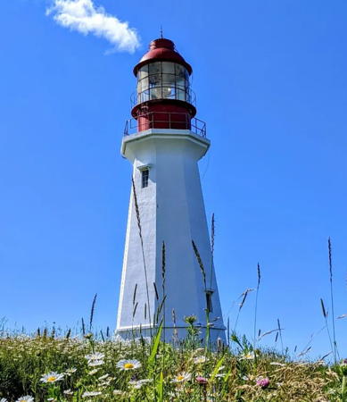
1938 (station established 1832). Active; focal plane 26 m (85 ft); white flash every 5 s. 22 m (72 ft) octagonal concrete tower, painted white. Rare Chance Brothers circular lantern, painted red; rotating aerobeacon. The 3rd order Fresnel lens, replaced in 1984, is reported to be in storage at the Coast Guard base in Dartmouth. 1-story wood keeper's house, painted white with a red roof. Fog horn (two 3 s blasts, separated by 3 s, every 60 s). A 2022 photo is at right, Jarvis has a photo ,Ahmed Khaldi has a 2021 closeup, Bash has a good photo, Dave Carter has a closeup photo, Trabas has a photo, Marinas.com has aerial photos, Wú Zihào has a street view, and Google has a satellite view. One of the earliest and most important light stations of Nova Scotia, this lighthouse is endangered by erosion of the cape it marks. Vandalized after the lighthouse was automated in 1988, the keeper's house was restored in 2002-03 by the Sydney Harbour Fortification Society. The building was scheduled to be opened in summer 2003, but vandals struck again in May of that year. In 2014 the Low Point Lighthouse Society was formed to work for heritage designation and restoration of the lighthouse. In 2015 the society won the top prize of $75,000 in the National Trust Lighthouse Matters fund drive. These funds were used to repair and repaint the cracked concrete exterior of the tower in November 2017. The Society plans to restore the lighthouse and develop it as a major tourist attraction. Major funding is needed for erosion control, however. Located off NS 28 in New Waterford, marking the eastern entrance to Sydney Harbour. Visible from the Marine Atlantic ferries to Newfoundland. Site open, tower closed. Owner/site manager: Canadian Coast Guard. ARLHS CAN-287; CCG A-775. Admiralty H0758; NGA 9100.
#Glace Bay Range Front (relocated)
1907. Inactive since about 1980 and destroyed in 2018. This was an approx. 5 m (16 ft) square pyramidal wood tower with lantern. Lighthouse Digest has Dave Buckley's photo and Google has a 2012 street view and an indistinct satellite view. 2003 Buckley discovered this little lighthouse, previously thought to have been demolished, in the back yard of a private residence in Glace Bay. It was in very poor condition and in 2018 it was destroyed by fire. Lighthouse Digest featured the range lights in December 2003. Located near the end of Bathgate Street in Glace Bay. Site and tower closed. Owner/site manager: private. ARLHS CAN-957.
[Glace Bay Range Rear (2)]
Around 1980 (station established 1907). Active; focal plane 13 m (43 ft); continuous red light. 9.5 m (31 ft) triangular cylindrical skeletal tower carrying a trapezoidal daymark painted white with a red vertical stripe. Google has a street view and a satellite view. Lighthouse Digest has Dave and Pat Buckley's photo of the original lighthouse, a 13 m (42 ft) square pyramidal wood tower. Located on the east side of Glace Cove. Site open, tower closed. ARLHS CAN-897; CCG A-773; Admiralty H0752.1; NGA 9152.

Low Point Light, Cape Breton, July 2022
Instagram photo by kj.19.12
Flint Island (4)
1962 (station established 1856). Active; focal plane 21 m (70 ft); two white flashes, separated by 4 s, every 25 s. 18 m (59 ft) octagonal concrete tower with lantern and gallery, painted white; the lantern is red. Fog horn (3 s blast every 30 s). Darin Guthro has a closeup photo, a view from the sea is available, Marinas.com has aerial photos, and Bing has a satellite view. A historic photo of the station is available. The first lighthouse burned in August 1864. The second (1865) was replaced in 1910 by the third, a hexagonal concrete tower. The lighthouse was automated in 1985 and the keeper's house burned to the ground the following year. Located about 8 km (5 mi) off Cape Percé, the northeastern tip of Cape Breton Island. Accessible only by boat. Site open, tower closed. Owner/site manager: Canadian Coast Guard. ARLHS CAN-180; CCG A-770; Admiralty H0750; NGA 9156.

East Coast (Louisbourg Area) Lighthouses
Scatarie (3)
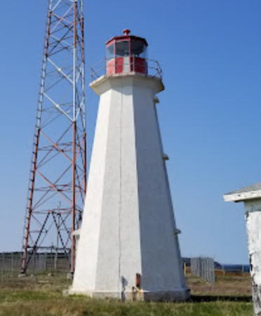
1981 (station established 1839). Inactive since 2017. 16 m (53 ft) square pyramidal wood tower attached to a 1-story fog signal building, painted white. Fog horn (three 2 s blasts every 60 s). The two 1-1/2 story keeper's houses (1959) are collapsing. Darin Guthro's closeup photo is at right, Paul van der Est has a 2015 photo, the Main-à-Dieu Fishermen's Museum has a photo, Marinas.com has aerial photos, and Google has a satellite view of the station. This is the easternmost lighthouse in Nova Scotia and the province's tallest "pepperpot" lighthouse. The first lighthouse was an octagonal wood tower. The present tower replaced an 18 m (60 ft) pyramidal skeletal tower with central cylinder built in 1953. The historic double keeper's house burned in 1957. In 2017 the Coast Guard installed a new solar powered LED light. Scatarie Island, off Cape Breton, is a narrow island about 10 km (6 mi) long. Uninhabited, it is protected as a wildlife refuge and wilderness area. Located at the northeast point of Scatarie Island. Accessible only by boat. Site open, tower closed. Owner: Canadian Coast Guard. Site manager: Nova Scotia Environment (Scatarie Island Wilderness Area). ARLHS CAN-451. Active light: CCG A-767; Admiralty H0742; NGA 9164.
#Main-à-Dieu (3)
1979 (station established 1871). Replaced in 2015. This was a 9 m (30 ft) fiberglass tower, painted white with two horizontal red bands. Google has a satellite view. The first lighthouse was a keeper's house with a square church-style light tower. It was replaced in 1934 by the second lighthouse, a square keepers' house with a lantern centered on the roof. In 2015 the fiberglass tower was replaced by a 9 m (30 ft) square skeletal tower carrying a daymark colored red with a white horizontal band (focal plane 24.5 m (81 ft); white flash every 4 s). Trabas has a view of the active light. Located at the west point of Scatarie Island, off Cape Breton, guarding the Main-à-Dieu Passage. Accessible only by boat. Site open, tower closed. Owner/site manager: Canadian Coast Guard. ARLHS CAN-296. Active light: CCG A-766; Admiralty H0744; NGA 9168.
[Little Lorraine (3)]
Date unknown (station established 1900). Active; focal plane 10.5 m (34 ft); continuous green light. 4.5 m (15 ft) round cylindrical tower painted white with a red band at the top. Wikimedia has a photo and Google has a distant satellite view. The original square wood lighthouse was replaced by a skeletal tower in 1946. Located on a promontory on the west side of the entrance to Little Lorraine Harbour. Site status unknown. Owner/site manager: Canadian Coast Guard. ARLHS CAN-1371; CCG A-761; Admiralty H3342; NGA 9196.

Scatarie Light, Cape Breton, January 2018
Google Maps photo by Darin Guthro
** Louisbourg (4)
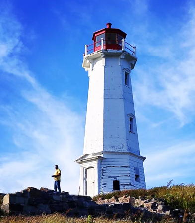
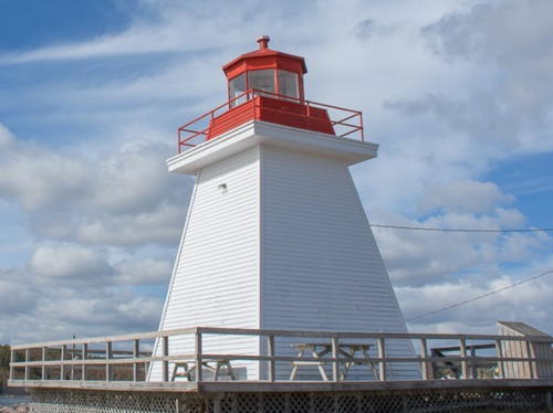
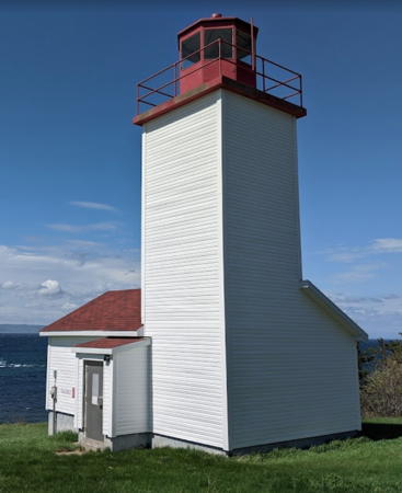
1923 (station established 1734, although inactive 1758-1842). Active; focal plane 32 m (105 ft); white flash every 10 s. 17 m (55 ft) octagonal concrete tower with lantern and gallery, painted white; lantern is red. Historic lenses from the lighthouse are displayed at the Louisbourg Marine Museum in Louisbourg. Fog horn (blast every 20 s). Sanjiv Arora's 2022 photo appears at the top of this page, Renzel Hernandez has a 2023 photo, Jarvis has a 2011 photo, Trabas has Klaus Potschien's photo, Marinas.com has aerial photos, and Google has a street view and a fuzzy satellite view. The lighthouse was in need of some restoration in Christine Goulet's 2021 photo. This is Canada's oldest light station, established by France during the period when Cape Breton Island (then called Île Royale) was a French colony. The original lighthouse was a round stone tower 16.5 m (54 ft) tall. Unfortunately it had a wooden lantern, which caught fire in September 1736 destroying the structure. A new stone tower, 17 m (56 ft) tall, replaced it in 1738. It was heavily damaged in 1758 during the second British siege of Louisbourg in the Seven Years ("French and Indian") War, and it was never repaired. The third lighthouse, built under British rule in 1842, burned in 1922. Foundations of both the 1738 and 1842 lighthouses have been stabilized and preserved. The Louisbourg Lighthouse Society works for preservation of the lighthouse and has applied to own it. During 2023 a $1.3 million restoration prepared the lighthouse for its ecntennial celebration set for 2024. Located at the end of Havenside Road on the north side of the entrance to Louisbourg harbor. Parking provided. Site open, tower closed. Owner: Canadian Coast Guard. Site manager: Louisbourg Lighthouse Society . ARLHS CAN-286; CCG A-756; Admiralty H3344; NGA 9204.
[Louisbourg Range Front (2?)]
Date unknown (station established 1897). Active; focal plane 7 m (23 ft); continuous yellow light. 5 m (17 ft) skeletal mast carrying a daymark colored white with a red vertical stripe. Trabas has Thomas Philipp's photo and Google has a satellite view and a street view showing both range lights. The range guides vessels entering Louisbourg Bay. This beacon replaced a square wood tower. Located on the west side of the bay about 2 km (1.25 mi) south of the town waterfront; the Louisbourg Old Town Trail passes the two range lights. Site open, tower closed. Owner/site manager: Canadian Coast Guard. ARLHS CAN-1372; CCG A-757; Admiralty H3348; NGA 9208.
[Louisbourg Range Rear (2?)]
Date unknown (station established 1897). Active; focal plane 12.5 m (41 ft); continuous yellow light. 6.5 m (21 ft) skeletal mast carrying a daymark colored white with a red vertical stripe. Trabas has Thomas Philipp's photo and Google has a satellite view and a street view showing both range lights. Located 166 m (545 ft) west of the front light; the Louisbourg Old Town Trail passes the two range lights. Site open, tower closed. Owner/site manager: Canadian Coast Guard. ARLHS CAN-1373; CCG A-758; Admiralty H3348.1; NGA 9212.
* Gabarus
1891. Active; focal plane 16.5 m (54 ft); continuous red light. 9.5 m (31 ft) hexagonal pyramidal wood tower with lantern and gallery, painted white; lantern and gallery are red. is at right, A 2020 photo is at right, Bash has a great 2008 photo, Jarvis has a fine 2011 photo, Mark Plummer has a photo, Trabas has Klaus Potschien's photo, Marinas.com has aerial photos, Matt Dagley has a 2017 street view, and Google has a satellite view. The lighthouse was endangered by erosion and needed to be moved back from the cliff face. In 2014 the Gabarus Lightkeepers Society formed to apply for ownership of the lighthouse and students from Cape Breton University helped develop the required business plan. The Society has a YouTube video of the lighthouse. In 2015 the society was awarded $50,000 in the National Trust Lighthouse Matters competition, plus another $6,000 throgh crowdfunding. The lighthouse was moved back from the cliff on 26-27 November 2015. Located at the end of Harbour Point Road, off NS 327, in Gabarus. Site open, tower closed. Owner/site manager: Canadian Coast Guard (?). . ARLHS CAN-189; CCG A-753; Admiralty H3358; NGA 9224.

Gabarus Light, Gabarus, November 2020
Instagram photo by hikeraud
* #Rouse Point (1)
1982. Removed in 2015. The light was mounted on a short mast above the square fog signal shed. Fog horn (two 3 s blasts every 60 s). Jarvis has a good photo, Trabas has Klaus Potschien's photo, and Google has a satellite view. In 2015 the building was demolished and the light moved to a 4 m (14 ft) square skeletal tower carrying a red and white daymark (focal plane 9 m (30 ft); one long yellow flash every 6 s). Located on a promontory about 600 m (0.4 mi) northeast of the Gabarus waterfront. Site open, tower closed. Owner/site manager: Canadian Coast Guard. ARLHS CAN-435. Active light: CCG A-752.6; Admiralty H3359; NGA 9226.
Guyon Island (3)
1964 (station established 1877). Active; focal plane 16 m (53 ft); white flash every 20 s. 13 m (43 ft) hexagonal pyramidal wood tower with lantern and gallery, painted white; lantern and gallery are red. Fog horn (6 s blast every 60 s). Two small keeper's houses (1964) in poor condition. Brad Mills has the 2022 view from the sea seen at right, Darin Guthro has a photo of the station, Marinas.com has aerial photos, and Google has a satellite view. The original lighthouse was replaced in 1927 by the lighthouse seen in a historic photo from the Nova Scotia Archives. Endangered by age and poor maintenance. Located offshore about 11 km (7 mi) south of Louisbourg. Accessible only by boat. Site status unknown. Owner/site manager: Canadian Coast Guard. ARLHS CAN-219; CCG A-750; Admiralty H3360; NGA 9232.

Guyon Island Light, Cape Breton, July 2022
Google Maps photo by Brad Mills

Richmond County Lighthouses

Fourchu and St. Esprit Lighthouses
[Fourchu Head (3)]
Date unknown (station established 1907). Active; focal plane 19 m (62 ft); white light, 2 s on, 4 s off. 9 m (30 ft) square skeletal tower carrying red and white daymark panels. 1-story wood fog signal building (1956). Clayton Isajenko has a 2021 closeup photo and Google has a satellite view. This light tower replaced a 10 m (32 ft) fiberglass tower, painted white with two narrow horizontal red bands, installed in 1979. Jarvis has a distant view of the fiberglass tower and Marinas.com has aerial photos, The original lighthouse was a 10 m (33 ft) wood "pepperpot" tower. Located on the point about 18 km (11 mi) southwest of Louisbourg. Accessible by a fairly strenuous hike from the South Fourchu waterfront. Site open, tower closed. Owner/site manager: Canadian Coast Guard. ARLHS CAN-182; CCG A-747; Admiralty H3362; NGA 9236.
[St. Esprit Island (2?)]
Date unknown (station established 1880). Active; focal plane 24 m (79 ft); white light, 2 s on, 10 s off. 10 m (33 ft) square cylindrical skeletal tower with an enclosed lower portion and a daymark colored with red and white horizontal bands. A very distant view is available and Google has a distant satellite view. Anderson's page has several historic photos of the original lighthouse. Its foundation ruins survive next to the present tower. Located on a small island about 1.6 km (1 mi) off the coast near St. Esprit. Accessible only by boat. Site open, tower closed. Owner/site manager: Canadian Coast Guard. ARLHS CAN-754; CCG A-743; Admiralty H3368; NGA 9252.

St. Peters Area Lighthouses
Lower l'Ardoise (L'Ardoise Harbour) Range Front (relocated)
1909. Inactive since about 1970. 7 m (23 ft) square pyramidal wood tower with lantern, painted white with red trim; lantern roof is red. Google has a satellite view and a 2012 street view. Lower l'Ardoise is a harbor at the eastern entrance to St. Peter's Bay. After deactivation the lighthouse was purchased by the Morrow family and relocated to Point Michaud, about 8 km (5 mi) east of the original location. Located just off Point Michaud Road (NS 247) at the junction of Point Michaud Beach Road. Site and tower closed (private property). Owner/site manager: private. ARLHS CAN-1227.
Lower l'Ardoise (L'Ardoise Harbour) Range Rear
1909. Inactive since about 1970. 7 m (23 ft) square pyramidal wood tower with lantern. Taras Tymozhynskyi has a 2022 photo, a distant 2012 street view is available, and Google has a satellite view. Critically endangered. According to Bob Crawford's 2005 report the lighthouse was then "located in a farmer's field where it is has been used as a wood shed." Lighthouse Digest has Crawford's photo but misidentifies the tower as the front range light. Located in a field at the end of Brymer Road, off NS 247 in Lower l'Ardoise. Site and tower closed. Owner/site manager: private. ARLHS CAN-1228.
* Jerome Point (St. Peter's Bay) (2)
1956 (station established 1883). Active; focal plane 15.5 m (51 ft); continuous red light. 10.5 m (35 ft) square pyramidal wood tower with lantern and gallery, painted white; lantern is red. The modern keeper's house (1956) was used after automation as the residence of the St. Peter's Canal lockmaster. Rhonda Landry's 2022 photo is at right, Jarvis has a good 2011 photo, Bash has a good 2008 photo, Trabas has Klaus Potschien's photo, a 2021 photo is available, Marinas.com has aerial photos, and Google has a satellite view and a closeup street view. This lighthouse is in a popular provincial park with a campground and picnic area nearby. Located at the east side of the entrance to St. Peter's Canal from St. Peter's Bay in St. Peter's. Accessible by paved road; parking provided. Site and park open mid June to mid September, tower closed. Owner: Canadian Coast Guard. Site manager: Battery Provincial Park. . ARLHS CAN-255; CCG A-734; Admiralty H3380; NGA 9264.

Jerome Point Light, St. Peter's, October 2022
Instagram photo by Rhonda Landry
* Cape George Harbour (St. Peter's) (2)
1950 (station established 1875). Inactive since 2013 (?). 8 m (27 ft) square pyramidal wood tower with lantern and gallery, painted white; lantern is red. Adam King has a 2020 photo showing the historic lighthouse and its replacement (the portion showing the historic light is at right), Bill Clyne has a distant view, Marinas.com has aerial photos, and Google has a satellite view. Trabas has a photo of the active light (focal plane 12.5 m (41 ft); white flash every 4 s.) on an 8 m (27 ft) square skeletal tower carrying red and white daymarks. This is one of two Cape George Lights in Nova Scotia, the other being on the west side of St. George's Bay (see Northwestern Nova Scotia). In October 2020 the lighthouse was added to the list of Heritage Lighthouses. However, the abandoned tower appears to be endangered. Located on the west side of the northern entrance to St. Peter's Inlet, the southern arm of the lake leading to St. Peter's Canal. Accessible by a short walk from the parking lot of the Bras d'Or Lake Lighthouse Campground, off NS 4 in St. Peter's. Site open, tower closed. Owner/site manager: Canadian Coast Guard. ARLHS CAN-099. Active light: CCG A-840; Admiralty H0838; NGA 9060.
[Gregory Island (3)]
2013 (?) (station established 1884). Active; focal plane 11 m (36 ft); green flash every 4 s. 10.5 m (34 ft) square skeletal tower carrying green and white square daymarks. No photo available. The historic lighthouse (a square wood tower) was replaced in 1950 by a steel tower; Ken Heaton has a 2012 photo of the 1950 light. Google has a satellite view. The keeper's house was sold and relocated in 1975; its present location is not known. The lighthouse was relocated a few meters southwest in 1988. Located on an island in St. Peter's Inlet. Accessible only by boat. Site open, tower closed. Owner/site manager: Canadian Coast Guard. ARLHS CAN-215; CCG A-841; Admiralty H0839; NGA 9064.
 

Cape George Harbour Light, St. Peter's, August 2020
Google Maps photo by Adam King
 
River Bourgeois (Bourgeois Inlet) (3) (replica)
2003 replica of the original 1903 lighthouse. Active (privately maintained); focal plane 7.5 m (25 ft); continuous red light. 8 m (26 ft) square pyramidal wood tower with lantern and gallery, painted white; lantern is red. Bash has a 2008 photo, Allan Touesnard has a 2020 photo, Jarvis has a view from the bay, Trabas has Bash's photo, Marinas.com has aerial photos, and Google has a satellite view and a very distant street view. This lighthouse is a replica of the original 1903 tower, which the Coast Guard burned in 1989 after it was replaced by an aluminum skeletal tower. Residents protested this destruction. In 2003 the light station was sold to a local group, which immediately built the replica. Located at Church Point in River Bourgeois northeast of Grandique Ferry. Accessible at low tide, but access may be cut off at high tide. Site open, tower closed. Owner/site manager: River Bourgeois Community Services Society. . ARLHS CAN-056; CCG A-732; Admiralty H3386; NGA 9396.
[Ouetique Island (3)]
Date unknown (station established 1874). Activ; focal plane 23 m (75 ft); red flash every 4 s. 8.5 m (28 ft) triangular skeletal tower carrying a daymark colored with red and white horizontal bands. A view from the sea (near the bottom of the page) is available and Google has a satellite view. Anderson has a historic photo of the first lighthouse. Foundation ruins of the second (1949) lighthouse are seen next to the modern light. Located on an island in the Lennox Passage, between the mainland and Isle Madame. Accessible only by boat. Site open, tower closed. Owner/site manager: Canadian Coast Guard. ARLHS CAN-1309; CCG A-731; Admiralty H3384; NGA 9265.

River Bourgeois Light, River Bourgeois, April 2020
Google Maps photo by Allan Touesnard

Isle Madame Lighthouses
Isle Madame, an island about 16 km by 11 km (10 by 7 mi), is separated from the south coast of Cape Breton Island by a narrow strait, the Lennox Passage. The island has a population of about 4300 and is accessible by bridge on NS 320.
* Grandique (Grand Dique) Point (2)
1907 (station established 1884). Active; focal plane 9 m (29 ft); continuous green light. 8.5 m (28 ft) square pyramidal wood tower with lantern and gallery, painted white; lantern is red. Jenny Chaisson's 2022 photo is at right, Jarvis has a photo Trabas has Klaus Potschien's photo, Pieter Groot has a 2019 closeup, Marinas.com has aerial photos, and Google has a satellite view. The lighthouse, which replaced a light on a pole, marks a dangerous north-pointing spit. In 1963 and again in 2010 it had to be moved southward to escape continuing beach erosion. Located on the north side of Isle Madame facing the Lennox Passage, a strait connecting St. Peter's Bay to the Strait of Canso. Accessible by a gravel road within the provincial park. Site open, tower closed. Owner: Canadian Coast Guard. Site manager: Lennox Passage Provincial Park. ARLHS CAN-208; CCG A-729; Admiralty H3392; NGA 9267.
[Hawk Island (Poulaman) (2?)]
Date unknown (station established 1901). Active; focal plane 13 m (43 ft); green flash every 4 s. 10 m (33 ft) triangular skeletal tower with enclosed lower section carrying a daymark colored with red and white horizontal bands. No photo available but Google has a satellite view. Located on a tiny island on the south side of the eastern entrance to the Lennox Passage. Accessible only by boat. Owner/site manager: Canadian Coast Guard. ARLHS CAN-1213; CCG A-730; Admiralty H3388; NGA 9266.
#Green Island (2)
1927 (station established 1865). Inactive since 1968. This was a 2-story square wood keeper's house, formerly with a lantern centered on the roof. It is not known when this building was demolished (it was gone by 2012) but Google's satellite view shows only the foundation. The light was replaced by a skeletal tower in 1968 and then by the current lighthouse in 1986. In 1971, the lantern was replaced by the emitter of an electronic foghorn. Keepers continued to live in the building until 1986. Owner/site manager: Canadian Coast Guard.

Grandique Point Light, Isle Madame, August 2022
Google Maps photo by Jenny Chaisson
Green Island (4)
1986 (station established 1865). Active; focal plane 34 m (112 ft); two long (2 s) flashes, separated by 2 s, every 20 s. 11.5 m (38 ft) fiberglass tower with lantern, painted white; lantern is red. 1-1/2 story keepers house and fog signal building intact. Lighthouse marks the northeastern entrance to Chedabucto Bay and the Strait of Canso. Marinas.com has aerial photos and Google has a satellite view. This is one of two Green Island Lights in Nova Scotia, the other one being at Yarmouth (see Southern Nova Scotia). Located at the summit of a small island to the southeast of Isle Madame. Accessible only by boat; visible from Cap Rouge on Petit-de-Grat Island, which is accessible by road from Isle Madame. Site open, tower closed. Owner/site manager: Canadian Coast Guard. ARLHS CAN-211; CCG A-722; Admiralty H3376; NGA 9312.
* Marache Point (Arichat, Cape Auguet) (4)
2018 (station established 1851). Active; focal plane 10 m (34 ft); continuous white light. 7.5 m (25 ft) square pyramidal tower with lantern and gallery, colored white; lantern is red. Jenni Boswell has a 2020 photo is at the bottom of this page, Jarvis has a photo, Martin Cathrae has a photo, Trabas has Klaus Potschien's photo, Marinas.com has aerial photos, and Google has a satellite view. This station was known as Arichat Light until 1970, when the keepers' houses were sold and removed. (It is not known if they survive.) The original lighthouse, a short tower, was replaced by a 2-story structure in 1869. In 2017 residents agreed with a Coast Guard proposal to replace the 1949 wood lighthouse with a replica made of more durable materials, and this replacement was accomplished in 2018. Located at the southern entrance to Arichat Harbour on the south coast of Isle Madame; accessible by a short walk on a dirt road. Site open, tower closed. Owner/site manager: Canadian Coast Guard. . ARLHS CAN-303; CCG A-708; Admiralty H3404; NGA 9356.
Jerseyman Island (3)
2017 (station established 1872). Active; focal plane 12 m (39 ft); continuous red light. 7.5 m (25 ft) square pyramidal wood tower with lantern and gallery, painted white; lantern is red. The keeper's house was sold and removed in 1980. Harvey Hensley has a 2022 photo, a 2019 view from the sea is available, and Google has a satellite view. The original lighthouse was replaced in 1950. The 1950 tower became seriously deteriorated and was replaced by a new tower of the same design in 2017. Jarvis has a photo of the earlier lighthouse, Trabas has Klaus Potschien's photo, Marinas.com has aerial photos, and Google has a very distant street view from the mainland. Located at the north end of the island, south of Isle Madame, marking the western entrance to Arichat Harbour. Accessible only by boat, although there is a view from the mainland. Site open, tower closed. Owner/site manager: Canadian Coast Guard. ARLHS CAN-256; CCG A-707; Admiralty H3406; NGA 9364.

Canso Canal Lighthouse
* Balache Point Range Rear
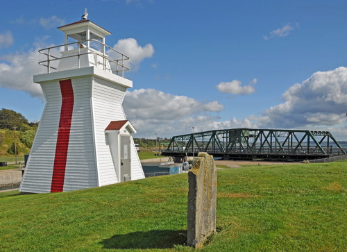
1963. Active; focal plane 9 m (30 ft); continuous red light. 6 m (20 ft) square pyramidal wood tower with lantern and gallery, painted white with a red vertical stripe on the range line; lantern is red. Jarvis's photo is at right, Alain Quevillon has a 2022 closeup, Bash has a photo, Trabas has Thomas Philipp's photo, and Google has a street view and a satellite view. The front light is on a 6 m (20 ft) skeletal tower. The range guides vessels entering the Canso Canal; completed in 1955, the canal provides a tidal lock allowing safe navigation of the narrow Strait of Canso separating Cape Breton Island from the mainland. Located at the northern entrance to the canal, off the Trans-Canada Highway just west of the Canso Causeway. Site and tower closed but the lighthouse can be viewed from outside the fence. Owner/site manager: Canadian Coast Guard. ARLHS CAN-017; CCG A-702; Admiralty H3436.1; NGA 8708.
Balache Point Light
Balache Point Light, Canso Canal, September 2011
Wikimedia Creative Commons photo by Dennis Jarvis

Information available on lost lighthouses:

  • Bear Island (1906-?), Chedabucto Bay, Richmond. There is no longer a light at this location. ARLHS CAN-1363.
  • Cap Rond (Cape la Ronde) (1874-?), Île Madame, Richmond. The lighthouse was replaced with a light on a mast; later that light was replaced by a buoy offshore. ARLHS CAN-1367.
  • Chéticamp Harbour Range Rear (1890-1950), Chéticamp Harbour, Inverness. The front lighthouse survives (see above) but the range has been discontinued and the rear lighthouse was demolished. ARLHS CAN-1369.
  • Clarke Cove Range Rear (1903-1977), Great Bras d'Or Lake. The range was discontinued in 1977. The lighthouse was to be moved to a museum but it was destroyed when a helicopter dropped it in transit. The front light was moved to Cameron Island, where it survives (see above). ARLHS CAN-1193.
  • Crichton Head (1874-1950s?), Isle Madame, Richmond. The lighthouse was replaced by a skeletal tower; in 2012 that light was replaced by a series of buoys. ARLHS CAN-1267.
  • Glace Bay North Breakwater (1956-?), near Sydney. The original light was a 7.5 m (25 ft) square tower mounted on a 1-story square equipment building. No photos of this light have been found. There is a small beacon on the breakwater today. ARLHS CAN-202; CCG A-774. Admiralty H0756; NGA 9144.
  • Glasgow Point (1884-1933), Isle Madame, Richmond. There is no longer a light at this location. ARLHS CAN-1215.
  • Grand Étang (1901-1951), northwest coast, Inverness. The lighthouse has been demolished. There are small beacons on the harbor breakwaters, barely visible in Marinas.com aerial photos. ARLHS CAN-1216.
  • Iona (1901-1929), west side of Grand Narrows, Great Bras d'Or Lake. There is no longer a light at this location. ARLHS CAN-1222.
  • Lingan Head (1874-?), Sydney area. There is no longer a light at this location; a pair of small range beacons guide vessels into Lingan Harbour. ARLHS CAN-1226.
  • Mabou Harbour Range Front (1884-1987), west coast, Inverness. The original lighthouse was replaced by a skeletal tower after being damaged by a winter storm in 1964. The skeletal tower was removed in 1987. ARLHS CAN-1374.
  • McKenzie Point (1874-?), Baddeck area, Great Bras d'Or Lake. There is no longer a light at this location. ARLHS CAN-1229
  • Petit-de-Grat (1877-?), Isle Madame, Richmond. The lighthouse was replaced by a skeletal tower, which was discontinued and removed in 2000. ARLHS CAN-1375.
  • Point Tupper (1870-?), Strait of Canso. There is no longer a light at this location. ARLHS CAN-1376.
  • Port Hood (1854-1938), west coast, Inverness. The lighthouse was not replaced after being destroyed by fire in 1938. ARLHS CAN-1209.
  • Red Islands (1895-1964), Great Bras d'Or Lake. There is no longer a light at this location. ARLHS CAN-1235.
  • Rochefort Point Range Front and Rear (1924-?), Louisbourg area, Cape Breton. Huelse has a postcard view of the rear lighthouse. The range has been discontinued and the lighthouses removed. ARLHS CAN-1237-38.
  • St. Ann Harbour (1871-?), St. Ann Harbour, Victoria. There is no longer a light at this location. ARLHS CAN-1241.
  • West Arichat Range Front and Rear (1904-?), Isle Madame, Richmond. The range has been discontinued and the lighthouses removed. ARLHS CAN-1245-46.

Marache Point Light, Arichat, October 2020
Google Maps photo by Jenni Boswell

Notable faux lighthouses:

Adjoining pages: South: Eastern Nova Scotia | West: Northwestern Nova Scotia

Return to the Lighthouse Directory index

Posted June 2003. Checked and revised April 1, 2024. Lighthouses: 51. Site copyright 2024 Russ Rowlett and the University of North Carolina at Chapel Hill.