Lighthouses of the Philippines: Panay and Guimaras

The Republic of the Philippines (Pilipinas in Filipino) includes more than 7600 islands stretching over 1750 km (1100 mi) of the western Pacific and separating the Philippine Sea on the east from the South China Sea on the west. The largest islands are Luzon at the northern end of the country and Mindanao at the southern end. As of 2020 the population of the country was about 109 million.

The archipelago was a Spanish colony until the Spanish-American War of 1898, which brought the islands under U.S. administration. Japan occupied the islands during World War II (1942-45) and the country became independent shortly thereafter (1946).

The Philippines is divided into 17 regions and subdivided into 81 provinces. Panay and Guimaras are located in the Western Visayas Region near the geographical center of the archipelago. The sixth largest island of the Philippines, Panay is triangular in shape and has a population of about 4.5 million. Iloilo on the southeast coast, San Jose de Buenavista on the southwest coast, and Roxas on the north coast are among the major cities on the island. Guimaras is an island province off the east coast of Panay.

Panay faces the Sibuyan Sea to the north, the Visayan Sea to the northeast, and the much deeper Panay Gulf and Sulu Sea to the southwest. Guimaras is separated from Panay by the narrow channel of the Iloilo Strait and from Negros by the broader Guimaras Strait.

Filipino and English are official languages in the Philippines. In Filipino a lighthouses is called a parola; an island is an isla or pulo. Many English maritime terms have been adopted into Filipino, including cape, bay, and port, and the names of historic lighthouses are often retained in their Spanish forms.

Lighthouses in the Philippines are maintained by the Marine Safety Services Command of the Philippine Coast Guard. Notices to Mariners are posted by the National Mapping and Resource Information Agency (NAMRIA).

Many Philippine lighthouses are not well known so better information and photos are always needed.

ARLHS numbers are from the ARLHS World List of Lights. PCG numbers are the Philippines Light List numbers, where known. Admiralty numbers are from volume F of the Admiralty List of Lights & Fog Signals. U.S. NGA List numbers are from Publication 112.

General Sources
Lighthouses in the Philippines
Photos and observations in blog entries by Loyd Martinez.
Lighthouses in the Philippines
Wikipedia article, with links to articles on several of the individual lighthouses.
Spanish Lighthouses of the Philippines
This is the Directory's own list of the Spanish light stations, with notes on their current status.
Lighthouses in the Philippines
Photos by various photographers available from Wikimedia.
World of Lighthouses - Philippines
Photos by various photographers available from Lightphotos.net.
Online List of Lights - Philippines
Photos by various photographers posted by Alexander Trabas.
Navionics Charts
Navigation chart for Panay and Guimaras.
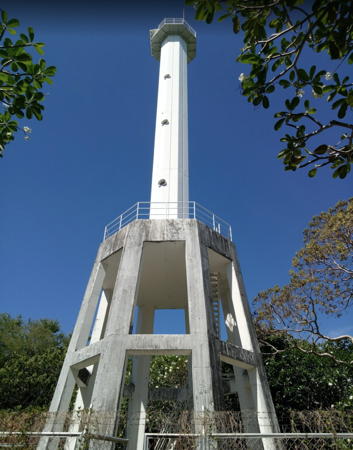

Nogas Island lighthouses, Anini-y, March 2018
Google Maps photo by Elbert Quimpo
Panay Lighthouses

Antique Province: West Coast (Sulu Sea) Lighthouses
Nogas Island (2)
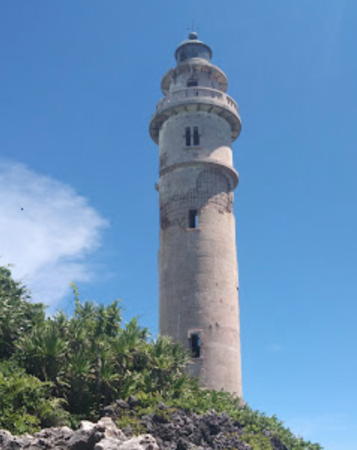
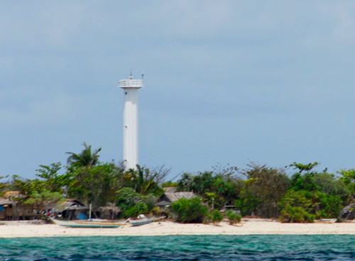
1990s (station established 1917). Active; focal plane 35 m (115 ft); white flash every 10 s. 30 m (98 ft) octagonal cylindrical tower with gallery mounted on a concrete skeletal base. This is a modern tower of the "Apo Reef" class. Elbert Quimpo has the 2018 closeup photo seen at the top of this page, Vicente Tenefrancia has a 2022 photo, Marcus Chymera has a photo, there's also a distant view, and Google has a satellite view. The original light tower, a 16 m (52 ft) wood skeletal tower, is known to have been replaced sometime in the 1990s. Located on an island about 5 km (3 mi) off Anini-y in southernmost Panay. Accessible only by boat. Site status unknown. . ARLHS PHI-093; PCG-0204; Admiralty F2332; NGA 14720.
San José de Buenavista (Tubigan Point) (2)
Date unknown (station established 1916). Active; focal plane 15 m (49 ft); three white flashes every 5 s. 12 m (39 ft) round barbell-shaped white metal and fiberglass tower. Entire lighthouse is white. No photo available but Bing has a fuzzy satellite view. The original lighthouse was a concrete tower on the corner of the Spanish fort. San José de Buenavista is the capital of Antique Province; it is seaport with a population of about 65,000. Located on Tubigan Point, which shelters the harbor of San José de Buenavista on the southwestern coast of Panay. Site open, tower closed. PCG-0203; Admiralty F2334; NGA 14724.
* Amparo
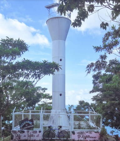
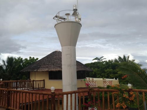
Date unknown. Active; focal plane unlisted; white flash every 5 s. 10 m (33 ft) round barbell-shaped white metal and fiberglass tower. A 2018 photo is at right, Martin Federic Palco has a 2016 closeup, and Google has a street view. A resort called La Parola has been built around the lighthouse but this makes the tower hard to find in Google's satellite view. Located just above the beach at Amparo, about 32 km (20 mi) north of San José de Buenavista. Site open, tower closed. Admiralty F2335; NGA 14724.3.
 

Amparo Light, Patnongon, June 2018
Google Maps photo by Eugene Stan Engelbert Pet
 
Tibiao Point (?)
Date unknown. Active; focal plane unknown; white flash every 10 s. No description provided and no photo available. Google's satellite view of the listed location does not show a tower and none has been found in the vicinity; it's possible the light is hidden by trees. Located on a low promontory in Tibiao on the central west coast of Panay. Site status unknown. PCG-0202; Admiralty F2336; NGA 14725.
Maniguin (Maningning) Island (1)
1906 (U.S.). Inactive. 30 m (99 ft) round cylindrical concrete tower with lantern and gallery, painted white. Keeper's house occupied by a resident keeper. Ernie Surot's 2021 photo is at right, Jonathan Sulit has a 2023 photo, Kuliko Tero has a 2018 closeup, and Bing has a satellite view of the station. This handsome American lighthouse has been abandoned and is now endangered. The lighthouse marks the Cuyo East Passage, a main shipping route south into the Sulu Sea. Located on heights near the southeastern tip of the island, 37 km (24 mi) northwest of Culasi and 25 km (15 mi) southwest of Pucio Point. The lighthouse was replaced by a round cylindrical tower with flared top seen in a 2009 photo of both lighthouses. Island accessible by charter boats; it is a popular scuba diving destination. Site open, tower status unknown. . ARLHS PHI-091.
Maniguin (Maningning) Island (3)
Date unknown. Active; focal plane 58 m (191 ft); two white flashes every 10 s. Approx. 30 m (98 ft) square skeletal tower. Jonathan Sulit has a 2023 photo showing this tower with the historic lighthouse and Kuliko Tero has a 2018 view from the sea. The skeletal tower replaced the white round cylindrical tower with flared top seen in the 2009 photo. Located next to the historic lighthouse. PCG-0201; Admiralty F2288; NGA 14500.
* Libertad
Date unknown. Active; focal plane 15 m (49 ft); white flash every 5 s. Approx.12 m (39 ft) square concrete post attached to or rising through a building. The light can be seen in a YouTube video posted by the Philippines Port Authority following reconstruction of the Libertad Port in 2018-19; the post is by the red-and-white roofed building at the rear of the pier and is best seen near the end of the video. Glenn A. Taman has a distant 2023 photo and Google has a satellite view of the port; in this older view the building with the light has a blue roof. Located in the village of Libertad on the south side of Panay's Northwest Peninsula. Site open, tower closed. Admiralty F2336.5; NGA 14727.
* [Pucio Point]
Date unknown. Active; focal plane about 20 m (66 ft); white flash every 7 s. Approx. 7 m (23 ft) mast. Google has a 2023 street view and Monina Alexandra Payad has a 2022 photo but the small light is not seen in Google's satellite view. An unpaved road along the coast from Libertad leads to a popular observation deck at the tip of the point, just below the light. Located at the tip of the Northwest Peninsula, the westernmost point of Panay. Site open, tower closed. PCG-0590; Admiralty F2337; NGA 14728.

1906 Maniguin Island Light, Panay, July 2021
Google Maps photo by Ernie Surot

Antique Province: Caluya (Semirara Islands) Lighthouses
The municipality of Caluya includes a group of islands at the northern edge of the Sulu Sea, west of the Northwest Peninsula of Panay and south of the southern coast of Mindoro. The islands have a population of about 35,000.

Malaqui (Malaki) Island (?)
Date unknown. Active; focal plane unknown; white flash every 10 s. 10 m (33 ft) white metal and fiberglass tower. No photo available. The location of this lighthouse is uncertain; it is not found in Google's fuzzy satellite view of the listed location. Located on Malaqui, the smallest and westernmost of the Semirara Islands. Site status unknown. PCG-0613; Admiralty F2287.2; NGA 14499.
Magtang Point (Sibay Island)
Date unknown. Active; focal plane unknown; white flash every 5 s. Approx. 10 m (33 ft) white metal and fiberglass tower. No photo available but Google has a satellite view. Sibay is at the southeastern corner of the Semirara Islands; it is about 15 km (9 mi) long but only 4 km (2.5 mi) wide. Located on a headland on the northwest coast of Sibay. Site status unknown. Admiralty F2287.4; NGA 14498.5.
Caluya Island
Date unknown. Active; focal plane unknown; two white flashes every 5 s. Approx. 10 m (33 ft) white metal and fiberglass tower. No photo available but Google has an indistinct satellite view. Located on the southeast side of Caluya, an island on the east side of the Semirara Islands. Site status unknown. Admiralty F2287.5; NGA 14498.
Alegria (Semirara Island)
Date unknown. Active; focal plane 110 m (361 ft); white flash every 5 s. 10 m (33 ft) white metal or fiberglass tower. No photo available but Google has a satellite view. Semirara is the largest island of the group; in recent years coal has been mined in the north of the island. Located in the southern portion of the island. Site status unknown. PCG-0604; Admiralty F2287.7; NGA 14478.
Sibolo (Sibolon) Island
Date unknown. Active; focal plane 56 m (184 ft); white flash every 10 s. 10 m (33 ft) white metal or fiberglass tower. Rona Gocon has a photo, a view from the beach is available, and Bing has a satellite view. Located at the southwestern tip of Sibolo, a small island at the northeastern corner of the Semirara Islands. Site apparently open, tower closed. Admiralty F2287.75; NGA 14477.

Aklan Province: Northwest Coast (Sibuyan Sea) Lighthouses
* Nasag Point
Date unknown. Active; focal plane unknown; white flash every 5 s. Approx. 12 m (39 ft) round barbell-shaped white metal and fiberglass tower. J-Marc Mendoza has the closeup 2021 photo at right, Trabas has Rainer Arndt's photo, and Google has an indistinct satellite view. The lighthouse is in a park that has a popular observation deck. Located on heights about 1 km (0.6 mi) east of a prominent cape and 3 km (2 mi) west of Malay. Site open, tower closed. Admiralty F2336.8; NGA 14727.5.

Nasag Point Light, Malay, November 2021
Google Maps photo by J-Marc Mendoza
Afga (Apga) Point
Date unknown. Active; focal plane unknown; white flash every 6 s. 11 m (36 ft) round barbell-shaped white metal and fiberglass tower. A closeup photo and a second closeup (third photo on the page) are available and Google has an indistinct satellite view. Both the Admiralty and NGA spell the name as Apga Point. Located on a promontory at Tangalan on the western north coast of Panay. Site open, tower closed. . PCG-0210; Admiralty F2301; NGA 14626.
Floripon Point (Fatima)
Date unknown (station established 1910). Active; focal plane 12 m (39 ft); three white flashes every 15 s. 11 m (36 ft) round hourglass-shaped white metal tower. Pramod Panda has a 2022 closeup photo and Google has a satellite view. Located at the west side of the entrance to Batan Bay at New Washington on the central north coast of Panay. Site open, tower closed. ARLHS PHI-083; Admiralty F2302; NGA 14628.
Sonculan (Port Batan, Batan Point) (?)
Date unknown. Active; focal plane about 14 m (46 ft); light characteristic unknown. Approx. 12 m (39 ft) round hourglass-shaped white metal tower. No photo available. The listed location for this light is inland and obviously incorrect. Navionics charts the light near Batan Point, on the east side of the entrance to Batan Bay and a Bing satellite view may show the light just offshore of that point. Site status unknown. PCG-0641; Admiralty F2303; NGA 14629.

Capiz Province: North Coast (Sibuyan Sea) Lighthouses
* Culasi Point (2)
Date unknown. Active; focal plane 48 m (157 ft); flash every 7 s. Approx. 11 m (36 ft) hexagonal white aluminum tower with gallery. A closeup photo by Clover Batiancila Sarco is at right, Segourney Perez has a 2020 photo, a distant view is available, and Google has a satellite view and a very distant street view. Leo Crisologo has a photo taken from the gallery of the tower. NGA lists a 5 m (16 ft) concrete tower at this location. Located in a small park on a promontory at the entrance to the harbor of Roxas, the capital of Capiz Province and a city of about 180,000 residents. Site open, tower closed. . PCG-0212; Admiralty F2304; NGA 14632.
Olutayan (Olutaya) Island
2013. Active; focal plane unknown; white flash every 5 s. Approx. 10 m (33 ft) white fiberglass tower. No photo available but Google has a satellite view. Olutayan Island is a short distance off the coast about 15 m (9 mi) east of Roxas. Site status unknown. Admiralty F2306.5; NGA 14641.

Culasi Point Light, Roxas, June 2018
Google Maps photo by Clover Batiancila Sarco
Zapatos Islands
Date unknown. Active; focal plane about 70 m (230 ft); two white flashes every 10 s (?). Approx. 12 m (39 ft) round barbell-shaped white tower. A distant view from the sea is available and Google has a distant satellite view. The Zapatos Islands are three small islands in the center of the Jintotolo Channel, which separates Masbate from Panay. Located on the highest point of Zapato Mayor, the northernmost of the islands (and not on Zapata Menor, an error on the light lists). Accessible only by boat. Site open, tower closed. PCG-0463; Admiralty F2307; NGA 14642.

Iloilo Province: Northeast Coast (Visayan Sea) Lighthouses
Manigonigo Island (2)
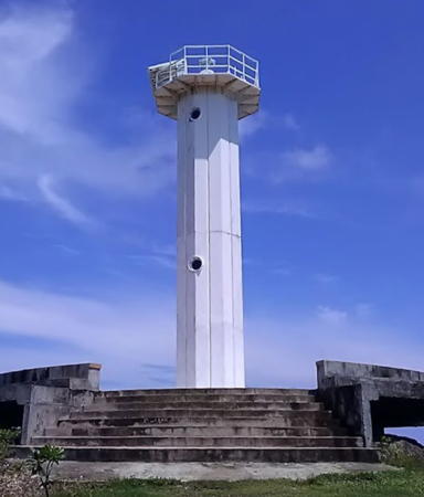
Date unknown (station established 1894). Active; focal plane 21 m (68 ft); white flash every 7 s. Approx. 20 m (66 ft) octagonal cylindrical tower with gallery. Entire lighthouse is white. Original 1-story keeper's house, unroofed and in ruins. A photo by Loyd Martinez is at right, another closeup and a more distant view are available, and Google has a satellite view. The original lighthouse was a steel tourelle prefabricated in France; according to Martinez it "no longer exists." Located on a tiny island in the Visayan Sea about 6 km (4 mi) off the northeastern point of Panay. Accessible only by boat. Site open, tower closed. ARLHS PHI-090; Admiralty F2308; NGA 14644.
North Gigante Island (Gigantes) (2)
Date unknown (station established 1895). Active; focal plane 23 m (77 ft); white flash every 10 s. Approx. 18 m (59 ft) octagonal cylindrical tower with gallery. Entire lighthouse is white. Keeper's house falling into ruin, as seen in a photo by Necan Ramos. Dan Vicera has a closeup photo, Thomas Scheibl has a good photo, Mark Lester Cordova has a street view from the base of the lighthouse, and Google has a sea view and a satellite view. Loyd Martinez reports that only the foundation remains of the original lighthouse, a prefabricated cast iron tourelle. Located on the northeastern tip of the northernmost of the Gigantes Islands, in the northwestern corner of the Visayan Sea about 25 km (15 mi) northeast of the northeastern point of Panay. Accessible only by boat. Site open, tower closed. . ARLHS PHI-094; Admiralty F2294; NGA 14648.
* Estancia
Date unknown. Active; focal plane 15 m (49 ft); red flash every 7 s. 10 m (33 ft) slender white fiberglass tower. Google has a distant street view and an indistinct satellite view. Located south of the pier in Estancia, a small fishing port near the northeastern corner of Panay. Site open, tower closed. Admiralty F2310; NGA 14656.

Manigonigo Island Light, November 2014
photo copyright Loyd Martinez; used by permission
Baliguian Island (2)
Date unknown (station established 1916). Active; focal plane 23 m (75 ft); white flash every 7 s. 20 m (66 ft) octagonal cylindrical tower with gallery. Entire lighthouse is white. Raul Banias's photo is at right, Cristina Antonio has a closeup 2018 photo and Bing has a satellite view. Baliguian is an inhabited island far out at sea, equidistant from Panay, Negros, and Bantayan Island, Cebu. Located on the island, about 22 km (14 mi) east of Conception in northeastern Panay. Accessible only by boat. Site open, tower closed. ARLHS PHI-007; Admiralty F2314; NGA 14668.

Iloilo Province: East Coast (Iloilo Strait) Lighthouses
#Calabazas Island (1)
1895. Inactive. Approx. 10 m (33 ft) round cylindrical cast iron tower with lantern and gallery, attached to a 1-story keeper's house. The light tower has collapsed in recent years and the keeper's house is in ruins; Ryan Yap has a 2018 photo showing the lighthouse disappearing into jungle. The lighthouse was a prefabricated French cast iron tourelle. Klaus Huelse has a historic postcard view showing the original appearance of the lighthouse. Located adjacent to the modern light (next entry). ARLHS PHI-073.
Calabazas Island (2)
Date unknown (station established 1895). Active; focal plane 40 m (131 ft); green flash every 5 s. 20 m (66 ft) octagonal concrete tower with gallery. Entire lighthouse is white. The 1-story keeper's house of the original light station survives in ruins. Norberto Babiera has a 2018 closeup photo, a 2020 photo is available, Gerson Espinosa has a 2021 drone view, Gerson Espinosa has a more distant drone view, and Google has a satellite view of the station. Located on an island southeast of Ajuy in northeastern Panay. Accessible only by boat, but apparently there is ferry service available from Ajuy. Site open, tower closed. ARLHS PHI-033; Admiralty F2316; NGA 14688.
Baliguian Island Light
Baliguian Island Light, Panay, April 2007
Flickr photo copyright Raul Banias; used by permission

Iloilo City Lighthouses
Iloilo City, the capiatl of Iloilo Province, is a city of nearly half a million residents with more than 1.1 million in the metropolitan area. Its busy harbor is the largest port of the Visayas.

 
Siete Pecados (1)
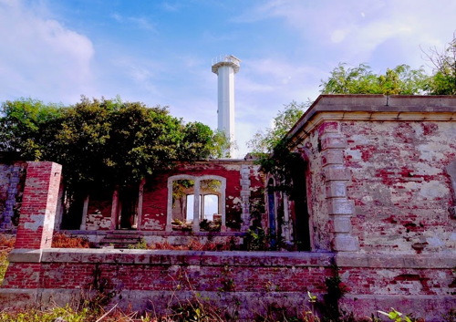
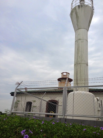
1904. Inactive. 10 m (33 ft) tower with lantern and gallery, attached to or mounted on a 1-story keeper's house. Lighthouse formerly painted white, but little paint remains. A photo by Loyd Martinez is at right, Rex Delsar Dianala has a view from the sea, a photo of the lighthouse entrance is available, and Google has a satellite view of the station. Unlike the one at Calabazas (see below) this Spanish lighthouse is still standing, but it is in poor condition, covered with rust. "Siete Pecados" is Spanish for "Seven Sins." Located on the largest of 7 tiny islands off the northern tip of Guimaras Island, marking the entrance to Iloilo. Accessible only by boat. Site status unknown. ARLHS PHI-058.
Siete Pecados (2)
Date unknown (station established 1904). Active; focal plane 27 m (89 ft); white flash every 5 s. 10 m (33 ft) round barbell-shaped white tower. A photo by Loyd Martinez is at right, Myralen Petinglay has a 2018 closeup, Eulogio Empio has a very distant view from the sea, and Google has a satellite view of the station. Located adjacent to the historic lighthouse. Accessible only by boat. Site status unknown. PCG-0205; Admiralty F2320; NGA 14692.
San Juan Point
Active; focal plane about 12 m (39 ft); continuous white light. Approx. 10 m (33 ft) white tower. No photo available but Bing has an indistinct satellite view. Located on a promontory at Banate, a town about 50 km (30 mi) northeast of Iloilo City. Site status unknown. Admiralty F2318; NGA 14687.
Iloilo River Entrance North
Date unknown. Active; focal plane 9 m (30 ft); red flash every 4 s. 6 m (20 ft) vase-shaped red fiberglass tower on a square base. This light is at the far left in Eb Blair's photo of the river mouth and Google has a satellite view and a distant street view across the river. Located on the north side of the Iloilo River entrance in Iloilo City. Site status unknown. PCG-0206; Admiralty F2326.2; NGA 14696.
* Iloilo River Entrance South
Date unknown. Active; focal plane 8 m (26 ft); green flash every 4 s. 6 m (20 ft) vase-shaped green fiberglass tower on a square base. This light is at the far right in Eb Blair's photo of the river mouth, Jimrey Biosa has a 2018 closeup photo, Titoinks Vlog has a view from the river, and Google has a satellite view. Located on the south side of the Iloilo River entrance in Iloilo City. Site open, tower closed. PCG-0207; Admiralty F2326; NGA 14700.

Siete Pecados Light, Guimaras, July 2014
photo copyright Loyd Martinez; used by permission

Guimaras Province Lighthouses

The island of Guimaras is elliptical, about 40 km (25 mi) long northeast to southwest and 20 km (13 mi) wide. At its northern end it is separated from Iloilo City, Panay, by the Iloilo Strait, which narrows to about 1500 m (0.9 mi). Plans for a bridge are being prepared, which a projected completion date of 2028; meanwhile ferries cross the strait every few minutes in the daytime. The population of Guimaras is about 190,000.

East Coast (Guimaras Strait) Lighthouse
Navalas Point
Date unknown. Active; focal plane unknown; three white flashes every 6 s. Approx. 12 m (39 ft) round white barbell-shaped fiberglass tower. No photo available but Google has a satellite view. Located on the northeastern tip of Guimaras. Site open, tower closed. PCG-0209; Admiralty F2319; NGA 14694.
San Enrique
Date unknown. Active; focal plane 10 m (33 ft); white flash every 5 s. Approx. 10 m (33 ft) round white barbell-shaped fiberglass tower. Google has a street view and a satellite view. This light marks the easternmost point of Guimaras. Located on a low point of land on the east coast of Guimaras. Site status unknown. May be accessible from the nearby Vilches Resort. PCG-0640; Admiralty F2319.5; NGA 14695.

South Coast (Panay Gulf) Lighthouse
Taklong Island
Date unknown. Active; focal plane approx. 33 m (108 ft); white flash every 5 s. Approx. 12 m (39 ft) round barbell-shaped fiberglass tower. No closeup photo available, but Google has a distant sea view and a satellite view. NGA lists the focal plane as 10 m (33 ft) but the sea view shows that it is more likely to be 33 m rather than 33 ft. Located on an island off the southern tip of Guimaras. Accessible only by boat. Site status unknown. PCG-0612; Admiralty F2330; NGA 14877.7.

West Coast (Iloilo Strait) Lighthouses
* Lusaran Point (Guisi Point, Guimaras) (1)
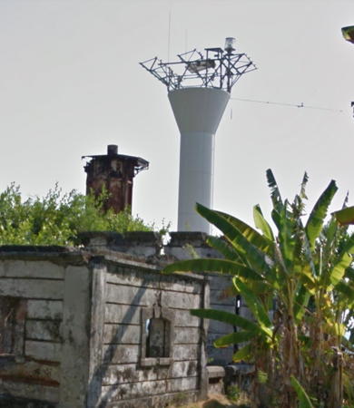
1894. Inactive. 17.5 m (58 ft) cylindrical tower cast iron tower. Ruined 1-story stone keeper's house. J.L.V. Salazar has a closeup photo, Renz Ticsay has another photo, and Google has a street view (seen at right) and a satellite view of the station. Gravely endangered: only the iron shell of the tower survives. M. Habana has a 2019 photo showing some attempts at restoration. Located on Guimaras island opposite Iloilo, next to the current Lusaran Point Light (next entry). Site open, tower open but not climbable. . ARLHS PHI-121.
* Lusaran Point (Guisi Point, Guimaras) (2)
Date unknown. Inactive. 18 m (59 ft) square skeletal tower with lantern and gallery. The lighthouse was probably painted white, although very little paint remains. Jon Mannion has a photo and Google has a street view. Thanks to Jürgen Klinksiek for alerting me to the existence of this lighthouse; we need information on its history. Site open, tower closed.
* Lusaran Point (Guisi Point, Guimaras) (3)
Date unknown. Active; focal plane 34 m (111 ft); white flash every 15 s. 11.5 m (38 ft) barbell-shaped metal tower, painted white. The Gooogle street view at right shows the tops of the oldest and newest towers rising above the ruins of the ight station. Renz Ticsay has a closeup photo, Gabiano Rogelio has a 2012 closeup, Abigail Regala has a photo, and Google has a sea view, the street view seen at right, and a satellite view of the station. Located on the southwestern point on Guimaras Island opposite the port of Iloilo, Panay, marking the southern entrance to Iloilo Strait and Harbor. Site status unknown. ARLHS PHI-047; PCG-0208; Admiralty F2328; NGA 14708.
Sinapsapan Point
Date unknown. Active; focal plane unknown; white flash every 5 s. 10 m (33 ft) round barbell-shaped steel and fiberglass tower. Entire lighthouse is white. Google has a sea view and a satellite view. Located on a promontory, the western tip of Guimaras, near the village of Sinapsapin. Site status unknown. PCG-0623; Admiralty F2329; NGA 14706.
Bundolan Point
Date unknown. Active; focal plane about 80 m (262 ft); white flash every 7 s. Approx. 11 m (36 ft) round barbell-shaped white metal and fiberglass tower. No photo available but Google has a satellite view and a distant sea view. Located on a steep promontory at Jordan, directly opposite the Iloilo waterfront. Site status unknown. PCG-0622; Admiralty F2327; NGA 14702.
* [Jordan Wharf]
Date unknown. Active; focal plane about 8 m (26 ft); red flash every 5 s. Approx. 6 m (20 ft) white concrete post with gallery. Google has a street view, a sea view and a satellite view. Located at the end of a wharf near the tourism office in Jordan, the provincial capital and the terminal for ferries from Iloilo City. Site open, tower closed. PCG-0845; Admiralty F2326.6.

Old and newLusaran Point Lights, Guimaras, May 2015
Google Maps street view

Information available on lost lighthouses:

Notable faux lighthouses:

Adjoining pages: Northeast: Masbate | Southeast: Negros | South: Northern Mindanao | Northwest: Romblon and Marinduque

Return to the Lighthouse Directory index | Ratings key

Posted July 24, 2005. Checked and revised December 20, 2023. Lighthouses: 39. Site copyright 2023 Russ Rowlett and the University of North Carolina at Chapel Hill.