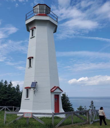
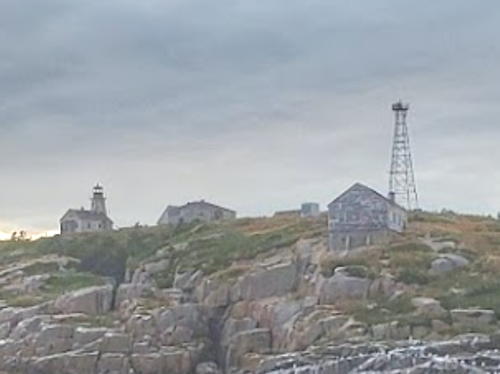
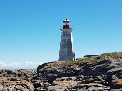
Lighthouses of Canada: Northeastern Québec (Côte-Nord)

The nation of Canada was created by the British North America Act in 1867 with Ontario, Québec, New Brunswick, and Nova Scotia as the four original provinces. The province of Québec was the heart of New France, the former French empire in North America, from tthe founding of Québec city in 1608 until France was forced to cede its Canadian territories to Britain at the end of the Seven Years War in 1763.

Today Canada is a federation of ten provinces and three large federal territories in the far north of the country. Québec is the largest and second most populous of the provinces. It includes both sides of the St. Lawrence River and Estuary from Montréal to the Gulf of St. Lawrence as well as the north shore of the Gulf; it also extends far to the north with long coastlines on Hudson Bay and Hudson Strait. Its population, more than 8 million, is concentrated in the valley of the St. Lawrence.

The province once had at least 275 lighthouses but only about 80 remain today. North of the St. Lawrence many lighthouses are accessible from Québec highway 138, which follows the north shore of the St. Lawrence. The province plans to extend this highway all the way to the border of Labrador, but currently there is still a gap of some 375 km (233 mi) between Kegashka and Vieux-Fort.

Québec is divided into 17 administrative regions (région administrative). Outside of the major urban areas Québec is further divided into 86 county-level regional county municipalities (municipalité régionale de comté). This page lists lighthouses of the north shores of the Gulf of St. Lawrence and the St. Lawrence Estuary in the Côte-Nord Region.

Aids to navigation in Canada are maintained by the Canadian Coast Guard. In 2008 Parliament passed the Heritage Lighthouse Protection Act to designate and protect historic lighthouses.

French is the official language of Québec. The French word for a lighthouse, phare, is often reserved for the larger lighthouses; a smaller light or harbor light is called a feu (literally "fire," but here meaning "light"). The front light of a range (alignement) is the feu antérieur and the rear light is the feu postérieur. In French île is an island, cap is a cape, pointe is a promontory or point of land, roche is a rock, récife is a reef, baie is a bay, estuaire is an estuary or inlet, détroit is a strait, rivière is a river, and havre is a harbor.

ARLHS numbers are from the ARLHS World List of Lights. CCG numbers are from the Atlantic Coast list of the List of Lights, Buoys, and Fog Signals of Fisheries and Oceans Canada. Admiralty numbers are from Volume H of the Admiralty List of Lights & Fog Signals. U.S. NGA numbers are from Publication 110.
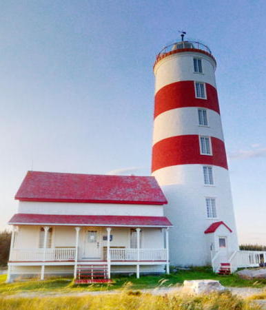

Pointe des Monts Light, Baie Trinité, July 2009
Creative Commons photo by Yves Galipeau

General Sources
Quebec Canada Lighthouses
Photos and text, including travel directions, by Kraig Anderson.
Photos des Phares du Saint-Laurent
A Flickr.com collection of outstanding photos by Jean Goupil.
Lighthouses in Quebec
Photos by various photographers available from Wikimedia.
World of Lighthouses - Atlantic Coast of Canada
Photos by various photographers available from Lightphotos.net.
Online List of Lights - Canada
Photos by various photographers posted by Alexander Trabas. Photos for this area are mostly by Michael Boucher.
Phares de la Côte-Nord/North Shore Lighthouses
Photos posted on Flickr.com by the Québec office of the Department of Fisheries and Oceans.
Phares/Lighthouses
Historic lighthouse photos, also posted on Flickr.com by the Québec office of the Department of Fisheries and Oceans.
Leuchttürme Kanadas auf historischen Postkarten
Historic postcard views posted by Klaus Huelse.
List of Lights, Buoys, and Fog Signals
Official Canadian light lists.
GPS Navigation Charts
Navigational chart for this area.
Navionics Charts
Navigational chart for this area.
Golfe-du-St.-Laurent Regional County Municipality Lighthouses
* Blanc-Sablon Range Front (2)
Date unknown (station established 1939). Active; focal plane 35 m (115 ft); continuous white light visible only on the range line. 15.5 m (51 ft) square cylindrical skeletal tower carrying a rectangular orange daymark with a black vertical stripe. Trabas has Brigitte Adam's closeup photo and Google has a satellite view. The range guides vessels arriving in Blanc-Sablon from the west. The rear light is on a shorter tower. The original light was in a 6 m (19 ft) square white tower; this lighthouse survived at least to 1980 and we do not know when it was replaced. Blanc-Sablon, a town of about 1100 residents, is the terminal for car ferries arriving from St. Barbe, Newfoundland, across the Strait of Belle Isle. Located beside the coastal highway (QC 138) about 2 km (1.25 mi) southeast of Blanc-Sablon. Site open, tower closed. CCG A1524; Admiralty H0122; NGA 1020.
Île Greenly (3)
1983 (station established 1878). Active; focal plane 35 m (115 ft); white flash every 15 s. 22 m (72 ft) trapezoidal pyramidal skeletal tower with a square lantern room and gallery. The tower also carries an orange slatted daymark. Trevor Pearson-Jones has a photo (also seen at right) and Google has a good satellite view. This is the landfall light for Blanc-Sablon, the easternmost village of Québec on the north shore of the Gulf of St. Lawrence. The original lighthouse was destroyed by fire in 1947. It was replaced by a skeletal tower in 1949 and then by the present tower in 1983. Since 2019, the Corporation de l'Île Greenly , a citizens' committee, has been working to restore and promote the site. On 13 April 1928 the German aircraft Bremen landed on Île Greenly after the first successful east to west non-stop crossing of the Atlantic. Located on the southwestern point of Île Greenly, about 8 km (5 mi) southwest of Blanc-Sablon. Accessible only by boat; the island is a protected bird sanctuary. Site open, tower closed. Site manager: Baie de Brador Migratory Bird Sanctuary. ARLHS CAN-975; CCG A1528.9; Admiralty H0123.5.
Baie de Brador Range Front
Date unknown. Active; focal plane 20 m (66 ft); red light, 1 s on, 1 s off, visible only on the range line. 15.5 m (51 ft) square cylindrical skeletal tower carrying a trapezoidal orange daymark with a black vertical stripe. No photo available but Google has an indistinct satellite view. The range guides vessels into the Baie de Brador on the west side of Blanc-Sablon. The rear light is on a 5 m (16 ft) skeletal tower. Located on the east side of the bay. Accessible only by boat. Site open, tower closed. CCG A1530; Admiralty H0124; NGA 2752.
Baie Salmon Range Front
Date unknown. Active; focal plane 20 m (66 ft); green light, 1 s on, 1 s off, visible only on the range line. 15.5 m (51 ft) square cylindrical skeletal tower carrying a trapezoidal orange daymark with a black vertical stripe. No photo available but Google has a satellite view. The range guides vessels into the Baie Salmon and a landing serving the village of Bonne-Esperance. The rear light is on a 6.5 m (21 ft) skeletal tower. Located near the north end of the bay. Accessible only by boat. Site open, tower closed. CCG A1532; Admiralty H1887; NGA 2776.

Île Greenly Light, Blanc-Sablon, September 2012
Google Maps photo
by Trevor Pearson-Jones
Chenal du Vieux Fort
2019. Active; focal plane 17.5 m (57 ft); white, red or green light depending on direction, 4 s on, 4 s off. 15 m (49 ft) square skeletal tower carrying a red and white daymark. Jérôme Legault has a distant July 2019 street view and Bing has an indistinct satellite view. This leading light replaced a pair of range lights guiding vessels through a narrow passage into the Baie du Vieux-Fort. Vieux-Fort (Old Fort) is a village of about 275 residents. Located at the west end of an island about 5 km (3 mi) south of Vieux-Fort. Accessible only by boat. Site open, tower closed. CCG A1539.125; Admiralty H1889.705; NGA 2801(?).
Île Paul-Nadeau Range Rear
Date unknown. Active; focal plane 43.5 m (143 ft); green light, 1 s on, 1 s off, visible only on the range line. 15.5 m (51 ft) square cylindrical skeletal tower carrying a trapezoidal orange daymark with a black vertical stripe. No photo available but Bing has a satellite view. The range guides vessels in a long northeast reach through a maze of islands in the municipality of Saint-Augustin. Located on the north side of the Île Paul-Nadeau. Accessible only by boat. Site open, tower closed. CCG A1539.42; Admiralty H1890.56.
Île Plate (1)
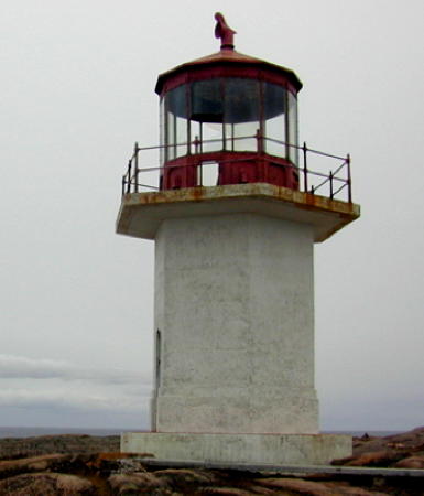
1913. Inactive since 1979. 10 m (34 ft) hexagonal cylindrical concrete tower with lantern; tower painted white, lantern red. Keeper's houses demolished. An aerial photo is at right and Bing has a satellite view of the station. The abandoned tower is certainly endangered. Located on an island on the north side of the Gulf of Saint Lawrence south of Saint-Augustin. Accessible only by boat; should be visible from ferry steamers serving the isolated villages along the north shore of the gulf. Accessible only by boat. Site and tower closed. Owner/site manager: Canadian Coast Guard. ARLHS CAN-242.
Île Plate (2) (?)
1979 (station established 1913). Inactive since 2014. 24 m (80 ft) square steel skeletal tower with gallery. The active light (focal plane 22.5 m (74 ft); white flash every 15 s) is now on a mast. A photo is at right. The skeletal tower probably has been removed. The active light (focal plane 22.5 m (74 ft); white flash every 15s) is now on a 7.5 m (25 ft) "cylindrical mast." Located near the historic lighthouse. Site and tower closed. Owner/site manager: Canadian Coast Guard. Active light: CCG A1543; Admiralty H1894; NGA 2840.
Baie de la Tabatière Outer Range Front (2)
1973 (?) (station established 1950). Active; focal plane 50 m (164 ft); continuous green light seen only on the range line. 30.5 m (100 ft) square pyramidal skeletal tower carrying a rectangular orange daymark with a black vertical stripe. A very distant view is available and Google has a satellite view. The original lighthouse was a 23.5 m (77 ft) skeletal tower. The rear light is on a 4.5 m (15 ft) skeletal tower. Located on a steep bluff about 800 m (1/2 mi) north of La Tabatière, a village in the municipality of Gros-Mécatina. Site status unknown. CCG A1546; Admiralty H1891.2; NGA 2856.

Île Plate Lights, Gros-Mécatina, undated
Dept. of Fisheries and Oceans photo
* Baie de Tabatière Inner Range Front
Date unknown. Active; focal plane 17.5 m (57 ft); continuous red light seen only on the range line. 15.5 m (51 ft) square cylindrical skeletal tower carrying an orange daymark with a black vertical stripe. Wikipedia has Dominic Cournoyer's photo and Bing has an indistinct satellite view. Located beside the Route Mécatina at the south end of the Baie de Tabatière. Site open, tower closed. CCG A1548; Admiralty H1891.5; NGA 2864.
[Baie des Moutons Range Front (2)]
1985 (station established 1929). Active; focal plane 13 m (43 ft); continuous green light. 13 m (43 ft) square skeletal mast. Lighthouse Digest has photos of the present front and rear lights, and Bing has an indistinct satellite view. The original front lighthouse was a 5.5 m (18 ft) square pyramidal wood tower, and the rear lighthouse was a 4 m (14 ft) square pyramidal wood tower. Located on the waterfront in Gros-Macatina, about 13 km (8 mi) south of La Tabatière. Site open, tower closed. CCG A1551; Admiralty H1896; NGA 2876.
Île Sainte-Marie (St. Mary Islands) (1)
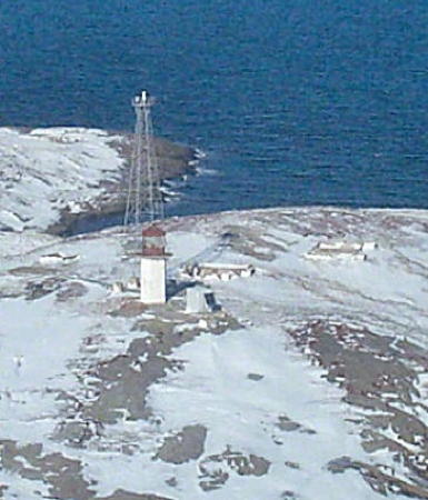
1913. Inactive since 1981. Approx. 7 m (23 ft) hexagonal cylindrical concrete tower with lantern and gallery, painted white; lantern painted red. A Coast Guard photo is at right and Bing has a satellite view of the station. The active light (focal plane 42 m (138 ft); white flash every 2.5 s) is on a 16 m (52 ft) square skeletal tower. The abandoned tower is certainly endangered. Located on an island off a prominent cape guiding vessels into the northeastern corner of the Gulf of Saint Lawrence. Accessible only by boat. Site open, tower closed. Site manager: Îles Sainte-Marie Migratory Bird Sanctuary. ARLHS CAN-243. Active light: CCG A1562; Admiralty H1904; NGA 2932.
Rochers au Cormoran (Île aux Cormorants, Cape Whittle) (3?)
1970s (station established 1928). Active; focal plane 24 m (79 ft); white flash every 15 s. 15.5 m (51 ft) square skeletal tower. A small photo of the station shows the second (?) tower and a newer one, and Bing has a satellite view. The original lighthouse was a square wood tower centered on a 2-story keeper's house. Cape Whittle is the point on the northwest side of the entrance to the northeastern extension of the Gulf of St. Lawrence. Located on a small island off the point of the cape. Accessible only by boat. Site open, tower closed. ARLHS CAN-776; CCG A1563; Admiralty H1906; NGA 2940.

1913 Île Sainte-Marie Light, Harrington Harbour, undated
Dept. of Fisheries and Oceans photo

Minganie Regional County Municipality: Île d'Anticosti Lighthouses
The Île d'Anticosti is an island in the mouth of the St. Lawrence estuary. It is quite large, almost 220 km (135 mi) long, but its permanent population is less than 300. Port-Menier, on the south coast near the west end of the island, is the only settlement of any size. Anticosti is accessible in the summer by air or by car ferry from Rivière-au-Renard on the Gaspé Peninsula or from Havre St.-Pierre on the north shore of the St. Lawrence. The Route Transanticosti, a rough gravel road, runs the length of the island; 4WD vehicles are strongly recommended. Several companies offer ecotours that include stops at one or more lighthouses. The island is administered as part of the Minganie Regional County Municipality.

#Pointe Heath (2)
1835. Inactive since 1965 at least. Ruins of a demolished 40.5 m (133 ft) masonry tower. Bing has a satellite view of the station. The original lighthouse was a 27 m (90 ft) round stone tower. In 1908 is was extended to 40.5 m (133 ft), making it one of Canada's largest lighthouses. Anderson has a 1936 photo. Sadly, this great lighthouse was demolished in 1965. The navigational light was shown from a skeletal tower from 1965 to 2002, but the skeletal tower was demolished in 2003. Today a 123 m (403 ft) skeletal tower carries aviation beacons (white flashes every 1.5 s) at focal planes of 128 and 68 m (420 and 223 ft). Located at the easternmost point of Île d'Anticosti. Accessible only by boat. Site open, tower closed. Owner: Environnement Québec. Site manager: Pointe Heath Ecological Reserve. ARLHS CAN-986; ex-CCG A1513.1; NGA 3130.
Escarpement Bagot (Bagot Bluff) (2)
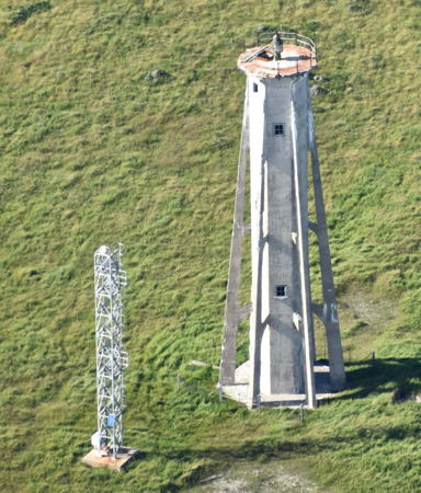
1912 (station established 1871). Inactive since 1980. Approx. 25 m (82 ft) pyramidal concrete tower with flying buttresses; lantern removed. Keeper's houses demolished in 1989. A photo by S. Boisvert is at right and Google has a satellite view. The original lighthouse was a hexagonal wood tower. The abandoned tower is certainly endangered. Located near Pointe du Sud on the southeast coast of Île d'Anticosti. Accessible only by boat. Site open, tower closed. Owner/site manager: Canadian Coast Guard. ARLHS CAN-172.
Escarpement Bagot (Bagot Bluff) (3)
1980 (station established 1871). Active; focal plane 19.5 m (64 ft); white flash every 6 s). 15 m (50 ft) square cylindrical skeletal tower. S. Boisvert's photo shows both lighthouses. Located near the historic lighthouse. Site open, tower closed. Owner/site manager: Canadian Coast Guard. CCG A1514; Admiralty H1864; NGA 3132.
 

1912 Escarpement Bagot (Bagot Bluff) Light, Île d'Anticosti, June 2005
Google Maps photo by S. Boisvert
 
Pointe du Sud-Ouest (Southwest Point) (1)
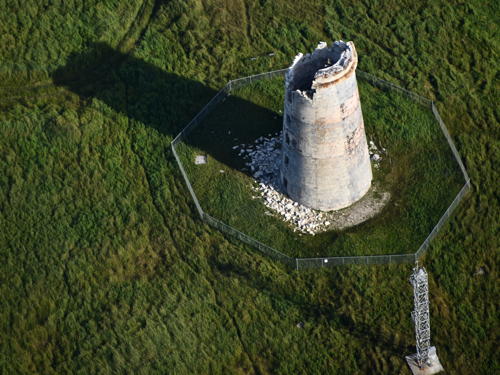
1831. Inactive since 1959. 24 m (80 ft) stone tower, formerly with lantern and gallery and painted white with two horizontal red bands. Critically endangered. The abandoned lighthouse is falling quickly into ruins; Anderson's photos show that the top of the tower has collapsed, dropping the lantern to the ground. Marc Serre's 2008 photo is at right, Alexandre Mainguy has a 2014 photo, an October 2006 closeup photo showed the poor condition of the lighthouse at that time, and Bing has a satellite view. Located on the point, in the middle of the south side of Île d'Anticosti. Accessible only by boat. Owner/site manager: Canadian Coast Guard. ARLHS CAN-398.
Pointe du Sud-Ouest (Southwest Point) (3)
1972 (station established 1831). Active; focal plane 21 m (68 ft); white flash every 6 s. 15 m (50 ft) square cylindrical skeletal tower. The active tower is seen behind the old tower in Alexandre Mainguy's 2014 photo. Located adjacent to the historic lighthouse. Owner/site manager: Canadian Coast Guard. CCG A1515; Admiralty H1866; NGA 3136.
* Baie Ellis Range Rear (1)
1906. Inactive since about 1986. 16 m (52 ft) round cylindrical cast iron tower with lantern and gallery, painted white. Richard Cote has a 2022 photo, Sebastien Lalancette has a 2018 photo, Lighthouse Digest has a good closeup photo by Katherine McIntyre, and Google has a satellite view. The abandoned tower is rusting and clearly endangered. Prefabricated by Sauter & Harle, this lighthouse is a typical French tourelle, one of only a few such towers surviving in North America. Both towers were relocated to the head of the bay in 1927 due to a change in the channel alignment. The lighthouse was taken down, repaired, and relocated to a new foundation close to its original location in 1989, but its lantern was damaged in the process. The lantern from the front light was then placed on the refurbished tower. Located on the waterfront at Port-Menier, the island's only protected anchorage. Site open, tower closed. Owner/site manager: unknown. ARLHS CAN-959.
Pointe du Sud-Ouest
Pointe du Sud-Ouest Light, Île d'Anticosti, August 2008
Flickr photo copyright Marc Serre; used by permission

 
Baie Ellis Range Front (1)
1906. Inactive since about 1986. 10 m (33 ft) round cylindrical cast iron tower with gallery, painted white. The active light is on a 9 m (30 ft) square cylindrical skeletal tower displaying a continuous green light only on the range line (focal plane 12 m (40 ft)). Anderson has a photo. The abandoned tower is rusting and clearly endangered. Prefabricated by Sauter & Harle, this lighthouse is a typical French tourelle, one of only a few such towers surviving in North America. Both towers were relocated in 1927 due to a change in the channel alignment; The lantern of this light was moved to the rear lighthouse (previous entry) in 1989. According to Anderson the lighthouse is in the woods just off the road from Port-Menier to Baie Sainte Claire; Bing's distant satellite view may show it a short distance west of the modern tower (next entry). Site open, tower closed. Owner/site manager: unknown. ARLHS CAN-958. Active light: CCG A1519; Admiralty H1870; NGA 3144.
Baie Ellis Range Rear (2)
About 1986. Active; focal plane 27 m (88 ft); continuous green light seen only on the range line. 15.5 m (51 ft) square cylindrical skeletal tower carrying an orange daymark with a black vertical stripe. Anderson has a photo and Bing has a satellite view. Located near the head of the bay and north of the road from Port-Menier to Baie Sainte Claire. Site status unknown. CCG A1520; Admiralty H1870.1; NGA 3148.
* Pointe de l'Ouest (West Point) (2)
1967 (station established 1858). Active; focal plane 27 m (88 ft); white flash every 5 s. 18 m (60 ft) square pyramidal skeletal tower with gallery. Two 1-story wood keeper's cottages (1950s) survive and are available for vacation rental. Stéphane Boucher has a photo of the station, Gaétan and Danièle Morin-Laprise have a more distant view, and Google has a satellite view. The original lighthouse was a 34 m (112 ft) stone tower. Anderson has a historic photo of that tower. Located at the westernmost point of the island; accessible by road from Port-Menier. Site open, tower closed. Owner: Canadian Coast Guard. Site manager: Auberge de la Pointe-Ouest. ARLHS CAN-525; CCG A1523; Admiralty H1878; NGA 3160.
* Cap de Rabast (Pointe-Nord)
1919. Active; focal plane 24 m (78 ft); three white flashes, separated by 5 s, every 30 s. 22 m (72 ft) octagonal concrete tower with lantern and gallery, painted white; lantern is red. 2-story wood duplex keeper's house. Sébastien DeNobile has the wintry photo at right, Dennid Bailey has a 2021 photo, Alexandre Mainguy has an aerial view, and Google has a fuzzy satellite view. Prior to the Covid pandemic the keeper's house was available for vacation rental. Located on the northernmost point of the island about 25 km (15 mi) northeast of Port-Menier. Site open, tower closed. Owner: Canadian Coast Guard. Site manager: private. ARLHS CAN-084; CCG A1602; Admiralty H1882; NGA 3164.

Cap de Rabast Light, Île d'Anticosti, December 2019
Google Maps photo by Sébastien DeNobile

* Pointe Carleton
1919. Active; focal plane 38.5 m (126 ft); green flash every 6 s. 12 m (40 ft) octagonal concrete tower with lantern and gallery, painted white; lantern is red. 2-story wood keeper's quarters. Danh Pham's 2022 photo is at right, Goupil has a good photo (with a deer), Alexandre Mainguy has a 2014 photo, a good closeup is available, and Google has a good satellite view. The keeper's houses were formerly available for vacation rentals but they have been abandoned since 2006. According to Anderson, the buildings are to be demolished. Located in the middle of the north coast of the island; accessible by road from Port-Menier. Site open, tower closed. Owner: Canadian Coast Guard. Site manager: Sépaq. ARLHS CAN-395; CCG A1601; Admiralty H1884; NGA 3168.
* Cap de la Table (Table Head)
1919. Active; focal plane 34 m (112 ft); red flash every 6 s. 12 m (40 ft) octagonal concrete tower with lantern and gallery, painted white; lantern is red. Two 2-story wood keeper's houses (1960) were demolished in 2011. S. Boisvert has a photo of the station and Bing has a satellite view. The light station is leased by a tour company which formerly provided overnight accommodations for tourists. Located on the northeast coast of the island. Site open, tower closed. Owner: Canadian Coast Guard. Site manager: Safari Anticosti. ARLHS CAN-082; CCG A1600; Admiralty H1886; NGA 3172.

Minganie Regional County Municipality: Mainland Coast and Mingan Archipelago Lighthouses
The Mingan Archipelago (Archipel-de-Mingan) is a ragged chain of mostly small islands extending for 175 km (110 mi) along the north coast of the St. Lawrence estuary across from the Île d'Anticosti. The islands are included in the Mingan Archipelago National Park Reserve and are administered as part of the Minganie Regional County Municipality.

[Pointe de Natashquan (2)]
1914. Lighthouse destroyed in 1995; station inactive since 2006. 9.5 m (31 ft) square skeletal tower. The original lighthouse was a 9 m (30 ft) hexagonal concrete tower, buttressed at the corners, with lantern and gallery. In 1992, as the lighthouse was threatened by erosion of the cliff on which it stood, the light was moved to a 9.5 m (31 ft) square skeletal tower. Bing has a distant satellite view of the location. The historic lighthouse could have been saved by moving it back from the cliff, but it was abandoned to its fate and collapsed over the edge in 1995. Anderson has a photo of the lighthouse lying on the beach at the base of the cliff. One small building survives at the station. The light on the skeletal tower was discontinued in 2006. Located on a prominent cape about 13 km (8 mi) southeast of Natashquan. Site open. ARLHS CAN-336; ex-Admiralty H1912; ex-NGA 3004.

Pointe Carleton Light, Île d'Anticosti, July 2022
Google Maps
photo by Danh Pham
[Île Joncas (Petite Natashquan) (2)]
1969 (station established 1906). Active; focal plane 13.5 m (44 ft); green light, 1 s on, 1 s off. 9.5 m (31 ft) square skeletal tower. This light replaced a 10 m (33 ft) square wood tower with lantern and gallery that was swept away in a winter storm in 1969. Bing has an indistinct satellite view. A 2004 photo does not show the light but it does show a small service building seen in another Bing satellite view. Located at the southeast end of a small island in the entrance to the harbor of Natashquan. Accessible only by boat. Site open, tower closed. ARLHS CAN-1141; CCG A1576; Admiralty H1914; NGA 3008.
Petite Île au Marteau (2)
1955 (station established 1915). Inactive since about 1976. 11.5 m (38 ft) octagonal concrete (?) tower, painted white; lantern is red. Patrick Matte's photo of the station is at right, Goupil has a closeup and a photo of the station, and Google has a street view and a satellite view of the station. In 2005 Parks Canada allocated $125,000 to begin restoration of the two Mingan Archipelago lighthouses. Eventually some $2 million was spent on restoration and site improvements, including expanded wharf and visitor facilities. The project was completed in October 2010. Located on an island a few miles southeast of Havre-St.-Pierre. Island accessible only by boat; transportation is available in Havre-St.-Pierre, and a hiking trail leads to the lighthouse. Site open, tower closed. Owner: Canadian Coast Guard. Site manager: Mingan Archipelago National Park Reserve. . ARLHS CAN-375.
Petite Île au Marteau (3)
1976 (station established 1915). Active; focal plane 28.5 m (94 ft); white flash every 2.5 s. 25.5 m (84 ft) square pyramidal steel skeletal tower. Goupil has a photo of the station. Located near the historic lighthouse. Site open, tower closed. Owner: Canadian Coast Guard. Site manager: Mingan Archipelago National Park Reserve. CCG A1585; Admiralty H1934; NGA 3048.
* Havre-Saint-Pierre Range Rear (3?)
Date unknown (station established 1907). Active; focal plane 24.5 m (80 ft); continuous red light seen only on the range line. 18.5 m (61 ft) square skeletal mast carrying a trapezoidal slatted daymark colored orange with a black vertical stripe. This light is in the distance in a Google street view showing both range lights. Bing has a satellite view. The guides vessels approaching from the south. The front light is on a similar tower 11 m (36 ft) tall. The original light was on a mast. Havre-Saint-Pierre is a town of about 3500 residents and the seat of the Minganie Municipality. Located north of the Rue Boréale and east of the Avenue Anticoste in a residential neighborhood of Havre-Saint-Pierre. Site status unknown, but the light is easy to see from nearby streets. CCG A1588; Admiralty H1936.1; NGA 3056.

Petite Île au Marteau Light, Havre St.-Pierre, July 2015
Google Maps photo by Patrick Matte
* Pointe aux Esquimaux (Eskimo Point) Range Rear
1951 (?) (station established 1907). Active; focal plane 23.5 m (77 ft); continuous red light seen only on the range line. 18 m (59 ft) square skeletal tower carrying a trapezoidal slatted daymark colored orange with a black vertical stripe. Ali Nnaemeka has a street view and Bing has a satellite view. The guides vessels approaching from the west, parallel to the coast. The front light is on a similar tower 12 m (39 ft) tall. The original light was on a mast. Pointe aux Esquimaux is the location of the port facilities of Havre St.-Pierre. Located across the street from the Parks Canada Reception and Interpretation Centre. Site open, tower closed. CCG A1591; Admiralty H1940.1; NGA 3092.
Île du Fantôme (Fright Island) Entrance Range Rear
1950. Active; focal plane 19 m (62 ft); continuous green light seen only on the range line. 18.5 m (61 ft) square skeletal tower carrying a trapezoidal slatted daymark colored orange with a black vertical stripe. No photo available but Bing has an indistinct satellite view. The range guides ferries arriving in Havre-St.-Pierre in a narrow passage between the Île du Fantôme and the Île du Havre. Located a short distance northwest of the point. Site status unknown, but the light is easy to see from nearby streets. CCG A1593; Admiralty H1943.1; NGA 3084.
Havre de Mingan Western Entrance Range Rear (2?)
Date unknown. Active; focal plane 21 m (69 ft); continuous green light seen only on the range line. 15.5 m (50 ft) square skeletal mast carrying a trapezoidal slatted daymark colored orange with a black vertical stripe. No photo available but the shadow of the tower is seen in Google's satellite view. The front light is on a similar tower 6.5 m (21 ft) tall. The harbor of Mingan is sheltered behind an island and can be approached from either end of the island. Located just of the river bank about 800 m (1/2 mi) east of Mingan. Site status unknown. CCG A1607; Admiralty H1950.1; NGA 3120.
* Havre de Mingan Eastern Entrance Range Rear (3?)
Date unknown (station established 1927). Active; focal plane 22 m (72 ft); continuous green light seen only on the range line. 21 m (62 ft) square skeletal mast carrying a trapezoidal slatted daymark colored orange with a black vertical stripe. Benjamin Augustin has a street view and Bing has a satellite view. The front light is on a similar tower 12.5 m (41 ft) tall. The harbor of Mingan is sheltered behind an island and can be approached from either end of the island. Located on the south side of QC 138 in Mingan. Site status unknown, but the light is easy to see from nearby streets. CCG A1605; Admiralty H1946.1; NGA 3112.
Île aux Perroquets (2)
1951 (station established 1888). Active; focal plane 24 m (79 ft); white flash every 5 s. 10.5 m (35 ft) octagonal concrete tower, painted white; lantern is red. 1-1/2 story wood keeper's house. A photo is at right, Jean-Sebastien Chouinard has a 2008 closeup photo, Jean-François Petit has a photo of the station, Huelse has a historic postcard view, and Google has a street view and a satellite view of the station. A historic photo of the 1888 lighthouse is also available. In 2005 Parks Canada allocated $125,000 to begin restoration of the two Mingan Archipelago lighthouses. In 2014 this became the first Québec lighthouse to receive the heritage designation. Also in 2014 the lighthouse was transferred to the Corporation de l'Île aux Perroquets, which opened the keeper's house for overnight stays. Located on an island, the westernmost island of the Mingan Archipelago, off the north shore near Longue-Pointe. Accessible only by boat; tours to the lighthouse are available. Site open, tower closed. Owner: Canadian Coast Guard. Site manager: Mingan Archipelago National Park Reserve. . ARLHS CAN-236; CCG A1608; Admiralty H1958; NGA 3124.
Île aux Perroquets Light
Île aux Perroquets Light, Mingan, 2013
Parks Canada photo

Sept-Rivières Regional County Municipality Lighthouses
Île du Corossol (Carousel Island, Sept-Îles) (2)
1953 (station established 1876). Inactive since 1988. 17 m (56 ft) octagonal concrete (?) tower, painted white; lantern is red. 1-1/2 story wood keeper's house and other buildings. A portion of Julien St-Laurent's 2018 view from the sea is at right, Fisheries and Oceans has a 1990 aerial view of the station, and Bing has a satellite view of the station. Endangered by abandonment, the lighthouse is deteriorating. The first nation council of Uashat-Maliotenam is interested in restoring the buildings as a tourist attraction, but funds are lacking. Located on an island off the entrance to Sept-Îles. Accessible only by boat; boat tours out of Sept-Îles sometimes pass the site. Site and tower closed (important bird nesting area). Owner: Ministry of Indian and Northern Affairs. Site manager: Canadian Wildlife Service (Île du Corossol Migratory Bird Sanctuary). ARLHS CAN-239.
Île du Corossol (Carousel Island, Sept-Îles) (3)
1988 (station established 1876). Active; focal plane unknown; white flash every 2.5 s. 18 m (60 ft) skeletal tower, painted white. A photo is at right. This light marks a turn in the St. Lawrence channel where vessels bound upstream turn from west to southwest. Located near the historic lighthouse. Owner: Canadian Coast Guard. CCG A1658; Admiralty H1990; NGA 3196.
* Sept-Îles Wharf
Date unknown. Active; focal plane 13.5 m (44 ft); green light, 1 s on, 1 s off. 12.5 m (41 ft) square cylindrical skeletal tower mounted on a square 1-story concrete base. Alain Racine has a street view and Bing has a satellite view. Sept-Îles (Seven Islands) is a city of about 25,000 and a port shipping ioron ore from nearby mines. Located on the commercial wharf. Site open, tower closed. CCG A1667; Admiralty H1994.2; NGA 3208.

Île du Corossol Lights, Sept-Îles,September 2018
Google Maps photo by Julien St-Laurent
Port-Cartier Range Front
Date unknown. Active (privately maintained); focal plane 51 m (166 ft); continuous green light. Approx. 40 m (131 ft) square skeletal tower. No photo available but Bing has a satellite view. Port-Cartier is an industrial town 63 km (39 mi) southwest of Sept-Îles. The range guides vessels arriving at a large iron processing and shipping plant on the east side of the town. Located within the industrial facilities. Site and tower closed. CCG A1678; Admiralty H2002; NGA 3256.
Port-Cartier Range Rear
Date unknown. Active (privately maintained); focal plane 88 m (290 ft); continuous green light. 25 m (75 ft) square skeletal tower. No photo available but Google has a satellite view. Located 495 m (0.3 mi) north northeast of the front light. Site and tower closed. CCG A1679; Admiralty H2002.1; NGA 3260.
Île du Grand Caouis (Great Cawee Island) (2)
1955 (station established 1927). Active; focal plane 45 m (148 ft); white flash every 6 s. 10 m (33 ft) octagonal concrete (?) tower, painted white; lantern is red. Patrick Matte has a portfolio of recent photos, Coast Guard has a photo taken around 1990, Eduardo Lopez has a sunrise view from the sea, and Bing has a satellite view. The keeper's house was demolished after the station was automated in 1970; foundation ruins remain. Located on an island off the north shore about 50 km (30 mi) south of Port-Cartier. Accessible only by boat. Site status uncertain. Owner/site manager: Canadian Coast Guard. ARLHS CAN-240; CCG A1686; Admiralty H2010; NGA 3280.
Île aux Oeufs (Egg Island) (2)
1955 (station established 1871). Inactive since 2003. 11 m (36 ft) octagonal concrete tower, painted white; lantern is red. Keeper's house demolished in the 1970s. A 2017 photo is at right and Google has a satellite view of the station. Endangered by abandonment. According to Robert Giroux of the Canadian Coast Guard, this lighthouse was deactivated in October 2003 but there are no plans to demolish it. Located on an island south of Rivière-Pentecôte. Accessible only by boat. Site open, tower closed. Owner/site manager: Canadian Coast Guard. ARLHS CAN-235; ex-Admiralty H2018; ex-NGA 3284.

Île aux Oeufs Light, Rivière-Pentecôte, June 2017
Google Maps photo by Capharnaum86
 

Manicouagan Regional County Municipality Lighthouse
**** Pointe des Monts
1830. Inactive since 2000. 27.5 m (90 ft) round stone tower with a small square lantern room perched on a platform-like gallery. Lighthouse painted white with two broad red horizontal bands; lantern is also red. 1-1/2 story keeper's house and several other light station buildings. Yves Galipeau's photo is at the top of this page, Anderson has a good page with several photos, Fred Lefebvre has another good photo, Laval Poulin has a 2016 photo, Huelse has a historic postcard view, and Google has a street view and a satellite view. This magnificent lighthouse is one of Canada's oldest and most famous. The 7 floors of the tower are a museum; the keeper's house is operated as a restaurant. There is a bed and breakfast inn as well as cottages and camping facilities on site. The lighthouse was saved from demolition in 1964 by Jacques Landry and his wife, the final keepers; it was transferred to the government of Québec in 1965. The area is accessible via QC 138 from Québec city or by ferry from Matane on the south shore. Located about 4 km (2.5 mi) southwest of Baie Trinité off QC 138 at the end of the Chemin de la Pointe des Monts. Accessible by a footbridge about 45 m (150 ft) long. Site open; tower open daily early June to mid September. Owner: Québec Ministère de la Culture et des Communication. Site manager: Gîte du Phare de Pointe-des-Monts . ARLHS CAN-396; ex-Admiralty H2024.
[Pointe Saint-Pancrace (2)]
Date unknown (station established 1925). Active; focal plane 25 m (82 ft); white flash every 6 s. 11 m (36 ft) square skeletal tower with rectangular orange daymark on two faces. No photo available but Bing has a satellite view. The original lighthouse had a lantern atop a keeper's house; it was replaced sometime in the 1970s. Located on a prominent headland about 5 km (3 mi) northeast of Baie-Comeau. Site status unknown. ARLHS CAN-987; CCG A1709; Admiralty H2050; NGA 3304.
Baie des Anglais Range Front
Date unknown. Active; focal plane 27 m (89 ft); continuous green light seen only on the range line. 15.5 m (50 ft) square skeletal mast carrying a trapezoidal slatted daymark colored orange with a black vertical stripe. No photo available but the shadow of the tower is seen in Bing's satellite view. The rear light is on tower only 3 m (10 ft) tall. Cargill Grain and Alcoa Aluminum have failities on the west side of the bay. Located at the head of the bay. Site status unknown. CCG A1710; Admiralty H2050.5; NGA 3308.
Baie Comeau
Date unknown. Active; focal plane 12.5 m (41 ft); red flash every 6 s. 10 m (33 ft) square cylindrical skeletal tower atop a 1-story pierhead building. Trabas has Boucher's photo and Bing has an indistinct satellite view. A city of about 30,000 residents, Baie Comeau is the county seat for Manicouagan. Located at the end of the Quai Fédéral, the main wharf at Baie Comeau. Site and tower closed, but there's a good view from ferries arriving from Matane on the south shore of the estuary. CCG A1716; Admiralty H2054; NGA 3324.
Pointe de Manicouagan (2)
Date unknown (station established 1975). Active; focal plane 36 m (118 ft); white flash every 6 s. 30.5 m (100 ft) square pyramidal skeletal tower. Google has a street view and a satellite view. This light marks a very prominent cape. The present tower replaced a triangular skeletal tower of similar height. Located beside the Rue Granier about 16 km (10 mi) south of Baie-Comeau. Site open, tower closed. CCG A1719; Admiralty H2056; NGA 3336.

La-Haute-Côte-Nord (Upper North Coast) Regional County Municipality Lighthouse
Pointe Rocheuse (Forestville)
Date unknown. Active; focal plane 20 m (66 ft); white flash every 6 s. 16 m (52 ft) square cylindrical skeletal tower. Trabas has Boucher's photo, Google has a street view from the pierhead beacon, and Bing has an indistinct satellite view. Located near the foot of the pier at Forestville. Site status unknown; there's a good view from ferries arriving from Rimouski on the south shore of the estuary. CCG A1738; Admiralty H2064; NGA 3360.
*** Bon Désir (2)
1957 (station established 1941). Active; focal plane 44.5 m (146 ft); white flash every 5 s. 10.5 m (35 ft) octagonal concrete tower, painted white; lantern is red. A Culture Ministry photo is at right, Goupil has a photo, Trabas has Boucher's photo, and Google has a street view and a satellite view. This readily accessible light station is also a popular site for whale watching. Gift shop and ample parking provided. Located at the end of the Chemin du Cap-Bon-Désir, off QC 138 about 3 km (2 mi) east of Grandes-Bergeronnes. Site open, interpretive center open daily mid June through mid October, tower closed. Owner: Canadian Coast Guard. Site manager: Parc Marin du Saguenay-St. Laurent (Centre d'Interprétation et d'Observation de Cap-de-Bon-Désir) . ARLHS CAN-080; CCG A1755; Admiralty H2093; NGA 3396.

Cap de Bon Désir Light, La-Haute-Côte-Nord, 2015
Ministère de la Culture photo by Andréane Beloin

Information available on lost lighthouses:

Notable faux lighthouses:

Adjoining pages: North: Labrador | East: Central and Western Newfoundland | South: Eastern Québec | West: Central Québec

Return to the Lighthouse Directory index | Ratings key

Posted September 12, 2003. Checked and revised July 17, 2023. Lighthouses: 45. Site copyright 2023 Russ Rowlett and the University of North Carolina at Chapel Hill.