Lighthouses of Canada: Southwestern Québec (Montérégie)

The nation of Canada was created by the British North America Act in 1867 with Québec as one of the four original provinces, along with Nova Scotia, New Brunswick, and Ontario. Québec is descended from New France, the French empire in North America, which fell to Britain during the Seven Years War (1756-63). Today Québec is the largest of Canada's ten provinces by area and second-largest by population. It retains its French heritage and has French as its official language. The heart of the province is the valley of the St. Lawrence River and Estuary. The St. Lawrence is one of the world's greatest inland waterways: ocean-going ships sail the river to Montréal and many continue on the St. Lawrence Seaway to the Great Lakes.

Québec is divided into 17 administrative regions (régions administratives). Outside of the major urban areas Québec is further divided into 86 county-level regional county municipalities (municipalités régionale de comté). This page covers lighthouses of southwestern Québec in the larger part of the region of Montérégie, located south of the St. Lawrence River opposite the metropolitan Montréal area. The Montérégie Region also includes the Vaudreuil-Soulanges Municipality west of Montréal and north of the river. Lighthouses of that area are described on the Western Québec page.

The French word for a lighthouse is phare, although a smaller light or harbor light is called a feu (literally "fire," but here meaning "light") or a balise (beacon). In French île is an island, cap is a cape, pointe is a promontory or point of land, roche is a rock, récife is a reef, baie is a bay, estuaire is an estuary or inlet, détroit is a strait, rivière is a river, and havre is a harbor.

Aids to navigation in Canada are maintained by the Canadian Coast Guard (CCG-GCC), an agency of Fisheries and Oceans Canada (DFO-MPO). In 2008 Parliament passed the Heritage Lighthouse Protection Act to designate and protect historic lighthouses.

ARLHS numbers are from the ARLHS World List of Lights. CCG numbers are from the Inland Waters (I) and Atlantic Coast (A) portions of the List of Lights, Buoys, and Fog Signals of Fisheries and Oceans Canada; the Inland Waters list includes lights in and west of Montréal. Admiralty numbers are from Volume H of the Admiralty List of Lights & Fog Signals. U.S. NGA numbers are from Publication 110.

General Sources
Quebec, Canada Lighthouses
Photos and text by Kraig Anderson.
Online List of Lights - North and East Canada
Photos by various photographers posted by Alexander Trabas. Most of the photos for the St. Lawrence are by Michael Boucher.
Quebec
Photos of Québec lighthouses taken in 2008 and posted by C.W. Bash.
Lighthouses in Quebec
Photos by various photographers available from Wikimedia.
World of Lighthouses - Atlantic Coast of Canada
Photos by various photographers available from Lightphotos.net.
Quebec, Canada Lighthouses
Aerial photos posted by Marinas.com.
Leuchttürme Kanadas auf historischen Postkarten
Historic postcard views posted by Klaus Huelse.
List of Lights, Buoys, and Fog Signals
Official Canadian light lists.
GPSNauticalCharts
Navigation chart information for the St. Lawrence.
Navionics Charts
Navigation chart for the St. Lawrence.

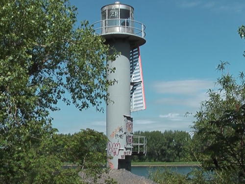
Île Sainte-Thérèse Range Front Light
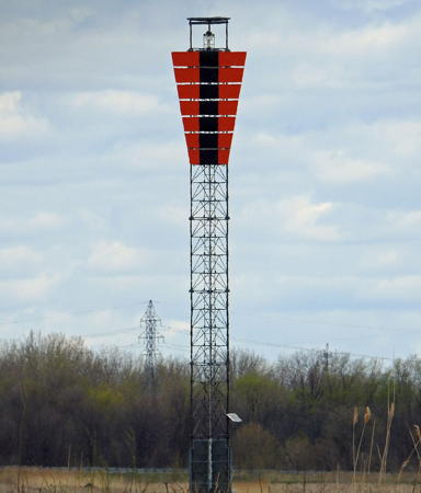
Île Sainte-Thérèse Upper Range Front Light, Varennes, September 2011
photo copyright Jon Clay; used by permission


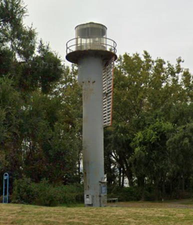
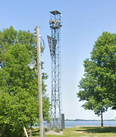
Longue Pointe Traverse Upstream Range Front Light, Longueuil, April 2023
Google Maps photo by Chami Shaw
Le-Haut-Saint-Laurent (Upper St. Lawrence) Municipality Lighthouses
These lights are located in a wide section of the St. Lawrence River known as Lac Saint-François.
Saint-Anicet (South Gulby) West Range Front
Date unknown. Active; focal plane 10.5 m (34 ft); continuous white light. 10.5 m (34 ft) round white concrete tower carrying a triangular slatted daymark painted orange with a black vertical stripe. Trabas has Boucher's distant view and Google has a satellite view. This range guides vessels on a long upstream reach. The rear light is in Ontario waters (see the Southeast Ontario page). Located in the river about 1.6 km (1 mi) northwest of Lancaster Bar. Accessible only by boat. Site open, tower closed. CCG I-0114.1; Admiralty H2551; NGA 6184.
Pointe Dupuis Range Rear
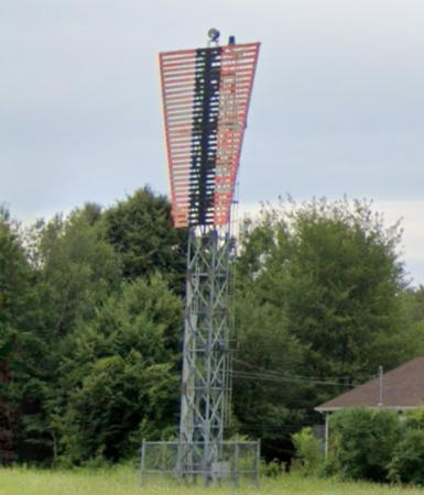
Date unknown. Active; focal plane 20 m (66 ft); continuous yellow light. 19 m (62 ft) square skeletal tower carrying a daymark colored orange with a black vertical stripe. Trabas has Boucher's fuzzy view from the river and Google has a street view and a satellite view. The range guides vessels downstream. Located off QC 132 at the end of 101st Avenue in Saint-Anicet. The light stands surrounded by private property, but it can be seen from the end of the public portion of the street. Site and tower closed. CCG I-0112; Admiralty H2548.1; NGA 6156.
Île Chrétien Range Rear
Date unknown. Active; focal plane 17 m (56 ft); continuous red light. 16 m (59 ft) square skeletal tower carrying a daymark colored orange with a black vertical stripe. Trabas has Boucher's distant view of the two range lights and Google has a satellite view. The range guides vessels upstream. Located on the northeastern tip of Île Chrétien, a small island off Saint-Anicet. Accessible only by boat. Site status unknown. CCG I-0105; Admiralty H2545.1; NGA 6124
Saint Anicet (Port Louis Flats) Downstream (East) Range Rear
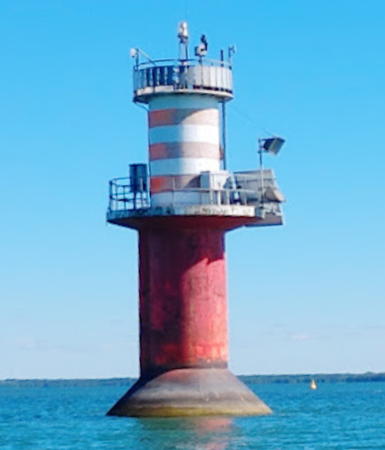
Date unknown. Active; focal plane 22 m (72 ft); continuous green light. 23 m (75 ft) round cylindrical steel tower mounted on a round concrete pier. Trabas has Boucher's photo (also seen at right) and Google has a satellite view. This range guides eastbound vessels in the Seaway channel. Located in the middle of the St. Lawrence about 2 km (1.25 mi) east of Pointe Beaudette. Accessible only by boat. CCG I-0099.5; Admiralty H2550.1; NGA 6100.
Saint Anicet (Port Louis Flats) Downstream (East) Range Front
Date unknown. Active; focal plane 12 m (39 ft); continuous green light. 12 m (39 ft) round cylindrical steel tower mounted on a round concrete pier. Trabas has Boucher's photo and Google has a satellite view. Located 1218 m (0.76 mi) northeast of the rear light. Accessible only by boat. CCG I-0099.4; Admiralty H2550; NGA 6096.

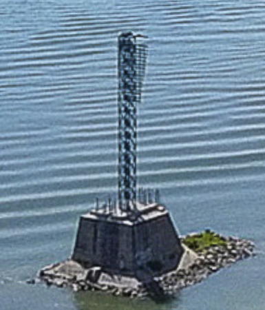
Saint-Anicet Downstream Range Rear Light, Pointe Beaudette
photo copyright Michael Boucher; used by permission

Beauharnois-Salaberry Municipality Lighthouses
These lights guide vessels in the Beauharnois Canal, an important link in the St. Lawrence Seaway. The canal is 24 km (15 mi) long, connecting Lac Saint-Louis downstream with Lac Saint-François upstream. The elevation difference between the lakes is 24 m (79 ft).

*
Beauharnois Upper Entrance Range Rear (1)
Date unknown. Replaced around 2017; focal plane 28 m (92 ft); continuous green light. This was a 28 m (92 ft) square skeletal tower carrying a daymark colored orange with a black vertical stripe. Trabas has Boucher's photo and Google has a 2021 street view and an indistinct satellite view. The range guides vessels sailing downstream on the Seaway into the western entrance to the Beauharnois Canal. The front range light is an 11 m (36 ft) skeletal tower. Located just west of the intersection of Chemin Larocque and Rue Daoust in Salaberry-de-Valleyfield. Site open, tower closed. CCG I-0076; Admiralty H2538.1; NGA 5988.
St. Louis Bridge Range Rear
Date unknown. Active; focal plane 19 m (62 ft); continuous yellow light. 18 m (59 ft) square pyramidal skeletal tower carrying a daymark colored orange with a black vertical stripe. Trabas has Boucher's photo and Google has a satellite view. The range guides vessels upstream south of the St. Louis Bridge (Autoroute 30). The front range light is an 11 m (36 ft) skeletal tower. Located on the south side of the Beauharnois Canal about 3 km (2 mi) southwest of the bridge. Site status unknown. CCG I-0042; Admiralty H2531.1; NGA 5844.
Powerhouse Range Rear (2)
Date unknown. Active; focal plane 23 m (75 ft); continuous green light. 20 m (66 ft) triangular skeletal tower carrying a daymark colored orange with a black vertical stripe. Trabas has Boucher's photo and Google has a satellite view. The range guides vessels downstream in the Canal. The front light is on a 7 m (23 ft) skeletal tower. Located on the south side of the Beauharnois Canal about 1.5 km (0.9 mi) southwest of the St. Louis Bridge. Site status unknown. CCG I-0037.1; Admiralty H2530.1; NGA 5820.
Upper Beauharnois Lock Range Rear
Date unknown. Active; focal plane 20 m (66 ft); continuous yellow light. 16 m (52 ft) square pyramidal skeletal tower carrying a daymark colored orange with a black vertical stripe. Trabas has Boucher's photo and Google has a satellite view. The range guides vessels downstream into the lock at the east entrance of the Canal. The front light is on a 10 m (33 ft) skeletal tower. Located adjacent to the lock. Site status unknown. CCG I-0034; Admiralty H2528.1; NGA 5804.
* Melocheville Range Rear (2)
Date unknown. Active; focal plane 30 m (98 ft); continuous green light. 14 m (46 ft) square skeletal tower carrying a daymark colored orange with a black vertical stripe. Google has a street view and a satellite view. The range guides vessels upstream through Lac Saint-Louis toward the Beauharnois Canal. Located on 13th Avenue in Melocheville. Site open, tower closed. ARLHS CAN-872; CCG I-0032.4; Admiralty H2522.61; NGA 5792.

Longueuil City Lighthouses
The regional capital of Longueuil is the city on the south side of the St. Lawrence River opposite Montréal. The city's population is over 250,000 and the metropolitan population is more than 420,000.

* Longue Pointe Traverse Upstream Range Front
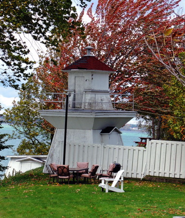
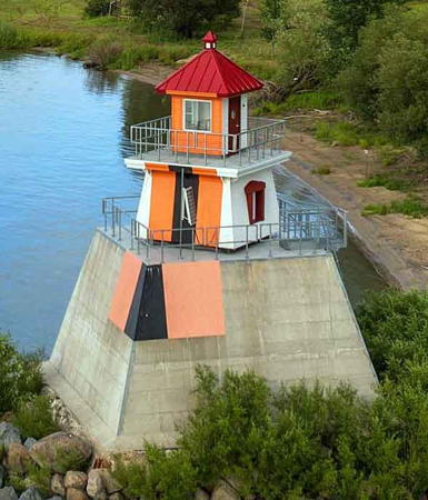
Date unknown. Active; focal plane 14 m (46 ft); green light, 1 s on, 1 s off, visible only on the range line. 9 m (30 ft) round steel tower with lantern and gallery, painted white and carrying a daymark colored orange with a black vertical stripe. Chami Shaw has the 2023 photo seen at the top of this page, Trabas has Boucher's photo, Jorge Adan has a 2021 photo, Benoît L'Heureux has a good street view, and Google has a satellite view. The original Longue Pointe Traverse Range Lights were on the west side of the river in Montréal; they guided vessels proceeding downstream. Sometime between 1977 and 1994 those lights were discontinued and new lights were placed at the opposite end of the range to guide vessels proceeding upstream. These lights are located in the Parc de la Pointe du Marigot. Located at the riverbank in Longueuil opposite the southern tip of Île Verte. Accessible by park walking trails, and in the winter the light can be seen from the Autoroute 20 (René Lévesque) freeway. Site open, tower closed. Site manager: Ville de Longueuil. ARLHS CAN-1120; CCG A-2361; Admiralty H2497; NGA 5564.
* Longue Pointe Traverse Upstream Range Rear
Date unknown. Active; focal plane 20.5 m (67 ft); green light, 1 s on, 1 s off, visible only on the range line. 13 m (43 ft) round unpainted steel tower with lantern and gallery. Trabas has Boucher's photo (also seen at right) and Google has a street view and a satellite view. Located beside the Autoroute 20 (René Lévesque) freeway 190 m (625 ft) south of the front light. Accessible by park walking trails. Site open; tower closed. Site manager: Ville de Longueuil. ARLHS CAN-1121; CCG A-2362; Admiralty H2497.1; NGA 5568.

Longue Pointe Traverse Upstream Range Rear Light, Longueuil
photo copyright Michael Boucher; used by permission
Route Longue Pointe (Longue Point Course, Grand Battures Thaihandier) Range Rear (2)
Date unknown. Active; focal plane 24 m (79 ft); white light, 1 s on, 1 s off. 19 m (62) square cylindrical skeletal tower painted white and carrying a daymark colored orange with a black vertical stripe. A distant drone view is available and Google has a satellite view. This tower replaced a round cylindrical tower. The range guides ships northward toward Montréal.The front light is on a 7 m (23 ft) skeletal tower. Located on the low island of Grand Battures Thaihandier off Boucherville. Accessible only by boat. Site status unknown. CCG A-2364; Admiralty H2499.1; NGA 5576.

Marguerite-D'Youville Municipality (Contrecoeur-Verchères Area) Lighthouses
Île Sainte-Thérèse Upper Range Front (4)
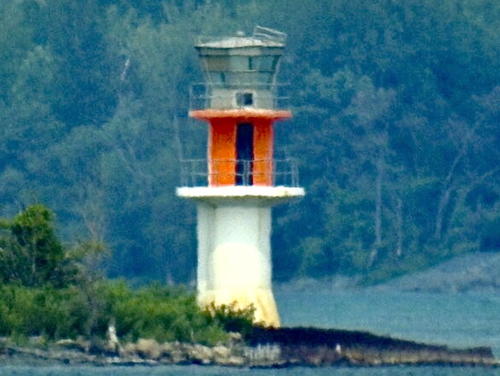
Date unknown (station established 1879). Active; focal plane 11 m (36 ft); continuous green light. 12 m (39 ft) round cylindrical concrete tower with lantern and double gallery. Tower painted white; there is a daymark painted red with a black vertical stripe between the two galleries. The lantern is gray metallic. Jon Clay contributed the photo at the top of this page, Trabas has Boucher's photo, Pingouins Dansant has a photo, and Google has a satellite view. Anderson has a historic photo of the second lighthouse, built in 1924. This range guides vessels downstream leaving Montréal. The range towers were relocated in 1884. Located on the east bank of the Île aux Vaches, a smaller island southeast of the Île Sainte-Thérèse, in Varennes, a suburban town of about 25,000 residents. Accessible only by boat; there is a distant view from the boat ramp in Varennes. Site status unknown. CCG A-2346; Admiralty H2490; NGA 5512.
Île Sainte-Thérèse Upper Range Rear (4)
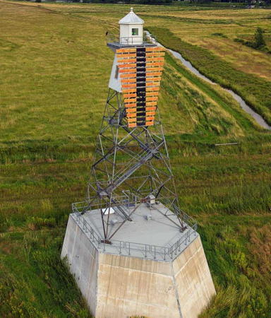
Date unknown (station established 1879). Active; focal plane 27 m (89 ft); continuous green light. 22 m (72 ft) square skeletal mast mounted on a robust pentagonal concrete pier. Tower painted white, carrying a trapezoidal slatted daymark painted red with a black vertical stripe. Trabas has Boucher's photo (also seen at right), a 2021 drone view is available, and Google has a satellite view. The pier has a pointed end to break up ice floes. Anderson has a historic photo of the original lighthouse. Located just off the east bank of the Île Sainte-Thérèse in Varennes. Accessible only by boat; there is a distant view from the boat ramp in Varennes. Site status unknown. CCG A-2347; Admiralty H2490.1; NGA 5516.
[Île Sainte-Thérèse Lower Range Front (4?)]
Date unknown (station established 1871). Active; focal plane 11 m (36 ft); continuous green light. 4 m (13 ft) post carrying an orange slatted daymark with a black vertical stripe on the range line. Trabas has Boucher's photo and Google has a satellite view. A square wood tower, built in 1889, was replaced by a second wood tower in 1924. There is a historic photo of the 1924 light. Located on the east side of Île Sainte-Thérèse opposite Varennes. Accessible only by boat. Site status unknown. CCG A-2335; Admiralty H2484; NGA 5448.
Île Sainte-Thérèse Lower Range Rear (4?)
Date unknown (station established 1871). Active; focal plane 18 m (59 ft); continuous green light. 13 m (43 ft) square cylindrical skeletal tower carrying an orange slatted daymark with a black vertical stripe on the range line. Trabas has Boucher's photo and Google has a satellite view. The historic photo of the front light shows the previous rear light in the distance. Located on the east side of Île Sainte-Thérèse opposite Varennes. Accessible only by boat. Site status unknown. ARLHS CAN-1111; CCG A-2336; Admiralty H2484.1; NGA 5452.

Île Sainte-Thérèse Upper Range Rear Light, Varennes
photo copyright Michael Boucher; used by permission
Île Deslauriers Range Rear (3?)
Date unknown (station established 1902). Active; focal plane 32 m (105 ft); green light, 1 s on, 1 s off. 27 m (89 ft) square pyramidal skeletal tower carrying an orange slatted daymark with a black vertical stripe. Trabas has Boucher's view from across the river and Google has a satellite view. This is an upstream range. The front light is on a 7 m (23 ft) tower. Located on the east side of the lower Île Sainte-Thérèse (this portion known as Île Deslauriers). Accessible only by boat. Site status unknown. ARLHS CAN-1100; CCG A-2331; Admiralty H2482.1; NGA 5408.
Verchères Village Range Rear
1902. Active; focal plane 24 m (79 ft); continuous green light. 20 m (66 ft) square pyramidal skeletal tower with gallery. The tower carries an orange slatted daymark with a black vertical stripe on the range line. Larry Myhre's photo is at the bottom of this page, Trabas has Boucher's photo and Google has a street view and a satellite view. Verchères is a riverside suburban village of about 6000 residents. Located on the southwest side of Verchères, off QC 132 near the Rue de St.-Alexandre, about 635 m (0.4 mi) southwest of the front light. Site and tower closed (private property), but the light can be seen from the foot of the Rue de l'Aqueduc. CCG A-2320; Admiralty H2476.1; NGA 5356.
* Verchères Village Range Front (2)
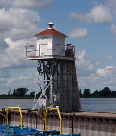
1929 (station established 1902). Active; focal plane 9.5 m (32 ft); continuous green light. 6 m (20 ft) square skeletal tower with square wooden lantern. Tower painted white; roof and front face of lantern painted red. The tower also carries a slatted trapezoidal daymark, painted red with a black vertical stripe on the range line. Bash's photo is at right, Trabas has Boucher's photo, Larry Myhre has a view from the river, another photo is available, and Google has a street view and a satellite view. Located on the east breakwater at Verchères, on the southeast side of the river about 25 km (15 mi) northeast of Montréal. Site open, tower closed. Owner/site manager: Canadian Coast Guard. ARLHS CAN-1206; CCG A-2319; Admiralty H2476; NGA 5352.
Verchères Traverse Range Front (4)
1967 (station established 1902). Active; focal plane 16 m (52 ft); continuous green light. 12.5 m (41 ft) post carrying an orange slatted daymark with a black vertical stripe. Trabas has Boucher's photo, Lighthouse Digest has a Coast Guard photo, and Google has a street view and a satellite view. The original front light was replaced in 1909. In 1946 it was moved to the windmill that had carried the rear light. Located at the river's edge about 3 km (1.8 mi) northeast of Verchères. Site and tower closed (private property). Owner/site manager: Canadian Coast Guard. ARLHS CAN-1342; CCG A-2317; Admiralty H2478; NGA 5364.
* Verchères Traverse Range Rear (4)
Date unknown (station established 1902). Active; focal plane 25 m (82 ft); continuous green light. 16 m (52 ft) square skeletal mast carrying an orange slatted daymark with a vertical black stripe. Trabas has Boucher's photo and Google has a street view and a satellite view. The light was originally placed atop the round tower of a former windmill; Anderson has Michel Forand's closeup historic photo. In 1946 the front light was moved to the windmill and a skeletal tower was built for the rear light. This was replaced by a tall mast, seen on the Lighthouse Digest page, in 1972. Located beside QC 132 about 500 m (0.3 mi) northeast of the front light. Site open, tower closed. Owner/site manager: Canadian Coast Guard. ARLHS CAN-1343; CCG A-2318; Admiralty H2478.1; NGA 5368.
Verchères Village Range Front Right
Verchères Village Range Front Light, Verchères, June 2008
Flickr Creative Commons photo by C.W. Bash
Contrecoeur Traverse Range Rear (2?)
Date unknown (station established 1904). Active; focal plane 28 m (92 ft); continuous green light. 22.5 m (74 ft) square pyramidal skeletal tower with lantern and gallery. The tower carries an orange slatted daymark with a black vertical stripe on the range line. Google has a satellite view. Located in the Contrecoeur Marine Terminal, a bulk materials port on the south side of the river about 4 km (2.5 mi) southwest of Contrecoeur and 1725 m (1.07 mi) southwest of the front light. Site and tower closed (industrial area). Site manager: Yara Canada. CCG A-2313; Admiralty H2470.1; NGA 5304.
Contrecoeur Traverse Range Front (2?)
Date unknown (station established 1904). Active; focal plane 16 m (52 ft); continuous green light. 11.5 m (38 ft) round cylindrical tower carrying an orange daymark with a black vertical stripe. Google has a satellite view. Located on the north side of the Contrecoeur Marine Terminal. Site and tower closed (industrial area). Site manager: Yara Canada. CCG A-2312; Admiralty H2470; NGA 5300.
Contrecoeur-Verchères Range Front (2)
Date unknown (station established 1903). Active; focal plane 10 m (31 ft); continuous green light visible only on the range line. 7 m (23 ft) square cylindrical skeletal tower with lantern and gallery, mounted on a square pyramidal concrete pier. The tower also carries a trapezoidal slatted daymark painted orange with a black vertical stripe on the range line. Trabas has Boucher's photo, Lighthouse Digest has a closeup photo, Carlota Bodot has a winter 2019 photo, and Bing has a satellite view. Anderson has a historic photo of the original light, which was mounted on the same pier. Located on a marshy island in the Îles de Contrecoeur National Wildlife Area northwest of Contrecoeur. Accessible only by boat. Site open, tower closed. Owner: Canadian Coast Guard. ARLHS CAN-1260; CCG A-2315; Admiralty H2472; NGA 5308.
Contrecoeur-Verchères Range Rear
Date unknown (station established 1903). Active; focal plane 19 m (62 ft); green light, 1 s on, 1 s off; a continuous green light is shown on the range line. 16 m (52 ft) square cylindrical skeletal tower with gallery. The tower carries an orange slatted daymark with a black vertical stripe on the range line. Bing has a satellite view. Anderson has a historic photo of the original lighthouse. Located on the south bank of the river near Île Ronde, 1725 m (1.07 mi) northeast of the front light. Accessible only by boat. Owner: Canadian Coast Guard. Site manager: Îles de Contrecoeur National Wildlife Area. Site open, tower closed. CCG A-2316; Admiralty H2472.1; NGA 5312.
Route Île-Saint-Ours Range Rear (2?)
Date unknown (station established 1903). Active; focal plane 33 m (108 ft); continuous green light. 18.5 m (61 ft) square skeletal mast carrying a slatted trapezoidal daymark painted orange with a black vertical stripe. Trabas has Boucher's photo (also seen at right), Google has a street view, and Bing has a satellite view. This is an upstream range. Located on the east side of QC 132 at Rue des Peupliers, a short distantance north of Contrecoeur. Site and tower closed (private property) but the tower can be seen from the highway. ARLHS CAN-1108; CCG A-2283; Admiralty H2452.1; NGA 5176.

Île Saint-Ours Range Rear Light, Contrecoeur
photo copyright Michael Boucher; used by permission
[Route Île-Saint-Ours Range Front (2?)]
Date unknown (station established 1903). Active; focal plane 17 m (56 ft); continuous green light. 13 m (43 ft) square skeletal mast carrying a trapezoidal daymark painted orange with a black vertical stripe. Trabas has Boucher's photo and Bing has an indistinct satellite view. Located on private property west of QC 132 about 670 m (0.42 mi) north of the rear light. Site and tower closed. ARLHS CAN-1107; CCG A-2282; Admiralty H2452; NGA 5172.
[Petite Traverse Range Front (2?)]
Date unknown (station established 1903). Active; focal plane 17 m (56 ft); continuous green light. 8 m (26 ft) round cylindrical white tower carrying a slatted daymark painted orange with a black vertical stripe. No photo available but Google has a satellite view. Anderson has a historic photo of the original lighthouse, a square pyramidal wood tower. Located on the riverbank about 800 m (1/2 mi) south of Montée St.-Roch. Site and tower closed (private property). CCG A-2288; Admiralty H2454; NGA 5192.
Petite Traverse Range Rear (2?)
Date unknown (station established 1903). Active; focal plane 32 m (108 ft); continuous green light. 20.5 m (67 ft) square skeletal tower carrying a trapezoidal daymark painted orange with a black vertical stripe. Trabas has Boucher's photo but trees conceal the light in Google's satellite view. Anderson has a historic photo of the original lighthouse, a square skeletal tower with enclosed upper portion. Located in a forest east of QC 132, 517 m (1/3 mi) northeast of the front light. Site and tower closed (private property). CCG A-2289; Admiralty H2454.1; NGA 5196.
Route de Contrecoeur (Contrecoeur Course) Range Front (1)
1903. Inactive. Approx. 6 m (20 ft) square pyramidal wood tower with lantern and gallery, painted white; lantern roof is red. Boucher's photo is at right, a tree hides the top of the tower in Google's street view, and Google has an indistinct satellite view. Located on the east side of the river off QC 132 about 600 m (3/8 mi) north of Montée St.-Roch. Site and tower closed (private property) but the light can be seen from nearby. ARLHS CAN-965.
Route de Contrecoeur (Contrecoeur Course) Range Front (2)
Date unknown. Active; focal plane 26 m (85 ft); continuous yellow light. 17.5 m (57 ft) square skeletal mast. Trabas has Boucher's photo of the new light and Google has a street view and a satellite view. Located close to the historic lighthouse. CCG A-2290; Admiralty H2458; NGA 5224.
 
Route de Contrecoeur Range Rear (2?)
Date unknown. Active; focal plane 42 m (138 ft); continuous yellow light. 25 m (82 ft) square skeletal tower carrying a trapezoidal daymark painted orange with a black vertical stripe. Trabas has Boucher's photo and Google has a distant street view and a distant satellite view. Located east of QC 132 about 770 m (0.48 mi) north of the front light. Site and tower closed (private property) but the light can be seen distantly from the highway. CCG A-2291; Admiralty H2458.1; NGA 5228.
Route de Contrecoeur Range Front Light
Route de Contrecoeur Range Front Light, October 2014
photo copyright Michael Boucher; used by permission

Le-Haut-Richelieu Municipality (Upper Richelieu River) Lighthouse
The Richelieu River drains Lake Champlain and serves as part of an international waterway connecting the St. Lawrence to the Hudson River in New York. There were formerly a series of lighthouses along the river, but none are active today, and the Ash Island lighthouse is the only known survivor. The Richelieu flows into the St. Lawrence at Sorel-Tracy.

Cantic
Date unknown. Active; focal plane 7 m (23 ft); red light, 1 s on, 1 s off. 4 m (13 ft) mast centered on a 1-story customs building. A photo is available and Google has a satellite view. Located on the end of a pier projecting into the river a short distance north of the U.S. border. Site open, tower closed. Operator/site manager: Canadian Border Services Agency. CCG A-2272.31.
Ash Island (Île Ash, Île aux Têtes) Range Front (2)
1913 (station established 1875). Inactive since 2005. 13.5 m (44 ft) square pyramidal steel skeletal tower with enclosed upper portion, lantern and gallery. Lighthouse painted white with red trim; lantern roof is red. Endangered: the abandoned lighthouse appears dilapidated in Sylvain Rancourt's 2014 photo at right and it looks worse in Bob Holleyo's 2023 photo. Yannick Fortin has a 2021 night time closeup, Marinas.com has aerial photos and Google has a satellite view. The original lighthouse was a square wooden tower attached to a small keeper's house. This was a northbound (downstream) range guiding vessels in the northernmost end of Lake Champlain as they approached Ash Island, a large island in the river at Lacolle. Located on the south bank of the island, about 400 m (1/4 mi) south of the Lacolle railroad bridge and 5 km (3 mi) north of the U.S. border. Accessible only by boat. Site open, tower closed. ARLHS CAN-866.
Ash Island (Île Ash, Île aux Têtes) Range Rear (2?)
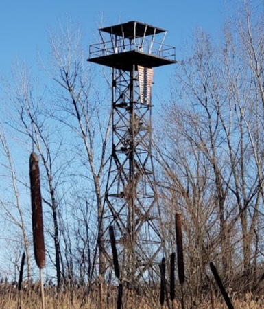
Date unknown. Inactive at least since 2005. Approx. 20 m (66 ft) square skeletal tower; lantern replaced by an observation platform. The tower still carries its range daymark painted red with a black vertical stripe. Joel Poirier has a 2020 photo and closeup and Google has a satellite view. Endangered by abandonment. Located on Ash Island about 250 m (800 ft) north of the QC 202 bridge. Site open, tower dangerous to climb.

Ash Island Range Front Light, March 2014
ex-Panoramio photo copyright Sylvain Rancourt; used by permission

Pierre-De Saurel Municipality (Sorel-Tracy Area) Lighthouses
Sainte-Anne-de-Sorel Range Rear (3)
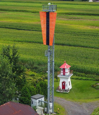
Around 2020 (station established 1905). Active; focal plane 31 m (102 ft); continuous green light visible only on the range line. 24 m (79 ft) triangular skeletal mast with gallery carrying trapezoidal slatted daymark painted red with a black vertical stripe. Until recently this was a skeletal tower with enclosed upper portion, lantern and gallery. Trabas has Boucher's closeup drone view and Google has a satellite view. The small lighthouse seen in the drone view has not been identified. Located on the south bank of the river 770 m (0.48 mi) southwest of the front light. Site and tower closed, but the light can be viewed from a nearby church. Owner/site manager: Canadian Coast Guard. ARLHS CAN-1270; CCG A-2178; Admiralty H2422.1; NGA 5076.
Sainte-Anne-de-Sorel Range Front
1905. Active; focal plane 12.5 m (41 ft); continuous green light visible only on the range line; also a green passing light (2 s on, 2 s off). 9 m (30 ft) square pyramidal wood tower, painted white with red trim. The front (downstream) face of the tower is painted orange with a black vertical stripe on the range line. Trabas has Boucher's closeup photo (also seen at right), Lighthouse Digest has a 1997 Coast Guard photo, and Google has a satellite view. Located on the south bank of the river just off the Chemin du Chenal du Moine in Ste.-Anne-de-Sorel, just northeast of Sorel. Site and tower closed (surrounded by private residences). Owner/site manager: Canadian Coast Guard. ARLHS CAN-1269; CCG A-2177; Admiralty H2422; NGA 5072.
Île de Grâce Range Front (2)
1928 (station established 1905). Active; focal plane 13 m (42 ft); continuous green light visible only on the range line; also a green passing light (1 s on, 1 s off). 9 m (30 ft) square pyramidal wood tower, painted white with red trim. The front (downstream) face of the tower is painted orange with a black vertical stripe on the range line. Trabas has Boucher's photo, Lighthouse Digest has a 1991 photo, Marinas.com has aerial photos, and Google has a satellite view. This is a downstream range. The range lights replaced a single lighthouse built on the Île de Grâce in 1871. Anderson has a historic photo of the first front light, which was built on a concrete pier in the river. Located at the upper (southwest) end of the island, at the upper end of the Lac St.-Pierre basin about 10 km (6 mi) northeast of Sorel. Accessible only by boat. Site open, tower closed. Owner/site manager: Canadian Coast Guard. ARLHS CAN-1095; CCG A-2175; Admiralty H2426; NGA 5104.

Range Front Light, Sainte-Anne-de-Sorel
photo copyright Michael Boucher; used by permission
Île de Grâce Range Rear
1905. Active; focal plane 22 m (73 ft); continuous green light visible only on the range line; also a green passing light (1 s on, 1 s off). 16.5 m (54 ft) square pyramidal skeletal tower with lantern and enclosed watch room. Tower painted black, watch room white, lantern red; the front face of the watch room is red with a black vertical stripe on the range line. Trabas has Boucher's photo, Marinas.com has aerial photos, and Google has an indistinct satellite view. Located about 600 m (0.4 mi) east northeast of the front range (next entry). Accessible only by boat. Site open, tower closed. Owner/site manager: Canadian Coast Guard. ARLHS CAN-1096; CCG A-2176; Admiralty H2426.1; NGA 5108.
Île du Moine Range Front
1906. Active; focal plane 13 m (43 ft); continuous green light visible only on the range line. 5 m (18 ft) square wood tower mounted on a square pyramidal concrete pier. Tower painted white, except the front is painted bright orange-red with a black vertical stripe on the range line. Trabas has Boucher's drone view seen at right, France Polychuck has a 2022 photo (misidentified as Sainte-Anne-de-Sorel Range Rear), Guylaine Dionne has a 2021 distant view, Lighthouse Digest has a Coast Guard photo showing both range lights, and Google has a satellite view and a distant street view. This is a downstream range. Located at the southwestern tip of Île du Moine about 7 km (4.5 mi) east northeast of Sainte-Anne-de-Sorel. Accessible only by boat, but there's a distant view from a nearby boat ramp. Site open, tower closed. Owner/site manager: Canadian Coast Guard. ARLHS CAN-1101; CCG A-2180; Admiralty H2424; NGA 5047.
Île du Moine Range Rear (2)
Date unknown (station established 1906). Active; focal plane 27.5 m (90 ft); continuous green light visible only on the range line. 18.5 m (57 ft) square pyramidal skeletal tower with lantern and gallery, mounted on a prow-shaped pentagonal concrete pier. The front of the tower carries a large rectangular daymark, painted bright orange-red with a black vertical stripe on the range line. Trabas has Boucher's drone view and Google has a satellite view. Located near the southwestern tip of Île du Moine, 490 m (0.3 mi) east of the front light (next entry). Accessible only by boat. Site open, tower closed. Owner/site manager: Canadian Coast Guard. ARLHS CAN-1102; CCG A-2181; Admiralty H2424.1; NGA 5048.
Île des Barques Range Rear (3)
2011 (?) (station established 1907). Active; focal plane 25 m (82 ft); continuous green light visible only on the range line. Until recently this was a 20 m (66 ft) round tower with gallery, painted white, but Anderson's photo shows that the current light is on a skeletal mast with gallery. The tower also carries a trapezoidal slatted daymark, painted orange with a black vertical stripe on the range line. Marinas.com has aerial photos of the previous light and Google has a satellite view. Located 480 m (0.3 mi) southwest of the front light. Accessible only by boat. Site open, tower closed. Owner/site manager: Canadian Coast Guard. ARLHS CAN-1098; CCG A-2169; Admiralty H2416.1; NGA 5046.
Île des Barques Range Front
1907. Active; focal plane 11.5 m (37 ft); continuous green light visible only on the range line. 5 m (18 ft) square wood tower mounted on a square pyramidal concrete pier. Tower painted white, except the front is painted bright orange-red with a black vertical stripe on the range line. Lighthouse Digest has a closeup photo and Google has a satellite view. This is an upstream range. Located on an island near the southwestern end of the Lac St.-Pierre basin about 10 km (6 mi) northeast of Sainte-Anne-de-Sorel. Accessible only by boat. Site open, tower closed. Owner/site manager: Canadian Coast Guard. ARLHS CAN-1097; CCG A-2168; Admiralty H2416; NGA 5044.

Île du Moine Range Front Light, Sorel,2022
photo copyright Michael Boucher; used by permission
[Île aux Raisins Range Front (3?)]
Date unknown (station established 1843). Active; focal plane 9.5 m (31 ft); continuous green light visible only on the range line. 7 m (23 ft) post carrying a daymark painted orange with a black vertical stripe. Google has a distant satellite view. The original light, described as an "open-frame" tower, was replaced in 1907 by a square wood tower. Located on the Île aux Raisins, a marshy area on the south side of the river about 3 km (2 mi) northeast of the Île des Barques. Site status unknown. Owner/site manager: Canadian Coast Guard. ARLHS CAN-1092; CCG A-2166; Admiralty H2414; NGA 5028.
Île aux Raisins Range Rear (3?)
Date unknown (station established 1863). Active; focal plane 27 m (89 ft); continuous green light visible only on the range line, and also a white light, 1 s on, 1 s off. 23.5 m (77 ft) square skeletal mast carrying a daymark painted orange with a black vertical stripe. Google has a satellite view. The first rear light was replaced in 1903 by a 26 m (85 ft) square pyramidal skeletal tower. Located about 575 m (0.36 mi) south of the front light. Site status unknown. Owner/site manager: Canadian Coast Guard. CCG A-2167; Admiralty H2414.1; NGA 5032.
Gallia Bay Upper Range Rear
1907. Inactive since the 1960s. 16 m (52 ft) round cylindrical steel tower centered on a square concrete pier. Jon Clay's photo shows how trees now hide the tower in Google's satellite view. The front light, formerly mounted on a concrete pier, has been removed. The lighthouse is deteriorating and endangered. Located on the south side of Île Lapierre about 6 km (4 mi) northeast of Ste.-Anne-de-Sorel. Accessible only by boat. Site open, tower closed. ARLHS CAN-951.
Gallia Bay Lower Range Rear
1907. Inactive since the 1960s. 21 m (69 ft) round cylindrical steel tower centered on a square concrete pier. A 2023 closeup is available and Google has a satellite view. The front light, formerly mounted on a concrete pier, has been removed. The lighthouse is deteriorating and endangered. Located on the south side of Île Lapierre about 7 km (4.5 mi) northeast of Ste.-Anne-de-Sorel. Accessible only by boat. Site open, tower closed. ARLHS CAN-1006.
Courbe Maskinongé (Maskinongé Curve)
1973. Active; focal plane 14 m (46 ft); yellow light, 1 s on, 1 s off. 14 m (46 ft) cylindrical tower with double gallery but no lantern, painted with red and white horizontal bands. A photo by Olivier Des is at right, Anderson has Jon Clay's photo, and Google has a distant satellite view. Previously there was a helipad atop the light, as seen in a 2000 photo. Located on the south side of the channel at a bend in the middle of Lac St.-Pierre southeast of Louiseville. Accessible only by boat. Site open, tower closed. Owner/site manager: Canadian Coast Guard. ARLHS CAN-1263; CCG A-2153.3; Admiralty H2411; NGA 4988.

Courbe Maskinongé Light, Lac St.-Pierre, September 2021
Google Maps photo by Olivier Des

Information available on lost lighthouses:

Verchères Village Range Rear Light
Verchères Village Range Rear Light, Verchères, May 2004
Flickr Creative Commons photo by Larry Myhre

Notable faux lighthouses:

Adjoining pages: North: Western Québec | East: Southern Québec | South: Vermont | Northwest: Southeastern Ontario

Return to the Lighthouse Directory index | Ratings key

Posted September 12, 2003. Checked and revised February 8, 2024. Lighthouses: 45. Site copyright 2024 Russ Rowlett and the University of North Carolina at Chapel Hill.