Lighthouses of Southern Türkiye (Turkey)

Prior to World War I (1914-18) the Ottoman (Turkish) Empire had for centuries controlled most of the Middle East and (for varying amounts of time) North Africa and Southeast Europe. Following the war the Empire was partitioned by the 1920 Treaty of Sèvres and after a period of turmoil and warfare the Republic of Türkiye (Türkiye Cumhuriyeti in Turkish) was established in 1923. The country was historically called Turkey but in 2022 the Turkish government informed the United Nations that it prefers the official spelling Türkiye to be used in English. The Directory uses the spelling Türkiye in its descriptions but retains Turkish as the adjective form and preserves the more familiar spelling Turkey on the index page.

Most of Türkiye (97%) is in Asia, including the broad peninsula of Anatolia (Asia Minor) with the Black Sea on the north, the Aegean Sea on the west and the Mediterranean Sea; on the south. The remaining 3% is the region of East Thrace at the southeastern corner of Europe.

For administrative purposes Türkiye is divided into 81 provinces (il or vilayet). This page includes Anatolian Türkiye's lighthouses on the eastern Mediterranean coast, including the provinces of Hatay, Adana, Mersin, and Antalya.

Since the 1920s the Turkish language has been written in a Latin script; a distinctive feature of the alphabet is that the dotted (İ and i) and dotless (I and ı) forms of the letter I are different letters. The Turkish phrase for a lighthouse is fener (plural fenerler) or deniz feneri ("sea lantern"). Ada or adası is an island, yarımada is a peninsula, kaya is a rock or reef, burnu is a cape, burun ("nose") is a headland, körfez is a gulf, koy is a bay or inlet, boğaz is a strait, nehir is a river, and liman is a harbor. In Turkish the Mediterranean Sea is called Akdeniz.

Lighthouses in Türkiye are operated by the Directorate General of Coastal Safety (Kıyı Emniyeti Genel Müdürlüğü, KEGM).

The severe earthquake of 6 February 2023 caused catastrophic damage in Adana and Hatay provinces. Information is lacking on how lighthouses fared in this disaster, so some descriptions may be outdated.

ARLHS numbers are from the ARLHS World List of Lights. Admiralty numbers are from volume N of the Admiralty List of Lights & Fog Signals. U.S. NGA List numbers are from Publication 113.

General Sources
Seyir Yardımcıları (Navigational Aids)
Information on major lighthouses posted by the Directorate General.
Online List of Lights - Türkei
Photos by various photographers posted by Alexander Trabas. Many of the photos from this area are by Eckhard Meyer.
Deniz Fenerleri
Photos of 22 lighthouses by Haluk Özözlü.
Leuchtfeuer an der türkischen Mittelmeerküste
Photos of 17 Mediterranean coast lighthouses posted by Bernd Claußen.
Lighthouses in Turkey
Photos by various photographers available from Wikimedia.
World of Lighthouses - Turkey
Photos by various photographers available from Lightphotos.net.
The Lighthouses of Turkey (South)
This site by Charles Bash preserves a series of small photos formerly posted on the Directorate General's web site.
Leuchttürme in Türkei
Photos by Andreas Köhler.
Europäische Leuchttürme auf historischen Postkarten
Historic postcard images posted by Klaus Huelse (Asiatic Türkiye is included on this page of European lighthouses).
GPSNauticalCharts
Navigational chart information for Türkiye.
Navionics Charts
Navigational chart for Türkiye.
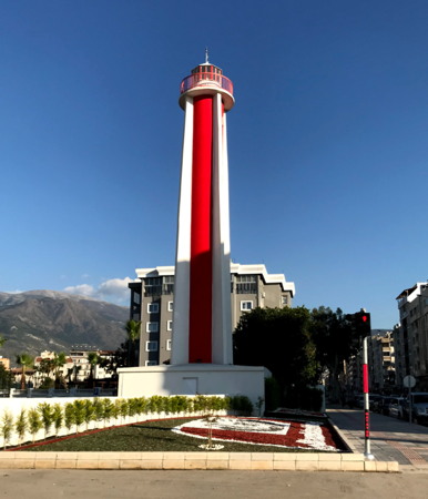
İskenderun Light, İskenderun, March 2018
Google Maps photo by Oğuzhan Sıvacılar

Hatay Province Lighthouses

 
İskenderun (formerly called Alexandretta) is the seaport of the province of Hatay. The city has a population nof about 250,000. Located on the south side of the Gulf of İskenderun, Hatay faces west, rather than south, on the Mediterranean. After World War I Hatay, then known as the Sanjak of Alexandretta, became an autonomous province of the French Mandate for Syria and the Lebanon. The province broke off from Syria in 1938 after the arrival of Turkish forces in the territory; it was annexed by Türkiye the following year. It is still claimed by Syria.

Antakya Lighthouses
* Çevlik (Antakya) Outer Breakwater
Date unknown. Active; focal plane about 10 m (33 ft); green flash every 3 s. Approx. 7 m (23 ft) round concrete tower, painted white with one narrow grenn horizontal band. Fehmi Yavuz has a 2018 street view and Google has a distant satellite view. Çevlik is the harbor of Antakya (ancient Antioch), the capital of Hatay Province. Accessible by walking the pier. Site open, tower closed. Admiralty N5918; NGA 20833.
* Çevlik (Antakya) Inner Breakwater
Date unknown. Active; focal plane about 10 m (33 ft); red flash every 3 s. Approx. 8 m (26 ft) round concrete tower, painted white with one narrow red horizontal band. A 2-story Turkish Coast Guard station stands next to the lighthouse. Esad Emir has a photo, Thomas Frenzel has a photo, Trabas has Meyer's view, and Google has a distant satellite view. Accessible by walking the pier. Site open, tower closed. Admiralty N5918.02; NGA 20834.

Kale Lighthouse
Akıncı Burnu (Resülhinzir)
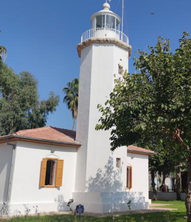
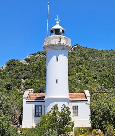
1933 (French). Active; focal plane 109 m (357 ft); two white flashes every 5 s. Approx. 12 m (39 ft) stone tower with lantern and gallery, adjacent to a 1-1/2-story masonry keeper's house. Lighthouse painted white; house painted white with a red tile roof. Mahmut Güven has the 2022 photo seen at right, Cüneyt Bulut has a 2018 photo, and Google has a satellite view. Akıncı Burnu is the cape at the southern entrance to the Gulf of İskenderun. Located on the heights above the point of the cape, about 40 km (25 mi) southwest of İskenderun. Site apparently open; tower closed. ARLHS TUR-011; Admiralty N5917; NGA 20832.

Akıncı Burnu Light, Hatay, July 2022
Google Maps photo by Mahmut Güven

İskenderun Lighthouses
* İskenderun (İskenderun Roadstead)
Date unknown (station established 1886). Active; focal plane 45 m (148 ft); white flash every 10 s. 10 m (33 ft) round concrete tower with gallery, painted white with one red horizontal band. Trabas has Meyer's photo, a 2019 photo is available, and Google has a satellite view. Located on a promontory at Büyükdere, about 12 km (7.5 mi) southwest of İskenderun. Accessible by road. Site open, tower closed. ARLHS TUR-032; Admiralty N5916; NGA 20816.
* İskenderun Limanı (İskenderun Harbor) (2?)
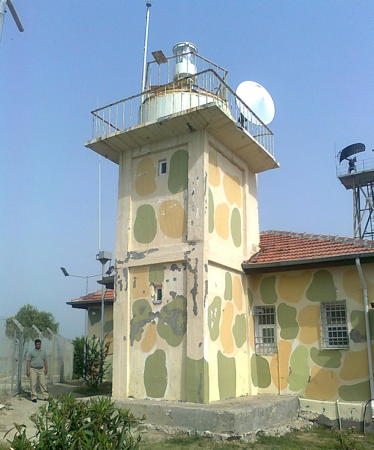
Date unknown (station established 1864). Active but unofficial; focal plane about 40 m (131 ft); white light, pattern unknown. Approx. 36 m (118 ft) round concrete tower with lantern, gallery, and four ribs. Lighthouse painted white with a red vertical stripe on the seaward side, lantern and gallery black. Oğuzhan Sıvacılar's photo is at the top of this page, the red stripe is also seen in a 2019 photo and in Abdulhameed Alkumity's 2017 photo, Wikimedia has a 2007 photo, Martin Stevens has posted a photo, Huelse has a historic postcard view, and Google has a 2022 street view and a satellite view. Although this lighthouse is not on the international light lists and not in KEGM's database, İbrahim Süslü has a 2017 photo of the light in action. Abdullah Arslan has a photo dated September 2023; if that's when it was taken it shows that the lighthouse survived the earthquake. The original light was a mast on a keeper's house, and that light was still listed in 1904. We need information on the history of the present lighthouse. Located on Fener Caddesi (Lighthouse Avenue) on the waterfront of İskenderun. Site open, tower closed. . Not listed by the Admiralty.
İskenderun Fishing Harbor North Breakwater
Date unknown. Active; focal plane 8 m (26 ft); green flash every 3 s. 5 m (17 ft) round white concrete tower. Mehmet Bilgin has a 2019 street view and Google has a satellite view. Located at the end of the north breakwater of the traditional harbor of İskenderun. Site open, tower closed. Admiralty N5915.4; NGA 20825.

İskenderun Roadstead Light, Büyükdere
Directorate General of Coastal Safety photo
İskenderun Breakwater
Date unknown. Active; focal plane 13 m (43 ft); green light, 2 s on, 1 s off. 10 m (33 ft) round cylindrical concrete tower, now painted green with a narrow white horizontal band. Karl Agre has a photo and Google has a satellite view. Located at the end of the main breakwater of İskenderun. Site and tower closed. Admiralty N5915; NGA 20820.
İsdemir South Mole
Date unknown. Active; focal plane 10 m (33 ft); green flash every 3 s. 8 m (26 ft) round cylindrical tower painted green with a narrow white horizontal band. Alexander Pavelyev has a very distant view of the two mole lights (this one on the left) and Google has a satellite view. Located at the end of the north mole at the İsdemir power station north of İskenderun. Site and tower closed. Admiralty N5914; NGA 20813.
İsdemir North Mole
Date unknown. Active; focal plane 10 m (33 ft); red flash every 3 s. 8 m (26 ft) round cylindrical concrete tower painted red with a narrow white horizontal band. Alexander Pavelyev has a very distant view of the two mole lights (this one on the right) Google has a satellite view. Located at the end of the north mole at the İsdemir power station north of İskenderun. Site and tower closed. Admiralty N5914.4; NGA 20813.5.

Adana Province Lighthouses

Yumurtalık Lighthouses
* Yumurtalık Main (2)
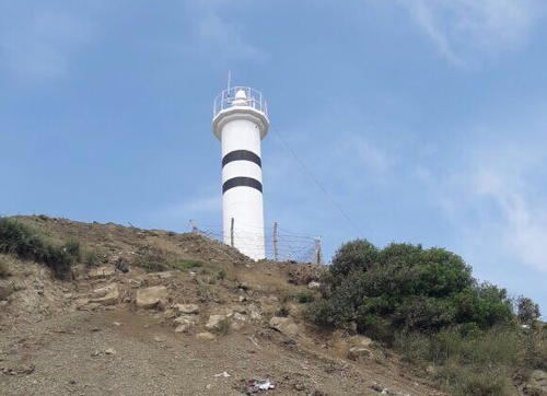
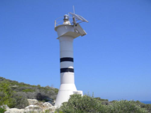
Date unknown. Active; focal plane 30 m (98 ft); two white flashes every 10 s. 7 m (23 ft) round cylindrical concrete tower painted white with two narrow black horizontal bands. A photo is at right, Ebru Guven has a 2018 photo, Ahmet Alanç also has a 2018 photo, and Google has a 2022 street view and a satellite view. The lighthouse was refurbished and repainted in 2017; previously it was all white. NGA lists a 10 m (33 ft) skeletal tower. Located on a bluff on the north side of Yumurtalık, a small seaport and seaside resort on the north side of the Gulf of İskenderun. Site open, tower closed. Admiralty N5875; NGA 20768.

Yumurtalık Main Light, Yumurtalık, 2017
Directorate General of Coastal Safety photo
* Yumurtalık Breakwater (Shelter Mole) (3)
2012 (?). Active; focal plane 13 m (43 ft); red flash every 5 s. 9 m (30 ft) round hourglass-shaped fiberglass tower colored white with a narrow red band. A 2019 closeup photo is available, Tariq Isaksson has a 2022 street view, and Google has a satellite view. KEGM's page formerly showed a smaller tower and NGA lists a 6 m (20 ft) framework tower. Located at the end of the mole at Yumurtalık. Accessible by walking the pier. Site open, tower closed. Admiralty N5875.2; NGA 20772.

Karataş Lighthouses
* Karataş Small Breakwater
Date unknown. Active; focal plane 9 m (30 ft); green flash every 5 s. 5 m (17 ft) round white concrete tower with a narrow green horizontal band. Bedirhan Küpeli has a photo showing both breakwater lights, Duygu Özcan has a very distant view of the two breakwater lights and Google has a satellite view. Located at the end of the north breakwater of Karataş harbor. Accessible by walking the pier. Site open, tower closed. Admiralty N5874.5; NGA 20764.
Karataş Main Breakwater
Date unknown. Active; focal plane 10 m (33 ft); red flash every 5 s. 5 m (17 ft) round white concrete tower with a narrow red horizontal band. Fatih Arsin has a photo, Bedirhan Küpeli has a 2022 photo and a photo showing both breakwater lights, Duygu Özcan has a very distant view of the two breakwater lights, and Google has a satellite view. Located at the end of the south breakwater of Karataş harbor. Site open, tower closed. Admiralty N5874.4; NGA 20760.
* Karataş (Karadash, Fener Burnu)
1864. Active; focal plane 38 m (125 ft); white flash every 10 s. 12 m (39 ft) square cylindrical concrete tower with lantern and gallery, attached to the seaward side of a 1-story masonry keeper's house. The lantern has been added recently. Lighthouse normally painted white; house painted white with a red tile roof. The KEGM photo is at right shows the lighthouse gaily painted and before the present lantern was installed, Trabas has Meyer's photo and Google has a satellite view. It appears that the tower on this lighthouse was replaced, but the house may be original. The lighthouse marks the entrance to the Bay of İskenderun, at the extreme northeastern corner of the Mediterranean Sea. Located on Karataş Burnu, also called Fener Burnu (Lighthouse Point), about 5 km (3 mi) southwest of the city of Karataş. Site open, tower closed. Admiralty N5874; NGA 20756.

Karataş Light, Karataş
unattributed photo from Mapio.net

Mersin Province Lighthouses

Mersin is a large city with a population of more than one million; it is also Türkiye's largest seaport.

Tarsus Lighthouse
Deli Burnu (Deliburnu, Seyhan Nehri) (2)
2015 (station established 1977). Active; focal plane 12 m (39 ft); white flash every 5 s. 10 m (33 ft) round barbell-shaped tower colored white wth two narrow black horizontal bands. Google has a satellite view. This light replaced a 15 m (49 ft) square pyramidal steel skeletal tower; LighthousesRUs.org has a small Directorate General photo (second photo on the page). Deli Burnu is the low cape formed by the delta of the Seyhan River, on the east side of the Gulf of Mersin. Located on the west bank of the river, about 25 km (15 mi) east of Mersin (Içel). Site status unknown. Admiralty N5873.8; NGA 20752.

Mersin Lighthouses
Mersin Limanı Range Front
Date unknown. Active; focal plane 19 m (62 ft); green light occulting once every 3 s. 17 m (56 ft) triangular steel skeletal tower carrying a red triangular daymark, point up. Trabas has Capt. Peter Mosselberger's photo and Google has a satellite view. The range guides ships within the harbor. Located near several large fuel tanks at the east end of Mersin's harbor. Site status unknown. Admiralty N5873.2; NGA 20724.
Mersin Limanı Range Rear
Date unknown. Active; focal plane 24 m (79 ft); green light occulting once every 3 s. 20 m (66 ft) triangular steel skeletal tower carrying a red triangular daymark, point up. Trabas has Capt. Peter Mosselberger's photo, Yasin Keçef has a photo, and Google has an indistinct satellite view. Located about 190 m (620 ft) northeast of the front light. Site status unknown. Admiralty N5873.3; NGA 20728.
Mersin North Breakwater
Date unknown. Active; focal plane 9 m (30 ft); green flash every 3 s. 6 m (20 ft) round hourglass-shaped tower, white with a narrow green horizontal band. Google has a satellite view. The light was removed temporarily in 2021 for construction to shorten the pier. Bing's satellite view shows this construction in progress. Located on the north breakwater of Mersin. Site and tower closed. Admiralty N5873; NGA 20720.
Mersin South Breakwater
Date unknown. Active; focal plane 9 m (30 ft); red flash every 3 s. 6 m (20 ft) round hourglass-shaped tower, white with a narrow red horizontal band. Google has a satellite view. Located on the south breakwater of Mersin. Site and tower closed. Admiralty N5872.2; NGA 20712.
Mersin Directional
Date unknown. Active; focal plane 10 m (33 ft); flash every 5 s, white or red depending on direction. 6 m (20 ft) round white hourglass-shaped tower. Ozan Çelik has a 2020 photo and Google has a satellite view. This leading light guides ships leaving the harbor. Located at the elbow of the south breakwater. Site and tower closed. Admiralty N5872.4; NGA 20716.
* Mersin (Içel) (2)
1883 (station established 1865). Active; focal plane 16 m (52 ft); three white flashes every 10 s. 15 m (49 ft) octagonal cylindrical stone tower with lantern and gallery, rising from a 1-1/2 story masonry keeper's house. Lighthouse painted white with a red band around the base of the lantern; house painted white with a red tile roof. Bekir Arslan's 2020 photo is at right and Google has a street view and a satellite view. Sometime between 2017 and 2020 the attached building was rebuilt in a historically accurate form as seen in the historic postcard view posted by Klaus Huelse; it is much smaller than the attached building seen in Nedim Ardoğa's 2011 photo, Hüseyin Subaşı's 2017 photo, Meyer's closeup photo posted by Trabas, and Özözlü's photo (first thumbnail in sixth row). This is one of the most accessible lighthouses of Türkiye's Mediterranean coast, but recent photos are surprisingly scarce. Located in Mersin, on the west side of the mouth of the river and about 1.5 km (1 mi) west of the modern harbor entrance. Site open, tower closed. . ARLHS TUR-043; Admiralty N5872; NGA 20708.

Mersin Light, Mersin, October 2020
Google Maps photo by Bekir Arslan

Taşucu Lighthouses
A small port, Taşucu is the terminal for ferries to Girne (Kyrenia), the capital of Turkish Northern Cyprus.

#İncekum Burnu
Date unknown (station established 1864). Inactive since 2015 and subsequently removed. This was a 13 m (43 ft) round skeletal tower with gallery, mounted on a round platform supported by concrete piles. No photo available; Google has a satellite view of the location. İncekum Burnu is a broad, sandy point about 15 km (9 mi) southeast of Taşucu. The original light was shown from a mast on a keeper's house at the tip of the point. The more recent light marked the end of the shoal offshore, about 1.5 km (1 mi) south of the point. It was replaced in 2015 by a lightfloat. ex-Admiralty N5871.5; ex-NGA 20696.
Taşucu North Breakwater (2)
Date unknown. Active; focal plane 12 m (39 ft); two green flashes every 10 s. 8 m (26 ft) round hourglass-shaped tower, white with two narrow green horizontal bands. Google has a satellite view. NGA lists a skeletal tower. Gezen Dünyalı has a very distant street view of the two breakwater lights taken from the beach. Located on the north breakwater of Taşucu. Site status unknown. Admiralty N5871.32; NGA 20684.
Taşucu South Breakwater (2)
Date unknown. Active; focal plane 12 m (39 ft); two red flashes every 10 s. 8 m (26 ft) round hourglass-shaped tower, white with two narrow red horizontal bands. Google has a satellite view. NGA lists a skeletal tower. Located on the south breakwater of Taşucu. Site status unknown. Admiralty N5871.3; NGA 20680.

Yeşilovacık Lighthouses
Bölükada Burnu (Yarim Adası, Ovacık Yarimadası)
1993. Active; focal plane 43 m (141 ft); two white flashes every 5 s. 10 m (33 ft) round barbell-shaped metal or fiberglass tower with gallery. Entire lighthouse is white. A Directorate General photo is at right, LighthousesRUs.org has a small Directorate General photo (third photo on the page), and Google has a satellite view. Yarim Adası (Bölük Ada) is not actually an island, although it appears to be one from a distance; it is connected to the mainland by a narrow isthmus. Located at the southern point of Yarim Adası, about 8 km (5 mi) south of Yeşilovacık. Site status unknown. Site manager: Dilek Peninsula - Büyük Menderes Delta National Park. Admiralty N5867; NGA 20670.
Ovacık East Breakwater
Date unknown. Active; focal plane 12 m (39 ft); red flash every 5 s. 10 m (33 ft) round white concrete tower with a narrow red horizontal band. Nikolay Frolov has a very distant street view from the west breakwater and Google has a distant satellite view. NGA has the colors of these breakwater lights reversed. Located at the end of the east (main) breakwater of Ovacık harbor. Accessible only by boat. Site open, tower closed. Admiralty N5866.51; NGA 20669.1.
Ovacık West Breakwater
Date unknown. Active; focal plane 12 m (39 ft); green flash every 5 s. 10 m (33 ft) round white concrete tower with a narrow green horizontal band. Zafer Nizamoğlu has a 2022 photo, Nikolay Frolov has a street view, and Google has a satellite view. Located at the end of the west breakwater of Ovacık harbor. Accessible only by boat. Site open, tower closed. Admiralty N5866.5; NGA 20669.

Bölükada Light, Yeşilovacık
Directorate General of Coastal Safety photo

Anamur Lighthouses
Bozyazı Secondary Breakwater
Date unknown. Active; focal plane 7 m (23 ft); green flash every 4 s. 4 m (13 ft) round white concrete tower with a narrow green horizontal band. A photo is available, Trabas has Meyer's photo of the two breakwater lights, Mehmet Erdoğan also has a photo showing both lights (this one on the right), and Google has a distant satellite view. Located at the end of the east breakwater of Bozyazı harbor on the east side of Anamur. Site status unknown. Admiralty N5864.2.
Bozyazı Main Breakwater
Date unknown. Active; focal plane 7 m (23 ft); red flash every 4 s. 4 m (13 ft) round white concrete tower with a narrow red horizontal band. Trabas has Meyer's photo of the two breakwater lights, Mehmet Erdoğan also has a photo showing both lights (this one on the left), and Google has a satellite view. Located at the end of the west breakwater of Bozyazı harbor. Accessible only by boat. Site open, tower closed. Admiralty N5864.
Anamur (Anamur Burnu)
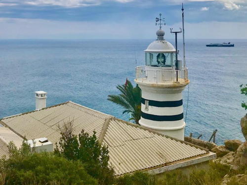
1912. Active; focal plane 68 m (223 ft); two white flashes every 5 s. 10 m (33 ft) round masonry tower with lantern and gallery, attached to the seaward side of a 2-story masonry keeper's house. Lighthouse painted white with two narrow black horizontal bands. The black bands, added in 2015, are seen in Mustafa Onur İnce's 2020 photo at right and Igor Buzatu's 2016 photo. Trabas has Meyer's closeup photo, Mert Aydemir has a distant view from below, and Google has a satellite view. This lighthouse was built by French engineers for the Ottoman Empire. Cape Anamur is the southernmost point of the Anatolian mainland, and the lighthouse here marks the west entrance to the Cyprus Strait separating Cyprus from Türkiye. The cape is a rocky headland projecting abruptly into the Mediterranean. Located at the point of the cape, about 8 km (5 mi) southwest of the city of Anamur. Site status unknown. . ARLHS TUR-062; Admiralty N5862; NGA 20664.

Anamur Burnu Light, Anamur, August 2020
Instagram photo by Mustafa Onur İnce

Antalya Province Lighthouses

Alanya Area Lighthouses
Alanya is a beach resort city with a population of about 365,000. It is sheltered by a steep cape, a projection of the Taurus Mountains, that was a stronghold for empires over many centuries.
* Alanya North Breakwater
2011. Active; focal plane 11 m (36 ft); green flash every 5 s. 8 m (26 ft) octagonal cylindrical tower with an open lantern. Entire lighthouse is white. Trabas has Erich Hartmann's photo, Vad Lai has a photo of the light in action, Oleg Petrovich has a closeup street view, and Google has a satellite view. Located at the end of the north breakwater of Alanya harbor. Accessible by walking the pier. Site open, tower closed. Admiralty N5860.4.
** Alanya South Breakwater (2)
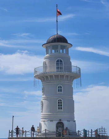
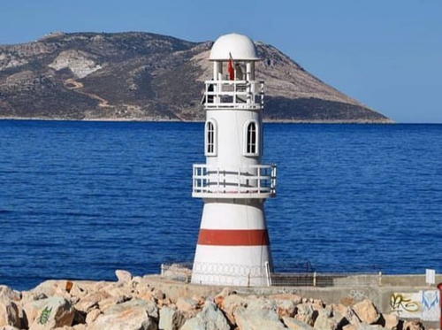
2009(?) (station establishment date unknown). Active; focal plane about 20 m (66 ft); red flash every 5 s. 16 m (52 ft) round masonry tower with lantern and gallery. The lighthouse is painted a light gray with a darker gray dome. A 2024 photo is at right, Wikimedia has a fine 2020 photo, Věra Hyršová has a 2016 photo, Trabas has Werner Seiler's photo, Abek Narynov has a 2022 photo, Pasha Goroshko has a street view, and Google has a satellite view. This new lighthouse was built as a tourist attraction. Located at the end of the south breakwater of Alanya harbor. Accessible by walking the pier. Site open; the tower is also open, but no information is available on the schedule. Admiralty N5860.45. .
Alanya (Kaleardı Burnu)
1880. Active; focal plane 209 m (686 ft); one long (2 s) white flash every 20 s. 6 m (20 ft) round cylindrical masonry tower with lantern and gallery, attached to the seaward side of a 2-story masonry keeper's house. Entire lighthouse painted white. Claußen has closeup photos, Trabas has Meyer's photo, and Google has an indistinct satellite view. Claußen's 2012 photos show a modern lamp on a short post behind the historic lantern; he was not able to determine if the light had been moved. Alanya is a modern resort city with very popular beaches, but looming above the beaches is a mountainous peninsula projecting into the Mediterranean. Atop the peninsula is the old fortified city of Alaiye, now called Alanya Castle, built by the Seljuk Turks in the 13th century as their capital. The lighthouse is near the south end of the peninsula, attached to the outer wall of the citadel. Site status unknown, but it should be possible to see this lighthouse from Kale (Castle) Road. ARLHS TUR-012; Admiralty N5860; NGA 20656.
* Side (Selimiye)
1974. Active; focal plane 14 m (46 ft); two white flashes every 5 s. 12 m (39 ft) round hourglass-shaped metal or fiberglass tower with gallery. The lighthouse is white with one narrow red horizontal band. Andreas Köhler has a 2003 photo, Trabas has Erich Hartmann's sunset photo, and Kürşad Ulkat has an evening street view, and Google has a satellite view. Located at a small boat harbor on a sandy cape projecting into the Gulf of Antalya at Side, a town about 40 km (25 mi) east of Antalya. and a similar distance west of Alanya. Accessible by road. Site open, tower closed. ARLHS TUR-045; Admiralty N5859; NGA 20652.

South Breakwater Light, Alanya, May 2024
Instagram photo by xatyusha1105

Antalya Area Lighthouses
Antalya is the provincial capital and the largest city of Türkiye's south coast, with a population of more than 1.3 million in the city proper and 2.6 milllion in the metropolitan area.
** Baba Burnu (Antalya) (2?)
1945 (station established 1869). Active; focal plane 35 m (155 ft); white flash every 5 s. 6 m (20 ft) round tower with double gallery, attached to a 1-story keeper's house. Lighthouse painted white with a narrow black band under the gallery. Mehmet Akdemir's 2017 photo is at right, another closeup is available, Jenny Liu has a 2023 photo, Levent Şen has a street view showing the light in action, and Google has a satellite view. This lighthouse guides vessels into the harbor of Antalya, the principal port of southwestern Türkiye and a popular seaside resort with a metropolitan population of more than one million. The keeper's house has been renovated as a popular restaurant. Located on a promontory on the southeast side of the city, about 6 km (3.5 mi) southeast of the port area. Located just off Lara Caddesi, the coastal road. Site open, tower closed. Site manager: Fener 1945 Restaurant. . ARLHS TUR-065; Admiralty N5858; NGA 20648.
* Antalya South Mole (2)
Date unknown. Active; focal plane about 12 m (39 ft); green flash every 3 s. Approx. 10 m (33 ft) round barbell-shaped fiberglass tower, colored white with a narrow green horizontal band. Igor Buzatu has a 2018 photo, Trabas has Hartmut Knape's photo, Marek Roczniak has a view of the two mole lights, and Google has a street view and a satellite view. The earlier light was a small skeletal tower. Located on the south mole of the old fishing harbor of Antalya. Site open, tower closed. Admiralty N5856; NGA 20644.
* Antalya North Mole (2)
Date unknown. Active; focal plane about 12 m (39 ft); red flash every 3 s. Approx. 10 m (33 ft) round barbell-shaped fiberglass tower, colored white with a narrow red horizontal band. Trabas has Hartmut Knape's photo, Marek Roczniak has a view of the two mole lights, Aleksei Fedorishchev has a sea view, and Google has an indistinct satellite view. The earlier light was a small skeletal tower. Located on the north mole of the old fishing harbor of Antalya. Site open, tower closed. Admiralty N5857; NGA 20640.

Baba Burnu Light, Antalya, November 2017
Google Maps photo by Mehmet Akdemir
Antalya New Harbor Lee Breakwater
Date unknown. Active; focal plane 14 m (46 ft); green flash every 3 s. 11 m (36 ft) round cylindrical concrete tower, painted white with a narrow green horizontal band. Trabas has Hartmut Knape's photo, Osman Zeki Ertuğrul has a street view, and Google has a satellite view. The tower was previously all white, and for a time it was painted green with a white band. Located at the end of the north breakwater of Antalya's industrial harbor, about 8 km (5 mi) southwest of the old harbor. Site status unknown. ARLHS TUR-064; Admiralty N5855.4; NGA 20636.
Antalya New Harbor Main Breakwater
Date unknown. Active; focal plane 12 m (39 ft); red flash every 3 s. 10 m (33 ft) round barbell-shaped metal tower, painted red with two narrow white horizontal bands. Prior to 2014 the lighthouse was painted all white, then red with a white horizontal band, and then white with a red horizontal band. Eugene Yakovenko has a photo, Trabas has Hartmut Knape's photo, and Google has a satellite view. Located at the end of the south (main) breakwater of Antalya's industrial harbor. Site status unknown. ARLHS TUR-063; Admiralty N5855; NGA 20632.

Kumluca and Finike Lighthouses
* Kemer West Pierhead
Date unknown. Active; focal plane 11 m (36 ft); green flash every 3 s. 8 m (26 ft) round cylindrical tower. Tower painted green with two narrow white horizontal bands. Trabas has Meyer's closeup photo and Google has a street view and a satellite view. In the past the tower has been painted white. Kemer is a resort town about 40 km (25 mi) south of Antalya. Located on the west pier at Kemer. Site open, tower closed. Admiralty N5854.6.
* Kemer North Pierhead
Date unknown. Active; focal plane 11 m (36 ft); red flash every 3 s. 8 m (26 ft) round cylindrical tower mounted on the roof of a 1-story pierhead building. Tower painted red with two narrow white horizontal bands. Trabas has Meyer's closeup photo and Google has a street view and a satellite view. In the past the tower has been painted white, and for a time it was red with wider white bands. Located on the main pier at Kemer. Site open, tower closed. Admiralty N5854.7.
[Çavus (Adrasar)]
1939. Active; focal plane 45 m (148 ft); white light, 1 s on, 2 s off, 2 s on, 10 s off. 10 m (33 ft) square pyramidal skeletal tower with gallery, painted white. Nearby is a 1-story masonry keeper's house, painted white with a red tile roof. LighthousesRUs.org has a small Directorate General photo (sixth photo on the page) and a Google satellite view is available. Located on a promontory at the south entrance to the small bay of Adrasar, about 3 km (2 mi) southeast of Çavus and 12 km (7.5 mi) northeast of Cape Gelidonya. Accessible only by boat. Site status unknown. Admiralty N5854; NGA 20624.
Taşlık (Selidonya) Burnu (Cape Gelidonya)
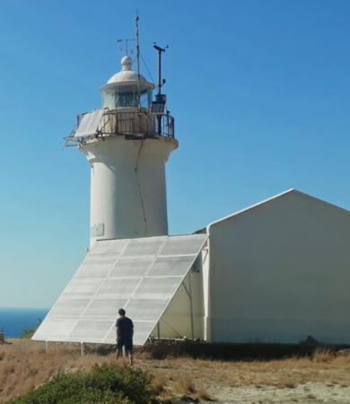
1936. Active; focal plane 277 m (745 ft); three white flashes every 10 s. 9 m (30 ft) round masonry tower with lantern and gallery, attached to a 1-story masonry keeper's house. Entire lighthouse painted white, house painted white with a red tile roof. A 2023 photo by Yakup Yavuz is at right, Onur Kocatas has a fine 2014 photo, Wikimedia has a fine panoramic view of the cape and lighthouse by Knut Thieme, Mehmet Taşkiran has a 2022 photo, Scott Newman has a fine 2008 photo, Trabas has Meyer's photo, Andet Ilyin has a street view, and Google has a satellite view. The lighthouse was operated "by hand" until 2017 when a solar power installation was completed. One of the most prominent capes of Türkiye's Mediterranean coast, Cape Gelidonya has been the site of countless shipwrecks ever since the dawn of sea travel. The cape is a steep ridge that continues offshore as a line of rocky shoals and islands. The lighthouse is located on the point of the cape, a remote location accessible to backpackers by a hiking trail. Site open, tower closed. . ARLHS TUR-049; Admiralty N5850; NGA 20616.

Taşlık Burnu Light, Cape Gelidonya, April 2023
Google Maps photo by Yakup Yavuz
* Finike West Breakwater
Date unknown. Active; focal plane 13 m (43 ft); green flash every 3 s. 9 m (30 ft) round cylindrical concrete tower painted green with a narrow white horizontal band. Ahmet Bağoğlu has a photo, Ahmet Oran has a street view and Google has a distant satellite view. Located on the west breakwater at Finike, a resort town northwest of Cape Gelidonya. Accessible by walking the pier. Site open, tower closed. Admiralty N5849.6; NGA 20612.
* Finike East Breakwater
Date unknown. Active; focal plane 13 m (43 ft); red flash every 3 s. 9 m (30 ft) round cylindrical concrete tower painted red with a narrow white horizontal band. Ahmet Oran has a street view and Google has a distant satellite view. Located on the east (main) breakwater at Finike. Accessible by walking the pier. Site open, tower closed. Admiralty N5849.4; NGA 20608.
Finike
Date unknown. Active; focal plane 30 m (98 ft); two white flashes every 7 s. 6 m (20 ft) round metal tower with a flared top, mounted on a round stone base. Tower painted white with two black horizontal bands. Google has a street view and a distant satellite view. Located on a promontory about 2 km (1.25 mi) south of Finike harbor. Site status unknown. Admiralty N5849; NGA 20604.

Kaş District Lighthouses
* Kaş (Mole Head)
Date unknown. Active; focal plane about 10 m (33 ft); red light, pattern unknown. Approx. 7 m (23 ft) round tower with gallery and an open lantern structure. Tower pianted white with one narrow red horizontal band. A 2023 photo is at right, Ömer Korkut has a 2017 photo, an aerial view is available, and Google has a distant satellite view. Located on the breakwater at Kaş, a resort town on a broad bay sheltered by the Greek island of Megísti (Kastellorizo). Accessible by walking the pier. . Admiralty N5847.4.
 

Breakwater Light, Kaş, March 2023
Instagram photo by mavi_antalyam
 
* Bucak Denizinde
Date unknown. Active; focal plane 16 m (52 ft); two flashes every 10 s, white, red or green depending on direction. 10 m (33 ft) round barbell-shaped white fiberglass tower. Google has a street view and an indistinct satellite view. This leading light guides vessels into Bucak Roads, a sheltered inlet popular with recreational boaters. Located beside the D400 coastal highway just west of Kaş. Site open, tower closed. Admiralty N5847.6; NGA 20568.
* Kalkan Limanı
Date unknown. Active; focal plane 10 m (33 ft); green flash every 5 s. 7 m (23 ft) round cylindrical concrete tower, painted white with a narrow green horizontal band. H. Cihangir Tarakçı has a closeup photo, Pete Kiddy has a street view, and Google has an indistinct satellite view. The tower has also been painted green with a white band. Kalkan is a former fishing village, now a popular resort town, about 25 km (15 mi) west of Kaş. Located on the patio of a popular resturant on the east side of the harbor entrance. Site manager: Lighthouse Café and Brasserie. Admiralty N5844.83; NGA 20566.
* Kalkan Limanı Breakwater
Date unknown. Active; focal plane 10 m (33 ft); red flash every 5 s. 7 m (23 ft) round cylindrical concrete tower, painted white with a narrow red horizontal band. A photo is available and Google has an indistinct satellite view. The tower has also been painted green with a white band. Kalkan is a former fishing village, now a popular resort town, about 25 km (15 mi) west of Kaş. Located on the east side of the harbor entrance. Accessible by walking the pier. Admiralty N5844.8; NGA 20565.
* Patara
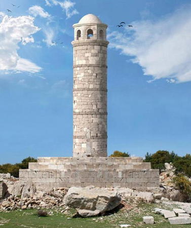
2022 reconstruction in progress of a Roman lighthouse built during the reign of Nero (54-68 CE). 26.5 m (87 ft) round cylindrical stone tower, toppled by a tsunami in 1481. In recent years the surviving portion of the tower stood about 5 m (17 ft) high. Onat Erdogan has a 2017 photo and Barış Okay has a 2019 closeup. It was unearthed about 2005 by archaeologists studying the Roman port of Patara, an ancient Greek city annexed to the Empire in 43 CE. (St. Nicholas was born in Patera about 270 CE.) The ancient harbor eventually filled in completely and became a swamp; the lighthouse was apparently excavated from this sediment. After years of study and preparation, tagging the stones and using computers to figure out how they fit together, workers began in 2021 to rebuild the lighthouse using 2500 of the original stones. Tom Janssens has a November 2021 photo of the work in progress and a May 2023 photo of the work nearing completion of the tower. In August 2022 the original inscription was installed as the tower reached about 12 m (39 ft) high. Google has a satellite view. The image at right shows how the lighthouse will appear when work is completed. The site is near the village of Gelemiş, about 10 km (6 mi) west of Kalkan in westernmost Antalya province. Site open.

Patera Light, Kalkan
image copyright Denizbulten.com; used for educational purpose

Information available on lost lighthouses:

Notable faux lighthouses:

Adjoining pages: Northwest: Southwestern Türkiye | East: Syria | South: Northern Cyprus

Return to the Lighthouse Directory index | Ratings key

Posted May 5, 2007. Checked and revised May 30, 2024. Lighthouses: 50. Site copyright 2024 Russ Rowlett and the University of North Carolina at Chapel Hill.