Lighthouses of Southern Finland: Uusimaa

The Republic of Finland (Suomi in Finnish) is a country of northern Europe with coastlines facing south on the Gulf of Finland (Suomenlahti) and west on the Gulf of Bothnia (Pohjanlahti), both arms of the Baltic Sea. Finland also administers the Åland Islands (Ahvenanmaa), an archipelago at the junction of the two gulfs. After centuries of rule by Sweden, Finland was conquered by Russia in 1809 and became an autonomous grand duchy within the Russian Empire. The country declared its independence from Russia at the start of the Russian Revolution in 1917. It lost some of its eastern territory to Russia as a result of World War II but has retained its independence.

Finland is divided into nineteen regions (maakunta) and the regions are divided into municipalities (kunta). This page includes the lighthouses of the Uusimaa ("New Land") Region including the greater Helsinki area.

The Finnish word for a lighthouse is majakka (plural majakat). Saari is an island, luoto is an islet or skerry, niemi is a cape or headland, niemimaa is a peninsula, lahti is a bay, salmi is a strait, joki is a river, and satama is a port or harbor. Swedish is a second official language in Finland and some of the lighthouses are commonly known by their Swedish names.

Lighthouses in Finland are maintained by the Waterways Section of the Finnish Transport Infrastructure Agency (Liikennevirasto).

ARLHS numbers are from the ARLHS World List of Lights. SU numbers are from the official Finnish light list. Admiralty numbers are from volume C of the Admiralty List of Lights & Fog Signals. U.S. NGA List numbers are from Publication 116.

General Sources
Online List of Lights - Finland
Photos by various photographers posted by Alexander Trabas.
Finskt fyrväsende
Photos and information posted by the Swedish Lighthouse Society.
Finnish Lighthouses
Excellent photos of the some of the better known lighthouses, posted to Flickr by Mikko Rauhala.
Lighthouses in Finland
Photos by various photographers available from Wikimedia.
World of Lighthouses - Finland
Photos by various photographers available from Lightphotos.net.
Lighthouses in Finland
Aerial photos posted by Marinas.com.
Weitere Europäische Leuchttürme auf historischen Postkarten
Historic postcard images posted by Klaus Huelse.
List of Lights
The Finnish light list is available for download.
Finnish Lighthouse Society
The national lighthouse preservation association.
GPSNauticalCharts
Navigational chart information for this area.
Navionics Charts
Navigational chart for southern Finland.
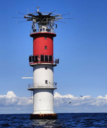

Helsinki Light, Gulf of Finland, August 2023
Google Maps photo by Oscar Henriksson
Loviisa Municipality Lighthouses
Orrengrund (3)
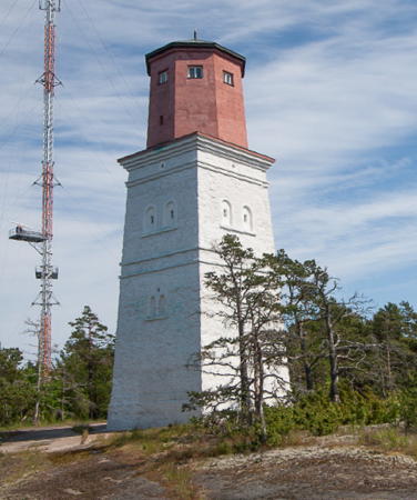
1858 (station established 1760s). Inactive since 1957. Approx. 22 m (72 ft) square masonry tower topped by an octagonal concrete observation room. Tower painted white, observation room red. A photo is at right, a 2010 photo is available, Pekka Kainulainen has a view that shows both the old and new lighthouses, Marinas.com has aerial photos, and Google has a satellite view. Orrengrund is an island about 8 km (5 mi) southwest of Söderby and 18 km (12 mi) southeast of Loviisa. The original beacon was replaced by a lighthouse in 1838 but that building collapsed after only 20 years. The upper section, originally wood, was replaced by concrete in the 1920s. Apparently the tower is now part of a coast guard station. Located near the ferry terminal on the north (?) side of the island. Site status unknown. .
Orrengrund (4)
1957 (station established 1760s). Active; focal plane 13 m (43 ft); white, red or green light, depending on direction, 2 s on, 1 s off. 12 m (39 ft) round cylindrical concrete tower with lantern and gallery. Tower painted white with a black band at the base, lantern painted black. Marinas.com has aerial photos and Google has a satellite view. Orrengrund is the point where the approaches to Kotka and Loviisa diverge; one white sector guides vessels approaching from the south and another guides vessels departing Loviisa. The light also serves as the rear light of a range; the front light is seen near the center of Pekka Kainulainen's view showing both the old and new lighthouses. Located at the west end of the island. Accessible only by boat. Site status unknown. SU-106; Admiralty C5322.
Skarven
Date unknown (station established 1933). Active; focal plane 7 m (23 ft); flash every 3 s, white, red or green depending on direction. 7 m (23 ft) round tower with lantern mounted on a tapered square white concrete pier. Lantern painted black. Veli-Pekka Karvinen has a photo and Google has a satellite view. This light guides vessels sailing parallel to the coast past Loviisa. Located on a reef about 3 km (2 mi) southeast of Bastö. Accessible only by boat. Site open, tower closed. SU-335; Admiralty C5328; NGA 13828.
Tainio (2)
1966 (station established 1956). Active; focal plane 17 m (56 ft); five very quick white flashes every 6 s. 17 m (56 ft) round cylindrical concrete tower. Upper 2/3 of the tower painted black, lower 1/3 white. Bing has a satellite view. This light marks the begining of the approach to both Kotka and Loviisa. The original light was destroyed by a winter storm in 1964. Located on a shoal about 16 km (10 mi) southeast of Loviisa. Accessible only by boat. Site open, tower closed. SU-307; ARLHS FIN-064; Admiralty C5321; NGA 13824.

Orrengrund Tower, Gulf of Finland, June 2009
Wikimedia Creative Commons photo by Kiisla Oy
Tiiskeri
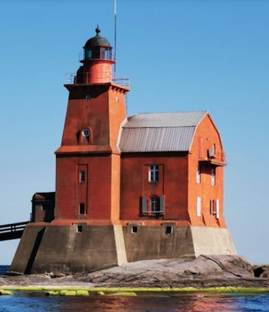
1933. Active; focal plane 16.5 m (54 ft); two white flashes every 10 s. 13 m (43 ft) square cylindrical concrete tower with lantern and two galleries. Tower painted black; lantern and galleries painted orange. Between the galleries is an opening that formerly held a fog bell. A photo is at right, a 2021 photo is available, Juha Hovilainen has a 2018 street view, Marinas.com has aerial photos, and Google has a satellite view. Located on a small island about 20 km (13 mi) south of Loviisa. Accessible only by boat. Site open, tower closed. SU-104; ARLHS FIN-068; Admiralty C5318; NGA 13936.

Porvoo Municipality Lighthouses
Skarvgaddarna (1)
Date unknown. Apparently replaced but still listed with focal plane 6 m (20 ft); flash every 2 s, white, red or green depending on direction. 6 m (20 ft) concrete tower with lantern and gallery. Tower painted white, lantern black. A 2021 photo shows that the light apparently has moved to a 12 m (39 ft) post next to the lighthouse. Google has a satellite view. The light guides vessels on the coastal passage between Helsinki and Kotka. Located on a rocky reef about 7 km (4 mi) west northwest of the Tiiskeri lighthouse. Accessible only by boat. Site open, tower closed. SU-081; Admiralty C5284; NGA 13940.
Pellinki (Glosholm)
1832. Inactive since 1862. Timo Jattu has a closeup photo and Google has a satellite view. Stone ruins about 9 m (30 ft) high remain of this historic lighthouse. It was deactivated when the Söderskär lighthouse was inaugurated. Located on the island of Glosholm about 1.6 km (1 mi) southwest of Söderby and 3 km (2 mi) southwest of Pellinki. Accessible only by boat. Site open, tower closed. ARLHS FIN-083.
Kalbådagrund
1953 (lightship station established 1854). Active; focal plane 27 m (89 ft); four long (2 s) white flashes every 30 s. 25 m (82 ft) round cylindrical concrete tower, incorporating keeper's quarters, with lantern, three galleries, and a helipad on top. Lighthouse painted with red and white horizontal bands. Esko Paunonen has an excellent photo, Janne Piikivi has a 2022 photo, Trabas also has a photo, and the Swedish Lighthouse Association has a page for the lighthouse, but the lighthouse is not shown in Google's satellite view. The design of the lighthouse is similar to that of several Swedish Baltic Sea lighthouses. The lighthouse replaced a lightship station and the most recent lightship survives as a dockside restaurant in Vaasa (see Ostrobothnia). Located on a dangerous shoal near the centerline of the Gulf of Finland, 12 km (7.5 mi) from shore and about 25 km (15 mi) south of Porvoo. Accessible only by boat. Site open, tower closed. ARLHS FIN-013; SU-627; Admiralty C5239; NGA 14084.

Tiiskeri Light, Gulf of Finland, October 2007
photo copyright Mari Hirsikallio; used by permission
Porvoo (Porvoon Majakka) (Larsskär Range Front)
1976. Active; focal plane 10.5 m (34 ft); flash every 2 s, white, red or green depending on direction. 10 m (33 ft) concrete tower, probably with lantern and gallery, painted red with a black horizontal band. Mika Lehtonen has a closeup photo and another photo (second photo on the page) is available but the light is not seen in Google's satellite view. One of the white sectors serve as the front light of an approach range for Porvoo. Located 12 km (7.5 mi) north of the Kalbådagrund lighthouse. Accessible only by boat. Site open, tower closed. ARLHS FIN-044; SU-294; Admiralty C5239.4; NGA 14088.
Larsskär Range Rear
Date unknown. Active; focal plane 36 m (118 ft); white light, 2 s on, 6 s off. 30 m (98 ft) triangular skeletal tower carrying a large slatted daymark colored red with a yellow vertical stripe. Trabas has a distant view and Google has a satellite view. Located on a skerry 5.5 km (3.4 mi) north northeast of the Porvoo light. Accessible only by boat. Site open, tower closed. SU-032; Admiralty C5239.41; NGA 14092.
Svartskär Range Rear
Date unknown. Active; focal plane 19 m (62 ft); white light, 2 s on, 4 s off. 19 m (62 ft) triangular skeletal tower mounted on a square concrete pier. Trabas has a distant view and Google has a satellite view. The front light is on a 6 m (20 ft) skeletal tower. Located Lillören, a rocky reef about 10 km (6 mi) northeast of the Porvoo light. Accessible only by boat. Site open, tower closed. SU-035; Admiralty C5241.1.
 
Kölhällen
Date unknown. Active; focal plane 10.5 m (34 ft); three flashes every 10 s. 10 m (33 ft) concrete tower, painted black with a white horizontal band. No photo available and Google has only a fuzzy satellite view. Located on an isolated skerry about 2.5 km (1.5 mi) northeast of the Porvoo light. Accessible only by boat. Site open, tower closed. SU-034; Admiralty C5240.4; NGA 14096.
Brunskär Range Rear
Date unknown. Active; focal plane 24 m (79 ft); white or yellow light, depending on direction, 2 s on, 4 s off. Approx. 21 m (69 ft) skeletal tower carrying a rectangular daymark painted red with a yellow vertical stripe. Trabas has a very distant view and Bing has a satellite view. The front light is on a 9 m (30 ft) skeletal tower. This is the second range for vessels approaching Porvoo. Located on a skerry 7 km (4 mi) northeast of the Porvoo light. Accessible only by boat. Site open, tower closed. SU-033; Admiralty C5240.1; NGA 14116.
Gråskär (Range Rear)
Date unknown (station established 1911). Active; focal plane 17 m (56 ft); white light, 2 s on, 4 s off. 10 m (33 ft) skeletal mast atop a square rubblestone tower. Tower painted white; the mast carries a daymark painted red with a yellow vertical stripe. Trabas has a photo and Google has a satellite view. Located on a small island about 6 km (3.6 mi) east of the front light (next entry). Accessible only by boat. Site open, tower closed. SU-327; Admiralty C5227.1; NGA 14228.
Tallörn (Range Front)
Date unknown (station established 1911). Active; focal plane 7 m (23 ft); two quick flashes every 3 s, white, red or green depending on direction. 7 m (23 ft) square rubblestone tower with lantern and gallery, painted white. The tower carries a daymark painted red with a yellow vertical stripe. Trabas has a photo and Google has a satellite view. Located on a small island about 5 km (3 mi) south of Kalkkiranta. Accessible only by boat. Site open, tower closed. SU-11623; Admiralty C5227; NGA 14224.
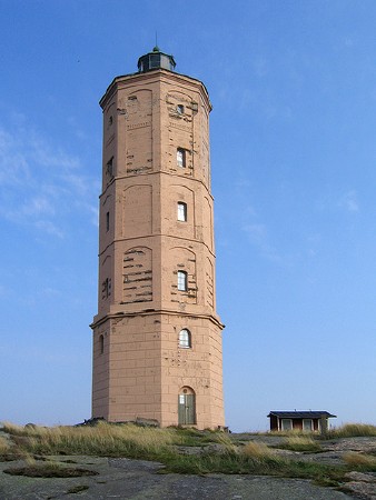
Söderskär
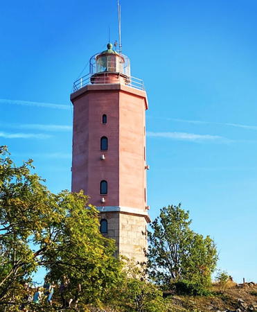
1862. Inactive since 1989. Approx. 25 m (82 ft) octagonal tower with lantern; the lowest stage of the tower is stone and the remainder is brick. The lighthouse is a light brown color; lantern painted black. Two 1-1/2 story wood keeper's houses. Miika Silfverberg's photo appears at right, the Swedish Lighthouse Association has a page for the lighthouse, Tero Koski has a nice photo of the station, Lassi Lintunen has a 2020 photo, another photo is available, Wikimedia has many photos, Marinas.com has aerial photos, and Google has a satellite view. This historic lighthouse is located on a small island in the Gulf of Finland about 12 km (7.5 mi) south of Kalkstrand. Unlit beacons were placed here in the 1700s. Accessible only by boat. Accommodations are available in the lighthouse between mid May and mid September. The island is an important bird nesting site, and landing private boats requires a permit. Site generally closed to the public; tours are available from Helsinki three times a week during the summer. Site manager: Söderskär Majakka . ARLHS FIN-057.
Söderskär Lighthouse
Söderskär Light, Gulf of Finland, September 2005
Flickr Creative Commons photo by Miika Silfverberg

Helsinki Municipality Lighthouses
Trutholmen Range Rear
Date unknown. Active; focal plane 19 m (62 ft); white light, 2 s on, 4 s off. Approx. 13 m (43 ft) triangular skeletal tower carrying a large rectangular daymark colored orange with a yellow vertical stripe. Trabas has a photo and Google has an indistinct satellite view. The range guides vessels hugging the coast westbound toward Helsinki. The front light is on a 9 m (30 ft) skeletal tower. Located on Louesaari, a small island southeast of Santahamina. Accessible only by boat. Site open, tower closed. SU-11455; Admiralty C5216.1; NGA 14384.
Kuivasaari
Date unknown. Active; focal plane 6 m (20 ft); two quick flashes every 4 s, white, red or green depending on direction. 5 m (16 ft) octagonal white lantern standing on a stone pedestal. Trabas has a photo and Bing has a satellite view. Located on a small island about 5 km (3 mi) southeast of Helsinki. Accessible only by boat. Site open, tower closed. SU-11439; Admiralty C5200; NGA 14584.
Helsinki (Årunsgrund)
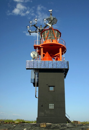
1959. Active; focal plane 25 m (82 ft); white light, 3 s on, 9 s off. 27 m (89 ft) round cylindrical concrete tower, incoporating keeper's quarters, with lantern, three galleries, and a helipad above the lantern. Lighthouse painted white with a red horizontal band in the upper third. Oscar Henriksson's 2023 photo is at the top of this page, a 2007 photo is available, Larry Myhre has a 2008 photo, Trabas has Capt. Peter Mosselberger's distant photo, the Swedish Lighthouse Association has a page for the lighthouse, and Marinas.com has aerial photos, but the lighthouse is not shown in Google's satellite view. The lighthouse replaced a historic lightship station (see the Kymenlaakso page for the lightship, since renamed Hyöky). Located in the Gulf of Finland about 15 km (9 mi) south of Helsinki. Accessible only by boat. Site open, tower closed. . SU-11435; 0Admiralty C5184; NGA 14516.
Harmaja (Gråhara) (Range Front) (2)
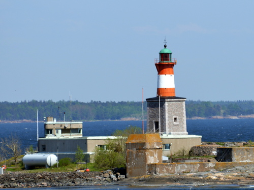
1883 (substantially altered in 1900). Active; focal plane 24 m (79 ft); white, red or green light depending on direction, 4 s on, 2 s off. 15 m (49 ft) 2-stage tower: a 7.5 m (25 ft) round cast iron tower with lantern and gallery centered on a square 7.3 m (24 ft) stone tower. The stone is unpainted; the cast iron tower is painted red with a white horizontal band; the lantern roof is greenish metallic. Harvey Barrison's photo is at right, Trabas has a closeup photo, Mikko Rauhala also has an excellent closeup, the Swedish Lighthouse Association has a page for the lighthouse, Marinas.com has aerial photos, Wikimedia has several photos including a nice aerial view of the entire island, Finnish Wikipedia has a page with several photos, and Google has a satellite view. Harmaja is a small island about 10 km (6 mi) south of Helsinki. It is one of many small islands in the neighborhood, but it happens to lie beside the main ship channel into the city. Stone daybeacons were built on the island as early as the 1500s to guide arriving ships. The original stone lighthouse proved to be too short, so in 1900 its lantern was removed and replaced by the cast iron tower. The Helsinki pilot station and a tall communications tower also occupy the island. Located at the eastern end of the island. Accessible only by boat. Site and tower closed. . ARLHS FIN-008; SU-11436; Admiralty C5190; NGA 14528.
Remmarholmen
Date unknown. Active; focal plane 11 m (36 ft); two quick flashes every 4 s, white, red or green depending on direction. 5 m (17 ft) round concrete tower with lantern and gallery. Tower painted red, lantern and gallery white. Trabas has a photo, Heikki Immonen has a photo, and Google has a satellite view. This light has three white sectors defining safe paths across the harbor. Located on Reimarisaari, a small island off the southwestern tip of the larger island of Vallisaari, about 3.5 km (2 mi) southeast of Helsinki. Accessible only by boat. Site open, tower closed. SU-11425; Admiralty C5195; NGA 14572.

Harmaja Light, Helsinki, May 2013
Flickr Creative Commons photo by Harvey Barrison
* Kustaanmiekka (Gustavsvård) Range Front
Date unknown (station established 1889). Active; focal plane 8 m (26 ft); quick-flashing light, white or red depending on direction. 6 m (20 ft) square pyramidal tower with lantern and gallery, mounted on a square stone base. Lighthouse painted white; the side facing the range has two vertical red stripes outlining a white stripe. Jeanie Mackinder's closeup shows this range light well, Trabas has a photo, and Google has a satellite view. The rear light is atop a large daymark panel. Kustaanmiekka (Gustav's Sword) is an island seaward of Suomenlinna; the channel leading onto Helsinki harbor passes through a narrow opening between Kustaanmiekka and neighboring island of Vallisaari. The Suomenlinna fortress is actually built on the eastern tip of Kustaanmiekka to guard this passage. The lighthouse is on the tip of the island below the walls of the fortress. Site open, tower closed. SU-11683; Admiralty C5196; NGA 14564.
* Länsi Mustasaari (Västra Svartö)
Date unknown (station established 1891). Active; focal plane 6 m (20 ft); white, red or green light depending on direction, occulting once every 2 s. 4 m (13 ft) octagonal lantern, painted white with one red horizontal band. A closeup photo is available, Trabas has a closeup photo by Thomas Philipp and Google has a satellite view. Located at the southwest side of Länsi Musta, an island on the southeast side of Helsinki harbor. Site open, tower closed. SU-11441; Admiralty C5166; NGA 14472.
** Suomenlinna (Sveaborg) (Harmaja Range Rear)
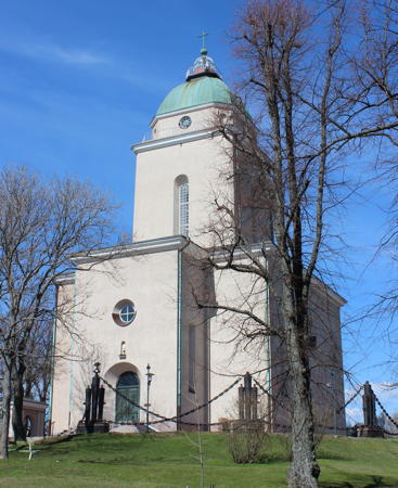
1929. Active; focal plane 54 m (177 ft); four white flashes every 15 s. Approx. 27 m (89 ft) light mounted atop the dome of a square cylindrical stone tower, centered on a square stone church. Gunthar Tiflett's photo is at right, Trabas has a photo, a closeup of the lantern and a photo of the light in action are available, the Swedish Lighthouse Association has a page for the lighthouse, Marinas.com has aerial photos, and Google has a street view and a satellite view. The church of Suomenlinna, a well known Helsinki landmark, was built as a Russian Orthodox cathedral in 1854, but it was converted to a Lutheran church when Finland became independent. The building was rebuilt and altered considerably in 1927-29, and the light was added at that time. The light serves as the rear light of a range with the front light being the Harmaja lighthouse 4.8 km (3 mi) to the south. Located at the highest point of the island of Suomenlinna, southeast of Helsinki. The island is accessible by bridge. Site open, church open for tours Wednesday and Thursday afternoons and for Sunday services; tower closed. ARLHS FIN-063; SU-11437; Admiralty C5190.1; NGA 14532.
* Valkosaari (Blekholm) Range Rear
Date unknown (station established 1891). Active; focal plane 7 m (23 ft); white, red or green light depending on direction, 2 s on, 2 s off. 4 m (13 ft) octagonal lantern, painted white with one red horizontal band. Trabas has a good photo and Google has a satellite view. The front light is in a tiny lantern only 2 m (7 ft) tall. The white sectors of the rear light guides vessels into Helsinki's inner harbor. Located on a small island on the east side of Helsinki. Accessible only by boat. Site open, tower closed. SU-11446; Admiralty C5170.1; NGA 14480.

Suomenlinna Light, Helsinki, May 2012
Wikimedia Creative Commons photo
by Gunthar Tiflett
*** Majakkalaiva (Lightship) Relandersgrund
1888 (Crichton & Co. AB, Turku). Decommissioned 1937. 27.1 m (89 ft) iron lightship with a cylindrical light tower amidships. Vessel painted red. Risto Tuomarla has the 2021 photo seen at right, Larry Myhre has a photo, Neal Doan also has a photo, Niklas Sjöblom has a photo, Google has a street view, and Google has a satellite view. The ship served 26 years on the Relandersgrund station. In 1917 its Russian crew, celebrating the onset of the Revolution, sailed the ship across the Gulf of Finland and drunkenly ran it aground and sank it on the Estonian coast. The following year the new Finnish government had it raised and repaired in Tallinn. Returned to Finland, it served as the reserve lightship until it was decommissioned in 1937. Less is known about its career thereafter but it remained at sea until it was sold for scrap in 1978. Somehow rescued from the wreckers, it reappeared with its old name in Kotka, where it was renovated as a restaurant. In 2005 it was towed to Helsinki, where it continued to function as a restaurant. The ship was drydocked for maintenance and restoration in 2007 and returned to the Helsinki waterfront in May 2009. Drinks and light food are offered daily on deck; the salon interior can be leased for special functions. Located on the Meritullintori waterfront in downtown Helsinki. Owner/site manager: Majakkalaiva Relandersgrund . Site open, vessel open during the dinner meal daily. ARLHS FIN-108.
Lokkiluoto (Range Front/Rear)
Date unknown (station established 1937). Active; focal plane 6 m (20 ft); quick-flashing white light. 6 m (20 ft) rectangular concrete tower. Wikimedia has a photo, Trabas has a distant view, and Google has a satellite view. This is the front light for Abrahaminluoto and also the rear light for Tiirakari. Located midway between those two lights. Accessible only by boat. Site open, tower closed. SU-11444; Admiralty C5188.1; NGA 14544.
 

Majakkalaiva Relandersgrund, Helsinki, October 2021
Google Maps photo
by Risto Tuomarla
 
Abrahaminluoto (Abrahamsholm) (Lokkiluoto Range Rear)
Date unknown (station established 1937). Active; focal plane 10 m (33 ft); white light, 1.5 s on, 1.5 s off. 9.5 m (31 ft) octagonal concrete tower with lantern and gallery. Tower painted red, lantern white; the tower carries a large slatted daymark facing the range line, painted black with a white vertical stripe. Trabas has a closeup photo and Google has a satellite view. This is an outbound range, guiding ships as they leave Helsinki. Located on a small island about 2 km (1.25 mi) south of the Helsinki waterfront; Accessible only by boat. Site open, tower closed. SU-11423; Admiralty C5188; NGA 14548.
Tiirakari (Tirgrund) (Range Front)
Date unknown (station established 1903). Active; focal plane 6 m (20 ft); two very quick flashes every 3 s, white, red or green depending on direction. 7 m (23 ft) square pyramidal concrete tower with lantern and gallery. Lighthouse painted white, base black. Trabas has a photo, Larry Myhre has a photo, (also seen at right), and Google has a satellite view. Located at the northern tip of a small island about 1.6 km (1 mi) southwest of the entrance to Helsinki harbor. Accessible only by boat. Site open, tower closed. SU-11568; Admiralty C5160; NGA 14440.
Koirakari (Hundskär)
Date unknown (station established 1959). Active; focal plane 6 m (20 ft); flash every 3 s, white, red or green depending on direction. 7 m (23 ft) round concrete tower with lantern and gallery. Lighthouse painted white with a narrow black horizontal band. Trabas has Rainer Arndt's photo and Bing has an aerial view. Located at the tip of a small island about 1.6 km (1 mi) south of the entrance to Helsinki harbor. Accessible only by boat. Site open, tower closed. SU-11430; Admiralty C5156; NGA 14428.

Tiirakari Light, Helsinki, June 2008
Flickr Creative Commons photo
by Larry Myhre

Espoo Municipality Lighthouse
Kytökäringen (Kyto)
Date unknown. Active; focal plane 9 m (30 ft); five quick white flashes every 6 s. 4 m (13 ft) octagonal lantern on a stone pedestal. Finnish Wikipedia has a view from the sea, Pekka Laitinen has a similar view, Trabas has Rainer Arndt's fuzzy view, and Google has a satellite view. Located on a small island about halfway between Helsinki and Porkkala. Accessible only by boat. Site open, tower closed. SU-11420; Admiralty C5153; NGA 14608.

Kirkkonummi Municipality (Porkkala Area) Lighthouses
The Porkkala Peninsula (Porkkalanniemi) projects southwestward into the Gulf of Finland about 25 km (15 mi) west of Helsinki; the Gulf of Finland here is only 36 km (22 mi) wide. Soviet troops occupied Porkkala in 1944 under an armistice agreement between Finland and the Soviet Union and the Soviets continued to occupy the area as a military base until 1956.

Lill Lökgrund (Torrögrunden Range Front)
Date unknown. Active; focal plane about 8 m (26 ft); white, red or green light depending on direction, light pattern unknown. Approx. 6 m (20 ft) tower with lantern and gallery. Tower painted white, lantern red. A drone view is available and Google has a satellite view. The range guides vessels on the coastal passage between Helsinki and Porkkala. Accessible only by boat. Site open, tower closed. SU-11554; Admiralty C5142.
Porkkala (Kallbådan) (3)
1928 (lightship station established 1858). Inactive since 2015. 21 m (69 ft) square stone tower with lantern and gallery, rising from one end of a 2-story stone keeper's house, all mounted on a large square stone pier. Lighthouse and keeper's house painted red; the roof of the house is white, and the lantern dome is greenish metallic. A photo is at right, Trabas has a photo by Darlene Chisholm, the Finnish edition of Wikipedia has a photo, the Swedish Lighthouse Association has a page for the lighthouse, Mari Hirsikallio's page for the lighthouse has a good photo, and Tero Koski has a good photo, but the islet is only a faint blur in Google's satellite view. This lighthouse was built to replace the Rönnskär lighthouse (see below). The lighthouse appears to have been inactive during the Soviet occupation; afterward Finnish authorities found it in very poor condition and put in back in service with an automated light. A major restoration was underway in 2023, as seen in a photo by Annika Sorjonen. The lighthouse is built over a skerry about 8 km (5 mi) southwest of the tip of the peninsula. . ARLHS FIN-043.
Porkkala (Kallbådan) (4)
2015. Active; focal plane 21 m (69 ft); three quick flashes every 20 s, white, red or green depending on direction. 19 m (62 ft) triangular cylindrical skeletal tower. Wikipedia's photo shows the tower and Trabas has a photo by Darlene Chisholm. Built adjacent to the historic lighthouse. Although this tower was in place by 2009, the light was not transferred to it until 2015. Accessible only by boat. Site open, tower closed. SU-80368; Admiralty C5130; NGA 14656.
Mäkiluoto Range Rear
Date unknown. Active; focal plane 20 m (66 ft); white light, 2 s on, 4 s off. Approx. 12 m (39 ft) square skeletal tower carrying a daymark colored red with a white vertical stripe. Trabas has a photo and Bing has a satellite view. The range guides vessels on the approach to Porkkala. Located on a small island about 7 km (4 mi) north of the Porkkala lighthouse. Accessible only by boat. Site open, tower closed. SU-11402; Admiralty C5121.1; NGA 14664.

Porkkala Light, Gulf of Finland, August 2020
Google Maps photo by GoZa MiTe
Rönnskär (2)
1814 (significantly heightened in 1828) (station established 1800). Inactive since 1928. Approx. 27 m (89 ft) two-stage tower; the lower half is square cylindrical unpainted rubblestone, and the upper half is round cylindrical cut stone, painted white. Lantern removed, but radar and communications equipment is mounted atop the tower. Minna Katriina Suurimaa's photo is at right, Wikimedia has several photos including Raimo Mäkelä's photo, the Swedish Lighthouse Association has a page for the lighthouse, and Bing has a satellite view. The original lighthouse, built by Sweden, was destroyed during the war between Sweden and Russia in 1808-09. The present lighthouse, built on the same plans under Russian rule in 1814, was replaced by the Porkkala light in 1928. The tower now carries a radar antenna and communications gear. Located on a small island about 7.5 km (4.5 mi) north of the Porkkala lighthouse. Accessible only by boat; the island is a military post and permission is required for visits. . ARLHS FIN-087.

Raasepori (Raseborg) Municipality Lighthouses
Jussarö (2)
1922 (station established 1881). Active; focal plane 30 m (98 ft); one long (1.2 s) white flash every 12 s. 24 m (79 ft) square pyramidal concrete tower with lantern and gallery. Lighthouse painted white with one red horizontal band. Juha Meriluoto has a 2022 photo, Finnish Wikipedia has a page with an aerial photo, the Swedish Lighthouse Association has a page for the lighthouse, Rauhala has an excellent photo, Hristo Yotov's 2021 photo shows the lighthouse being repainted, Trabas has a photo, and Google has a satellite view. The first lighthouse was built on a nearby larger island where there was room for a keeper's house, but that location was not a good one for navigational purposes. Located on Sundharun, a small, rocky island in the Gulf of Finland about 4 km (2.5 mi) south of Jussarö and 8 km (5 mi) southeast of Sommarö. Accessible only by boat. Site open, tower closed. . ARLHS FIN-011; SU-11632; Admiralty C4980; NGA 14892.
Längden
1966. Active; focal plane 17 m (56 ft); three long (1.5 s) flashes every 15 s, white, red or green depending on direction. 17 m (56 ft) round cylindrical concrete tower with lantern and gallery, painted with red and white horizontal bands. Paavo Juntunen has an excellent 2020 photo, Petri Sillanpää has a 2023 photo, and Trabas has a distant view, but the location is only a faint blur in Google's satellite view. This is the landfall light for Raasepori. Lighthouse painted with red and white horizontal bands. Located on a skerry about 6 km (3.5 mi) southeast of Tvärminne. Accessible only by boat. Site open, tower closed. ARLHS FIN-026; SU-11495; Admiralty C4991.6; NGA 14944.

Rönnskär Light, Gulf of Finland, August 2020
Instagram photo by Minna Katriina Suurimaa

Hanko Municipality Lighthouses
Hanko is the southernmost town of Finland, located on a peninsula pointing southwest into the northern entrance to the Gulf of Finland.
Långskär Range Rear
Date unknown. Active; focal plane 23 m (75 ft); white light, 2 s on, 4 s off. 20 m (66 ft) triangular skeletal tower carrying a large rectangular daymark colored red with a yellow vertical stripe. Trabas has a very distant view and Google has a satellite view. This range guides vessels on a long eastward reach parallel to the coast. The front light is on a mast. Located on an islet about 6 km (4 mi) north of the Längden lighthouse. Accessible only by boat. Site open, tower closed. SU-11483; Admiralty C4940.1.
Kummelskär Range Rear
Date unknown. Active; focal plane 19 m (62 ft); white light, 2 s on, 4 s off. 18 m (59 ft) triangular skeletal tower carrying a large rectangular daymark colored red with a yellow vertical stripe and mounted on a square concrete base. Trabas has a distant view and Google has a satellite view. The range guides vessels on a northeastward range. The front light is on a similar, shorter tower. Located on an islet about 8 km (5 mi) east of Hanko. Accessible only by boat. Site open, tower closed. SU-11347; Admiralty C4932.1; NGA 15128.
Västerbåden (Range Rear)
Date unknown. Active; focal plane 22 m (72 ft); white light, 2 s on, 4 s off. 22 m (72 ft) skeletal tower carrying a large rectangular daymark colored red with a yellow vertical stripe. Trabas has a very distant view by Thomas-Michael Quatsling but Google has only a fuzzy satellite view of the area. Located on a reef about 2 km (1.25 mi) south southwest of the Russarö lighthouse (next entry). Accessible only by boat. Site open, tower closed. SU-11482; Admiralty C4915.81; NGA 15220.
* Russarö (Ruussaari) (2)
1863 (station established 1838). Active; focal plane 34 m (112 ft); four long (1.4 s) white flashes every 45 s. 21 m (69 ft) octagonal cylindrical stone tower with lantern and gallery. Upper 2/3 of the tower painted red, lower 1/3 unpainted; lantern dome is greenish metallic. A photo is at right, Rauhala has a fine photo, Trabas has Tom Chisholm's photo, the Swedish Lighthouse Association has a page for the lighthouse, Petri Kuittinen has a 2023 photo, Marinas.com has aerial photos, and Bing has a satellite view. The lighthouse is often called the "eye of Hanko," and a photo by Niklas Sjöblom captures the effect. Located on the southeastern side of the island of Båklandet (Söderviken) about 4 km (2.5 mi) south of Hanko. The island is accessible by ferry from Hanko. Site open, tower closed. . ARLHS FIN-089; SU-11334; Admiralty C4912; NGA 15212.
Ryssökobb (Range Front)
Date unknown. Active; focal plane 21 m (69 ft); quick-flashing white light. 17 m (56 ft) square cylindrical skeletal tower carrying a large rectangular daymark colored red with a yellow vertical stripe. Trabas has Tom Chisholm's photo and Google has a satellite view. Located on an islet off the east side of Ryssö, about 800 m (1/2 mi) south of the Gustavsvärn lighthouse. Accessible only by boat. Site open, tower closed. SU-11641; Admiralty C4919; NGA 15164.

Russarö Light, Hanko, August 2022
Instagram photo
by minzku82
Ryssö (Range Rear)
Date unknown. Active; focal plane 32 m (105 ft); white light, 2 s on, 4 s off. Approx. 17 m (56 ft) square cylindrical skeletal tower carrying a large rectangular daymark colored red with a yellow vertical stripe. Trabas has Thomas-Michael Quatsling's photo showing both range lights and Google has an indistinct satellite view. Located on Ryssö, 490 m (0.3 mi) west of the front light. Accessible only by boat. Site open, tower closed. SU-11346; Admiralty C4919.1; NGA 15168.
Gustavsvärn (2)
1949 (station established 1865). Active; focal plane 18 m (59 ft); two flashes every 10 s, white, red or green depending on direction. 16 m (52 ft) round cylindrical concrete tower with lantern and gallery. Lighthouse painted white, lantern red with a greenish metallic dome. The 1-story keeper's house is available for overnight accommodations. Olli Mustonen has the 2018 closeup photo at right, Niko Kalliotie has a drone view, Grigory Shmerling has a closeup, Trabas has a distant photo, Marinas.com has aerial photos, and Google has a satellite view. Located on a skerry about 1.5 km (1 mi) due south of Hanko. Accessible only by boat. Site open, tower closed. . ARLHS FIN-007; SU-11335; Admiralty C4918.4; NGA 15172.
Djupkobben Range Rear
Date unknown. Active; focal plane 22 m (72 ft); white light, 6 s on, 6 s off. 21 m (69 ft) triangular skeletal tower carrying a large rectangular daymark colored red with a yellow vertical stripe. Trabas has Tom Chisholm's photo, a 2017 photo is available, and the shadow of the tower is seen in Google's satellite view. The front light has a large daymark panel on a small skeletal tower. Located on the commercial waterfront of Hanko. Site status unknown. SU-11336; Admiralty C4920.21; NGA 15248.
[Hanko Mole]
Date unknown. Active; focal plane 7 m (23 ft); quick-flashing white, red or green light. 3 m (10 ft) octagonal white lantern. Trabas has Thomas-Michael Quatsling's photo and Google has a satellite view. Located at the end of the ferry terminal mole in Hanko. Site status unknown. SU-11338; Admiralty C4922; NGA 15252.

Gustavsvärn Light, Hanko, August 2018
Google Maps photo
by Olli Mustonen

Information available on lost lighthouses:

Notable faux lighthouses:

Adjoining pages: North: Finland Lakes | East: Kymenlaakso | West: Southwest Finland

Return to the Lighthouse Directory index | Ratings key

Posted September 17, 2007. Checked and revised September 3, 2023. Lighthouses: 45. Lightships: 1. Site copyright 2023 Russ Rowlett and the University of North Carolina at Chapel Hill.