Lighthouses of Russia: Northern Khabarovsk Region

Russia (Россия, Rossiya in Russian) is by far the world's largest country, spanning a little over 150° in longitude. It is organized as the Russian Federation (Rossiyskaya Federatsiya) with members known as federal subjects (sub'yekty federatsii). Russia is primarily a continental nation but it has important coastlines on the Baltic, Black, and Caspian Seas and very long coastlines on the Arctic Ocean and North Pacific Ocean. To guard these coasts it operates hundreds of lighthouses, many of them historic.

This page covers lighthouses of the northern half of Khabarovsk Krai, a huge province on Russia's far eastern coast. The northern coastline of the province faces the Sea of Okhotsk. The southern coastline faces the Tartar Strait, which separates the mainland from the large island of Sakhalin. This page includes lighthouses of the Okhotsky, Tuguro-Chumikansky and Nikolayevsky Districts, all in the north. The only important port in this area is Nikolayevsk na Amure on the lower Amur River.

The region is named for Yerofey Khabarov, who explored the area for Russia in 1649-50. However, the region was also claimed by China, and in the 1689 Treaty of Nerchinsk Russia gave up its claim to the heart of the territory, the Amur Basin. The situation was reversed in the 19th century as Russians occupied the area and in the 1858 Treaty of Aigun Russian sovereignty was established.

Nearly all the lighthouses in this region were built by the Soviet Union (1917-1991).

The Russian word for a lighthouse is mayak (маяк); ostrov is an island, poluostrov is a peninsula, kosa is a sandy spit, rif is a reef, mys is a cape, bukhta is a bay, zaliv is a larger bay or gulf, proliv is a strait, reka is a river, and gavan' is a harbor.

Russian lighthouses are owned by the Russian Navy and maintained by the Office of Navigation and Oceanography (Управление навигации и океанографии).

ARLHS numbers are from the ARLHS World List of Lights. Admiralty numbers are from volume M of the Admiralty List of Lights & Fog Signals. U.S. NGA List numbers are from Publication 112.

General Sources
Lighthouses of the USSR - Far Eastern Seas
This Russian-language reference provides valuable historical information.
Russian Lighthouse Society
Photos and information on many lighthouses.
World of Lighthouses - Russia Far East
Photos by various photographers available from Lightphotos.net.
Online List of Lights - Russia - Pacific Coast
Photos by various photographers posted by Alexander Trabas.
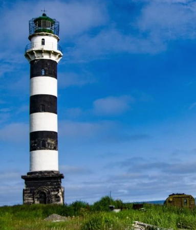
Marekan Light
Marekan Light, Okhotsk, summer 2012
ex-Panoramio photo copyright Igor Savitskiy
used by permission

Okhotsky District Lighthouses

The town of Okhotsk is Russia's oldest settlement on the Pacific; Cossacks established a camp here in 1643 and a fort was built in 1649. The name of the town is the Russian version of the word for "river" in the language of the Even indigenous residents. The town then gave its name to the sea. For nearly 200 years Okhotsk was the leading Russian port on the Pacific, accessible by river routes across the width of Siberia. Commercial operations moved to Ayen on the west coast of the Sea of Okhotsk around 1840 and after 1860 the newly-acquired warm-water port of Vladivostok rapidly took its place as the leading Russian Pacific port and naval station. Since the fall of the Soviet Union the population of the town has fallen more than half to about 4000.

Northwestern Sea of Okhotsk Lighthouses
Mys Duga Vostochnaya
1981. Active; focal plane 82 m (269 ft); two white flashes every 15 s. 34 m (112 ft) round cylindrical cast iron tower, painted red. Keeper's houses and other station buildings. Google has a satellite view of the station. This is one of the last major lighthouses built by the Soviet Union; the construction took five summers at this remote location. The lighthouse marks the southern tip of the Lisyan Peninsula, projecting into the Sea of Okhotsk about 225 km (140 mi) west of Magadan. Site status unknown. ARLHS ASR-144; Admiralty M8008.2; NGA 15566.
Mys Ushkalova (Eirineiskiy)
1976. Active; focal plane 49 m (161 ft); white flash every 4 s. 8 m (26 ft) concrete tower, painted black with a white horizontal band. No photo available but Google has a satellite view. Located on a promontory on the west side of the peninsula, about 30 km (20 mi) northwest of Mys Duga Vostochnaya. Site status unknown. Admiralty M8008.1; NGA 15566.2.
Inya
Date unknown. Active; focal plane 21 m (69 ft); white light 1.5 s on, 3.5 s off. 17 m (56 ft) square cylindrical skeletal tower painted black. No photo available but Bing has a satellite view. Located on a barrier beach about 100 km (60 mi) east of Okhotsk. Site status unknown. Admiralty M8008; NGA 15566.55.

Mys Duga Vostochnaya Light, Sea of Okhotsk
unattributed photo posted by Lighthouses of the USSR
Mys Marekan
1956. Active; focal plane 53 m (174 ft); white light, 4.5 s on, 7.5 s off. 34 m (112 ft) round cylindrical tower with lantern and gallery, mounted on a square stone base. Tower painted with black and white horizontal bands, base painted white, lantern painted red. This is a staffed station. Igor Savitskiy's photo is at the top of this page, Mapio.net has another of his photos, the Lighthouse Society has a page with a historic image, the lighthouse appeared on a 1984 Soviet postage stamp, and Google has a satellite view of the station. Located on the north shore of the Sea of Okhotsk about 320 km (200 mi) west of Magadan and 25 km (15 mi) southeast of Okhotsk. Site status unknown. ARLHS ASR-045; Admiralty M8007; NGA 15568.
Kukhtuy (Okhotsk)
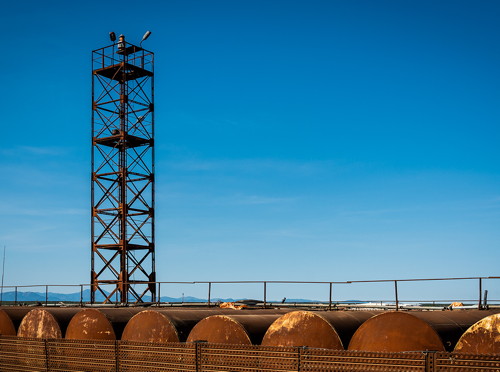
Date unknown. Active; focal plane 23 m (75 ft); white flash every 3 s. 18 m (56 ft) skeletal tower. Igor Savitskiy's photo is at right and Google has a satellite view. Located on the east side of the entrance to Kukhtuy Bay, the harbor of Okhotsk. Site status unknown. Admiralty M8006; NGA 15569.

Tuguro-Chumikansky District Lighthouse

Shantar Islands Lighthouse
Bol'shoy Shantar
1953. Active; focal plane 205 m (673 ft); white light, characteristic unknown. 12 m (39 ft) square cylindrical skeletal tower. No photo available and the tower is not seen in Bing's satellite view of the station. Located on the northern tip of Bolshoy Shantar, the largest of the Shantar Islands in the western Sea of Okhotsk. Accessible only by boat. Site and tower closed. Admiralty M7989.1.
Kukhtuy Light
Kukhtuy Light, Okhotsk, September 2014
ex-Panoramio photo copyright Igor Savitskiy; used by permission

Nikolayevsky District Lighthouses

Sakhalin Gulf Lighthouses
Sakhalin Gulf is an elliptical basin at the southern end of the Sea of Okhotsk. It is about 160 km (100 mi) wide, separating the mainland from the northern end of the island of Sakhalin.

Mys Litke (2)
Date unknown (station established 1954). Active (?); focal plane 35 m (115 ft); white light, 1.5 s on, 6 s off. This was originally a 9 m (30 ft) skeletal tower mounted atop a stone station building. Sometime in the 1990s the station was abandoned and the beacon was moved to a 3 m (10 ft) skeletal tower seen in a 2017 photo. Ivan Evsev has a distant 2019 view of the station and Google has a satellite view The station was established with a radiobeacon in 1943. A lighthouse was authorized in 1952 but plans for a taller tower were scaled back. Located on a prominent cape about 150 km (90 mi) northwest of Mys Menshikova. Site status unknown. Admiralty M7986; NGA 15582.
Menshikov (Mys Menshikova) (2)
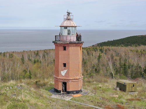
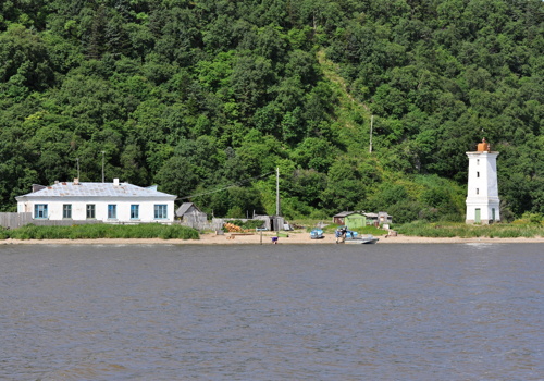
1952 (station established 1944). Inactive; listed with focal plane 101 m (331 ft); white light, 3 s on, 4.5 s off. 19 m (62 ft) round concrete tower with lantern and gallery. Lighthouse painted with black and white horizontal bands. A photo is at right and Google has a satellite view of the station. The first light was on a pyramidal wood skeletal tower. Endangered. Another page for the lighthouse has a 2017 photo and reports that the lighthouse is abandoned and rapidly deteriorating. Mys (Cape) Menshikova is the promontory on the west side of the entrance to Amur Bay from the Sakhalin Gulf. Site status unknown. ARLHS ARS-149; Admiralty M7985; NGA 15584.

Amur Estuary Northside Lighthouses
The Amur River, the world's tenth longest river, forms a large estuary before emptying into the northern part of Amur Bay. Nikolayevsk na Amure is a port on the north side of the estuary about 80 km (50 mi) above the mouth. The town has a population of about 25,000. Founded in 1850, it is named for then-Czar Nicholas I.

Chkhil'skiy Range Front
Date unknown. Active; focal plane 16 m (52 ft); red flash every 4 s. 13 m (43 ft) square cylindrical skeletal tower with gallery painted black. The tower carries two triangular slatted daymarks painted white with a black vertical stripe. Lightphotos.net has a photo by Alexander Barkov, Barkov has another photo, and Google has a satellite view. This is an entrance range for the Amur. Located on the north bank of the estuary about 8 km (5 mi) above the mouth. Site open, tower closed. Admiralty M7983.4.

Mys Menshikova Light, Amur Bay
unattributed photo posted by Lighthouses of the USSR
Chkhil'skiy Range Middle (?) and Rear
Date unknown. Active; focal plane 36 m (118 ft); red flash every 4 s. 9 m (30 ft) square cylindrical skeletal tower with gallery. No photo available but Google has a satellite view. The actual rear light appears to be on a much shorter tower; Google also has a satellite view of that light. Located about 120 m (130 yd) north northwest of the front light. Site status unknown. Rear light: Admiralty M7983.41.
Krasnoye (Pahtinskiy) Range Rear
Date unknown. Active; focal plane 20 m (66 ft); continuous red light. 17 m (56 ft) square cylindrical skeletal tower with gallery. The tower carries a large rectangular slatted daymark painted white with a black vertical stripe. Lightphotos.net has a photo by Alexander Barkov, he also has a closeup, and Google has an indistinct satellite view. This is a downstream range guiding vessels leaving Nikolayevsk. Located on the north bank of the estuary about 1 km (0.6 mi) above Krasnoye. Site open, tower closed. Admiralty M7983.71.
Krasnoye (Pahtinskiy) Range Front
Date unknown. Active; focal plane 15 m (49 ft); red light, 1.5 s on, 1.5 s off. 13 m (43 ft) square cylindrical skeletal tower with gallery. The tower carries a large rectangular slatted daymark painted white with a black vertical stripe. Alexander Barkov has a photo and Google has an indistinct satellite view. Located on a point of land about 300 m (1000 ft) west of the rear light. Site open, tower closed. Admiralty M7983.7.
* Nikolayevsk Range Front
1967. Active; focal plane 24 m (79 ft); continuous red light. 6 m (20 ft) octagonal concrete tower, painted white with a black vertical stripe on the range line. Alexander Barkov has a photo and Google has a satellite view. This is the entrance range for the protected harbor of Nikolayevsk. Located near the waterfront in the town. Site open, tower closed. Admiralty M7984.4.
* Nikolayevsk Range Rear
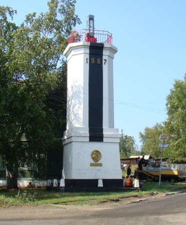
1967. Active; focal plane 30 m (98 ft); continuous red light. 10 m (33 ft) octagonal concrete tower, painted white with a black vertical stripe on the range line. Alexander Barkov has the photo at right and a second photo, a closeup photo by Roman Zhelezov is available, and Google has a satellite view. Located at a street intersection on a hillside about 100 m (330 ft) northwest of the front light. Site probably open, tower closed. Admiralty M7984.41.
Nikolayevsk Rear Light
Nikolayevsk Range Rear Light, Nikolayevsk, August 2012
ex-Panoramio photo copyright Alexander Barkov; used by permission

Amur Estuary Southside Lighthouses
Ostrov Vospri (Range Front)
Date unknown. Active; focal plane 21 m (69 ft); red flash every 3 s. 16 m (52 ft) square concrete tower, painted white with a black vertical stripe on the range line. A view from the estuary is at right, Alexander Barkov has a distant view and Google has a satellite view. This is a westbound (upstream) range. Located at the eastern tip of Ostrov Vospri, a large island in the center of the estuary about 15 km (9 mi) southeast of Nikolayevsk. Accessible only by boat. Site status unknown. Admiralty M7983.5.
Mys Meo (Ostrov Vospri Range Rear, Ostrovnoy Range Rear)
Date unknown. Active; focal plane 56 m (184 ft); continuous red light. 15 m (49 ft) square skeletal tower, carrying a daymark with a black vertical stripe. Google has a satellite view. Located on the south bank of the estuary just north of Konstantinovka. Site status unknown. Admiralty M7983.6.
Mys Vasse Range Rear
Date unknown. Active; focal plane 18 m (59 ft); green flash every 3 s. 17 m (56 ft) square pyramidal wood skeletal tower, carrying a daymark painted white with a black vertical stripe. Alexander Barkov has a very distant view from the estuary and Google has a satellite view. This range guides eastbound vessels. The front light is on a similar, shorter tower. Located on a sharp cape on the south bank of the estuary about 8 km (5 mi) southeast of Ostrov Vospri. Site status unknown. Admiralty M7983.31.
Nizhniypronge Range Rear
Date unknown. Active; focal plane 57 m (187 ft); one long red flash every 7.5 s. 12 m (39 ft) square concrete tower, painted white with a black vertical stripe on the range line. No photo available but Google has a satellite view. This is the entrance range for the Amur estuary. The front and middle lights are on short skeletal towers. Located on a slope on the south side of the village of Nizhniy Pronge on the Mys Pronge peninsula, about 4 km (2.5 mi) southwest of the tip. Site status unknown. Admiralty M7982.811.
Ostrov Vospri Light
Ostrov Vospri Range Front Light, Nikolayevsk-na-Amure, September 2009
ex-Panoramio photo copyright sireuz; permission requested
Pronge (Mys Pronge) (3)
1960 (station established 1943). Active; focal plane 101 m (331 ft); white flash every 9.7 s. 15 m (49 ft) octagonal concrete tower with lantern and gallery painted red. Roman Pozdny has a 2020 photo and Google has a satellite view. The original light was on an 18 m (59 ft) triangular wood skeletal tower. It was overthrown by a severe storm in December 1950 and replaced by a shorter wood tower. Located on the heights of Mys Pronge, a narrow cape on the south side of the mouth of the Amur. Site status unknown. Admiralty M7983.
Mys Pronge Range Front
Date unknown. Active; focal plane 11 m (36 ft); one long yellow flash every 7.5 s. 7 m (23 ft) square concrete tower, painted white with a black vertical stripe on the range line. Georgy Filippov has a photo of the two range lights and Google has a satellite view of the station and the two lights. The range apparently guides vessels around a shoal at the entrance to the river. The station appears to be staffed. Located on the point of the Pronge peninsula, on the south side of the mouth of the Amur. Site status unknown. Admiralty M7982.91.
Mys Pronge Range Rear
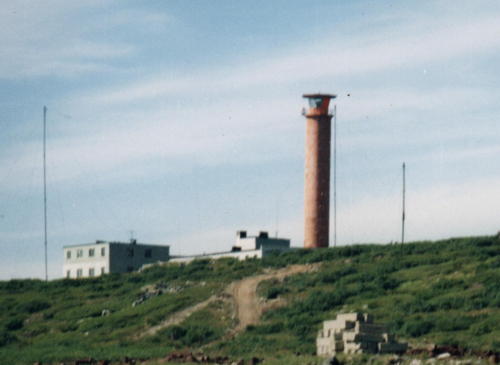
Date unknown. Active; focal plane 17 m (56 ft); one long yellow flash every 7.5 s. 11 m (36 ft) square concrete tower, painted white with a black vertical stripe on the range line. A photo is at right and another photo of the station is available. Located 93 m (305 ft) from the front light. Site status unknown. Admiralty M7982.911.
Pronge South Range Front
Date unknown. Active; focal plane 32 m (105 ft); red light, 3 s on, 4.5 s off. 11 m (36 ft) square concrete tower, painted white with a black vertical stripe on the range line. No photo available but Google has a satellite view. The function of this northbound range is not clear. Located on the south side of the cape. Site status unknown. Admiralty M7982.9.
Pronge South Range Rear
Date unknown. Active; focal plane 53 m (174 ft); red light, 3 s on, 4.5 s off. 7 m (23 ft) square concrete tower, painted white with a black vertical stripe on the range line. No photo available but Google has a satellite view. Located about 400 m (1/4 mi) north northeast of the front light. Site status unknown. Admiralty M7982.901.

Mys Pronge Range Rear Light, mouth of the Amur River, August 2010
ex-Panoramio Creative Commons photo by Malefesenta

Amur Bay Lighthouses
The Amur Bay is an irregular basin about 120 km (75 mi) long and roughly 30 km (19 mi) wide, connecting the Sakhalin Gulf to the north with the Nevel'skoy Strait to the south. In Russian it is called the Amurskiy Liman; although the geographic term liman is usually translated "estuary" or "lagoon" "bay" or "sound" seem more appropriate in this case. The bay is relatively shallow, with many shoals, so it is not easy to navigate. The bay is the northernmost element of the Tartar Strait, the passage separating Sakhalin Island from the mainland.

Khussinskiy (Mys Khuzi) Range Front
Date unknown. Active; focal plane 19 m (62 ft); white light, 1.5 s on, 1.5 s off. 16 m (52 ft) octagonal concrete tower, painted white with a black vertical stripe on the range line. No photo available but Google has a distant satellite view. This range guides vessels on a northeast to southwest reach toward the Nevel'skoy Strait. Located about 30 km (19 mi) south of the Amur River. Site status unknown. Admiralty M7982.4; NGA 15745.
Khussinskiy (Mys Khuzi) Range Rear
Date unknown. Active; focal plane 38 m (125 ft); white light, 3 s on, 3 s off. 29 m (95 ft) square skeletal tower carrying a rectangular slatted daymark painted white with a black vertical stripe on the range line. No photo available but Google has an indistinct satellite view. Located 1114 m (0.7 mi) southwest of the front light. Site status unknown. Admiralty M7982.41; NGA 15745.1.
Mys Dzhaore South Range Front
Date unknown. Active; focal plane 21 m (69 ft); green light, 3 s on, 4.5 s off. 8 m (26 ft) wood pyramidal tower carrying a slatted daymark painted white with a black vertical stripe. The photo at right probably shows this light at the right and Google has a fuzzy satellite view. The range guides northbound vessels. Mys Dzhaore is a prominent cape about 20 km (13 mi) south of Mys Pronge. Located next to the abandoned station buildings. Site status unknown. Admiralty M7982.3; NGA 15745.15.
Mys Dzhaore South Range Rear
Date unknown. Active; focal plane 35 m (115 ft); white light, 3 s on, 4.5 s off. 17 m (56 ft) wood pyramidal tower carrying a slatted daymark painted white with a black vertical stripe. No photo available but Google has an indistinct satellite view. Located 334 m (1096 ft) northwest of the front light. Site status unknown. Admiralty M7982.31; NGA 15745.16.
Mys Dzhaore North Range Front
Date unknown. Active; focal plane 20 m (66 ft); green light, 3 s on, 4.5 s off. 8 m (26 ft) wood pyramidal tower carrying a slatted daymark painted white with a black vertical stripe. No photo available but Google has a fuzzy satellite view. The range guides southbound vessels. Located 373 m (1200 ft) north of the front light. Site status unknown. Admiralty M7982.35; NGA 15745.2.
Mys Dzhaore North Range Rear
Date unknown. Active; focal plane 39 m (128 ft); green light, 3 s on, 4.5 s off. 11 m (36 ft) wood pyramidal tower carrying a slatted daymark painted white with a black vertical stripe. The photo at right shows this light at the upper left and Google has a fuzzy satellite view. The range guides southbound vessels. Located about 150 m (500 ft) south of the South Range Front Light. Site status unknown. Admiralty M7982.351; NGA 15745.21.

North Range Rear (left) and South Range Front Lights, Mys Dzhaore, March 2012
ex-Panoramio Creative Commons photo by Malefesenta
Mys Uarke
1959. Active; focal plane 133 m (436 ft); white flash every 6 s. 9 m (30 ft) octagonal concrete tower rising from a 1-story concrete keeper's cottage. No current photo available but Google has a fuzzy satellite view of the station. Located on a prominent cape about 50 km (30 mi) northwest of the Nevel'skoy Strait. Site status unknown. Admiralty M7982.2; NGA 15744.36.

Nevel'skoy Strait Area Lighthouses
The Nevel'skoy Strait is a narrow passage connecting the Amur Bay to the north with the Tartar Gulf to the south. It is named for Capt. Gennady Nevel'skoy, who sailed through the strait in 1849, proving to westerners that Sakhalin is an island. At its narrowest, the strait is only 7.3 km (4.5 mi) wide. Evgenia Stukalova has a photo taken from the Lazarev lighthouse that shows the narrow width of the strait. Under Stalin the Soviet government planned a railroad tunnel under the strait and actually began construction, but the project was abandoned after Stalin's death in 1953. In 2018 President Putin commissioned a study of building a bridge over the strait.
Ukhtomskiy (Mys Tkhadgou) Range Front
Date unknown. Active; focal plane 25 m (82 ft); white light, 3 s on, 3 s off. 16 m (52 ft) octagonal concrete tower, painted white with a black vertical stripe on the range line. No photo available but Google has a satellite view. This range guides vessels approaching the Nevel'skogo Strait from the north. Located about 20 km (13 mi) northwest of Mys Lazareva. Site status unknown. Admiralty M7982.1; NGA 15744.4.
Ukhtomskiy (Mys Tkhadgou) Range Rear
Date unknown. Active; focal plane 48 m (157 ft); white light, 3 s on, 3 s off. 21 m (69 ft) square skeletal tower carrying a rectangular slatted daymark painted white with a black vertical stripe on the range line. No photo available but Google has an indistinct satellite view. Located 1113 m (0.69 mi) south southwest of the front light. Site status unknown. Admiralty M7982.11; NGA 15744.41.
Lazarev (Mys Lazareva) (2)
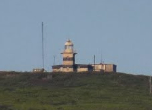
1968 (station established 1943). Active; focal plane 252 m (827 ft); white light, 3 s on, 3 s off. 13 m (43 ft) square tower with lantern and gallery, attached to one end of 1-story keeper's house. Entire structure, including the keeper's house, painted with black and white horizontal bands. Sergey Lysov's distant view is at right and Google has an indistinct satellite view. The original light was on an 18 m (59 ft) triangular wood skeletal tower. Mys (Cape) Lazareva projects eastward, nearly closing off the narrow Nevel'skoy Strait between Sakhalin Bay and Tartar Strait. This landfall light for the passage has a range of about 40 km (25 mi). Located on a mountaintop above the point of the cape. Site status unknown. ARLHS ARS-147; Admiralty M7982; NGA 15744.45.

Mys Lazarev Light, Nevel'skoy Strait, 2012
ex-Panoramio Creative Commons photo by Sergey Lysov

Information available on lost lighthouses:

Notable faux lighthouses:

Adjoining pages: North: Magadan | Southeast: Northern Sakhalin | South: Southern Khabarovsk Krai

Return to the Lighthouse Directory index | Ratings key

Posted May 19, 2006. Checked and revised March 18, 2023. Lighthouses: 33. Site copyright 2023 Russ Rowlett and the University of North Carolina at Chapel Hill.